Vietnam · Mixed
Bai Tu Long National Park
National park of 18,250 hectares in Vietnam, established in 2001.
Overview
National park of 18,250 hectares in Vietnam, established in 2001.
Bai Tu Long National Park is located in Vietnam (Asia). It covers both land and sea. Established in 2001, it covers about 18,250 hectares.
In our collections
Frequently asked questions
Where is Bai Tu Long National Park?
In Vietnam (Asia). Representative point: 21.0797° N, 107.5665° E.
How large is Bai Tu Long National Park?
About 18,250 hectares (183 km²). It is the 22nd largest of the 33 national parks in Vietnam covered by Parkavela. About 12,300 ha are at sea.
When was Bai Tu Long National Park established?
In 2001.
What habitats and landscapes does Bai Tu Long National Park include?
An area spanning land and sea, with forests and coasts.
When is the best time to visit Bai Tu Long National Park?
Best time to visit: from November to April, with average temperatures of 16 to 24 °C and moderate rainfall.
What is the nearest large city to Bai Tu Long National Park?
Nearest towns of over 50,000 people, as the crow flies: Quảng Ninh (26 km) and Fangchenggang (74 km). Nearest airport: Van Don (VDO), about 9 km away.
Which species can be seen in Bai Tu Long National Park?
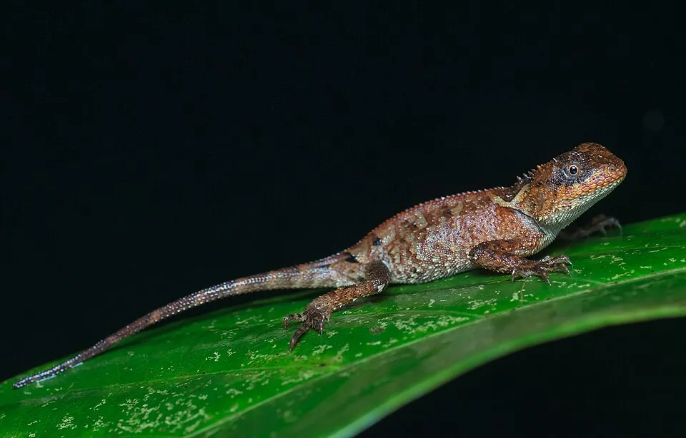
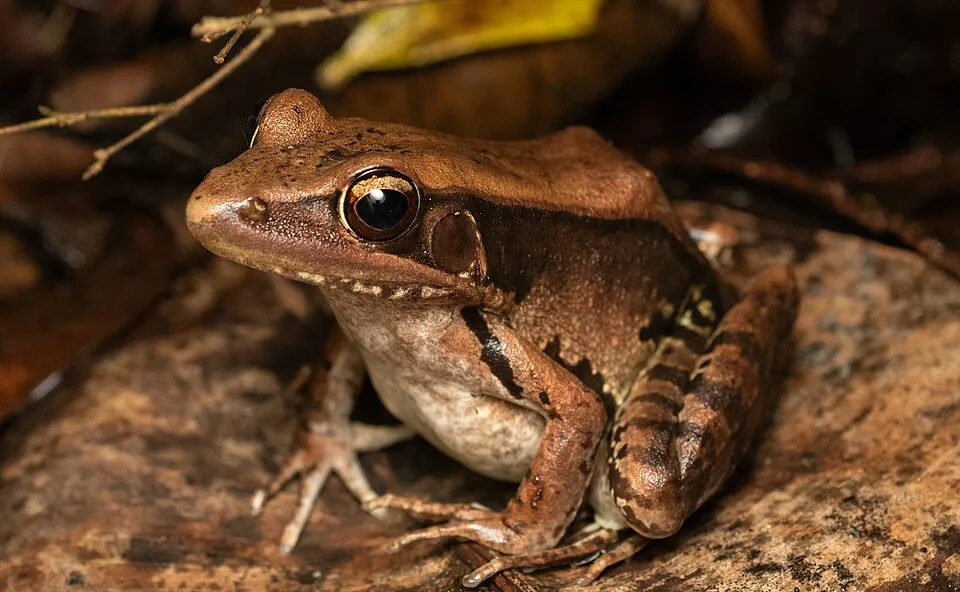
Among the species most often recorded on GBIF are Acanthosaura lepidogaster (Brown pricklenape), Sphenomorphus tonkinensis (Tonkin Forest Skink), Sylvirana guentheri (Guenther's Amoy Frog) and Tropidophorus hainanus (Hainan Water Skink).
© OpenStreetMap
Download the boundary: GeoJSON · GPX Boundary © OpenStreetMap contributors (ODbL).
Geography
The representative point of the site lies at around 2 m above sea level. Over the 1996–2025 period, the mean annual temperature is about 23.5 °C and total precipitation reaches roughly 2,243 mm per year. The warmest month is usually July, the coolest January, and the wettest August.
Area
- Area of the boundary
- 18,250 ha
- Elevation
- 2 m
- Median elevation
- 10 m
- Mean slope
- 11°
- Coordinates
- 21.0797, 107.5665
Terrain: Mapzen Terrain Tiles (SRTM, USGS)
Climate
● Mean temperature (°C) · ▮ Precipitation (mm)
Source: Copernicus ERA5-Land (C3S, doi:10.24381/cds.68d2bb30), monthly averages 1996–2025 interpolated to the representative point, temperatures adjusted for elevation.
Contains modified Copernicus Climate Change Service information 2026. Neither the European Commission nor ECMWF is responsible for any use that may be made of the Copernicus information or data it contains.
Natural habitats
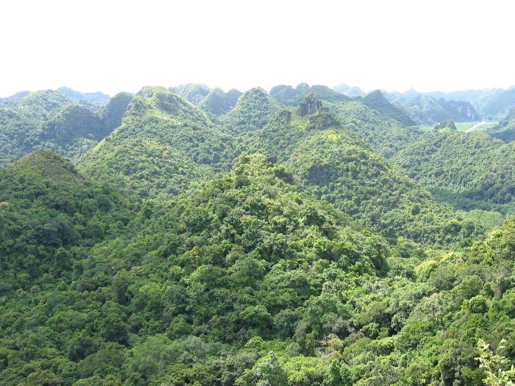
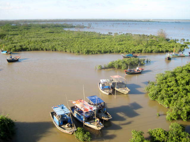
According to the global MODIS land cover (NASA, 2024), the land area is mainly made up of forests (49%) and marshes and bogs (48%). It is mostly dense evergreen broadleaved forest. The sea covers about 67% of the site. The seabed reaches about 12 m deep (median depth 6 m; GEBCO bathymetry). Elevation ranges from sea level to about 200 m (sampled elevations, SRTM).
Biodiversity
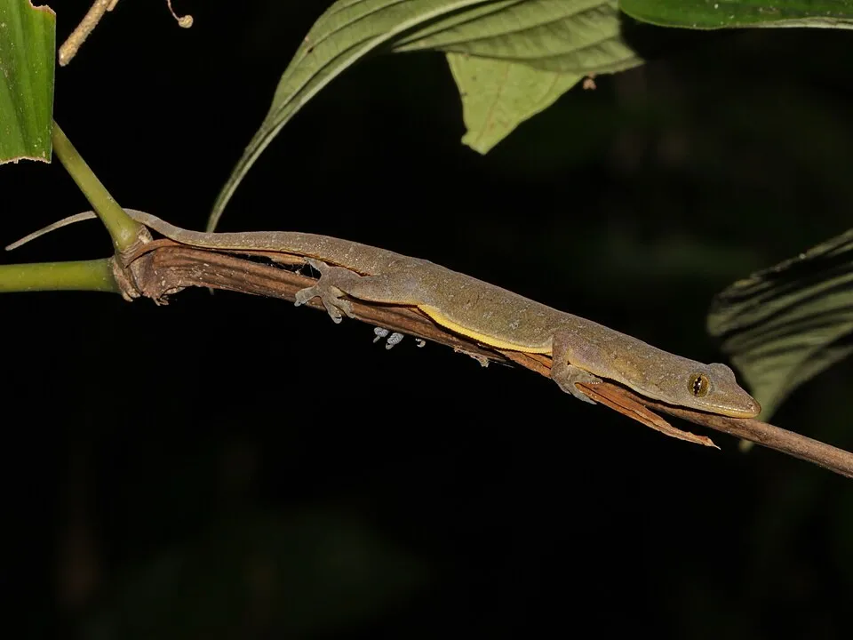
Based on occurrences aggregated by GBIF, several species are regularly recorded within the site. Among the most frequent are Acanthosaura lepidogaster (Brown pricklenape), Sphenomorphus tonkinensis (Tonkin Forest Skink), Sylvirana guentheri (Guenther's Amoy Frog) and Tropidophorus hainanus (Hainan Water Skink). The full list of documented taxa is shown below.
Species to look out for
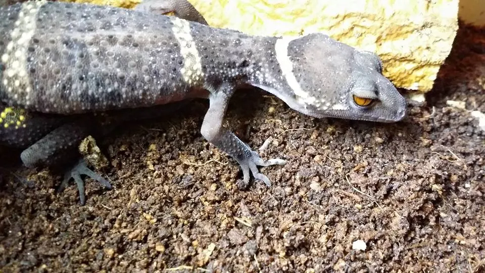
Reptile
Lichtenfelder's Gecko
Goniurosaurus lichtenfelderi6 records © Gordon lai (0101a) · CC BY-SA 4.0
Observed species
Occurrences documented via GBIF; they are neither an exhaustive inventory nor proof of current presence.
- Brown pricklenape · Acanthosaura lepidogaster · 15
- Tonkin Forest Skink · Sphenomorphus tonkinensis · 15
- Guenther's Amoy Frog · Sylvirana guentheri · 12
- Hainan Water Skink · Tropidophorus hainanus · 12
- Indo-Pacific gecko · Hemidactylus garnotii · 9
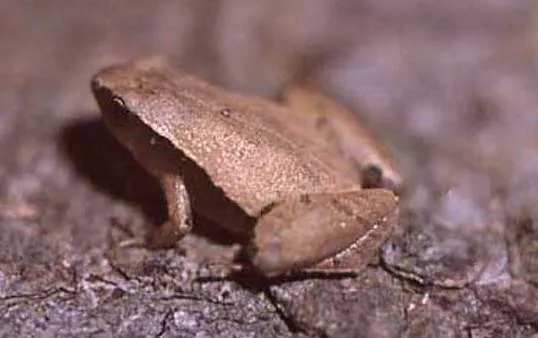
- Arcuate-spotted Pygmy Frog · Microhyla heymonsi · 6
- Burmese Whipping Frog · Polypedates mutus · 6
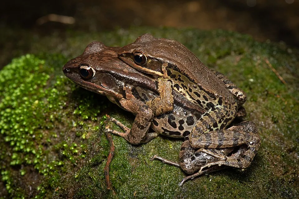
- Broad-folded Frog · Hylarana latouchii · 6
- Lichtenfelder's Gecko · Goniurosaurus lichtenfelderi · 6
- Quang Ninh Fanged Frog · Limnonectes quangninhensis · 4
- Chinese edible frog · Hoplobatrachus rugulosus · 3
- Common Mock Viper · Psammodynastes pulverulentus · 3
+18 more species
- Chinese Short-limbed Skink · Ateuchosaurus chinensis · 3
- Vietnam False Bloodsucker · Pseudocalotes brevipes · 3
- Many-banded Krait · Bungarus multicinctus · 3
- Man-Son Mountain Stream Snake · Opisthotropis lateralis · 3
- Common house gecko · Hemidactylus frenatus · 3
- Common Schefflera · Heptapleurum heptaphyllum · 2
- Oriental Pied Hornbill · Anthracoceros albirostris · 2
- Large-billed Crow · Corvus macrorhynchos · 2
- Common Tailorbird · Orthotomus sutorius · 2
- Black Kite · Milvus migrans · 2
- Day's Cymbidium · Cymbidium dayanum · 2
- Mayriella granulata · 2
- Caridina zhujiangensis · 2
- Asian Green Bee-eater · Merops orientalis · 1
- Edible-nest Swiftlet · Aerodramus fuciphagus · 1
- Crested Serpent Eagle · Spilornis cheela · 1
- Jerdon’s Baza · Aviceda jerdoni · 1
- Pacific Reef Heron · Egretta sacra · 1
Records: GBIF.org (CC-BY). Names: Wikidata (CC0), GBIF. Photos: Wikimedia Commons.
Conservation challenges
The primary purpose of the site is to preserve its natural habitats and the biodiversity they support. The species recorded (Biodiversity tab) reflect its ecological value. Its status as a national park sets the regulatory framework for its protection.
According to Global Forest Change data (University of Maryland, Global Forest Watch), about 75 ha of tree cover were lost within the boundary between 2001 and 2023 (under 1% of its area), peaking in 2004. These losses include logging, storms and fires, and do not account for regrowth. At night, 1% of the area gives off artificial light detectable from space (NASA VIIRS Black Marble composite, 2016).
Pressure indicators
Tree cover lost
75 ha
2001–2023
20012023
Light at night
1%
of the area gives off artificial light visible from space
DarkLit
Sources: Global Forest Change (Hansen et al., University of Maryland, via Global Forest Watch, CC-BY 4.0); EFFIS, European Commission / Copernicus; NASA Black Marble 2016 (public domain); CORINE Land Cover 2018 (Copernicus) or MODIS.
Practical information
Cities and airport
- Quảng Ninh
26 km as the crow flies - Fangchenggang
74 km as the crow flies - Airport: Van Don (VDO)
9 km as the crow flies
Data: Wikidata (CC0), pending OpenStreetMap data
Access and visiting
Nearest towns of over 50,000 people, as the crow flies: Quảng Ninh (26 km) and Fangchenggang (74 km). Nearest airport: Van Don (VDO), about 9 km away. About 150,000 people live within 20 km of the site boundary, 35,000 of them within 10 km; some 1,000 people are estimated to live inside (GHSL estimate, 2020). This population has grown by about 19% since 2000. To plan a visit (access, opening periods, visitor rules), it is best to consult the official information from the managing body and the official website listed in this page's sources.
Source: Wikidata (CC0), November 2026.
When to visit
Best time to visit: from November to April, with average temperatures of 16 to 24 °C and moderate rainfall. Precipitation peaks from May to September (up to 450 mm per month). Day length ranges from about 10 h 51 min in December to 13 h 24 min in June.
Source: Copernicus ERA5-Land (C3S), monthly averages 1996–2025 at the representative point, temperatures adjusted for elevation.
Contains modified Copernicus Climate Change Service information 2026. Neither the European Commission nor ECMWF is responsible for any use that may be made of the Copernicus information or data it contains.
Gallery
© Viethavvh · CC BY-SA 3.0
Sources and licences
- Wikidata: Q3895700
- Wikipedia: en.wikipedia.org/wiki/Bái_Tử_Long_National_Park
References
- cds.climate.copernicus.eu: climate · CC-BY-4.0
- registry.opendata.aws: elevation of the reference point, detailed relief · PD
- lpdaac.usgs.gov: land cover · PD
- doi.org: population around the site · CC-BY-4.0
- naturalearthdata.com: sea share · PD
- openstreetmap.org: official name, trail difficulty · ODbL-1.0
- gbif.org: coral records, seasonality of sightings, invasive alien species, observed species · CC-BY-4.0
- en.eurovelo.com: EuroVelo cycle routes · ODbL-1.0
- cycling.waymarkedtrails.org: cycle routes · ODbL-1.0
- gebco.net: depths · PD
- opentopodata.org: elevations · PD
- wikidata.org: establishment date, nearby cities and airport, access and peaks, lake depths, places to see · CC0-1.0
- globalforestwatch.org: tree cover loss · CC-BY-4.0
- earthobservatory.nasa.gov: night light · PD
- nsidc.org: snow cover · PD
- wikidata.org: Wikipedia article · CC-BY-SA-4.0
Data © OpenStreetMap contributors (ODbL), Wikidata (CC0) and the sources cited.