Indonesia · Marine
Bunaken National Park
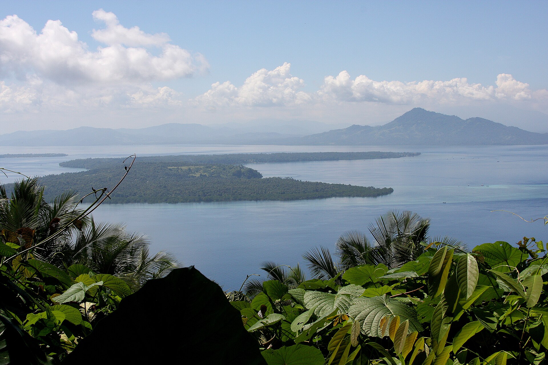
National park of 75,000 hectares in Indonesia, established in 1991.
Overview
National park of 75,000 hectares in Indonesia, established in 1991.
Bunaken National Park is located in Indonesia (Asia). It is a predominantly marine area. Established in 1991, it covers about 75,000 hectares.
Protections and designations
World Heritage tentative list
Protected as a national park. It is covered by an additional protection designation.
In our collections
Frequently asked questions
Where is Bunaken National Park?
In Indonesia (Asia). Representative point: 1.6429° N, 124.7215° E.
How large is Bunaken National Park?
About 75,000 hectares (750 km²). It is the 36th largest of the 54 national parks in Indonesia covered by Parkavela.
When was Bunaken National Park established?
In 1991.
What habitats and landscapes does Bunaken National Park include?
A marine area, with coasts and coral reefs.
When is the best time to visit Bunaken National Park?
Best time to visit: the dry season, from June to August, with less than 150 mm of rain per month.
What is the nearest large city to Bunaken National Park?
Nearest towns of over 50,000 people, as the crow flies: Manado (4 km) and Tomohon (20 km). Nearest airport: Sam Ratulangi (MDC), about 9 km away.
Which species can be seen in Bunaken National Park?
Among the species most often recorded on GBIF are Rhizophora apiculata (Mangrove), Chromodoris annae (Anna's Chromodoris), Chromodoris dianae (Diana's Chromodoris) and Hirundo javanica (Pacific Swallow).
© OpenStreetMap
Download the boundary: GeoJSON · GPX Boundary © OpenStreetMap contributors (ODbL).
Geography
Over the 1996–2025 period, the mean annual temperature is about 27.3 °C and total precipitation reaches roughly 2,429 mm per year. The warmest month is usually May, the coolest January, and the wettest December.
Area
- Area
- 75,000 ha
- Coordinates
- 1.6429, 124.7215
Climate
● Mean temperature (°C) · ▮ Precipitation (mm)
Source: Copernicus ERA5 (C3S, doi:10.24381/cds.f17050d7), monthly averages 1996–2025 interpolated to the representative point, temperatures adjusted for elevation.
Contains modified Copernicus Climate Change Service information 2026. Neither the European Commission nor ECMWF is responsible for any use that may be made of the Copernicus information or data it contains.
Natural habitats
The sea covers about 97% of the site. The seabed reaches about 1,821 m deep (median depth 92 m; GEBCO bathymetry). Reef-building corals are documented in the area: 1,031 records published on GBIF.
Biodiversity
Based on occurrences aggregated by GBIF, several species are regularly recorded within the site. Among the most frequent are Rhizophora apiculata (Mangrove), Chromodoris annae (Anna's Chromodoris), Chromodoris dianae (Diana's Chromodoris) and Hirundo javanica (Pacific Swallow). The full list of documented taxa is shown below.
Species to look out for
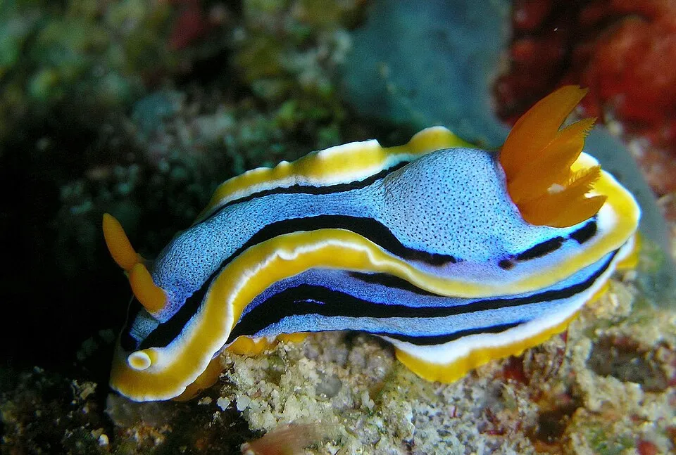
Mollusc
Anna's Chromodoris
Chromodoris annae146 records © Steve Childs from Lancaster, UK · CC BY 2.0

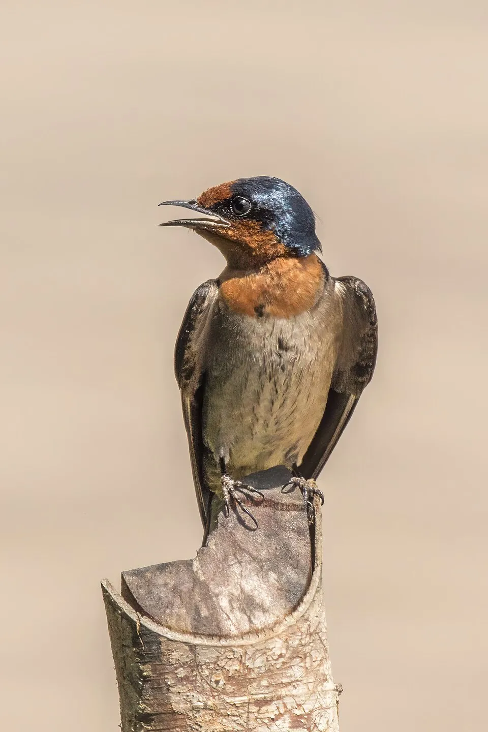

Bird
Pied Imperial Pigeon
Ducula bicolor84 records © Lip Kee from Singapore, Republic of Singapore · CC BY-SA 2.0
Observed species
Occurrences documented via GBIF; they are neither an exhaustive inventory nor proof of current presence.
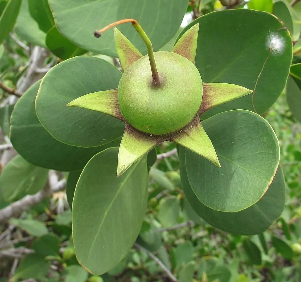
- Mangrove · Rhizophora apiculata · 337
- Anna's Chromodoris · Chromodoris annae · 146
- Diana's Chromodoris · Chromodoris dianae · 119
- Pacific Swallow · Hirundo javanica · 97
- Pied Imperial Pigeon · Ducula bicolor · 84
- Sonneratia alba · 83
- Striped White Sea Slug · Chromodoris willani · 73
- Warty Wart Slug · Phyllidiella pustulosa · 72
- Brown-throated Sunbird · Anthreptes malacensis · 70
- Pyjama Rainbow Dorid · Chromodoris lochi · 64
- Small giant clam · Tridacna maxima · 62
- Eurasian Tree Sparrow · Passer montanus · 58
+18 more species
- Collared Kingfisher · Todiramphus chloris · 54
- Pink-necked Green Pigeon · Treron vernans · 54
- Asian Glossy Starling · Aplonis panayensis · 50
- Azure sea star · Linckia laevigata · 49
- Orange-edged Sapsucking Slug · Thuridilla lineolata · 49
- Zebra Dove · Geopelia striata · 45
- Fried Egg Bubble Snail · Colpodaspis thompsoni · 45
- Yellow-tipped Phyllodesmium · Phyllodesmium briareum · 45
- Green Turtle · Chelonia mydas · 42
- Crocus Clam · Tridacna crocea · 40
- Crested Nembrotha · Nembrotha cristata · 39
- Moluccan Swiftlet · Aerodramus infuscatus · 37
- Blue dragon · Pteraeolidia semperi · 37
- Starry Doriprismatica · Doriprismatica stellata · 36
- Acropora muricata · 36
- Uniform Swiftlet · Aerodramus vanikorensis · 35
- Heavenly Wart Slug · Phyllidia coelestis · 35
- Pillow Cushion Star · Culcita novaeguineae · 35
Records: GBIF.org (CC-BY). Names: Wikidata (CC0), GBIF. Photos: Wikimedia Commons.
Conservation challenges
The primary purpose of the site is to preserve its natural habitats and the biodiversity they support. The species recorded (Biodiversity tab) reflect its ecological value. The designations it holds frame its management and the control of land use.
Practical information
Cities and airport
- Manado
4 km as the crow flies - Tomohon
20 km as the crow flies - Airport: Sam Ratulangi (MDC)
9 km as the crow flies
Data: Wikidata (CC0), pending OpenStreetMap data
Access and visiting
Nearest towns of over 50,000 people, as the crow flies: Manado (4 km) and Tomohon (20 km). Nearest airport: Sam Ratulangi (MDC), about 9 km away. About 850,000 people live within 20 km of the site boundary, 510,000 of them within 10 km (GHSL estimate, 2020). This population has grown by about 38% since 2000. To plan a visit (access, opening periods, visitor rules), it is best to consult the official information from the managing body and the official website listed in this page's sources.
Source: Wikidata (CC0), November 2026.
When to visit
Best time to visit: the dry season, from June to August, with less than 150 mm of rain per month. Precipitation peaks in December (up to 310 mm per month). Wildlife records published on GBIF peak for birds (August and September). These peaks also reflect when observers are most active.
Source: Copernicus ERA5 (C3S), monthly averages 1996–2025 at the representative point, temperatures adjusted for elevation.
Contains modified Copernicus Climate Change Service information 2026. Neither the European Commission nor ECMWF is responsible for any use that may be made of the Copernicus information or data it contains.
Wildlife records calendar
JFMAMJJASOND
Birds
Plants
Monthly records published on GBIF (CC-BY), relative to the busiest month; also reflects observer activity.
Gallery
© Btv70 · CC BY-SA 3.0
© Sakurai Midori · CC BY-SA 3.0
© User: (WT-shared) Jpatokal at wts wikivoyage · CC BY-SA 3.0
© Btv70 · CC BY-SA 3.0
© Sakurai Midori · CC BY-SA 3.0
© Matt Kieffer · CC BY-SA 2.0
Sources and licences
- Wikidata: Q1517532
- OpenStreetMap: relation 7759544
- Wikipedia: en.wikipedia.org/wiki/Bunaken_National_Park
- WDPA: 30012
References
- cds.climate.copernicus.eu: climate · CC-BY-4.0
- registry.opendata.aws: elevation of the reference point · PD
- lpdaac.usgs.gov: land cover · PD
- doi.org: population around the site · CC-BY-4.0
- naturalearthdata.com: sea share · PD
- wikidata.org: official area, establishment date, official name, nearby cities and airport, access and peaks, places to see · CC0-1.0
- gbif.org: coral records, seasonality of sightings, invasive alien species, observed species · CC-BY-4.0
- gebco.net: depths · PD
- opentopodata.org: elevations · PD
- wikidata.org: Wikipedia article · CC-BY-SA-4.0
Data © OpenStreetMap contributors (ODbL), Wikidata (CC0) and the sources cited.