United States · Mixed
Channel Islands National Park
National park of 101,000 hectares in the United States, established in 1980.
Overview
National park of 101,000 hectares in the United States, established in 1980.
Channel Islands National Park is located in the United States (North America). It covers both land and sea. Established in 1980, it covers about 101,000 hectares. The site is managed by National Park Service.
In our collections
Frequently asked questions
Where is Channel Islands National Park?
In the United States (North America). Representative point: 33.4481° N, 119.0360° W.
How large is Channel Islands National Park?
About 101,000 hectares (1,010 km²). It is the 26th largest of the 62 national parks in the United States covered by Parkavela. About 55,800 ha are at sea.
When was Channel Islands National Park established?
In 1980.
What habitats and landscapes does Channel Islands National Park include?
An area spanning land and sea, with coasts.
What is the highest point of Channel Islands National Park?
Montañon Peak, at 551 m (OpenStreetMap).
What are the main summits of Channel Islands National Park?
Montañon Peak (551 m), Vail Peak (484 m), High Mount (482 m), Soledad Peak (480 m) and Mount Pleasant (426 m) (OpenStreetMap).
Are there historic monuments in Channel Islands National Park?
Yes. According to Wikidata, 2 monuments listed in the National Register of Historic Places stand within the boundary. For example: “SS Winfield Scott” and “Anacapa Island Light”.
What is the nearest large city to Channel Islands National Park?
Nearest towns of over 50,000 people, as the crow flies: Ventura (2 km) and Oxnard (10 km). Nearest airport: Santa Barbara Municipal (SBA), about 37 km away.
Which species can be seen in Channel Islands National Park?
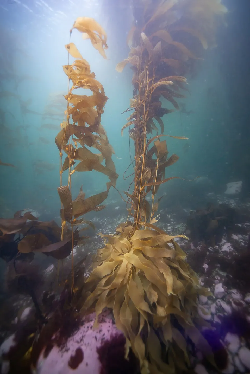
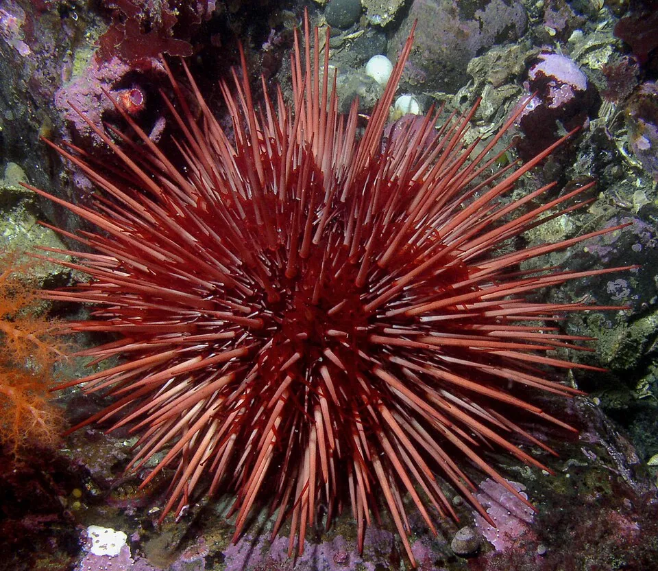
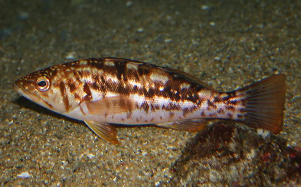
Among the species most often recorded on GBIF are Macrocystis pyrifera (Giant kelp), Mesocentrotus franciscanus (Red sea urchin), Strongylocentrotus purpuratus (Purple sea urchin) and Paralabrax clathratus (Kelp Bass).
Who manages Channel Islands National Park?
National Park Service.
What is the official website of Channel Islands National Park?
© OpenStreetMap
Download the boundary: GeoJSON · GPX Boundary © OpenStreetMap contributors (ODbL).
Geography
The representative point of the site lies at around 1 m above sea level.
Area
- Area
- 101,000 ha
- Elevation
- 1 m
- Median elevation
- 77 m
- Mean slope
- 10°
- Coordinates
- 33.4481, -119.036
Terrain: Mapzen Terrain Tiles (SRTM, USGS)
Main summits
- Montañon Peak551 m
- Vail Peak484 m
- High Mount482 m
- Soledad Peak480 m
- Mount Pleasant426 m
- Black Mountain395 m
- Sierra Pablo341 m
- Summit Peak285 m
- San Miguel Hill253 m
- Green Mountain249 m
Data © OpenStreetMap contributors (ODbL)
Natural habitats
According to the global MODIS land cover (NASA, 2024), the land area is mainly made up of grassland and meadows (81%) and marshes and bogs (15%). The sea covers about 55% of the site. The seabed reaches about 94 m deep (median depth 40 m; GEBCO bathymetry). Elevation ranges from sea level to 551 m (highest point: Montañon Peak).
Biodiversity
Based on occurrences aggregated by GBIF, several species are regularly recorded within the site. Among the most frequent are Macrocystis pyrifera (Giant kelp), Mesocentrotus franciscanus (Red sea urchin), Strongylocentrotus purpuratus (Purple sea urchin) and Paralabrax clathratus (Kelp Bass). The full list of documented taxa is shown below.
Species to look out for
Other species
Red sea urchin
Mesocentrotus franciscanus85,270 records © Taollan82, Kirt L. Onthank · CC BY 3.0

Other species
Purple sea urchin
Strongylocentrotus purpuratus83,468 records © Taollan82 · CC BY 3.0
Other species
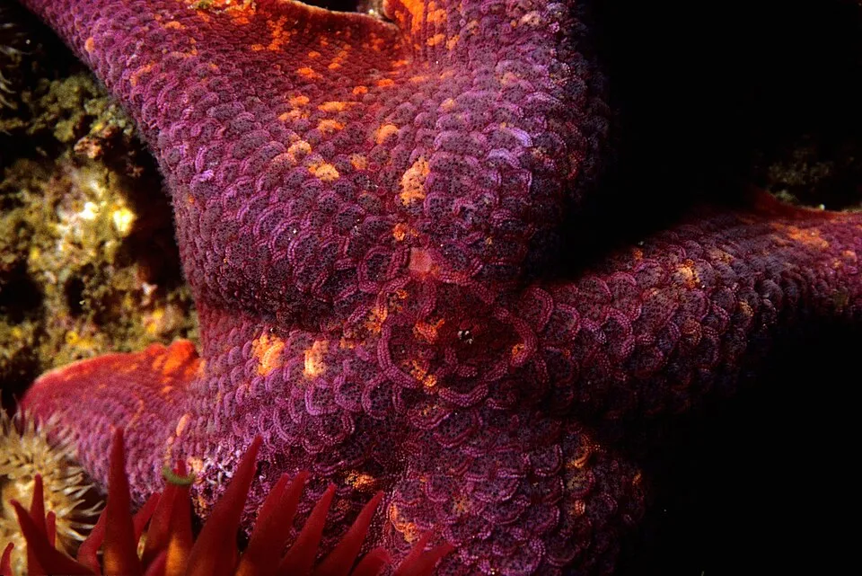
Bat star
Patiria miniata75,970 records © Dr. Dwayne Meadows, NOAA/NMFS/OPR. · Public domain
Observed species
Occurrences documented via GBIF; they are neither an exhaustive inventory nor proof of current presence.
- Giant kelp · Macrocystis pyrifera · 616242
- Red sea urchin · Mesocentrotus franciscanus · 85270
- Purple sea urchin · Strongylocentrotus purpuratus · 83468
- Kelp Bass · Paralabrax clathratus · 76826
- Bat star · Patiria miniata · 75970
- Señorita Wrasse · Oxyjulis californica · 69166
- Blacksmith chromis · Chromis punctipinnis · 68251
- Warty Sea Cucumber · Apostichopus parvimensis · 67504
- California sheephead · Semicossyphus pulcher · 61822
- Giant rock-scallop · Crassadoma gigantea · 57744
- Wavy turban · Megastraea undosa · 56503
- Sun anemone · Anthopleura sola · 54237
+18 more species
- Black Perch · Embiotoca jacksoni · 53719
- Southern sea palm · Eisenia arborea · 52523
- Chestnut cowrie · Neobernaya spadicea · 51503
- Kelp perch · Brachyistius frenatus · 49519
- Garibaldi · Hypsypops rubicundus · 47224
- California Spiny Lobster · Panulirus interruptus · 46752
- Orange rough ball horny sponge · Tethya californiana · 45534
- Painted greenling · Oxylebius pictus · 44524
- Rock wrasse · Halichoeres semicinctus · 43979
- Blue rockfish · Sebastes mystinus · 43948
- Kelp rockfish · Sebastes atrovirens · 43074
- Giant Sea Star · Pisaster giganteus · 42912
- Rudderfish · Girella nigricans · 41478
- Frilly Tube Anemone · Pachycerianthus fimbriatus · 40287
- Striped surfperch · Embiotoca lateralis · 39168
- Kellet's Whelk · Kelletia kelletii · 38055
- Crowned sea urchin · Centrostephanus coronatus · 37863
- Pile Perch · Rhacochilus vacca · 37034
Records: GBIF.org (CC-BY). Names: Wikidata (CC0), GBIF. Photos: Wikimedia Commons.
Conservation challenges
The primary purpose of the site is to preserve its natural habitats and the biodiversity they support. The species recorded (Biodiversity tab) reflect its ecological value. Its status as a national park sets the regulatory framework for its protection.
According to Global Forest Change data (University of Maryland, Global Forest Watch), about 11 ha of tree cover were lost within the boundary between 2001 and 2023, peaking in 2004 and 2013. These losses include logging, storms and fires, and do not account for regrowth. At night, the area gives off virtually no artificial light detectable from space (NASA VIIRS Black Marble composite, 2016).
Pressure indicators
Tree cover lost
11 ha
2001–2023 · < 1% of the area
20012023
Light at night
0%
of the area gives off artificial light visible from space
DarkLit
Sources: Global Forest Change (Hansen et al., University of Maryland, via Global Forest Watch, CC-BY 4.0); EFFIS, European Commission / Copernicus; NASA Black Marble 2016 (public domain); CORINE Land Cover 2018 (Copernicus) or MODIS.
Practical information
Cities and airport
- Ventura
2 km as the crow flies - Oxnard
10 km as the crow flies - Airport: Santa Barbara Municipal (SBA)
37 km as the crow flies
Wheelchair access
- Channel Islands National Park Headquarters and Visitors Center
visitor information - Robert J. Lagomarsino Visitor Center at Channel Islands National Park
visitor information
accessible toilets: 1
Reported by OpenStreetMap contributors (ODbL); check with the park before visiting.
Data © OpenStreetMap contributors (ODbL) · Wikidata (CC0)
Access and visiting
Nearest towns of over 50,000 people, as the crow flies: Ventura (2 km) and Oxnard (10 km). Nearest airport: Santa Barbara Municipal (SBA), about 37 km away. About 420,000 people live within 20 km of the site boundary, 240,000 of them within 10 km; the site itself is virtually uninhabited (GHSL estimate, 2020). This population has grown by about 18% since 2000. OpenStreetMap contributors list 2 wheelchair-accessible places: Channel Islands National Park Headquarters and Visitors Center and Robert J. Lagomarsino Visitor Center at Channel Islands National Park; check with the park before visiting. To plan a visit (access, opening periods, visitor rules), it is best to consult the official information from the managing body (National Park Service) and the official website listed in this page's sources.
Source: OpenStreetMap (ODbL), Wikidata (CC0), October 2026.
Built heritage
According to Wikidata, 2 monuments listed in the National Register of Historic Places stand within the boundary. Examples include “SS Winfield Scott” and “Anacapa Island Light”.
1 bridge, lighthouse, mill or working building1 prehistoric or archaeological site
Source: Wikidata (CC0), monuments in each country’s official heritage protection registers, at national or regional level. Each item links to its Wikidata entry.
Wildlife records calendar
JFMAMJJASOND
Birds
Plants
Butterflies & moths
Dragonflies
Mammals
Monthly records published on GBIF (CC-BY), relative to the busiest month; also reflects observer activity.
Gallery
© Copernicus Sentinel-2, ESA · CC BY-SA 3.0
© Derek Lohuis, National Park Service · Public domain
© hakkun · CC BY-SA 3.0
© Natecation · CC BY-SA 4.0
© National Park Service Digital Image Archives · Public domain
© Joyful Graphics · CC BY-SA 4.0
Sources and licences
- Wikidata: Q306193
- OpenStreetMap: relation 3636334
- Official website: https://nps.gov/chis
- Wikipedia: en.wikipedia.org/wiki/Channel_Islands_National_Park
- WDPA: 1033
References
- registry.opendata.aws: elevation of the reference point, detailed relief · PD
- lpdaac.usgs.gov: land cover · PD
- doi.org: population around the site · CC-BY-4.0
- naturalearthdata.com: sea share · PD
- wikidata.org: official area, establishment date, protected heritage, managing body, nearby cities and airport, access and peaks, lake depths, places to see, official website · CC0-1.0
- en.eurovelo.com: EuroVelo cycle routes · ODbL-1.0
- cycling.waymarkedtrails.org: cycle routes · ODbL-1.0
- gebco.net: depths · PD
- opentopodata.org: elevations · PD
- globalforestwatch.org: tree cover loss · CC-BY-4.0
- gbif.org: seasonality of sightings, observed species · CC-BY-4.0
- openstreetmap.org: official name, access and peaks, trail difficulty, wheelchair access · ODbL-1.0
- earthobservatory.nasa.gov: night light · PD
- nsidc.org: snow cover · PD
- wikidata.org: Wikipedia article · CC-BY-SA-4.0
Data © OpenStreetMap contributors (ODbL), Wikidata (CC0) and the sources cited.