Colombia · Terrestrial
El Cocuy National Park
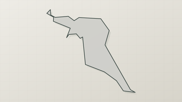
National park of 305,879 hectares in Colombia, established in 1977.
Overview
National park of 305,879 hectares in Colombia, established in 1977.
El Cocuy National Park is located in Colombia (South America). It is a predominantly terrestrial area. Established in 1977, it covers about 305,879 hectares.
In our collections
Frequently asked questions
Where is El Cocuy National Park?
In Colombia (South America). Representative point: 6.4944° N, 72.2977° W.
How large is El Cocuy National Park?
About 305,879 hectares (3,059 km²). It is the 10th largest of the 44 national parks in Colombia covered by Parkavela.
When was El Cocuy National Park established?
In 1977.
What habitats and landscapes does El Cocuy National Park include?
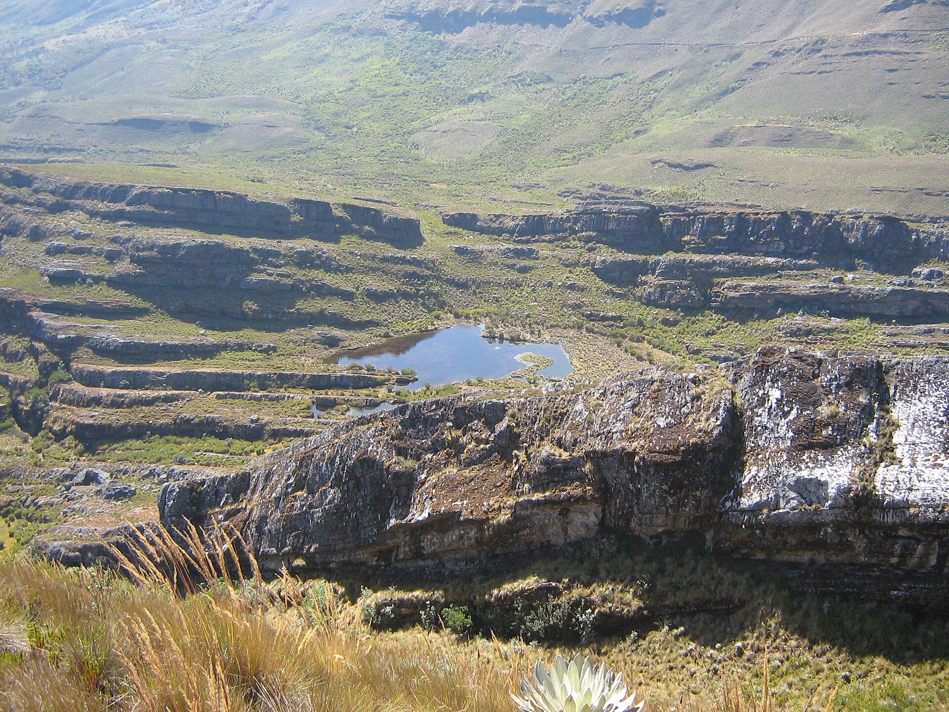
A terrestrial area, with forests and mountains.
What is the highest point of El Cocuy National Park?
Ritacuba Blanco, at 5,410 m (OpenStreetMap).
What are the main summits of El Cocuy National Park?
Ritacuba Blanco (5,410 m), Ritacuba Negro (5,340 m), San Pablin Sur (5,290 m), Pan de Azucar (5,250 m) and Ritacuba Norte (5,180 m) (OpenStreetMap).
What is there to see in El Cocuy National Park?
1 lake or pond and 2 glaciers, including Laguna Grande de la Sierra (4,500 m), Parque nacional natural El Cocuy and Pulpito Del Diablo Glacier (Wikidata).
What is the nearest large city to El Cocuy National Park?
Nearest towns of over 50,000 people, as the crow flies: Bucaramanga (84 km) and Rubio (84 km). Nearest airport: El Alcaraván (EYP), about 89 km away.
Where can I get visitor information on site?
Control Parques.
Are there waymarked hiking trails in El Cocuy National Park?
Yes. Waymarked hiking routes listed in OpenStreetMap: 4, including Vuelta al Cocuy. The “AM-VC · Vuelta al Cocuy” route runs for about 52 km through the site, with some 2,700 m of ascent on its longest section.
Which species can be seen in El Cocuy National Park?
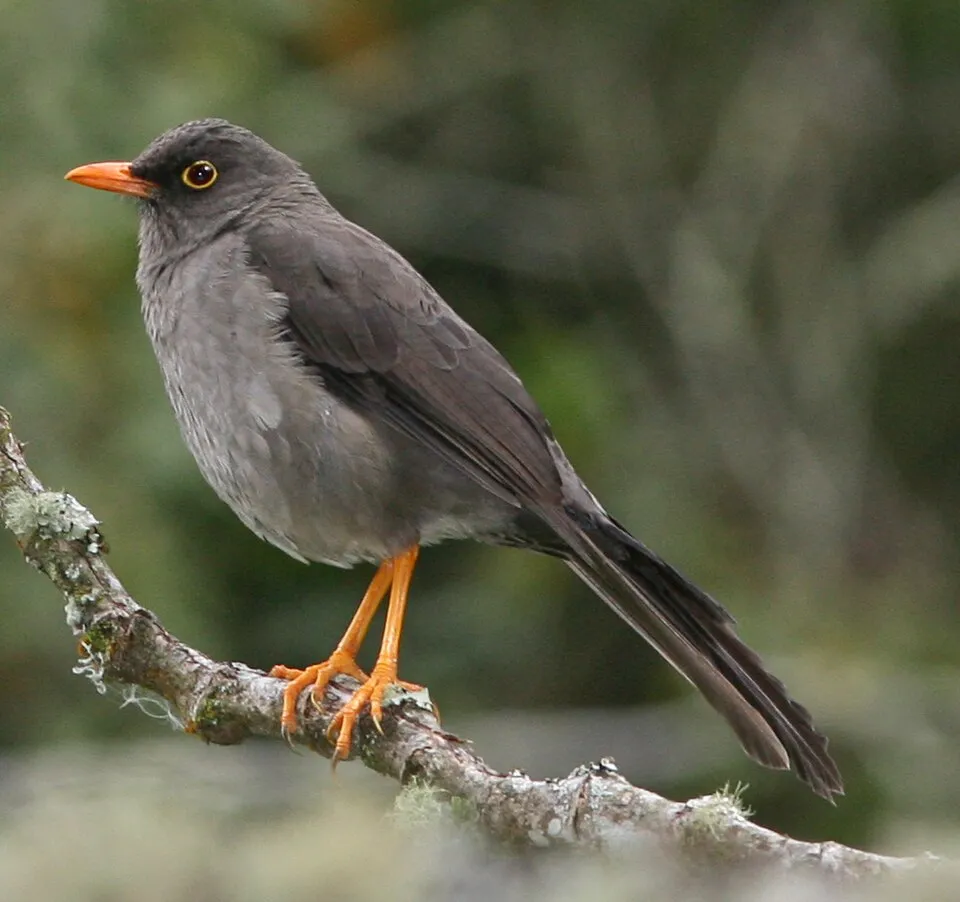
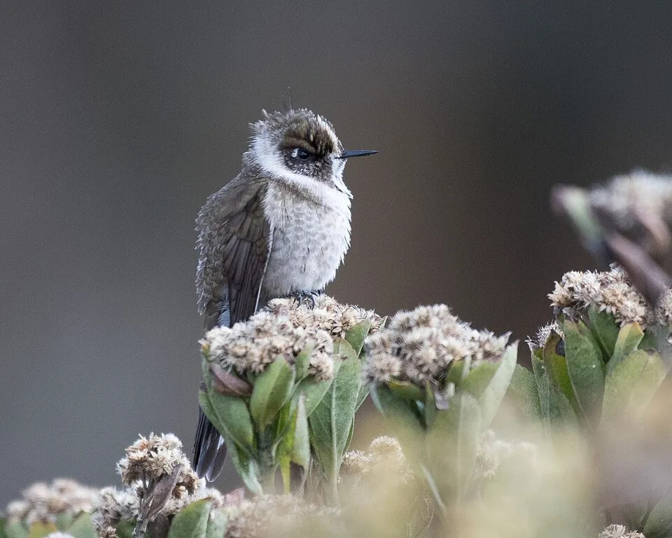
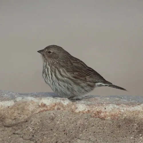
Among the species most often recorded on GBIF are Campylopus pittieri, Turdus fuscater (Great Thrush), Oxypogon guerinii (Green-bearded Helmetcrest) and Geospizopsis unicolor (Plumbeous Sierra Finch).
What is the official website of El Cocuy National Park?
parquesnacionales.gov.co/PNN/portel/libreria/php/decide.php?patron=01.020201
© OpenStreetMap
Download the boundary: GeoJSON · GPX Boundary © OpenStreetMap contributors (ODbL).
Geography
The representative point of the site lies at around 5,333 m above sea level. Over the 1996–2025 period, the mean annual temperature is about -1.2 °C and total precipitation reaches roughly 3,996 mm per year. The warmest month is usually April, the coolest January, and the wettest May.
Area
- Area
- 305,879 ha
- Elevation
- 5,333 m
- Median elevation
- 3,070 m
- Mean slope
- 26°
- Coordinates
- 6.4944, -72.2977
Terrain: Mapzen Terrain Tiles (SRTM, USGS)
Elevation bands
- 500–1,000 m 2%
- 1,000–1,500 m 7%
- 1,500–2,000 m 12%
- 2,000–2,500 m 13%
- 2,500–3,000 m 14%
- above 3,000 m 52%
share of the site in each elevation band (smoothed terrain model: summits are rounded off) · Terrain: Mapzen Terrain Tiles (SRTM, USGS)
Main summits
- Ritacuba Blanco5,410 m
- Ritacuba Negro5,340 m
- San Pablin Sur5,290 m
- Pan de Azucar5,250 m
- Ritacuba Norte5,180 m
- El Castillo5,170 m
- Cóncavo5,165 m
- San Pablín Norte5,112 m
- Concavito5,080 m
- Pico San Antonio5,070 m
Data © OpenStreetMap contributors (ODbL)
Climate
● Mean temperature (°C) · ▮ Precipitation (mm)
Source: Copernicus ERA5-Land (C3S, doi:10.24381/cds.68d2bb30), monthly averages 1996–2025 interpolated to the representative point, temperatures adjusted for elevation.
Contains modified Copernicus Climate Change Service information 2026. Neither the European Commission nor ECMWF is responsible for any use that may be made of the Copernicus information or data it contains.
Natural habitats
According to the global MODIS land cover (NASA, 2024), the site is mainly made up of forests (46%), grassland and meadows (29%) and heath and scrub (23%). It is mostly dense evergreen broadleaved forest. Elevation ranges from about 1,010 m to 5,410 m (highest point: Ritacuba Blanco). Median elevation is 3,070 m, and 52% of the site lies above 3,000 m (SRTM elevation model). The terrain is steep: 35% of slopes exceed 30° (mean slope 26°).
Biodiversity
Based on occurrences aggregated by GBIF, several species are regularly recorded within the site. Among the most frequent are Campylopus pittieri, Turdus fuscater (Great Thrush), Oxypogon guerinii (Green-bearded Helmetcrest) and Geospizopsis unicolor (Plumbeous Sierra Finch). The full list of documented taxa is shown below.
Species to look out for
Plant
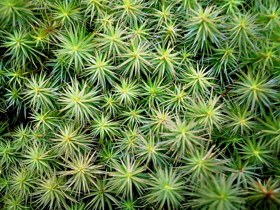
Juniper polytrichum moss
Polytrichum juniperinum67 records © Juni from Kyoto, Japan · CC BY 2.0

Observed species
Occurrences documented via GBIF; they are neither an exhaustive inventory nor proof of current presence.
- Campylopus pittieri · 77
- Great Thrush · Turdus fuscater · 74
- Green-bearded Helmetcrest · Oxypogon guerinii · 74
- Plumbeous Sierra Finch · Geospizopsis unicolor · 72
- Juniper polytrichum moss · Polytrichum juniperinum · 67
- Luzula racemosa · 65
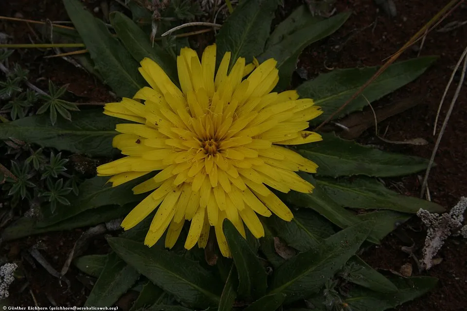
- Chikku Chikku · Hypochaeris sessiliflora · 65
- Zygodon pichinchensis · 64
- Cacalote · Gaultheria myrsinoides · 62
- Espeletia lopezii · 54
- Campylopus cavifolius · 53
- Fragile campylopus moss · Campylopus fragilis · 50
+18 more species
- Chestnut-winged Cinclodes · Cinclodes albidiventris · 48
- Southern House Wren · Troglodytes musculus · 47
- Andreaea moss · Andreaea rupestris · 46
- Paramochloa effusa · 43
- Rufous-collared Sparrow · Zonotrichia capensis · 43
- Silvergreen bryum moss · Bryum argenteum · 40
- Common Cladia · Cladia aggregata · 39
- Many-striped Canastero · Asthenes flammulata · 39
- Campylopus nivalis · 39
- Agrostis breviculmis · 37
- Brown-backed Chat-Tyrant · Ochthoeca fumicolor · 36
- Eastern Meadowlark · Sturnella magna · 35
- Boyaca antpitta · Grallaria alticola · 33
- Bronze-tailed Thornbill · Chalcostigma heteropogon · 33
- Andean Tit-Spinetail · Leptasthenura andicola · 32
- Monticalia flosfragrans · 32
- Andean Siskin · Spinus spinescens · 32
- Black-chested Buzzard-Eagle · Geranoaetus melanoleucus · 31
Records: GBIF.org (CC-BY). Names: Wikidata (CC0), GBIF. Photos: Wikimedia Commons.
Conservation challenges
The primary purpose of the site is to preserve its natural habitats and the biodiversity they support. The species recorded (Biodiversity tab) reflect its ecological value. Its status as a national park sets the regulatory framework for its protection.
According to Global Forest Change data (University of Maryland, Global Forest Watch), about 1,370 ha of tree cover were lost within the boundary between 2001 and 2023 (under 1% of its area), peaking in 2012. These losses include logging, storms and fires, and do not account for regrowth. At night, 1% of the area gives off artificial light detectable from space (NASA VIIRS Black Marble composite, 2016).
Pressure indicators
Tree cover lost
1,370 ha
2001–2023 · < 1% of the area
20012023
Light at night
1%
of the area gives off artificial light visible from space
DarkLit
Built-up land
< 1%
buildings, business areas, roads, quarries
Sources: Global Forest Change (Hansen et al., University of Maryland, via Global Forest Watch, CC-BY 4.0); EFFIS, European Commission / Copernicus; NASA Black Marble 2016 (public domain); CORINE Land Cover 2018 (Copernicus) or MODIS.
Practical information
Cities and airport
- Bucaramanga
84 km as the crow flies - Rubio
84 km as the crow flies - Airport: El Alcaraván (EYP)
89 km as the crow flies
Visitor information
- Control Parques
within the site
Things to see
1 lake or pond · 2 glaciers
- Laguna Grande de la Sierra
lake or pond · 4,500 m - Parque nacional natural El Cocuy
glacier - Pulpito Del Diablo Glacier
glacier
Hiking
4 waymarked routes listed, including:
Vuelta al Cocuy
Data © OpenStreetMap contributors (ODbL) · Wikidata (CC0)
Waymarked hiking routes
AM-VC Vuelta al Cocuy
51.9 km within the site ↗ 2,698 m↘ 2,569 m 3,959–4,689 m
up to T3 · demanding mountain hiking faint path in places
Camino a la Laguna Grande de la Sierra
8.6 km within the site ↗ 955 m↘ 52 m 3,577–4,513 m
up to T3 · demanding mountain hiking
Ruta normal Ritacuba Blanco
8.5 km within the site ↗ 1,304 m↘ 67 m 4,021–5,330 m
up to T4 · alpine hiking faint path in places
Tracks © OpenStreetMap contributors (ODbL), clipped to the boundary; elevation gain and profiles computed on the longest section from Mapzen Terrain Tiles (≈ 30 m), indicative only. Indicative difficulty (SAC scale, OpenStreetMap, via Waymarked Trails): check with the park.
Access and visiting
Nearest towns of over 50,000 people, as the crow flies: Bucaramanga (84 km) and Rubio (84 km). Nearest airport: El Alcaraván (EYP), about 89 km away. About 88,000 people live within 20 km of the site boundary, 19,000 of them within 10 km; some 1,900 people are estimated to live inside (GHSL estimate, 2020). This population has fallen by about 5% since 2000. Visitor information on site: Control Parques. Waymarked hiking routes listed in OpenStreetMap: 4, including Vuelta al Cocuy. To see: 1 lake or pond and 2 glaciers, including Laguna Grande de la Sierra (4,500 m), Parque nacional natural El Cocuy and Pulpito Del Diablo Glacier. To plan a visit (access, opening periods, visitor rules), it is best to consult the official information from the managing body and the official website listed in this page's sources.
Source: OpenStreetMap (ODbL), Wikidata (CC0), November 2026.
When to visit
Average temperatures drop below 0 °C from January to December: frost is common. These averages apply to the site's representative point (5,333 m); higher up it is markedly cooler and snow lasts longer. Day length ranges from about 11 h 45 min in December to 12 h 30 min in June. Wildlife records published on GBIF peak for plants (March). These peaks also reflect when observers are most active.
Source: Copernicus ERA5-Land (C3S), monthly averages 1996–2025 at the representative point, temperatures adjusted for elevation.
Contains modified Copernicus Climate Change Service information 2026. Neither the European Commission nor ECMWF is responsible for any use that may be made of the Copernicus information or data it contains.
Wildlife records calendar
JFMAMJJASOND
Birds
Plants
Monthly records published on GBIF (CC-BY), relative to the busiest month; also reflects observer activity.
Gallery
© Petruss · Public domain
© Petruss · CC BY-SA 3.0
© Martin Roca · CC BY-SA 3.0
© Wilsonjb · CC BY-SA 4.0
© Martin Roca · CC BY-SA 3.0
© Petruss · CC BY-SA 3.0
Sources and licences
- Wikidata: Q1068068
- OpenStreetMap: relation 912564
- Official website: http://www.parquesnacionales.gov.co/PNN/portel/libreria/php/decide.php?patron=01.020201
- Wikipedia: en.wikipedia.org/wiki/Sierra_Nevada_del_Cocuy
- WDPA: 133
References
- cds.climate.copernicus.eu: climate · CC-BY-4.0
- registry.opendata.aws: elevation of the reference point, detailed relief · PD
- lpdaac.usgs.gov: land cover · PD
- doi.org: population around the site · CC-BY-4.0
- naturalearthdata.com: sea share · PD
- wikidata.org: official area, establishment date, protected heritage, nearby cities and airport, access and peaks, lake depths, places to see, official website · CC0-1.0
- en.eurovelo.com: EuroVelo cycle routes · ODbL-1.0
- cycling.waymarkedtrails.org: cycle routes · ODbL-1.0
- opentopodata.org: elevations · PD
- globalforestwatch.org: tree cover loss · CC-BY-4.0
- gbif.org: seasonality of sightings, invasive alien species, observed species · CC-BY-4.0
- openstreetmap.org: official name, access and peaks · ODbL-1.0
- earthobservatory.nasa.gov: night light · PD
- hiking.waymarkedtrails.org: route difficulty · ODbL-1.0
- nsidc.org: snow cover · PD
- wikidata.org: Wikipedia article · CC-BY-SA-4.0
Data © OpenStreetMap contributors (ODbL), Wikidata (CC0) and the sources cited.