Australia · Terrestrial
Eucla National Park
National park of 3,300 hectares in Australia, established in 1979.
Overview
National park of 3,300 hectares in Australia, established in 1979.
Eucla National Park is located in Australia (Oceania). It is a predominantly terrestrial area. Established in 1979, it covers about 3,300 hectares. The site is managed by Department of Parks and Wildlife.
In our collections
Frequently asked questions
Where is Eucla National Park?
In Australia (Oceania). Representative point: 31.6803° S, 128.9450° E.
How large is Eucla National Park?
About 3,300 hectares (33 km²). It is the 430th largest of the 678 national parks in Australia covered by Parkavela. About 400 ha are at sea.
When was Eucla National Park established?
In 1979.
What habitats and landscapes does Eucla National Park include?
A terrestrial area, with coasts.
When is the best time to visit Eucla National Park?
The climate suits visits all year round.
Which species can be seen in Eucla National Park?
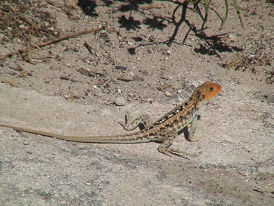
Among the species most often recorded on GBIF are Ctenophorus pictus (Painted Ground-dragon), Morethia obscura (Shrubland Morethia Skink), Lerista baynesi (Bayne's Slider) and Lerista dorsalis (Southern Slider).
Who manages Eucla National Park?
Department of Parks and Wildlife.
What is the official website of Eucla National Park?
dec.wa.gov.au/component/option,com_hotproperty/task,view/id,108/Itemid,755
© OpenStreetMap
Download the boundary: GeoJSON · GPX Boundary © OpenStreetMap contributors (ODbL).
Geography
The representative point of the site lies at around 97 m above sea level. Over the 1996–2025 period, the mean annual temperature is about 17.6 °C and total precipitation reaches roughly 266 mm per year. The warmest month is usually January, the coolest July, and the wettest December.
Area
- Area
- 3,300 ha
- Elevation
- 97 m
- Coordinates
- -31.6803, 128.945
Climate
● Mean temperature (°C) · ▮ Precipitation (mm)
Source: Copernicus ERA5-Land (C3S, doi:10.24381/cds.68d2bb30), monthly averages 1996–2025 interpolated to the representative point, temperatures adjusted for elevation.
Contains modified Copernicus Climate Change Service information 2026. Neither the European Commission nor ECMWF is responsible for any use that may be made of the Copernicus information or data it contains.
Natural habitats
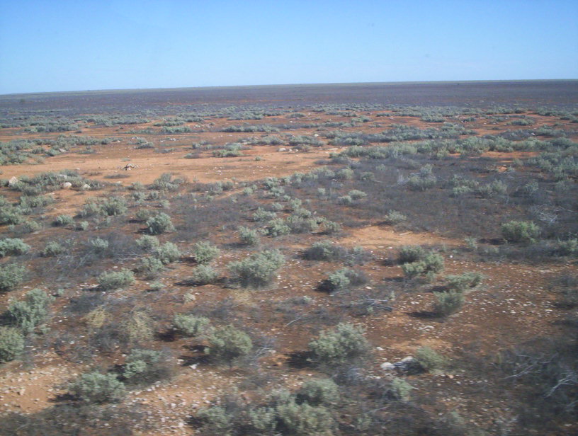
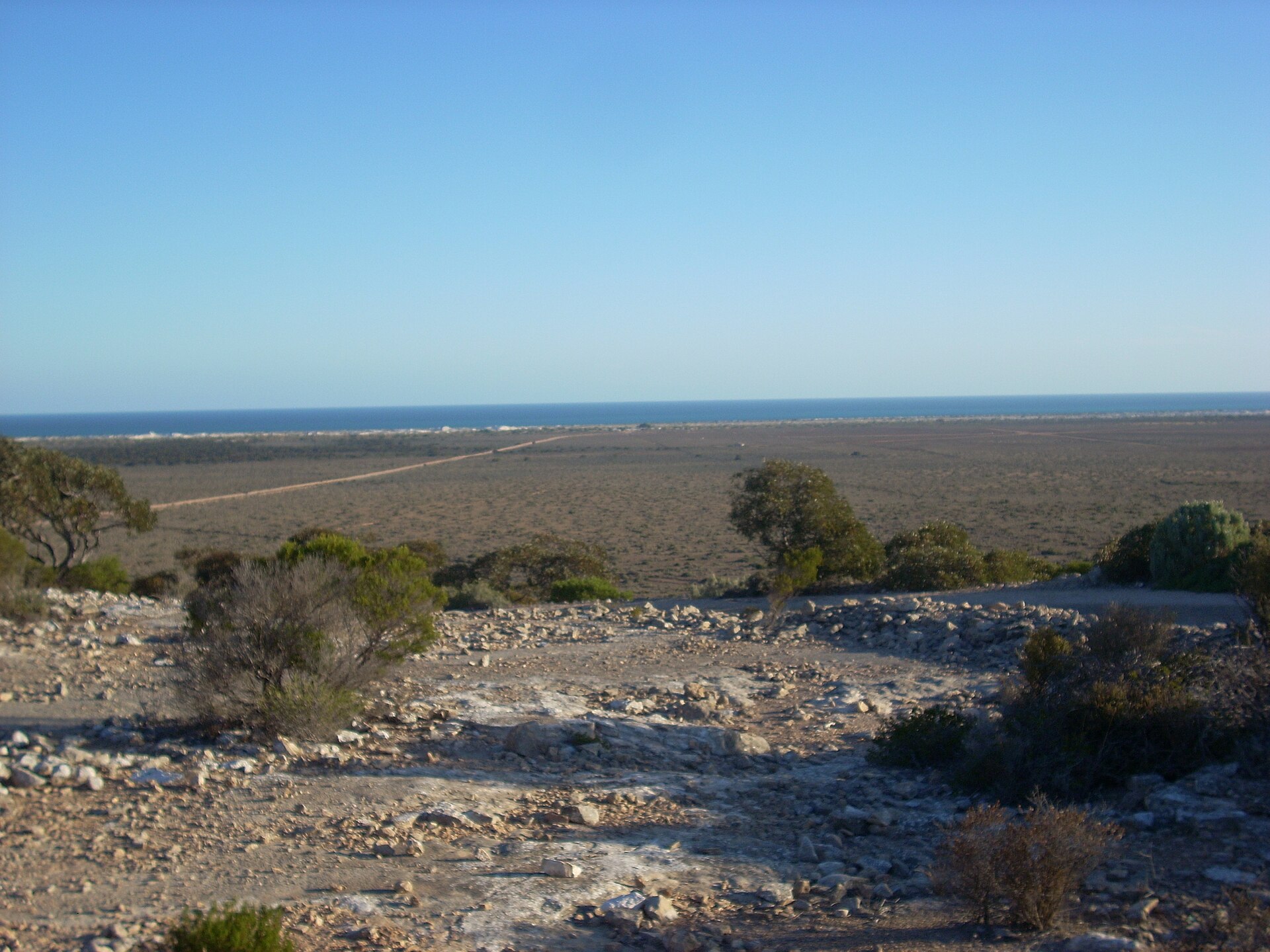
According to the global MODIS land cover (NASA, 2024), the site is mainly made up of heath and scrub (70%), bare rock and scree (20%) and grassland and meadows (9%). The site borders the coast. Elevation ranges from sea level to about 100 m (sampled elevations, SRTM).
Biodiversity
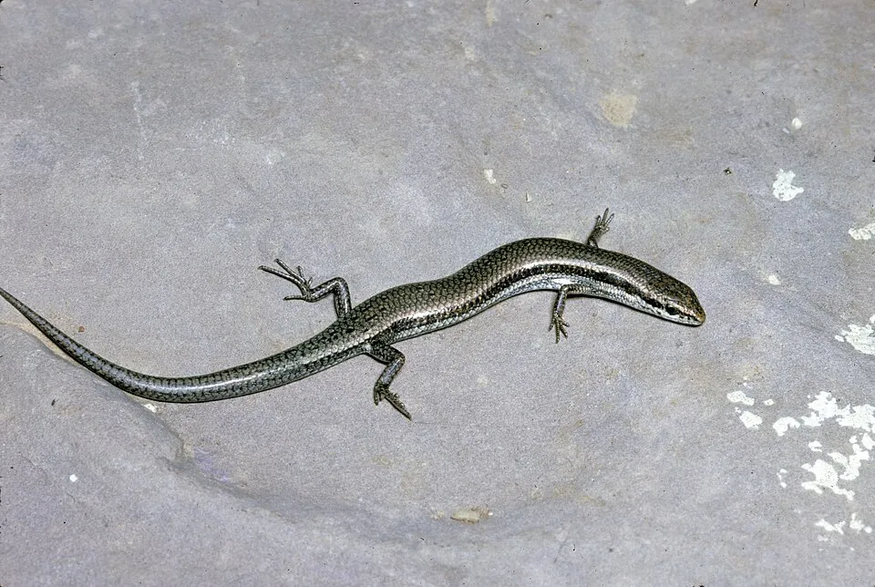
Based on occurrences aggregated by GBIF, several species are regularly recorded within the site. Among the most frequent are Ctenophorus pictus (Painted Ground-dragon), Morethia obscura (Shrubland Morethia Skink), Lerista baynesi (Bayne's Slider) and Lerista dorsalis (Southern Slider). The full list of documented taxa is shown below.
Species to look out for
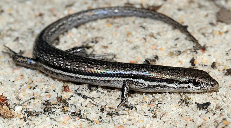
Reptile
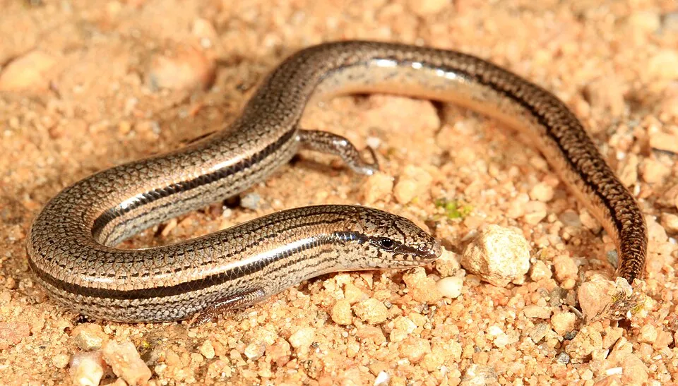
Shrubland Morethia Skink
Morethia obscura39 records © Matt from Melbourne, Australia · CC BY 2.0

Observed species
Occurrences documented via GBIF; they are neither an exhaustive inventory nor proof of current presence.
- Painted Ground-dragon · Ctenophorus pictus · 53
- Shrubland Morethia Skink · Morethia obscura · 39
- Bayne's Slider · Lerista baynesi · 33
- Southern Slider · Lerista dorsalis · 25
- Common dwarf skink · Menetia greyii · 16
- Alexander’s Southern Gecko · Christinus alexanderi · 12
- Bynoe's gecko · Heteronotia binoei · 12
- Desert hopbush · Dodonaea stenozyga · 12
- Sinumelon nullarboricum · 10
- Aboriginal saltbush · Atriplex vesicaria · 10
- Pomaderris forrestiana · 10
- Wedgesnout Ctenotus · Ctenotus euclae · 7
+18 more species
- Eucalyptus · Eucalyptus oleosa · 7
- Southwestern Earless Skink · Hemiergis initialis · 6
- Saltbush Morethia Skink · Morethia adelaidensis · 6
- Bluegreen saltbush · Atriplex nummularia · 6
- Red mallee · Eucalyptus gracilis · 5
- Nundroo Mallee · Eucalyptus calcareana · 5
- Moonah · Melaleuca lanceolata · 5
- Dysphania melanocarpa · 5
- Basedowena polypleura · 5
- Common White-tail Spider · Lampona cylindrata · 4
- Bothriembryon barretti · 4
- Rosy bluebush · Maireana erioclada · 4
- Pale twinleaf · Roepera glauca · 4
- Chapman's Dragon · Ctenophorus chapmani · 4
- Gray saltbush · Atriplex cinerea · 4
- Bumpy Leaf Emu Bush · Eremophila weldii · 4
- Omegapilla australis · 4
- Ardozyga cryptosperma · 3
Records: GBIF.org (CC-BY). Names: Wikidata (CC0), GBIF. Photos: Wikimedia Commons.
Conservation challenges
The primary purpose of the site is to preserve its natural habitats and the biodiversity they support. The species recorded (Biodiversity tab) reflect its ecological value. Its status as a national park sets the regulatory framework for its protection.
At night, the area gives off virtually no artificial light detectable from space (NASA VIIRS Black Marble composite, 2016).
Pressure indicators
Light at night
0%
of the area gives off artificial light visible from space
DarkLit
Sources: Global Forest Change (Hansen et al., University of Maryland, via Global Forest Watch, CC-BY 4.0); EFFIS, European Commission / Copernicus; NASA Black Marble 2016 (public domain); CORINE Land Cover 2018 (Copernicus) or MODIS.
Access and visiting
To plan a visit (access, opening periods, visitor rules), it is best to consult the official information from the managing body (Department of Parks and Wildlife) and the official website listed in this page's sources.
When to visit
The climate suits visits all year round. Day length ranges from about 10 h 05 min in June to 14 h 12 min in December. Wildlife records published on GBIF peak for birds (from August to October) and plants (October). These peaks also reflect when observers are most active.
Source: Copernicus ERA5-Land (C3S), monthly averages 1996–2025 at the representative point, temperatures adjusted for elevation.
Contains modified Copernicus Climate Change Service information 2026. Neither the European Commission nor ECMWF is responsible for any use that may be made of the Copernicus information or data it contains.
Wildlife records calendar
JFMAMJJASOND
Birds
Plants
Monthly records published on GBIF (CC-BY), relative to the busiest month; also reflects observer activity.
Gallery
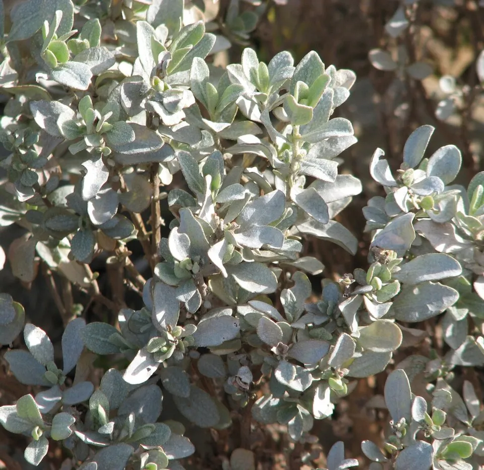
© JarrahTree · CC BY 2.5
Sources and licences
- Wikidata: Q1130900
- OpenStreetMap: relation 14767300
- Official website: http://www.dec.wa.gov.au/component/option,com_hotproperty/task,view/id,108/Itemid,755/
- Wikipedia: en.wikipedia.org/wiki/Eucla_National_Park
- WDPA: 2790
References
- cds.climate.copernicus.eu: climate · CC-BY-4.0
- registry.opendata.aws: elevation of the reference point, detailed relief · PD
- lpdaac.usgs.gov: land cover · PD
- doi.org: population around the site · CC-BY-4.0
- naturalearthdata.com: sea share · PD
- wikidata.org: official area, highest point, establishment date, protected heritage, managing body, official name, nearby cities and airport, lake depths, official website · CC0-1.0
- en.eurovelo.com: EuroVelo cycle routes · ODbL-1.0
- cycling.waymarkedtrails.org: cycle routes · ODbL-1.0
- opentopodata.org: elevations · PD
- globalforestwatch.org: tree cover loss · CC-BY-4.0
- gbif.org: seasonality of sightings, invasive alien species, observed species · CC-BY-4.0
- earthobservatory.nasa.gov: night light · PD
- openstreetmap.org: access and peaks · ODbL-1.0
- nsidc.org: snow cover · PD
- wikidata.org: Wikipedia article · CC-BY-SA-4.0
Data © OpenStreetMap contributors (ODbL), Wikidata (CC0) and the sources cited.