France · Terrestrial
Guiana Amazonian Park
National park of 2,030,000 hectares in France, established in 2007.
Overview
National park of 2,030,000 hectares in France, established in 2007.
Guiana Amazonian Park is a national park in France (overseas). It is a predominantly terrestrial area. Established in 2007, it covers about 2,030,000 hectares.
In our collections
Frequently asked questions
Where is Guiana Amazonian Park?
In France (overseas). Representative point: 3.2892° N, 53.3308° W.
How large is Guiana Amazonian Park?
About 2,030,000 hectares (20,300 km²). It is the largest of the 13 national parks in France covered by Parkavela.
When was Guiana Amazonian Park established?
In 2007.
What habitats and landscapes does Guiana Amazonian Park include?
A terrestrial area, with forests.
What is the highest point of Guiana Amazonian Park?
Bellevue de l'Inini, at 851 m (OpenStreetMap).
What are the main summits of Guiana Amazonian Park?
Bellevue de l'Inini (851 m), Mont Itoupé (823 m), Monts Belvédère (761 m), Pic Coudreau (711 m) and Mont Tsiminiwɨp (640 m) (OpenStreetMap).
When is the best time to visit Guiana Amazonian Park?
Best time to visit: the dry season, from August to November, with less than 70 mm of rain per month.
What is there to see in Guiana Amazonian Park?
43 waterfalls and 3 lakes and ponds, including Bodjuhu ɨtu, Jalbot Uwa’a, Bɨlɨtsi ɨtu and Tsa'i Tchua Uwa'a (OpenStreetMap).
Are there historic monuments in Guiana Amazonian Park?
Yes. According to the French Ministry of Culture's Mérimée database, 2 historic monuments stand within the boundary, all at the second level of protection (inscrit). For example: “La Roche Crabe” in Camopi and “Roches gravées de la crique du Marouini” in Maripasoula.
What is the nearest airport to Guiana Amazonian Park?
Nearest airport: Cayenne – Félix Eboué (CAY), about 98 km away.
Which species can be seen in Guiana Amazonian Park?
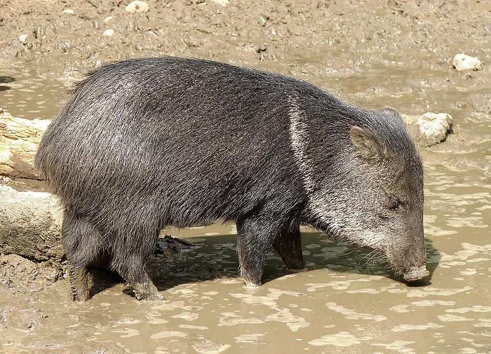
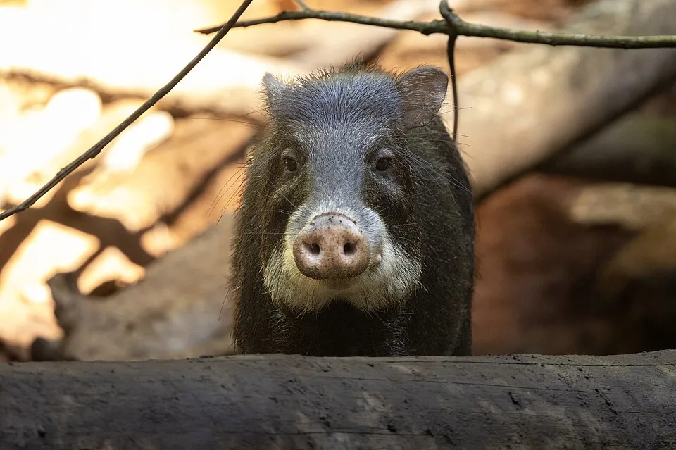
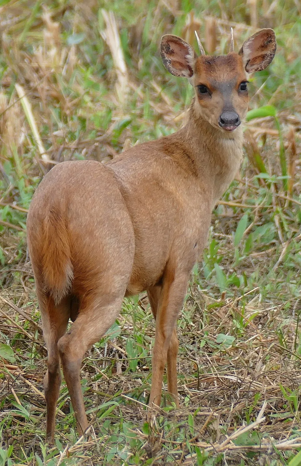
Among the species most often recorded on GBIF are Pecari tajacu (Collared peccary), Mazama gouazoubira (Gray Brocket), Tayassu pecari (White-lipped peccary) and Mazama americana (Red brocket).
What is the official website of Guiana Amazonian Park?
© OpenStreetMap
Download the boundary: GeoJSON · GPX Boundary © OpenStreetMap contributors (ODbL).
Geography
The representative point of the site lies at around 212 m above sea level. Over the 1996–2025 period, the mean annual temperature is about 25.3 °C and total precipitation reaches roughly 1,646 mm per year. The warmest month is usually October, the coolest January, and the wettest May.
Area
- Area
- 2,030,000 ha
- Elevation
- 212 m
- Median elevation
- 190 m
- Coordinates
- 3.2892, -53.3308
Terrain: Mapzen Terrain Tiles (SRTM, USGS)
Main summits
- Bellevue de l'Inini851 m
- Mont Itoupé823 m
- Monts Belvédère761 m
- Pic Coudreau711 m
- Mont Tsiminiwɨp640 m
- Tchoukouchipan620 m
- Ɨwɨtãsĩ - Mont Saint-Marcel620 m
- Pic Ardent593 m
- Monts Barruol545 m
- Massif Emerillon530 m
Data © OpenStreetMap contributors (ODbL)
Climate
● Mean temperature (°C) · ▮ Precipitation (mm)
Source: Copernicus ERA5-Land (C3S, doi:10.24381/cds.68d2bb30), monthly averages 1996–2025 interpolated to the representative point, temperatures adjusted for elevation.
Contains modified Copernicus Climate Change Service information 2026. Neither the European Commission nor ECMWF is responsible for any use that may be made of the Copernicus information or data it contains.
Natural habitats
According to the global MODIS land cover (NASA, 2024), the site is mainly made up of forests (100%). It is mostly dense evergreen broadleaved forest. Elevation ranges from about 110 m to 851 m (highest point: Bellevue de l'Inini).
Biodiversity
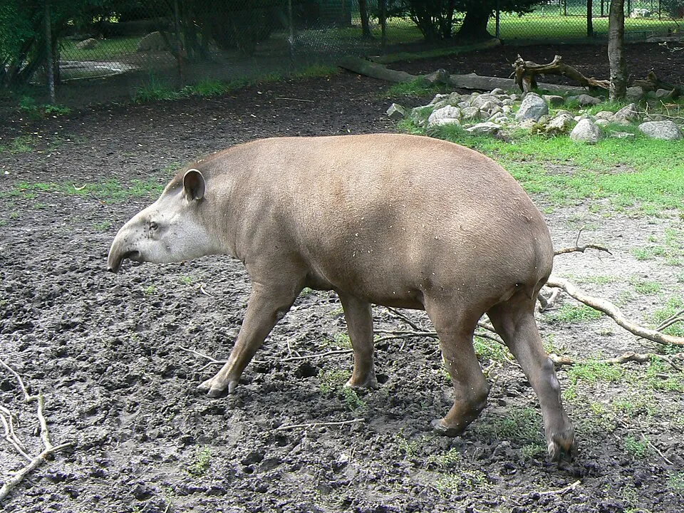
Based on occurrences aggregated by GBIF, several species are regularly recorded within the site. Among the most frequent are Pecari tajacu (Collared peccary), Mazama gouazoubira (Gray Brocket), Tayassu pecari (White-lipped peccary) and Mazama americana (Red brocket). The full list of documented taxa is shown below.
Species to look out for


Observed species
Occurrences documented via GBIF; they are neither an exhaustive inventory nor proof of current presence.
- Collared peccary · Pecari tajacu · 834
- Gray Brocket · Mazama gouazoubira · 502
- White-lipped peccary · Tayassu pecari · 474
- Red brocket · Mazama americana · 392
- South American tapir · Tapirus terrestris · 310
- Earthworm · Pontoscolex corethrurus · 309
- Black-capped Capuchin · Sapajus apella · 300
- Red-faced Black Spider Monkey · Ateles paniscus · 276
- Animals · Animalia spec · 254
- Venezuelan red howler · Alouatta seniculus · 223
- Lowland paca · Cuniculus paca · 219
- Green iguana · Iguana iguana · 217
+18 more species
- Grey-winged Trumpeter · Psophia crepitans · 216
- White-throated Toucan · Ramphastos tucanus · 212
- Black Curassow · Crax alector · 199
- Channel-billed Toucan · Ramphastos vitellinus · 128
- Marail Guan · Penelope marail · 127
- Cuvier's dwarf caiman · Paleosuchus palpebrosus · 121
- Nouraguesia parare · 117
- Moenkhausia georgiae · 89
- Cyclocephala diluta · 87
- Striped Headstander · Hypomasticus despaxi · 86
- Ranadivia modesta · 84
- Moenkhausia chrysargyrea · 74
- Leporinus nijsseni · 74
- Bivibranchia simulata · 66
- Moenkhausia surinamensis · 64
- Red-handed tamarin · Saguinus midas · 64
- Guyanan red howler · Alouatta macconnelli · 64
- Anostomus brevior · 60
Records: GBIF.org (CC-BY). Names: Wikidata (CC0), GBIF. Photos: Wikimedia Commons.
Conservation challenges
The primary purpose of the site is to preserve its natural habitats and the biodiversity they support. The species recorded (Biodiversity tab) reflect its ecological value. Its status as a national park sets the regulatory framework for its protection.
According to Global Forest Change data (University of Maryland, Global Forest Watch), about 3,340 ha of tree cover were lost within the boundary between 2001 and 2023 (under 1% of its area), peaking in 2011 and 2012. These losses include logging, storms and fires, and do not account for regrowth. At night, the area gives off virtually no artificial light detectable from space (NASA VIIRS Black Marble composite, 2016). According to the Water Framework Directive assessment (2022 river basin management plans, data 2015–2017), 87% of the 5,320 km of rivers assessed within the site are in good or high ecological status.
Pressure indicators
Tree cover lost
3,342 ha
2001–2023 · < 1% of the area
20012023
Fires since 2016
0
No large fire mapped (fires over about 30 ha)
Light at night
0%
of the area gives off artificial light visible from space
DarkLit
Rivers and lakes
87%
of the 5,320 km of assessed rivers in good or high ecological status · WFD 2022
assessments 2015–2017
Sources: Global Forest Change (Hansen et al., University of Maryland, via Global Forest Watch, CC-BY 4.0); EFFIS, European Commission / Copernicus; NASA Black Marble 2016 (public domain); CORINE Land Cover 2018 (Copernicus) or MODIS.
Ecological status of water bodies: European Environment Agency, WISE – Water Framework Directive, 3rd river basin management plans (2022), CC BY 4.0. Official national classification, not comparable between countries.
Practical information
Cities and airport
- Airport: Cayenne – Félix Eboué (CAY)
98 km as the crow flies
Things to see
43 waterfalls · 3 lakes and ponds
- Bodjuhu ɨtu
waterfall - Jalbot Uwa’a
lake or pond - Bɨlɨtsi ɨtu
waterfall - Tsa'i Tchua Uwa'a
lake or pond - Mɨtũ ɨtu
waterfall
Data © OpenStreetMap contributors (ODbL) · Wikidata (CC0)
Access and visiting
Nearest airport: Cayenne – Félix Eboué (CAY), about 98 km away. Fewer than 5,000 people live within 20 km of the site boundary, a very sparsely populated area; the site itself is virtually uninhabited (GHSL estimate, 2020). To see: 43 waterfalls and 3 lakes and ponds, including Bodjuhu ɨtu, Jalbot Uwa’a, Bɨlɨtsi ɨtu and Tsa'i Tchua Uwa'a. To plan a visit (access, opening periods, visitor rules), it is best to consult the official information from the managing body and the official website listed in this page's sources.
Source: OpenStreetMap (ODbL), Wikidata (CC0), October 2026.
Built heritage
According to the French Ministry of Culture's Mérimée database, 2 historic monuments stand within the boundary, all at the second level of protection (inscrit). Examples include “La Roche Crabe” in Camopi and “Roches gravées de la crique du Marouini” in Maripasoula.
-
La Roche Crabe
Camopi -
Roches gravées de la crique du Marouini
Maripasoula
Source: Mérimée database, French Ministry of Culture (Licence Ouverte 2.0). Each record links to the Plateforme ouverte du patrimoine (POP).
When to visit
Best time to visit: the dry season, from August to November, with less than 70 mm of rain per month. Precipitation peaks in April and May (up to 300 mm per month). Wildlife records published on GBIF peak for birds (November), plants (March), butterflies and moths (from December to February), dragonflies (August) and mammals (from June to November). These peaks also reflect when observers are most active.
Source: Copernicus ERA5-Land (C3S), monthly averages 1996–2025 at the representative point, temperatures adjusted for elevation.
Contains modified Copernicus Climate Change Service information 2026. Neither the European Commission nor ECMWF is responsible for any use that may be made of the Copernicus information or data it contains.
Wildlife records calendar
JFMAMJJASOND
Birds
Plants
Butterflies & moths
Dragonflies
Mammals
Monthly records published on GBIF (CC-BY), relative to the busiest month; also reflects observer activity.
Gallery
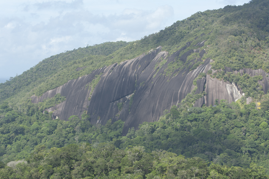
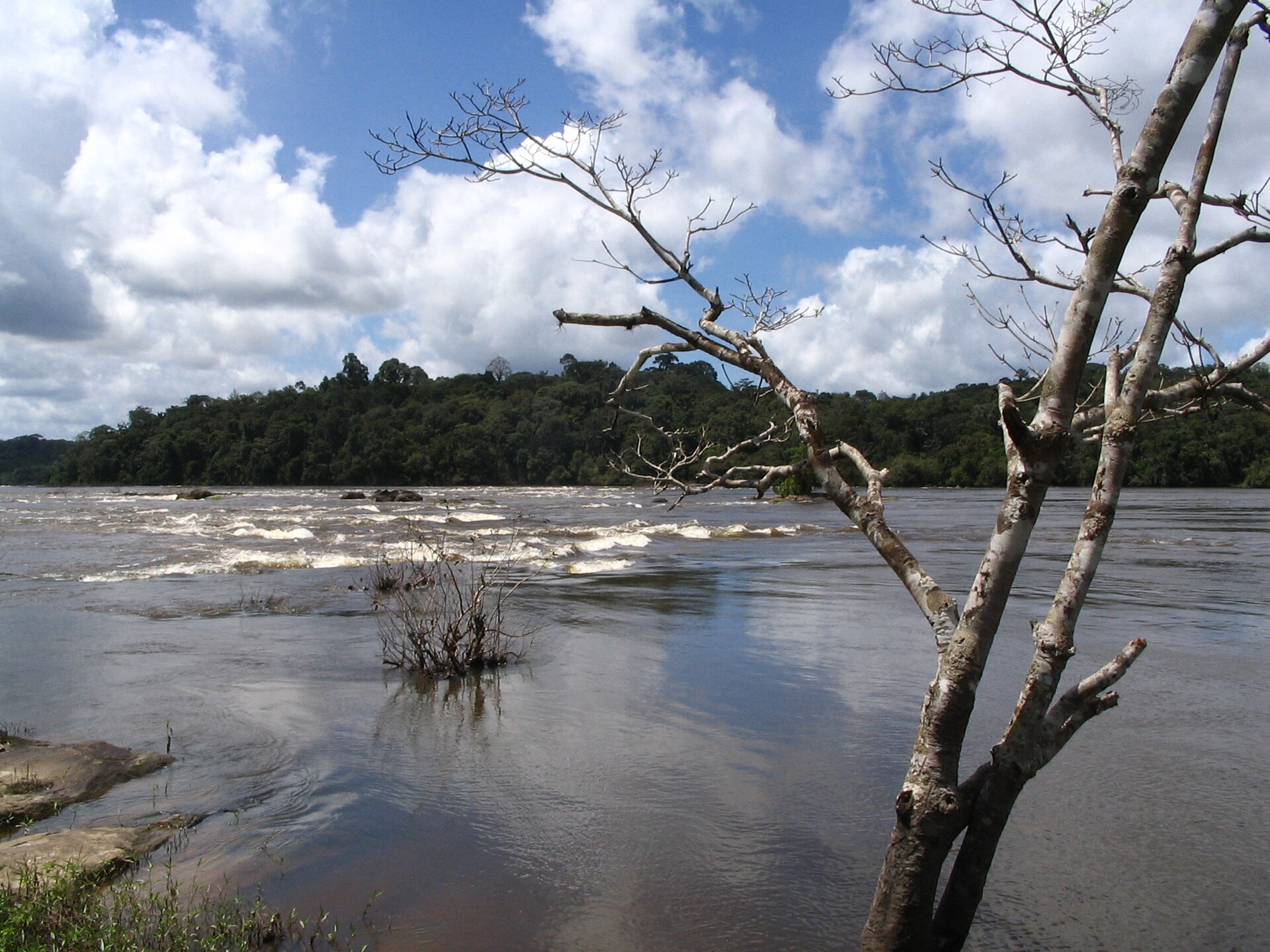
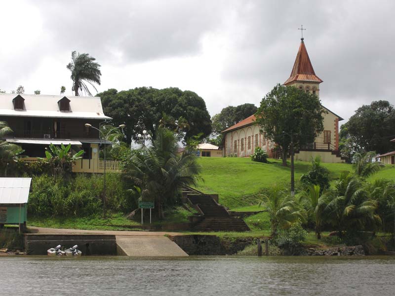
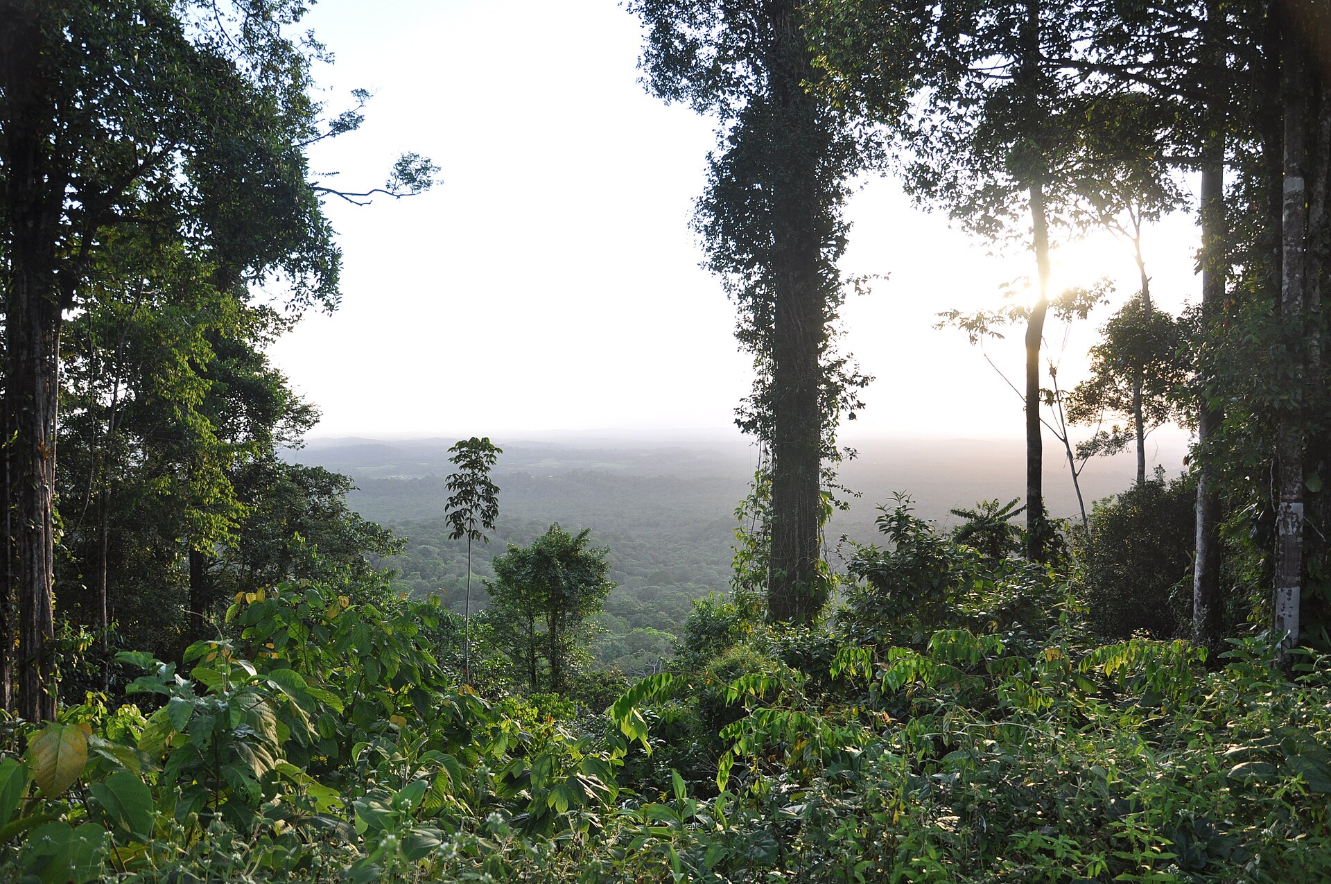
© Joey Allen · CC BY-SA 3.0
© Joey Allen · CC BY-SA 3.0
© Maurizio Alì · CC BY-SA 4.0
© Melanie Dinane · CC BY-SA 4.0
© A. Jailloux · CC BY-SA 4.0
© Jonathan Rochet · CC BY-SA 4.0
Sources and licences
- Wikidata: Q665459
- OpenStreetMap: relation 1106416
- Official website: http://www.parc-amazonien-guyane.fr/
- Wikipedia: en.wikipedia.org/wiki/Guiana_Amazonian_Park
- WDPA: 388667
References
- parc-amazonien-guyane.fr: official area · LO-2.0
- cds.climate.copernicus.eu: climate · CC-BY-4.0
- registry.opendata.aws: elevation of the reference point, detailed relief · PD
- lpdaac.usgs.gov: land cover · PD
- doi.org: population around the site · CC-BY-4.0
- naturalearthdata.com: sea share · PD
- eea.europa.eu: bathing water quality, ecological status of waters · CC-BY-4.0
- en.eurovelo.com: EuroVelo cycle routes · ODbL-1.0
- cycling.waymarkedtrails.org: cycle routes · ODbL-1.0
- opentopodata.org: elevations · PD
- wikidata.org: establishment date, nearby cities and airport, access and peaks, lake depths, places to see, official website · CC0-1.0
- forest-fire.emergency.copernicus.eu: wildfires · COPERNICUS
- globalforestwatch.org: tree cover loss · CC-BY-4.0
- gbif.org: seasonality of sightings, invasive alien species, observed species · CC-BY-4.0
- pop.culture.gouv.fr: protected heritage · LO-2.0
- hydrosheds.org: lakes · CC-BY-4.0
- openstreetmap.org: official name, access and peaks, places to see, trail difficulty · ODbL-1.0
- earthobservatory.nasa.gov: night light · PD
- nsidc.org: snow cover · PD
- wikidata.org: Wikipedia article · CC-BY-SA-4.0
Data © OpenStreetMap contributors (ODbL), Wikidata (CC0) and the sources cited.