
Philippines · Terrestrial
Mount Guiting-Guiting Natural Park
National park of 15,450 hectares in the Philippines.
Overview
National park of 15,450 hectares in the Philippines.
Mount Guiting-Guiting Natural Park is a national park in the Philippines (Asia). It is a predominantly terrestrial area. It covers about 15,450 hectares.
In our collections
Frequently asked questions
Where is Mount Guiting-Guiting Natural Park?
In the Philippines (Asia). Representative point: 12.4063° N, 122.5766° E.
How large is Mount Guiting-Guiting Natural Park?
About 15,450 hectares (155 km²). It is the 8th largest of the 16 national parks in the Philippines covered by Parkavela.
What habitats and landscapes does Mount Guiting-Guiting Natural Park include?
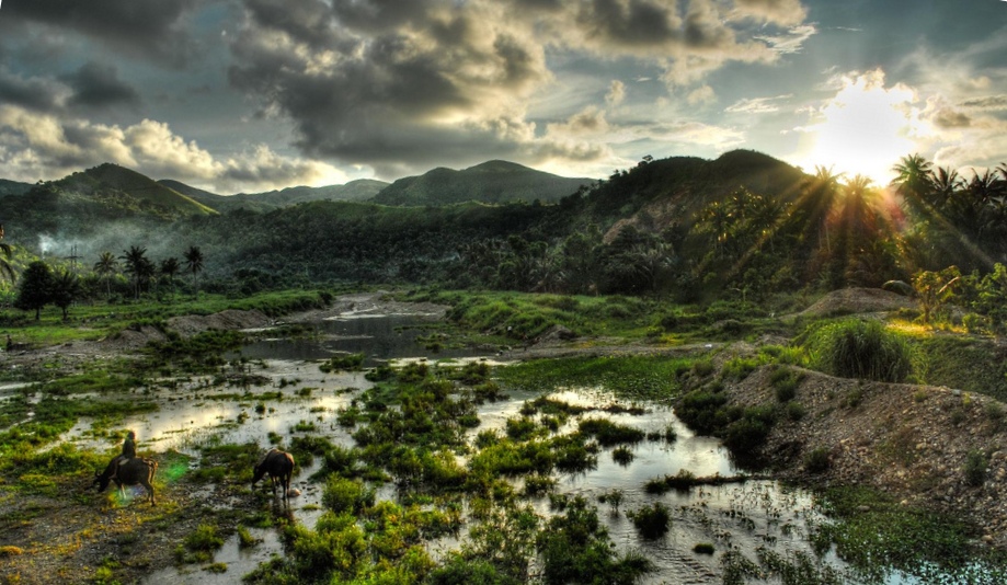
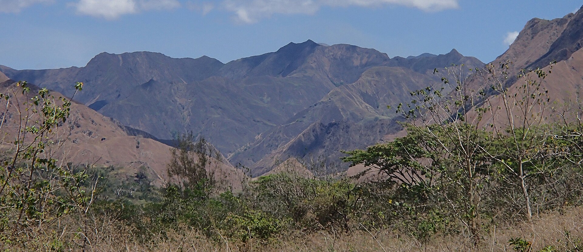
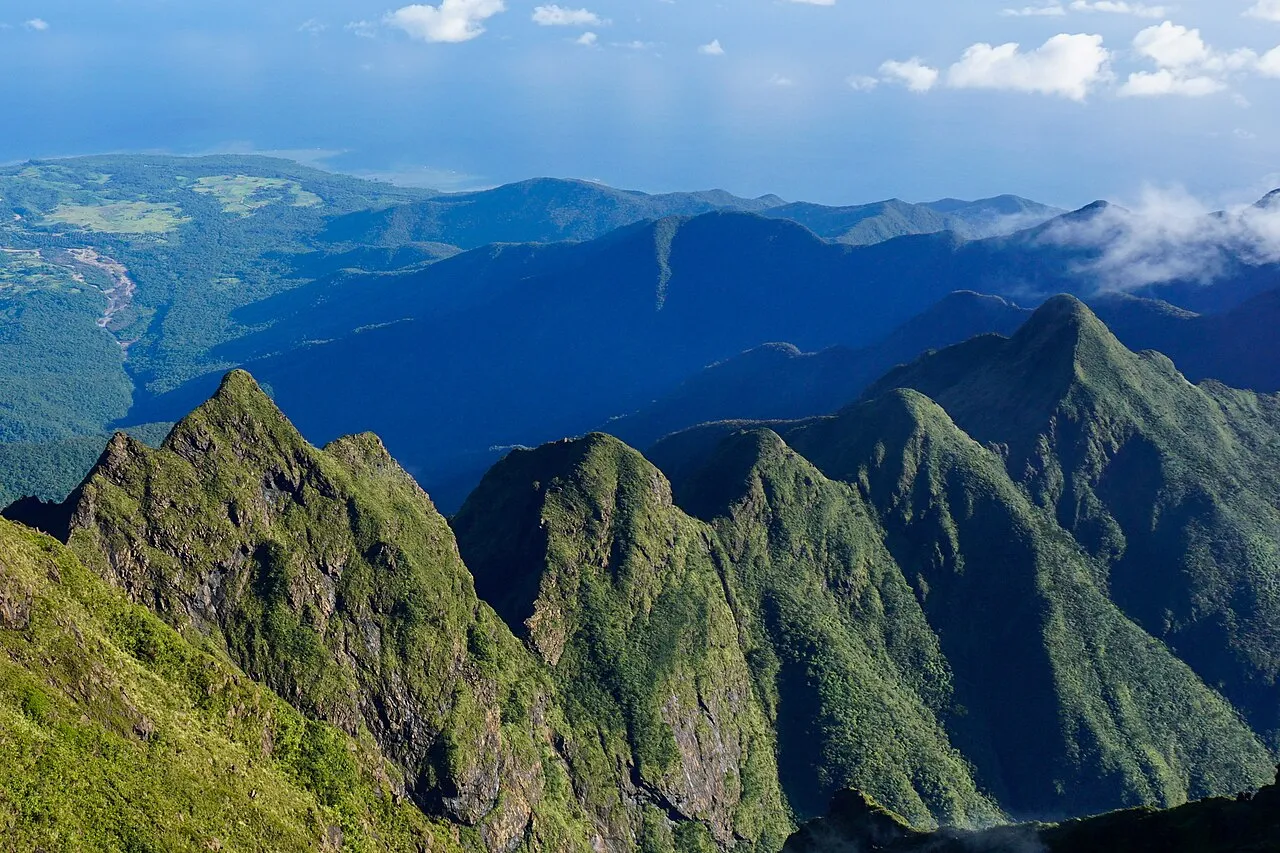
A terrestrial area, with forests and mountains.
What is the highest point of Mount Guiting-Guiting Natural Park?
Mount Guiting-Guiting, at 2,058 m (Wikidata).
When is the best time to visit Mount Guiting-Guiting Natural Park?
The climate suits visits all year round.
Which species can be seen in Mount Guiting-Guiting Natural Park?
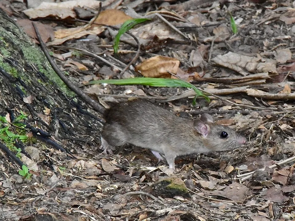
Among the species most often recorded on GBIF are Rhinolophus arcuatus (Arcuate horseshoe bat), Rattus everetti (Philippine Forest Rat), Cynopterus brachyotis (Lesser short-nosed fruit bat) and Rattus tanezumi (Tanezumi rat).
© OpenStreetMap
Download the boundary: GeoJSON · GPX Boundary © OpenStreetMap contributors (ODbL).
Geography
The representative point of the site lies at around 1,500 m above sea level. Over the 1996–2025 period, the mean annual temperature is about 17.8 °C and total precipitation reaches roughly 2,931 mm per year. The warmest month is usually May, the coolest January, and the wettest July.
Area
- Area of the boundary
- 15,450 ha
- Elevation
- 1,500 m
- Median elevation
- 663 m
- Mean slope
- 27°
- Coordinates
- 12.4063, 122.5766
Terrain: Mapzen Terrain Tiles (SRTM, USGS)
Elevation bands
- below 500 m 29%
- 500–1,000 m 52%
- 1,000–1,500 m 16%
- 1,500–2,000 m 3%
share of the site in each elevation band (smoothed terrain model: summits are rounded off) · Terrain: Mapzen Terrain Tiles (SRTM, USGS)
Climate
● Mean temperature (°C) · ▮ Precipitation (mm)
Source: Copernicus ERA5-Land (C3S, doi:10.24381/cds.68d2bb30), monthly averages 1996–2025 interpolated to the representative point, temperatures adjusted for elevation.
Contains modified Copernicus Climate Change Service information 2026. Neither the European Commission nor ECMWF is responsible for any use that may be made of the Copernicus information or data it contains.
Natural habitats
According to the global MODIS land cover (NASA, 2024), the site is mainly made up of forests (99%). It is mostly dense evergreen broadleaved forest. Elevation ranges from about 90 m to 2,058 m (highest point: Mount Guiting-Guiting). Median elevation is 663 m, and 19% of the site lies above 1,000 m (SRTM elevation model). The terrain is steep: 39% of slopes exceed 30° (mean slope 27°).
Biodiversity
Based on occurrences aggregated by GBIF, several species are regularly recorded within the site. Among the most frequent are Rhinolophus arcuatus (Arcuate horseshoe bat), Rattus everetti (Philippine Forest Rat), Cynopterus brachyotis (Lesser short-nosed fruit bat) and Rattus tanezumi (Tanezumi rat). The full list of documented taxa is shown below.
Species to look out for

Mammal
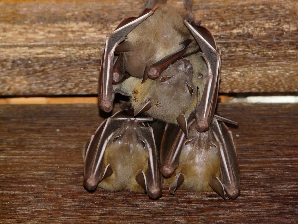
Fischer's pygmy fruit bat
Haplonycteris fischeri24 records © Materialscientist · Public domain
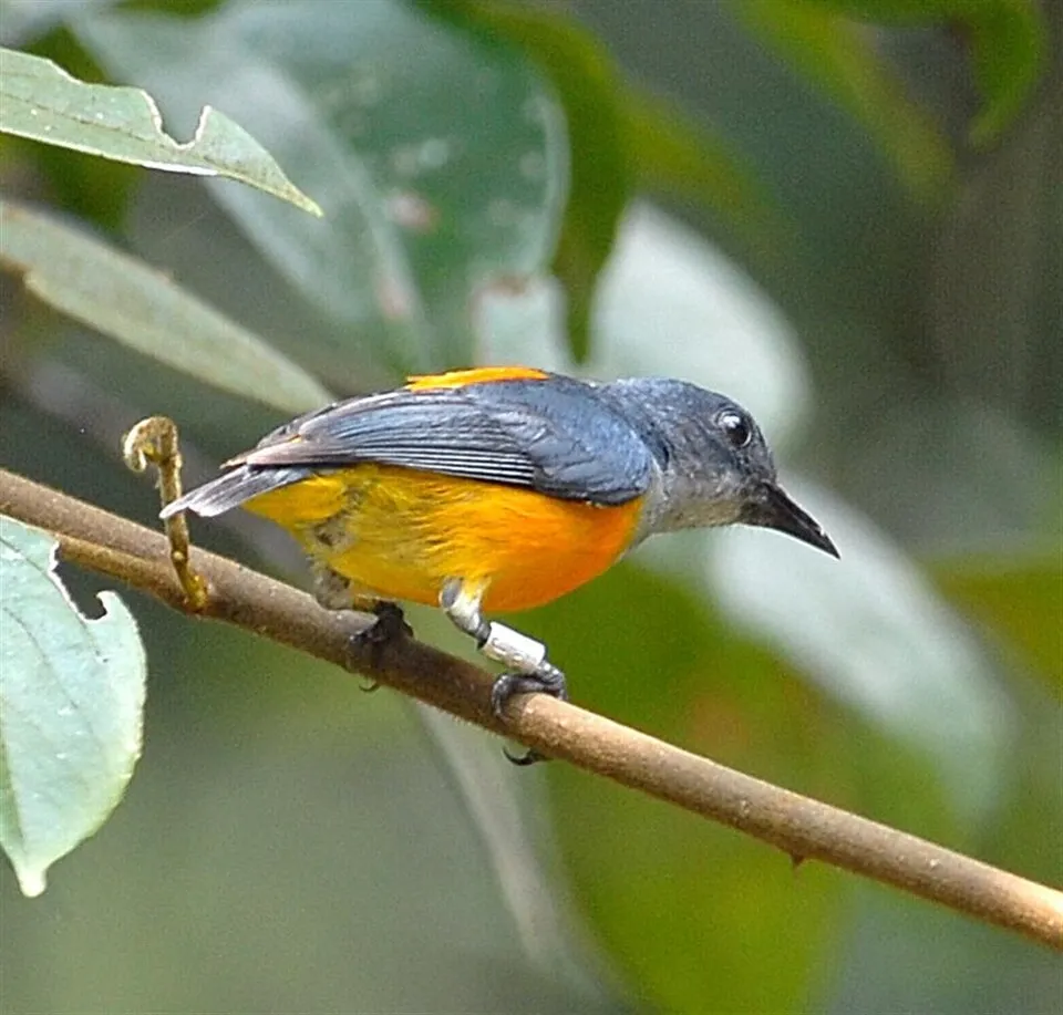
Bird
Orange-bellied Flowerpecker
Dicaeum trigonostigma14 records © Flickr user NatureAtYourBackyard . Photo · CC BY 2.0
Observed species
Occurrences documented via GBIF; they are neither an exhaustive inventory nor proof of current presence.
- Arcuate horseshoe bat · Rhinolophus arcuatus · 101
- Philippine Forest Rat · Rattus everetti · 57
- Lesser short-nosed fruit bat · Cynopterus brachyotis · 44
- Tanezumi rat · Rattus tanezumi · 35
- Eurema sarilata · 32
- Fischer's pygmy fruit bat · Haplonycteris fischeri · 24
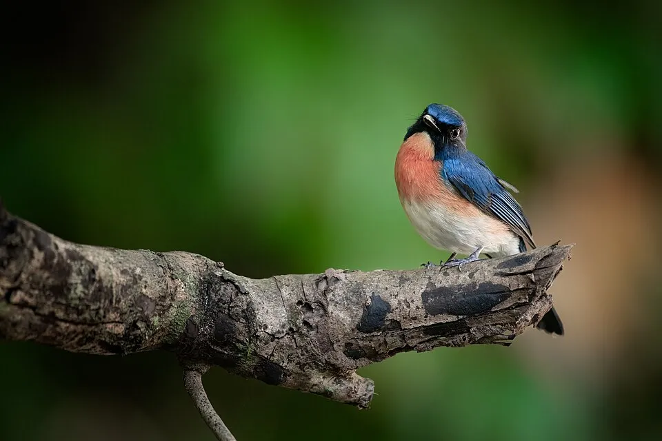
- Mangrove Blue Flycatcher · Cyornis rufigastra · 21
- White-vented Whistler · Pachycephala homeyeri · 18
- Geoffroy's Rousette · Rousettus amplexicaudatus · 14
- Orange-bellied Flowerpecker · Dicaeum trigonostigma · 14
- Philippine Forest Leaf-nosed Bat · Hipposideros obscurus · 12
- Xylocopa cuernosensis · 10
+18 more species
- Black-naped Monarch · Hypothymis azurea · 10
- Philippine narrowmouth toad · Kaloula conjuncta · 9
- Garcinia brevirostris · 9
- Guioa koelreuteria · 9
- White-eared Brown Dove · Phapitreron leucotis · 8
- Garcinia rhizophoroides · 8
- Purple-throated Sunbird · Leptocoma sperata · 8
- Romblon Hawk-Owl · Ninox spilonotus · 8
- Suregada glomerulata · 7
- Graphium decolor · 7
- Long-tongued Nectar Bat · Macroglossus minimus · 7
- Manila Champereia · Champereia manillana · 7
- Garden sunbird · Cinnyris jugularis · 7
- Dipterocarpus grandiflorus · 7
- Grey-rumped Swiftlet · Collocalia marginata · 7
- Luzon Striped Ringlet · Ragadia luzonia · 6
- Painted Jezebel · Delias hyparete · 6
- Rufous paradise flycatcher · Terpsiphone cinnamomea · 6
Records: GBIF.org (CC-BY). Names: Wikidata (CC0), GBIF. Photos: Wikimedia Commons.
Conservation challenges
The primary purpose of the site is to preserve its natural habitats and the biodiversity they support. The species recorded (Biodiversity tab) reflect its ecological value. Its status as a national park sets the regulatory framework for its protection.
According to Global Forest Change data (University of Maryland, Global Forest Watch), about 150 ha of tree cover were lost within the boundary between 2001 and 2023 (under 1% of its area), peaking in 2009 and 2012. These losses include logging, storms and fires, and do not account for regrowth. At night, 3% of the area gives off artificial light detectable from space (NASA VIIRS Black Marble composite, 2016).
Pressure indicators
Tree cover lost
150 ha
2001–2023
20012023
Light at night
3%
of the area gives off artificial light visible from space
DarkLit
Sources: Global Forest Change (Hansen et al., University of Maryland, via Global Forest Watch, CC-BY 4.0); EFFIS, European Commission / Copernicus; NASA Black Marble 2016 (public domain); CORINE Land Cover 2018 (Copernicus) or MODIS.
Practical information
Cities and airport
- Roxas
81 km as the crow flies - Airport: Kalibo (KLO)
74 km as the crow flies
Trail difficulty
- T3–T6 · demanding or alpine hiking · 100% · 16 km
16 km graded out of 27 km of paths
SAC scale (T1–T6) © OpenStreetMap contributors (ODbL): indicative only, check with the park.
Data: Wikidata (CC0), pending OpenStreetMap data · Data © OpenStreetMap contributors (ODbL)
Access and visiting
About 70,000 people live within 20 km of the site boundary, 62,000 of them within 10 km; the site itself is virtually uninhabited (GHSL estimate, 2020). This population has grown by about 20% since 2000. To plan a visit (access, opening periods, visitor rules), it is best to consult the official information from the managing body and the official website listed in this page's sources.
When to visit
The climate suits visits all year round. These averages apply to the site's representative point (1,500 m); higher up it is markedly cooler and snow lasts longer. Day length ranges from about 11 h 24 min in December to 12 h 51 min in June. Wildlife records published on GBIF peak for birds (February and March), plants (April and May), butterflies and moths (March) and mammals (February and March). These peaks also reflect when observers are most active.
Source: Copernicus ERA5-Land (C3S), monthly averages 1996–2025 at the representative point, temperatures adjusted for elevation.
Contains modified Copernicus Climate Change Service information 2026. Neither the European Commission nor ECMWF is responsible for any use that may be made of the Copernicus information or data it contains.
Wildlife records calendar
JFMAMJJASOND
Birds
Plants
Butterflies & moths
Mammals
Monthly records published on GBIF (CC-BY), relative to the busiest month; also reflects observer activity.
Gallery
© Androkoy · CC BY-SA 4.0
© rjabalosIII · CC BY 2.0
© Udo Schmidt from Deutschland · CC BY-SA 2.0
© Androkoy · CC BY-SA 4.0
© Androkoy · CC BY-SA 4.0
© Androkoy · CC BY-SA 4.0
Sources and licences
- Wikidata: Q31847015
References
- cds.climate.copernicus.eu: climate · CC-BY-4.0
- registry.opendata.aws: elevation of the reference point, detailed relief · PD
- lpdaac.usgs.gov: land cover · PD
- doi.org: population around the site · CC-BY-4.0
- naturalearthdata.com: sea share · PD
- openstreetmap.org: official name, trail difficulty · ODbL-1.0
- en.eurovelo.com: EuroVelo cycle routes · ODbL-1.0
- cycling.waymarkedtrails.org: cycle routes · ODbL-1.0
- wikidata.org: highest point, protected heritage, nearby cities and airport, access and peaks, lake depths, places to see · CC0-1.0
- opentopodata.org: elevations · PD
- globalforestwatch.org: tree cover loss · CC-BY-4.0
- gbif.org: seasonality of sightings, invasive alien species, observed species · CC-BY-4.0
- earthobservatory.nasa.gov: night light · PD
- nsidc.org: snow cover · PD
Data © OpenStreetMap contributors (ODbL), Wikidata (CC0) and the sources cited.