Kenya · Terrestrial
Mount Kenya National Park
National park of 71,500 hectares in Kenya, established in 1949.
Overview
National park of 71,500 hectares in Kenya, established in 1949.
Mount Kenya National Park is located in Kenya (Africa). It is a predominantly terrestrial area. Established in 1949, it covers about 71,500 hectares.
Protections and designations
UNESCO World Heritage
Protected as a national park. International labels and designations: UNESCO World Heritage (“Mount Kenya National Park”). Key dates: established in 1949 and World Heritage listing in 1997.
In our collections
Timeline
-
1949
Established
-
1997
Inscribed as a UNESCO World Heritage Site Mount Kenya National Park
Sources: Wikidata (CC0) for establishment and international labels; EEA Natura 2000 database (CC-BY 4.0) for site designation dates.
Frequently asked questions
Where is Mount Kenya National Park?
In Kenya (Africa). Representative point: 0.1239° S, 37.3367° E.
How large is Mount Kenya National Park?
About 71,500 hectares (715 km²). It is the 9th largest of the 26 national parks in Kenya covered by Parkavela.
When was Mount Kenya National Park established?
In 1949.
What habitats and landscapes does Mount Kenya National Park include?
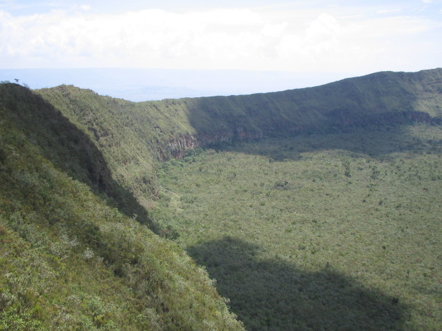
A terrestrial area, with mountains.
What is the highest point of Mount Kenya National Park?
Mont Kenya, at 5,199 m (OpenStreetMap).
What are the main summits of Mount Kenya National Park?
Mont Kenya (5,199 m), Nelion (5,188 m), Point Lenana (4,985 m), Point Thomson (4,955 m) and Point Dutton (4,885 m) (OpenStreetMap).
Which international labels apply to Mount Kenya National Park?
UNESCO World Heritage (“Mount Kenya National Park”).
When is the best time to visit Mount Kenya National Park?
The climate suits visits all year round.
What is there to see in Mount Kenya National Park?
2 lakes and ponds and 8 glaciers, including Lake Alice, Northey Glacier, Lake Ellis and Krapf Glacier (Wikidata).
What is the nearest airport to Mount Kenya National Park?
Nearest airport: Jomo Kenyatta (NBO), about 121 km away.
How can I reach Mount Kenya National Park by train?
The nearest railway station is Karatina, about 27 km from the site boundary.
Are there waymarked hiking trails in Mount Kenya National Park?
Yes. Waymarked hiking routes listed in OpenStreetMap: 4, including Chogoria route, Sirimon route, Naro Moru route and Summit circuit. The “Sirimon route” route runs for about 19 km through the site, with some 80 m of ascent on its longest section.
Which species can be seen in Mount Kenya National Park?
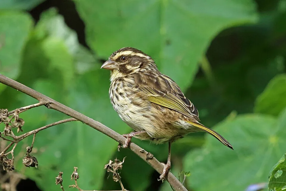
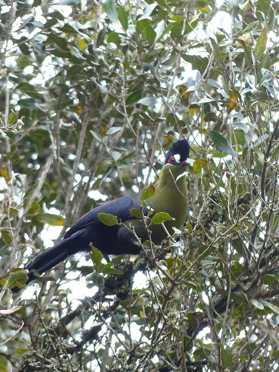
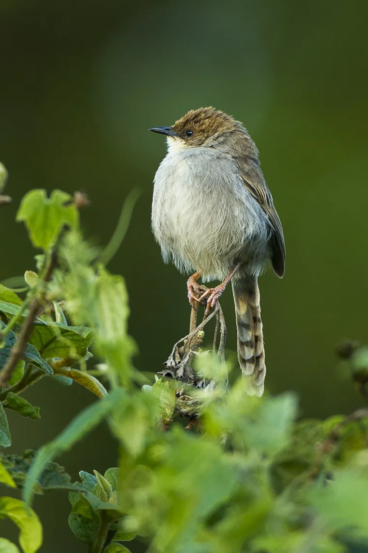
Among the species most often recorded on GBIF are Crithagra striolata (Streaky Seedeater), Tauraco hartlaubi (Hartlaub's turaco), Cisticola hunteri (Hunter's Cisticola) and Pinarochroa sordida (Moorland Chat).
What is the official website of Mount Kenya National Park?
© OpenStreetMap
Download the boundary: GeoJSON · GPX Boundary © OpenStreetMap contributors (ODbL).
Geography
The representative point of the site lies at around 4,289 m above sea level. Over the 1996–2025 period, the mean annual temperature is about 4.5 °C and total precipitation reaches roughly 3,833 mm per year. The warmest month is usually April, the coolest July, and the wettest April.
Area
- Area
- 71,500 ha
- Elevation
- 4,289 m
- Median elevation
- 3,613 m
- Mean slope
- 15°
- Coordinates
- -0.1239, 37.3367
Terrain: Mapzen Terrain Tiles (SRTM, USGS)
Main summits
- Mont Kenya5,199 m
- Nelion5,188 m
- Point Lenana4,985 m
- Point Thomson4,955 m
- Point Dutton4,885 m
- Point John4,883 m
- Point Melhuish4,880 m
- Point Peter4,757 m
- Point Slade4,750 m
- Midget Peak4,700 m
Data © OpenStreetMap contributors (ODbL)
Climate
● Mean temperature (°C) · ▮ Precipitation (mm)
Source: Copernicus ERA5-Land (C3S, doi:10.24381/cds.68d2bb30), monthly averages 1996–2025 interpolated to the representative point, temperatures adjusted for elevation.
Contains modified Copernicus Climate Change Service information 2026. Neither the European Commission nor ECMWF is responsible for any use that may be made of the Copernicus information or data it contains.
Natural habitats
According to the global MODIS land cover (NASA, 2024), the site is mainly made up of grassland and meadows (81%), heath and scrub (12%) and forests (6%). Elevation ranges from about 2,940 m to 5,199 m (highest point: Mont Kenya). Median elevation is 3,613 m, and 97% of the site lies above 3,000 m (SRTM elevation model).
Biodiversity
Based on occurrences aggregated by GBIF, several species are regularly recorded within the site. Among the most frequent are Crithagra striolata (Streaky Seedeater), Tauraco hartlaubi (Hartlaub's turaco), Cisticola hunteri (Hunter's Cisticola) and Pinarochroa sordida (Moorland Chat). The full list of documented taxa is shown below.
Species to look out for
Bird
Hunter's Cisticola
Cisticola hunteri302 records © Francesco Veronesi from Italy · CC BY-SA 2.0


Bird
Jackson's Francolin
Pternistis jacksoni263 records © https://www.flickr.com/photos/francesco_veronesi · CC BY-SA 2.0
Observed species
Occurrences documented via GBIF; they are neither an exhaustive inventory nor proof of current presence.
- Streaky Seedeater · Crithagra striolata · 321
- Hartlaub's turaco · Tauraco hartlaubi · 309
- Hunter's Cisticola · Cisticola hunteri · 302
- Moorland Chat · Pinarochroa sordida · 277
- Jackson's Francolin · Pternistis jacksoni · 263
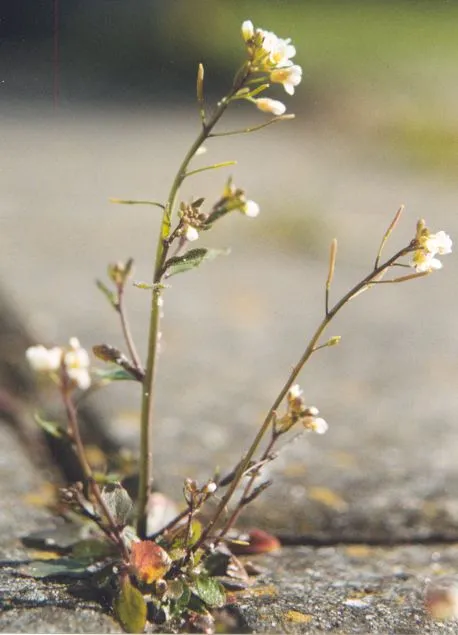
- Thale cress · Arabidopsis thaliana · 241
- White-eyed Slaty Flycatcher · Dioptrornis fischeri · 237
- Kikuyu White-eye · Zosterops kikuyuensis · 225
- Augur Buzzard · Buteo augur · 219
- Eastern Double-collared Sunbird · Cinnyris mediocris · 212
- Black Saw-wing · Psalidoprocne pristoptera · 211
- African Dusky Flycatcher · Muscicapa adusta · 210
+18 more species
- Abyssinian Thrush · Turdus abyssinicus · 200
- Red-fronted Parrot · Poicephalus gulielmi · 198
- Dendrosenecio keniodendron · 196
- Tacazze Sunbird · Nectarinia tacazze · 182
- Scarlet-Tufted Sunbird · Nectarinia johnstoni · 180
- Mountain Buzzard · Buteo oreophilus · 166
- Olive-breasted greenbul · Arizelocichla kikuyuensis · 165
- Yellow-crowned Canary · Serinus flavivertex · 163
- Baglafecht Weaver · Ploceus baglafecht · 153
- Dendrosenecio keniensis · 153
- Common Bulbul · Pycnonotus barbatus · 150
- Brown Woodland Warbler · Phylloscopus umbrovirens · 150
- Slender-billed Starling · Onychognathus tenuirostris · 148
- Cinnamon-chested Bee-eater · Merops oreobates · 144
- Mountain yellow warbler · Iduna similis · 142
- Lobelia telekii · 140
- Alpine rockcress · Arabis alpina · 139
- White-headed Wood Hoopoe · Phoeniculus bollei · 124
Records: GBIF.org (CC-BY). Names: Wikidata (CC0), GBIF. Photos: Wikimedia Commons.
Conservation challenges
The primary purpose of the site is to preserve its natural habitats and the biodiversity they support. The species recorded (Biodiversity tab) reflect its ecological value. The designations it holds frame its management and the control of land use.
According to Global Forest Change data (University of Maryland, Global Forest Watch), about 95 ha of tree cover were lost within the boundary between 2001 and 2023 (under 1% of its area), peaking in 2003 and 2010. These losses include logging, storms and fires, and do not account for regrowth. At night, the area gives off virtually no artificial light detectable from space (NASA VIIRS Black Marble composite, 2016).
Pressure indicators
Tree cover lost
95 ha
2001–2023 · < 1% of the area
20012023
Light at night
0%
of the area gives off artificial light visible from space
DarkLit
Invasive alien species
1
recorded since 2000
Sources: Global Forest Change (Hansen et al., University of Maryland, via Global Forest Watch, CC-BY 4.0); EFFIS, European Commission / Copernicus; NASA Black Marble 2016 (public domain); CORINE Land Cover 2018 (Copernicus) or MODIS.
Invasive alien species: Global Register of Introduced and Invasive Species (ISSG, CC BY 4.0); Union list, Regulation (EU) 1143/2014 (INBO, CC0); GBIF.org records (CC0 / CC BY 4.0), at least 2 per species.
Practical information
Cities and airport
- Airport: Jomo Kenyatta (NBO)
121 km as the crow flies
Things to see
2 lakes and ponds · 8 glaciers
- Lake Alice
lake or pond - Northey Glacier
glacier - Lake Ellis
lake or pond - Krapf Glacier
glacier - Lewis glacier
glacier
Hiking
4 waymarked routes listed, including:
Chogoria routeSirimon routeNaro Moru routeSummit circuit
Data © OpenStreetMap contributors (ODbL) · Wikidata (CC0)
Waymarked hiking routes
Chogoria route
13.9 km within the site ↗ 1,627 m↘ 56 m 3,195–4,783 m
up to T2 · mountain hiking
Naro Moru route
11.3 km within the site ↗ 15 m↘ 1,560 m 3,217–4,775 m
up to T2 · mountain hiking
Tracks © OpenStreetMap contributors (ODbL), clipped to the boundary; elevation gain and profiles computed on the longest section from Mapzen Terrain Tiles (≈ 30 m), indicative only. Indicative difficulty (SAC scale, OpenStreetMap, via Waymarked Trails): check with the park.
Access and visiting
The nearest railway station is Karatina, about 27 km from the site boundary. Nearest airport: Jomo Kenyatta (NBO), about 121 km away. About 610,000 people live within 20 km of the site boundary, 84,000 of them within 10 km; the site itself is virtually uninhabited (GHSL estimate, 2020). This population has grown by about 36% since 2000. Waymarked hiking routes listed in OpenStreetMap: 4, including Chogoria route, Sirimon route, Naro Moru route and Summit circuit. To see: 2 lakes and ponds and 8 glaciers, including Lake Alice, Northey Glacier, Lake Ellis and Krapf Glacier. To plan a visit (access, opening periods, visitor rules), it is best to consult the official information from the managing body and the official website listed in this page's sources.
Source: OpenStreetMap (ODbL), Wikidata (CC0), November 2026.
When to visit
The climate suits visits all year round. Precipitation peaks in April and in October (up to 510 mm per month). These averages apply to the site's representative point (4,289 m); higher up it is markedly cooler and snow lasts longer. Wildlife records published on GBIF peak for birds (January and February), plants (June and July), butterflies and moths (January) and mammals (March). These peaks also reflect when observers are most active.
Source: Copernicus ERA5-Land (C3S), monthly averages 1996–2025 at the representative point, temperatures adjusted for elevation.
Contains modified Copernicus Climate Change Service information 2026. Neither the European Commission nor ECMWF is responsible for any use that may be made of the Copernicus information or data it contains.
Wildlife records calendar
JFMAMJJASOND
Birds
Plants
Butterflies & moths
Mammals
Monthly records published on GBIF (CC-BY), relative to the busiest month; also reflects observer activity.
Gallery
© Doron · CC BY-SA 3.0
© Ronaldcameron · CC BY-SA 4.0
© Lodewicus de Honsvels · CC BY 2.0
© Nina R · CC BY 2.0
© Nina R · CC BY 2.0
© Daniel Case · CC BY-SA 4.0
Sources and licences
- Wikidata: Q1639468
- Official website: http://www.kws.org/nairobi.html
- Wikipedia: en.wikipedia.org/wiki/Mount_Kenya_National_Park
- WDPA: 757
References
- cds.climate.copernicus.eu: climate · CC-BY-4.0
- registry.opendata.aws: elevation of the reference point, detailed relief · PD
- lpdaac.usgs.gov: land cover · PD
- doi.org: population around the site · CC-BY-4.0
- naturalearthdata.com: sea share · PD
- wikidata.org: official area, establishment date, protected heritage, official name, nearby cities and airport, access and peaks, lake depths, places to see, official website · CC0-1.0
- en.eurovelo.com: EuroVelo cycle routes · ODbL-1.0
- cycling.waymarkedtrails.org: cycle routes · ODbL-1.0
- opentopodata.org: elevations · PD
- globalforestwatch.org: tree cover loss · CC-BY-4.0
- gbif.org: seasonality of sightings, invasive alien species, observed species · CC-BY-4.0
- earthobservatory.nasa.gov: night light · PD
- openstreetmap.org: access and peaks · ODbL-1.0
- hiking.waymarkedtrails.org: route difficulty · ODbL-1.0
- nsidc.org: snow cover · PD
- wikidata.org: Wikipedia article · CC-BY-SA-4.0
Data © OpenStreetMap contributors (ODbL), Wikidata (CC0) and the sources cited.