Chile · Terrestrial
Pali Aike National Park
National park of 5,030 hectares in Chile, established in 1970.
Overview
National park of 5,030 hectares in Chile, established in 1970.
Pali Aike National Park is located in Chile (South America). It is a predominantly terrestrial area. Established on 23 October 1970, it covers about 5,030 hectares.
In our collections
Frequently asked questions
Where is Pali Aike National Park?
In Chile (South America). Representative point: 52.1000° S, 69.7333° W.
How large is Pali Aike National Park?
About 5,030 hectares (50 km²). It is the 42nd largest of the 45 national parks in Chile covered by Parkavela.
When was Pali Aike National Park established?
On 23 October 1970.
What habitats and landscapes does Pali Aike National Park include?
A terrestrial area, where land cover is dominated by grassland and meadows (100%).
What is the highest point of Pali Aike National Park?
Cerro Pionero, at 255 m (OpenStreetMap).
When is the best time to visit Pali Aike National Park?
Best time to visit: January and February, with average temperatures of 11 to 12 °C and moderate rainfall.
What is there to see in Pali Aike National Park?
Lago Ana (Wikidata).
Are there historic monuments in Pali Aike National Park?
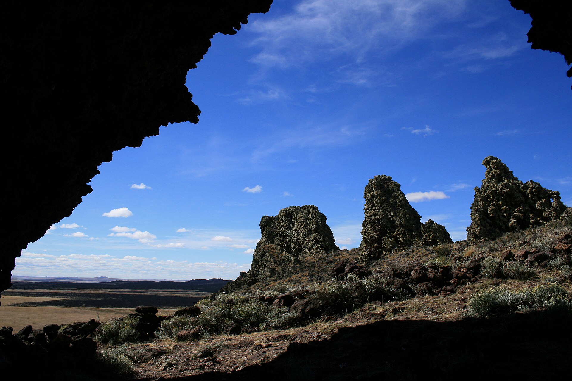
Yes. According to Wikidata, one monument protected in Chile as Historic Monuments (Monumento Histórico) stands within the boundary. For example: “Pali-Aike Cave” in San Gregorio.
What is the nearest large city to Pali Aike National Park?
Nearest towns of over 50,000 people, as the crow flies: Río Gallegos (61 km). Nearest airport: Piloto Civil Norberto Fernández (RGL), about 59 km away.
Where can I get visitor information on site?
Guardería Parque Nacional Pali Aike.
Which species can be seen in Pali Aike National Park?
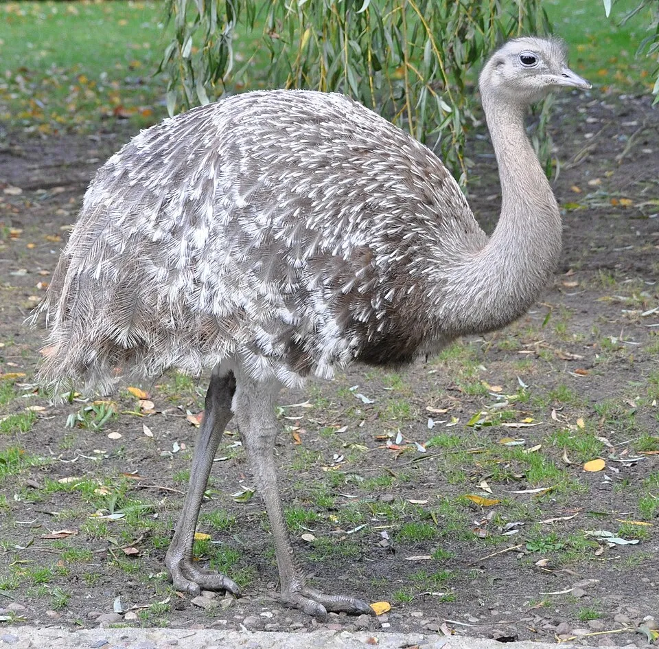
Among the species most often recorded on GBIF are Rhea pennata (Lesser Rhea), Zonotrichia capensis (Rufous-collared Sparrow), Phrygilus gayi (Grey-hooded Sierra Finch) and Muscisaxicola capistratus (Cinnamon-bellied Ground Tyrant).
What is the official website of Pali Aike National Park?
© OpenStreetMap
Download the boundary: GeoJSON · GPX Boundary © OpenStreetMap contributors (ODbL).
Geography
The representative point of the site lies at around 146 m above sea level. Over the 1996–2025 period, the mean annual temperature is about 6.2 °C and total precipitation reaches roughly 436 mm per year. The warmest month is usually January, the coolest July, and the wettest December.
Area
- Area
- 5,030 ha
- Elevation
- 146 m
- Coordinates
- -52.1, -69.7333
Climate
● Mean temperature (°C) · ▮ Precipitation (mm)
Source: Copernicus ERA5-Land (C3S, doi:10.24381/cds.68d2bb30), monthly averages 1996–2025 interpolated to the representative point, temperatures adjusted for elevation.
Contains modified Copernicus Climate Change Service information 2026. Neither the European Commission nor ECMWF is responsible for any use that may be made of the Copernicus information or data it contains.
Snow cover measured by satellite
J
F
M
A
M
J
J
A
S
O
N
D
average share of the site under snow · snowiest parts · ≈ 25 days a year
Snow cover: MODIS/Terra MOD10CM v61 (Hall & Riggs, 2021, NASA NSIDC DAAC, doi:10.5067/MODIS/MOD10CM.061), imagery from NASA GIBS (ESDIS); 2015–2025 average, grid of about 5 km.
Natural habitats
According to the global MODIS land cover (NASA, 2024), the site is mainly made up of grassland and meadows (100%). Elevation ranges from about 100 m to 255 m (highest point: Cerro Pionero).
Biodiversity
Based on occurrences aggregated by GBIF, several species are regularly recorded within the site. Among the most frequent are Rhea pennata (Lesser Rhea), Zonotrichia capensis (Rufous-collared Sparrow), Phrygilus gayi (Grey-hooded Sierra Finch) and Muscisaxicola capistratus (Cinnamon-bellied Ground Tyrant). The full list of documented taxa is shown below.
Species to look out for


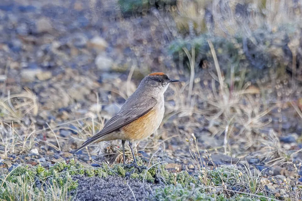
Bird
Cinnamon-bellied Ground Tyrant
Muscisaxicola capistratus166 records © Charles J. Sharp · CC BY-SA 4.0


Observed species
Occurrences documented via GBIF; they are neither an exhaustive inventory nor proof of current presence.
- Lesser Rhea · Rhea pennata · 211
- Rufous-collared Sparrow · Zonotrichia capensis · 173
- Grey-hooded Sierra Finch · Phrygilus gayi · 169
- Cinnamon-bellied Ground Tyrant · Muscisaxicola capistratus · 166
- Austral Negrito · Lessonia rufa · 139
- Tawny-throated Dotterel · Oreopholus ruficollis · 129
- Least Seedsnipe · Thinocorus rumicivorus · 127
- Upland Goose · Chloephaga picta · 126
- Common Miner · Geositta cunicularia · 108
- Black-faced Ibis · Theristicus melanopis · 106
- Buff-winged Cinclodes · Cinclodes fuscus · 106
- Crested Caracara · Caracara plancus · 105
+18 more species
- Chilean Flamingo · Phoenicopterus chilensis · 105
- Cordilleran Canastero · Asthenes modesta · 100
- Prosopantrum inerme · 93
- Southern House Wren · Troglodytes musculus · 85
- Chocolate-vented Tyrant · Neoxolmis rufiventris · 77
- Long-tailed Meadowlark · Sturnella loyca · 71
- Baird's Sandpiper · Calidris bairdii · 69
- Scaly-throated Earthcreeper · Upucerthia dumetaria · 57
- Correndera Pipit · Anthus correndera · 54
- Patagonian Yellow Finch · Sicalis lebruni · 53
- Rufous-chested Plover · Charadrius modestus · 51
- White-bridled Finch · Melanodera melanodera · 51
- Southern Lapwing · Vanellus chilensis · 51
- Short-billed Miner · Geositta antarctica · 50
- Crested Duck · Lophonetta specularioides · 49
- Black-chested Buzzard-Eagle · Geranoaetus melanoleucus · 44
- Peregrine Falcon · Falco peregrinus · 37
- Chilean Swallow · Tachycineta leucopyga · 35
Records: GBIF.org (CC-BY). Names: Wikidata (CC0), GBIF. Photos: Wikimedia Commons.
Conservation challenges
The primary purpose of the site is to preserve its natural habitats and the biodiversity they support. The species recorded (Biodiversity tab) reflect its ecological value. Its status as a national park sets the regulatory framework for its protection.
At night, the area gives off virtually no artificial light detectable from space (NASA VIIRS Black Marble composite, 2016).
Pressure indicators
Light at night
0%
of the area gives off artificial light visible from space
DarkLit
Sources: Global Forest Change (Hansen et al., University of Maryland, via Global Forest Watch, CC-BY 4.0); EFFIS, European Commission / Copernicus; NASA Black Marble 2016 (public domain); CORINE Land Cover 2018 (Copernicus) or MODIS.
Practical information
Cities and airport
- Río Gallegos
61 km as the crow flies - Airport: Piloto Civil Norberto Fernández (RGL)
59 km as the crow flies
Visitor information
- Guardería Parque Nacional Pali Aike
within the site
Parking
4 public car parks listed within the site
Data © OpenStreetMap contributors (ODbL) · Wikidata (CC0)
Access and visiting
Nearest towns of over 50,000 people, as the crow flies: Río Gallegos (61 km). Nearest airport: Piloto Civil Norberto Fernández (RGL), about 59 km away. Visitor information on site: Guardería Parque Nacional Pali Aike. Public car parks listed within the site: 4. To see: Lago Ana. To plan a visit (access, opening periods, visitor rules), it is best to consult the official information from the managing body and the official website listed in this page's sources.
Source: OpenStreetMap (ODbL), Wikidata (CC0), October 2026.
Built heritage
According to Wikidata, one monument protected in Chile as Historic Monuments (Monumento Histórico) stands within the boundary. It is “Pali-Aike Cave” in San Gregorio.
-
Pali-Aike Cave
San Gregorio
Source: Wikidata (CC0), monuments in each country’s official heritage protection registers, at national or regional level. Each item links to its Wikidata entry.
When to visit
Best time to visit: January and February, with average temperatures of 11 to 12 °C and moderate rainfall. Snow only makes brief appearances in winter (about 25 days a year on average, MODIS satellites 2015–2025). Day length ranges from about 7 h 45 min in June to 16 h 43 min in December. Wildlife records published on GBIF peak for birds (November), plants (November) and mammals (January). These peaks also reflect when observers are most active.
Source: Copernicus ERA5-Land (C3S), monthly averages 1996–2025 at the representative point, temperatures adjusted for elevation.
Contains modified Copernicus Climate Change Service information 2026. Neither the European Commission nor ECMWF is responsible for any use that may be made of the Copernicus information or data it contains.
Wildlife records calendar
JFMAMJJASOND
Birds
Plants
Mammals
Monthly records published on GBIF (CC-BY), relative to the busiest month; also reflects observer activity.
Gallery
© Jpfergoy · CC BY-SA 3.0
© Janitoalevic · CC BY-SA 4.0
© Oswaldpat · CC BY-SA 4.0
© Mat Austro · CC BY 4.0
© Janitoalevic · CC BY-SA 4.0
© Janitoalevic · CC BY-SA 4.0
Sources and licences
- Wikidata: Q1367137
- OpenStreetMap: relation 7134778
- Official website: http://www.conaf.cl
- Wikipedia: en.wikipedia.org/wiki/Pali-Aike_National_Park
- WDPA: 107
References
- cds.climate.copernicus.eu: climate · CC-BY-4.0
- registry.opendata.aws: elevation of the reference point, detailed relief · PD
- lpdaac.usgs.gov: land cover · PD
- doi.org: population around the site · CC-BY-4.0
- naturalearthdata.com: sea share · PD
- wikidata.org: official area, establishment date, protected heritage, nearby cities and airport, access and peaks, lake depths, places to see, official website · CC0-1.0
- en.eurovelo.com: EuroVelo cycle routes · ODbL-1.0
- cycling.waymarkedtrails.org: cycle routes · ODbL-1.0
- opentopodata.org: elevations · PD
- globalforestwatch.org: tree cover loss · CC-BY-4.0
- gbif.org: seasonality of sightings, invasive alien species, observed species · CC-BY-4.0
- openstreetmap.org: official name, access and peaks, trail difficulty · ODbL-1.0
- earthobservatory.nasa.gov: night light · PD
- nsidc.org: snow cover · PD
- wikidata.org: Wikipedia article · CC-BY-SA-4.0
Data © OpenStreetMap contributors (ODbL), Wikidata (CC0) and the sources cited.