Peru · Terrestrial
Río Abiseo National Park
National park of 272,400 hectares in Peru, established in 1983.
Overview
National park of 272,400 hectares in Peru, established in 1983.
Río Abiseo National Park is located in Peru (South America). It is a predominantly terrestrial area. Established on 11 August 1983, it covers about 272,400 hectares.
Protections and designations
UNESCO World Heritage
UNESCO Biosphere Reserve
Protected as a national park. International labels and designations: UNESCO World Heritage (“Río Abiseo National Park”) and UNESCO Biosphere Reserve (“Gran Pajatén Biosphere Reserve”). Key dates: established in 1983, World Heritage listing in 1990 and Biosphere Reserve in 2016.
In our collections
Timeline
-
1983
Established
-
1990
Inscribed as a UNESCO World Heritage Site Río Abiseo National Park
-
2016
UNESCO Biosphere Reserve Gran Pajatén Biosphere Reserve
Sources: Wikidata (CC0) for establishment and international labels; EEA Natura 2000 database (CC-BY 4.0) for site designation dates.
Frequently asked questions
Where is Río Abiseo National Park?
In Peru (South America). Representative point: 7.7500° S, 77.2500° W.
How large is Río Abiseo National Park?
About 272,400 hectares (2,724 km²). It is the 9th largest of the 15 national parks in Peru covered by Parkavela.
When was Río Abiseo National Park established?
On 11 August 1983.
What habitats and landscapes does Río Abiseo National Park include?
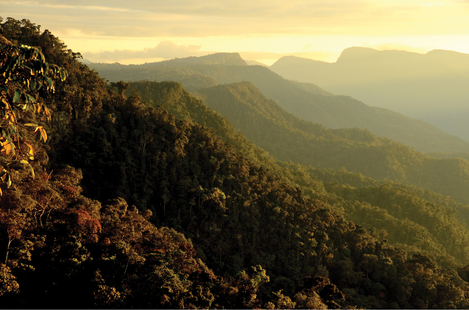
A terrestrial area, with forests and mountains.
Which international labels apply to Río Abiseo National Park?
UNESCO World Heritage (“Río Abiseo National Park”) and UNESCO Biosphere Reserve (“Gran Pajatén Biosphere Reserve”).
When is the best time to visit Río Abiseo National Park?
Best time to visit: from April to October, with average temperatures of 17 to 19 °C and moderate rainfall.
Are there historic monuments in Río Abiseo National Park?
Yes. According to Wikidata, one monument protected in Peru as Cultural Heritage of the Nation stands within the boundary. For example: “Gran Pajáten” in provincia de Mariscal Cáceres.
What is the nearest large city to Río Abiseo National Park?
Nearest towns of over 50,000 people, as the crow flies: Juanjuí (36 km). Nearest airport: Mayor General FAP Armando Revoredo Iglesias (CJA), about 119 km away.
Where can I get visitor information on site?
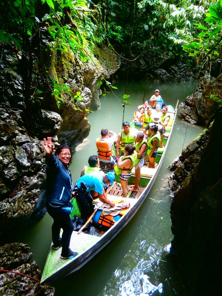
Puesto de Control Churos and Abiseo Tours.
Which species can be seen in Río Abiseo National Park?
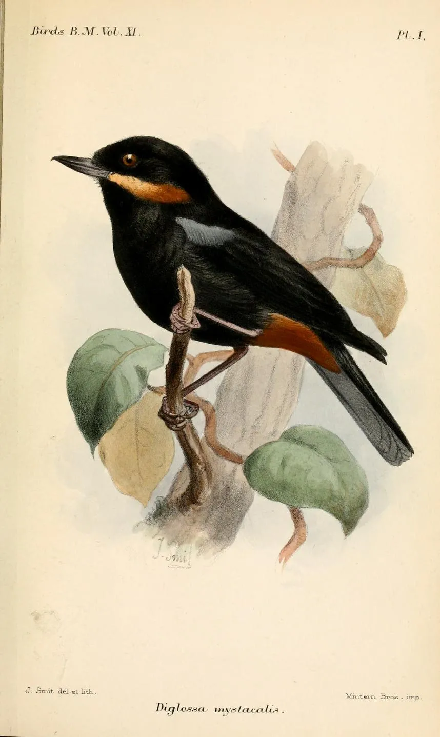
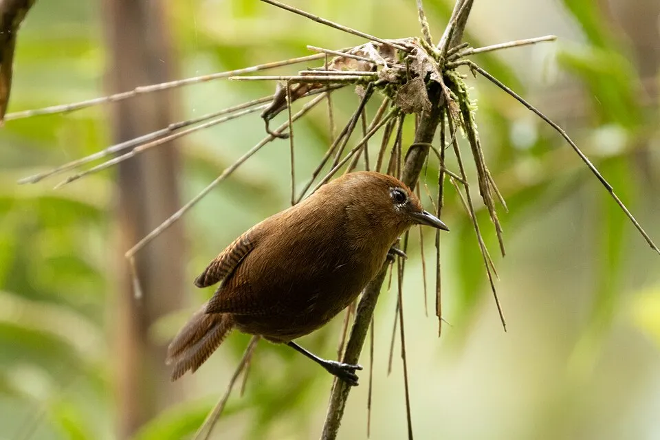
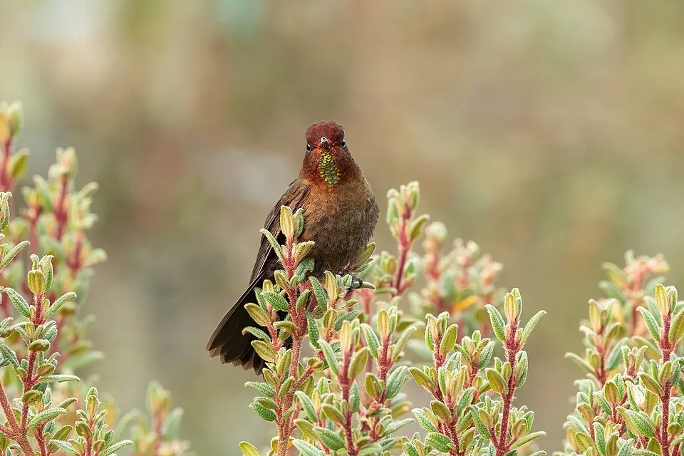
Among the species most often recorded on GBIF are Diglossa mystacalis (Moustached Flowerpiercer), Myiothlypis luteoviridis (Citrine Warbler), Cinnycerthia peruana (Peruvian Wren) and Metallura theresiae (Coppery Metaltail).
© OpenStreetMap
Download the boundary: GeoJSON · GPX Boundary © OpenStreetMap contributors (ODbL).
Geography
The representative point of the site lies at around 1,919 m above sea level. Over the 1996–2025 period, the mean annual temperature is about 18.6 °C and total precipitation reaches roughly 2,657 mm per year. The warmest month is usually November, the coolest July, and the wettest January.
Area
- Area
- 272,400 ha
- Elevation
- 1,919 m
- Median elevation
- 2,678 m
- Mean slope
- 29°
- Coordinates
- -7.75, -77.25
Terrain: Mapzen Terrain Tiles (SRTM, USGS)
Elevation bands
- 500–1,000 m 3%
- 1,000–1,500 m 10%
- 1,500–2,000 m 14%
- 2,000–2,500 m 17%
- 2,500–3,000 m 15%
- above 3,000 m 41%
share of the site in each elevation band (smoothed terrain model: summits are rounded off) · Terrain: Mapzen Terrain Tiles (SRTM, USGS)
Climate
● Mean temperature (°C) · ▮ Precipitation (mm)
Source: Copernicus ERA5-Land (C3S, doi:10.24381/cds.68d2bb30), monthly averages 1996–2025 interpolated to the representative point, temperatures adjusted for elevation.
Contains modified Copernicus Climate Change Service information 2026. Neither the European Commission nor ECMWF is responsible for any use that may be made of the Copernicus information or data it contains.
Natural habitats
According to the global MODIS land cover (NASA, 2024), the site is mainly made up of forests (73%), grassland and meadows (19%) and heath and scrub (8%). It is mostly dense evergreen broadleaved forest. Elevation ranges from about 970 to 4,060 m (sampled elevations, SRTM). Median elevation is 2,678 m, and 41% of the site lies above 3,000 m (SRTM elevation model). The terrain is steep: 49% of slopes exceed 30° (mean slope 29°).
Biodiversity
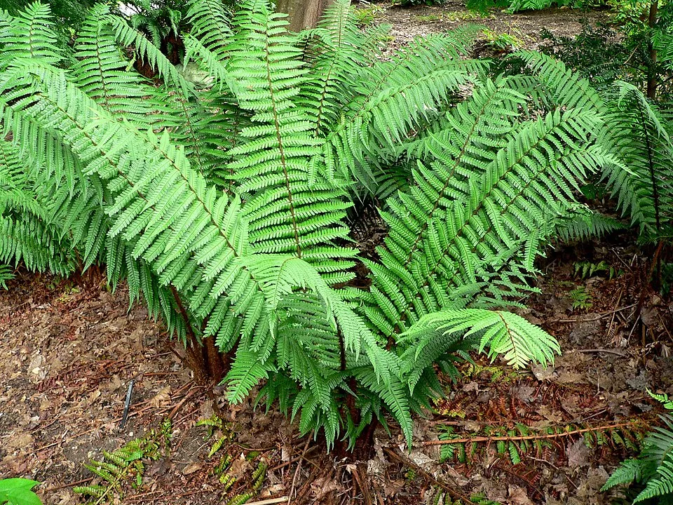
Based on occurrences aggregated by GBIF, several species are regularly recorded within the site. Among the most frequent are Diglossa mystacalis (Moustached Flowerpiercer), Myiothlypis luteoviridis (Citrine Warbler), Cinnycerthia peruana (Peruvian Wren) and Metallura theresiae (Coppery Metaltail). The full list of documented taxa is shown below.
Species to look out for
Bird
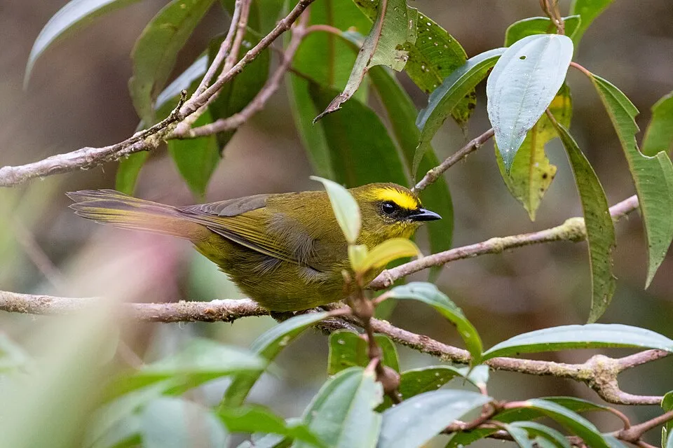
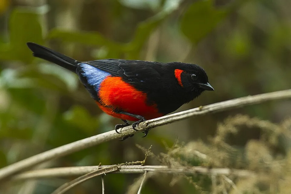
Scarlet-bellied Mountain Tanager
Anisognathus igniventris14 records © Francesco Veronesi · CC BY-SA 2.0
Observed species
Occurrences documented via GBIF; they are neither an exhaustive inventory nor proof of current presence.
- Moustached Flowerpiercer · Diglossa mystacalis · 19
- Citrine Warbler · Myiothlypis luteoviridis · 19
- Peruvian Wren · Cinnycerthia peruana · 16
- Coppery Metaltail · Metallura theresiae · 15
- Alpine woodfern · Dryopteris wallichiana · 15
- Scarlet-bellied Mountain Tanager · Anisognathus igniventris · 14
- Sweet potato · Ipomoea batatas · 12
- El Dorado grass mouse · Akodon orophilus · 10
- Bolivian Starfrontlet · Coeligena violifer · 10
- Crowned Chat-tyrant · Ochthoeca frontalis · 10
- Fuchsia decussata · 10
- Fuchsia sanmartina · 10
+18 more species
- White-chinned Thistletail · Schizoeaca fuliginosa · 9
- White-capped Dipper · Cinclus leucocephalus · 9
- Black-capped Hemispingus · Kleinothraupis atropileus · 9
- Pearled Treerunner · Margarornis squamiger · 8
- Pardusco · Nephelornis oneilli · 8
- White-collared Jay · Cyanolyca viridicyanus · 8
- Rufous-headed Pygmy Tyrant · Pseudotriccus ruficeps · 7
- Streaked Tuftedcheek · Pseudocolaptes boissonneautii · 7
- Muisca antpitta · Grallaria rufula · 7
- Geranium sibbaldioides · 7
- Grass-green Tanager · Chlorornis riefferii · 7
- Tyrian Metaltail · Metallura tyrianthina · 6
- Grey-breasted Mountain Toucan · Andigena hypoglauca · 6
- Slaty-backed Chat-Tyrant · Ochthoeca cinnamomeiventris · 6
- Barred Fruiteater · Pipreola arcuata · 6
- Yellow-whiskered Bush Tanager · Chlorospingus parvirostris · 6
- Spectacled Whitestart · Myioborus melanocephalus · 6
- Great Thrush · Turdus fuscater · 6
Records: GBIF.org (CC-BY). Names: Wikidata (CC0), GBIF. Photos: Wikimedia Commons.
Conservation challenges
The primary purpose of the site is to preserve its natural habitats and the biodiversity they support. The species recorded (Biodiversity tab) reflect its ecological value. The designations it holds frame its management and the control of land use.
According to Global Forest Change data (University of Maryland, Global Forest Watch), about 2,230 ha of tree cover were lost within the boundary between 2001 and 2023 (under 1% of its area), peaking in 2010 and 2012. These losses include logging, storms and fires, and do not account for regrowth. At night, the area gives off virtually no artificial light detectable from space (NASA VIIRS Black Marble composite, 2016).
Pressure indicators
Tree cover lost
2,234 ha
2001–2023 · < 1% of the area
20012023
Light at night
0%
of the area gives off artificial light visible from space
DarkLit
Sources: Global Forest Change (Hansen et al., University of Maryland, via Global Forest Watch, CC-BY 4.0); EFFIS, European Commission / Copernicus; NASA Black Marble 2016 (public domain); CORINE Land Cover 2018 (Copernicus) or MODIS.
Practical information
Cities and airport
- Juanjuí
36 km as the crow flies - Airport: Mayor General FAP Armando Revoredo Iglesias (CJA)
119 km as the crow flies
Visitor information
- Puesto de Control Churos
2 km from the site boundary - Abiseo Tours
2 km from the site boundary
Data © OpenStreetMap contributors (ODbL) · Wikidata (CC0)
Access and visiting
Nearest towns of over 50,000 people, as the crow flies: Juanjuí (36 km). Nearest airport: Mayor General FAP Armando Revoredo Iglesias (CJA), about 119 km away. About 60,000 people live within 20 km of the site boundary, 23,000 of them within 10 km; the site itself is virtually uninhabited (GHSL estimate, 2020). This population has grown by about 23% since 2000. Visitor information on site: Puesto de Control Churos and Abiseo Tours. To plan a visit (access, opening periods, visitor rules), it is best to consult the official information from the managing body and the official website listed in this page's sources.
Source: OpenStreetMap (ODbL), Wikidata (CC0), November 2026.
Built heritage
According to Wikidata, one monument protected in Peru as Cultural Heritage of the Nation stands within the boundary. It is “Gran Pajáten” in provincia de Mariscal Cáceres.
-
Gran Pajáten
provincia de Mariscal Cáceres
Source: Wikidata (CC0), monuments in each country’s official heritage protection registers, at national or regional level. Each item links to its Wikidata entry.
When to visit
Best time to visit: from April to October, with average temperatures of 17 to 19 °C and moderate rainfall. These averages apply to the site's representative point (1,919 m); higher up it is markedly cooler and snow lasts longer. Day length ranges from about 11 h 40 min in June to 12 h 34 min in December. Wildlife records published on GBIF peak for birds (August), plants (August) and butterflies and moths (August and September). These peaks also reflect when observers are most active.
Source: Copernicus ERA5-Land (C3S), monthly averages 1996–2025 at the representative point, temperatures adjusted for elevation.
Contains modified Copernicus Climate Change Service information 2026. Neither the European Commission nor ECMWF is responsible for any use that may be made of the Copernicus information or data it contains.
Wildlife records calendar
JFMAMJJASOND
Birds
Plants
Butterflies & moths
Monthly records published on GBIF (CC-BY), relative to the busiest month; also reflects observer activity.
Gallery
© Ti galan · CC BY-SA 4.0
© Joss.alberto · CC BY-SA 3.0
© Martín Chumbe · CC BY-SA 4.0
© Javier cosavalente galán · CC BY-SA 3.0
© DEZE DANIEL · CC BY-SA 4.0
© Cosavalentino · CC BY-SA 3.0
Sources and licences
- Wikidata: Q941412
- OpenStreetMap: relation 6421151
- Wikipedia: en.wikipedia.org/wiki/Rio_Abiseo_National_Park
- WDPA: 7461
References
- cds.climate.copernicus.eu: climate · CC-BY-4.0
- registry.opendata.aws: elevation of the reference point, detailed relief · PD
- lpdaac.usgs.gov: land cover · PD
- doi.org: population around the site · CC-BY-4.0
- naturalearthdata.com: sea share · PD
- wikidata.org: official area, establishment date, protected heritage, official name, nearby cities and airport, access and peaks, lake depths, places to see · CC0-1.0
- en.eurovelo.com: EuroVelo cycle routes · ODbL-1.0
- cycling.waymarkedtrails.org: cycle routes · ODbL-1.0
- opentopodata.org: elevations · PD
- globalforestwatch.org: tree cover loss · CC-BY-4.0
- gbif.org: seasonality of sightings, invasive alien species, observed species · CC-BY-4.0
- earthobservatory.nasa.gov: night light · PD
- openstreetmap.org: access and peaks · ODbL-1.0
- nsidc.org: snow cover · PD
- wikidata.org: Wikipedia article · CC-BY-SA-4.0
Data © OpenStreetMap contributors (ODbL), Wikidata (CC0) and the sources cited.