Chile · Terrestrial
Río Clarillo National Park
National park of 13,085 hectares in Chile, established in 1982.
Overview
National park of 13,085 hectares in Chile, established in 1982.
Río Clarillo National Park is located in Chile (South America). It is a predominantly terrestrial area. Established in 1982, it covers about 13,085 hectares.
In our collections
Frequently asked questions
Where is Río Clarillo National Park?
In Chile (South America). Representative point: 33.7667° S, 70.4500° W.
How large is Río Clarillo National Park?
About 13,085 hectares (131 km²). It is the 32nd largest of the 45 national parks in Chile covered by Parkavela.
When was Río Clarillo National Park established?
In 1982.
What habitats and landscapes does Río Clarillo National Park include?
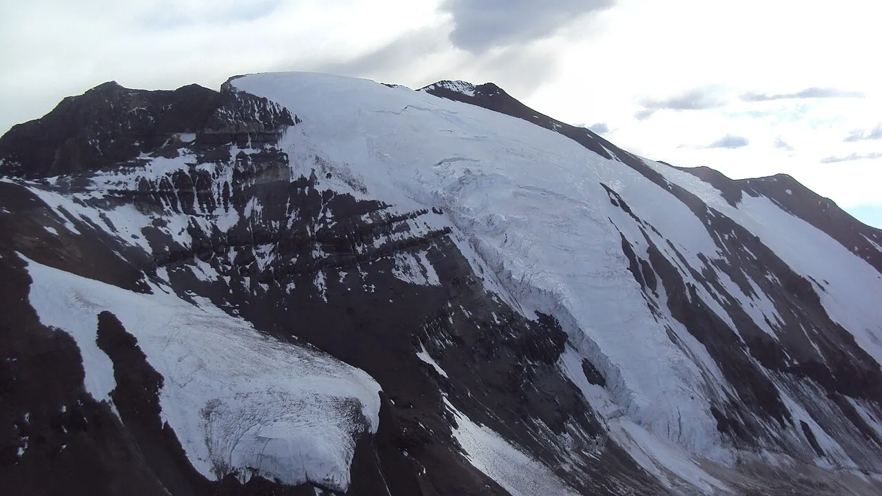
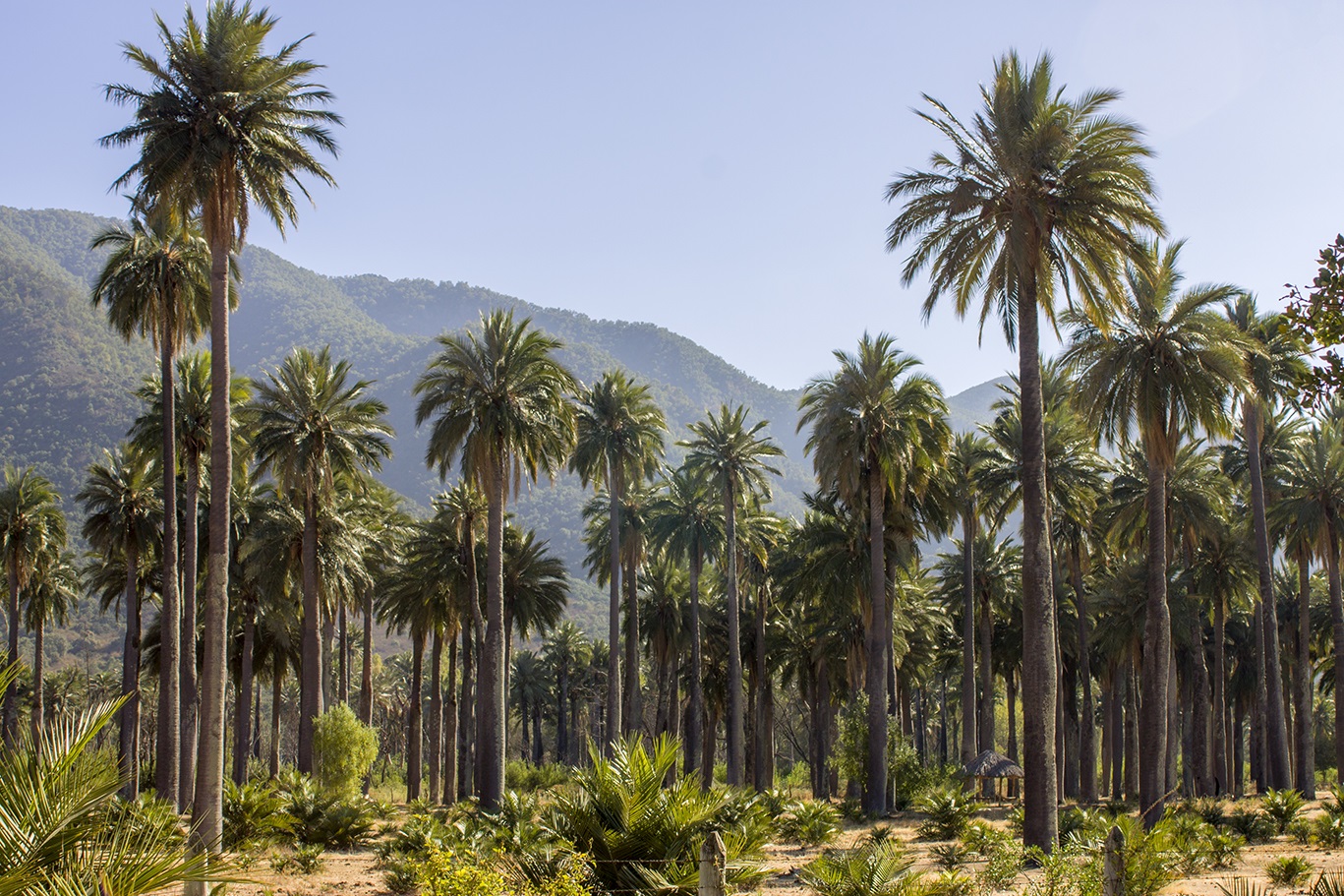
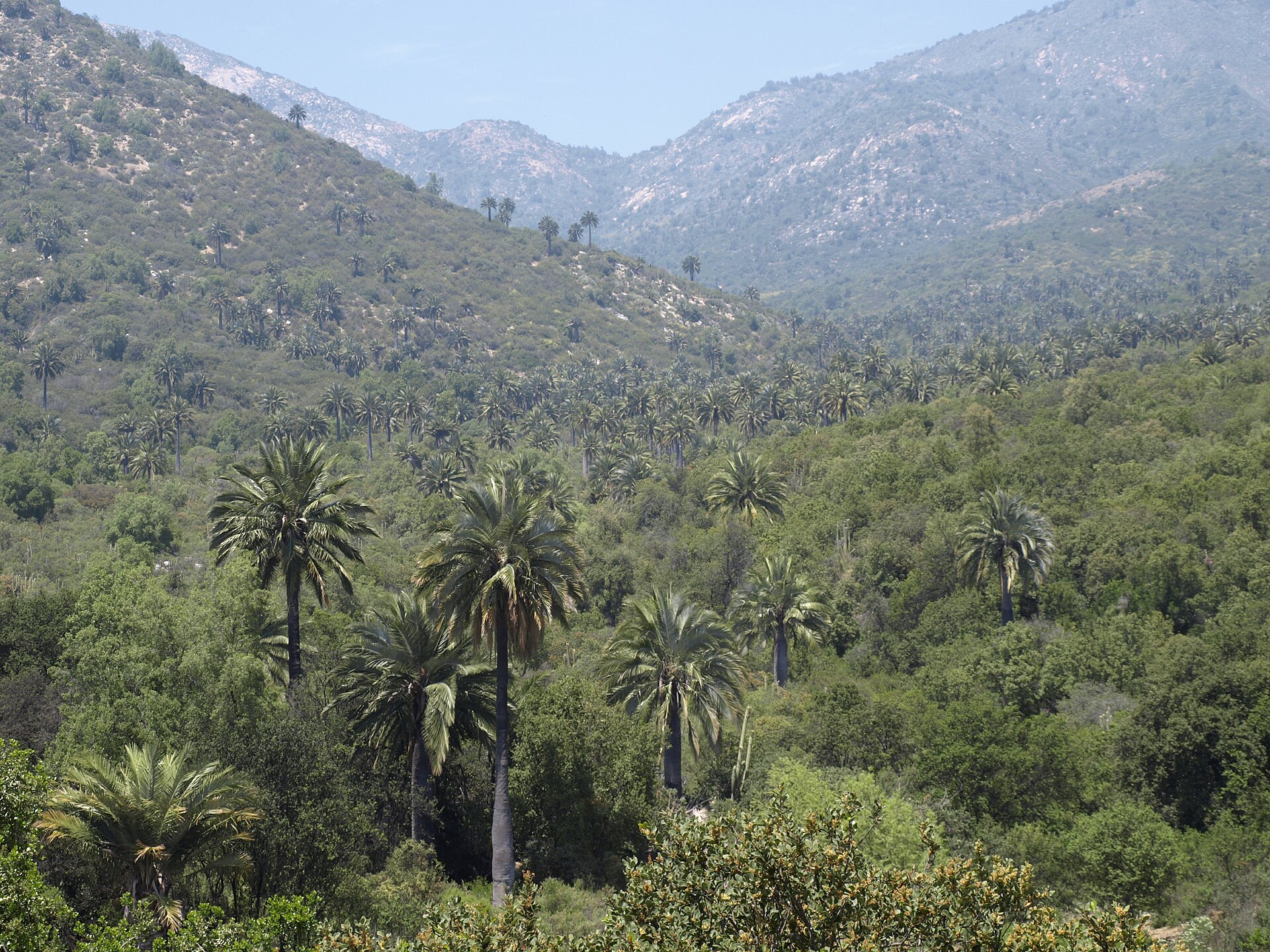
A terrestrial area, with mountains.
What are the main summits of Río Clarillo National Park?
Cerro Morado (2,732 m), Cerro Cruzada Las Hormigas (2,532 m), Cerro Quelén (2,468 m), Morro Las Heladas (2,437 m) and Cerro Toro Seco (2,384 m) (OpenStreetMap).
When is the best time to visit Río Clarillo National Park?
Best time to visit: from October to April, with average temperatures of 10 to 20 °C and moderate rainfall.
Is there snow in Río Clarillo National Park?
Yes. According to NASA's MODIS satellites (2015–2025 average), snow covers most of the site in July, and until October on higher ground, with about 60 snow-covered days a year on average.
What is the nearest large city to Río Clarillo National Park?
Nearest towns of over 50,000 people, as the crow flies: Puente Alto (14 km) and Buin (24 km). Nearest airport: Arturo Merino Benítez (SCL), about 45 km away.
How can I reach Río Clarillo National Park by train?
The nearest railway station is Buin, about 22 km from the site boundary.
Are there waymarked hiking trails in Río Clarillo National Park?
Yes. Waymarked hiking routes listed in OpenStreetMap: 2, including Greater Patagonian Trail Section and Sendero de Chile. The “Sendero de Chile: Tramo Quebrada de Los Bueyes” route runs for about 12 km through the site, with some 730 m of ascent on its longest section.
Which species can be seen in Río Clarillo National Park?
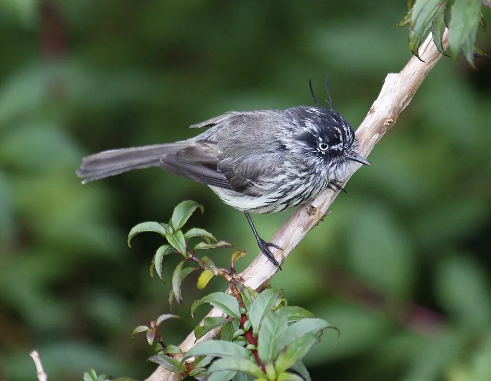
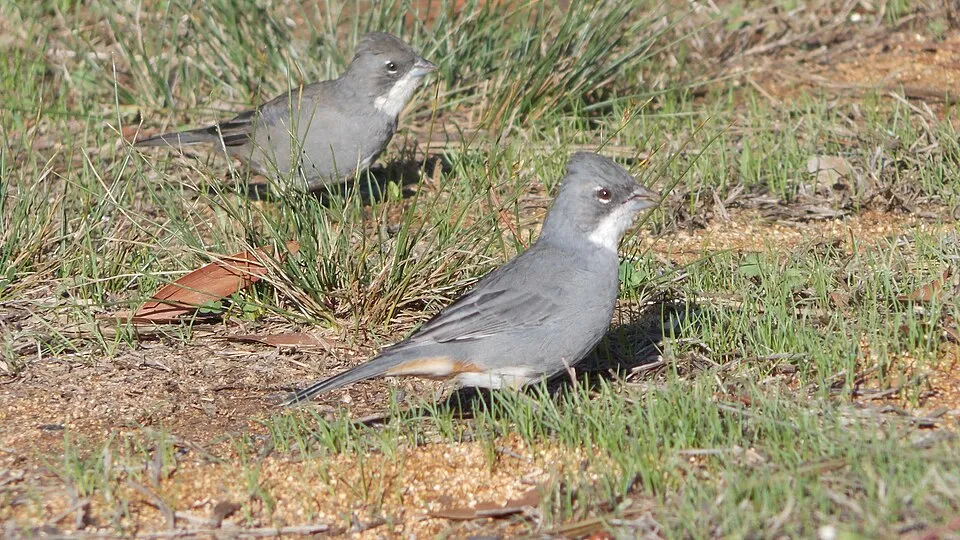
Among the species most often recorded on GBIF are Anairetes parulus (Tufted Tit-Tyrant), Zonotrichia capensis (Rufous-collared Sparrow), Callipepla californica (California Quail) and Troglodytes musculus (Southern House Wren).
© OpenStreetMap
Download the boundary: GeoJSON · GPX Boundary © OpenStreetMap contributors (ODbL).
Geography
The representative point of the site lies at around 1,322 m above sea level. Over the 1996–2025 period, the mean annual temperature is about 11.5 °C and total precipitation reaches roughly 854 mm per year. The warmest month is usually January, the coolest July, and the wettest June.
Area
- Area
- 13,085 ha
- Elevation
- 1,322 m
- Median elevation
- 1,801 m
- Mean slope
- 26°
- Snow cover
- ≈ 60 days a year
- Coordinates
- -33.7667, -70.45
Terrain: Mapzen Terrain Tiles (SRTM, USGS)
Elevation bands
- 500–1,000 m 2%
- 1,000–1,500 m 28%
- 1,500–2,000 m 34%
- 2,000–2,500 m 25%
- 2,500–3,000 m 11%
share of the site in each elevation band (smoothed terrain model: summits are rounded off) · Terrain: Mapzen Terrain Tiles (SRTM, USGS)
Main summits
- Cerro Morado2,732 m
- Cerro Cruzada Las Hormigas2,532 m
- Cerro Quelén2,468 m
- Morro Las Heladas2,437 m
- Cerro Toro Seco2,384 m
- Loma del Diablo2,324 m
- Cerro Blanco2,248 m
- Cerro San Roque2,147 m
- Cerro Quilín2,013 m
- Morro La Argolla1,976 m
Data © OpenStreetMap contributors (ODbL)
Climate
● Mean temperature (°C) · ▮ Precipitation (mm)
Source: Copernicus ERA5-Land (C3S, doi:10.24381/cds.68d2bb30), monthly averages 1996–2025 interpolated to the representative point, temperatures adjusted for elevation.
Contains modified Copernicus Climate Change Service information 2026. Neither the European Commission nor ECMWF is responsible for any use that may be made of the Copernicus information or data it contains.
Snow cover measured by satellite
J
F
M
A
M
J
J
A
S
O
N
D
average share of the site under snow · snowiest parts · ≈ 60 days a year
Snow cover: MODIS/Terra MOD10CM v61 (Hall & Riggs, 2021, NASA NSIDC DAAC, doi:10.5067/MODIS/MOD10CM.061), imagery from NASA GIBS (ESDIS); 2015–2025 average, grid of about 5 km.
Natural habitats
According to the global MODIS land cover (NASA, 2024), the site is mainly made up of grassland and meadows (85%), heath and scrub (8%) and bare rock and scree (6%). Elevation ranges from about 1,030 to 2,890 m (sampled elevations, SRTM). Median elevation is 1,801 m, and 11% of the site lies above 2,500 m (SRTM elevation model). The terrain is steep: 34% of slopes exceed 30° (mean slope 26°).
Biodiversity
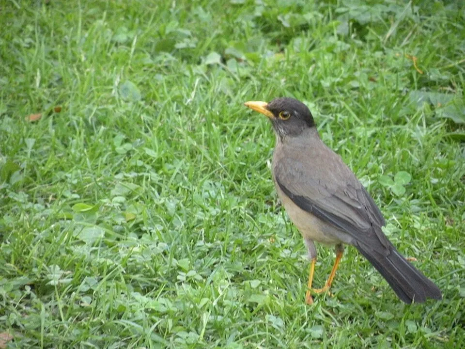
Based on occurrences aggregated by GBIF, several species are regularly recorded within the site. Among the most frequent are Anairetes parulus (Tufted Tit-Tyrant), Zonotrichia capensis (Rufous-collared Sparrow), Callipepla californica (California Quail) and Troglodytes musculus (Southern House Wren). The full list of documented taxa is shown below.
Species to look out for

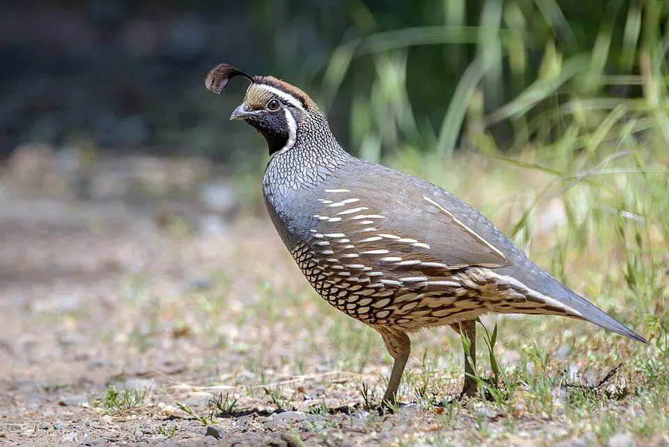
Bird
California Quail
Callipepla californica219 records © Becky Matsubara from El Sobrante, California · CC BY 2.0
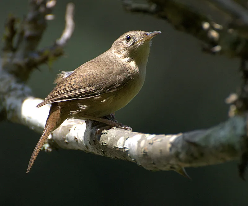
Bird
Southern House Wren
Troglodytes musculus215 records © Dario Sanches from SÃO PAULO, BRASIL · CC BY-SA 2.0
Observed species
Occurrences documented via GBIF; they are neither an exhaustive inventory nor proof of current presence.
- Tufted Tit-Tyrant · Anairetes parulus · 233
- Rufous-collared Sparrow · Zonotrichia capensis · 221
- California Quail · Callipepla californica · 219
- Southern House Wren · Troglodytes musculus · 215
- Common Diuca Finch · Diuca diuca · 213
- Austral Thrush · Turdus falcklandii · 211
- White-crested elaenia · Elaenia albiceps · 209
- Moustached Turca · Pteroptochos megapodius · 179
- Austral Blackbird · Curaeus curaeus · 158
- Eared Dove · Zenaida auriculata · 155
- Fire-eyed Diucon · Xolmis pyrope · 149
- Striped Woodpecker · Veniliornis lignarius · 142
+18 more species
- Chilean Pigeon · Patagioenas araucana · 140
- Giant Hummingbird · Patagona gigas · 139
- Chilean Swallow · Tachycineta leucopyga · 137
- Chilean Mockingbird · Mimus thenca · 126
- Green-backed Firecrown · Sephanoides sephaniodes · 115
- Thorn-tailed Rayadito · Aphrastura spinicauda · 113
- Plain-mantled Tit-Spinetail · Leptasthenura aegithaloides · 103
- Chilean Flicker · Colaptes pitius · 102
- Chaudoirina nigrofasciata · 101
- Variable Hawk · Buteo polyosoma · 95
- Patagonian Tyrant · Colorhamphus parvirostris · 90
- Black-chinned Siskin · Spinus barbatus · 90
- Dusky-tailed canastero · Asthenes humicola · 86
- Picui Ground Dove · Columbina picui · 74
- Grey-hooded Sierra Finch · Phrygilus gayi · 73
- Harris's Hawk · Parabuteo unicinctus · 66
- Black-chested Buzzard-Eagle · Geranoaetus melanoleucus · 58
- Long-tailed Meadowlark · Sturnella loyca · 57
Records: GBIF.org (CC-BY). Names: Wikidata (CC0), GBIF. Photos: Wikimedia Commons.
Conservation challenges
The primary purpose of the site is to preserve its natural habitats and the biodiversity they support. The species recorded (Biodiversity tab) reflect its ecological value. Its status as a national park sets the regulatory framework for its protection.
At night, the area gives off virtually no artificial light detectable from space (NASA VIIRS Black Marble composite, 2016). Invasive alien species have been recorded within the site since 2000 (GBIF observations). Among them: Molothrus bonariensis (Shiny Cowbird), Myiopsitta monachus (Monk Parakeet) and Cerastium arvense (Field mouse-ear).
Pressure indicators
Tree cover lost
3 ha
2001–2023 · < 1% of the area
20012023
Light at night
0%
of the area gives off artificial light visible from space
DarkLit
Invasive alien species
4
recorded since 2000
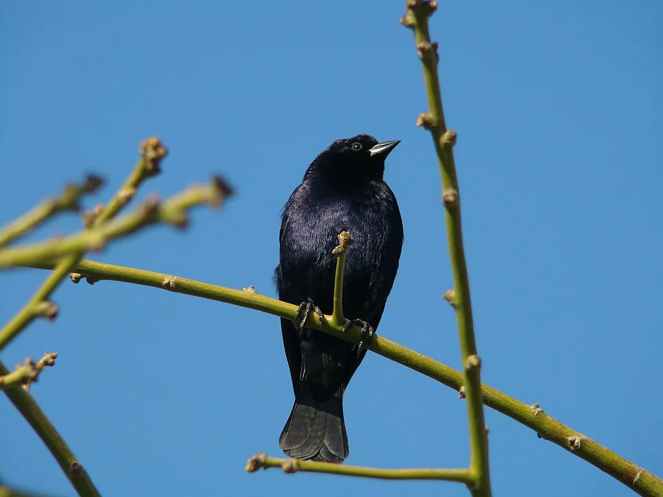 Shiny Cowbird
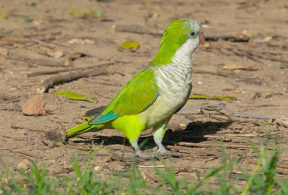 Monk Parakeet
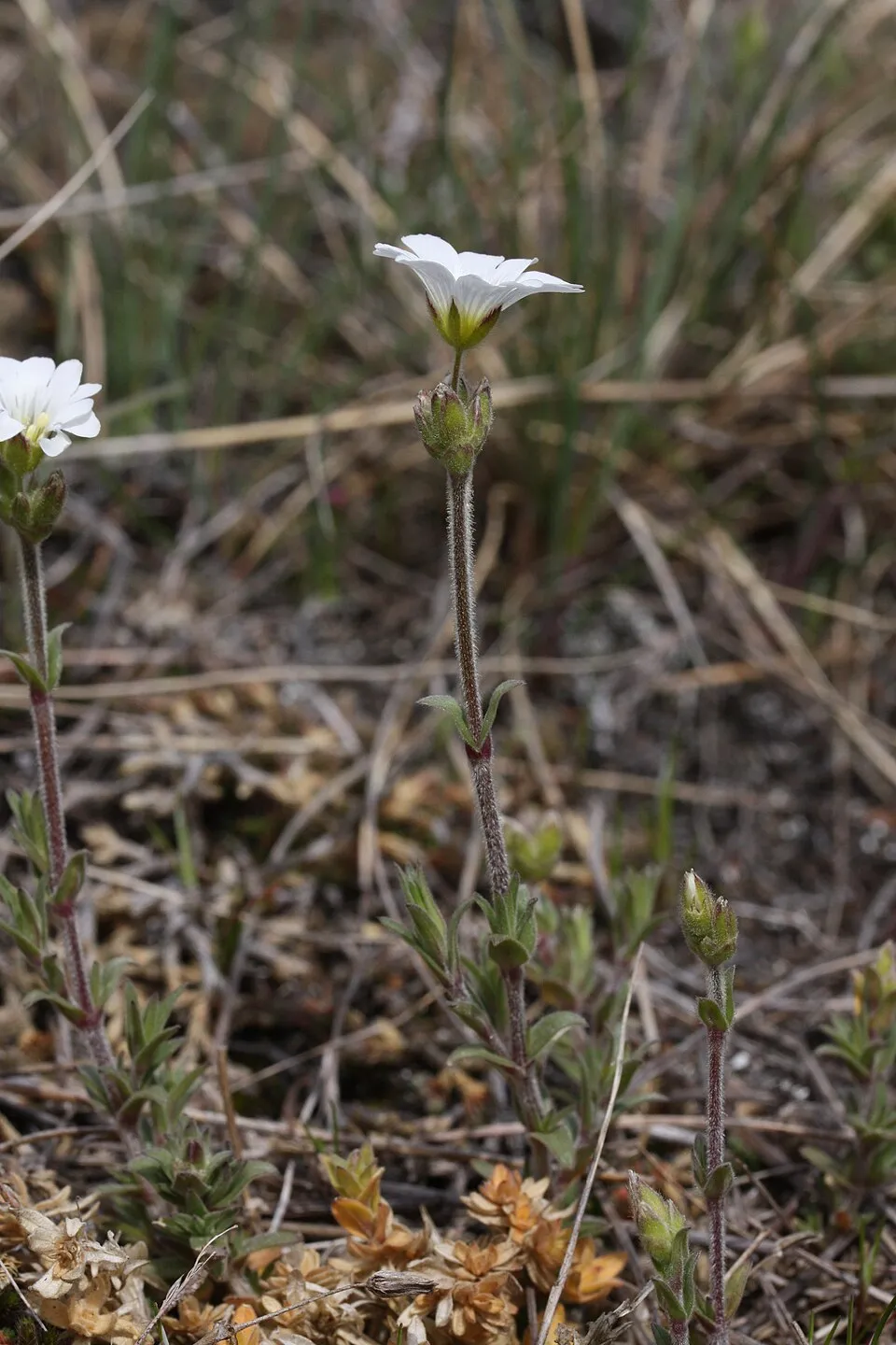 Field mouse-ear
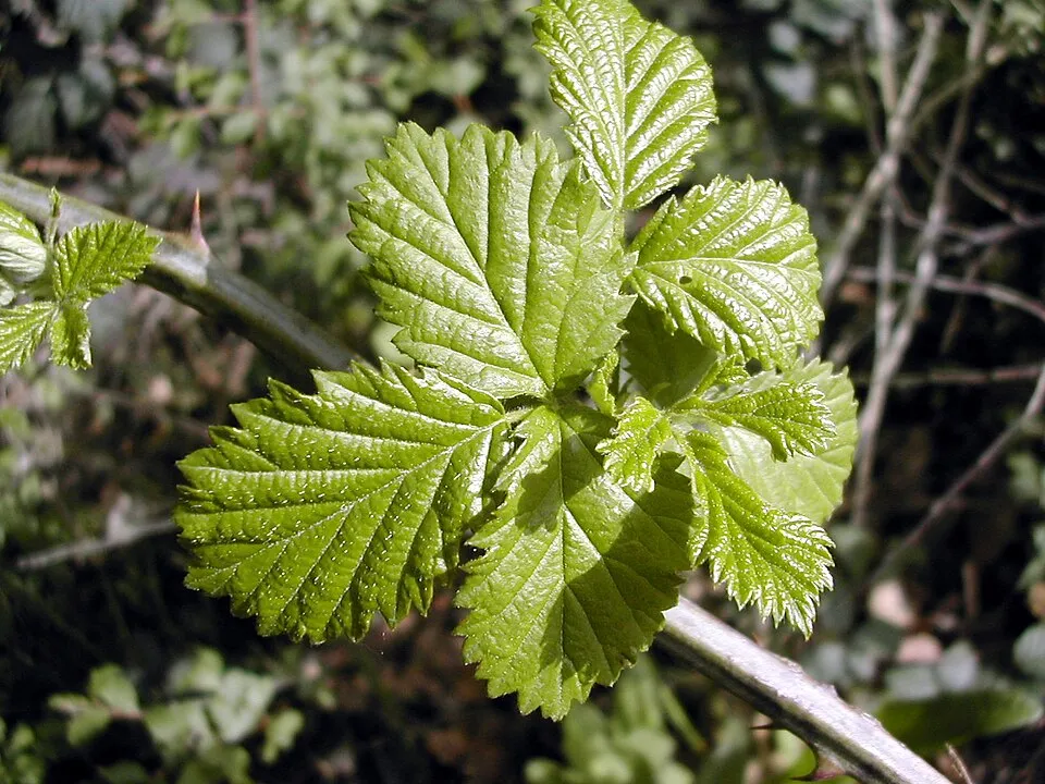 Elmleaf blackberry
Photos: Shiny Cowbird © Daniel Talevi · Public domain; Monk Parakeet © Kevin Jones · CC BY 2.0; Field mouse-ear © Walter Siegmund (talk) · CC BY-SA 3.0; Elmleaf blackberry © David.gaya · CC BY-SA 2.5
Sources: Global Forest Change (Hansen et al., University of Maryland, via Global Forest Watch, CC-BY 4.0); EFFIS, European Commission / Copernicus; NASA Black Marble 2016 (public domain); CORINE Land Cover 2018 (Copernicus) or MODIS.
Invasive alien species: Global Register of Introduced and Invasive Species (ISSG, CC BY 4.0); Union list, Regulation (EU) 1143/2014 (INBO, CC0); GBIF.org records (CC0 / CC BY 4.0), at least 2 per species.
Practical information
Cities and airport
- Puente Alto
14 km as the crow flies - Buin
24 km as the crow flies - Airport: Arturo Merino Benítez (SCL)
45 km as the crow flies
Parking
4 public car parks listed within the site
Hiking
2 waymarked routes listed, including:
Greater Patagonian Trail SectionSendero de Chile
Data © OpenStreetMap contributors (ODbL) · Wikidata (CC0)
Waymarked hiking routes
GPT02 Greater Patagonian Trail Section 2: Mina El Teniente
1.7 km within the site ↗ 298 m↘ 0 m 2,350–2,658 m
up to T1 · hiking
Tracks © OpenStreetMap contributors (ODbL), clipped to the boundary; elevation gain and profiles computed on the longest section from Mapzen Terrain Tiles (≈ 30 m), indicative only. Indicative difficulty (SAC scale, OpenStreetMap, via Waymarked Trails): check with the park.
Access and visiting
The nearest railway station is Buin, about 22 km from the site boundary. Nearest towns of over 50,000 people, as the crow flies: Puente Alto (14 km) and Buin (24 km). Nearest airport: Arturo Merino Benítez (SCL), about 45 km away. About 1.4 million people live within 20 km of the site boundary, 28,000 of them within 10 km; the site itself is virtually uninhabited (GHSL estimate, 2020). This population has grown by about 88% since 2000. Public car parks listed within the site: 4. Waymarked hiking routes listed in OpenStreetMap: 2, including Greater Patagonian Trail Section and Sendero de Chile. To plan a visit (access, opening periods, visitor rules), it is best to consult the official information from the managing body and the official website listed in this page's sources.
Source: OpenStreetMap (ODbL), Wikidata (CC0), October 2026.
When to visit
Best time to visit: from October to April, with average temperatures of 10 to 20 °C and moderate rainfall. Precipitation peaks from June to August (up to 170 mm per month). These averages apply to the site's representative point (1,322 m); higher up it is markedly cooler and snow lasts longer. According to NASA's MODIS satellites (2015–2025 average), snow covers most of the site in July, and until October on higher ground, with about 60 snow-covered days a year on average. Day length ranges from about 9 h 55 min in June to 14 h 23 min in December. Wildlife records published on GBIF peak for birds (October), plants (October) and mammals (May). These peaks also reflect when observers are most active.
Source: Copernicus ERA5-Land (C3S), monthly averages 1996–2025 at the representative point, temperatures adjusted for elevation.
Contains modified Copernicus Climate Change Service information 2026. Neither the European Commission nor ECMWF is responsible for any use that may be made of the Copernicus information or data it contains.
Wildlife records calendar
JFMAMJJASOND
Birds
Plants
Mammals
Monthly records published on GBIF (CC-BY), relative to the busiest month; also reflects observer activity.
Gallery
© Osmar Valdebenito · CC BY-SA 2.0
© Nicolás valdés Ortega · CC BY-SA 4.0
© Fernando López Ramírez · CC0-1.0
© Nelson Pérez · CC BY-SA 3.0
© Nicolasbecerrac · CC BY-SA 4.0
© Gabriel.nolopez · CC BY-SA 4.0
Sources and licences
- Wikidata: Q7386244
- OpenStreetMap: relation 4772866
- Wikipedia: en.wikipedia.org/wiki/Río_Clarillo_National_Park
References
- cds.climate.copernicus.eu: climate · CC-BY-4.0
- registry.opendata.aws: elevation of the reference point, detailed relief · PD
- lpdaac.usgs.gov: land cover · PD
- doi.org: population around the site · CC-BY-4.0
- naturalearthdata.com: sea share · PD
- wikidata.org: official area, establishment date, protected heritage, official name, nearby cities and airport, access and peaks, lake depths, places to see · CC0-1.0
- en.eurovelo.com: EuroVelo cycle routes · ODbL-1.0
- cycling.waymarkedtrails.org: cycle routes · ODbL-1.0
- opentopodata.org: elevations · PD
- globalforestwatch.org: tree cover loss · CC-BY-4.0
- gbif.org: seasonality of sightings, invasive alien species, observed species · CC-BY-4.0
- earthobservatory.nasa.gov: night light · PD
- openstreetmap.org: access and peaks · ODbL-1.0
- hiking.waymarkedtrails.org: route difficulty · ODbL-1.0
- nsidc.org: snow cover · PD
- wikidata.org: Wikipedia article · CC-BY-SA-4.0
Data © OpenStreetMap contributors (ODbL), Wikidata (CC0) and the sources cited.