United States · Terrestrial
Saguaro National Park
National park of 37,400 hectares in the United States, established in 1994.
Overview
National park of 37,400 hectares in the United States, established in 1994.
Saguaro National Park is located in the United States (North America). It is a predominantly terrestrial area. Established in 1994, it covers about 37,400 hectares. The site is managed by National Park Service.
In our collections
Frequently asked questions
Where is Saguaro National Park?
In the United States (North America). Representative point: 32.2022° N, 110.6109° W.
How large is Saguaro National Park?
About 37,400 hectares (374 km²). It is the 40th largest of the 62 national parks in the United States covered by Parkavela.
When was Saguaro National Park established?
In 1994.
What habitats and landscapes does Saguaro National Park include?
A terrestrial area, with mountains.
What is the highest point of Saguaro National Park?
Mica Mountain, at 2,627 m (OpenStreetMap).
What are the main summits of Saguaro National Park?
Mica Mountain (2,627 m), Rincon Peak (2,585 m), Duckbill (2,559 m), Spud Rock (2,553 m) and Man Head (2,550 m) (OpenStreetMap).
When is the best time to visit Saguaro National Park?
Best time to visit: from April to June, with average temperatures of 13 to 24 °C and moderate rainfall.
Are there historic monuments in Saguaro National Park?
Yes. According to Wikidata, one monument listed in the National Register of Historic Places stands within the boundary. For example: “Manning Cabin”.
What is the nearest large city to Saguaro National Park?
Nearest towns of over 50,000 people, as the crow flies: Tucson (16 km) and Heroica Nogales (91 km). Nearest airport: Tucson (TUS), about 18 km away.
How can I reach Saguaro National Park by train?
The nearest railway station is Tucson, about 12 km from the site boundary.
Where can I get visitor information on site?
Rincon Mountain Visitor Center.
Are there waymarked hiking trails in Saguaro National Park?
Yes. Waymarked hiking routes listed in OpenStreetMap: 11, including Arizona Trail and Sky Islands Traverse. The “AZT · Arizona Trail” route runs for about 28 km through the site, with some 1,790 m of ascent on its longest section.
Which species can be seen in Saguaro National Park?
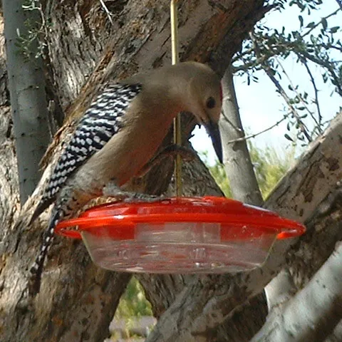
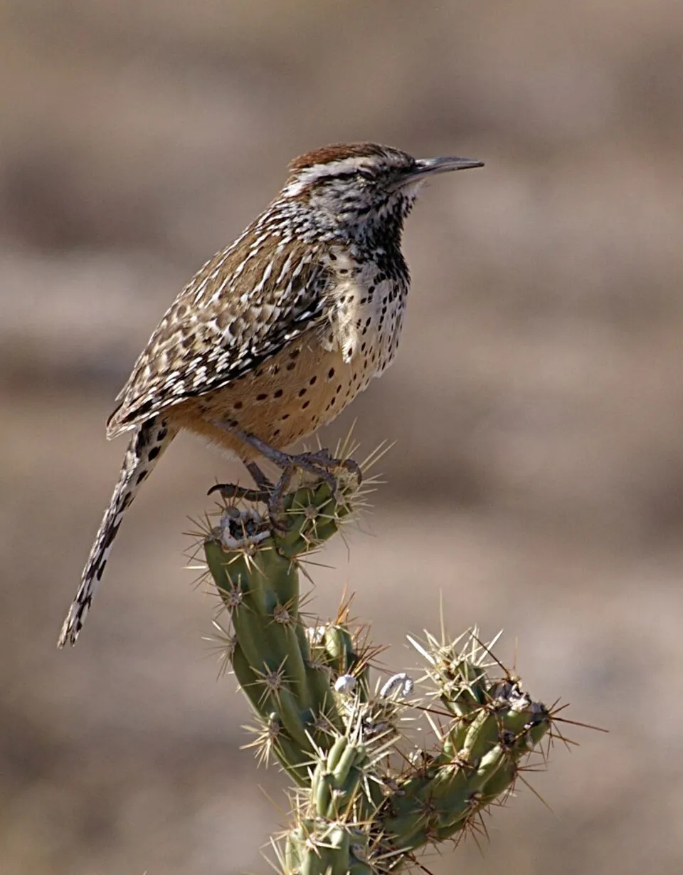
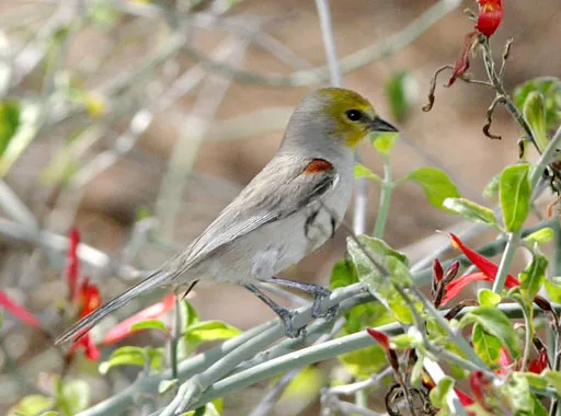
Among the species most often recorded on GBIF are Melanerpes uropygialis (Gila Woodpecker), Toxostoma curvirostre (Curve-billed Thrasher), Campylorhynchus brunneicapillus (Cactus Wren) and Auriparus flaviceps (Verdin).
Who manages Saguaro National Park?
National Park Service.
What is the official website of Saguaro National Park?
© OpenStreetMap
Download the boundary: GeoJSON · GPX Boundary © OpenStreetMap contributors (ODbL).
Geography
The representative point of the site lies at around 1,925 m above sea level. Over the 1996–2025 period, the mean annual temperature is about 13.9 °C and total precipitation reaches roughly 279 mm per year. The warmest month is usually July, the coolest January, and the wettest July.
Area
- Area
- 37,400 ha
- Elevation
- 1,925 m
- Median elevation
- 1,286 m
- Mean slope
- 15°
- Coordinates
- 32.2022, -110.6109
Terrain: Mapzen Terrain Tiles (SRTM, USGS)
Elevation bands
- 500–1,000 m 33%
- 1,000–1,500 m 27%
- 1,500–2,000 m 27%
- 2,000–2,500 m 12%
- 2,500–3,000 m 1%
share of the site in each elevation band (smoothed terrain model: summits are rounded off) · Terrain: Mapzen Terrain Tiles (SRTM, USGS)
Main summits
- Mica Mountain2,627 m
- Rincon Peak2,585 m
- Duckbill2,559 m
- Spud Rock2,553 m
- Man Head2,550 m
- Reef Rock2,519 m
- Wrong Mountain2,458 m
- Helens Dome2,430 m
- Tanque Verde Peak2,147 m
- Wasson Peak1,414 m
Data © OpenStreetMap contributors (ODbL)
Climate
● Mean temperature (°C) · ▮ Precipitation (mm)
Source: Copernicus ERA5-Land (C3S, doi:10.24381/cds.68d2bb30), monthly averages 1996–2025 interpolated to the representative point, temperatures adjusted for elevation.
Contains modified Copernicus Climate Change Service information 2026. Neither the European Commission nor ECMWF is responsible for any use that may be made of the Copernicus information or data it contains.
Natural habitats
According to the global MODIS land cover (NASA, 2024), the site is mainly made up of grassland and meadows (55%) and heath and scrub (44%). Elevation ranges from about 760 m to 2,627 m (highest point: Mica Mountain). Median elevation is 1,286 m, and 13% of the site lies above 2,000 m (SRTM elevation model).
Biodiversity
Based on occurrences aggregated by GBIF, several species are regularly recorded within the site. Among the most frequent are Melanerpes uropygialis (Gila Woodpecker), Toxostoma curvirostre (Curve-billed Thrasher), Campylorhynchus brunneicapillus (Cactus Wren) and Auriparus flaviceps (Verdin). The full list of documented taxa is shown below.
Species to look out for

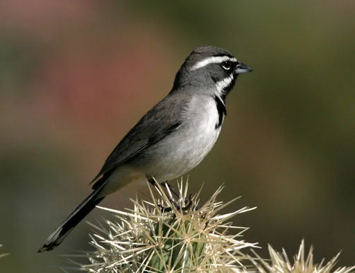
Bird
Black-throated Sparrow
Amphispiza bilineata9,066 records © Patrick Coin (Patrick Coin) · CC BY-SA 2.5

Observed species
Occurrences documented via GBIF; they are neither an exhaustive inventory nor proof of current presence.
- Gila Woodpecker · Melanerpes uropygialis · 13048
- Curve-billed Thrasher · Toxostoma curvirostre · 11345
- Cactus Wren · Campylorhynchus brunneicapillus · 11064
- Verdin · Auriparus flaviceps · 9332
- Black-throated Sparrow · Amphispiza bilineata · 9066
- House finch · Haemorhous mexicanus · 6424
- Gilded flicker · Colaptes chrysoides · 6416
- Mourning Dove · Zenaida macroura · 6309
- White-winged Dove · Zenaida asiatica · 6222
- Gambel's Quail · Callipepla gambelii · 5244
- Rufous-winged Sparrow · Peucaea carpalis · 5096
- Phainopepla · Phainopepla nitens · 5070
+18 more species
- Black-tailed Gnatcatcher · Polioptila melanura · 5062
- Desert cardinal · Cardinalis sinuatus · 4948
- Turkey Vulture · Cathartes aura · 4298
- Northern Raven · Corvus corax · 3957
- Red-tailed Hawk · Buteo jamaicensis · 3748
- Northern Mockingbird · Mimus polyglottos · 3747
- Canyon Towhee · Melozone fusca · 3590
- Ladder-backed Woodpecker · Dryobates scalaris · 3134
- Northern Cardinal · Cardinalis cardinalis · 3088
- Ash-throated Flycatcher · Myiarchus cinerascens · 2469
- Purple Martin · Progne subis · 2317
- Lesser Goldfinch · Spinus psaltria · 2278
- Rock Wren · Salpinctes obsoletus · 2246
- American Kestrel · Falco sparverius · 2148
- Greater Roadrunner · Geococcyx californianus · 1908
- White-crowned Sparrow · Zonotrichia leucophrys · 1861
- Lucy's Warbler · Leiothlypis luciae · 1832
- Brown-crested Flycatcher · Myiarchus tyrannulus · 1663
Records: GBIF.org (CC-BY). Names: Wikidata (CC0), GBIF. Photos: Wikimedia Commons.
Conservation challenges
The primary purpose of the site is to preserve its natural habitats and the biodiversity they support. The species recorded (Biodiversity tab) reflect its ecological value. Its status as a national park sets the regulatory framework for its protection.
According to Global Forest Change data (University of Maryland, Global Forest Watch), about 47 ha of tree cover were lost within the boundary between 2001 and 2023 (under 1% of its area), peaking in 2003 and 2021. These losses include logging, storms and fires, and do not account for regrowth. At night, 6% of the area gives off artificial light detectable from space (NASA VIIRS Black Marble composite, 2016).
Pressure indicators
Tree cover lost
47 ha
2001–2023 · < 1% of the area
20012023
Light at night
6%
of the area gives off artificial light visible from space
DarkLit
Built-up land
< 1%
buildings, business areas, roads, quarries
Sources: Global Forest Change (Hansen et al., University of Maryland, via Global Forest Watch, CC-BY 4.0); EFFIS, European Commission / Copernicus; NASA Black Marble 2016 (public domain); CORINE Land Cover 2018 (Copernicus) or MODIS.
Practical information
Cities and airport
- Tucson
16 km as the crow flies - Heroica Nogales
91 km as the crow flies - Airport: Tucson (TUS)
18 km as the crow flies
Visitor information
- Rincon Mountain Visitor Center
< 1 km from the site boundary
Parking
18 public car parks listed within the site · 17 trailheads
Camino Loma AltaMica View Trailhead
Hiking
11 waymarked routes listed, including:
Arizona TrailSky Islands Traverse
Wheelchair access
- Desert Ecology Trail
path
accessible toilets: 1
Reported by OpenStreetMap contributors (ODbL); check with the park before visiting.
Data © OpenStreetMap contributors (ODbL) · Wikidata (CC0)
Waymarked hiking routes
AZT Arizona Trail
27.5 km within the site ↗ 1,794 m↘ 655 m 940–2,618 m
King Canyon / Gould Mine Loop
9.7 km within the site ↗ 5 m↘ 531 m 898–1,425 m
up to T2 · mountain hiking
Hugh Norris Big Loop
8.2 km within the site ↗ 361 m↘ 260 m 778–1,134 m
up to T2 · mountain hiking
DS Douglas Spring Trail
3.9 km within the site ↗ 294 m↘ 7 m 837–1,128 m
up to T2 · mountain hiking
Three Tank Trail
3.4 km within the site ↗ 226 m↘ 26 m 925–1,158 m
up to T2 · mountain hiking
Tracks © OpenStreetMap contributors (ODbL), clipped to the boundary; elevation gain and profiles computed on the longest section from Mapzen Terrain Tiles (≈ 30 m), indicative only. Indicative difficulty (SAC scale, OpenStreetMap, via Waymarked Trails): check with the park.
Access and visiting
The nearest railway station is Tucson, about 12 km from the site boundary. Nearest towns of over 50,000 people, as the crow flies: Tucson (16 km) and Heroica Nogales (91 km). Nearest airport: Tucson (TUS), about 18 km away. About 1 million people live within 20 km of the site boundary, 400,000 of them within 10 km; some 920 people are estimated to live inside (GHSL estimate, 2020). This population has grown by about 34% since 2000. Visitor information on site: Rincon Mountain Visitor Center. Public car parks listed within the site: 18, including Camino Loma Alta and Mica View Trailhead. Waymarked hiking routes listed in OpenStreetMap: 11, including Arizona Trail and Sky Islands Traverse. OpenStreetMap contributors list one wheelchair-accessible place: Desert Ecology Trail; check with the park before visiting. To plan a visit (access, opening periods, visitor rules), it is best to consult the official information from the managing body (National Park Service) and the official website listed in this page's sources.
Source: OpenStreetMap (ODbL), Wikidata (CC0), October 2026.
Built heritage
According to Wikidata, one monument listed in the National Register of Historic Places stands within the boundary. It is “Manning Cabin”.
Source: Wikidata (CC0), monuments in each country’s official heritage protection registers, at national or regional level. Each item links to its Wikidata entry.
When to visit
Best time to visit: from April to June, with average temperatures of 13 to 24 °C and moderate rainfall. These averages apply to the site's representative point (1,925 m); higher up it is markedly cooler and snow lasts longer. Day length ranges from about 10 h 03 min in December to 14 h 15 min in June. Wildlife records published on GBIF peak for birds (from March to May), plants (March), butterflies and moths (from August to October), dragonflies (July) and mammals (February and March). These peaks also reflect when observers are most active.
Source: Copernicus ERA5-Land (C3S), monthly averages 1996–2025 at the representative point, temperatures adjusted for elevation.
Contains modified Copernicus Climate Change Service information 2026. Neither the European Commission nor ECMWF is responsible for any use that may be made of the Copernicus information or data it contains.
Wildlife records calendar
JFMAMJJASOND
Birds
Plants
Butterflies & moths
Dragonflies
Mammals
Monthly records published on GBIF (CC-BY), relative to the busiest month; also reflects observer activity.
Gallery
© Luke Jones from Yucca Valley · CC BY 2.0
© naturenps · Public domain
© Alexander Hatley · CC BY 2.0
© Los Paseos from Earth · CC BY-SA 2.0
© NPS Photo · Public domain
© NPS · Public domain
Sources and licences
- Wikidata: Q676206
- OpenStreetMap: relation 9529323
- Official website: https://www.nps.gov/sagu/index.htm
- Wikipedia: en.wikipedia.org/wiki/Saguaro_National_Park
- WDPA: 374162
References
- cds.climate.copernicus.eu: climate · CC-BY-4.0
- registry.opendata.aws: elevation of the reference point, detailed relief · PD
- lpdaac.usgs.gov: land cover · PD
- doi.org: population around the site · CC-BY-4.0
- naturalearthdata.com: sea share · PD
- wikidata.org: official area, establishment date, protected heritage, managing body, nearby cities and airport, access and peaks, lake depths, places to see, official website · CC0-1.0
- en.eurovelo.com: EuroVelo cycle routes · ODbL-1.0
- cycling.waymarkedtrails.org: cycle routes · ODbL-1.0
- opentopodata.org: elevations · PD
- globalforestwatch.org: tree cover loss · CC-BY-4.0
- gbif.org: seasonality of sightings, observed species · CC-BY-4.0
- openstreetmap.org: official name, access and peaks, trail difficulty, wheelchair access · ODbL-1.0
- earthobservatory.nasa.gov: night light · PD
- hiking.waymarkedtrails.org: route difficulty · ODbL-1.0
- nsidc.org: snow cover · PD
- wikidata.org: Wikipedia article · CC-BY-SA-4.0
Data © OpenStreetMap contributors (ODbL), Wikidata (CC0) and the sources cited.