Bolivia · Terrestrial
Sajama National Park
National park of 100,200 hectares in Bolivia, established in 1938.
Overview
National park of 100,200 hectares in Bolivia, established in 1938.
Sajama National Park is located in Bolivia (South America). It is a predominantly terrestrial area. Established in 1938, it covers about 100,200 hectares.
Protections and designations
World Heritage tentative list
Protected as a national park. It is covered by an additional protection designation.
In our collections
Frequently asked questions
Where is Sajama National Park?
In Bolivia (South America). Representative point: 18.0833° S, 68.9167° W.
How large is Sajama National Park?
About 100,200 hectares (1,002 km²). It is the 10th largest of the 13 national parks in Bolivia covered by Parkavela.
When was Sajama National Park established?
In 1938.
What habitats and landscapes does Sajama National Park include?
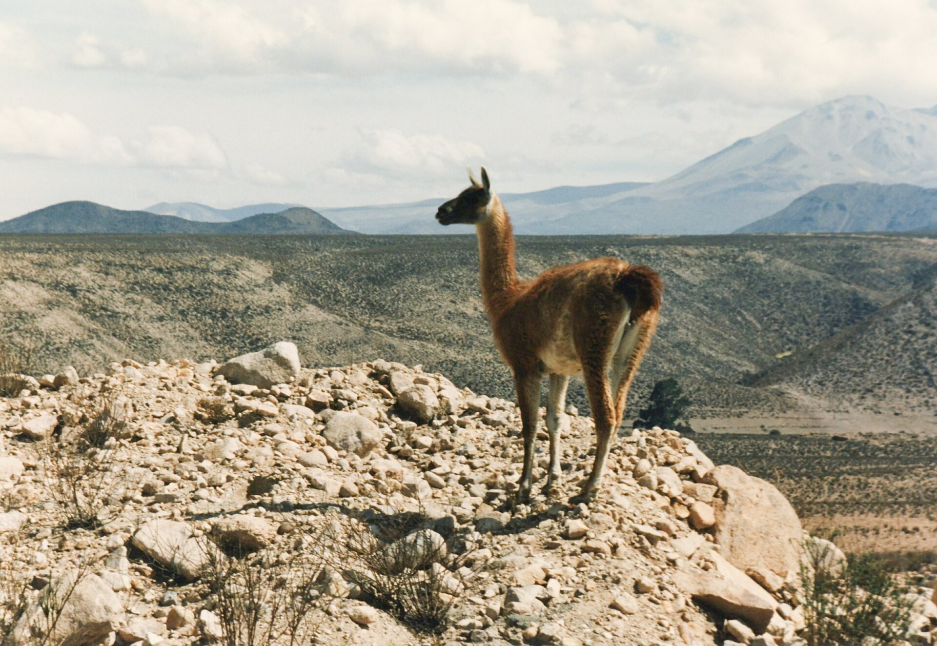
A terrestrial area, with mountains.
What is the highest point of Sajama National Park?
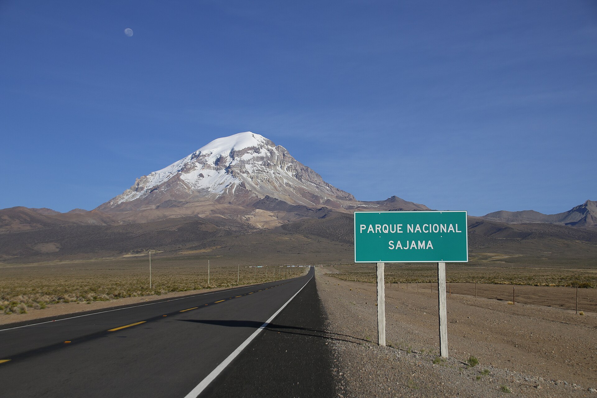
Nevado Sajama, at 6,542 m (OpenStreetMap).
What are the main summits of Sajama National Park?
Nevado Sajama (6,542 m), Volcán Parinacota (6,348 m), Volcán Pomerape (6,282 m), Jisk'a Kunturiri (5,488 m) and Cerro Chiar Kkota (5,452 m) (OpenStreetMap).
When is the best time to visit Sajama National Park?
Mildest period: from October to March, with average temperatures of 3 to 5 °C.
What is there to see in Sajama National Park?
3 lakes and ponds, including Laguna Sajama (4,401 m), Waña Quta (4,350 m) and Chiar Kkota (5,090 m) (Wikidata).
What is the nearest airport to Sajama National Park?
Nearest airport: El Alto (LPB), about 176 km away.
Where can I get visitor information on site?
Campamento Guardaparque Sajama and Entrada Parque Nacional Sajama.
Which species can be seen in Sajama National Park?
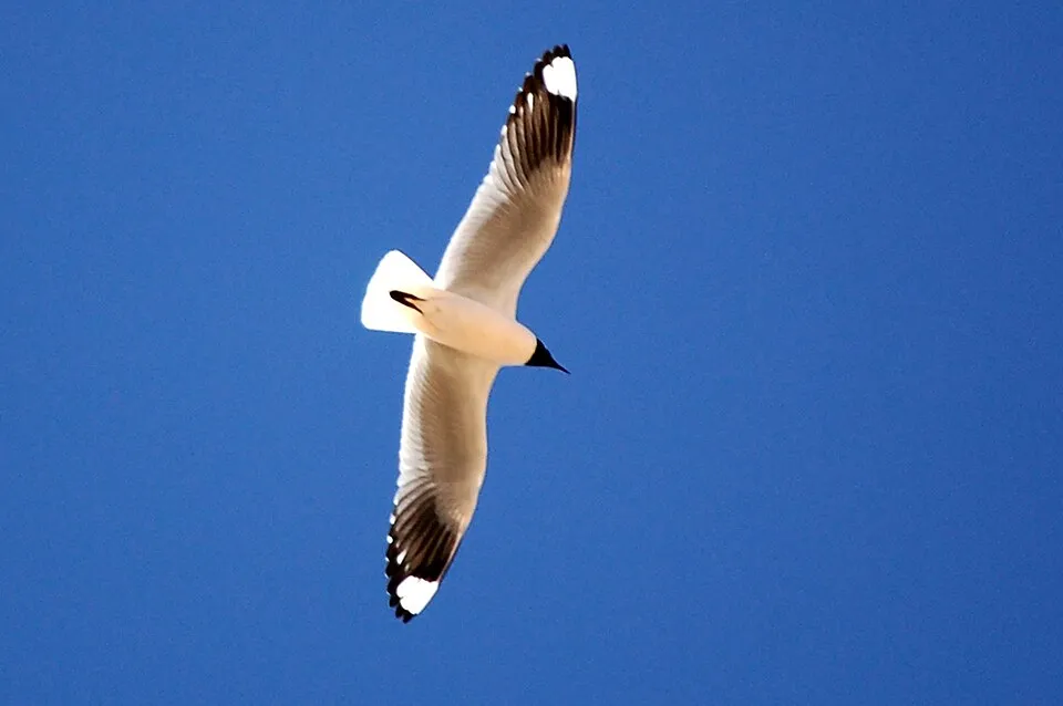
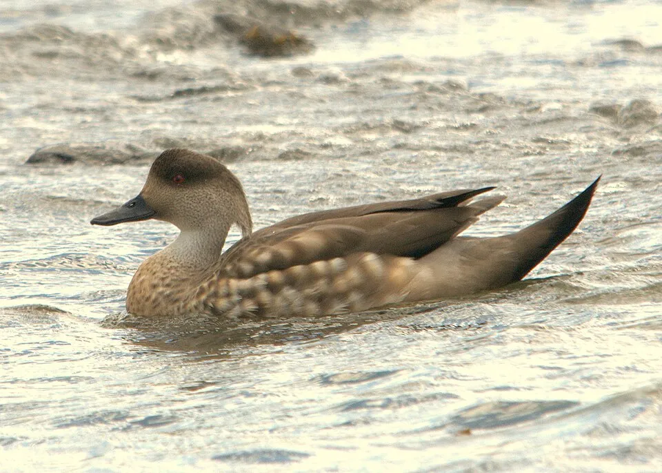
Among the species most often recorded on GBIF are Chroicocephalus serranus (Andean Gull), Chloephaga melanoptera (Andean Goose), Lophonetta specularioides (Crested Duck) and Phrygilus atriceps (Black-hooded Sierra Finch).
© OpenStreetMap
Download the boundary: GeoJSON · GPX Boundary © OpenStreetMap contributors (ODbL).
Geography
The representative point of the site lies at around 4,774 m above sea level. Over the 1996–2025 period, the mean annual temperature is about 2.6 °C and total precipitation reaches roughly 1,043 mm per year. The warmest month is usually November, the coolest July, and the wettest January.
Area
- Area
- 100,200 ha
- Elevation
- 4,774 m
- Median elevation
- 4,447 m
- Mean slope
- 9°
- Coordinates
- -18.0833, -68.9167
Terrain: Mapzen Terrain Tiles (SRTM, USGS)
Main summits
- Nevado Sajama6,542 m
- Volcán Parinacota6,348 m
- Volcán Pomerape6,282 m
- Jisk'a Kunturiri5,488 m
- Cerro Chiar Kkota5,452 m
- Volcán Larancagua5,360 m
- Nevado Kaquepe Juntuma5,356 m
- Phaq'u Q'awa5,320 m
- Cerro Casiri5,290 m
- Huisalla5,053 m
Data © OpenStreetMap contributors (ODbL)
Climate
● Mean temperature (°C) · ▮ Precipitation (mm)
Source: Copernicus ERA5-Land (C3S, doi:10.24381/cds.68d2bb30), monthly averages 1996–2025 interpolated to the representative point, temperatures adjusted for elevation.
Contains modified Copernicus Climate Change Service information 2026. Neither the European Commission nor ECMWF is responsible for any use that may be made of the Copernicus information or data it contains.
Snow cover measured by satellite
J
F
M
A
M
J
J
A
S
O
N
D
average share of the site under snow · snowiest parts · ≈ 10 days a year
Snow cover: MODIS/Terra MOD10CM v61 (Hall & Riggs, 2021, NASA NSIDC DAAC, doi:10.5067/MODIS/MOD10CM.061), imagery from NASA GIBS (ESDIS); 2015–2025 average, grid of about 5 km.
Natural habitats
According to the global MODIS land cover (NASA, 2024), the site is mainly made up of grassland and meadows (36%), bare rock and scree (35%) and heath and scrub (28%). Elevation ranges from about 4,080 m to 6,542 m (highest point: Nevado Sajama). Median elevation is 4,447 m, and 100% of the site lies above 3,000 m (SRTM elevation model).
Biodiversity
Based on occurrences aggregated by GBIF, several species are regularly recorded within the site. Among the most frequent are Chroicocephalus serranus (Andean Gull), Chloephaga melanoptera (Andean Goose), Lophonetta specularioides (Crested Duck) and Phrygilus atriceps (Black-hooded Sierra Finch). The full list of documented taxa is shown below.
Species to look out for
Bird
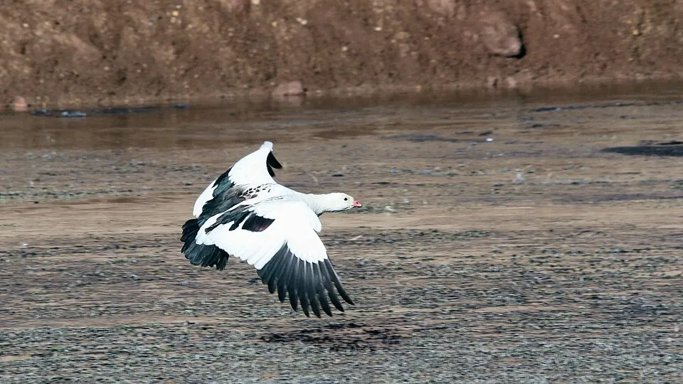
Andean Goose
Chloephaga melanoptera74 records © Greg Schechter from San Francisco, USA · CC BY 2.0
Bird
Crested Duck
Lophonetta specularioides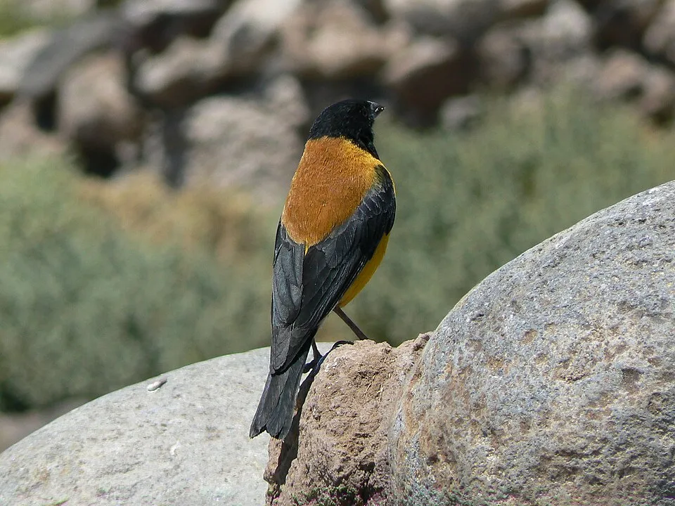


Observed species
Occurrences documented via GBIF; they are neither an exhaustive inventory nor proof of current presence.
- Andean Gull · Chroicocephalus serranus · 90
- Andean Goose · Chloephaga melanoptera · 74
- Crested Duck · Lophonetta specularioides · 67
- Black-hooded Sierra Finch · Phrygilus atriceps · 65
- Yellow-billed Teal · Anas flavirostris · 64
- Giant Coot · Fulica gigantea · 60
- Cordilleran Canastero · Asthenes modesta · 49
- Silvery Grebe · Podiceps occipitalis · 48
- Puna Ibis · Plegadis ridgwayi · 47
- Lesser Rhea · Rhea pennata · 46
- Golden-spotted Ground Dove · Metriopelia aymara · 43
- Andean Negrito · Lessonia oreas · 43
+18 more species
- Andean Flicker · Colaptes rupicola · 42
- Chilean Flamingo · Phoenicopterus chilensis · 41
- Rufous-collared Sparrow · Zonotrichia capensis · 41
- Leptodontium proliferum · 39
- Andean Swallow · Haplochelidon andecola · 37
- Ash-breasted Sierra Finch · Geospizopsis plebejus · 36
- Puna Teal · Spatula puna · 35
- Andean Lapwing · Vanellus resplendens · 33
- Andean Coot · Fulica ardesiaca · 32
- Ornate Tinamou · Nothoprocta ornata · 32
- Andean Duck · Oxyura ferruginea · 30
- Buff-winged Cinclodes · Cinclodes fuscus · 29
- Baird's Sandpiper · Calidris bairdii · 28
- Puna Ground Tyrant · Muscisaxicola juninensis · 28
- White-winged Cinclodes · Cinclodes atacamensis · 28
- Puna Miner · Geositta punensis · 28
- Long-beaked grimmia · Grimmia longirostris · 27
- Pohlia wilsonii · 27
Records: GBIF.org (CC-BY). Names: Wikidata (CC0), GBIF. Photos: Wikimedia Commons.
Conservation challenges
The primary purpose of the site is to preserve its natural habitats and the biodiversity they support. The species recorded (Biodiversity tab) reflect its ecological value. The designations it holds frame its management and the control of land use.
At night, the area gives off virtually no artificial light detectable from space (NASA VIIRS Black Marble composite, 2016).
Pressure indicators
Tree cover lost
1 ha
2001–2023 · < 1% of the area
20012023
Light at night
0%
of the area gives off artificial light visible from space
DarkLit
Invasive alien species
1
recorded since 2000
Sources: Global Forest Change (Hansen et al., University of Maryland, via Global Forest Watch, CC-BY 4.0); EFFIS, European Commission / Copernicus; NASA Black Marble 2016 (public domain); CORINE Land Cover 2018 (Copernicus) or MODIS.
Invasive alien species: Global Register of Introduced and Invasive Species (ISSG, CC BY 4.0); Union list, Regulation (EU) 1143/2014 (INBO, CC0); GBIF.org records (CC0 / CC BY 4.0), at least 2 per species.
Practical information
Cities and airport
- Airport: El Alto (LPB)
176 km as the crow flies
Visitor information
- Campamento Guardaparque Sajama
within the site - Entrada Parque Nacional Sajama
within the site
Parking
12 public car parks listed within the site
Parking Eaux ThermalesEstacionamiento Camiones Área de ExportaciónEstacionamiento Control de Vehículos Exportación
Things to see
3 lakes and ponds
- Laguna Sajama
lake or pond · 4,401 m - Waña Quta
lake or pond · 4,350 m - Chiar Kkota
lake or pond · 5,090 m
Data © OpenStreetMap contributors (ODbL) · Wikidata (CC0)
Access and visiting
Nearest airport: El Alto (LPB), about 176 km away. Fewer than 5,000 people live within 20 km of the site boundary, a very sparsely populated area; some 650 people are estimated to live inside (GHSL estimate, 2020). Visitor information on site: Campamento Guardaparque Sajama and Entrada Parque Nacional Sajama. Public car parks listed within the site: 12, including Parking Eaux Thermales, Estacionamiento Camiones Área de Exportación and Estacionamiento Control de Vehículos Exportación. To see: 3 lakes and ponds, including Laguna Sajama (4,401 m), Waña Quta (4,350 m) and Chiar Kkota (5,090 m). To plan a visit (access, opening periods, visitor rules), it is best to consult the official information from the managing body and the official website listed in this page's sources.
Source: OpenStreetMap (ODbL), Wikidata (CC0), November 2026.
When to visit
Mildest period: from October to March, with average temperatures of 3 to 5 °C. Precipitation peaks from December to March (up to 260 mm per month). These averages apply to the site's representative point (4,774 m); higher up it is markedly cooler and snow lasts longer. Snow only makes brief appearances in winter (about 10 days a year on average, MODIS satellites 2015–2025). Permanent snow remains on the summits even in midsummer. Day length ranges from about 11 h 03 min in June to 13 h 12 min in December. Wildlife records published on GBIF peak for birds (November) and plants (September). These peaks also reflect when observers are most active.
Source: Copernicus ERA5-Land (C3S), monthly averages 1996–2025 at the representative point, temperatures adjusted for elevation.
Contains modified Copernicus Climate Change Service information 2026. Neither the European Commission nor ECMWF is responsible for any use that may be made of the Copernicus information or data it contains.
Wildlife records calendar
JFMAMJJASOND
Birds
Plants
Monthly records published on GBIF (CC-BY), relative to the busiest month; also reflects observer activity.
Gallery
© Gabriela Villanueva · CC BY-SA 4.0
© Léo Guellec · CC BY-SA 2.0
© JYB Devot · CC BY-SA 4.0
© Ale RaFlo · CC BY-SA 4.0
© ch images · CC BY 2.0
© Viscarra.cecilia · CC BY-SA 4.0
Sources and licences
- Wikidata: Q1519747
- OpenStreetMap: relation 421862
- Wikipedia: en.wikipedia.org/wiki/Sajama_National_Park
- WDPA: 33
References
- cds.climate.copernicus.eu: climate · CC-BY-4.0
- registry.opendata.aws: elevation of the reference point, detailed relief · PD
- lpdaac.usgs.gov: land cover · PD
- doi.org: population around the site · CC-BY-4.0
- naturalearthdata.com: sea share · PD
- wikidata.org: official area, highest point, establishment date, protected heritage, nearby cities and airport, access and peaks, lake depths, places to see · CC0-1.0
- en.eurovelo.com: EuroVelo cycle routes · ODbL-1.0
- cycling.waymarkedtrails.org: cycle routes · ODbL-1.0
- opentopodata.org: elevations · PD
- globalforestwatch.org: tree cover loss · CC-BY-4.0
- gbif.org: seasonality of sightings, invasive alien species, observed species · CC-BY-4.0
- openstreetmap.org: official name, access and peaks · ODbL-1.0
- earthobservatory.nasa.gov: night light · PD
- nsidc.org: snow cover · PD
- wikidata.org: Wikipedia article · CC-BY-SA-4.0
Data © OpenStreetMap contributors (ODbL), Wikidata (CC0) and the sources cited.