Argentina · Terrestrial
Aconquija National Park
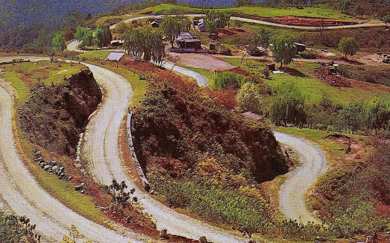
National park of 62,470 hectares in Argentina, established in 2018.
Overview
National park of 62,470 hectares in Argentina, established in 2018.
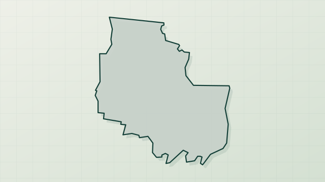
Aconquija National Park is located in Argentina (South America). It is a predominantly terrestrial area. Established on 17 April 2018, it covers about 62,470 hectares.
In our collections
Frequently asked questions
Where is Aconquija National Park?
In Argentina (South America). Representative point: 27.2857° S, 65.9245° W.
How large is Aconquija National Park?
About 62,470 hectares (625 km²). It is the 20th largest of the 37 national parks in Argentina covered by Parkavela.
When was Aconquija National Park established?
On 17 April 2018.
What habitats and landscapes does Aconquija National Park include?
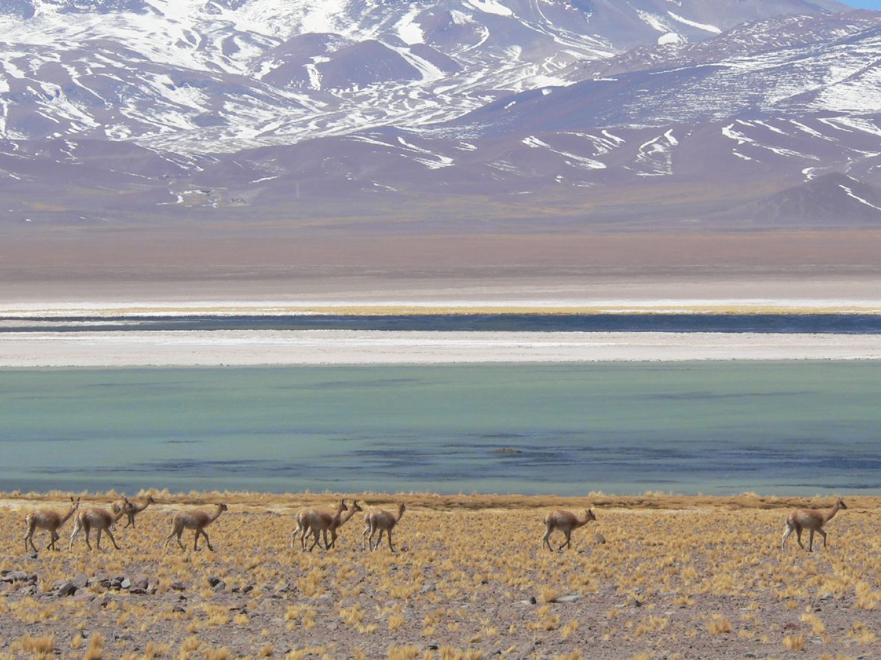
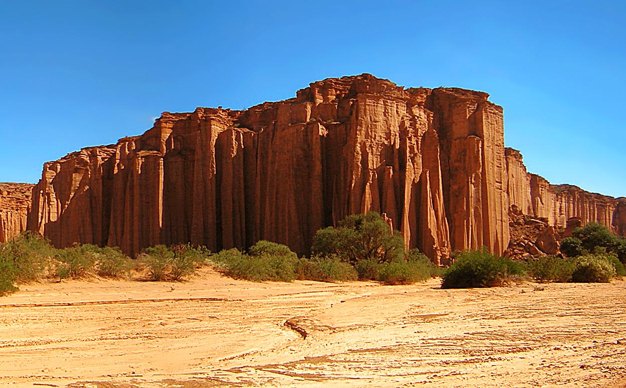
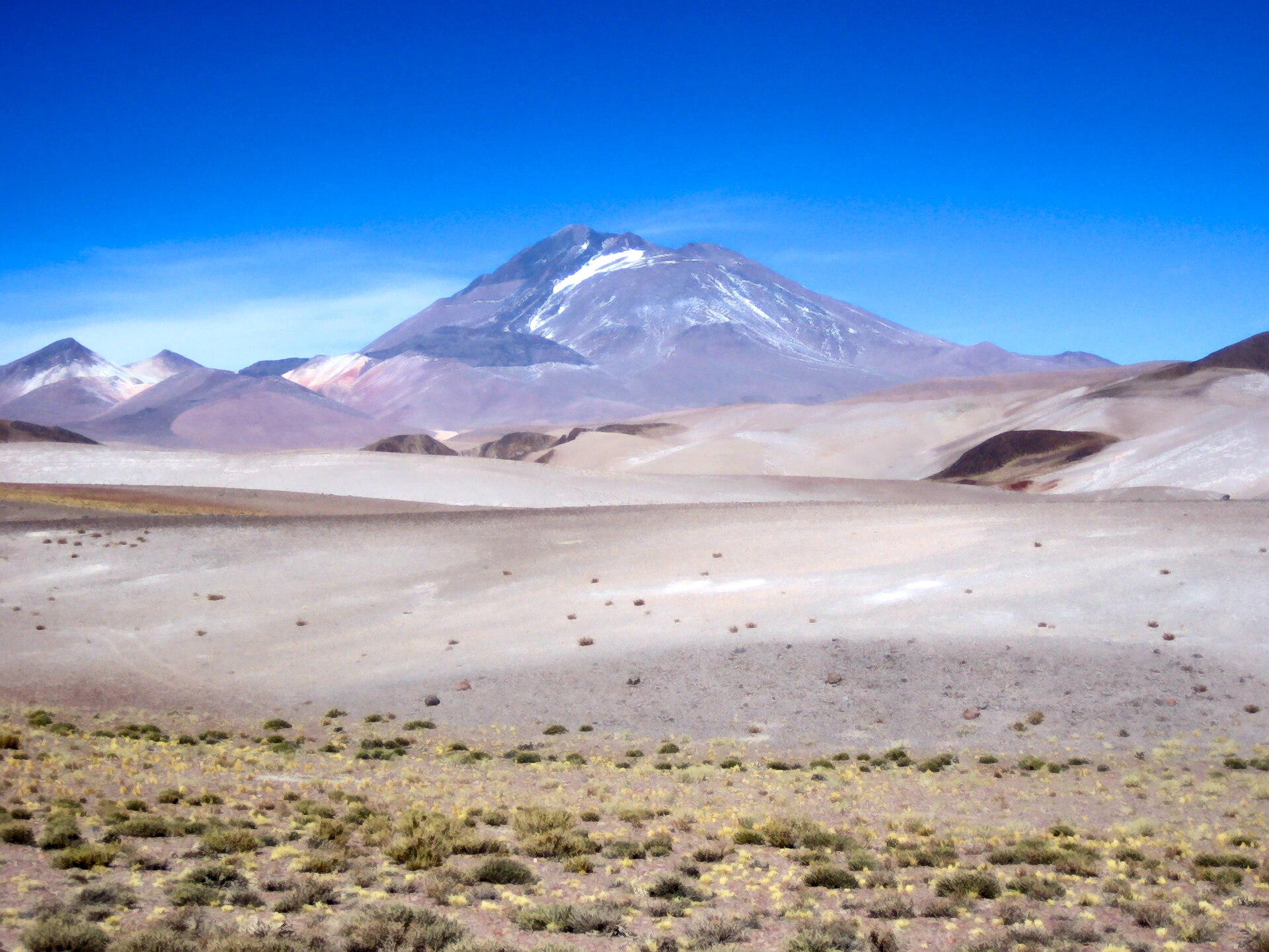
A terrestrial area, with forests and mountains.
When is the best time to visit Aconquija National Park?
Best time to visit: from April to October, with average temperatures of 10 to 17 °C and moderate rainfall.
Are there historic monuments in Aconquija National Park?
Yes. According to Wikidata, 4 monuments protected in Argentina as National Historic Monuments or Sites stand within the boundary. For example: “Bajo La Ciudacita”, “Sección Complejo Arqueológico La Ciudacita -- Punto Final” and “La Ciudacita”.
What is the nearest large city to Aconquija National Park?
Nearest towns of over 50,000 people, as the crow flies: Concepción (17 km) and Yerba Buena (56 km). Nearest airport: Teniente Benjamín Matienzo (TUC), about 70 km away.
Where can I get visitor information on site?
Puesto Santa Rosa de guardaparques, Puesto Los Chorizos de guardaparques and La Mesada.
Which species can be seen in Aconquija National Park?
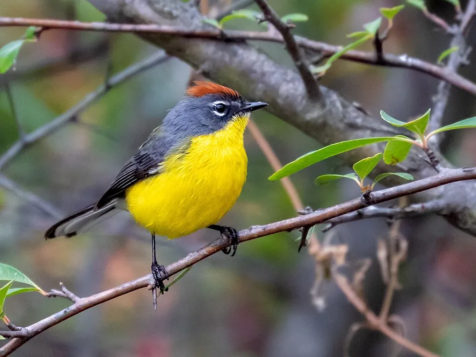
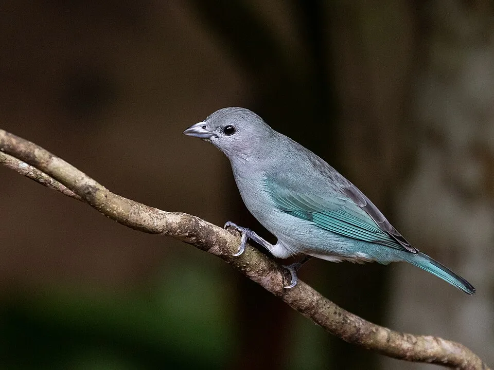
Among the species most often recorded on GBIF are Myioborus brunniceps (Brown-capped Whitestart), Zonotrichia capensis (Rufous-collared Sparrow), Syndactyla rufosuperciliata (Buff-browed Foliage-gleaner) and Thraupis sayaca (Sayaca Tanager).
What is the official website of Aconquija National Park?
argentina.gob.ar/interior/ambiente/parquesnacionales/aconquija
© OpenStreetMap
Download the boundary: GeoJSON · GPX Boundary © OpenStreetMap contributors (ODbL).
Geography
The representative point of the site lies at around 1,287 m above sea level. Over the 1996–2025 period, the mean annual temperature is about 15.5 °C and total precipitation reaches roughly 2,253 mm per year. The warmest month is usually January, the coolest July, and the wettest January.
Area
- Area of the boundary
- 62,470 ha
- Elevation
- 1,287 m
- Median elevation
- 1,689 m
- Mean slope
- 23°
- Coordinates
- -27.2857, -65.9245
Terrain: Mapzen Terrain Tiles (SRTM, USGS)
Elevation bands
- 500–1,000 m 19%
- 1,000–1,500 m 24%
- 1,500–2,000 m 19%
- 2,000–2,500 m 10%
- 2,500–3,000 m 5%
- above 3,000 m 24%
share of the site in each elevation band (smoothed terrain model: summits are rounded off) · Terrain: Mapzen Terrain Tiles (SRTM, USGS)
Climate
● Mean temperature (°C) · ▮ Precipitation (mm)
Source: Copernicus ERA5-Land (C3S, doi:10.24381/cds.68d2bb30), monthly averages 1996–2025 interpolated to the representative point, temperatures adjusted for elevation.
Contains modified Copernicus Climate Change Service information 2026. Neither the European Commission nor ECMWF is responsible for any use that may be made of the Copernicus information or data it contains.
Natural habitats
According to the global MODIS land cover (NASA, 2024), the site is mainly made up of forests (71%), grassland and meadows (18%) and heath and scrub (6%). Woodland is mostly broadleaved. Elevation ranges from about 690 to 4,910 m (sampled elevations, SRTM). Median elevation is 1,689 m, and 24% of the site lies above 3,000 m (SRTM elevation model). The terrain is steep: 28% of slopes exceed 30° (mean slope 23°).
Biodiversity
Based on occurrences aggregated by GBIF, several species are regularly recorded within the site. Among the most frequent are Myioborus brunniceps (Brown-capped Whitestart), Zonotrichia capensis (Rufous-collared Sparrow), Syndactyla rufosuperciliata (Buff-browed Foliage-gleaner) and Thraupis sayaca (Sayaca Tanager). The full list of documented taxa is shown below.
Species to look out for

Bird
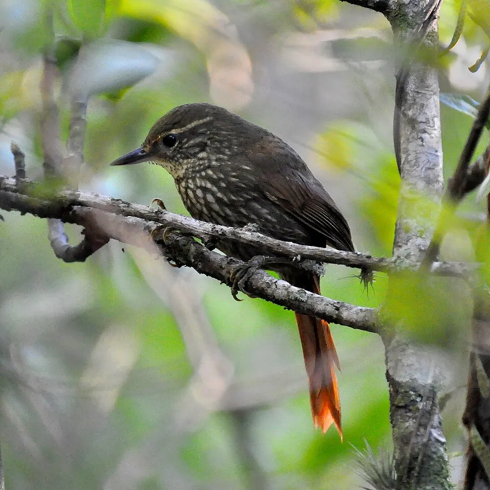
Buff-browed Foliage-gleaner
Syndactyla rufosuperciliata199 records © Cláudio Dias Timm from Rio Grande do Sul · CC BY-SA 2.0

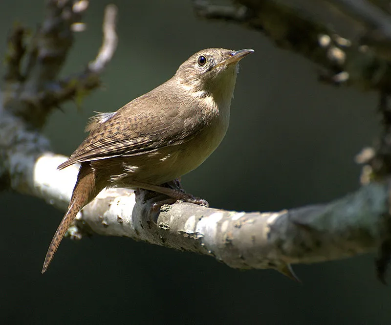
Bird
Southern House Wren
Troglodytes musculus177 records © Dario Sanches from SÃO PAULO, BRASIL · CC BY-SA 2.0
Observed species
Occurrences documented via GBIF; they are neither an exhaustive inventory nor proof of current presence.
- Brown-capped Whitestart · Myioborus brunniceps · 226
- Rufous-collared Sparrow · Zonotrichia capensis · 207
- Buff-browed Foliage-gleaner · Syndactyla rufosuperciliata · 199
- Sayaca Tanager · Thraupis sayaca · 192
- Rufous-bellied Thrush · Turdus rufiventris · 184
- Southern House Wren · Troglodytes musculus · 177
- Tropical Parula · Setophaga pitiayumi · 163
- Common Bush Tanager · Chlorospingus flavopectus · 147
- Plush-crested Jay · Cyanocorax chrysops · 139
- Crested Caracara · Caracara plancus · 136
- Mitred Parakeet · Aratinga mitrata · 135
- Yungas Guan · Penelope bridgesi · 118
+18 more species
- Mottle-cheeked Tyrannulet · Phylloscartes ventralis · 117
- Yellow-striped Brush Finch · Atlapetes citrinellus · 113
- Red-tailed Comet · Sappho sparganurus · 108
- Scaly-headed Parrot · Pionus maximiliani · 106
- Golden-crowned Warbler · Basileuterus culicivorus · 103
- Roadside Hawk · Rupornis magnirostris · 103
- Blue-and-white Swallow · Notiochelidon cyanoleuca · 96
- Turkey Vulture · Cathartes aura · 94
- Black Vulture · Coragyps atratus · 92
- Azara's Spinetail · Synallaxis azarae · 84
- Blue-fronted Parrot · Amazona aestiva · 83
- Mountain Wren · Troglodytes solstitialis · 82
- Rusty-browed Warbling Finch · Microspingus erythrophrys · 82
- White-throated Tyrannulet · Mecocerculus leucophrys · 81
- Red-eyed Vireo · Vireo olivaceus · 80
- Purple-throated Euphonia · Euphonia chlorotica · 72
- Picazuro Pigeon · Patagioenas picazuro · 65
- White-bellied Hummingbird · Elliotomyia chionogaster · 63
Records: GBIF.org (CC-BY). Names: Wikidata (CC0), GBIF. Photos: Wikimedia Commons.
Conservation challenges
The primary purpose of the site is to preserve its natural habitats and the biodiversity they support. The species recorded (Biodiversity tab) reflect its ecological value. Its status as a national park sets the regulatory framework for its protection.
According to Global Forest Change data (University of Maryland, Global Forest Watch), about 405 ha of tree cover were lost within the boundary between 2001 and 2023 (under 1% of its area), peaking in 2015 and 2016. These losses include logging, storms and fires, and do not account for regrowth. At night, the area gives off virtually no artificial light detectable from space (NASA VIIRS Black Marble composite, 2016).
Pressure indicators
Tree cover lost
405 ha
2001–2023
20012023
Light at night
0%
of the area gives off artificial light visible from space
DarkLit
Invasive alien species
2
recorded since 2000
 Rock Dove
 House Sparrow
Photos: Rock Dove © william_stephens · CC BY 4.0; House Sparrow © Diliff · CC BY-SA 3.0
Sources: Global Forest Change (Hansen et al., University of Maryland, via Global Forest Watch, CC-BY 4.0); EFFIS, European Commission / Copernicus; NASA Black Marble 2016 (public domain); CORINE Land Cover 2018 (Copernicus) or MODIS.
Invasive alien species: Global Register of Introduced and Invasive Species (ISSG, CC BY 4.0); Union list, Regulation (EU) 1143/2014 (INBO, CC0); GBIF.org records (CC0 / CC BY 4.0), at least 2 per species.
Practical information
Cities and airport
- Concepción
17 km as the crow flies - Yerba Buena
56 km as the crow flies - Airport: Teniente Benjamín Matienzo (TUC)
70 km as the crow flies
Visitor information
- Puesto Santa Rosa de guardaparques
within the site - Puesto Los Chorizos de guardaparques
within the site - La Mesada
within the site - Saladillo
within the site
Data © OpenStreetMap contributors (ODbL) · Wikidata (CC0)
Access and visiting
Nearest towns of over 50,000 people, as the crow flies: Concepción (17 km) and Yerba Buena (56 km). Nearest airport: Teniente Benjamín Matienzo (TUC), about 70 km away. About 200,000 people live within 20 km of the site boundary, 11,000 of them within 10 km; some 150 people are estimated to live inside (GHSL estimate, 2020). This population has grown by about 17% since 2000. Visitor information on site: Puesto Santa Rosa de guardaparques, Puesto Los Chorizos de guardaparques and La Mesada. To plan a visit (access, opening periods, visitor rules), it is best to consult the official information from the managing body and the official website listed in this page's sources.
Source: OpenStreetMap (ODbL), Wikidata (CC0), October 2026.
Built heritage
According to Wikidata, 4 monuments protected in Argentina as National Historic Monuments or Sites stand within the boundary. Examples include “Bajo La Ciudacita”, “Sección Complejo Arqueológico La Ciudacita -- Punto Final” and “La Ciudacita”.
-
Bajo La Ciudacita
-
Sección Complejo Arqueológico La Ciudacita -- Punto Final
-
La Ciudacita
-
Sección Complejo Arqueológico La Ciudacita -- Punto Inicial
Source: Wikidata (CC0), monuments in each country’s official heritage protection registers, at national or regional level. Each item links to its Wikidata entry.
When to visit
Best time to visit: from April to October, with average temperatures of 10 to 17 °C and moderate rainfall. Precipitation peaks from December to March (up to 360 mm per month). These averages apply to the site's representative point (1,287 m); higher up it is markedly cooler and snow lasts longer. Day length ranges from about 10 h 26 min in June to 13 h 51 min in December. Wildlife records published on GBIF peak for birds (October) and butterflies and moths (April). These peaks also reflect when observers are most active.
Source: Copernicus ERA5-Land (C3S), monthly averages 1996–2025 at the representative point, temperatures adjusted for elevation.
Contains modified Copernicus Climate Change Service information 2026. Neither the European Commission nor ECMWF is responsible for any use that may be made of the Copernicus information or data it contains.
Wildlife records calendar
JFMAMJJASOND
Birds
Plants
Butterflies & moths
Monthly records published on GBIF (CC-BY), relative to the busiest month; also reflects observer activity.
Gallery
© rodoluca · CC BY-SA 3.0
© Silvio Montani · CC BY 4.0
© Martín Acosta Albarracín · CC BY 4.0
© Silvio Montani · CC BY 4.0
© Silvio Montani · CC BY 4.0
Sources and licences
- Wikidata: Q58233041
- OpenStreetMap: relation 9210766
- Official website: https://www.argentina.gob.ar/interior/ambiente/parquesnacionales/aconquija
- Wikipedia: en.wikipedia.org/wiki/Aconquija_National_Park
References
- cds.climate.copernicus.eu: climate · CC-BY-4.0
- registry.opendata.aws: elevation of the reference point, detailed relief · PD
- lpdaac.usgs.gov: land cover · PD
- doi.org: population around the site · CC-BY-4.0
- naturalearthdata.com: sea share · PD
- openstreetmap.org: official name, access and peaks · ODbL-1.0
- en.eurovelo.com: EuroVelo cycle routes · ODbL-1.0
- cycling.waymarkedtrails.org: cycle routes · ODbL-1.0
- opentopodata.org: elevations · PD
- wikidata.org: establishment date, protected heritage, nearby cities and airport, access and peaks, lake depths, places to see, official website · CC0-1.0
- globalforestwatch.org: tree cover loss · CC-BY-4.0
- gbif.org: seasonality of sightings, invasive alien species, observed species · CC-BY-4.0
- earthobservatory.nasa.gov: night light · PD
- nsidc.org: snow cover · PD
- wikidata.org: Wikipedia article · CC-BY-SA-4.0
Data © OpenStreetMap contributors (ODbL), Wikidata (CC0) and the sources cited.