Lithuania · Terrestrial
Biržai Regional Park
Nature park of 14,400 hectares in Lithuania, established in 1992.
Overview
Nature park of 14,400 hectares in Lithuania, established in 1992.
Biržai Regional Park is a nature park in Lithuania (Europe). It is a predominantly terrestrial area. Established in 1992, it covers about 14,400 hectares.
Protections and designations
Natura 2000 · habitats (SAC) · 8 sites
- Ąžuolynės miškas LTBIR0008
- Daudžgirių miškas LTBIR0002
- Drąseikių kaimo apylinkės LTBIR0007
- Gipso karsto ežerai ir jų apyežerės LTBIR0004
- Karajimiškio kaimo apylinkės LTBIR0005
- Padaičių miškas LTBIR0009
- and 2 more
Protected as a nature park. International labels and designations: Natura 2000 network (8 sites). Key dates: established in 1992 and first Natura 2000 site under the Habitats Directive in 2009.
Timeline
-
1992
Established
-
2009
First Natura 2000 site under the Habitats Directive
Sources: Wikidata (CC0) for establishment and international labels; EEA Natura 2000 database (CC-BY 4.0) for site designation dates.
Frequently asked questions
Where is Biržai Regional Park?
In Lithuania (Europe). Representative point: 56.2010° N, 24.6590° E.
How large is Biržai Regional Park?
About 14,400 hectares (144 km²). It is the 10th largest of the 29 nature parks in Lithuania covered by Parkavela.
When was Biržai Regional Park established?
In 1992.
What habitats and landscapes does Biržai Regional Park include?
A terrestrial area, where land cover is dominated by farmland (70%).
Which international labels apply to Biržai Regional Park?
Natura 2000 network (8 sites).
When is the best time to visit Biržai Regional Park?
Mildest period: July and August, with average temperatures of 18 to 19 °C.
Is there snow in Biržai Regional Park?
Yes. According to NASA's MODIS satellites (2015–2025 average), snow covers most of the site from December to February, with about 75 snow-covered days a year on average.
What is there to see in Biržai Regional Park?
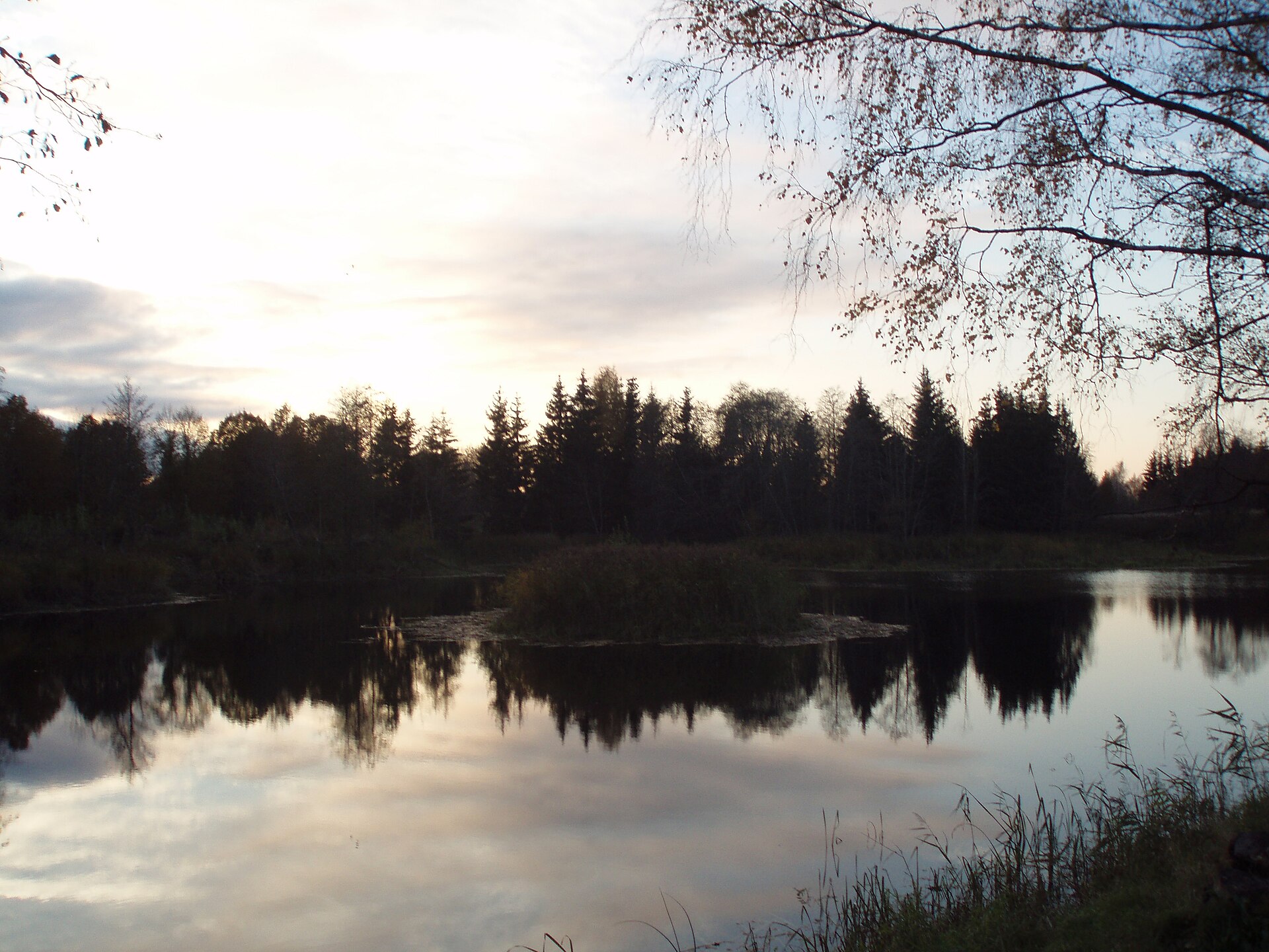
13 lakes and ponds and 1 cave, including Širvėnos ežeras (62 m), Karvės ola, Dubužė and Drąseikių ežeras (Wikidata).
Can you swim in Biržai Regional Park?
2 monitored bathing sites lie in or within 1 km of the site; official 2025 classification: 1 excellent and 1 good (European Environment Agency). Swimming is only permitted at the sites and times authorised locally.
What is the nearest large city to Biržai Regional Park?
Nearest towns of over 50,000 people, as the crow flies: Panevėžys (44 km) and Jelgava (70 km). Nearest airport: Kaunas (KUN), about 130 km away.
How can I reach Biržai Regional Park by train?
The nearest railway station is Joniškėlio geležinkelio stotis, about 20 km from the site boundary.
Where can I get visitor information on site?
Biržų regioninio parko lankytojų centras and Biržų turizmo informacijos centras.
Are there waymarked hiking trails in Biržai Regional Park?
Yes. Waymarked hiking routes listed in OpenStreetMap: 6, including Camino Lituano Aukštaitijos.
Which species can be seen in Biržai Regional Park?
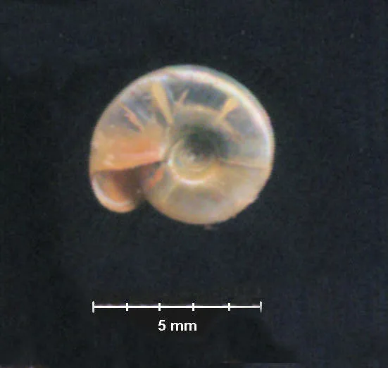
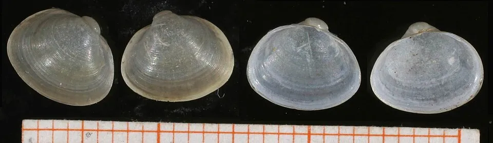
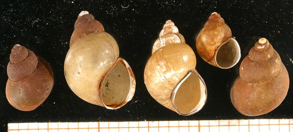
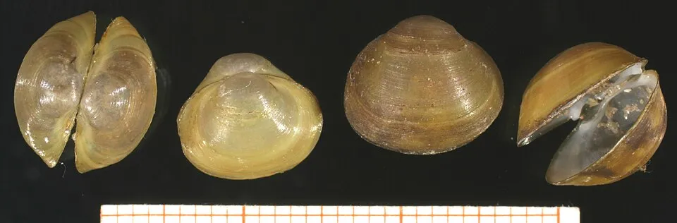
Among the species most often recorded on GBIF are Segmentina nitida (Shining ram's-horn snail), Musculium lacustre (Lake Fingernailclam), Bithynia tentaculata (Common Bithynia) and Anisus vorticulus (Lesser Ramshorn Snail).
What is the official website of Biržai Regional Park?
© OpenStreetMap
Download the boundary: GeoJSON · GPX Boundary © OpenStreetMap contributors (ODbL).
Geography
The representative point of the site lies at around 47 m above sea level. Over the 1996–2025 period, the mean annual temperature is about 7.6 °C and total precipitation reaches roughly 718 mm per year. The warmest month is usually July, the coolest January, and the wettest July. The site contains 2 lakes larger than 10 ha, totalling 3.0 km² of water; the largest, Širvėnos ežeras, covers 2.9 km² (HydroLAKES).
Area
- Area
- 14,400 ha
- Elevation
- 47 m
- Snow cover
- ≈ 75 days a year
- Lakes over 10 ha
- 2 (3.0 km²)
- Coordinates
- 56.201, 24.659
Lakes: HydroLAKES (Messager et al. 2016, hydrosheds.org, CC BY 4.0) · depths: Wikidata (CC0)
Climate
● Mean temperature (°C) · ▮ Precipitation (mm)
Source: Copernicus ERA5-Land (C3S, doi:10.24381/cds.68d2bb30), monthly averages 1996–2025 interpolated to the representative point, temperatures adjusted for elevation.
Contains modified Copernicus Climate Change Service information 2026. Neither the European Commission nor ECMWF is responsible for any use that may be made of the Copernicus information or data it contains.
Snow cover measured by satellite
J
F
M
A
M
J
J
A
S
O
N
D
average share of the site under snow · snowiest parts · ≈ 75 days a year
Snow cover: MODIS/Terra MOD10CM v61 (Hall & Riggs, 2021, NASA NSIDC DAAC, doi:10.5067/MODIS/MOD10CM.061), imagery from NASA GIBS (ESDIS); 2015–2025 average, grid of about 5 km.
Natural habitats
According to CORINE Land Cover (2018), the site is mainly made up of farmland (70%), forests (18%) and built-up or developed land (5%). The land is almost flat (mean slope under 2°). The 8 Natura 2000 sites overlapping the area list 11 habitats of European interest (2 priority), the most extensive being Fennoscandian hemiboreal natural old broad-leaved deciduous forests (Quercus, Tilia, Acer, Fraxinus or Ulmus) rich in epiphytes, Fennoscandian deciduous swamp woods and lakes of gypsum karst.
Biodiversity
Based on occurrences aggregated by GBIF, several species are regularly recorded within the site. Among the most frequent are Segmentina nitida (Shining ram's-horn snail), Musculium lacustre (Lake Fingernailclam), Bithynia tentaculata (Common Bithynia) and Anisus vorticulus (Lesser Ramshorn Snail). The full list of documented taxa is shown below. The overlapping Natura 2000 sites list 2 species of European interest: 2 invertebrates.
Habitats of European interest
From the official forms of the 8 Natura 2000 sites overlapping the area (areas reported for each whole site).
- Fennoscandian hemiboreal natural old broad-leaved deciduous forests (Quercus, Tilia, Acer, Fraxinus or Ulmus) rich in epiphytes priority 276 ha
- Fennoscandian deciduous swamp woods priority 50 ha
- Lakes of gypsum karst 18 ha
- Water courses of plain to montane levels with the Ranunculion fluitantis and Callitricho-Batrachion vegetation 13 ha
- Lowland hay meadows (Alopecurus pratensis, Sanguisorba officinalis) 9 ha
- Northern boreal alluvial meadows 6 ha
- Fennoscandian herb-rich forests with Picea abies 3 ha
- Semi-natural dry grasslands and scrubland facies on calcareous substrates (Festuco-Brometalia) (* important orchid sites) 2 ha
and 3 more
Species of European interest
Invertebrates · 2
Lilypad whiteface (Leucorrhinia caudalis), Yellow-spotted Whiteface (Leucorrhinia pectoralis)
Source: Natura 2000 standard data forms (EEA, CC-BY 4.0). Not exhaustive: sensitive species are not published.
Species to look out for
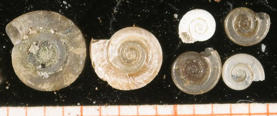
Mollusc
Lesser Ramshorn Snail
Anisus vorticulus40 records © Francisco Welter Schultes · CC BY-SA 2.5

Observed species
Occurrences documented via GBIF; they are neither an exhaustive inventory nor proof of current presence.
- Shining ram's-horn snail · Segmentina nitida · 415
- Lake Fingernailclam · Musculium lacustre · 97
- Common Bithynia · Bithynia tentaculata · 45
- Lesser Ramshorn Snail · Anisus vorticulus · 40
- Horny orb mussel · Sphaerium corneum · 25
- Mallard · Anas platyrhynchos · 18
- Hooded Crow · Corvus cornix · 17
- Great tit · Parus major · 17
- Common Starling · Sturnus vulgaris · 17
- Common Coot · Fulica atra · 16
- Fieldfare · Turdus pilaris · 16
- Eurasian Chaffinch · Fringilla coelebs · 16
+18 more species
- Common Wood Pigeon · Columba palumbus · 16
- White Wagtail · Motacilla alba · 16
- White stork · Ciconia ciconia · 15
- Great Crested Grebe · Podiceps cristatus · 15
- Common Blackbird · Turdus merula · 15
- Eurasian blue tit · Cyanistes caeruleus · 14
- Big-eared Radix · Radix auricularia · 14
- Western Marsh Harrier · Circus aeruginosus · 13
- White-lipped Ramshorn · Anisus leucostoma · 13
- Black Gloss Snail · Zonitoides nitidus · 11
- Rook · Corvus frugilegus · 11
- Common House Martin · Delichon urbicum · 11
- Eurasian Magpie · Pica pica · 11
- Keeled Ramshorn · Planorbis carinatus · 11
- Pfeifers amber snail · Oxyloma elegans · 11
- Great Spotted Woodpecker · Dendrocopos major · 10
- Common Chiffchaff · Phylloscopus collybita · 10
- European Goldfinch · Carduelis carduelis · 10
Records: GBIF.org (CC-BY). Names: Wikidata (CC0), GBIF. Photos: Wikimedia Commons.
Conservation challenges
The primary purpose of the site is to preserve its natural habitats and the biodiversity they support. The species recorded (Biodiversity tab) reflect its ecological value. The designations it holds frame its management and the control of land use.
According to Global Forest Change data (University of Maryland, Global Forest Watch), about 232 ha of tree cover were lost within the boundary between 2001 and 2023 (2% of its area), peaking in 2010 and 2016. These losses include logging, storms and fires, and do not account for regrowth. According to CORINE Land Cover, land cover here remained almost unchanged between 1990 and 2018 (less than 0.5% of the area affected). At night, 4% of the area gives off artificial light detectable from space (NASA VIIRS Black Marble composite, 2016). Built-up and developed land (buildings, business areas, roads, quarries) covers 5% of the area, and farmland 70% (CORINE Land Cover). According to the Natura 2000 forms, of 11 assessed habitats of European interest, 1 is in average or reduced condition and the rest in good condition. According to the Water Framework Directive assessment (2022 river basin management plans, data 2014–2019), none of the 46 km of rivers assessed within the site reaches good ecological status; they mostly have moderate ecological status. Other assessed water bodies: lakes, 0 of 1 in good ecological status or better.
Pressure indicators
Tree cover lost
232 ha
2001–2023 · 2% of the area
20012023
Fires since 2016
0
No large fire mapped (fires over about 30 ha)
Light at night
4%
of the area gives off artificial light visible from space
DarkLit
Built-up land
5%
buildings, business areas, roads, quarries · farmland 70%
Land cover change
< 0.5%
of the area changed, 1990–2018 · CORINE
Rivers and lakes
0%
of the 46 km of assessed rivers in good or high ecological status · WFD 2022
Lakes: 0 of 1 good or better
assessments 2014–2019
Sources: Global Forest Change (Hansen et al., University of Maryland, via Global Forest Watch, CC-BY 4.0); EFFIS, European Commission / Copernicus; NASA Black Marble 2016 (public domain); CORINE Land Cover 2018 (Copernicus) or MODIS.
CORINE Land Cover Change 1990–2018: generated using European Union's Copernicus Land Monitoring Service information (EEA), aggregated by Parkavela; DOI 10.2909/f30f1000-7cf8-43bb-872c-5eb093911b24.
Ecological status of water bodies: European Environment Agency, WISE – Water Framework Directive, 3rd river basin management plans (2022), CC BY 4.0. Official national classification, not comparable between countries.
Practical information
Cities and airport
- Panevėžys
44 km as the crow flies - Jelgava
70 km as the crow flies - Airport: Kaunas (KUN)
130 km as the crow flies
Visitor information
- Biržų regioninio parko lankytojų centras
within the site - Biržų turizmo informacijos centras
< 1 km from the site boundary
Things to see
13 lakes and ponds · 1 cave
- Širvėnos ežeras
lake or pond · 62 m - Karvės ola
cave - Dubužė
lake or pond - Drąseikių ežeras
lake or pond - Jonavos ežeras
lake or pond
Hiking
6 waymarked routes listed, including:
Camino Lituano Aukštaitijos
Data © OpenStreetMap contributors (ODbL) · Wikidata (CC0)
Bathing
2 monitored bathing sites in or within 1 km of the site · 2025 classification
Excellent · 1
Good · 1
- Jaunimo Parko · lake · Excellent
- Centrine · lake · Good
Source: European Environment Agency, official bathing water classification (Directive 2006/7/EC, CC-BY 4.0). Swimming is only permitted at the sites and times authorised locally.
Access and visiting
The nearest railway station is Joniškėlio geležinkelio stotis, about 20 km from the site boundary. Nearest towns of over 50,000 people, as the crow flies: Panevėžys (44 km) and Jelgava (70 km). Nearest airport: Kaunas (KUN), about 130 km away. About 42,000 people live within 20 km of the site boundary, 23,000 of them within 10 km; some 5,500 people are estimated to live inside (GHSL estimate, 2020). This population has fallen by about 34% since 2000. Visitor information on site: Biržų regioninio parko lankytojų centras and Biržų turizmo informacijos centras. Waymarked hiking routes listed in OpenStreetMap: 6, including Camino Lituano Aukštaitijos. To see: 13 lakes and ponds and 1 cave, including Širvėnos ežeras (62 m), Karvės ola, Dubužė and Drąseikių ežeras. To plan a visit (access, opening periods, visitor rules), it is best to consult the official information from the managing body and the official website listed in this page's sources.
Source: OpenStreetMap (ODbL), Wikidata (CC0), October 2026.
When to visit
Mildest period: July and August, with average temperatures of 18 to 19 °C. Average temperatures drop below 0 °C from December to February: frost is common. According to NASA's MODIS satellites (2015–2025 average), snow covers most of the site from December to February, with about 75 snow-covered days a year on average. Day length ranges from about 6 h 56 min in December to 17 h 38 min in June. Wildlife records published on GBIF peak for birds (April), plants (August and September) and butterflies and moths (October). These peaks also reflect when observers are most active.
Source: Copernicus ERA5-Land (C3S), monthly averages 1996–2025 at the representative point, temperatures adjusted for elevation.
Contains modified Copernicus Climate Change Service information 2026. Neither the European Commission nor ECMWF is responsible for any use that may be made of the Copernicus information or data it contains.
Wildlife records calendar
JFMAMJJASOND
Birds
Plants
Butterflies & moths
Monthly records published on GBIF (CC-BY), relative to the busiest month; also reflects observer activity.
Gallery
© Qwarc · CC BY-SA 3.0
© Benjamin Eavey · CC BY-SA 3.0
© Saras.kub · CC BY-SA 4.0
© Powermelon · CC0-1.0
© Saras.kub · CC BY-SA 4.0
Sources and licences
- Wikidata: Q2039160
- OpenStreetMap: relation 5226162
- Official website: https://birzuparkas.lt/
- Wikipedia: en.wikipedia.org/wiki/Biržai_Regional_Park
- WDPA: 62273
References
- cds.climate.copernicus.eu: climate · CC-BY-4.0
- registry.opendata.aws: elevation of the reference point, detailed relief · PD
- land.copernicus.eu: land cover, land cover change, sea share · COPERNICUS
- doi.org: population around the site · CC-BY-4.0
- wikidata.org: official area, establishment date, official name, nearby cities and airport, access and peaks, lake depths, places to see, official website · CC0-1.0
- eea.europa.eu: bathing water quality, ecological status of waters · CC-BY-4.0
- en.eurovelo.com: EuroVelo cycle routes · ODbL-1.0
- cycling.waymarkedtrails.org: cycle routes · ODbL-1.0
- opentopodata.org: elevations · PD
- forest-fire.emergency.copernicus.eu: wildfires · COPERNICUS
- globalforestwatch.org: tree cover loss · CC-BY-4.0
- gbif.org: seasonality of sightings, invasive alien species, observed species · CC-BY-4.0
- hydrosheds.org: lakes · CC-BY-4.0
- natura2000.eea.europa.eu: Natura 2000 habitats and species · CC-BY-4.0
- earthobservatory.nasa.gov: night light · PD
- openstreetmap.org: access and peaks · ODbL-1.0
- nsidc.org: snow cover · PD
- wikidata.org: Wikipedia article · CC-BY-SA-4.0
Data © OpenStreetMap contributors (ODbL), Wikidata (CC0) and the sources cited.