Mexico · Terrestrial
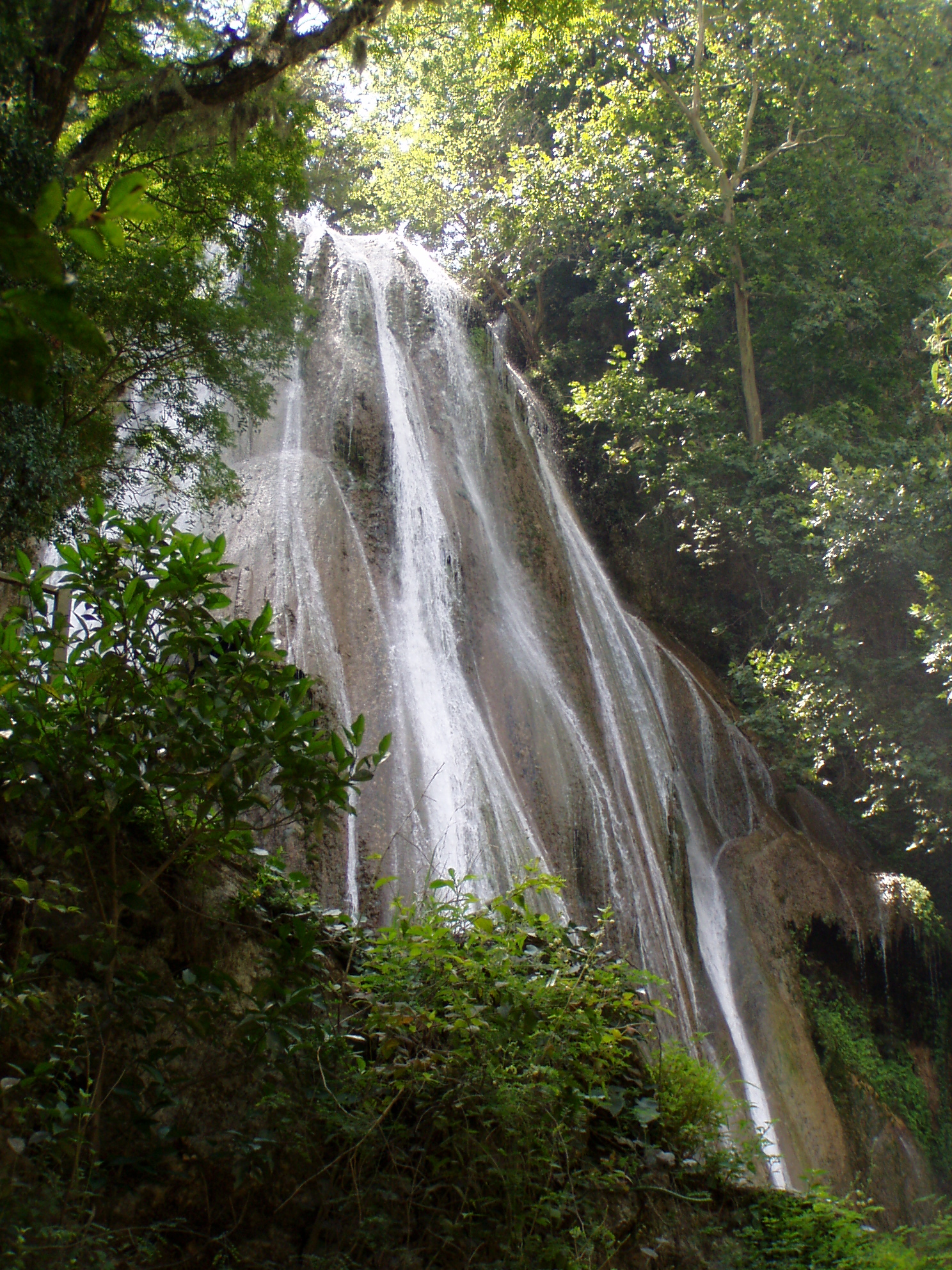
El Sabinal National Park
National park of 8 hectares in Mexico, established in 1938.
Overview
National park of 8 hectares in Mexico, established in 1938.
El Sabinal National Park is located in Mexico (North America). It is a predominantly terrestrial area. Established on 25 August 1938, it covers about 8 hectares.
Frequently asked questions
Where is El Sabinal National Park?
In Mexico (North America). Representative point: 26.0839° N, 99.6222° W.
How large is El Sabinal National Park?
About 8 hectares. It is the 51st largest of the 52 national parks in Mexico covered by Parkavela.
When was El Sabinal National Park established?
On 25 August 1938.
What habitats and landscapes does El Sabinal National Park include?
A terrestrial area.
When is the best time to visit El Sabinal National Park?
Best time to visit: March and April, with average temperatures of 21 to 25 °C and moderate rainfall.
What is the nearest large city to El Sabinal National Park?
Nearest towns of over 50,000 people, as the crow flies: Guadalupe (74 km) and Monterrey (82 km). Nearest airport: Monterrey-Gen. Mariano Escobedo (MTY), about 59 km away.
Which species can be seen in El Sabinal National Park?
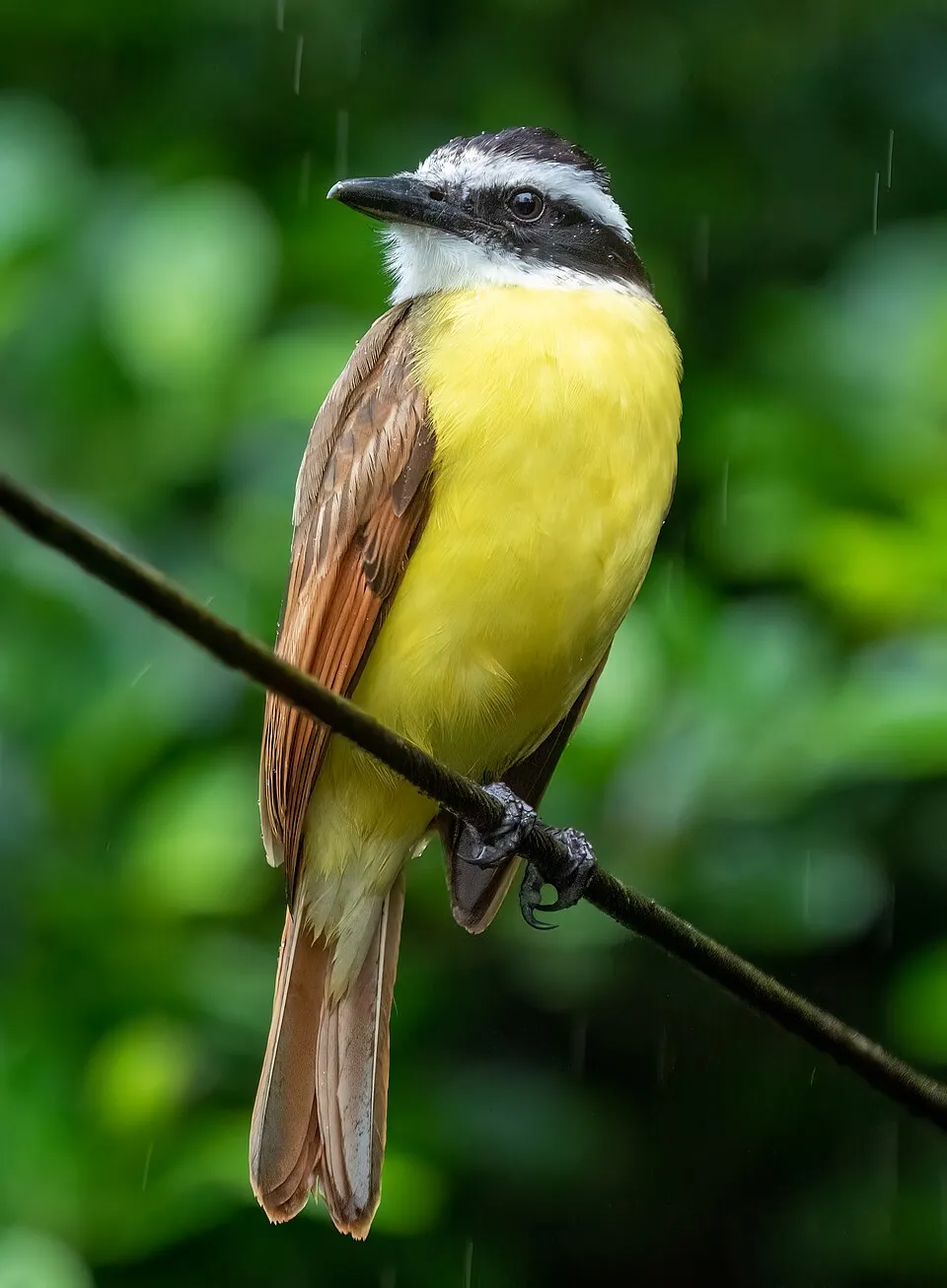
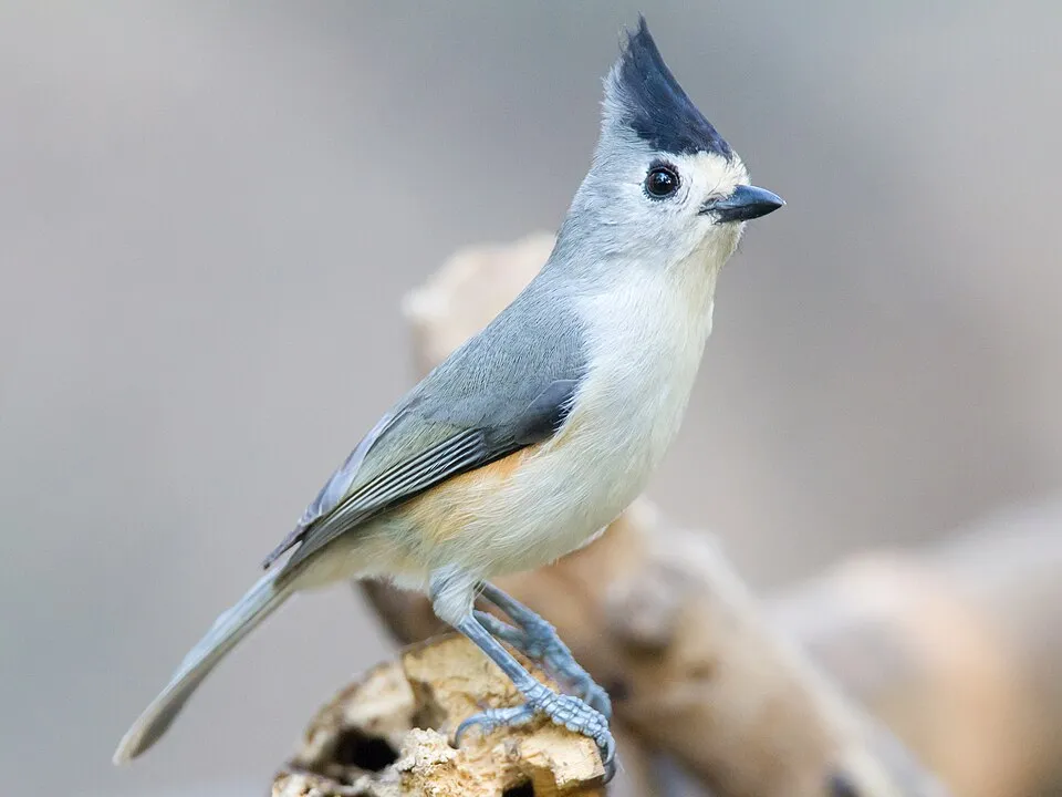
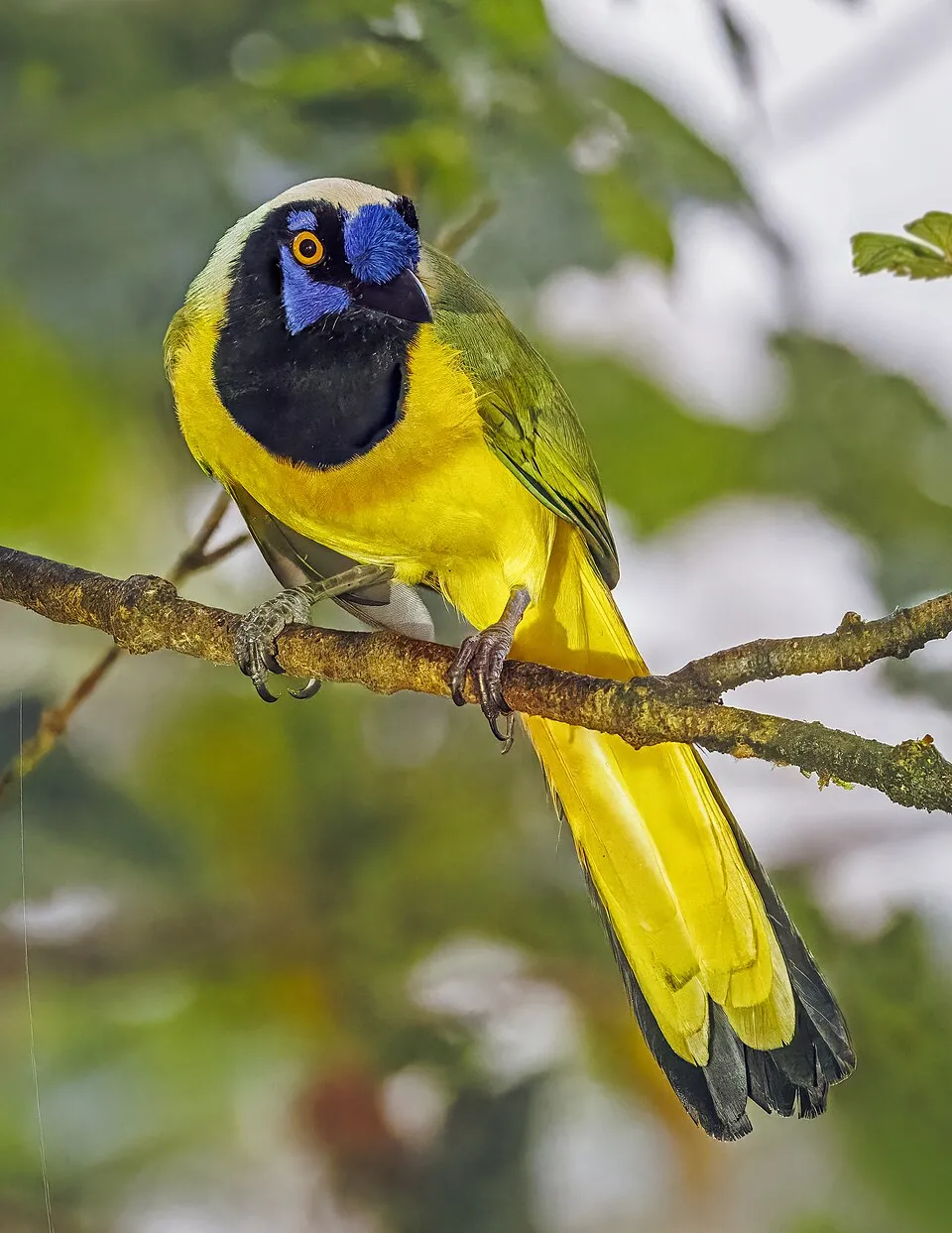
Among the species most often recorded on GBIF are Pitangus sulphuratus (Great Kiskadee), Melanerpes aurifrons (Golden-fronted Woodpecker), Baeolophus atricristatus (Black-crested Titmouse) and Cyanocorax yncas (Inca Jay).
© OpenStreetMap
Download the boundary: GeoJSON · GPX Boundary © OpenStreetMap contributors (ODbL).
Geography
The representative point of the site lies at around 290 m above sea level. Over the 1996–2025 period, the mean annual temperature is about 23.5 °C and total precipitation reaches roughly 654 mm per year. The warmest month is usually August, the coolest January, and the wettest September.
Area
- Area
- 8 ha
- Elevation
- 290 m
- Coordinates
- 26.0839, -99.6222
Climate
● Mean temperature (°C) · ▮ Precipitation (mm)
Source: Copernicus ERA5-Land (C3S, doi:10.24381/cds.68d2bb30), monthly averages 1996–2025 interpolated to the representative point, temperatures adjusted for elevation.
Contains modified Copernicus Climate Change Service information 2026. Neither the European Commission nor ECMWF is responsible for any use that may be made of the Copernicus information or data it contains.
Biodiversity
Based on occurrences aggregated by GBIF, several species are regularly recorded within the site. Among the most frequent are Pitangus sulphuratus (Great Kiskadee), Melanerpes aurifrons (Golden-fronted Woodpecker), Baeolophus atricristatus (Black-crested Titmouse) and Cyanocorax yncas (Inca Jay). The full list of documented taxa is shown below.
Species to look out for
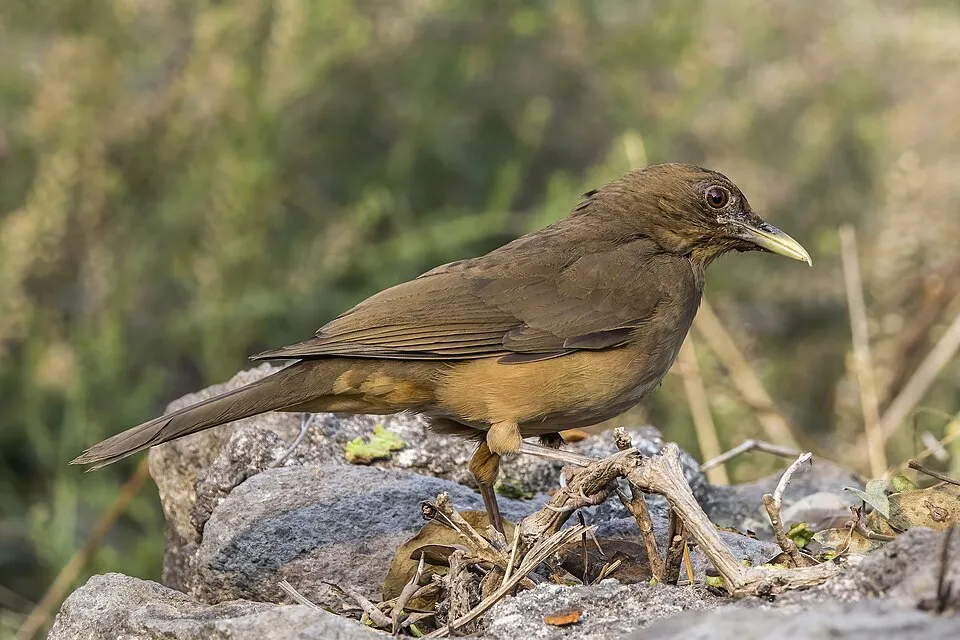
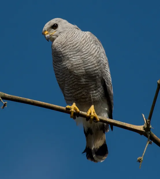
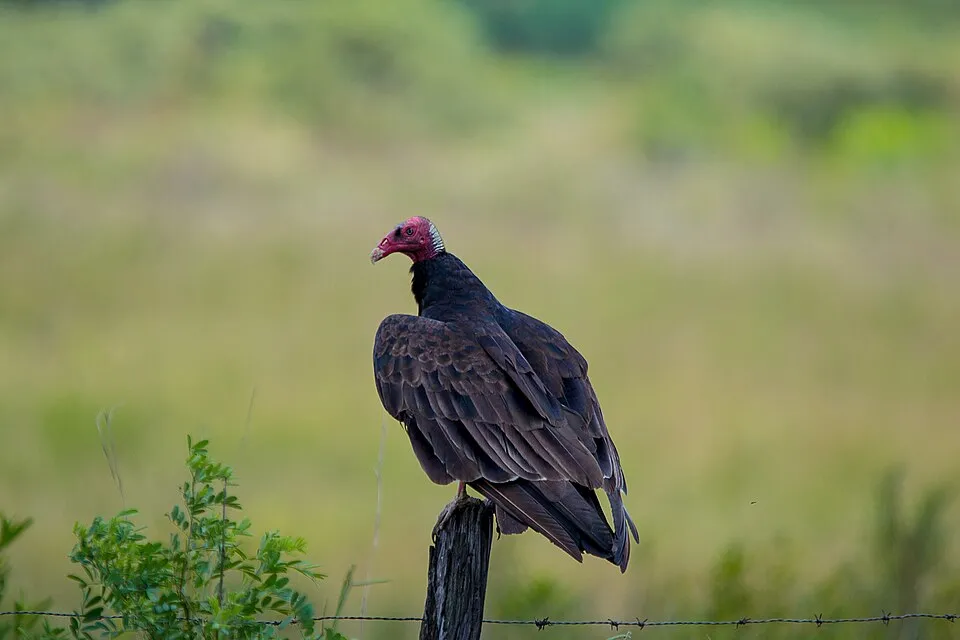
Observed species
Occurrences documented via GBIF; they are neither an exhaustive inventory nor proof of current presence.
- Great Kiskadee · Pitangus sulphuratus · 11
- Golden-fronted Woodpecker · Melanerpes aurifrons · 10
- Black-crested Titmouse · Baeolophus atricristatus · 8
- Inca Jay · Cyanocorax yncas · 7
- Clay-colored Thrush · Turdus grayi · 6
- Grey-lined Hawk · Buteo nitidus · 5
- Turkey Vulture · Cathartes aura · 5
- Black Vulture · Coragyps atratus · 5
- Ruby-crowned Kinglet · Regulus calendula · 5
- Bare-throated Tiger Heron · Tigrisoma mexicanum · 4
- Bronzed Cowbird · Molothrus aeneus · 4
- Carolina Wren · Thryothorus ludovicianus · 4
+18 more species
- Mourning Dove · Zenaida macroura · 4
- Couch's Kingbird · Tyrannus couchii · 4
- Hooded Oriole · Icterus cucullatus · 4
- Ladder-backed Woodpecker · Dryobates scalaris · 4
- Yellow-bellied Sapsucker · Sphyrapicus varius · 3
- Eastern phoebe · Sayornis phoebe · 3
- Blue-grey Gnatcatcher · Polioptila caerulea · 3
- Summer Tanager · Piranga rubra · 3
- Montezuma bald cypress · Taxodium mucronatum · 3
- Rose-throated Becard · Pachyramphus aglaiae · 3
- Northern Mockingbird · Mimus polyglottos · 3
- Capote · Xanthosoma robustum · 3
- Myrtle Warbler · Setophaga coronata · 3
- Orange-crowned Warbler · Leiothlypis celata · 3
- Great-tailed Grackle · Quiscalus mexicanus · 3
- Red admiral · Vanessa atalanta · 2
- Rio Grande Leopard Frog · Lithobates berlandieri · 2
- Ringed Kingfisher · Megaceryle torquata · 2
Records: GBIF.org (CC-BY). Names: Wikidata (CC0), GBIF. Photos: Wikimedia Commons.
Conservation challenges
The primary purpose of the site is to preserve its natural habitats and the biodiversity they support. The species recorded (Biodiversity tab) reflect its ecological value. Its status as a national park sets the regulatory framework for its protection.
Practical information
Cities and airport
- Guadalupe
74 km as the crow flies - Monterrey
82 km as the crow flies - Airport: Monterrey-Gen. Mariano Escobedo (MTY)
59 km as the crow flies
Data © OpenStreetMap contributors (ODbL) · Wikidata (CC0)
Access and visiting
Nearest towns of over 50,000 people, as the crow flies: Guadalupe (74 km) and Monterrey (82 km). Nearest airport: Monterrey-Gen. Mariano Escobedo (MTY), about 59 km away. About 11,000 people live within 20 km of the site boundary, 9,400 of them within 10 km (GHSL estimate, 2020). This population has grown by about 9% since 2000. To plan a visit (access, opening periods, visitor rules), it is best to consult the official information from the managing body and the official website listed in this page's sources.
Source: OpenStreetMap (ODbL), Wikidata (CC0), November 2026.
When to visit
Best time to visit: March and April, with average temperatures of 21 to 25 °C and moderate rainfall. Precipitation peaks in September (up to 130 mm per month). Day length ranges from about 10 h 31 min in December to 13 h 46 min in June. Wildlife records published on GBIF peak for birds (December). These peaks also reflect when observers are most active.
Source: Copernicus ERA5-Land (C3S), monthly averages 1996–2025 at the representative point, temperatures adjusted for elevation.
Contains modified Copernicus Climate Change Service information 2026. Neither the European Commission nor ECMWF is responsible for any use that may be made of the Copernicus information or data it contains.
Wildlife records calendar
JFMAMJJASOND
Birds
Monthly records published on GBIF (CC-BY), relative to the busiest month; also reflects observer activity.
Gallery
© Pewenator · Public domain
Sources and licences
- Wikidata: Q4307538
- Wikipedia: fr.wikipedia.org/wiki/Parc_national_El_Sabinal
- WDPA: 306791
References
- cds.climate.copernicus.eu: climate · CC-BY-4.0
- registry.opendata.aws: elevation of the reference point, detailed relief · PD
- land.copernicus.eu: land cover · COPERNICUS
- doi.org: population around the site · CC-BY-4.0
- naturalearthdata.com: sea share · PD
- wikidata.org: official area, establishment date, protected heritage, nearby cities and airport, access and peaks, lake depths, places to see · CC0-1.0
- en.eurovelo.com: EuroVelo cycle routes · ODbL-1.0
- cycling.waymarkedtrails.org: cycle routes · ODbL-1.0
- opentopodata.org: elevations · PD
- globalforestwatch.org: tree cover loss · CC-BY-4.0
- gbif.org: seasonality of sightings, invasive alien species, observed species · CC-BY-4.0
- openstreetmap.org: official name, access and peaks · ODbL-1.0
- nsidc.org: snow cover · PD
- wikidata.org: Wikipedia article · CC-BY-SA-4.0
Data © OpenStreetMap contributors (ODbL), Wikidata (CC0) and the sources cited.