France · Terrestrial
Espace naturel sensible des Sables de la Grange
Protected area of 76 hectares in France.
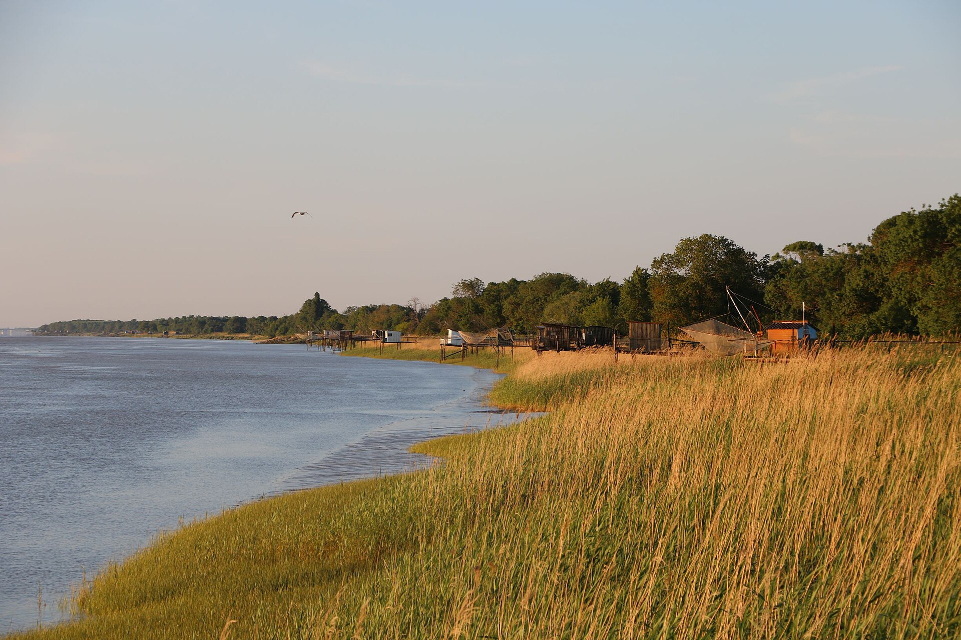
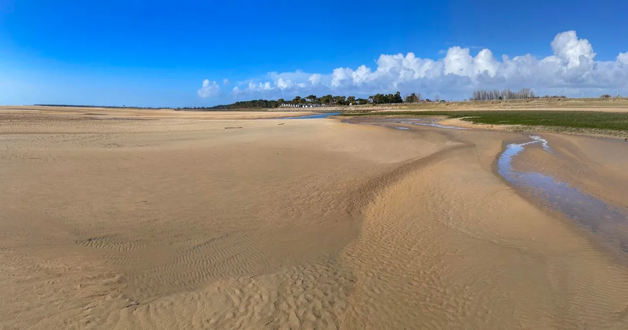
Illustrative photo · Vendée · © sandimage / Magnific
Overview
Protected area of 76 hectares in France.
Espace naturel sensible des Sables de la Grange is a protected area in France (Europe). It is a predominantly terrestrial area. It covers about 76 hectares.
Protections and designations
Natura 2000 · habitats (SAC)
Designated as a protected area. International labels and designations: Natura 2000 network (1 site: “Marais de Talmont et zones littorales entre les Sables-d'Olonne et Jard-sur-Mer”).
In our collections
Frequently asked questions
Where is Espace naturel sensible des Sables de la Grange?
In France (Europe). Representative point: 46.4174° N, 1.6217° W.
How large is Espace naturel sensible des Sables de la Grange?
About 76 hectares. It is the 22nd largest of the 32 other protected areas in France covered by Parkavela.
What habitats and landscapes does Espace naturel sensible des Sables de la Grange include?
A terrestrial area, with forests and coasts.
What rocks lie beneath Espace naturel sensible des Sables de la Grange?
According to the BRGM's simplified lithological map, the bedrock consists mainly of sands (100% of sampled points). These are mostly sedimentary rocks.
Which international labels apply to Espace naturel sensible des Sables de la Grange?
Natura 2000 network (1 site: “Marais de Talmont et zones littorales entre les Sables-d'Olonne et Jard-sur-Mer”).
When is the best time to visit Espace naturel sensible des Sables de la Grange?
Best time to visit: from April to September, with average temperatures of 11 to 20 °C and moderate rainfall.
Can you swim in Espace naturel sensible des Sables de la Grange?
One monitored bathing site lies in or within 1 km of the site; official 2025 classification: 1 excellent (European Environment Agency). Swimming is only permitted at the sites and times authorised locally.
What is the nearest large city to Espace naturel sensible des Sables de la Grange?
Nearest towns of over 50,000 people, as the crow flies: La Roche-sur-Yon (31 km) and La Rochelle (46 km). Nearest airport: La Rochelle – Île de Ré (LRH), about 42 km away.
How can I reach Espace naturel sensible des Sables de la Grange by train?
The nearest railway station is La Mothe Achard, about 21 km from the site boundary.
Which species can be seen in Espace naturel sensible des Sables de la Grange?
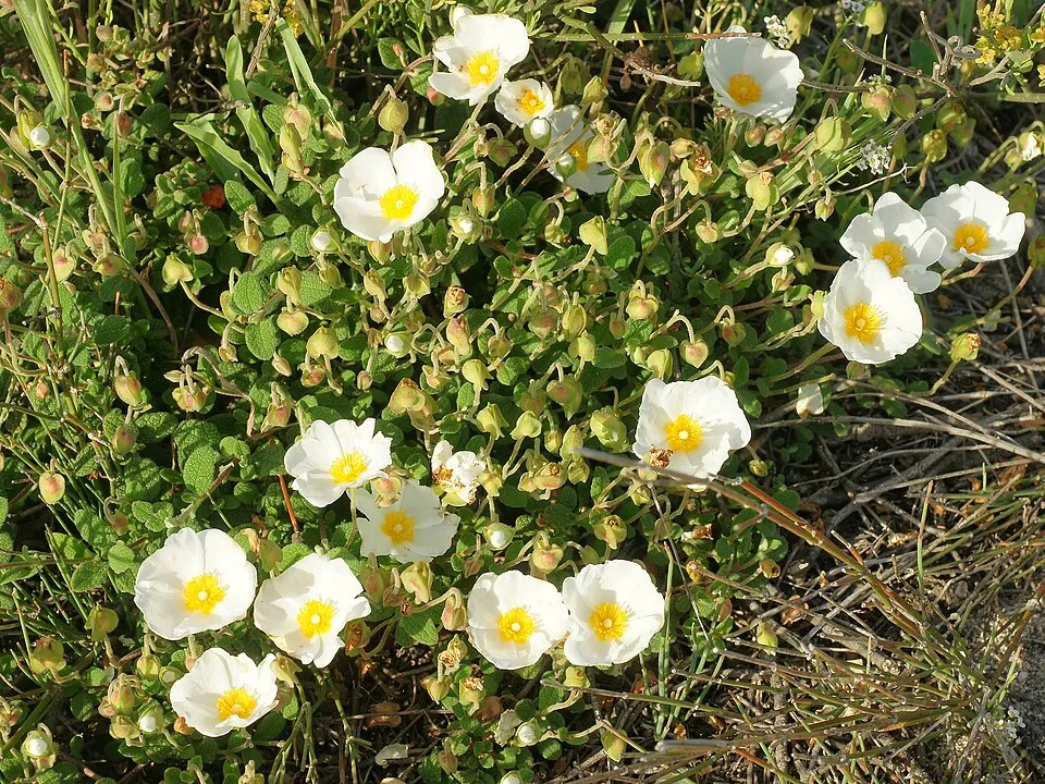
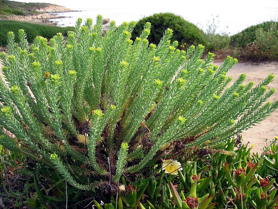
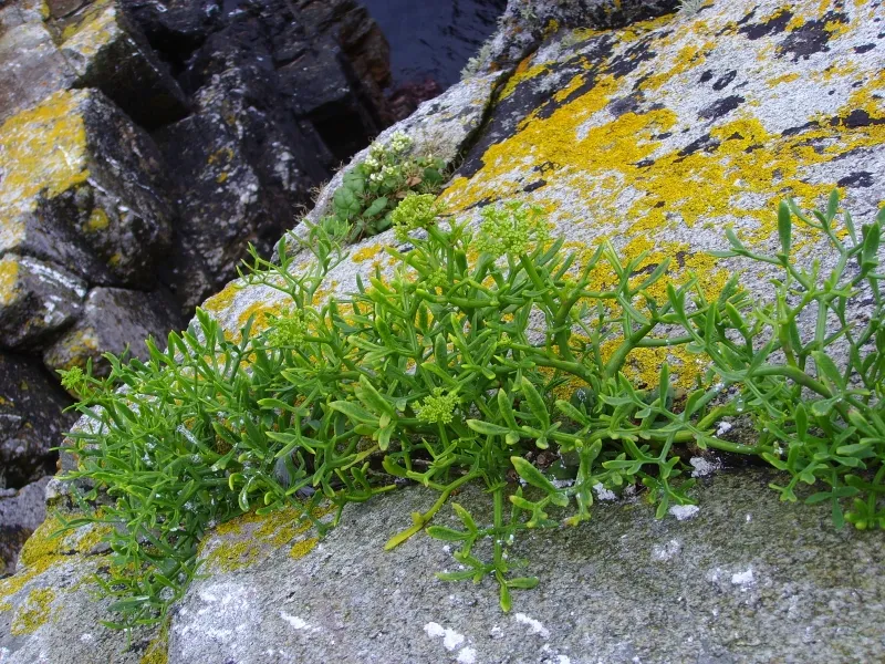
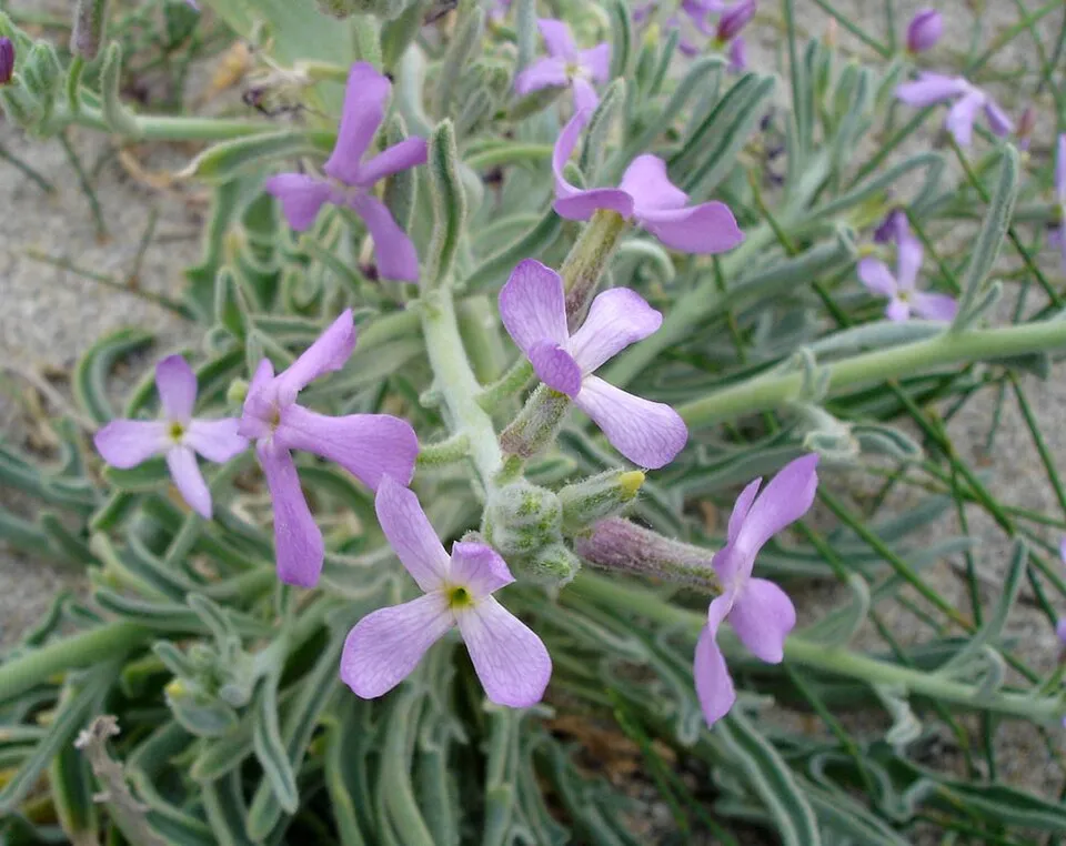
Among the species most often recorded on GBIF are Cistus salviifolius (Salvia cistus), Euphorbia paralias (Sea spurge), Crithmum maritimum (Rock samphire) and Matthiola sinuata (Sea Stock).
© OpenStreetMap
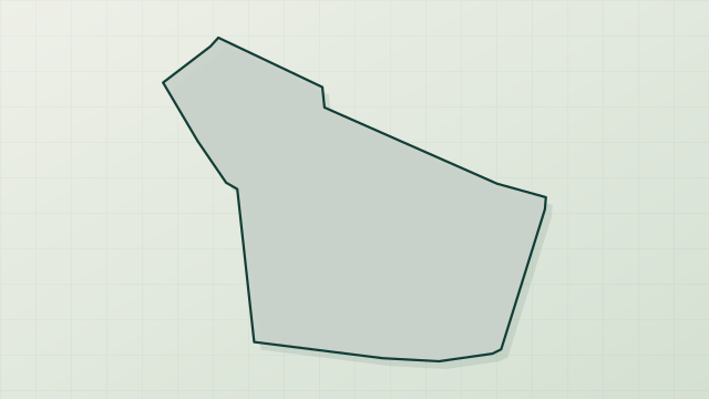
Download the boundary: GeoJSON · GPX Boundary © OpenStreetMap contributors (ODbL).
Geography
The representative point of the site lies at around 19 m above sea level. Over the 1996–2025 period, the mean annual temperature is about 13.3 °C and total precipitation reaches roughly 788 mm per year. The warmest month is usually August, the coolest January, and the wettest November. According to the BRGM's simplified lithological map, the bedrock consists mainly of sands (100% of sampled points). These are mostly sedimentary rocks.
Area
- Area of the boundary
- 75.9 ha
- Elevation
- 19 m
- Coordinates
- 46.4174, -1.6217
Bedrock
- Sands 100 %
Sedimentary rocks 100 %
Source: BRGM, simplified lithological map at 1:1,000,000 (Licence Ouverte), 13 points sampled within the boundary.
Climate
● Mean temperature (°C) · ▮ Precipitation (mm)
Source: Copernicus ERA5-Land (C3S, doi:10.24381/cds.68d2bb30), monthly averages 1996–2025 interpolated to the representative point, temperatures adjusted for elevation.
Contains modified Copernicus Climate Change Service information 2026. Neither the European Commission nor ECMWF is responsible for any use that may be made of the Copernicus information or data it contains.
Natural habitats
According to CORINE Land Cover (2018), the site is mainly made up of forests (99%). Woodland is mostly coniferous. The site borders the coast. The Natura 2000 site overlapping the area lists 26 habitats of European interest (4 priority), the most extensive being wooded dunes of the Atlantic, Continental and Boreal region, coastal lagoons and reefs.
Biodiversity
Based on occurrences aggregated by GBIF, several species are regularly recorded within the site. Among the most frequent are Cistus salviifolius (Salvia cistus), Euphorbia paralias (Sea spurge), Crithmum maritimum (Rock samphire) and Matthiola sinuata (Sea Stock). The full list of documented taxa is shown below. The overlapping Natura 2000 site lists 11 species of European interest: 5 mammals, 1 reptile, 3 amphibians and 2 plants.
Habitats of European interest
From the official form of the Natura 2000 site overlapping the area (areas reported for the whole site).
- Wooded dunes of the Atlantic, Continental and Boreal region 393 ha
- Coastal lagoons priority 281 ha
- Reefs 261 ha
- Estuaries 120 ha
- Spartina swards (Spartinion maritimae) 83 ha
- Mediterranean salt meadows (Juncetalia maritimi) 83 ha
- Mudflats and sandflats not covered by seawater at low tide 65 ha
- Atlantic salt meadows (Glauco-Puccinellietalia maritimae) 64 ha
and 18 more
Species of European interest
Mammals · 5
Barbastelle (Barbastella barbastellus), Eurasian otter (Lutra lutra), Daubenton's bat (Myotis daubentonii), Greater Horseshoe Bat (Rhinolophus ferrumequinum), Lesser horseshoe bat (Rhinolophus hipposideros)
Reptiles · 1
Amphibians · 3
Common tree frog (Hyla arborea), Western Spadefoot (Pelobates cultripes), Marbled newt (Triturus marmoratus)
Plants · 2
Omphalodes littoralis, Shore dock (Rumex rupestris)
Source: Natura 2000 standard data forms (EEA, CC-BY 4.0). Not exhaustive: sensitive species are not published.
Species to look out for
Observed species
Occurrences documented via GBIF; they are neither an exhaustive inventory nor proof of current presence.
- Salvia cistus · Cistus salviifolius · 22
- Sea spurge · Euphorbia paralias · 16
- Rock samphire · Crithmum maritimum · 9
- Sea Stock · Matthiola sinuata · 9
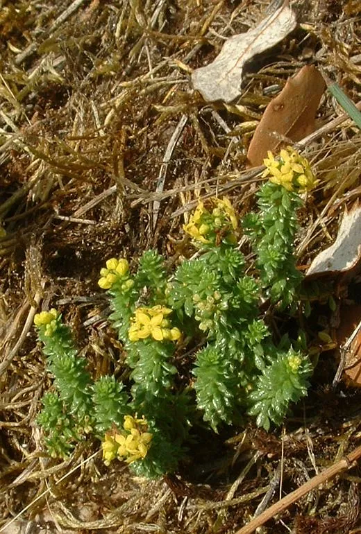
- Sand Bedstraw · Galium arenarium · 8
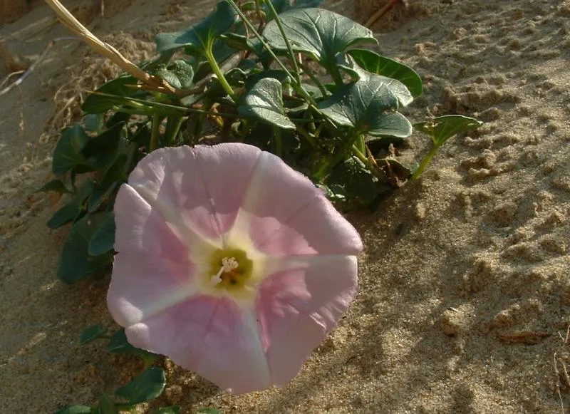
- Sea Bindweed · Calystegia soldanella · 8
- Butcher's-broom · Ruscus aculeatus · 4
- Sea-holly · Eryngium maritimum · 4
- Field eryngo · Eryngium campestre · 4
- By-the-wind-sailor · Velella velella · 3
- Common cuttlefish · Sepia officinalis · 3
- Holm Oak · Quercus ilex · 3
+18 more species
- Wild Madder · Rubia peregrina · 3
- Gorse · Ulex europaeus · 3
- Marramgrass · Calamagrostis arenaria · 3
- Yellow hornpoppy · Glaucium flavum · 3
- Black locust · Robinia pseudoacacia · 3
- Dwarf weaver · Tenuiphantes tenuis · 2
- Minicia marginella · 2
- Minicia candida · 2
- Peus's Long-back Spider · Mecopisthes peusi · 2
- Spotted rock-rose · Tuberaria guttata · 2
- Alexanders · Smyrnium olusatrum · 2
- Japweed · Sargassum muticum · 2
- Maritime pine · Pinus pinaster · 2
- Harestail grass · Lagurus ovatus · 2
- Stinking iris · Iris foetidissima · 2
- Wild Celery · Apium graveolens · 2
- Bladder wrack · Fucus vesiculosus · 2
- Common Ivy · Hedera helix · 2
Records: GBIF.org (CC-BY). Names: Wikidata (CC0), GBIF. Photos: Wikimedia Commons.
Conservation challenges
The primary purpose of the site is to preserve its natural habitats and the biodiversity they support. The species recorded (Biodiversity tab) reflect its ecological value. The designations it holds frame its management and the control of land use.
At night, the area gives off virtually no artificial light detectable from space (NASA VIIRS Black Marble composite, 2016). Built-up and developed land (buildings, business areas, roads, quarries) covers 1% of the area (CORINE Land Cover). According to the Natura 2000 forms, of 26 assessed habitats of European interest, 11 are in average or reduced condition and the rest in good condition.
Pressure indicators
Tree cover lost
6 ha
2001–2023
20012023
Fires since 2016
0
No large fire mapped (fires over about 30 ha)
Light at night
0%
of the area gives off artificial light visible from space
DarkLit
Built-up land
1%
buildings, business areas, roads, quarries
Invasive alien species
2
recorded since 2000
 Black locust
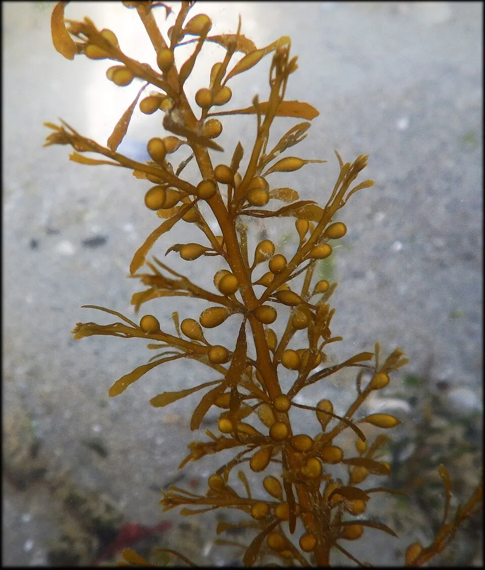 Japweed
Photos: Black locust © This Photo was taken by Wolfgang Moroder. Feel free to use my photos, but please mention me as the author and send me a message. This image is not in the public domain. Please respect the copyright protection. It may only be used according… · CC BY-SA 3.0; Japweed © Lamiot · CC BY-SA 4.0
Sources: Global Forest Change (Hansen et al., University of Maryland, via Global Forest Watch, CC-BY 4.0); EFFIS, European Commission / Copernicus; NASA Black Marble 2016 (public domain); CORINE Land Cover 2018 (Copernicus) or MODIS.
Invasive alien species: Global Register of Introduced and Invasive Species (ISSG, CC BY 4.0); Union list, Regulation (EU) 1143/2014 (INBO, CC0); GBIF.org records (CC0 / CC BY 4.0), at least 2 per species.
Practical information
Cities and airport
- La Roche-sur-Yon
31 km as the crow flies - La Rochelle
46 km as the crow flies - Airport: La Rochelle – Île de Ré (LRH)
42 km as the crow flies
Parking
2 public car parks listed within the site
Plage de Four à Chaux. Accès Jard 03
Data © OpenStreetMap contributors (ODbL) · Wikidata (CC0)
Bathing
1 monitored bathing site in or within 1 km of the site · 2025 classification
Excellent · 1
- La Mine · sea · Excellent
Source: European Environment Agency, official bathing water classification (Directive 2006/7/EC, CC-BY 4.0). Swimming is only permitted at the sites and times authorised locally.
Access and visiting
The nearest railway station is La Mothe Achard, about 21 km from the site boundary. Nearest towns of over 50,000 people, as the crow flies: La Roche-sur-Yon (31 km) and La Rochelle (46 km). Nearest airport: La Rochelle – Île de Ré (LRH), about 42 km away. About 92,000 people live within 20 km of the site boundary, 16,000 of them within 10 km (GHSL estimate, 2020). This population has grown by about 32% since 2000. Public car parks listed within the site: 2, including Plage de Four à Chaux. Accès Jard 03. To plan a visit (access, opening periods, visitor rules), it is best to consult the official information from the managing body and the official website listed in this page's sources.
Source: OpenStreetMap (ODbL), Wikidata (CC0), October 2026.
When to visit
Best time to visit: from April to September, with average temperatures of 11 to 20 °C and moderate rainfall. Precipitation peaks in November (up to 100 mm per month). Day length ranges from about 8 h 36 min in December to 15 h 47 min in June. Wildlife records published on GBIF peak for plants (May). These peaks also reflect when observers are most active.
Source: Copernicus ERA5-Land (C3S), monthly averages 1996–2025 at the representative point, temperatures adjusted for elevation.
Contains modified Copernicus Climate Change Service information 2026. Neither the European Commission nor ECMWF is responsible for any use that may be made of the Copernicus information or data it contains.
Wildlife records calendar
JFMAMJJASOND
Plants
Monthly records published on GBIF (CC-BY), relative to the busiest month; also reflects observer activity.
Gallery
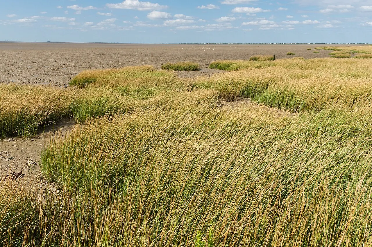
© sandimage / Magnific
Sources and licences
- OpenStreetMap: relation 21467824
References
- cds.climate.copernicus.eu: climate · CC-BY-4.0
- registry.opendata.aws: elevation of the reference point, detailed relief · PD
- land.copernicus.eu: land cover, land cover change, sea share · COPERNICUS
- doi.org: population around the site · CC-BY-4.0
- openstreetmap.org: official name, access and peaks, places to see, trail difficulty · ODbL-1.0
- eea.europa.eu: bathing water quality, ecological status of waters · CC-BY-4.0
- en.eurovelo.com: EuroVelo cycle routes · ODbL-1.0
- cycling.waymarkedtrails.org: cycle routes · ODbL-1.0
- opentopodata.org: elevations · PD
- forest-fire.emergency.copernicus.eu: wildfires · COPERNICUS
- globalforestwatch.org: tree cover loss · CC-BY-4.0
- gbif.org: seasonality of sightings, invasive alien species, observed species · CC-BY-4.0
- infoterre.brgm.fr: geology · LO-2.0
- pop.culture.gouv.fr: protected heritage · LO-2.0
- hydrosheds.org: lakes · CC-BY-4.0
- natura2000.eea.europa.eu: Natura 2000 habitats and species · CC-BY-4.0
- earthobservatory.nasa.gov: night light · PD
- nsidc.org: snow cover · PD
- wikidata.org: nearby cities and airport, access and peaks, lake depths, places to see · CC0-1.0
Data © OpenStreetMap contributors (ODbL), Wikidata (CC0) and the sources cited.