
United States · Terrestrial
Glacier National Park
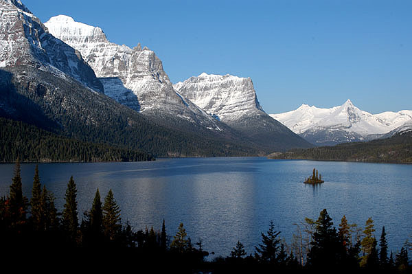
National park of 409,998 hectares in the United States, established in 1910.
Overview
National park of 409,998 hectares in the United States, established in 1910.
Glacier National Park is located in the United States (North America). It is a predominantly terrestrial area. Established on 11 May 1910, it covers about 409,998 hectares. The site is managed by National Park Service.
Protections and designations
UNESCO World Heritage
UNESCO Biosphere Reserve
Protected as a national park. International labels and designations: UNESCO World Heritage (“Waterton-Glacier International Peace Park”) and UNESCO Biosphere Reserve (“Crown of the Continent”). Key dates: established in 1910 and World Heritage listing in 1995.
In our collections
Timeline
-
1910
Established
-
1995
Inscribed as a UNESCO World Heritage Site Waterton-Glacier International Peace Park
Sources: Wikidata (CC0) for establishment and international labels; EEA Natura 2000 database (CC-BY 4.0) for site designation dates.
Frequently asked questions
Where is Glacier National Park?
In the United States (North America). Representative point: 48.7550° N, 113.8000° W.
How large is Glacier National Park?
About 409,998 hectares (4,100 km²). It is the 12th largest of the 62 national parks in the United States covered by Parkavela.
When was Glacier National Park established?
On 11 May 1910.
What habitats and landscapes does Glacier National Park include?
A terrestrial area, with forests and mountains.
What is the highest point of Glacier National Park?
Mount Cleveland, at 3,190 m (OpenStreetMap).
What are the main summits of Glacier National Park?
Mount Cleveland (3,190 m), Mount Stimson (3,091 m), Kintla Peak (3,079 m), Mount Jackson (3,064 m) and Mount Merritt (3,054 m) (OpenStreetMap).
Which international labels apply to Glacier National Park?
UNESCO World Heritage (“Waterton-Glacier International Peace Park”) and UNESCO Biosphere Reserve (“Crown of the Continent”).
When is the best time to visit Glacier National Park?
Best time to visit: from July to September, with average temperatures of 12 to 19 °C and moderate rainfall.
Is there snow in Glacier National Park?
Yes. According to NASA's MODIS satellites (2015–2025 average), snow covers most of the site from November to April, and until May on higher ground, with about 200 snow-covered days a year on average.
What is there to see in Glacier National Park?
15 waterfalls, 104 lakes and ponds and 70 glaciers, including Akaiyan Falls, Saint Mary Lake (1,367 m), Grinnell Glacier (2,100 m) and Beaver Chief Falls (Wikidata).
Where can I stay in Glacier National Park?
3 mountain huts, including Gunsight Pass Shelter (2,117 m), Granite Park Chalet (2,040 m) and Sperry Chalet (2,009 m) (Wikidata).
Are there historic monuments in Glacier National Park?
Yes. According to Wikidata, 84 monuments listed in the National Register of Historic Places stand within the boundary, 3 of them National Historic Landmarks. For example: “Going-to-the-Sun Road”, “Great Northern Railway Buildings” and “Lake McDonald Lodge”.
What is the nearest large city to Glacier National Park?
Nearest towns of over 50,000 people, as the crow flies: Lethbridge (95 km). Nearest airport: Glacier Park (FCA), about 22 km away.
How can I reach Glacier National Park by train?
The nearest railway station is Essex, less than 1 km from the site boundary.
Where can I get visitor information on site?
Apgar Visitor Center, Logan Pass Visitor Center and Goat Haunt Ranger Station.
Are there waymarked hiking trails in Glacier National Park?
Yes. Waymarked hiking routes listed in OpenStreetMap: 22, including Pacific Northwest Trail, CDT fccCM and CDT fa- Montana Alternates. The “CDT - Idaho & Montana Section” route runs for about 176 km through the site, with some 4,880 m of ascent on its longest section.
Which species can be seen in Glacier National Park?
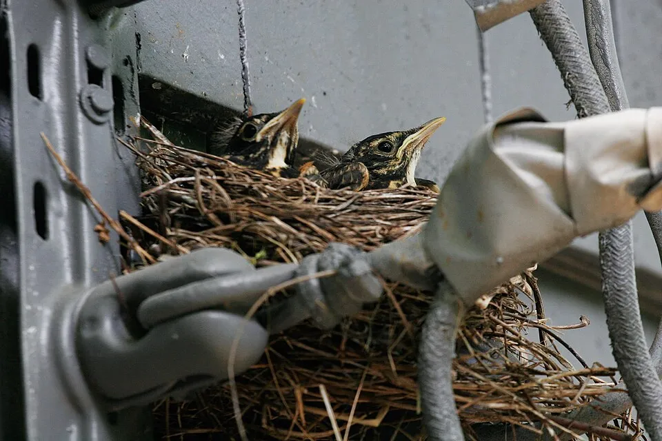
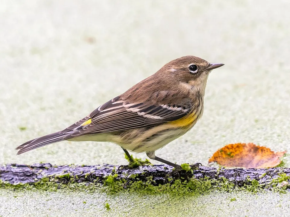
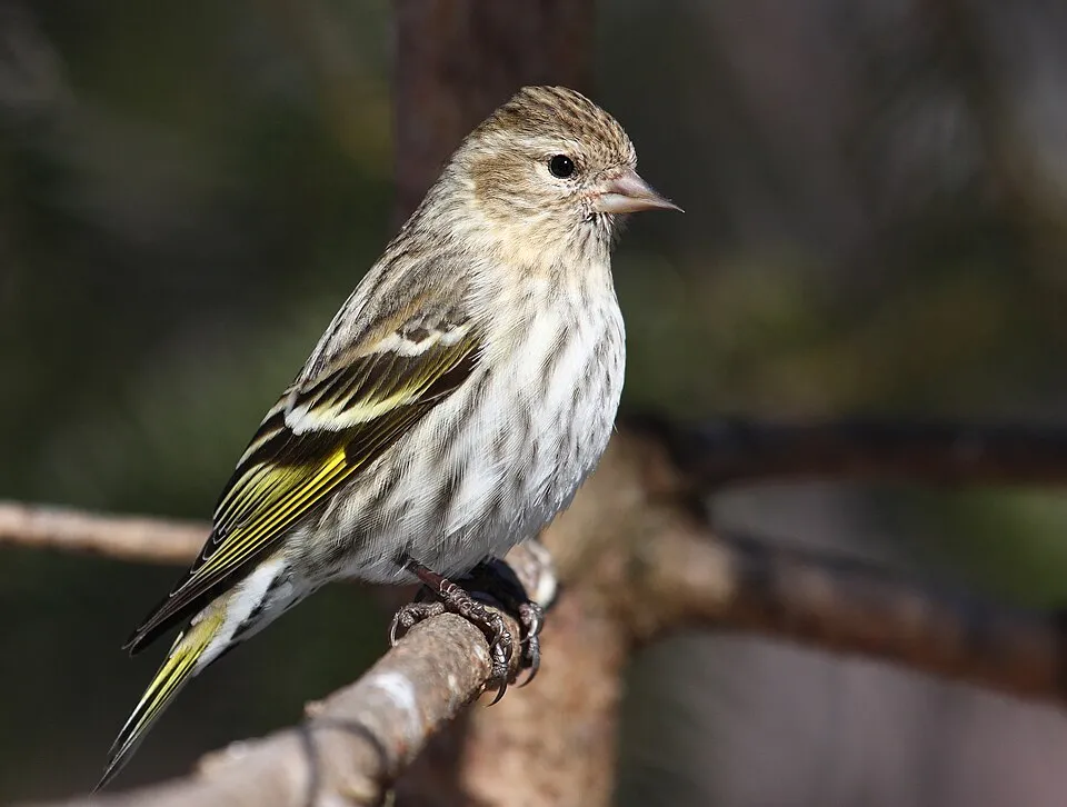
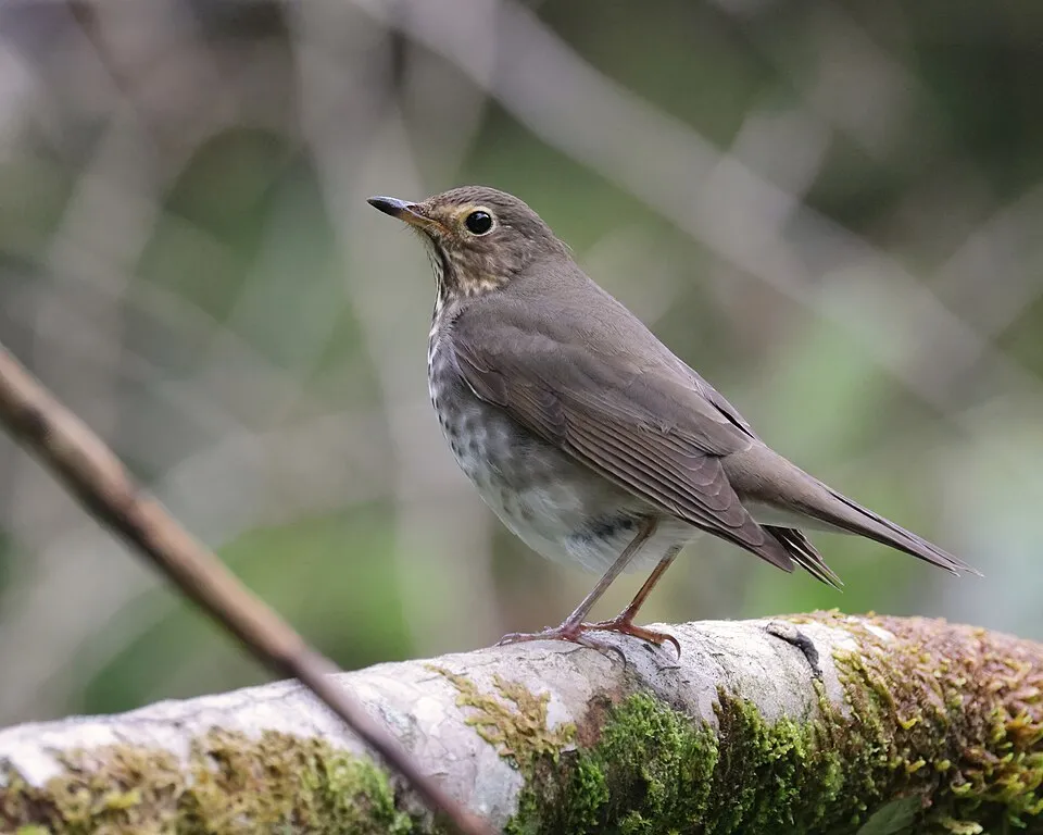
Among the species most often recorded on GBIF are Turdus migratorius (American Robin), Setophaga coronata (Myrtle Warbler), Spinus pinus (Pine Siskin) and Catharus ustulatus (Swainson's Thrush).
Who manages Glacier National Park?
National Park Service.
What is the official website of Glacier National Park?
© OpenStreetMap
Download the boundary: GeoJSON · GPX Boundary © OpenStreetMap contributors (ODbL).
Geography
The representative point of the site lies at around 1,314 m above sea level. Over the 1996–2025 period, the mean annual temperature is about 4.9 °C and total precipitation reaches roughly 869 mm per year. The warmest month is usually July, the coolest December, and the wettest June.
Area
- Area
- 409,998 ha
- Elevation
- 1,314 m
- Median elevation
- 1,700 m
- Mean slope
- 20°
- Snow cover
- ≈ 200 days a year
- Coordinates
- 48.755, -113.8
Terrain: Mapzen Terrain Tiles (SRTM, USGS)
Elevation bands
- 500–1,000 m 1%
- 1,000–1,500 m 32%
- 1,500–2,000 m 40%
- 2,000–2,500 m 24%
- 2,500–3,000 m 3%
share of the site in each elevation band (smoothed terrain model: summits are rounded off) · Terrain: Mapzen Terrain Tiles (SRTM, USGS)
Main summits
- Mount Cleveland3,190 m
- Mount Stimson3,091 m
- Kintla Peak3,079 m
- Mount Jackson3,064 m
- Mount Merritt3,054 m
- Mount Siyeh3,052 m
- Kinnerly Peak3,032 m
- Mount Carter3,000 m
- Cracker Benchmark2,992 m
- Rainbow Peak2,988 m
Data © OpenStreetMap contributors (ODbL)
Climate
● Mean temperature (°C) · ▮ Precipitation (mm)
Source: Copernicus ERA5-Land (C3S, doi:10.24381/cds.68d2bb30), monthly averages 1996–2025 interpolated to the representative point, temperatures adjusted for elevation.
Contains modified Copernicus Climate Change Service information 2026. Neither the European Commission nor ECMWF is responsible for any use that may be made of the Copernicus information or data it contains.
Snow cover measured by satellite
J
F
M
A
M
J
J
A
S
O
N
D
average share of the site under snow · snowiest parts · ≈ 200 days a year
Snow cover: MODIS/Terra MOD10CM v61 (Hall & Riggs, 2021, NASA NSIDC DAAC, doi:10.5067/MODIS/MOD10CM.061), imagery from NASA GIBS (ESDIS); 2015–2025 average, grid of about 5 km.
Natural habitats
According to the global MODIS land cover (NASA, 2024), the site is mainly made up of grassland and meadows (50%), forests (25%) and heath and scrub (21%). Woodland is mostly coniferous. Elevation ranges from about 960 m to 3,190 m (highest point: Mount Cleveland). Median elevation is 1,700 m, and 27% of the site lies above 2,000 m (SRTM elevation model). The terrain is steep: 25% of slopes exceed 30° (mean slope 20°).
Biodiversity
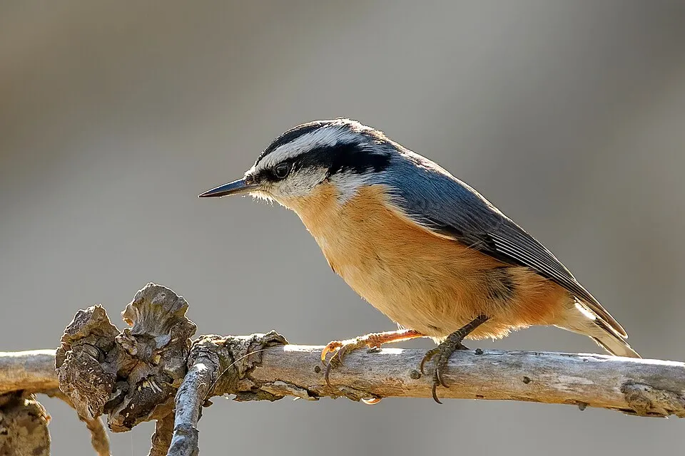
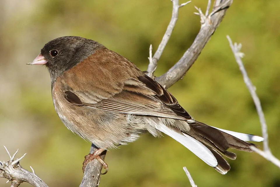
Based on occurrences aggregated by GBIF, several species are regularly recorded within the site. Among the most frequent are Turdus migratorius (American Robin), Setophaga coronata (Myrtle Warbler), Spinus pinus (Pine Siskin) and Catharus ustulatus (Swainson's Thrush). The full list of documented taxa is shown below.
Species to look out for
Bird
Red-breasted Nuthatch
Sitta canadensis6,087 records © Becky Matsubara from El Sobrante, California · CC BY 2.0
Observed species
Occurrences documented via GBIF; they are neither an exhaustive inventory nor proof of current presence.
- American Robin · Turdus migratorius · 10973
- Myrtle Warbler · Setophaga coronata · 8445
- Pine Siskin · Spinus pinus · 7099
- Swainson's Thrush · Catharus ustulatus · 7089
- Red-breasted Nuthatch · Sitta canadensis · 6087
- Dark-eyed junco · Junco hyemalis · 6023
- Northern Raven · Corvus corax · 5790
- Chipping Sparrow · Spizella passerina · 5280
- Ruby-crowned Kinglet · Regulus calendula · 5234
- Cedar Waxwing · Bombycilla cedrorum · 5112
- White-crowned Sparrow · Zonotrichia leucophrys · 4858
- Warbling Vireo · Vireo gilvus · 4521
+18 more species
- Golden-crowned Kinglet · Regulus satrapa · 4446
- MacGillivray's Warbler · Geothlypis tolmiei · 4201
- Mountain Chickadee · Poecile gambeli · 3902
- Western Tanager · Piranga ludoviciana · 3845
- Common Merganser · Mergus merganser · 3655
- Northern Flicker · Colaptes auratus · 3616
- Townsend's Warbler · Setophaga townsendi · 3376
- Tree Swallow · Tachycineta bicolor · 3258
- American Dipper · Cinclus mexicanus · 3183
- Mangrove Warbler · Setophaga petechia · 3098
- Black-capped Chickadee · Poecile atricapillus · 3018
- Steller's Jay · Cyanocitta stelleri · 2996
- Northern Waterthrush · Parkesia noveboracensis · 2846
- Varied Thrush · Ixoreus naevius · 2822
- Pacific Wren · Troglodytes pacificus · 2670
- Red-naped Sapsucker · Sphyrapicus nuchalis · 2509
- American Crow · Corvus brachyrhynchos · 2490
- Canada Jay · Perisoreus canadensis · 2460
Records: GBIF.org (CC-BY). Names: Wikidata (CC0), GBIF. Photos: Wikimedia Commons.
Conservation challenges
The primary purpose of the site is to preserve its natural habitats and the biodiversity they support. The species recorded (Biodiversity tab) reflect its ecological value. The designations it holds frame its management and the control of land use.
According to Global Forest Change data (University of Maryland, Global Forest Watch), about 75,630 ha of tree cover were lost within the boundary between 2001 and 2023 (18% of its area), peaking in 2003 and 2004. These losses include logging, storms and fires, and do not account for regrowth. At night, the area gives off virtually no artificial light detectable from space (NASA VIIRS Black Marble composite, 2016).
Pressure indicators
Tree cover lost
75,633 ha
2001–2023 · 18% of the area
20012023
Light at night
0%
of the area gives off artificial light visible from space
DarkLit
Sources: Global Forest Change (Hansen et al., University of Maryland, via Global Forest Watch, CC-BY 4.0); EFFIS, European Commission / Copernicus; NASA Black Marble 2016 (public domain); CORINE Land Cover 2018 (Copernicus) or MODIS.
Practical information
Cities and airport
- Lethbridge
95 km as the crow flies - Airport: Glacier Park (FCA)
22 km as the crow flies
Visitor information
- Apgar Visitor Center
within the site - Logan Pass Visitor Center
within the site - Goat Haunt Ranger Station
within the site - Polebridge Ranger Station
within the site
Parking
169 public car parks listed within the site · 61 trailheads
Trail of the Cedars ParkingSunrift Gorge Pullout
Things to see
15 waterfalls · 104 lakes and ponds · 70 glaciers
- Akaiyan Falls
waterfall - Saint Mary Lake
lake or pond · 1,367 m - Grinnell Glacier
glacier · 2,100 m - Beaver Chief Falls
waterfall - Kintla Lake
lake or pond · 1,222 m
Where to stay
3 mountain huts
- Gunsight Pass Shelter
mountain hut · 2,117 m - Granite Park Chalet
mountain hut · 2,040 m - Sperry Chalet
mountain hut · 2,009 m
Hiking
22 waymarked routes listed, including:
Pacific Northwest TrailCDT fccCMCDT fa- Montana Alternates
Wheelchair access
- Running Eagle Falls
path - Trail of the Cedars
path
accessible toilets: 3
Reported by OpenStreetMap contributors (ODbL); check with the park before visiting.
Data © OpenStreetMap contributors (ODbL) · Wikidata (CC0)
Waymarked hiking routes
CDT CDT - Idaho & Montana Section
176.1 km within the site ↗ 4,877 m↘ 4,446 m 1,284–2,326 m
PNT Pacific Northwest Trail 01 Montana
87.4 km within the site ↗ 2,053 m↘ 1,513 m 1,083–2,099 m
CDT fccCM - Chief Mountain Route to Canada
43.8 km within the site ↗ 1,298 m↘ 1,167 m 1,391–2,299 m
Tracks © OpenStreetMap contributors (ODbL), clipped to the boundary; elevation gain and profiles computed on the longest section from Mapzen Terrain Tiles (≈ 30 m), indicative only.
Access and visiting
The nearest railway station is Essex, less than 1 km from the site boundary. Nearest towns of over 50,000 people, as the crow flies: Lethbridge (95 km). Nearest airport: Glacier Park (FCA), about 22 km away. About 30,000 people live within 20 km of the site boundary, 4,200 of them within 10 km; some 70 people are estimated to live inside (GHSL estimate, 2020). This population has grown by about 36% since 2000. Visitor information on site: Apgar Visitor Center, Logan Pass Visitor Center and Goat Haunt Ranger Station. Public car parks listed within the site: 169, including Trail of the Cedars Parking and Sunrift Gorge Pullout. Waymarked hiking routes listed in OpenStreetMap: 22, including Pacific Northwest Trail, CDT fccCM and CDT fa- Montana Alternates. OpenStreetMap contributors list 2 wheelchair-accessible places: Running Eagle Falls and Trail of the Cedars; check with the park before visiting. To see: 15 waterfalls, 104 lakes and ponds and 70 glaciers, including Akaiyan Falls, Saint Mary Lake (1,367 m), Grinnell Glacier (2,100 m) and Beaver Chief Falls. Where to stay: 3 mountain huts, including Gunsight Pass Shelter (2,117 m), Granite Park Chalet (2,040 m) and Sperry Chalet (2,009 m). To plan a visit (access, opening periods, visitor rules), it is best to consult the official information from the managing body (National Park Service) and the official website listed in this page's sources.
Source: OpenStreetMap (ODbL), Wikidata (CC0), October 2026.
Built heritage
According to Wikidata, 84 monuments listed in the National Register of Historic Places stand within the boundary, 3 of them National Historic Landmarks. Among them are 35 houses and civic buildings, 12 castles and fortifications and 4 bridges, lighthouses, mills and working buildings. Nationally designated items include “Going-to-the-Sun Road”, “Great Northern Railway Buildings” and “Lake McDonald Lodge”.
35 houses and civic buildings12 castles and fortifications4 bridges, lighthouses, mills and working buildings
-
Going-to-the-Sun Road
National
-
Great Northern Railway Buildings
National
-
Lake McDonald Lodge
National
-
Apgar Fire Lookout
20th c. -
Alice Beck Cabin
20th c. -
Bowman Lake Road
-
Belly River Ranger Station Historic District
-
Greve's Tourist Cabins
and 76 more
Source: Wikidata (CC0), monuments in each country’s official heritage protection registers, at national or regional level. Each item links to its Wikidata entry.
When to visit
Best time to visit: from July to September, with average temperatures of 12 to 19 °C and moderate rainfall. Average temperatures drop below 0 °C from November to March: frost is common. These averages apply to the site's representative point (1,314 m); higher up it is markedly cooler and snow lasts longer. According to NASA's MODIS satellites (2015–2025 average), snow covers most of the site from November to April, and until May on higher ground, with about 200 snow-covered days a year on average. Day length ranges from about 8 h 17 min in December to 16 h 08 min in June. Wildlife records published on GBIF peak for birds (June and July), plants (July), butterflies and moths (July), dragonflies (August) and mammals (July and August). These peaks also reflect when observers are most active.
Source: Copernicus ERA5-Land (C3S), monthly averages 1996–2025 at the representative point, temperatures adjusted for elevation.
Contains modified Copernicus Climate Change Service information 2026. Neither the European Commission nor ECMWF is responsible for any use that may be made of the Copernicus information or data it contains.
Wildlife records calendar
JFMAMJJASOND
Birds
Plants
Butterflies & moths
Dragonflies
Mammals
Monthly records published on GBIF (CC-BY), relative to the busiest month; also reflects observer activity.
Gallery
© U.S. National Park Service · Public domain
© Keegsieb · CC BY-SA 4.0
© Wing-Chi Poon · CC BY-SA 2.5
© Caleb Putnam · CC BY 2.0
© USDA NRCS Montana · Public domain
© Bernd Thaller from Graz, Austria · CC BY 2.0
Sources and licences
- Wikidata: Q373567
- OpenStreetMap: relation 1242641
- Official website: https://nps.gov/glac
- Wikipedia: en.wikipedia.org/wiki/Glacier_National_Park_(U.S.)
- WDPA: 11111516
References
- cds.climate.copernicus.eu: climate · CC-BY-4.0
- registry.opendata.aws: elevation of the reference point, detailed relief · PD
- lpdaac.usgs.gov: land cover · PD
- doi.org: population around the site · CC-BY-4.0
- naturalearthdata.com: sea share · PD
- wikidata.org: official area, highest point, establishment date, protected heritage, managing body, nearby cities and airport, access and peaks, lake depths, places to see, official website · CC0-1.0
- en.eurovelo.com: EuroVelo cycle routes · ODbL-1.0
- cycling.waymarkedtrails.org: cycle routes · ODbL-1.0
- opentopodata.org: elevations · PD
- globalforestwatch.org: tree cover loss · CC-BY-4.0
- gbif.org: seasonality of sightings, observed species · CC-BY-4.0
- openstreetmap.org: official name, access and peaks, trail difficulty, wheelchair access · ODbL-1.0
- earthobservatory.nasa.gov: night light · PD
- hiking.waymarkedtrails.org: route difficulty · ODbL-1.0
- nsidc.org: snow cover · PD
- wikidata.org: Wikipedia article · CC-BY-SA-4.0
Data © OpenStreetMap contributors (ODbL), Wikidata (CC0) and the sources cited.
