France · Terrestrial
Réserve biologique dirigée des gorges de la Méouge
Nature reserve of 188 hectares in France, established in 1981.
Overview
Nature reserve of 188 hectares in France, established in 1981.
Réserve biologique dirigée des gorges de la Méouge is a nature reserve in France (Europe). It is a predominantly terrestrial area. Established in 1981, it covers about 188 hectares.
Protections and designations
Natura 2000 · habitats (SAC)
- Gorges de la Méouge FR9301518
Protected as a nature reserve. International labels and designations: Natura 2000 network (1 site: “Gorges de la Méouge”). Key dates: established in 1981 and first Natura 2000 site under the Habitats Directive in 2010.
In our collections
Timeline
-
1981
Established
-
2010
First Natura 2000 site under the Habitats Directive
Sources: Wikidata (CC0) for establishment and international labels; EEA Natura 2000 database (CC-BY 4.0) for site designation dates.
Frequently asked questions
Where is Réserve biologique dirigée des gorges de la Méouge?
In France (Europe). Representative point: 44.2729° N, 5.7875° E.
How large is Réserve biologique dirigée des gorges de la Méouge?
About 188 hectares (2 km²). It is the 72nd largest of the 121 nature reserves in France covered by Parkavela.
When was Réserve biologique dirigée des gorges de la Méouge established?
In 1981.
What habitats and landscapes does Réserve biologique dirigée des gorges de la Méouge include?
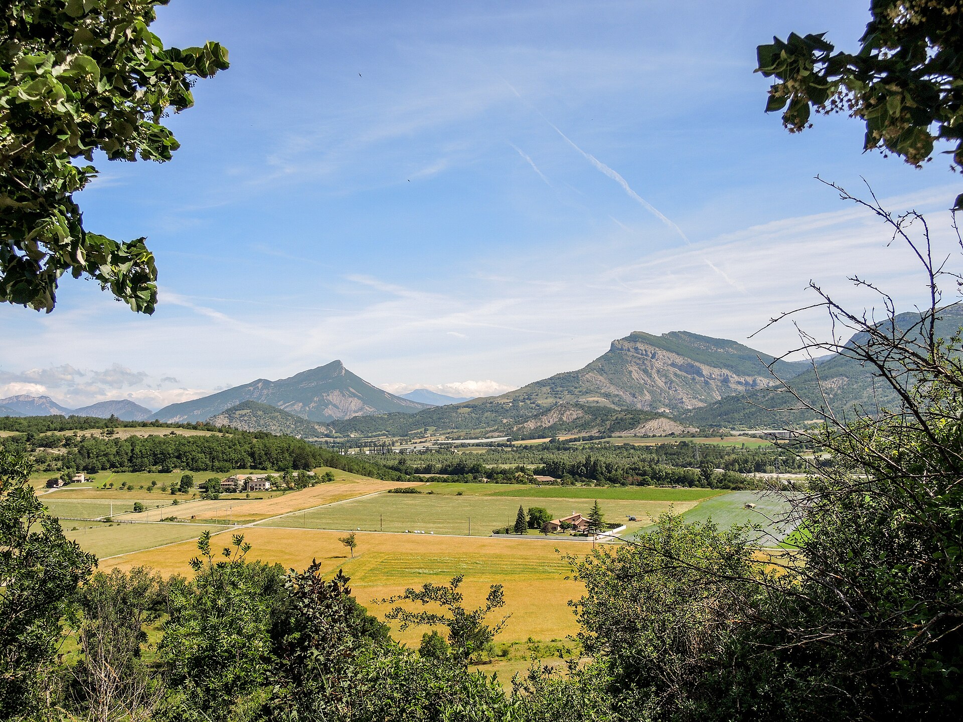
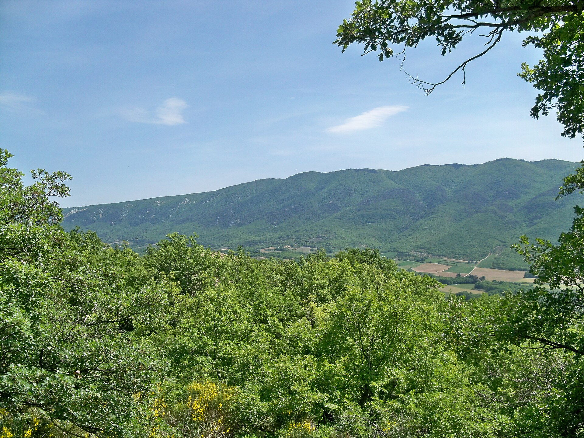
A terrestrial area, with forests.
What rocks lie beneath Réserve biologique dirigée des gorges de la Méouge?
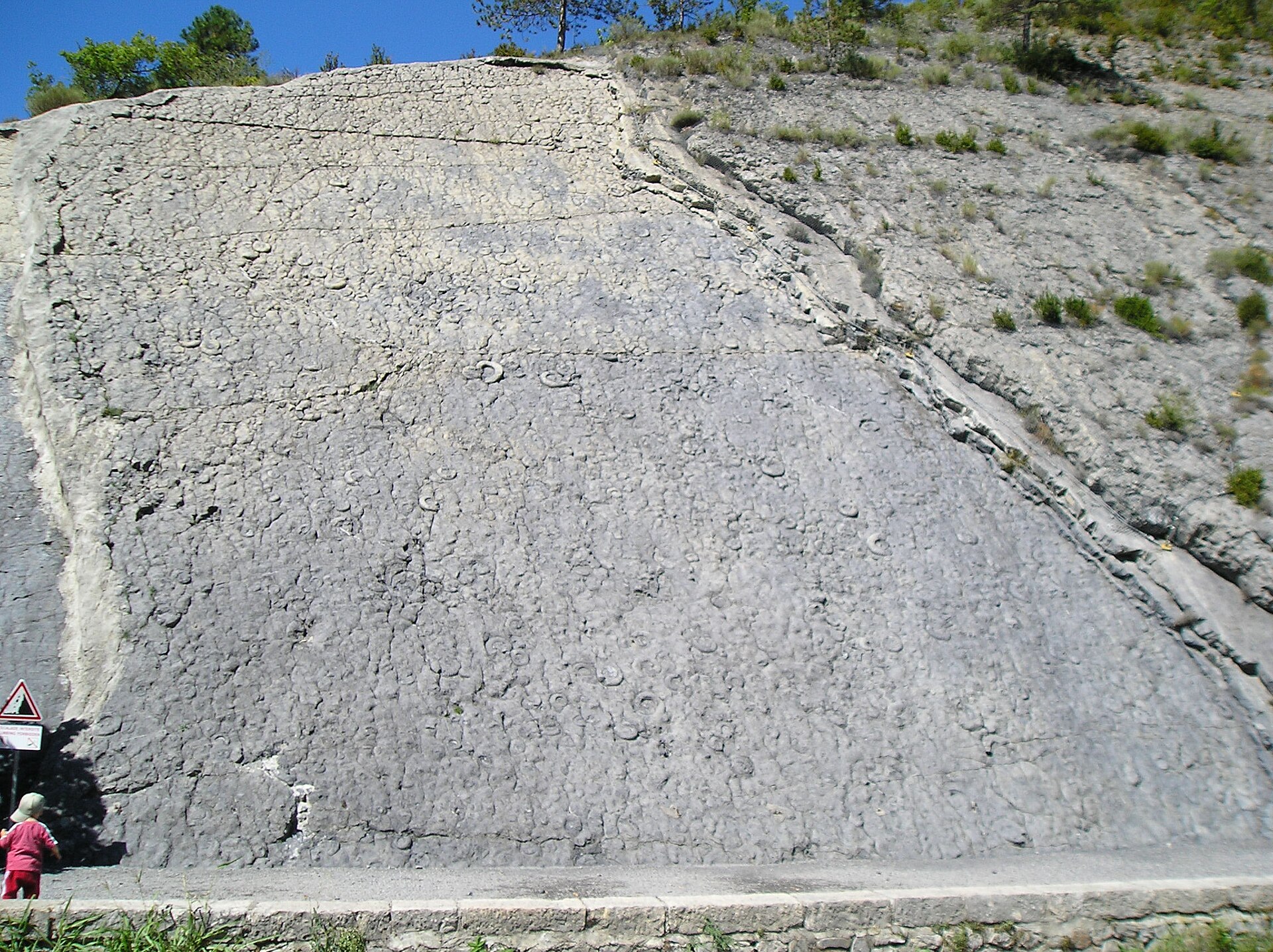
According to the BRGM's simplified lithological map, the bedrock consists mainly of limestones, marls and gypsum (100% of sampled points). These are mostly sedimentary rocks.
Which international labels apply to Réserve biologique dirigée des gorges de la Méouge?
Natura 2000 network (1 site: “Gorges de la Méouge”).
When is the best time to visit Réserve biologique dirigée des gorges de la Méouge?
Best time to visit: from June to September, with average temperatures of 15 to 21 °C and moderate rainfall.
What is there to see in Réserve biologique dirigée des gorges de la Méouge?
5 viewpoints and 1 waterfall, including Gorges de la Méouge and Le Banc du Bouc (OpenStreetMap).
Are there historic monuments in Réserve biologique dirigée des gorges de la Méouge?
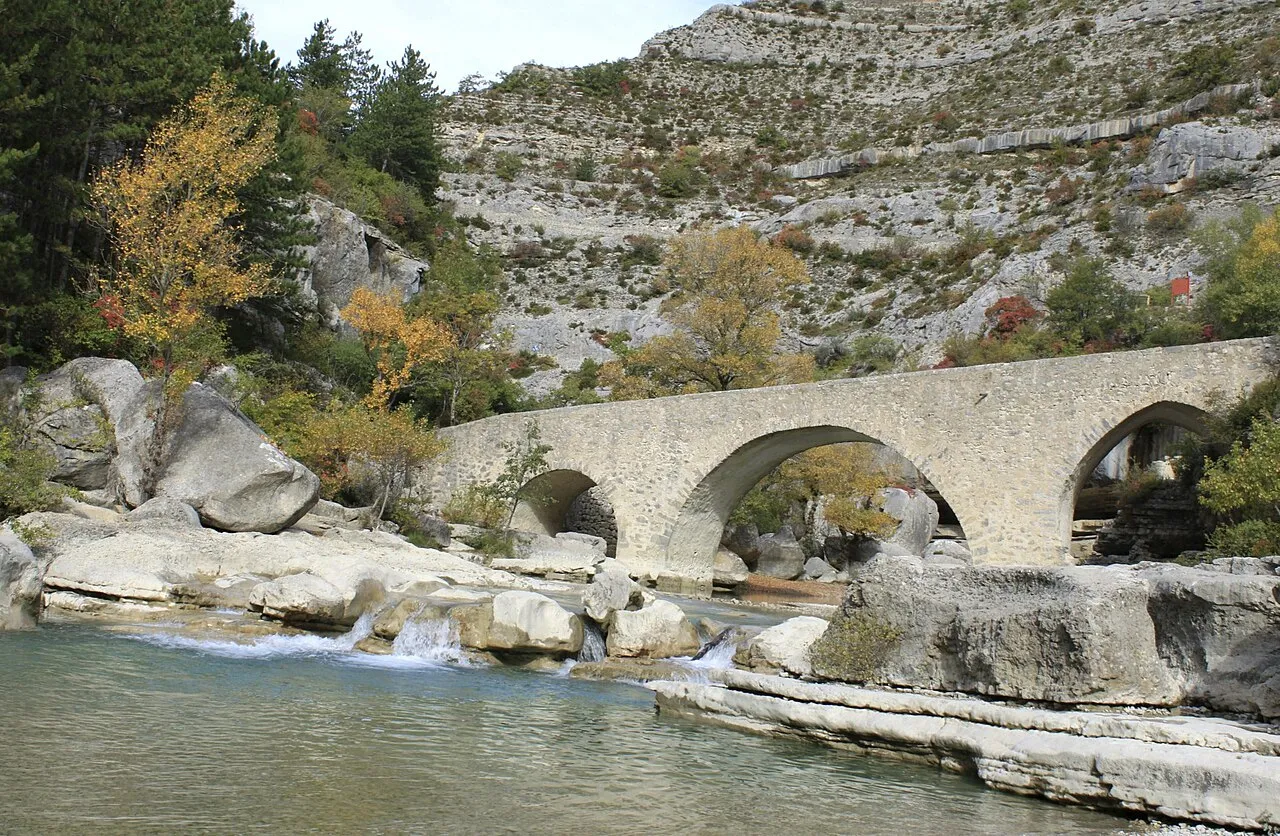
Yes. According to the French Ministry of Culture's Mérimée database, one historic monument (classé) stands within the boundary. For example: “Pont médiéval sur la Meouge” in Châteauneuf-de-Chabre.
Can you swim in Réserve biologique dirigée des gorges de la Méouge?
One monitored bathing site lies in or within 1 km of the site; official 2025 classification: 1 sufficient (European Environment Agency). Swimming is only permitted at the sites and times authorised locally.
What is the nearest large city to Réserve biologique dirigée des gorges de la Méouge?
Nearest towns of over 50,000 people, as the crow flies: Avignon (85 km) and Aix-en-Provence (86 km). Nearest airport: Marseille Provence (MRS), about 102 km away.
How can I reach Réserve biologique dirigée des gorges de la Méouge by train?
The nearest railway station is Laragne, about 4 km from the site boundary.
Which species can be seen in Réserve biologique dirigée des gorges de la Méouge?
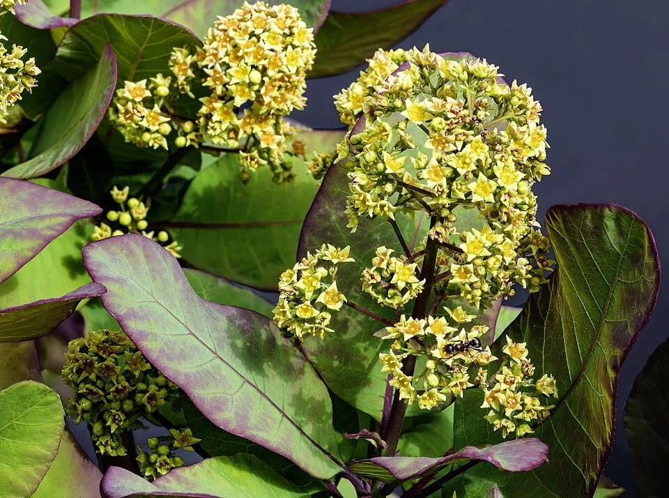
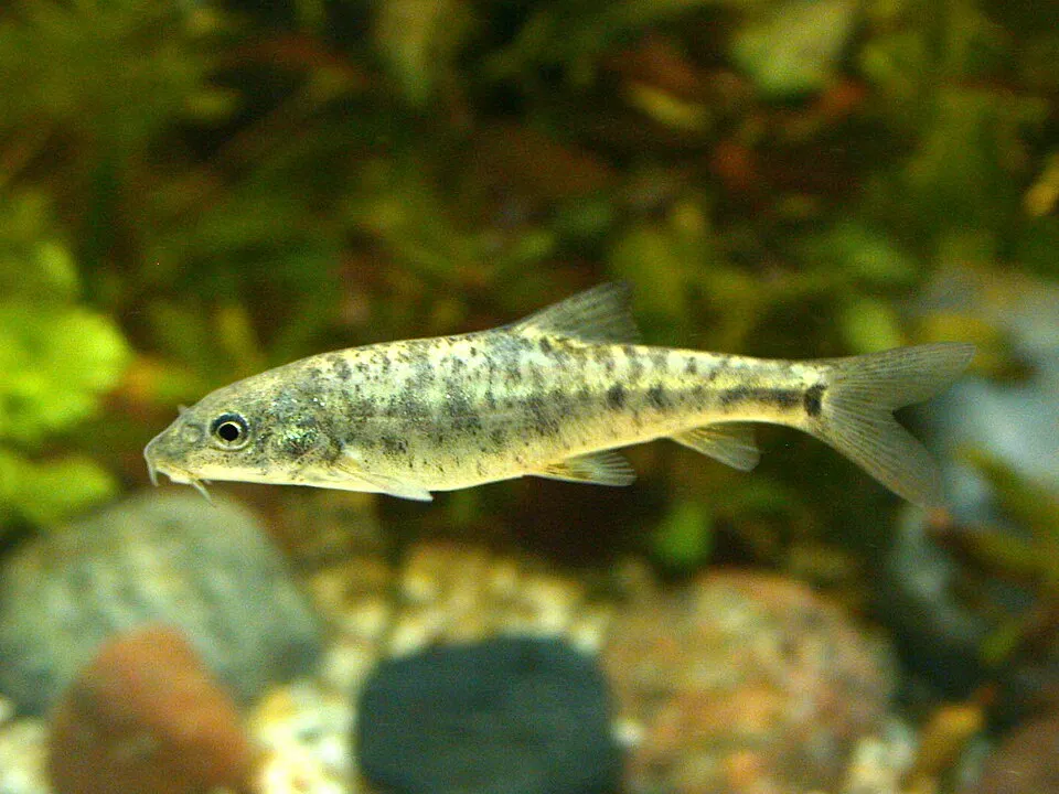
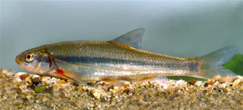
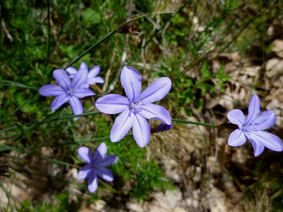
Among the species most often recorded on GBIF are Cotinus coggygria (European smoketree), Barbus barbus (Barbel), Telestes souffia (Souffia) and Aphyllanthes monspeliensis (Blue Aphyllanthes).
© OpenStreetMap
Download the boundary: GeoJSON · GPX Boundary © OpenStreetMap contributors (ODbL).
Geography
The representative point of the site lies at around 731 m above sea level. Over the 1996–2025 period, the mean annual temperature is about 10.5 °C and total precipitation reaches roughly 1,021 mm per year. The warmest month is usually July, the coolest January, and the wettest November. According to the BRGM's simplified lithological map, the bedrock consists mainly of limestones, marls and gypsum (100% of sampled points). These are mostly sedimentary rocks.
Area
- Area
- 188 ha
- Elevation
- 731 m
- Median elevation
- 642 m
- Mean slope
- 25°
- Coordinates
- 44.2729, 5.7875
Terrain: Mapzen Terrain Tiles (SRTM, USGS)
Bedrock
- Limestones, marls and gypsum 100 %
Sedimentary rocks 100 %
Source: BRGM, simplified lithological map at 1:1,000,000 (Licence Ouverte), 16 points sampled within the boundary.
Climate
● Mean temperature (°C) · ▮ Precipitation (mm)
Source: Copernicus ERA5-Land (C3S, doi:10.24381/cds.68d2bb30), monthly averages 1996–2025 interpolated to the representative point, temperatures adjusted for elevation.
Contains modified Copernicus Climate Change Service information 2026. Neither the European Commission nor ECMWF is responsible for any use that may be made of the Copernicus information or data it contains.
Natural habitats
According to CORINE Land Cover (2018), the site is mainly made up of forests (40%), Mediterranean scrub (37%) and heath and scrub (23%). Woodland is mostly broadleaved. Elevation ranges from about 580 to 810 m (sampled elevations, SRTM). The terrain is steep: 38% of slopes exceed 30° (mean slope 25°). The Natura 2000 site overlapping the area lists 13 habitats of European interest (2 priority), the most extensive being Medio-European limestone beech forests of the Cephalanthero-Fagion, alpine rivers and their ligneous vegetation with Salix elaeagnos and western Mediterranean and thermophilous scree.
Biodiversity
Based on occurrences aggregated by GBIF, several species are regularly recorded within the site. Among the most frequent are Cotinus coggygria (European smoketree), Barbus barbus (Barbel), Telestes souffia (Souffia) and Aphyllanthes monspeliensis (Blue Aphyllanthes). The full list of documented taxa is shown below. The overlapping Natura 2000 site lists 10 species of European interest: 5 mammals, 2 fish and 3 invertebrates.
Habitats of European interest
From the official form of the Natura 2000 site overlapping the area (areas reported for the whole site).
- Medio-European limestone beech forests of the Cephalanthero-Fagion 32 ha
- Alpine rivers and their ligneous vegetation with Salix elaeagnos 24 ha
- Western Mediterranean and thermophilous scree 17 ha
- Stable xerothermophilous formations with Buxus sempervirens on rock slopes (Berberidion p.p.) 11 ha
- Calcareous rocky slopes with chasmophytic vegetation 10 ha
- Juniperus communis formations on heaths or calcareous grasslands 10 ha
- Semi-natural dry grasslands and scrubland facies on calcareous substrates (Festuco-Brometalia) (* important orchid sites) 7 ha
- Rupicolous calcareous or basophilic grasslands of the Alysso-Sedion albi priority 5 ha
and 5 more
Species of European interest
Mammals · 5
Lesser mouse-eared myotis (Myotis blythii), Long-fingered bat (Myotis capaccinii), Greater mouse-eared bat (Myotis myotis), Greater Horseshoe Bat (Rhinolophus ferrumequinum), Lesser horseshoe bat (Rhinolophus hipposideros)
Invertebrates · 3
Greater Capricorn Beetle (Cerambyx cerdo), Marsh fritillary (Euphydryas aurinia), Stag beetle (Lucanus cervus)
Source: Natura 2000 standard data forms (EEA, CC-BY 4.0). Not exhaustive: sensitive species are not published.
Species to look out for
Observed species
Occurrences documented via GBIF; they are neither an exhaustive inventory nor proof of current presence.
- European smoketree · Cotinus coggygria · 24
- Barbel · Barbus barbus · 20
- Souffia · Telestes souffia · 19
- Blue Aphyllanthes · Aphyllanthes monspeliensis · 17
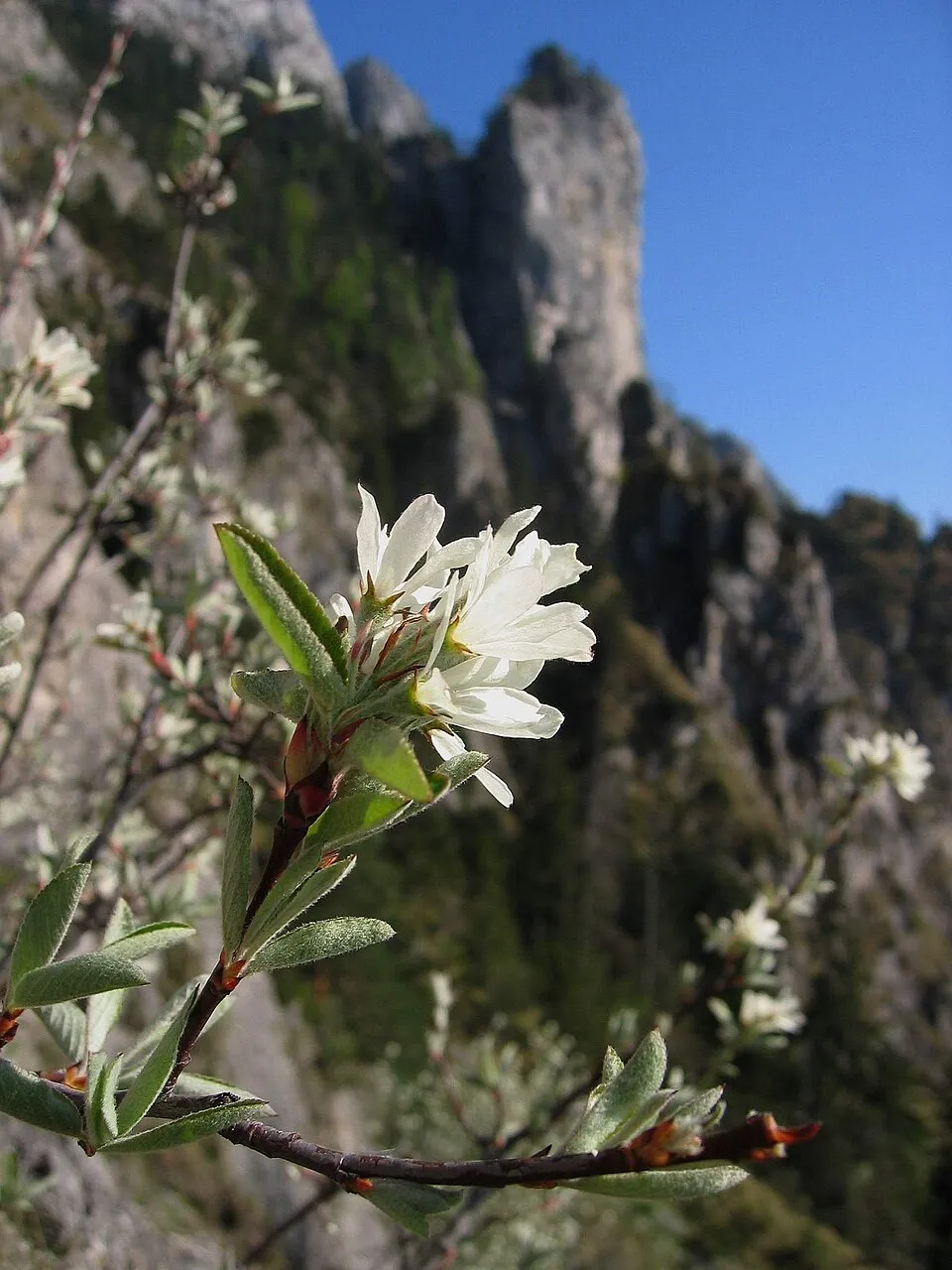
- Snowy Mespilus · Amelanchier ovalis · 17
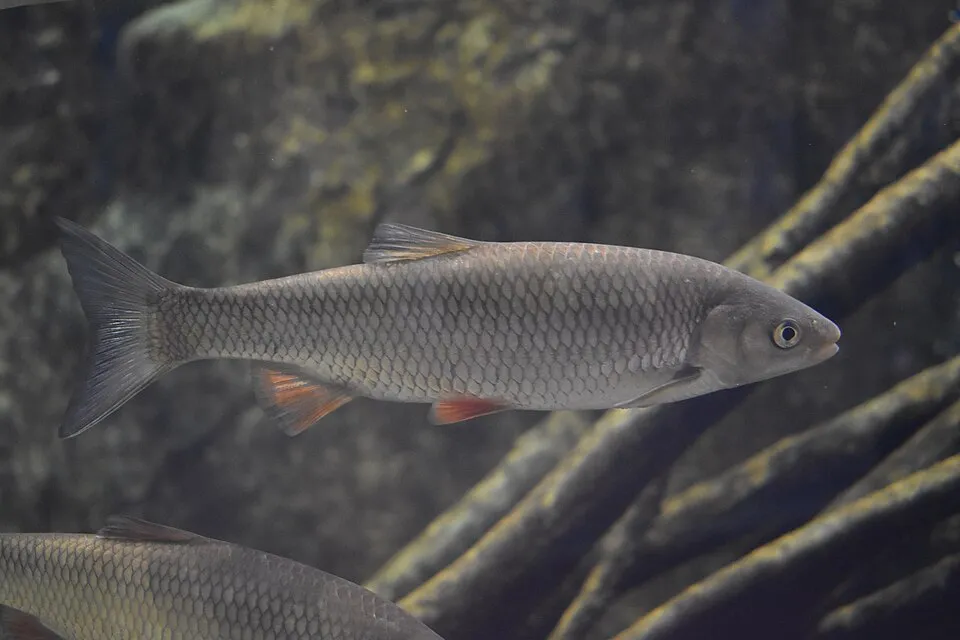
- Chub · Squalius cephalus · 15
- Western Common Toad · Bufo spinosus · 15
- Montpellier Maple · Acer monspessulanum · 9
- Bastard Balm · Melittis melissophyllum · 9
- Fire salamander · Salamandra salamandra · 8
- Common box · Buxus sempervirens · 7
- Mediterranean Barbel · Barbus meridionalis · 7
+18 more species
- Gold germander · Teucrium aureum · 7
- Downy oak · Quercus pubescens · 6
- Garden thyme · Thymus vulgaris · 6
- Thick-leaved Saxifrage · Saxifraga callosa · 6
- Brown Trout · Salmo trutta · 6
- Northern Raven · Corvus corax · 5
- Grey Wagtail · Motacilla cinerea · 5
- Common Chiffchaff · Phylloscopus collybita · 5
- Eurasian Chaffinch · Fringilla coelebs · 5
- Mountain Lettuce · Lactuca perennis · 5
- Cyprus turpentine · Pistacia terebinthus · 5
- Scots Pine · Pinus sylvestris · 5
- Spanish Gorse · Genista hispanica · 5
- Hepatica · Hepatica nobilis · 5
- Wall germander · Teucrium chamaedrys · 5
- Short-toed Snake Eagle · Circaetus gallicus · 4
- Common Juniper · Juniperus communis · 4
- St. Bernard’s lily · Anthericum liliago · 4
Records: GBIF.org (CC-BY). Names: Wikidata (CC0), GBIF. Photos: Wikimedia Commons.
Conservation challenges
The primary purpose of the site is to preserve its natural habitats and the biodiversity they support. The species recorded (Biodiversity tab) reflect its ecological value. The designations it holds frame its management and the control of land use.
At night, the area gives off virtually no artificial light detectable from space (NASA VIIRS Black Marble composite, 2016). According to the Natura 2000 forms, of 12 assessed habitats of European interest, 2 are in excellent condition and 2 in average or reduced condition. According to the Water Framework Directive assessment (2022 river basin management plans, data 2015–2017), the only river assessed within the site has moderate ecological status.
Pressure indicators
Tree cover lost
1 ha
2001–2023 · < 1% of the area
20012023
Fires since 2016
0
No large fire mapped (fires over about 30 ha)
Light at night
0%
of the area gives off artificial light visible from space
DarkLit
Rivers and lakes
0%
of the 4 km of assessed rivers in good or high ecological status · WFD 2022
assessments 2015–2017
Sources: Global Forest Change (Hansen et al., University of Maryland, via Global Forest Watch, CC-BY 4.0); EFFIS, European Commission / Copernicus; NASA Black Marble 2016 (public domain); CORINE Land Cover 2018 (Copernicus) or MODIS.
Ecological status of water bodies: European Environment Agency, WISE – Water Framework Directive, 3rd river basin management plans (2022), CC BY 4.0. Official national classification, not comparable between countries.
Practical information
Cities and airport
- Avignon
85 km as the crow flies - Aix-en-Provence
86 km as the crow flies - Airport: Marseille Provence (MRS)
102 km as the crow flies
Parking
4 public car parks listed within the site
CascadeRifPont Roman
Data © OpenStreetMap contributors (ODbL) · Wikidata (CC0)
Bathing
1 monitored bathing site in or within 1 km of the site · 2025 classification
Sufficient · 1
- Les Gorges de la Meouge · river · Sufficient
Source: European Environment Agency, official bathing water classification (Directive 2006/7/EC, CC-BY 4.0). Swimming is only permitted at the sites and times authorised locally.
Access and visiting
The nearest railway station is Laragne, about 4 km from the site boundary. Nearest towns of over 50,000 people, as the crow flies: Avignon (85 km) and Aix-en-Provence (86 km). Nearest airport: Marseille Provence (MRS), about 102 km away. About 28,000 people live within 20 km of the site boundary, 11,000 of them within 10 km (GHSL estimate, 2020). This population has grown by about 20% since 2000. Public car parks listed within the site: 4, including Cascade, Rif and Pont Roman. To see: 5 viewpoints and 1 waterfall, including Gorges de la Méouge and Le Banc du Bouc. To plan a visit (access, opening periods, visitor rules), it is best to consult the official information from the managing body and the official website listed in this page's sources.
Source: OpenStreetMap (ODbL), Wikidata (CC0), October 2026.
Built heritage
According to the French Ministry of Culture's Mérimée database, one historic monument (classé) stands within the boundary. It is “Pont médiéval sur la Meouge” in Châteauneuf-de-Chabre.
-
Pont médiéval sur la Meouge
Classé
Châteauneuf-de-Chabre
Source: Mérimée database, French Ministry of Culture (Licence Ouverte 2.0). Each record links to the Plateforme ouverte du patrimoine (POP).
When to visit
Best time to visit: from June to September, with average temperatures of 15 to 21 °C and moderate rainfall. Precipitation peaks in November (up to 130 mm per month). Day length ranges from about 8 h 52 min in December to 15 h 30 min in June. Wildlife records published on GBIF peak for birds (April), plants (May), butterflies and moths (from April to July) and dragonflies (June and July). These peaks also reflect when observers are most active.
Source: Copernicus ERA5-Land (C3S), monthly averages 1996–2025 at the representative point, temperatures adjusted for elevation.
Contains modified Copernicus Climate Change Service information 2026. Neither the European Commission nor ECMWF is responsible for any use that may be made of the Copernicus information or data it contains.
Wildlife records calendar
JFMAMJJASOND
Birds
Plants
Butterflies & moths
Dragonflies
Monthly records published on GBIF (CC-BY), relative to the busiest month; also reflects observer activity.
Gallery
© SBrunel3 · CC BY-SA 4.0
© Gilles San Martin from Namur, Belgium · CC BY-SA 2.0
© Ludovic Lubeigt from Taiwan · CC BY-SA 2.0
© Ludovic Lubeigt from Taiwan · CC BY-SA 2.0
© Gilles San Martin from Namur, Belgium · CC BY-SA 2.0
© Ludovic Lubeigt from Taiwan · CC BY-SA 2.0
Sources and licences
- Wikidata: Q65953708
- OpenStreetMap: relation 1178071
- WDPA: 15167
References
- cds.climate.copernicus.eu: climate · CC-BY-4.0
- registry.opendata.aws: elevation of the reference point, detailed relief · PD
- land.copernicus.eu: land cover, land cover change, sea share · COPERNICUS
- doi.org: population around the site · CC-BY-4.0
- wikidata.org: official area, establishment date, nearby cities and airport, access and peaks, lake depths, places to see · CC0-1.0
- eea.europa.eu: bathing water quality, ecological status of waters · CC-BY-4.0
- en.eurovelo.com: EuroVelo cycle routes · ODbL-1.0
- cycling.waymarkedtrails.org: cycle routes · ODbL-1.0
- opentopodata.org: elevations · PD
- forest-fire.emergency.copernicus.eu: wildfires · COPERNICUS
- globalforestwatch.org: tree cover loss · CC-BY-4.0
- gbif.org: seasonality of sightings, invasive alien species, observed species · CC-BY-4.0
- infoterre.brgm.fr: geology · LO-2.0
- pop.culture.gouv.fr: protected heritage · LO-2.0
- hydrosheds.org: lakes · CC-BY-4.0
- natura2000.eea.europa.eu: Natura 2000 habitats and species · CC-BY-4.0
- openstreetmap.org: official name, access and peaks, places to see · ODbL-1.0
- earthobservatory.nasa.gov: night light · PD
- nsidc.org: snow cover · PD
Data © OpenStreetMap contributors (ODbL), Wikidata (CC0) and the sources cited.