South Korea · Terrestrial
Gyeongju National Park
National park of 13,709 hectares in South Korea, established in 1968.
Overview
National park of 13,709 hectares in South Korea, established in 1968.
Gyeongju National Park is located in South Korea (Asia). It is a predominantly terrestrial area. Established in 1968, it covers about 13,709 hectares.
In our collections
Frequently asked questions
Where is Gyeongju National Park?
In South Korea (Asia). Representative point: 35.8675° N, 129.2225° E.
How large is Gyeongju National Park?
About 13,709 hectares (137 km²). It is the 14th largest of the 23 national parks in South Korea covered by Parkavela.
When was Gyeongju National Park established?
In 1968.
What habitats and landscapes does Gyeongju National Park include?
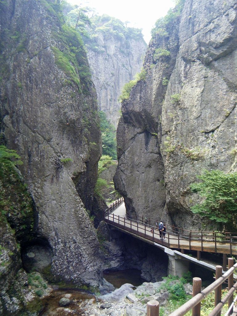
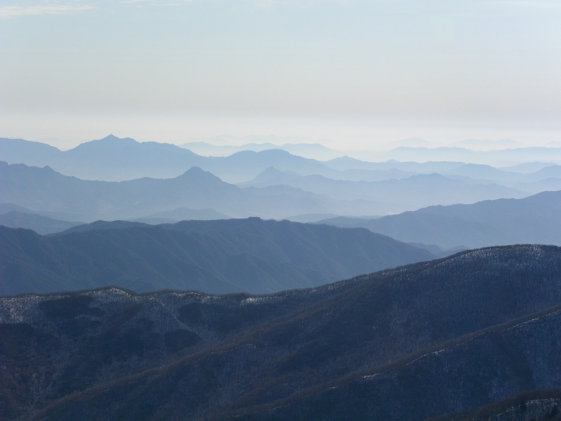
A terrestrial area, with forests and mountains.
What are the main summits of Gyeongju National Park?
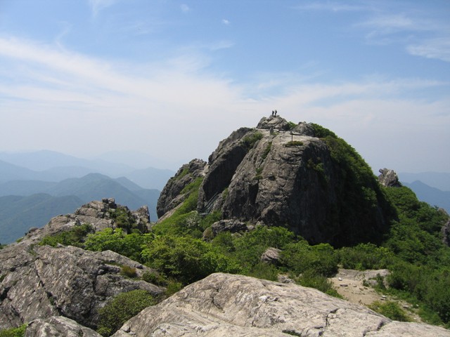
Tohamsan (745 m), Gowibong peak (495 m) and Geumobong (468 m) (OpenStreetMap).
When is the best time to visit Gyeongju National Park?
Mildest period: July and August, with average temperatures of 25 to 27 °C.
Are there historic monuments in Gyeongju National Park?
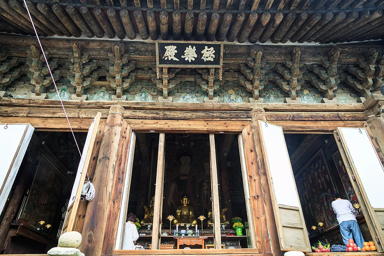
Yes. According to Wikidata, 16 monuments protected in South Korea as Treasures or Historic Sites (national heritage) stand within the boundary, 6 of them National Treasures. For example: “Seokguram” in Gyeongju, “Blue Cloud bridge and White Cloud Bridge” in Gyeongju and “Buddhas carved into the rock at the Chilbulam Hermitage” in Gyeongju.
What is the nearest large city to Gyeongju National Park?
Nearest towns of over 50,000 people, as the crow flies: Gyeongju (1 km) and Pohang (15 km). Nearest airport: Pohang Gyeongju (KPO), about 12 km away.
How can I reach Gyeongju National Park by train?
The nearest railway station is Gyeongju, about 1 km from the site boundary.
Where can I get visitor information on site?
Gyeongju Bulguksa Tourist Information Center and Ticket booth.
Are there waymarked hiking trails in Gyeongju National Park?
Yes. Waymarked hiking routes listed in OpenStreetMap: 1, including Nakdong Jeongmaek Trail.
Which species can be seen in Gyeongju National Park?
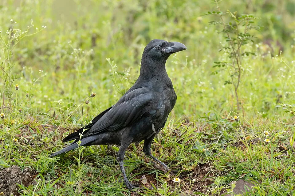
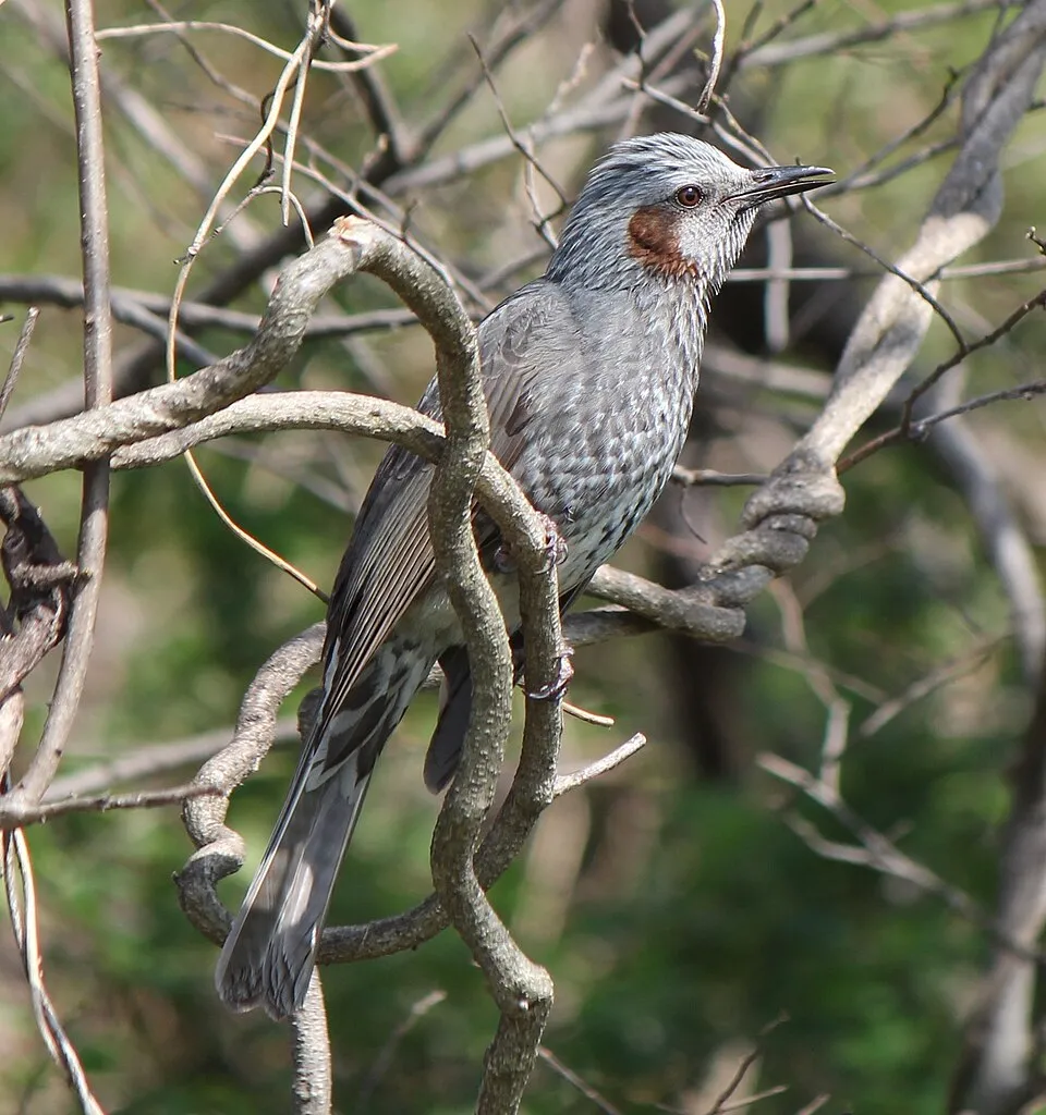
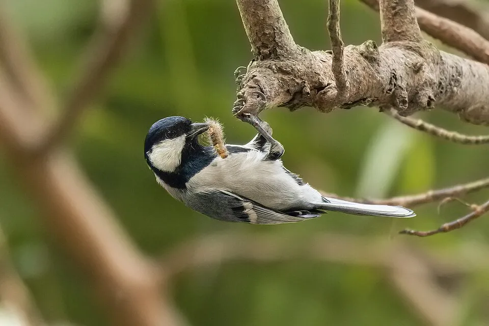
Among the species most often recorded on GBIF are Corvus macrorhynchos (Large-billed Crow), Hypsipetes amaurotis (Brown-eared Bulbul), Phoenicurus auroreus (Daurian Redstart) and Parus cinereus (Cinereous Tit).
© OpenStreetMap
Download the boundary: GeoJSON · GPX Boundary © OpenStreetMap contributors (ODbL).
Geography
The representative point of the site lies at around 34 m above sea level. Over the 1996–2025 period, the mean annual temperature is about 13.8 °C and total precipitation reaches roughly 1,120 mm per year. The warmest month is usually August, the coolest January, and the wettest July.
Area
- Area
- 13,709 ha
- Elevation
- 34 m
- Median elevation
- 312 m
- Mean slope
- 19°
- Coordinates
- 35.8675, 129.2225
Terrain: Mapzen Terrain Tiles (SRTM, USGS)
Main summits
- Tohamsan745 m
- Gowibong peak495 m
- Geumobong468 m
Data © OpenStreetMap contributors (ODbL)
Climate
● Mean temperature (°C) · ▮ Precipitation (mm)
Source: Copernicus ERA5-Land (C3S, doi:10.24381/cds.68d2bb30), monthly averages 1996–2025 interpolated to the representative point, temperatures adjusted for elevation.
Contains modified Copernicus Climate Change Service information 2026. Neither the European Commission nor ECMWF is responsible for any use that may be made of the Copernicus information or data it contains.
Natural habitats
According to the global MODIS land cover (NASA, 2024), the site is mainly made up of forests (90%) and heath and scrub (6%). Woodland is mostly broadleaved. Elevation ranges from about 30 to 630 m (sampled elevations, SRTM). The terrain is steep: 67% of slopes exceed 15° (mean slope 19°).
Biodiversity
Based on occurrences aggregated by GBIF, several species are regularly recorded within the site. Among the most frequent are Corvus macrorhynchos (Large-billed Crow), Hypsipetes amaurotis (Brown-eared Bulbul), Phoenicurus auroreus (Daurian Redstart) and Parus cinereus (Cinereous Tit). The full list of documented taxa is shown below.
Species to look out for


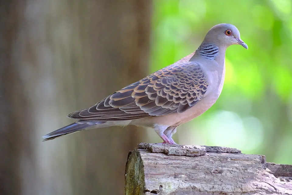
Observed species
Occurrences documented via GBIF; they are neither an exhaustive inventory nor proof of current presence.
- Large-billed Crow · Corvus macrorhynchos · 66
- Brown-eared Bulbul · Hypsipetes amaurotis · 60
- Daurian Redstart · Phoenicurus auroreus · 59
- Cinereous Tit · Parus cinereus · 53
- Oriental Magpie · Pica serica · 47
- Oriental Turtle Dove · Streptopelia orientalis · 41
- Marsh Tit · Poecile palustris · 37
- Coal tit · Periparus ater · 30
- Varied Tit · Poecile varius · 29
- Eurasian Tree Sparrow · Passer montanus · 27
- Japanese Pygmy Woodpecker · Yungipicus kizuki · 23
- Pholcus gajiensis · 22
+18 more species
- Yellow-throated Bunting · Emberiza elegans · 21
- White Wagtail · Motacilla alba · 21
- Eurasian Nuthatch · Sitta europaea · 20
- Long-tailed Tit · Aegithalos caudatus · 20
- Warbling white-eye · Zosterops japonicus · 16
- Hammock-web Spider · Ketambea nigripectoris · 16
- Great Spotted Woodpecker · Dendrocopos major · 14
- Barn Swallow · Hirundo rustica · 13
- Grey-capped Greenfinch · Chloris sinica · 12
- Joro Spider · Trichonephila clavata · 11
- Small Sheet-web Weaver · Microneta viaria · 11
- Common house spider · Parasteatoda tepidariorum · 11
- Vinous-throated Parrotbill · Sinosuthora webbiana · 11
- Corealithus coreanus · 10
- White-backed Woodpecker · Dendrocopos leucotos · 10
- Goldcrest · Regulus regulus · 10
- Eastern Buzzard · Buteo japonicus · 10
- Grey-headed Woodpecker · Picus canus · 9
Records: GBIF.org (CC-BY). Names: Wikidata (CC0), GBIF. Photos: Wikimedia Commons.
Conservation challenges
The primary purpose of the site is to preserve its natural habitats and the biodiversity they support. The species recorded (Biodiversity tab) reflect its ecological value. Its status as a national park sets the regulatory framework for its protection.
According to Global Forest Change data (University of Maryland, Global Forest Watch), about 136 ha of tree cover were lost within the boundary between 2001 and 2023 (under 1% of its area), peaking in 2009. These losses include logging, storms and fires, and do not account for regrowth. At night, 35% of the area gives off artificial light detectable from space (NASA VIIRS Black Marble composite, 2016). Built-up and developed land (buildings, business areas, roads, quarries) covers 1% of the area (MODIS).
Pressure indicators
Tree cover lost
136 ha
2001–2023 · < 1% of the area
20012023
Light at night
35%
of the area gives off artificial light visible from space
DarkLit
Built-up land
1%
buildings, business areas, roads, quarries · farmland 2%
Sources: Global Forest Change (Hansen et al., University of Maryland, via Global Forest Watch, CC-BY 4.0); EFFIS, European Commission / Copernicus; NASA Black Marble 2016 (public domain); CORINE Land Cover 2018 (Copernicus) or MODIS.
Practical information
Cities and airport
- Gyeongju
1 km as the crow flies - Pohang
15 km as the crow flies - Airport: Pohang Gyeongju (KPO)
12 km as the crow flies
Visitor information
- Gyeongju Bulguksa Tourist Information Center
< 1 km from the site boundary - Ticket booth
< 1 km from the site boundary
Parking
5 public car parks listed within the site
Bulguksa Parking Lot3Bulguksa Main Gate Parking Lot
Hiking
1 waymarked routes listed, including:
Nakdong Jeongmaek Trail
Data © OpenStreetMap contributors (ODbL) · Wikidata (CC0)
Waymarked hiking routes
Tracks © OpenStreetMap contributors (ODbL), clipped to the boundary; elevation gain and profiles computed on the longest section from Mapzen Terrain Tiles (≈ 30 m), indicative only. Indicative difficulty (SAC scale, OpenStreetMap, via Waymarked Trails): check with the park.
Access and visiting
The nearest railway station is Gyeongju, about 1 km from the site boundary. Nearest towns of over 50,000 people, as the crow flies: Gyeongju (1 km) and Pohang (15 km). Nearest airport: Pohang Gyeongju (KPO), about 12 km away. About 900,000 people live within 20 km of the site boundary, 270,000 of them within 10 km; some 6,000 people are estimated to live inside (GHSL estimate, 2020). Visitor information on site: Gyeongju Bulguksa Tourist Information Center and Ticket booth. Public car parks listed within the site: 5, including Bulguksa Parking Lot3 and Bulguksa Main Gate Parking Lot. Waymarked hiking routes listed in OpenStreetMap: 1, including Nakdong Jeongmaek Trail. To plan a visit (access, opening periods, visitor rules), it is best to consult the official information from the managing body and the official website listed in this page's sources.
Source: OpenStreetMap (ODbL), Wikidata (CC0), November 2026.
Built heritage
According to Wikidata, 16 monuments protected in South Korea as Treasures or Historic Sites (national heritage) stand within the boundary, 6 of them National Treasures. Among them are 4 religious buildings, 2 bridges, lighthouses, mills and working buildings and 1 castle or fortification. Nationally designated items include “Seokguram” in Gyeongju, “Blue Cloud bridge and White Cloud Bridge” in Gyeongju and “Buddhas carved into the rock at the Chilbulam Hermitage” in Gyeongju.
4 religious buildings2 bridges, lighthouses, mills and working buildings1 castle or fortification
-
Seokguram
National
Gyeongju -
Blue Cloud bridge and White Cloud Bridge
National
Gyeongju -
Buddhas carved into the rock at the Chilbulam Hermitage
National
Gyeongju -
Lotus Flower Bridge and Seven Treasure Bridge
National
Gyeongju -
Dabotap
National
Gyeongju -
Seokgatap
National
Gyeongju -
Daeungjeon
Gyeongju -
Namsansinseong
and 8 more
Source: Wikidata (CC0), monuments in each country’s official heritage protection registers, at national or regional level. Each item links to its Wikidata entry.
When to visit
Mildest period: July and August, with average temperatures of 25 to 27 °C. Precipitation peaks from June to September (up to 200 mm per month). Day length ranges from about 9 h 44 min in December to 14 h 35 min in June. Wildlife records published on GBIF peak for plants (July) and mammals (March). These peaks also reflect when observers are most active.
Source: Copernicus ERA5-Land (C3S), monthly averages 1996–2025 at the representative point, temperatures adjusted for elevation.
Contains modified Copernicus Climate Change Service information 2026. Neither the European Commission nor ECMWF is responsible for any use that may be made of the Copernicus information or data it contains.
Wildlife records calendar
JFMAMJJASOND
Birds
Plants
Mammals
Monthly records published on GBIF (CC-BY), relative to the busiest month; also reflects observer activity.
Gallery
© riNux from Taipei, Taiwan · CC BY-SA 2.0
© Gfievet · CC BY-SA 4.0
© Matt and Nayoung Wilson from Atlanta and surrounding, US · CC BY 2.0
© Gfievet · CC BY-SA 4.0
© Matt and Nayoung Wilson from Atlanta and surrounding, US · CC BY 2.0
© Matt and Nayoung Wilson from Atlanta and surrounding, US · CC BY 2.0
Sources and licences
- Wikidata: Q491567
- OpenStreetMap: relation 13117408
- Wikipedia: en.wikipedia.org/wiki/Gyeongju_National_Park
- WDPA: 772
References
- cds.climate.copernicus.eu: climate · CC-BY-4.0
- registry.opendata.aws: elevation of the reference point, detailed relief · PD
- lpdaac.usgs.gov: land cover · PD
- doi.org: population around the site · CC-BY-4.0
- naturalearthdata.com: sea share · PD
- wikidata.org: official area, establishment date, protected heritage, official name, nearby cities and airport, lake depths · CC0-1.0
- en.eurovelo.com: EuroVelo cycle routes · ODbL-1.0
- cycling.waymarkedtrails.org: cycle routes · ODbL-1.0
- opentopodata.org: elevations · PD
- globalforestwatch.org: tree cover loss · CC-BY-4.0
- gbif.org: seasonality of sightings, invasive alien species, observed species · CC-BY-4.0
- earthobservatory.nasa.gov: night light · PD
- openstreetmap.org: access and peaks · ODbL-1.0
- hiking.waymarkedtrails.org: route difficulty · ODbL-1.0
- nsidc.org: snow cover · PD
- wikidata.org: Wikipedia article · CC-BY-SA-4.0
Data © OpenStreetMap contributors (ODbL), Wikidata (CC0) and the sources cited.