Argentina · Marine
Isla Pingüino Interjurisdictional Marine Park
Marine protected area of 158,540 hectares in Argentina, established in 2012.
Overview
Marine protected area of 158,540 hectares in Argentina, established in 2012.
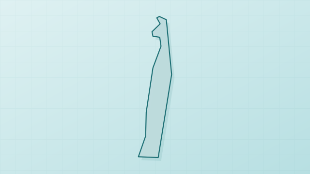
Isla Pingüino Interjurisdictional Marine Park is a marine protected area in Argentina (South America). It is a predominantly marine area. Established in 2012, it covers about 158,540 hectares.
Frequently asked questions
Where is Isla Pingüino Interjurisdictional Marine Park?
In Argentina (South America). Representative point: 47.9000° S, 65.7167° W.
How large is Isla Pingüino Interjurisdictional Marine Park?
About 158,540 hectares (1,585 km²). It is the largest of the 3 marine protected areas in Argentina covered by Parkavela.
When was Isla Pingüino Interjurisdictional Marine Park established?
In 2012.
What habitats and landscapes does Isla Pingüino Interjurisdictional Marine Park include?
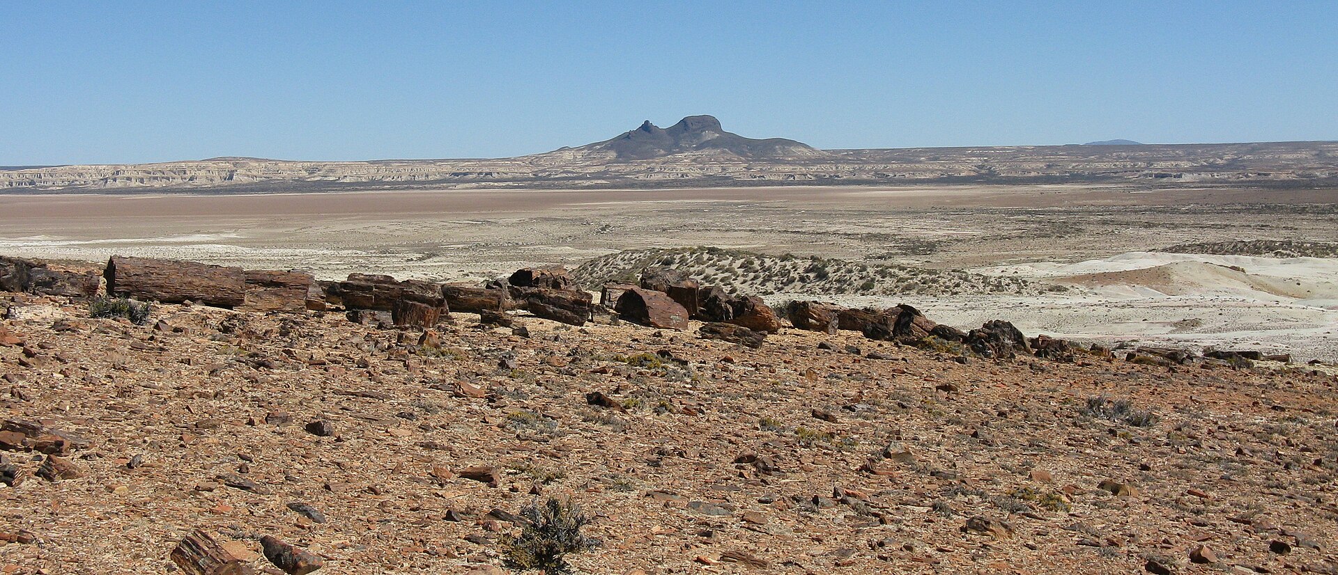
A marine area, where land cover is dominated by bare rock and scree (31%).
When is the best time to visit Isla Pingüino Interjurisdictional Marine Park?
Best time to visit: from October to April, with average temperatures of 10 to 17 °C and moderate rainfall.
Are there historic monuments in Isla Pingüino Interjurisdictional Marine Park?
Yes. According to Wikidata, one monument protected in Argentina as National Historic Monuments or Sites stands within the boundary. For example: “Isla Pingüino Lighthouse”.
Where can I get visitor information on site?
Oficina de Turismo.
Which species can be seen in Isla Pingüino Interjurisdictional Marine Park?
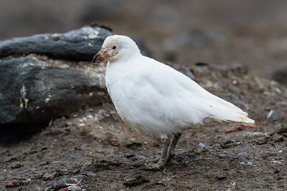
Among the species most often recorded on GBIF are Spheniscus magellanicus (Magellanic Penguin), Eudyptes chrysocome (Southern Rockhopper Penguin), Stercorarius antarcticus (Brown Skua) and Chionis albus (Snowy Sheathbill).
© OpenStreetMap
Download the boundary: GeoJSON · GPX Boundary © OpenStreetMap contributors (ODbL).
Geography
Over the 1996–2025 period, the mean annual temperature is about 10.8 °C and total precipitation reaches roughly 240 mm per year. The warmest month is usually January, the coolest July, and the wettest June.
Area
- Area of the boundary
- 158,540 ha
- Coordinates
- -47.9, -65.7167
Climate
● Mean temperature (°C) · ▮ Precipitation (mm)
Source: Copernicus ERA5-Land (C3S, doi:10.24381/cds.68d2bb30), monthly averages 1996–2025 interpolated to the representative point, temperatures adjusted for elevation.
Contains modified Copernicus Climate Change Service information 2026. Neither the European Commission nor ECMWF is responsible for any use that may be made of the Copernicus information or data it contains.
Natural habitats
The site is almost entirely marine. The seabed reaches about 53 m deep (median depth 29 m; GEBCO bathymetry).
Biodiversity
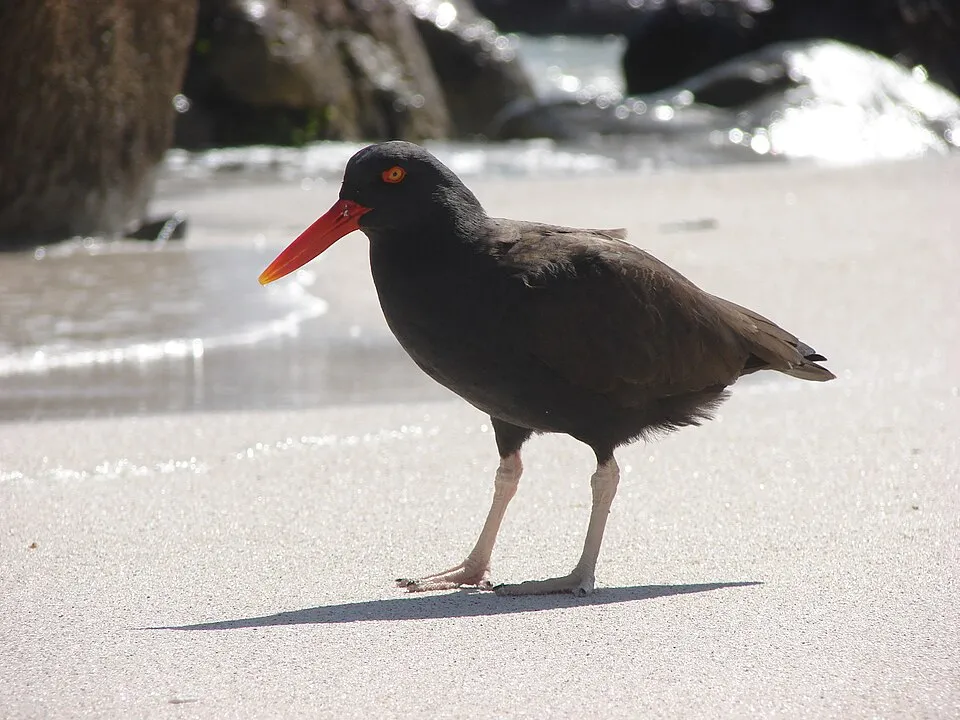
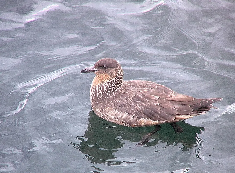
Based on occurrences aggregated by GBIF, several species are regularly recorded within the site. Among the most frequent are Spheniscus magellanicus (Magellanic Penguin), Eudyptes chrysocome (Southern Rockhopper Penguin), Stercorarius antarcticus (Brown Skua) and Chionis albus (Snowy Sheathbill). The full list of documented taxa is shown below.
Species to look out for
Bird
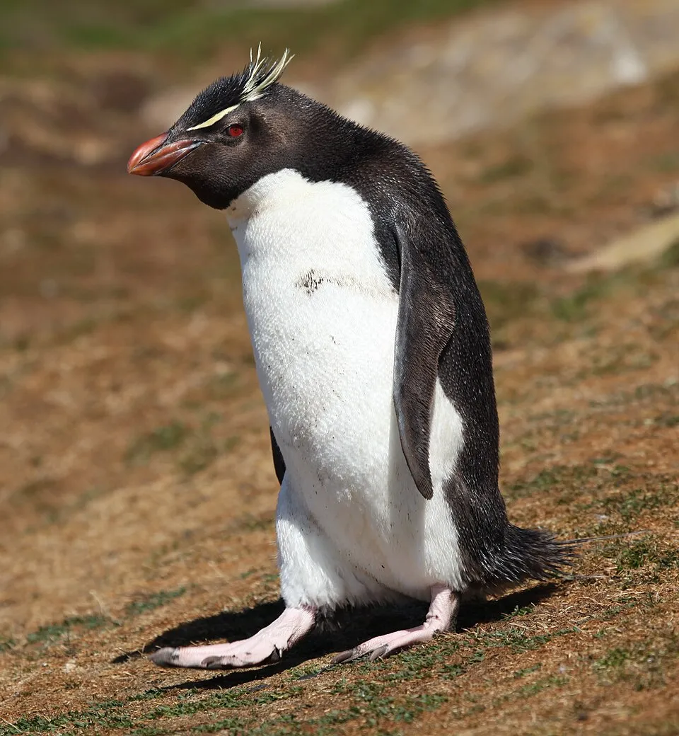
Southern Rockhopper Penguin
Eudyptes chrysocome188 records © Liam Quinn from Canada · CC BY-SA 2.0
Observed species
Occurrences documented via GBIF; they are neither an exhaustive inventory nor proof of current presence.
- Magellanic Penguin · Spheniscus magellanicus · 192
- Southern Rockhopper Penguin · Eudyptes chrysocome · 188
- Brown Skua · Stercorarius antarcticus · 173
- Snowy Sheathbill · Chionis albus · 166
- Blackish Oystercatcher · Haematopus ater · 165
- Chilean Skua · Stercorarius chilensis · 164
- Dolphin Gull · Leucophaeus scoresbii · 162
- Kelp Gull · Larus dominicanus · 161
- Imperial Shag · Leucocarbo atriceps · 153
- South American Tern · Sterna hirundinacea · 144
- Red-legged Cormorant · Phalacrocorax gaimardi · 129
- Rufous-collared Sparrow · Zonotrichia capensis · 125
+18 more species
- Flying Steamer Duck · Tachyeres patachonicus · 120
- Upland Goose · Chloephaga picta · 119
- Rock Shag · Phalacrocorax magellanicus · 116
- Southern Giant Petrel · Macronectes giganteus · 112
- Black-browed Albatross · Thalassarche melanophris · 110
- Crested Duck · Lophonetta specularioides · 99
- Austral Negrito · Lessonia rufa · 82
- Scaly-throated Earthcreeper · Upucerthia dumetaria · 69
- Great Grebe · Podiceps major · 59
- Neotropic Cormorant · Phalacrocorax brasilianus · 55
- Black-faced Ibis · Theristicus melanopis · 51
- Cinnamon-bellied Ground Tyrant · Muscisaxicola capistratus · 49
- White-rumped Sandpiper · Calidris fuscicollis · 41
- Black-crowned night heron · Nycticorax nycticorax · 30
- Sooty shearwater · Puffinus griseus · 28
- Baird's Sandpiper · Calidris bairdii · 27
- Magellanic Oystercatcher · Haematopus leucopodus · 25
- Snares Penguin · Eudyptes robustus · 20
Records: GBIF.org (CC-BY). Names: Wikidata (CC0), GBIF. Photos: Wikimedia Commons.
Conservation challenges
The primary purpose of the site is to preserve its natural habitats and the biodiversity they support. The species recorded (Biodiversity tab) reflect its ecological value. Its status as a marine protected area sets the regulatory framework for its protection.
Pressure indicators
Invasive alien species
1
recorded since 2000
Sources: Global Forest Change (Hansen et al., University of Maryland, via Global Forest Watch, CC-BY 4.0); EFFIS, European Commission / Copernicus; NASA Black Marble 2016 (public domain); CORINE Land Cover 2018 (Copernicus) or MODIS.
Invasive alien species: Global Register of Introduced and Invasive Species (ISSG, CC BY 4.0); Union list, Regulation (EU) 1143/2014 (INBO, CC0); GBIF.org records (CC0 / CC BY 4.0), at least 2 per species.
Practical information
Visitor information
- Oficina de Turismo
2 km from the site boundary
Data © OpenStreetMap contributors (ODbL)
Access and visiting
About 22,000 people live within 20 km of the site boundary (GHSL estimate, 2020). This population has grown by about 139% since 2000. Visitor information on site: Oficina de Turismo. To plan a visit (access, opening periods, visitor rules), it is best to consult the official information from the managing body and the official website listed in this page's sources.
Source: OpenStreetMap (ODbL), Wikidata (CC0), October 2026.
Built heritage
According to Wikidata, one monument protected in Argentina as National Historic Monuments or Sites stands within the boundary. It is “Isla Pingüino Lighthouse”.
-
Isla Pingüino Lighthouse
20th c.
Source: Wikidata (CC0), monuments in each country’s official heritage protection registers, at national or regional level. Each item links to its Wikidata entry.
When to visit
Best time to visit: from October to April, with average temperatures of 10 to 17 °C and moderate rainfall. Day length ranges from about 8 h 24 min in June to 16 h 00 min in December. Wildlife records published on GBIF peak for birds (December and January). These peaks also reflect when observers are most active.
Source: Copernicus ERA5-Land (C3S), monthly averages 1996–2025 at the representative point, temperatures adjusted for elevation.
Contains modified Copernicus Climate Change Service information 2026. Neither the European Commission nor ECMWF is responsible for any use that may be made of the Copernicus information or data it contains.
Wildlife records calendar
JFMAMJJASOND
Birds
Monthly records published on GBIF (CC-BY), relative to the busiest month; also reflects observer activity.
Gallery
© Mikelzubi · CC BY-SA 3.0
© AG.padu · CC BY-SA 4.0
Sources and licences
- Wikidata: Q16616357
- OpenStreetMap: relation 9946549
- Wikipedia: es.wikipedia.org/wiki/Parque_interjurisdiccional_marino_Isla_Pingüino
References
- cds.climate.copernicus.eu: climate · CC-BY-4.0
- registry.opendata.aws: elevation of the reference point · PD
- lpdaac.usgs.gov: land cover · PD
- doi.org: population around the site · CC-BY-4.0
- naturalearthdata.com: sea share · PD
- openstreetmap.org: official name, access and peaks, trail difficulty · ODbL-1.0
- gebco.net: depths · PD
- opentopodata.org: elevations · PD
- wikidata.org: establishment date, protected heritage, nearby cities and airport, access and peaks, places to see · CC0-1.0
- gbif.org: seasonality of sightings, invasive alien species, observed species · CC-BY-4.0
- wikidata.org: Wikipedia article · CC-BY-SA-4.0
Data © OpenStreetMap contributors (ODbL), Wikidata (CC0) and the sources cited.