
Finland · Terrestrial
Kurjenrahka National Park
National park of 3,100 hectares in Finland, established in 1998.
Overview
National park of 3,100 hectares in Finland, established in 1998.
Kurjenrahka National Park is located in Finland (Europe). It is a predominantly terrestrial area. Established in 1998, it covers about 3,100 hectares. The site is managed by Metsähallitus.
Protections and designations
Natura 2000 · habitats (SAC)
- Kurjenrahka FI0200084
Protected as a national park. International labels and designations: Natura 2000 network (1 site: “Kurjenrahka”).
In our collections
Frequently asked questions
Where is Kurjenrahka National Park?
In Finland (Europe). Representative point: 60.7206° N, 22.3836° E.
How large is Kurjenrahka National Park?
About 3,100 hectares (31 km²). It is the 28th largest of the 41 national parks in Finland covered by Parkavela.
When was Kurjenrahka National Park established?
In 1998.
What habitats and landscapes does Kurjenrahka National Park include?
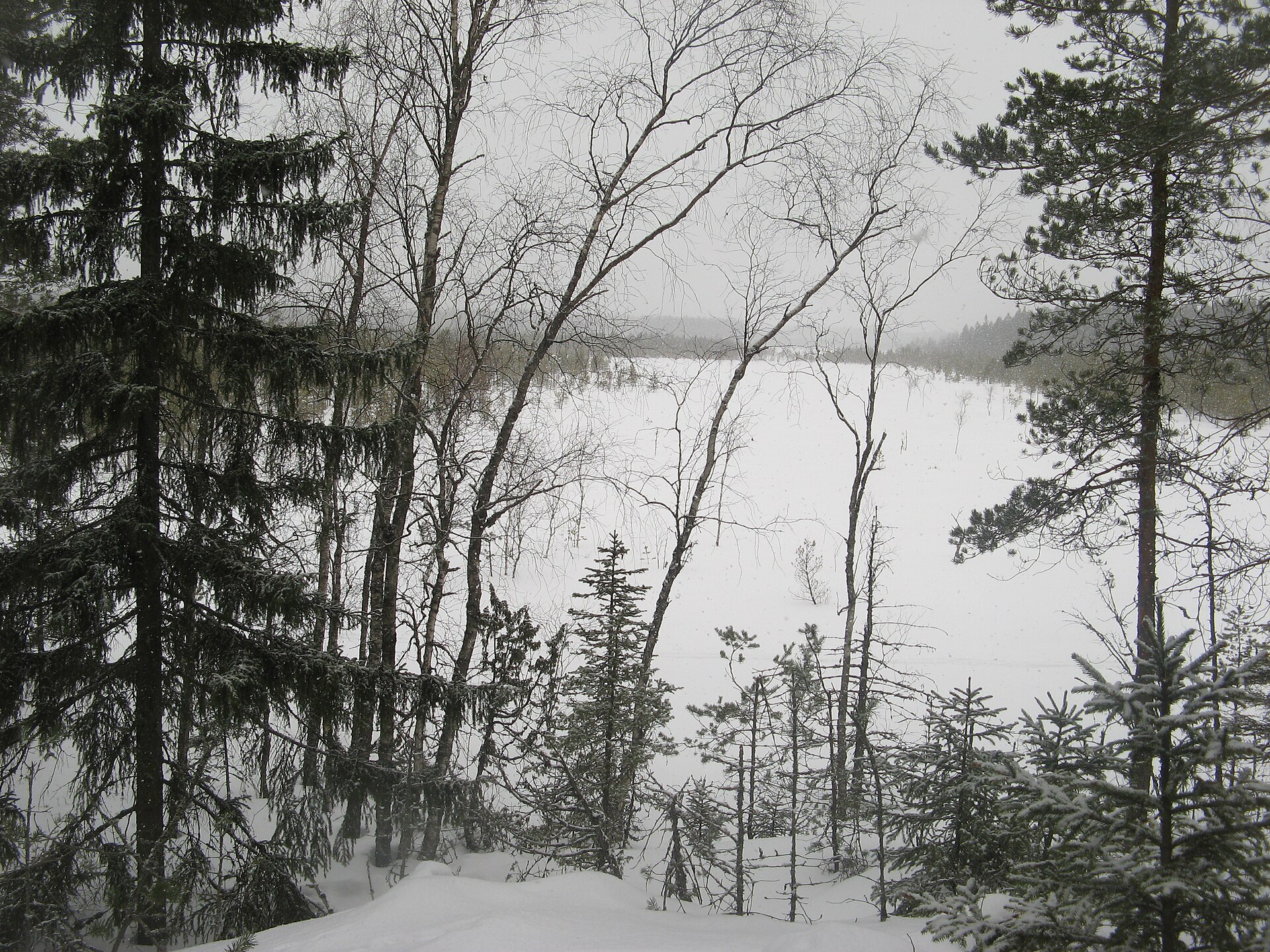
A terrestrial area, with forests and wetlands.
What rocks lie beneath Kurjenrahka National Park?
According to the European 1:1 million geological map (EGDI), the bedrock consists mainly of peat (69% of sampled points) and glacial deposits (19%). These are mostly sedimentary rocks. The geological units date mainly from the Quaternary (94% of sampled points).
Which international labels apply to Kurjenrahka National Park?
Natura 2000 network (1 site: “Kurjenrahka”).
When is the best time to visit Kurjenrahka National Park?
Mildest period: July and August, with average temperatures of 16 to 18 °C.
Is there snow in Kurjenrahka National Park?
Yes. According to NASA's MODIS satellites (2015–2025 average), snow covers most of the site from November to March, with about 135 snow-covered days a year on average.
What is there to see in Kurjenrahka National Park?
2 lakes and ponds, including Savojärvi (68 m) and Lakjärvi (74 m) (Wikidata).
What is the nearest large city to Kurjenrahka National Park?
Nearest towns of over 50,000 people, as the crow flies: Turku (25 km) and Pori (86 km). Nearest airport: Turku (TKU), about 19 km away.
How can I reach Kurjenrahka National Park by train?
The nearest railway station is Turku, about 25 km from the site boundary.
Are there waymarked hiking trails in Kurjenrahka National Park?
Yes. Waymarked hiking routes listed in OpenStreetMap: 9, including E 6 and Kuhankuonon retkeilyreitistö. The “Kuhankuonon retkeilyreitistö” route runs for about 10 km through the site.
Which species can be seen in Kurjenrahka National Park?
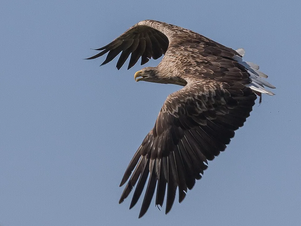
Among the species most often recorded on GBIF are Haliaeetus albicilla (White-tailed Eagle), Parus major (Great tit), Fringilla coelebs (Eurasian Chaffinch) and Corvus corax (Northern Raven).
Who manages Kurjenrahka National Park?
Metsähallitus.
What is the official website of Kurjenrahka National Park?
© OpenStreetMap
Download the boundary: GeoJSON · GPX Boundary © OpenStreetMap contributors (ODbL).
Geography
The representative point of the site lies at around 88 m above sea level. Over the 1996–2025 period, the mean annual temperature is about 5.7 °C and total precipitation reaches roughly 715 mm per year. The warmest month is usually July, the coolest February, and the wettest July. According to the European 1:1 million geological map (EGDI), the bedrock consists mainly of peat (69% of sampled points) and glacial deposits (19%). These are mostly sedimentary rocks. The geological units date mainly from the Quaternary (94% of sampled points). The site contains one lake larger than 10 ha (Savojärvi), totalling 85 ha of water (HydroLAKES).
Area
- Area
- 3,100 ha
- Elevation
- 88 m
- Snow cover
- ≈ 135 days a year
- Lakes over 10 ha
- 1 (85 ha)
- Coordinates
- 60.7206, 22.3836
Lakes: HydroLAKES (Messager et al. 2016, hydrosheds.org, CC BY 4.0) · depths: Wikidata (CC0)
Bedrock
- Peat 69 %
- Glacial deposits 19 %
- Basalts 6 %
- Clays and silts 6 %
Sedimentary rocks 94 % · Igneous rocks 6 % · Main age: Quaternary (94%)
Source: EGDI 1:1M geological map (EuroGeoSurveys and national geological surveys), CC BY 4.0 · 16 sampled points within the site.
Climate
● Mean temperature (°C) · ▮ Precipitation (mm)
Source: Copernicus ERA5-Land (C3S, doi:10.24381/cds.68d2bb30), monthly averages 1996–2025 interpolated to the representative point, temperatures adjusted for elevation.
Contains modified Copernicus Climate Change Service information 2026. Neither the European Commission nor ECMWF is responsible for any use that may be made of the Copernicus information or data it contains.
Snow cover measured by satellite
J
F
M
A
M
J
J
A
S
O
N
D
average share of the site under snow · snowiest parts · ≈ 135 days a year
Snow cover: MODIS/Terra MOD10CM v61 (Hall & Riggs, 2021, NASA NSIDC DAAC, doi:10.5067/MODIS/MOD10CM.061), imagery from NASA GIBS (ESDIS); 2015–2025 average, grid of about 5 km.
Natural habitats
According to CORINE Land Cover (2018), the site is mainly made up of forests (60%) and marshes and bogs (35%). Woodland is mostly coniferous. The Natura 2000 site overlapping the area lists 8 habitats of European interest (3 priority), the most extensive being active raised bogs, bog woodland and western Taïga.
Biodiversity
Based on occurrences aggregated by GBIF, several species are regularly recorded within the site. Among the most frequent are Haliaeetus albicilla (White-tailed Eagle), Parus major (Great tit), Fringilla coelebs (Eurasian Chaffinch) and Corvus corax (Northern Raven). The full list of documented taxa is shown below. The overlapping Natura 2000 site lists 2 species of European interest: 1 mammal and 1 plant.
Habitats of European interest
From the official form of the Natura 2000 site overlapping the area (areas reported for the whole site).
- Active raised bogs priority 2,170 ha
- Bog woodland priority 795 ha
- Western Taïga priority 135 ha
- Natural dystrophic lakes and ponds 88 ha
- Siliceous rocky slopes with chasmophytic vegetation 30 ha
- Transition mires and quaking bogs 2 ha
- Water courses of plain to montane levels with the Ranunculion fluitantis and Callitricho-Batrachion vegetation 0 ha
- Fennoscandian herb-rich forests with Picea abies 0 ha
Species of European interest
Mammals · 1
Plants · 1
Herzodiella moss (Herzogiella turfacea)
Source: Natura 2000 standard data forms (EEA, CC-BY 4.0). Not exhaustive: sensitive species are not published.
Species to look out for



Observed species
Occurrences documented via GBIF; they are neither an exhaustive inventory nor proof of current presence.
- White-tailed Eagle · Haliaeetus albicilla · 436
- Great tit · Parus major · 235
- Eurasian Chaffinch · Fringilla coelebs · 148
- Northern Raven · Corvus corax · 121
- Common Blackbird · Turdus merula · 115
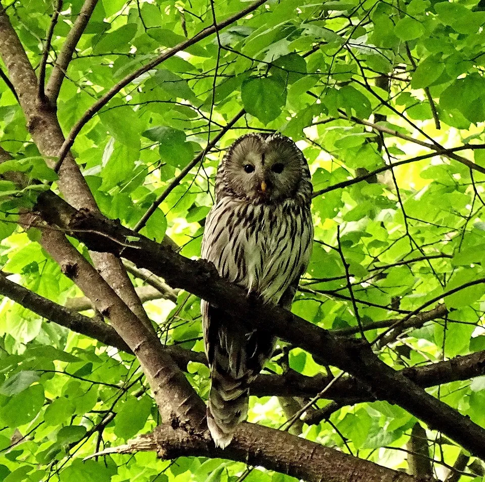
- Ural Owl · Strix uralensis · 111
- European robin · Erithacus rubecula · 106
- Eurasian Siskin · Spinus spinus · 106
- European Crested Tit · Lophophanes cristatus · 99
- Tree Pipit · Anthus trivialis · 97
- Eurasian Pygmy Owlet · Glaucidium passerinum · 96
- Goldcrest · Regulus regulus · 95
Records: GBIF.org (CC-BY). Names: Wikidata (CC0), GBIF. Photos: Wikimedia Commons.
Conservation challenges
The primary purpose of the site is to preserve its natural habitats and the biodiversity they support. The species recorded (Biodiversity tab) reflect its ecological value. The designations it holds frame its management and the control of land use.
According to Global Forest Change data (University of Maryland, Global Forest Watch), about 63 ha of tree cover were lost within the boundary between 2001 and 2023 (2% of its area), peaking in 2020 and 2021. These losses include logging, storms and fires, and do not account for regrowth. According to CORINE Land Cover, land cover here remained almost unchanged between 2000 and 2018 (less than 0.5% of the area affected). At night, the area gives off virtually no artificial light detectable from space (NASA VIIRS Black Marble composite, 2016). According to the Natura 2000 forms, of 8 assessed habitats of European interest, 1 is in excellent condition and the rest in good condition.
Pressure indicators
Tree cover lost
63 ha
2001–2023 · 2% of the area
20012023
Fires since 2016
0
No large fire mapped (fires over about 30 ha)
Light at night
0%
of the area gives off artificial light visible from space
DarkLit
Land cover change
< 0.5%
of the area changed, 2000–2018 · CORINE
Sources: Global Forest Change (Hansen et al., University of Maryland, via Global Forest Watch, CC-BY 4.0); EFFIS, European Commission / Copernicus; NASA Black Marble 2016 (public domain); CORINE Land Cover 2018 (Copernicus) or MODIS.
CORINE Land Cover Change 2000–2018: generated using European Union's Copernicus Land Monitoring Service information (EEA), aggregated by Parkavela; DOI 10.2909/f30f1000-7cf8-43bb-872c-5eb093911b24.
Practical information
Cities and airport
- Turku
25 km as the crow flies - Pori
86 km as the crow flies - Airport: Turku (TKU)
19 km as the crow flies
Parking
3 public car parks listed within the site
Hiking
9 waymarked routes listed, including:
E 6Kuhankuonon retkeilyreitistö
Wheelchair access
- Vajosuon vaellus
path
accessible toilets: 1
Reported by OpenStreetMap contributors (ODbL); check with the park before visiting.
Data © OpenStreetMap contributors (ODbL) · Wikidata (CC0)
Waymarked hiking routes
E6 Euroopan vapaareititetty digitaalinen kävelyreitti E6, Suomi
7.5 km within the site ↗ 51 m↘ 25 m 66–102 m
Tracks © OpenStreetMap contributors (ODbL), clipped to the boundary; elevation gain and profiles computed on the longest section from Mapzen Terrain Tiles (≈ 30 m), indicative only.
Access and visiting
The nearest railway station is Turku, about 25 km from the site boundary. Nearest towns of over 50,000 people, as the crow flies: Turku (25 km) and Pori (86 km). Nearest airport: Turku (TKU), about 19 km away. About 54,000 people live within 20 km of the site boundary, 8,800 of them within 10 km; the site itself is virtually uninhabited (GHSL estimate, 2020). This population has grown by about 14% since 2000. Public car parks listed within the site: 3. Waymarked hiking routes listed in OpenStreetMap: 9, including E 6 and Kuhankuonon retkeilyreitistö. OpenStreetMap contributors list one wheelchair-accessible place: Vajosuon vaellus; check with the park before visiting. To see: 2 lakes and ponds, including Savojärvi (68 m) and Lakjärvi (74 m). To plan a visit (access, opening periods, visitor rules), it is best to consult the official information from the managing body (Metsähallitus) and the official website listed in this page's sources.
Source: OpenStreetMap (ODbL), Wikidata (CC0), October 2026.
When to visit
Mildest period: July and August, with average temperatures of 16 to 18 °C. Average temperatures drop below 0 °C from December to March: frost is common. According to NASA's MODIS satellites (2015–2025 average), snow covers most of the site from November to March, with about 135 snow-covered days a year on average. Day length ranges from about 5 h 40 min in December to 19 h 06 min in June. Wildlife records published on GBIF peak for birds (June), plants (June) and butterflies and moths (May). These peaks also reflect when observers are most active.
Source: Copernicus ERA5-Land (C3S), monthly averages 1996–2025 at the representative point, temperatures adjusted for elevation.
Contains modified Copernicus Climate Change Service information 2026. Neither the European Commission nor ECMWF is responsible for any use that may be made of the Copernicus information or data it contains.
Wildlife records calendar
JFMAMJJASOND
Birds
Plants
Butterflies & moths
Monthly records published on GBIF (CC-BY), relative to the busiest month; also reflects observer activity.
Gallery
© Användare LPfi på Wikipedia · CC BY-SA 3.0
© J. Albert Vallunen (Albval) · CC BY-SA 3.0
© Användare LPfi på Wikipedia · CC BY-SA 3.0
© LPfi · CC BY-SA 3.0
© LPfi · CC BY-SA 4.0
© Makele-90 · CC BY-SA 3.0
Sources and licences
- Wikidata: Q2398213
- OpenStreetMap: relation 7041437
- Official website: https://www.luontoon.fi/kurjenrahka
- Wikipedia: en.wikipedia.org/wiki/Kurjenrahka_National_Park
- WDPA: 175210
References
- cds.climate.copernicus.eu: climate · CC-BY-4.0
- registry.opendata.aws: elevation of the reference point · PD
- land.copernicus.eu: land cover, land cover change, sea share · COPERNICUS
- doi.org: population around the site · CC-BY-4.0
- wikidata.org: official area, establishment date, protected heritage, managing body, official name, nearby cities and airport, access and peaks, lake depths, places to see, official website · CC0-1.0
- eea.europa.eu: bathing water quality · CC-BY-4.0
- en.eurovelo.com: EuroVelo cycle routes · ODbL-1.0
- cycling.waymarkedtrails.org: cycle routes · ODbL-1.0
- opentopodata.org: elevations · CC-BY-4.0
- forest-fire.emergency.copernicus.eu: wildfires · COPERNICUS
- globalforestwatch.org: tree cover loss · CC-BY-4.0
- gbif.org: seasonality of sightings, invasive alien species, observed species · CC-BY-4.0
- europe-geology.eu: geology · CC-BY-4.0
- hydrosheds.org: lakes · CC-BY-4.0
- natura2000.eea.europa.eu: Natura 2000 habitats and species · CC-BY-4.0
- earthobservatory.nasa.gov: night light · PD
- openstreetmap.org: access and peaks, trail difficulty, wheelchair access · ODbL-1.0
- registry.opendata.aws: detailed relief · CC-BY-4.0
- hiking.waymarkedtrails.org: route difficulty · ODbL-1.0
- nsidc.org: snow cover · PD
- wikidata.org: Wikipedia article · CC-BY-SA-4.0
Data © OpenStreetMap contributors (ODbL), Wikidata (CC0) and the sources cited.


