Finland · Marine
Bothnian Sea National Park
National park of 91,573 hectares in Finland, established in 2011.
Overview
National park of 91,573 hectares in Finland, established in 2011.
Bothnian Sea National Park is located in Finland (Europe). It is a predominantly marine area. Established in 2011, it covers about 91,573 hectares. The site is managed by Metsähallitus.
Protections and designations
Natura 2000 · habitats (SAC) · 7 sites
- Gummandooran saaristo FI0200075
- Katanpää FI0200172
- Luvian saaristo FI0200074
- Pooskerin saaristo FI0200076
- Preiviikinlahti FI0200080
- Rauman saaristo FI0200073
- and 1 more
Natura 2000 · birds (SPA) · 5 sites
- Gummandooran saaristo FI0200075
- Luvian saaristo FI0200074
- Pooskerin saaristo FI0200076
- Preiviikinlahti (SPA) FI0200151
- Uudenkaupungin saaristo FI0200072
Protected as a national park. International labels and designations: Natura 2000 network (8 sites). Key dates: first Natura 2000 site under the Birds Directive in 1998 and established in 2011.
In our collections
Timeline
-
1998
First Natura 2000 site under the Birds Directive 5 such sites designated up to 2005
-
2011
Established
Sources: Wikidata (CC0) for establishment and international labels; EEA Natura 2000 database (CC-BY 4.0) for site designation dates.
Frequently asked questions
Where is Bothnian Sea National Park?
In Finland (Europe). Representative point: 60.9790° N, 21.0986° E.
How large is Bothnian Sea National Park?
About 91,573 hectares (916 km²). It is the 5th largest of the 41 national parks in Finland covered by Parkavela.
When was Bothnian Sea National Park established?
In 2011.
What habitats and landscapes does Bothnian Sea National Park include?
A marine area.
Which international labels apply to Bothnian Sea National Park?
Natura 2000 network (8 sites).
When is the best time to visit Bothnian Sea National Park?
Best time to visit: from June to August, with average temperatures of 12 to 17 °C and moderate rainfall.
Are there historic monuments in Bothnian Sea National Park?
Yes. According to Wikidata, 4 monuments protected under the Finnish Built Heritage Act or listed in the inventory of built cultural environments of national significance (RKY) stand within the boundary. For example: “Katanpää Fortress” in Kustavi, “Isokari lighthouse” in Kustavi and “Santakarin pooki” in Rauma.
What is the nearest large city to Bothnian Sea National Park?
Nearest towns of over 50,000 people, as the crow flies: Pori (9 km) and Turku (60 km). Nearest airport: Turku (TKU), about 58 km away.
How can I reach Bothnian Sea National Park by train?
The nearest railway station is Pori, about 9 km from the site boundary.
Which species can be seen in Bothnian Sea National Park?
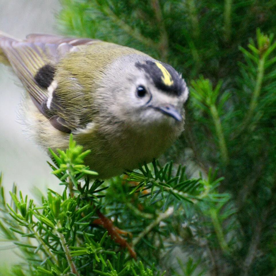
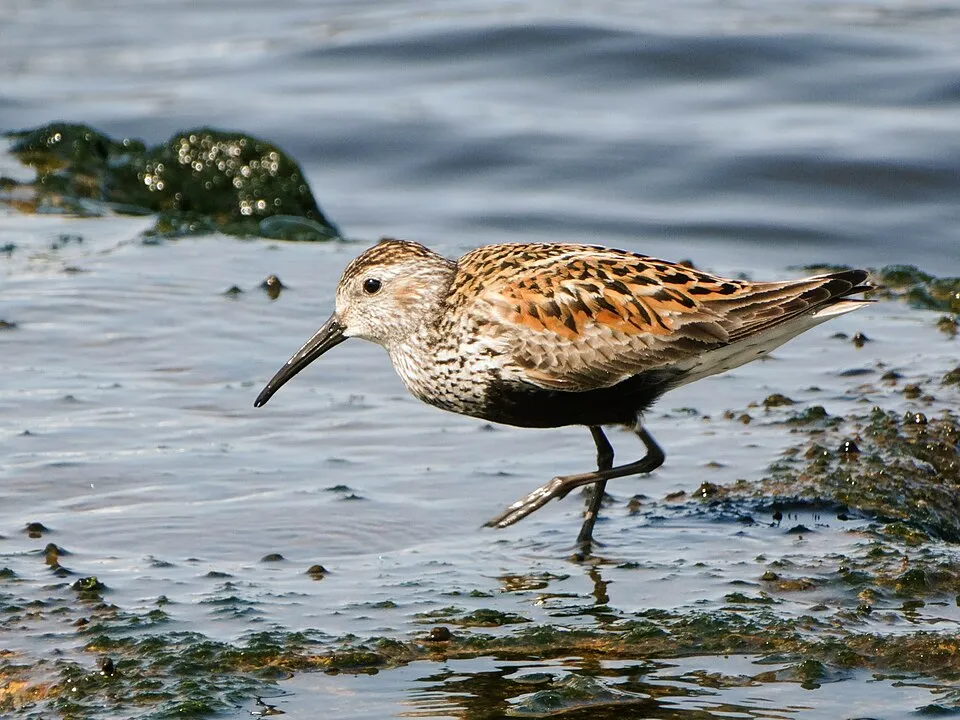
Among the species most often recorded on GBIF are Regulus regulus (Goldcrest), Erithacus rubecula (European robin), Acanthis flammea (Redpoll) and Calidris alpina (Dunlin).
Who manages Bothnian Sea National Park?
Metsähallitus.
What is the official website of Bothnian Sea National Park?
© OpenStreetMap
Download the boundary: GeoJSON · GPX Boundary © OpenStreetMap contributors (ODbL).
Geography
Over the 1996–2025 period, the mean annual temperature is about 6.5 °C and total precipitation reaches roughly 704 mm per year. The warmest month is usually August, the coolest February, and the wettest September.
Area
- Area
- 91,573 ha
- Coordinates
- 60.979, 21.0986
Climate
● Mean temperature (°C) · ▮ Precipitation (mm)
Source: Copernicus ERA5 (C3S, doi:10.24381/cds.f17050d7), monthly averages 1996–2025 interpolated to the representative point, temperatures adjusted for elevation.
Contains modified Copernicus Climate Change Service information 2026. Neither the European Commission nor ECMWF is responsible for any use that may be made of the Copernicus information or data it contains.
Natural habitats
The site is almost entirely marine. The seabed reaches about 31 m deep (median depth 13 m; GEBCO bathymetry). The 8 Natura 2000 sites overlapping the area list 34 habitats of European interest (10 priority), the most extensive being reefs, large shallow inlets and bays and Boreal Baltic islets and small islands.
Biodiversity
Based on occurrences aggregated by GBIF, several species are regularly recorded within the site. Among the most frequent are Regulus regulus (Goldcrest), Erithacus rubecula (European robin), Acanthis flammea (Redpoll) and Calidris alpina (Dunlin). The full list of documented taxa is shown below. The overlapping Natura 2000 sites list 83 species of European interest: 74 birds, 6 mammals, 2 invertebrates and 1 plant.
Habitats of European interest
From the official forms of the 8 Natura 2000 sites overlapping the area (areas reported for each whole site).
- Reefs 3,664 ha
- Large shallow inlets and bays 3,330 ha
- Boreal Baltic islets and small islands 855 ha
- Western Taïga priority 733 ha
- Coastal lagoons priority 482 ha
- Natural forests of primary succession stages of landupheaval coast priority 247 ha
- Vegetated sea cliffs of the Atlantic and Baltic Coasts 229 ha
- Sandbanks which are slightly covered by sea water all the time 220 ha
and 26 more
Species of European interest
Birds · 74
Great Reed Warbler (Acrocephalus arundinaceus) breeding, Razorbill (Alca torda) breeding passage, Northern Pintail (Anas acuta) passage breeding, Taiga bean goose (Anser fabalis) passage, Red-throated Pipit (Anthus cervinus) passage, Grey Heron (Ardea cinerea) passage breeding, Ruddy Turnstone (Arenaria interpres) breeding, Short-eared Owl (Asio flammeus) passage, Common Pochard (Aythya ferina) breeding passage, Tufted Duck (Aythya fuligula) passage breeding, Greater Scaup (Aythya marila) breeding passage, Hazel Grouse (Bonasa bonasia) resident and 62 more
Mammals · 6
Northern Bat (Eptesicus nilssonii), Grey Seal (Halichoerus grypus), Eurasian otter (Lutra lutra), Daubenton's bat (Myotis daubentonii), Siberian Flying Squirrel (Pteromys volans), Baltic Ringed Seal (Pusa hispida botnica)
Invertebrates · 2
Lilypad whiteface (Leucorrhinia caudalis), Yellow-spotted Whiteface (Leucorrhinia pectoralis)
Plants · 1
Fourleaf mare's-tail (Hippuris tetraphylla)
Source: Natura 2000 standard data forms (EEA, CC-BY 4.0). Not exhaustive: sensitive species are not published.
Species to look out for



Observed species
Occurrences documented via GBIF; they are neither an exhaustive inventory nor proof of current presence.
- Goldcrest · Regulus regulus · 112392
- European robin · Erithacus rubecula · 22658
- Redpoll · Acanthis flammea · 15315
- Dunlin · Calidris alpina · 13845
- Great tit · Parus major · 13292
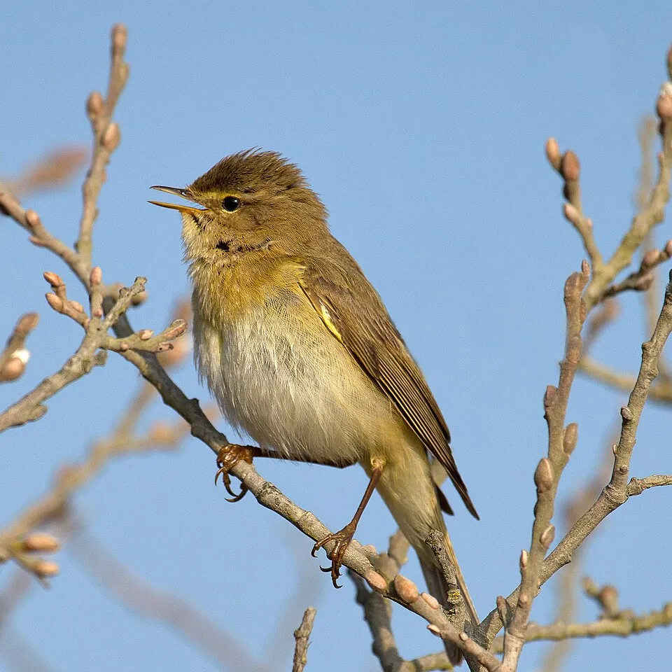
- Willow Warbler · Phylloscopus trochilus · 12837
- Long-tailed Tit · Aegithalos caudatus · 10709
- Eurasian Treecreeper · Certhia familiaris · 9765
- Foolish mussel · Mytilus trossulus · 7659
- Redwing · Turdus iliacus · 6306
- Eurasian Chaffinch · Fringilla coelebs · 6241
- Bay barnacle · Amphibalanus improvisus · 5881
Records: GBIF.org (CC-BY). Names: Wikidata (CC0), GBIF. Photos: Wikimedia Commons.
Conservation challenges
The primary purpose of the site is to preserve its natural habitats and the biodiversity they support. The species recorded (Biodiversity tab) reflect its ecological value. The designations it holds frame its management and the control of land use.
According to the European CORINE Land Cover inventory (Copernicus), land cover changed on about 43 ha of the site between 2000 and 2018 (3% of its area): farmland grew by 43 ha, mostly at the expense of wetlands, while wetlands shrank by 43 ha, mostly giving way to farmland. According to the Natura 2000 forms, of 34 assessed habitats of European interest, 16 are in excellent condition and 1 in average or reduced condition. Invasive alien species have been recorded within the site since 2000 (GBIF observations), several of them listed as of Union concern. Among them: Eriocheir sinensis (Chinese mitten crab), Impatiens glandulifera (Himalayan Balsam) and Heracleum mantegazzianum (Giant Hogweed).
Pressure indicators
Land cover change
43 ha
changed cover, 2000–2018 · CORINE · 3% of the area
- +43 ha · farmland
- −43 ha · wetlands
Invasive alien species
4
incl. 4 of EU concern · since 2000
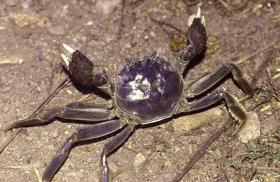 Chinese mitten crabEU
 Himalayan Balsam
 Giant Hogweed
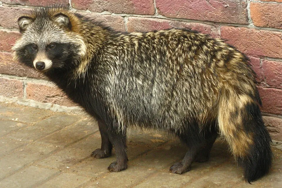 Raccoon Dog
Photos: Chinese mitten crab © Christian Fischer · CC BY-SA 3.0; Himalayan Balsam © Guptaele · CC BY-SA 4.0; Giant Hogweed © anastasiiamerkulova · CC BY 4.0; Raccoon Dog © Доктор рукиноги · CC BY-SA 3.0
Sources: Global Forest Change (Hansen et al., University of Maryland, via Global Forest Watch, CC-BY 4.0); EFFIS, European Commission / Copernicus; NASA Black Marble 2016 (public domain); CORINE Land Cover 2018 (Copernicus) or MODIS.
CORINE Land Cover Change 2000–2018: generated using European Union's Copernicus Land Monitoring Service information (EEA), aggregated by Parkavela; DOI 10.2909/f30f1000-7cf8-43bb-872c-5eb093911b24.
Invasive alien species: Global Register of Introduced and Invasive Species (ISSG, CC BY 4.0); Union list, Regulation (EU) 1143/2014 (INBO, CC0); GBIF.org records (CC0 / CC BY 4.0), at least 2 per species.
Practical information
Cities and airport
- Pori
9 km as the crow flies - Turku
60 km as the crow flies - Airport: Turku (TKU)
58 km as the crow flies
Wheelchair access
- Langoura
bird hide - Reitti Satakunta
path
Reported by OpenStreetMap contributors (ODbL); check with the park before visiting.
Data © OpenStreetMap contributors (ODbL) · Wikidata (CC0)
Waymarked hiking routes
Tracks © OpenStreetMap contributors (ODbL), clipped to the boundary; elevation gain and profiles computed on the longest section from Mapzen Terrain Tiles (≈ 30 m), indicative only.
Access and visiting
The nearest railway station is Pori, about 9 km from the site boundary. Nearest towns of over 50,000 people, as the crow flies: Pori (9 km) and Turku (60 km). Nearest airport: Turku (TKU), about 58 km away. About 160,000 people live within 20 km of the site boundary, 110,000 of them within 10 km (GHSL estimate, 2020). OpenStreetMap contributors list 2 wheelchair-accessible places: Langoura and Reitti Satakunta; check with the park before visiting. To plan a visit (access, opening periods, visitor rules), it is best to consult the official information from the managing body (Metsähallitus) and the official website listed in this page's sources.
Source: OpenStreetMap (ODbL), Wikidata (CC0), October 2026.
Built heritage
According to Wikidata, 4 monuments protected under the Finnish Built Heritage Act or listed in the inventory of built cultural environments of national significance (RKY) stand within the boundary. Examples include “Katanpää Fortress” in Kustavi, “Isokari lighthouse” in Kustavi and “Santakarin pooki” in Rauma.
2 bridges, lighthouses, mills and working buildings1 castle or fortification
-
Katanpää Fortress
Kustavi -
Isokari lighthouse
Kustavi · 19th c. -
Santakarin pooki
Rauma -
Säppi lighthouse
Eurajoki · 19th c.
Source: Wikidata (CC0), monuments in each country’s official heritage protection registers, at national or regional level. Each item links to its Wikidata entry.
When to visit
Best time to visit: from June to August, with average temperatures of 12 to 17 °C and moderate rainfall. Average temperatures drop below 0 °C from January to March: expect snow and frost. Day length ranges from about 5 h 35 min in December to 19 h 12 min in June. Wildlife records published on GBIF peak for birds (May), plants (July and August), butterflies and moths (from June to August) and dragonflies (September). These peaks also reflect when observers are most active.
Source: Copernicus ERA5 (C3S), monthly averages 1996–2025 at the representative point, temperatures adjusted for elevation.
Contains modified Copernicus Climate Change Service information 2026. Neither the European Commission nor ECMWF is responsible for any use that may be made of the Copernicus information or data it contains.
Wildlife records calendar
JFMAMJJASOND
Birds
Plants
Butterflies & moths
Dragonflies
Monthly records published on GBIF (CC-BY), relative to the busiest month; also reflects observer activity.
Gallery
© kallerna · CC BY-SA 3.0
© MPorciusCato · CC BY-SA 3.0
© Chino · Public domain
© Urjanhai · CC BY-SA 4.0
© kallerna · CC BY-SA 3.0
© Santtu37 · CC BY-SA 4.0
Sources and licences
- Wikidata: Q4948647
- OpenStreetMap: relation 7036414
- Official website: https://www.luontoon.fi/fi/kohteet/selkameren-kansallispuisto
- Wikipedia: en.wikipedia.org/wiki/Bothnian_Sea_National_Park
- WDPA: 555550497
References
- cds.climate.copernicus.eu: climate · CC-BY-4.0
- registry.opendata.aws: elevation of the reference point · PD
- land.copernicus.eu: land cover, land cover change, sea share · COPERNICUS
- doi.org: population around the site · CC-BY-4.0
- wikidata.org: official area, establishment date, protected heritage, managing body, nearby cities and airport, access and peaks, places to see, official website · CC0-1.0
- eea.europa.eu: bathing water quality · CC-BY-4.0
- gebco.net: depths · PD
- gbif.org: seasonality of sightings, invasive alien species, observed species · CC-BY-4.0
- natura2000.eea.europa.eu: Natura 2000 habitats and species · CC-BY-4.0
- openstreetmap.org: official name, access and peaks, trail difficulty, wheelchair access · ODbL-1.0
- hiking.waymarkedtrails.org: route difficulty · ODbL-1.0
- wikidata.org: Wikipedia article · CC-BY-SA-4.0
Data © OpenStreetMap contributors (ODbL), Wikidata (CC0) and the sources cited.