Argentina · Terrestrial
Mburucuyá National Park
National park of 17,660 hectares in Argentina.
Overview
National park of 17,660 hectares in Argentina.
Mburucuyá National Park is located in Argentina (South America). It is a predominantly terrestrial area. It covers about 17,660 hectares.
In our collections
Frequently asked questions
Where is Mburucuyá National Park?
In Argentina (South America). Representative point: 28.0130° S, 58.0693° W.
How large is Mburucuyá National Park?
About 17,660 hectares (177 km²). It is the 29th largest of the 37 national parks in Argentina covered by Parkavela.
What habitats and landscapes does Mburucuyá National Park include?
A terrestrial area, where land cover is dominated by grassland and meadows (89%).
When is the best time to visit Mburucuyá National Park?
Best time to visit: from March to November, with average temperatures of 15 to 25 °C and moderate rainfall.
What is the nearest large city to Mburucuyá National Park?
Nearest towns of over 50,000 people, as the crow flies: Corrientes (86 km) and Barranqueras (96 km). Nearest airport: Doctor Fernando Piragine Niveyro (CNQ), about 85 km away.
Where can I get visitor information on site?
Guardaparques.
Which species can be seen in Mburucuyá National Park?
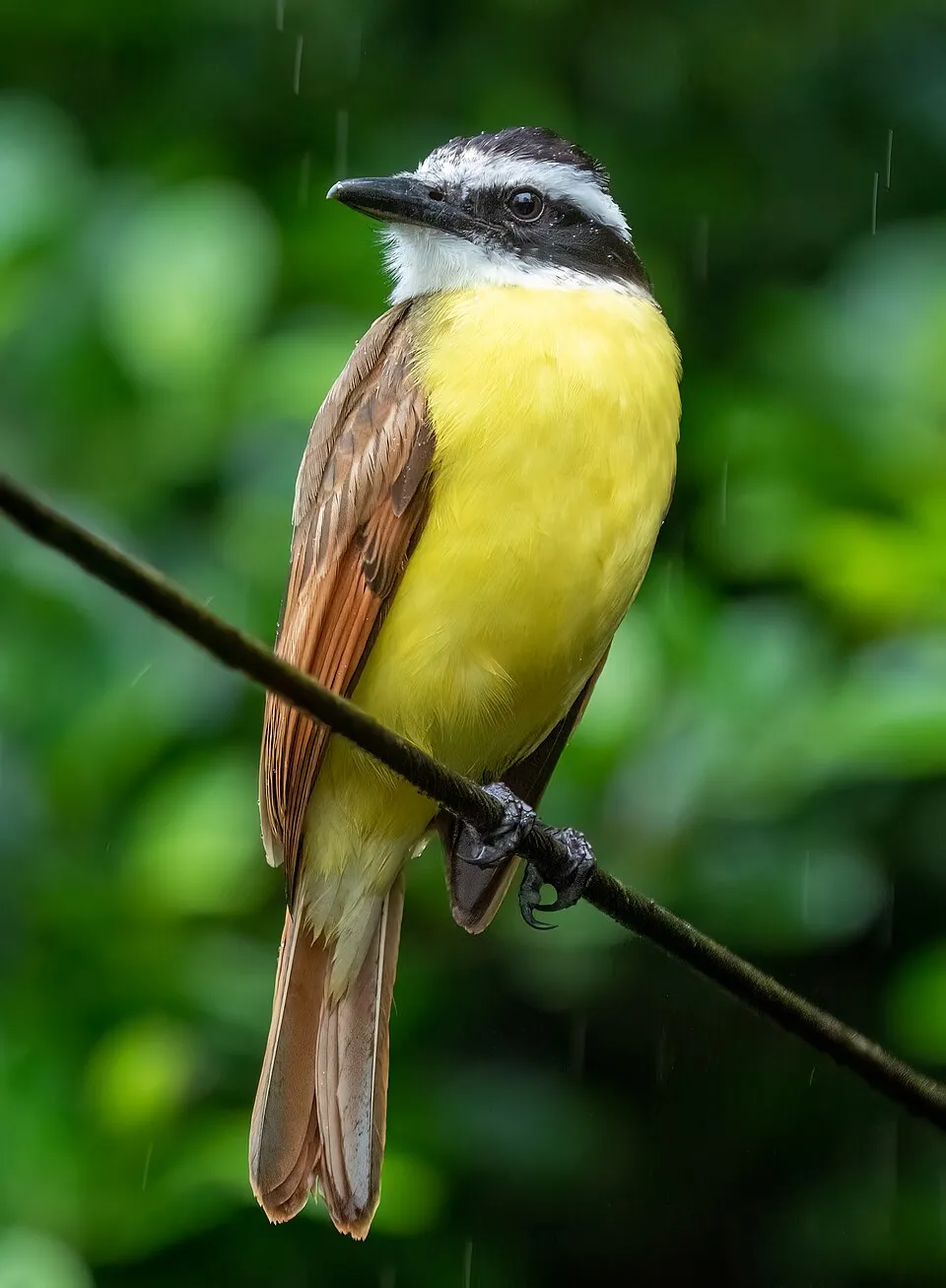
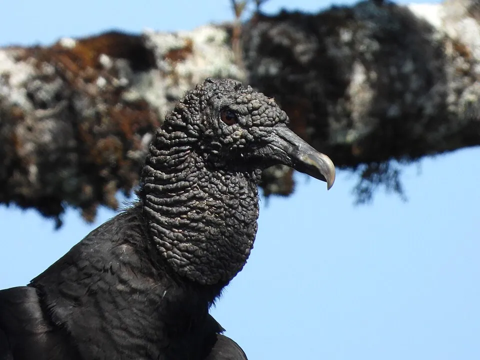
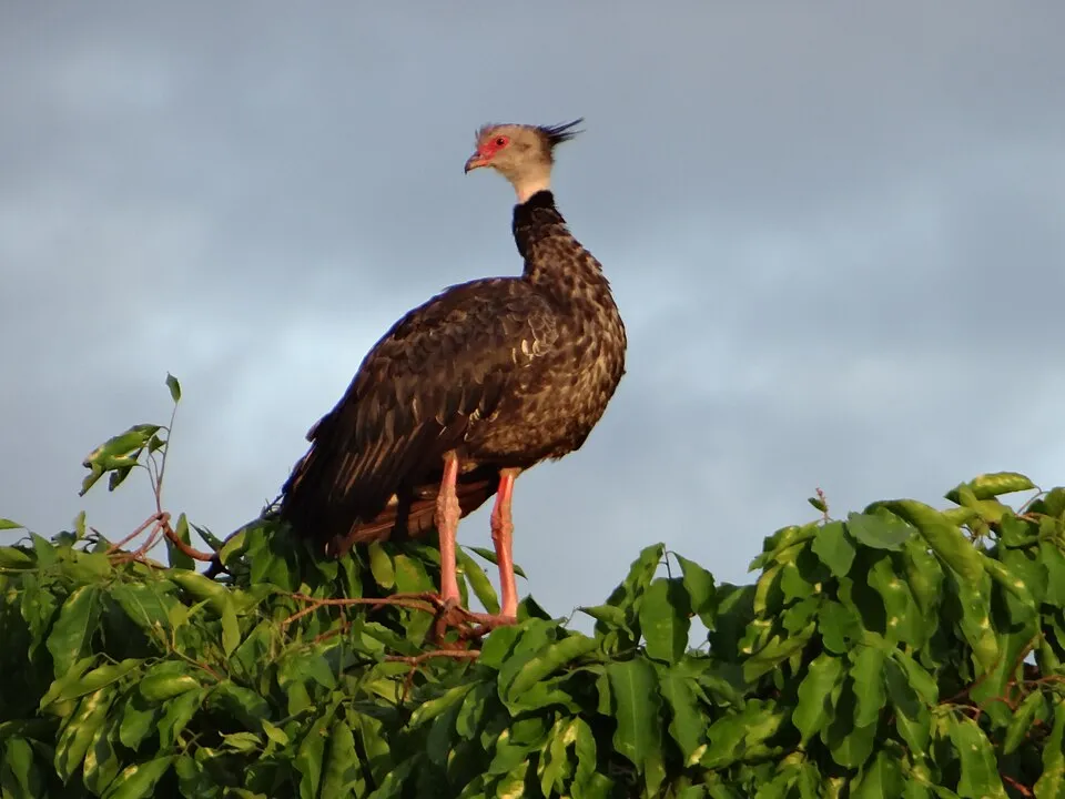
Among the species most often recorded on GBIF are Pitangus sulphuratus (Great Kiskadee), Coragyps atratus (Black Vulture), Vanellus chilensis (Southern Lapwing) and Chauna torquata (Southern Screamer).
What is the official website of Mburucuyá National Park?
parquesnacionales.gov.ar/03_ap/25_mburucuya_PN/_mburucuya_PN.htm
© OpenStreetMap
Download the boundary: GeoJSON · GPX Boundary © OpenStreetMap contributors (ODbL).
Geography
The representative point of the site lies at around 70 m above sea level. Over the 1996–2025 period, the mean annual temperature is about 21.4 °C and total precipitation reaches roughly 1,528 mm per year. The warmest month is usually January, the coolest July, and the wettest October.
Area
- Area
- 17,660 ha
- Elevation
- 70 m
- Coordinates
- -28.013, -58.0693
Climate
● Mean temperature (°C) · ▮ Precipitation (mm)
Source: Copernicus ERA5-Land (C3S, doi:10.24381/cds.68d2bb30), monthly averages 1996–2025 interpolated to the representative point, temperatures adjusted for elevation.
Contains modified Copernicus Climate Change Service information 2026. Neither the European Commission nor ECMWF is responsible for any use that may be made of the Copernicus information or data it contains.
Natural habitats
According to the global MODIS land cover (NASA, 2024), the site is mainly made up of grassland and meadows (89%) and forests (11%). The land is almost flat (mean slope under 2°).
Biodiversity
Based on occurrences aggregated by GBIF, several species are regularly recorded within the site. Among the most frequent are Pitangus sulphuratus (Great Kiskadee), Coragyps atratus (Black Vulture), Vanellus chilensis (Southern Lapwing) and Chauna torquata (Southern Screamer). The full list of documented taxa is shown below.
Species to look out for


Mammal
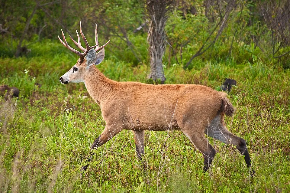
Marsh deer
Blastocerus dichotomus259 records © Phillip Capper from Wellington, New Zealand · CC BY 2.0
Observed species
Occurrences documented via GBIF; they are neither an exhaustive inventory nor proof of current presence.
- Great Kiskadee · Pitangus sulphuratus · 304
- Black Vulture · Coragyps atratus · 278
- Southern Lapwing · Vanellus chilensis · 272
- Southern Screamer · Chauna torquata · 269
- Wattled Jacana · Jacana jacana · 263
- Marsh deer · Blastocerus dichotomus · 259
- Creamy-bellied Thrush · Turdus amaurochalinus · 245
- Rufous-bellied Thrush · Turdus rufiventris · 243
- Rufous Hornero · Furnarius rufus · 241
- Guira Cuckoo · Guira guira · 230
- Rufous-collared Sparrow · Zonotrichia capensis · 228
- Sayaca Tanager · Thraupis sayaca · 226
+18 more species
- Red-crested Cardinal · Paroaria coronata · 225
- Giant Wood Rail · Aramides ypecaha · 223
- Picazuro Pigeon · Patagioenas picazuro · 223
- Greater rhea · Rhea americana · 218
- Greyish Saltator · Saltator coerulescens · 217
- White-lined Tanager · Tachyphonus rufus · 206
- Cattle Tyrant · Machetornis rixosa · 204
- White-tipped Dove · Leptotila verreauxi · 200
- White-eyed Parakeet · Aratinga leucophthalma · 198
- Great Egret · Ardea alba · 186
- Green-barred Woodpecker · Colaptes melanochloros · 179
- Rufous-browed Peppershrike · Cyclarhis gujanensis · 173
- Southern House Wren · Troglodytes musculus · 170
- Narrow-billed Woodcreeper · Lepidocolaptes angustirostris · 166
- Whistling Heron · Syrigma sibilatrix · 162
- White Monjita · Xolmis irupero · 161
- Chopi Blackbird · Gnorimopsar chopi · 161
- Crested Caracara · Caracara plancus · 158
Records: GBIF.org (CC-BY). Names: Wikidata (CC0), GBIF. Photos: Wikimedia Commons.
Conservation challenges
The primary purpose of the site is to preserve its natural habitats and the biodiversity they support. The species recorded (Biodiversity tab) reflect its ecological value. Its status as a national park sets the regulatory framework for its protection.
According to Global Forest Change data (University of Maryland, Global Forest Watch), about 11 ha of tree cover were lost within the boundary between 2001 and 2023, peaking in 2011 and 2017. These losses include logging, storms and fires, and do not account for regrowth. At night, the area gives off virtually no artificial light detectable from space (NASA VIIRS Black Marble composite, 2016). Invasive alien species have been recorded within the site since 2000 (GBIF observations). Among them: Passer domesticus (House Sparrow), Solanum pseudocapsicum (Jerusalem cherry) and Columba livia (Rock Dove).
Pressure indicators
Tree cover lost
11 ha
2001–2023 · < 1% of the area
20012023
Light at night
0%
of the area gives off artificial light visible from space
DarkLit
Invasive alien species
3
recorded since 2000
 House Sparrow
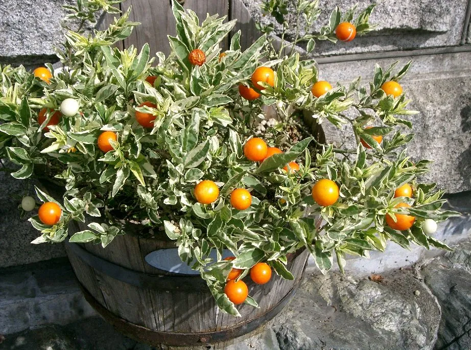 Jerusalem cherry
 Rock Dove
Photos: House Sparrow © Diliff · CC BY-SA 3.0; Jerusalem cherry © KENPEI · CC BY-SA 3.0; Rock Dove © william_stephens · CC BY 4.0
Sources: Global Forest Change (Hansen et al., University of Maryland, via Global Forest Watch, CC-BY 4.0); EFFIS, European Commission / Copernicus; NASA Black Marble 2016 (public domain); CORINE Land Cover 2018 (Copernicus) or MODIS.
Invasive alien species: Global Register of Introduced and Invasive Species (ISSG, CC BY 4.0); Union list, Regulation (EU) 1143/2014 (INBO, CC0); GBIF.org records (CC0 / CC BY 4.0), at least 2 per species.
Practical information
Cities and airport
- Corrientes
86 km as the crow flies - Barranqueras
96 km as the crow flies - Airport: Doctor Fernando Piragine Niveyro (CNQ)
85 km as the crow flies
Visitor information
- Guardaparques
within the site
Parking
1 public car parks listed within the site
Data © OpenStreetMap contributors (ODbL) · Wikidata (CC0)
Access and visiting
Nearest towns of over 50,000 people, as the crow flies: Corrientes (86 km) and Barranqueras (96 km). Nearest airport: Doctor Fernando Piragine Niveyro (CNQ), about 85 km away. About 24,000 people live within 20 km of the site boundary, 11,000 of them within 10 km; the site itself is virtually uninhabited (GHSL estimate, 2020). This population has grown by about 20% since 2000. Visitor information on site: Guardaparques. Public car parks listed within the site: 1. To plan a visit (access, opening periods, visitor rules), it is best to consult the official information from the managing body and the official website listed in this page's sources.
Source: OpenStreetMap (ODbL), Wikidata (CC0), October 2026.
When to visit
Best time to visit: from March to November, with average temperatures of 15 to 25 °C and moderate rainfall. Day length ranges from about 10 h 22 min in June to 13 h 55 min in December. Wildlife records published on GBIF peak for birds (October), plants (October), butterflies and moths (September), dragonflies (December) and mammals (from May to July). These peaks also reflect when observers are most active.
Source: Copernicus ERA5-Land (C3S), monthly averages 1996–2025 at the representative point, temperatures adjusted for elevation.
Contains modified Copernicus Climate Change Service information 2026. Neither the European Commission nor ECMWF is responsible for any use that may be made of the Copernicus information or data it contains.
Wildlife records calendar
JFMAMJJASOND
Birds
Plants
Butterflies & moths
Dragonflies
Mammals
Monthly records published on GBIF (CC-BY), relative to the busiest month; also reflects observer activity.
Gallery
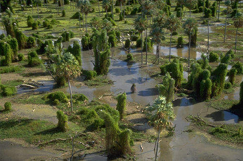
© Tencho · CC BY-SA 3.0
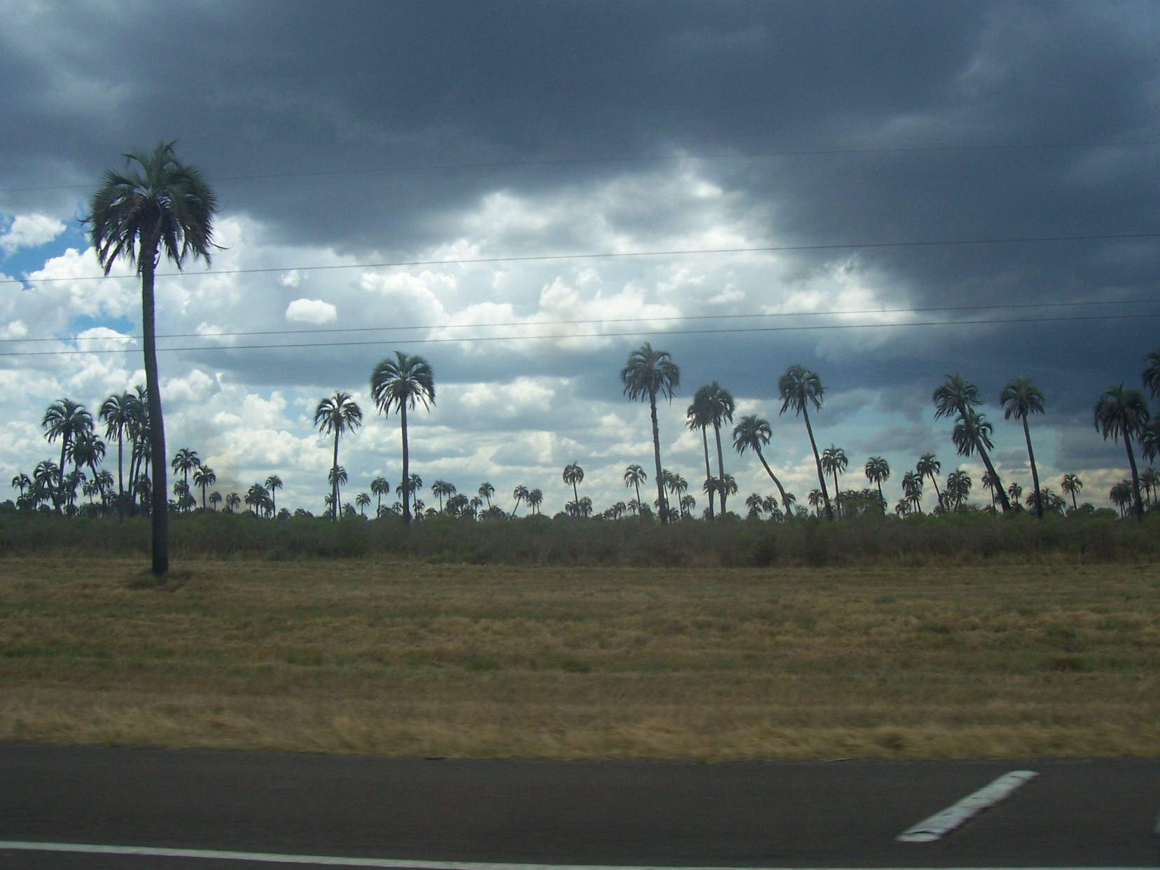
© LTrus · CC BY-SA 4.0
© Casa Rosada ( Argentina Presidency of the Nation ) · CC BY-SA 2.0
© Romi Galeota Lencina · CC BY 4.0
© Hugo Hulsberg · CC0-1.0
© Holger Braun · CC BY 4.0
Sources and licences
- Wikidata: Q829771
- OpenStreetMap: relation 10524557
- Official website: http://www.parquesnacionales.gov.ar/03_ap/25_mburucuya_PN/_mburucuya_PN.htm
- Wikipedia: en.wikipedia.org/wiki/Mburucuyá_National_Park
- WDPA: 97545
References
- cds.climate.copernicus.eu: climate · CC-BY-4.0
- registry.opendata.aws: elevation of the reference point, detailed relief · PD
- lpdaac.usgs.gov: land cover · PD
- doi.org: population around the site · CC-BY-4.0
- naturalearthdata.com: sea share · PD
- wikidata.org: official area, protected heritage, nearby cities and airport, access and peaks, lake depths, places to see, official website · CC0-1.0
- en.eurovelo.com: EuroVelo cycle routes · ODbL-1.0
- cycling.waymarkedtrails.org: cycle routes · ODbL-1.0
- opentopodata.org: elevations · PD
- globalforestwatch.org: tree cover loss · CC-BY-4.0
- gbif.org: seasonality of sightings, invasive alien species, observed species · CC-BY-4.0
- openstreetmap.org: official name, access and peaks, trail difficulty · ODbL-1.0
- earthobservatory.nasa.gov: night light · PD
- nsidc.org: snow cover · PD
- wikidata.org: Wikipedia article · CC-BY-SA-4.0
Data © OpenStreetMap contributors (ODbL), Wikidata (CC0) and the sources cited.