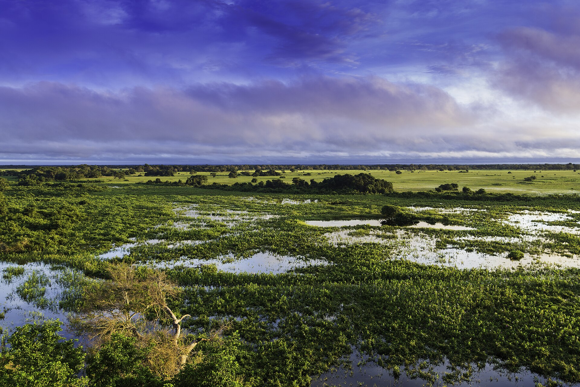
Bolivia · Terrestrial
Otuquis National Park
National park of 103,780 hectares in Bolivia, established in 1997.
Overview
National park of 103,780 hectares in Bolivia, established in 1997.
Otuquis National Park is located in Bolivia (South America). It is a predominantly terrestrial area. Established in 1997, it covers about 103,780 hectares.
In our collections
Frequently asked questions
Where is Otuquis National Park?
In Bolivia (South America). Representative point: 19.2190° S, 58.1200° W.
How large is Otuquis National Park?
About 103,780 hectares (1,038 km²). It is the 9th largest of the 13 national parks in Bolivia covered by Parkavela.
When was Otuquis National Park established?
In 1997.
What habitats and landscapes does Otuquis National Park include?
A terrestrial area, with forests.
When is the best time to visit Otuquis National Park?
Best time to visit: the dry season, from June to September, with less than 50 mm of rain per month.
What is the nearest large city to Otuquis National Park?
Nearest towns of over 50,000 people, as the crow flies: Corumbá (37 km).
Where can I get visitor information on site?
Servicio Nacional de Áreas Protegidas.
Which species can be seen in Otuquis National Park?
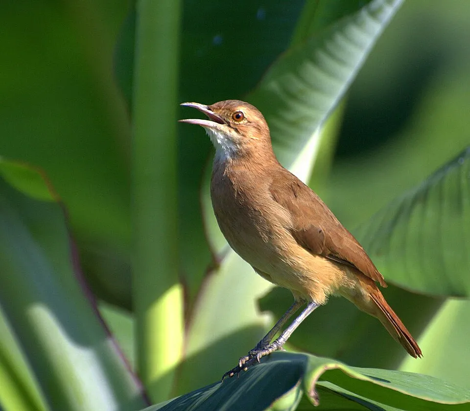
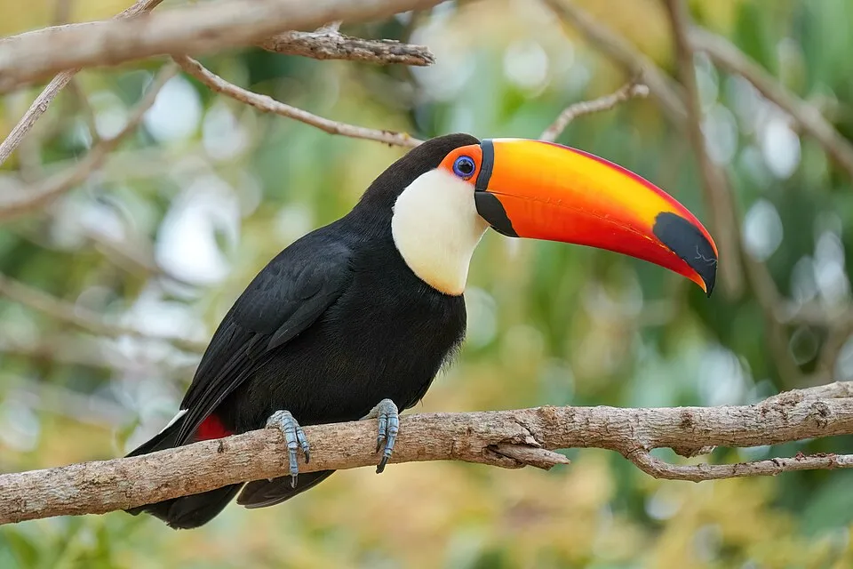
Among the species most often recorded on GBIF are Paroaria coronata (Red-crested Cardinal), Furnarius rufus (Rufous Hornero), Columbina picui (Picui Ground Dove) and Ramphastos toco (Toco Toucan).
© OpenStreetMap
Download the boundary: GeoJSON · GPX Boundary © OpenStreetMap contributors (ODbL).
Geography
The representative point of the site lies at around 102 m above sea level. Over the 1996–2025 period, the mean annual temperature is about 26.4 °C and total precipitation reaches roughly 1,106 mm per year. The warmest month is usually December, the coolest June, and the wettest January.
Area
- Area of the boundary
- 103,780 ha
- Elevation
- 102 m
- Coordinates
- -19.219, -58.12
Climate
● Mean temperature (°C) · ▮ Precipitation (mm)
Source: Copernicus ERA5-Land (C3S, doi:10.24381/cds.68d2bb30), monthly averages 1996–2025 interpolated to the representative point, temperatures adjusted for elevation.
Contains modified Copernicus Climate Change Service information 2026. Neither the European Commission nor ECMWF is responsible for any use that may be made of the Copernicus information or data it contains.
Natural habitats
According to the global MODIS land cover (NASA, 2024), the site is mainly made up of forests (77%), grassland and meadows (17%) and heath and scrub (6%). Woodland is mostly broadleaved. The land is almost flat (mean slope under 2°).
Biodiversity
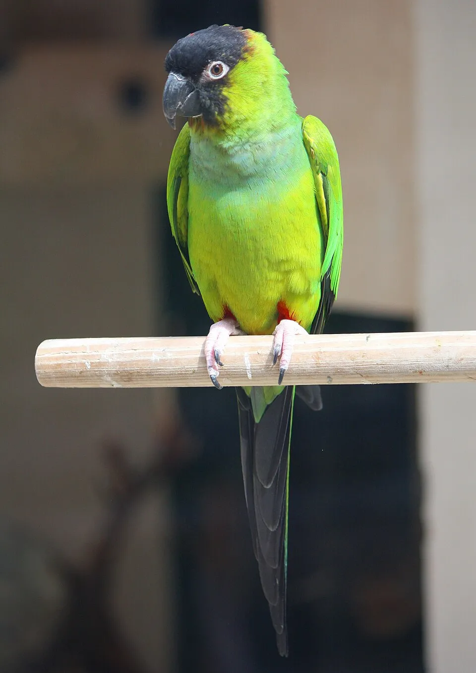
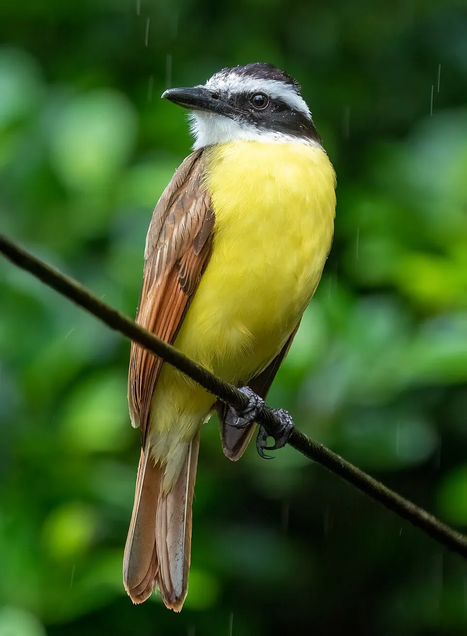
Based on occurrences aggregated by GBIF, several species are regularly recorded within the site. Among the most frequent are Paroaria coronata (Red-crested Cardinal), Furnarius rufus (Rufous Hornero), Columbina picui (Picui Ground Dove) and Ramphastos toco (Toco Toucan). The full list of documented taxa is shown below.
Species to look out for
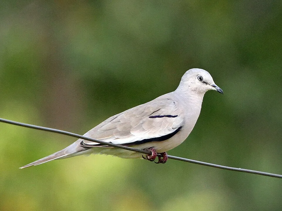
Bird
Picui Ground Dove
Columbina picui8 records © Greg Schechter from San Francisco, USA · CC BY 2.0
Observed species
Occurrences documented via GBIF; they are neither an exhaustive inventory nor proof of current presence.
- Red-crested Cardinal · Paroaria coronata · 9
- Rufous Hornero · Furnarius rufus · 8
- Picui Ground Dove · Columbina picui · 8
- Toco Toucan · Ramphastos toco · 7
- Nanday Parakeet · Nandayus nenday · 7
- Great Kiskadee · Pitangus sulphuratus · 7
- Monk Parakeet · Myiopsitta monachus · 6
- Crested Caracara · Caracara plancus · 6
- Lesser Yellow-headed Vulture · Cathartes burrovianus · 6
- Turkey Vulture · Cathartes aura · 6
- Cattle Tyrant · Machetornis rixosa · 6
- Pearly-vented Tody-Tyrant · Hemitriccus margaritaceiventer · 6
+18 more species
- Sayaca Tanager · Thraupis sayaca · 6
- White-bellied Seedeater · Sporophila leucoptera · 6
- Smooth-billed Ani · Crotophaga ani · 6
- Guira Cuckoo · Guira guira · 6
- Rufous-collared Sparrow · Zonotrichia capensis · 6
- Barred Antshrike · Thamnophilus doliatus · 6
- Wood Stork · Mycteria americana · 5
- Great Antshrike · Taraba major · 5
- Yellow-billed cardinal · Paroaria capitata · 5
- Curupay · Anadenanthera colubrina · 5
- Pied Water-tyrant · Fluvicola pica · 5
- Epaulet Oriole · Icterus cayanensis · 5
- Southern House Wren · Troglodytes musculus · 5
- Greyish Saltator · Saltator coerulescens · 5
- Yellow-chevroned Parakeet · Brotogeris chiriri · 4
- Snail Kite · Rostrhamus sociabilis · 4
- Black-collared Hawk · Busarellus nigricollis · 4
- Cocoi heron · Ardea cocoi · 4
Records: GBIF.org (CC-BY). Names: Wikidata (CC0), GBIF. Photos: Wikimedia Commons.
Conservation challenges
The primary purpose of the site is to preserve its natural habitats and the biodiversity they support. The species recorded (Biodiversity tab) reflect its ecological value. Its status as a national park sets the regulatory framework for its protection.
According to Global Forest Change data (University of Maryland, Global Forest Watch), about 8,550 ha of tree cover were lost within the boundary between 2001 and 2023 (8% of its area), peaking in 2002 and 2012. These losses include logging, storms and fires, and do not account for regrowth. At night, the area gives off virtually no artificial light detectable from space (NASA VIIRS Black Marble composite, 2016).
Pressure indicators
Tree cover lost
8,545 ha
2001–2023
20012023
Light at night
0%
of the area gives off artificial light visible from space
DarkLit
Sources: Global Forest Change (Hansen et al., University of Maryland, via Global Forest Watch, CC-BY 4.0); EFFIS, European Commission / Copernicus; NASA Black Marble 2016 (public domain); CORINE Land Cover 2018 (Copernicus) or MODIS.
Practical information
Cities and airport
- Corumbá
37 km as the crow flies
Visitor information
- Servicio Nacional de Áreas Protegidas
within the site
Data © OpenStreetMap contributors (ODbL) · Wikidata (CC0)
Access and visiting
Nearest towns of over 50,000 people, as the crow flies: Corumbá (37 km). About 5,100 people live within 20 km of the site boundary, 2,100 of them within 10 km; the site itself is virtually uninhabited (GHSL estimate, 2020). Visitor information on site: Servicio Nacional de Áreas Protegidas. To plan a visit (access, opening periods, visitor rules), it is best to consult the official information from the managing body and the official website listed in this page's sources.
Source: OpenStreetMap (ODbL), Wikidata (CC0), November 2026.
When to visit
Best time to visit: the dry season, from June to September, with less than 50 mm of rain per month. Precipitation peaks from December to February (up to 160 mm per month). Day length ranges from about 10 h 59 min in June to 13 h 17 min in December. Wildlife records published on GBIF peak for birds (July). These peaks also reflect when observers are most active.
Source: Copernicus ERA5-Land (C3S), monthly averages 1996–2025 at the representative point, temperatures adjusted for elevation.
Contains modified Copernicus Climate Change Service information 2026. Neither the European Commission nor ECMWF is responsible for any use that may be made of the Copernicus information or data it contains.
Wildlife records calendar
JFMAMJJASOND
Birds
Monthly records published on GBIF (CC-BY), relative to the busiest month; also reflects observer activity.
Gallery
© Ariom Alejandra · CC BY-SA 4.0
Sources and licences
- Wikidata: Q1651307
- OpenStreetMap: relation 9504399
- Wikipedia: en.wikipedia.org/wiki/Otuquis_National_Park_and_Integrated_Management_Natural_Area
- WDPA: 303883
References
- cds.climate.copernicus.eu: climate · CC-BY-4.0
- registry.opendata.aws: elevation of the reference point, detailed relief · PD
- lpdaac.usgs.gov: land cover · PD
- doi.org: population around the site · CC-BY-4.0
- naturalearthdata.com: sea share · PD
- openstreetmap.org: official name, access and peaks · ODbL-1.0
- en.eurovelo.com: EuroVelo cycle routes · ODbL-1.0
- cycling.waymarkedtrails.org: cycle routes · ODbL-1.0
- wikidata.org: highest point, establishment date, protected heritage, nearby cities and airport, access and peaks, lake depths, places to see · CC0-1.0
- opentopodata.org: elevations · PD
- globalforestwatch.org: tree cover loss · CC-BY-4.0
- gbif.org: seasonality of sightings, invasive alien species, observed species · CC-BY-4.0
- earthobservatory.nasa.gov: night light · PD
- nsidc.org: snow cover · PD
- wikidata.org: Wikipedia article · CC-BY-SA-4.0
Data © OpenStreetMap contributors (ODbL), Wikidata (CC0) and the sources cited.