India · Terrestrial
Raimona National Park
National park of 42,360 hectares in India, established in 2021.
Overview
National park of 42,360 hectares in India, established in 2021.
Raimona National Park is located in India (Asia). It is a predominantly terrestrial area. Established on 5 June 2021, it covers about 42,360 hectares.
In our collections
Frequently asked questions
Where is Raimona National Park?
In India (Asia). Representative point: 26.7062° N, 90.0974° E.
How large is Raimona National Park?
About 42,360 hectares (424 km²). It is the 29th largest of the 84 national parks in India covered by Parkavela.
When was Raimona National Park established?
On 5 June 2021.
What habitats and landscapes does Raimona National Park include?
A terrestrial area, with forests.
When is the best time to visit Raimona National Park?
Best time to visit: from October to April, with average temperatures of 15 to 24 °C and moderate rainfall.
What is the nearest large city to Raimona National Park?
Nearest towns of over 50,000 people, as the crow flies: Thimphu (84 km) and Lalmonirhat (93 km). Nearest airport: Lokpriya Gopinath Bordoloi (GAU), about 148 km away.
How can I reach Raimona National Park by train?
The nearest railway station is Gossaigaon Hat, about 23 km from the site boundary.
Which species can be seen in Raimona National Park?
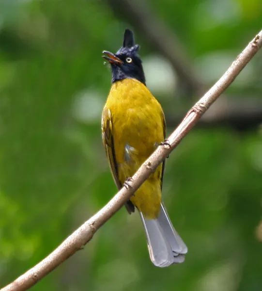
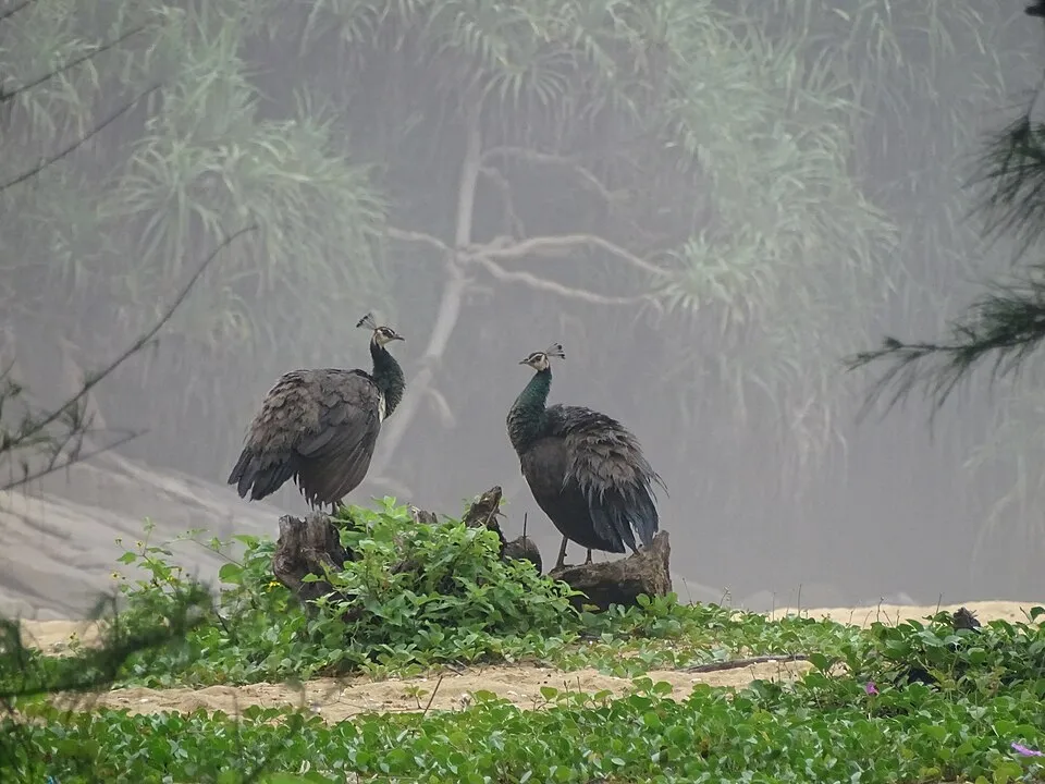
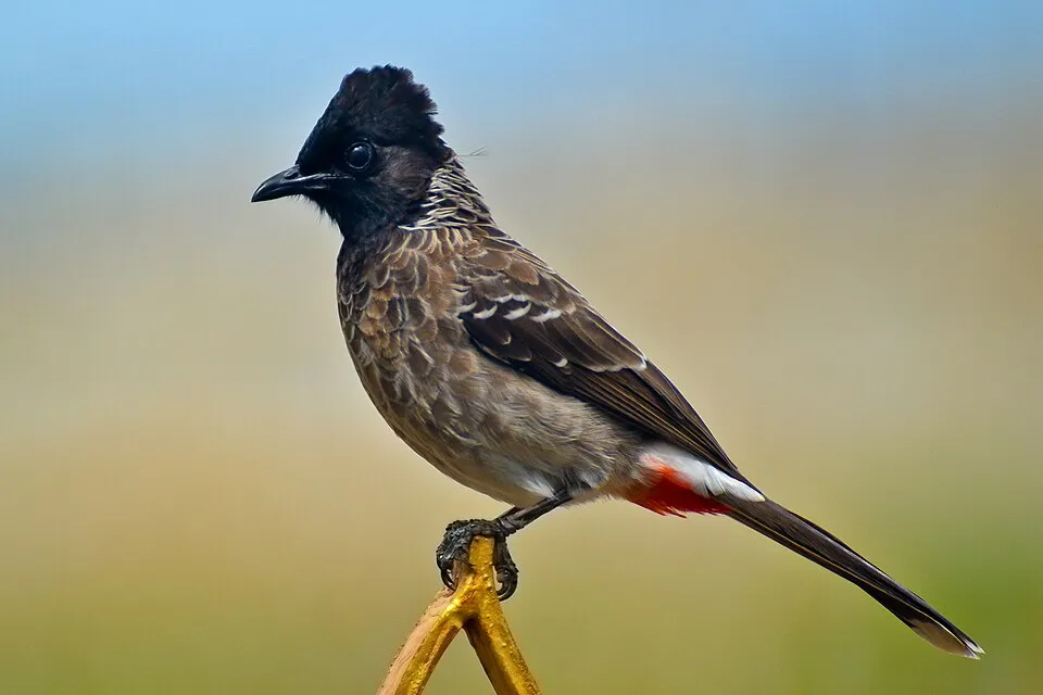
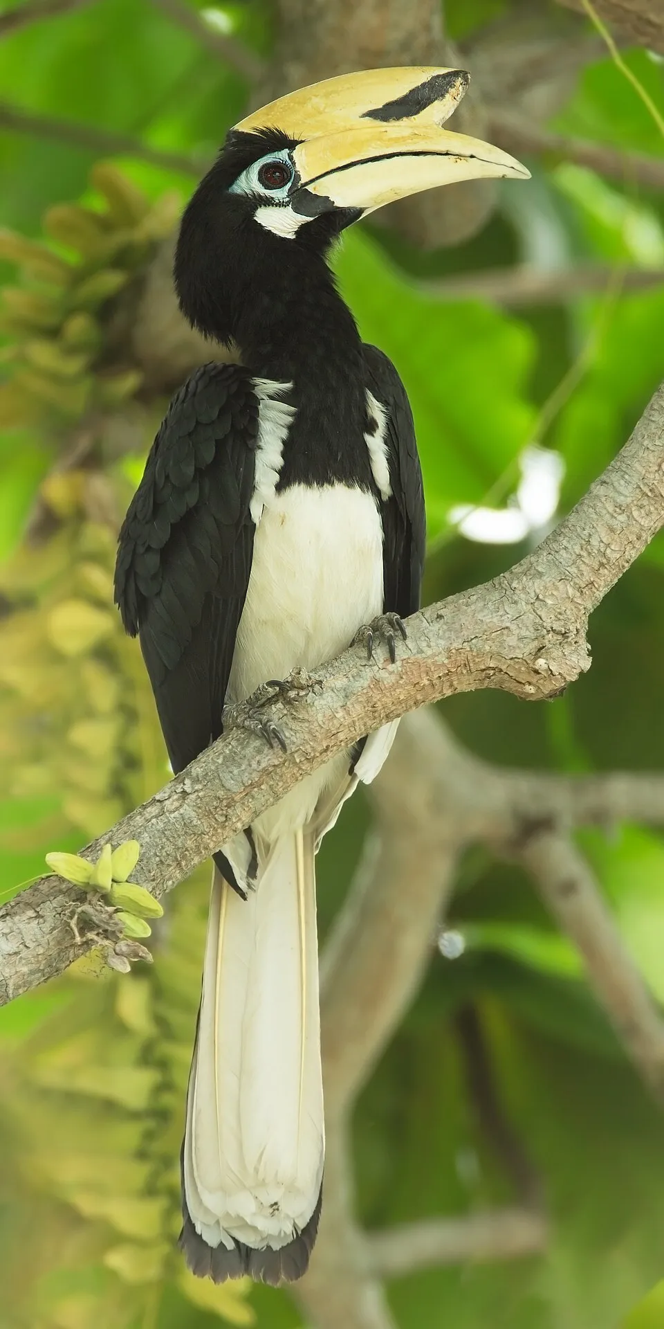
Among the species most often recorded on GBIF are Pycnonotus flaviventris (Black-crested Bulbul), Pavo cristatus (Indian Peafowl), Pycnonotus cafer (Red-vented Bulbul) and Anthracoceros albirostris (Oriental Pied Hornbill).
© OpenStreetMap
Download the boundary: GeoJSON · GPX Boundary © OpenStreetMap contributors (ODbL).
Geography
The representative point of the site lies at around 142 m above sea level. Over the 1996–2025 period, the mean annual temperature is about 22.3 °C and total precipitation reaches roughly 3,554 mm per year. The warmest month is usually August, the coolest January, and the wettest July.
Area
- Area of the boundary
- 42,360 ha
- Elevation
- 142 m
- Coordinates
- 26.7062, 90.0974
Climate
● Mean temperature (°C) · ▮ Precipitation (mm)
Source: Copernicus ERA5-Land (C3S, doi:10.24381/cds.68d2bb30), monthly averages 1996–2025 interpolated to the representative point, temperatures adjusted for elevation.
Contains modified Copernicus Climate Change Service information 2026. Neither the European Commission nor ECMWF is responsible for any use that may be made of the Copernicus information or data it contains.
Natural habitats
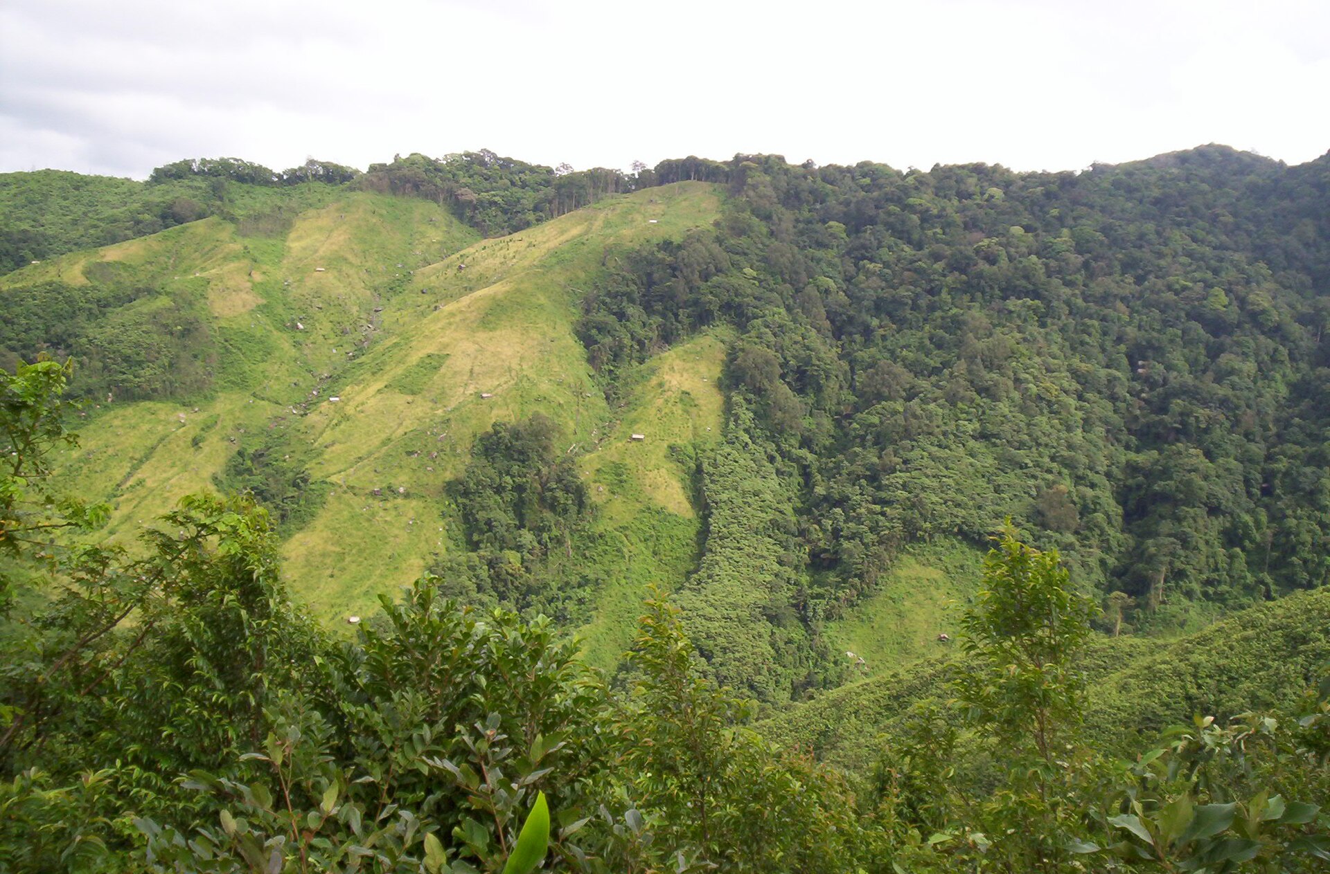
According to the global MODIS land cover (NASA, 2024), the site is mainly made up of forests (81%) and grassland and meadows (17%). It is mostly dense evergreen broadleaved forest. Elevation ranges from about 90 to 280 m (sampled elevations, SRTM).
Biodiversity
Based on occurrences aggregated by GBIF, several species are regularly recorded within the site. Among the most frequent are Pycnonotus flaviventris (Black-crested Bulbul), Pavo cristatus (Indian Peafowl), Pycnonotus cafer (Red-vented Bulbul) and Anthracoceros albirostris (Oriental Pied Hornbill). The full list of documented taxa is shown below.
Species to look out for

Bird
Oriental Pied Hornbill
Anthracoceros albirostris38 records © JJ Harrison (https://tiny.jjharrison.com.au/t/WnrNTPSv5UZYne9y) · CC BY-SA 4.0
Observed species
Occurrences documented via GBIF; they are neither an exhaustive inventory nor proof of current presence.
- Black-crested Bulbul · Pycnonotus flaviventris · 45
- Red Junglefowl · Gallus gallus · 44
- Indian Peafowl · Pavo cristatus · 41
- Red-vented Bulbul · Pycnonotus cafer · 40
- Oriental Pied Hornbill · Anthracoceros albirostris · 38
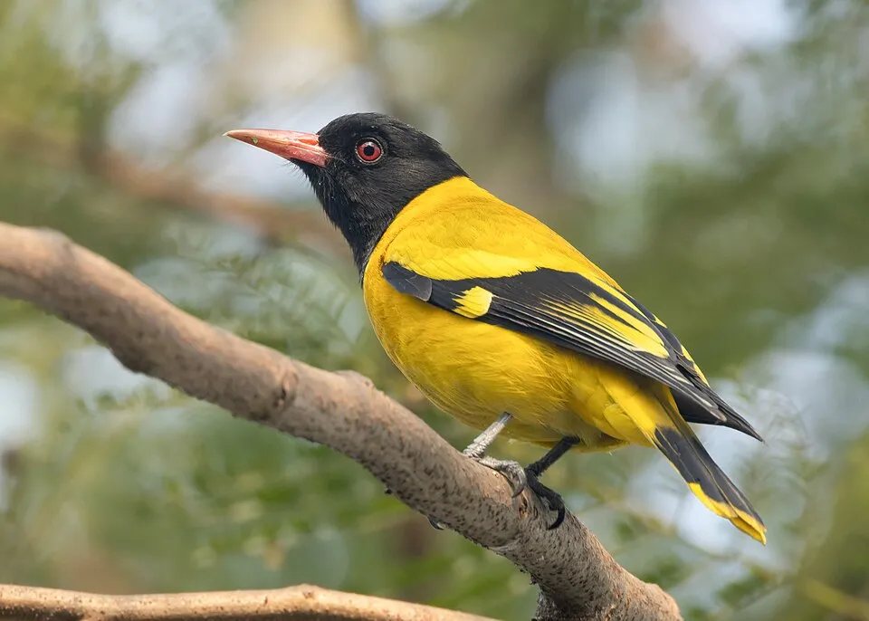
- Black-hooded Oriole · Oriolus xanthornus · 36
- Lineated Barbet · Psilopogon lineatus · 35
- Greater Racket-tailed Drongo · Dicrurus paradiseus · 32
- Spotted Dove · Spilopelia chinensis · 31
- River Lapwing · Vanellus duvaucelii · 29
- Blue-throated barbet · Psilopogon asiaticus · 29
- Golden-fronted Leafbird · Chloropsis aurifrons · 26
+18 more species
- Crested Serpent Eagle · Spilornis cheela · 24
- Streaked Spiderhunter · Arachnothera magna · 24
- Common Hill Myna · Gracula religiosa · 24
- White-throated Kingfisher · Halcyon smyrnensis · 24
- Common myna · Acridotheres tristis · 23
- Hair-crested Drongo · Dicrurus hottentottus · 23
- Oriental Turtle Dove · Streptopelia orientalis · 23
- Red-breasted Parakeet · Psittacula alexandri · 23
- Greater Flameback · Chrysocolaptes guttacristatus · 23
- Indochinese Roller · Coracias affinis · 22
- Rufous Treepie · Dendrocitta vagabunda · 22
- Common Tailorbird · Orthotomus sutorius · 22
- Taiga Flycatcher · Ficedula albicilla · 22
- White-rumped Shama · Copsychus malabaricus · 21
- Rhopodytes tristis · 21
- Grey-headed Canary-flycatcher · Culicicapa ceylonensis · 19
- Alexandrine Parakeet · Psittacula eupatria · 19
- Scarlet Minivet · Pericrocotus speciosus · 19
Records: GBIF.org (CC-BY). Names: Wikidata (CC0), GBIF. Photos: Wikimedia Commons.
Conservation challenges
The primary purpose of the site is to preserve its natural habitats and the biodiversity they support. The species recorded (Biodiversity tab) reflect its ecological value. Its status as a national park sets the regulatory framework for its protection.
According to Global Forest Change data (University of Maryland, Global Forest Watch), about 240 ha of tree cover were lost within the boundary between 2001 and 2023 (under 1% of its area), peaking in 2008 and 2010. These losses include logging, storms and fires, and do not account for regrowth. At night, the area gives off virtually no artificial light detectable from space (NASA VIIRS Black Marble composite, 2016).
Pressure indicators
Tree cover lost
240 ha
2001–2023
20012023
Light at night
0%
of the area gives off artificial light visible from space
DarkLit
Sources: Global Forest Change (Hansen et al., University of Maryland, via Global Forest Watch, CC-BY 4.0); EFFIS, European Commission / Copernicus; NASA Black Marble 2016 (public domain); CORINE Land Cover 2018 (Copernicus) or MODIS.
Practical information
Cities and airport
- Thimphu
84 km as the crow flies - Lalmonirhat
93 km as the crow flies - Airport: Lokpriya Gopinath Bordoloi (GAU)
148 km as the crow flies
Data: Wikidata (CC0), pending OpenStreetMap data
Access and visiting
The nearest railway station is Gossaigaon Hat, about 23 km from the site boundary. Nearest towns of over 50,000 people, as the crow flies: Thimphu (84 km) and Lalmonirhat (93 km). Nearest airport: Lokpriya Gopinath Bordoloi (GAU), about 148 km away. About 670,000 people live within 20 km of the site boundary, 250,000 of them within 10 km; some 1,600 people are estimated to live inside (GHSL estimate, 2020). This population has grown by about 20% since 2000. To plan a visit (access, opening periods, visitor rules), it is best to consult the official information from the managing body and the official website listed in this page's sources.
Source: Wikidata (CC0), November 2026.
When to visit
Best time to visit: from October to April, with average temperatures of 15 to 24 °C and moderate rainfall. Precipitation peaks from May to September (up to 900 mm per month). Day length ranges from about 10 h 28 min in December to 13 h 48 min in June. Wildlife records published on GBIF peak for birds (November). These peaks also reflect when observers are most active.
Source: Copernicus ERA5-Land (C3S), monthly averages 1996–2025 at the representative point, temperatures adjusted for elevation.
Contains modified Copernicus Climate Change Service information 2026. Neither the European Commission nor ECMWF is responsible for any use that may be made of the Copernicus information or data it contains.
Wildlife records calendar
JFMAMJJASOND
Birds
Monthly records published on GBIF (CC-BY), relative to the busiest month; also reflects observer activity.
Gallery
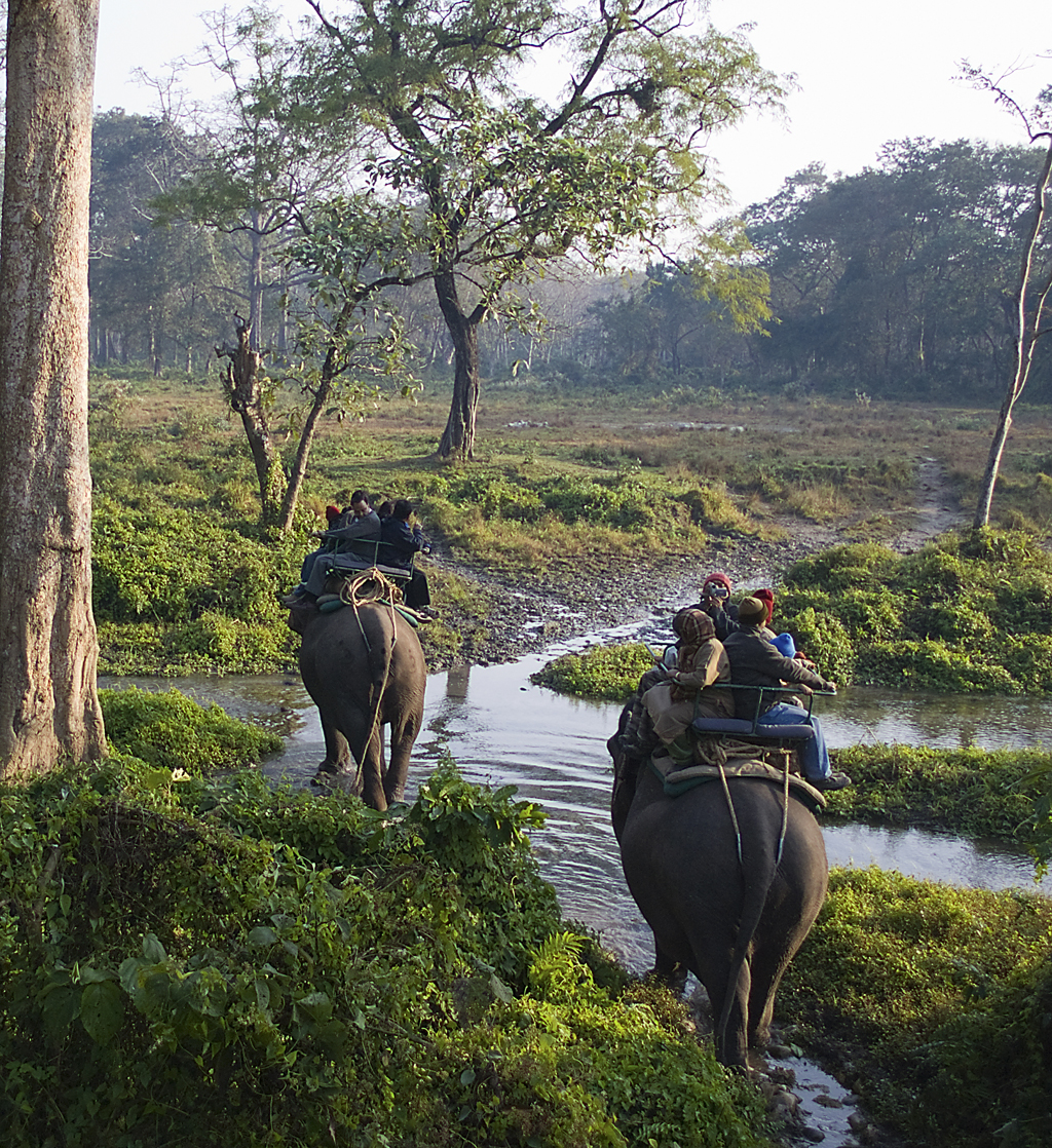
© Panjit basumatary · CC BY-SA 4.0
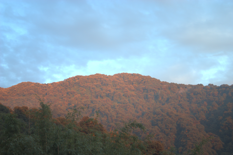
© Nayan j Nath · CC BY-SA 4.0
© Hiranya123 · CC BY-SA 4.0
Sources and licences
- Wikidata: Q107112206
- Wikipedia: en.wikipedia.org/wiki/Raimona_National_Park
References
- cds.climate.copernicus.eu: climate · CC-BY-4.0
- registry.opendata.aws: elevation of the reference point, detailed relief · PD
- lpdaac.usgs.gov: land cover · PD
- doi.org: population around the site · CC-BY-4.0
- naturalearthdata.com: sea share · PD
- openstreetmap.org · ODbL-1.0
- en.eurovelo.com: EuroVelo cycle routes · ODbL-1.0
- cycling.waymarkedtrails.org: cycle routes · ODbL-1.0
- opentopodata.org: elevations · PD
- wikidata.org: establishment date, protected heritage, official name, nearby cities and airport, access and peaks, lake depths, places to see · CC0-1.0
- globalforestwatch.org: tree cover loss · CC-BY-4.0
- gbif.org: seasonality of sightings, invasive alien species, observed species · CC-BY-4.0
- earthobservatory.nasa.gov: night light · PD
- nsidc.org: snow cover · PD
- wikidata.org: Wikipedia article · CC-BY-SA-4.0
Data © OpenStreetMap contributors (ODbL), Wikidata (CC0) and the sources cited.