Chile · Terrestrial
Rapa Nui National Park
National park of 6,908 hectares in Chile, established in 1935.
Overview
National park of 6,908 hectares in Chile, established in 1935.
Rapa Nui National Park is located in Chile (Oceania). It is a predominantly terrestrial area. Established on 16 January 1935, it covers about 6,908 hectares.
Protections and designations
UNESCO World Heritage
Protected as a national park. International labels and designations: UNESCO World Heritage. Key dates: established in 1935 and World Heritage listing in 1995.
In our collections
Timeline
-
1935
Established
-
1995
Inscribed as a UNESCO World Heritage Site
Sources: Wikidata (CC0) for establishment and international labels; EEA Natura 2000 database (CC-BY 4.0) for site designation dates.
Frequently asked questions
Where is Rapa Nui National Park?
In Chile (Oceania). Representative point: 27.0729° S, 109.3486° W.
How large is Rapa Nui National Park?
About 6,908 hectares (69 km²). It is the 39th largest of the 45 national parks in Chile covered by Parkavela. About 700 ha are at sea.
When was Rapa Nui National Park established?
On 16 January 1935.
What habitats and landscapes does Rapa Nui National Park include?
A terrestrial area, with coasts.
What is the highest point of Rapa Nui National Park?
Rano Kau, at 320 m (OpenStreetMap).
What are the main summits of Rapa Nui National Park?
Rano Kau (320 m), Ma'uŋa Tea Tea (280 m), Ma'uŋa Vai o Hao (270 m), Maꞌuŋa ꞌŌrito (218 m) and Ma'uŋa Perehe (216 m) (OpenStreetMap).
Which international labels apply to Rapa Nui National Park?
UNESCO World Heritage.
What is there to see in Rapa Nui National Park?
Cave Ana Kakenga (Wikidata).
Are there historic monuments in Rapa Nui National Park?
Yes. According to Wikidata, one monument protected in Chile as Historic Monuments (Monumento Histórico) stands within the boundary. For example: “Ahu Tongariki” in Isla de Pascua.
Where can I get visitor information on site?
Ana Te Pahu CONAF office, Agencia Orca and Sernatur.
Which species can be seen in Rapa Nui National Park?
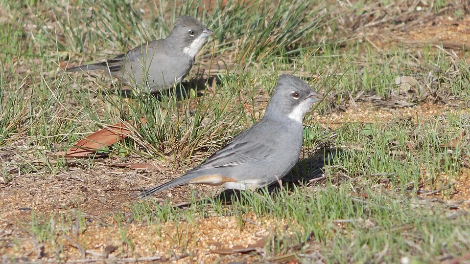
Among the species most often recorded on GBIF are Diuca diuca (Common Diuca Finch), Fregata minor (Great Frigatebird), Passer domesticus (House Sparrow) and Nothoprocta perdicaria (Chilean Tinamou).
© OpenStreetMap
Download the boundary: GeoJSON · GPX Boundary © OpenStreetMap contributors (ODbL).
Geography
The representative point of the site lies at around 231 m above sea level.
Area
- Area
- 6,908 ha
- Elevation
- 231 m
- Mean slope
- 6°
- Coordinates
- -27.0729, -109.3486
Terrain: Mapzen Terrain Tiles (SRTM, USGS)
Main summits
- Rano Kau320 m
- Ma'uŋa Tea Tea280 m
- Ma'uŋa Vai o Hao270 m
- Maꞌuŋa ꞌŌrito218 m
- Ma'uŋa Perehe216 m
- Ma'uŋa Te Miro O'one194 m
- Ma'uŋa Ori166 m
- Ma'uŋa Kahu Rere (Kahu Rea)131 m
- Ma'uŋa To'ato'a74 m
- Ma'uŋa Roua70 m
Data © OpenStreetMap contributors (ODbL)
Natural habitats
The site borders the coast. Elevation ranges from sea level to 320 m (highest point: Rano Kau).
Biodiversity
Based on occurrences aggregated by GBIF, several species are regularly recorded within the site. Among the most frequent are Diuca diuca (Common Diuca Finch), Fregata minor (Great Frigatebird), Passer domesticus (House Sparrow) and Nothoprocta perdicaria (Chilean Tinamou). The full list of documented taxa is shown below.
Species to look out for




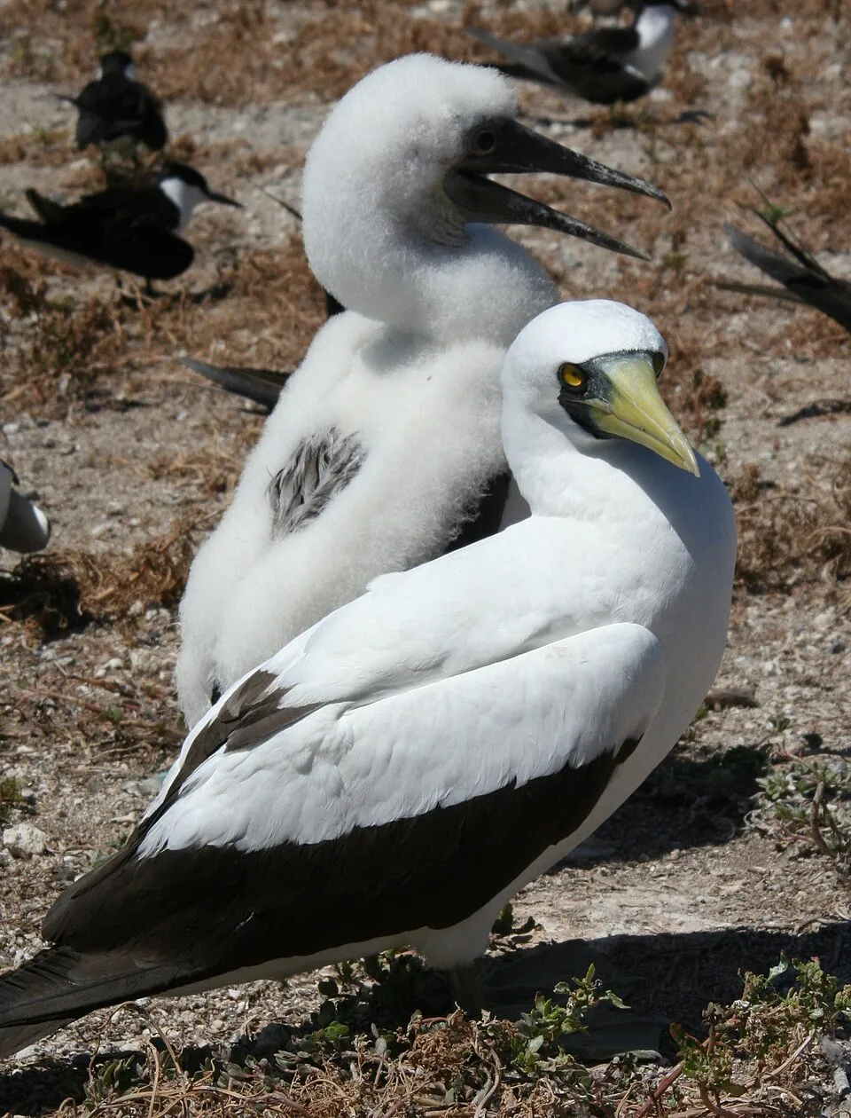
Observed species
Occurrences documented via GBIF; they are neither an exhaustive inventory nor proof of current presence.
- Common Diuca Finch · Diuca diuca · 555
- Great Frigatebird · Fregata minor · 354
- House Sparrow · Passer domesticus · 328
- Rock Dove · Columba livia · 292
- Chilean Tinamou · Nothoprocta perdicaria · 291
- Masked Booby · Sula dactylatra · 235
- Red-tailed Tropicbird · Phaethon rubricauda · 219
- Kermadec Petrel · Pterodroma neglecta · 86
- White-tailed Tropicbird · Phaethon lepturus · 71
- Brown Noddy · Anous stolidus · 60
- Herald Petrel · Pterodroma heraldica · 55
- Grey Noddy · Anous albivitta · 49
+18 more species
- Red Junglefowl · Gallus gallus · 47
- Henderson Petrel · Pterodroma atrata · 39
- Phoenix Petrel · Pterodroma alba · 38
- Oceania Snake-eyed Skink · Cryptoblepharus poecilopleurus · 29
- Christmas Shearwater · Puffinus nativitatis · 28
- Bryodelphax aaseae · 27
- Murphy's Petrel · Pterodroma ultima · 17
- Campylopus vesticaulis · 16
- Chaetomorpha ligustica · 14
- Echinolittorina pascua · 14
- Frullania ericoides · 13
- Asplenium obtusatum · 13
- Mourning gecko · Lepidodactylus lugubris · 11
- Callyspongia fusifera · 10
- Paramacrobiotus richtersi · 9
- Hinea akuana · 9
- Axonopus paschalis · 8
- Pseudosuberites sulcatus · 7
Records: GBIF.org (CC-BY). Names: Wikidata (CC0), GBIF. Photos: Wikimedia Commons.
Conservation challenges
The primary purpose of the site is to preserve its natural habitats and the biodiversity they support. The species recorded (Biodiversity tab) reflect its ecological value. The designations it holds frame its management and the control of land use.
At night, 12% of the area gives off artificial light detectable from space (NASA VIIRS Black Marble composite, 2016). Invasive alien species have been recorded within the site since 2000 (GBIF observations). Among them: Cirsium vulgare (Spear Thistle), Cenchrus clandestinus (Kikuyugrass) and Physalis viscosa (Starhair groundcherry).
Pressure indicators
Light at night
12%
of the area gives off artificial light visible from space
DarkLit
Invasive alien species
4
recorded since 2000
 Spear Thistle
 Kikuyugrass
 Starhair groundcherry
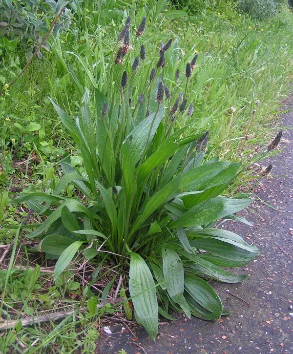 Ribwort Plantain
Photos: Spear Thistle © Dominicus Johannes Bergsma · CC BY-SA 4.0; Kikuyugrass © Nom. rev · CC BY 4.0; Starhair groundcherry © SAplants · CC BY-SA 4.0; Ribwort Plantain © sannse · CC BY-SA 3.0
Sources: Global Forest Change (Hansen et al., University of Maryland, via Global Forest Watch, CC-BY 4.0); EFFIS, European Commission / Copernicus; NASA Black Marble 2016 (public domain); CORINE Land Cover 2018 (Copernicus) or MODIS.
Invasive alien species: Global Register of Introduced and Invasive Species (ISSG, CC BY 4.0); Union list, Regulation (EU) 1143/2014 (INBO, CC0); GBIF.org records (CC0 / CC BY 4.0), at least 2 per species.
Practical information
Visitor information
- Ana Te Pahu CONAF office
< 1 km from the site boundary - Agencia Orca
1 km from the site boundary - Sernatur
2 km from the site boundary - Oficina Sernatur
2 km from the site boundary
Parking
25 public car parks listed within the site
Oroŋo
Data © OpenStreetMap contributors (ODbL)
Access and visiting
About 6,200 people live within 20 km of the site boundary; some 350 people are estimated to live inside (GHSL estimate, 2020). Visitor information on site: Ana Te Pahu CONAF office, Agencia Orca and Sernatur. Public car parks listed within the site: 25, including Oroŋo. To see: cave Ana Kakenga. To plan a visit (access, opening periods, visitor rules), it is best to consult the official information from the managing body and the official website listed in this page's sources.
Source: OpenStreetMap (ODbL), Wikidata (CC0), October 2026.
Built heritage
According to Wikidata, one monument protected in Chile as Historic Monuments (Monumento Histórico) stands within the boundary. It is “Ahu Tongariki” in Isla de Pascua.
-
Ahu Tongariki
Isla de Pascua
Source: Wikidata (CC0), monuments in each country’s official heritage protection registers, at national or regional level. Each item links to its Wikidata entry.
Wildlife records calendar
JFMAMJJASOND
Birds
Plants
Monthly records published on GBIF (CC-BY), relative to the busiest month; also reflects observer activity.
Gallery
© ProfessorX · CC BY-SA 3.0
© Bjørn Christian Tørrissen · CC BY-SA 3.0
© Alanbritom · CC BY-SA 2.0
© BjarteSorensen · CC BY-SA 3.0
© LANOEL · CC BY-SA 3.0
© American · CC BY-SA 3.0
Sources and licences
- Wikidata: Q1763364
- OpenStreetMap: relation 4657638
- Wikipedia: en.wikipedia.org/wiki/Rapa_Nui_National_Park
- WDPA: 105
References
- registry.opendata.aws: elevation of the reference point, detailed relief · PD
- land.copernicus.eu: land cover · COPERNICUS
- doi.org: population around the site · CC-BY-4.0
- naturalearthdata.com: sea share · PD
- wikidata.org: official area, establishment date, protected heritage, nearby cities and airport, access and peaks, lake depths, places to see · CC0-1.0
- en.eurovelo.com: EuroVelo cycle routes · ODbL-1.0
- cycling.waymarkedtrails.org: cycle routes · ODbL-1.0
- opentopodata.org: elevations · PD
- gbif.org: seasonality of sightings, invasive alien species, observed species · CC-BY-4.0
- openstreetmap.org: official name, access and peaks, trail difficulty · ODbL-1.0
- earthobservatory.nasa.gov: night light · PD
- wikidata.org: Wikipedia article · CC-BY-SA-4.0
Data © OpenStreetMap contributors (ODbL), Wikidata (CC0) and the sources cited.