France · Terrestrial
Réunion National Park
National park of 105,447 hectares in France, established in 2007.
Overview
National park of 105,447 hectares in France, established in 2007.
Réunion National Park is located in France (overseas). It is a predominantly terrestrial area. Established in 2007, it covers about 105,447 hectares.
Protections and designations
UNESCO World Heritage
Protected as a national park. International labels and designations: UNESCO World Heritage (“Pitons, cirques and remparts of Reunion Island”).
In our collections
Frequently asked questions
Where is Réunion National Park?
In France (overseas). Representative point: 21.1258° S, 55.5787° E.
How large is Réunion National Park?
About 105,447 hectares (1,054 km²). It is the 4th largest of the 13 national parks in France covered by Parkavela.
When was Réunion National Park established?
In 2007.
What habitats and landscapes does Réunion National Park include?
A terrestrial area, with forests and mountains.
What is the highest point of Réunion National Park?
Piton des Neiges, at 3,070 m (OpenStreetMap).
What are the main summits of Réunion National Park?
Piton des Neiges (3,070 m), Sommet Nord PN (3,052 m), Gros Morne (3,019 m), Tour du grand saisissement (3,013 m) and La dent (3,002 m) (OpenStreetMap).
Which international labels apply to Réunion National Park?
UNESCO World Heritage (“Pitons, cirques and remparts of Reunion Island”).
When is the best time to visit Réunion National Park?
Best time to visit: from April to November, with average temperatures of 14 to 20 °C and moderate rainfall.
What is there to see in Réunion National Park?
196 viewpoints, 67 waterfalls, 8 lakes and ponds and 34 caves, including Balcon de Dolomieu (2,485 m), Bassin Bleu, Bassin des Aigrettes and Caverne du Chisny (2,358 m) (OpenStreetMap).
Where can I stay in Réunion National Park?
23 mountain huts and 52 campsites, including Refuge de la Caverne Dufour (2,478 m), Aire de bivouac Cap Blanc and Gîte du Volcan (2,240 m) (OpenStreetMap).
Are there historic monuments in Réunion National Park?
Yes. According to the French Ministry of Culture's Mérimée database, 2 historic monuments stand within the boundary, all at the second level of protection (inscrit). For example: “Chemin dit des Anglais” in La Saint-Denis;Possession and “L'Ilet-à-Guillaume” in Saint-Denis.
Can you swim in Réunion National Park?
One monitored bathing site lies in or within 1 km of the site; official 2025 classification: 1 excellent (European Environment Agency). Swimming is only permitted at the sites and times authorised locally.
What is the nearest large city to Réunion National Park?
Nearest towns of over 50,000 people, as the crow flies: Saint-Denis (3 km) and Saint-André (5 km). Nearest airport: Roland Garros (RUN), about 5 km away.
Where can I get visitor information on site?
Chalet du Brulé - Kaz tuit-tuit, Boureau d'information de La Nouvelle and Office de Tourisme de Cilaos.
Are there waymarked hiking trails in Réunion National Park?
Yes. Waymarked hiking routes listed in OpenStreetMap: 27, including Canalisation des Orangers, Chemin Crémont, Sentier Jacky Inard and Sentier de la Grande Jument. The “GR R2” route runs for about 103 km through the site, with some 4,280 m of ascent on its longest section.
Which species can be seen in Réunion National Park?
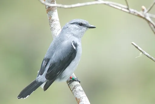
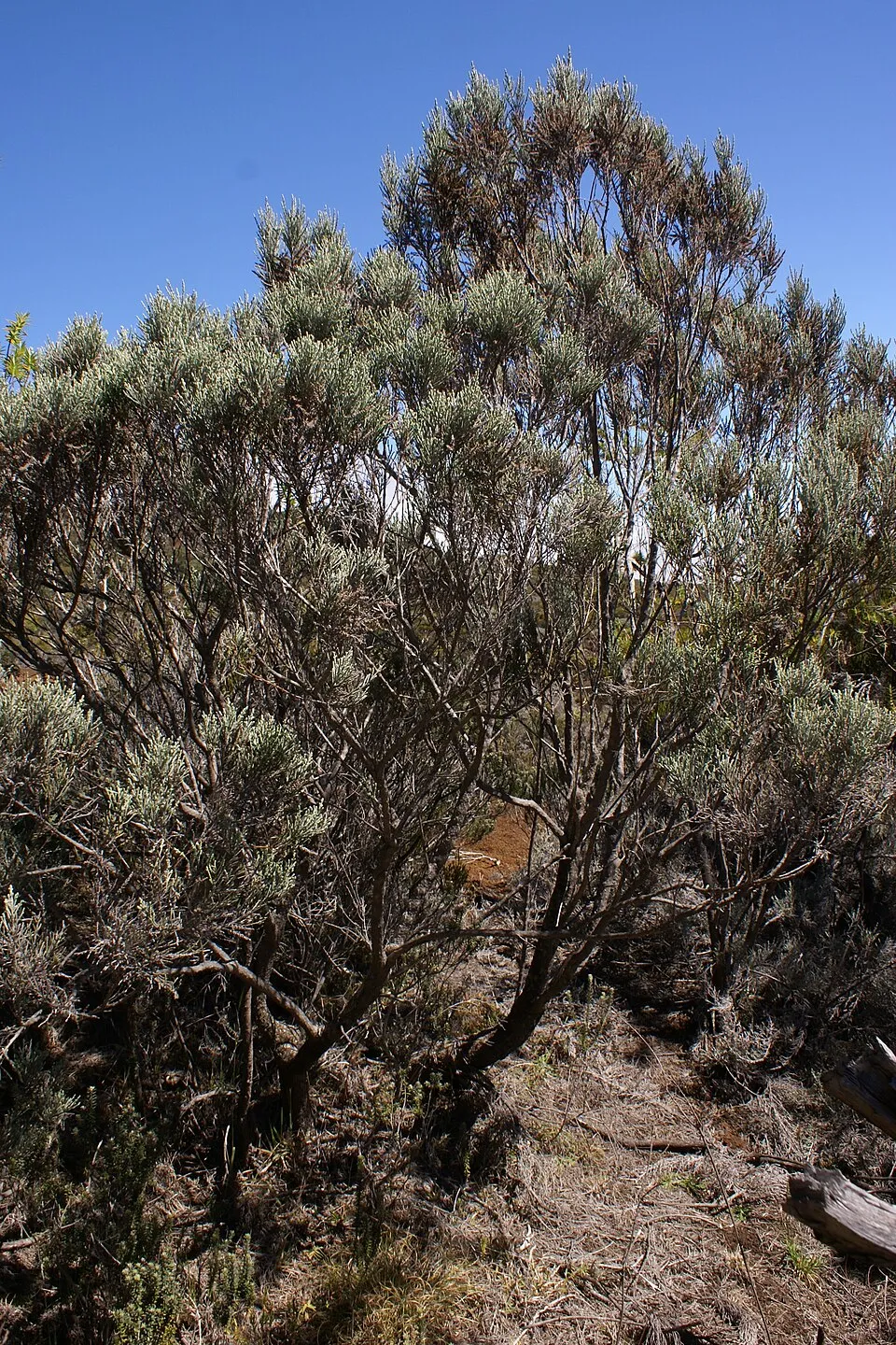
Among the species most often recorded on GBIF are Coracina newtoni (Reunion Cuckooshrike), Seriphium passerinoides, Psidium cattleianum (Cattley guava) and Phylica nitida.
What is the official website of Réunion National Park?
© OpenStreetMap
Download the boundary: GeoJSON · GPX Boundary © OpenStreetMap contributors (ODbL).
Geography
The representative point of the site lies at around 1,339 m above sea level. Over the 1996–2025 period, the mean annual temperature is about 18.2 °C and total precipitation reaches roughly 1,714 mm per year. The warmest month is usually January, the coolest July, and the wettest January.
Area
- Area
- 105,447 ha
- Elevation
- 1,339 m
- Median elevation
- 1,343 m
- Mean slope
- 22°
- Coordinates
- -21.1258, 55.5787
Terrain: Mapzen Terrain Tiles (SRTM, USGS)
Elevation bands
- below 500 m 8%
- 500–1,000 m 23%
- 1,000–1,500 m 30%
- 1,500–2,000 m 25%
- 2,000–2,500 m 13%
- 2,500–3,000 m 2%
share of the site in each elevation band (smoothed terrain model: summits are rounded off) · Terrain: Mapzen Terrain Tiles (SRTM, USGS)
Main summits
- Piton des Neiges3,070 m
- Sommet Nord PN3,052 m
- Gros Morne3,019 m
- Tour du grand saisissement3,013 m
- La dent3,002 m
- Pic du chat2,975 m
- Pic de l'oeuf2,958 m
- les Salazes2,952 m
- le Grand Bénare2,898 m
- Piton de la Fournaise2,632 m
Data © OpenStreetMap contributors (ODbL)
Climate
● Mean temperature (°C) · ▮ Precipitation (mm)
Source: Copernicus ERA5-Land (C3S, doi:10.24381/cds.68d2bb30), monthly averages 1996–2025 interpolated to the representative point, temperatures adjusted for elevation.
Contains modified Copernicus Climate Change Service information 2026. Neither the European Commission nor ECMWF is responsible for any use that may be made of the Copernicus information or data it contains.
Natural habitats
According to CORINE Land Cover (2018), the site is mainly made up of forests (50%), heath and scrub (29%) and sparsely vegetated land (10%). Woodland is mostly broadleaved. Elevation ranges from about 260 m to 3,070 m (highest point: Piton des Neiges). Median elevation is 1,343 m, and 15% of the site lies above 2,000 m (SRTM elevation model). The terrain is steep: 27% of slopes exceed 30° (mean slope 22°).
Biodiversity
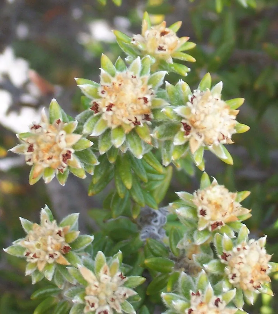
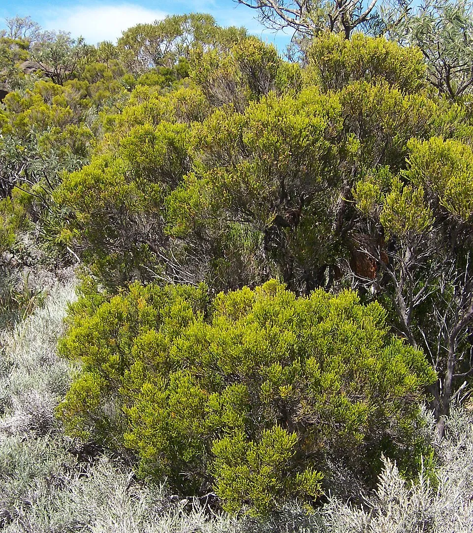
Based on occurrences aggregated by GBIF, several species are regularly recorded within the site. Among the most frequent are Coracina newtoni (Reunion Cuckooshrike), Seriphium passerinoides, Psidium cattleianum (Cattley guava) and Phylica nitida. The full list of documented taxa is shown below.
Species to look out for


Observed species
Occurrences documented via GBIF; they are neither an exhaustive inventory nor proof of current presence.
- Reunion Cuckooshrike · Coracina newtoni · 6893
- Seriphium passerinoides · 5755
- Cattley guava · Psidium cattleianum · 5505
- Phylica nitida · 4965
- Barau's Petrel · Pterodroma baraui · 4304
- Réunion grey white-eye · Zosterops borbonicus · 3943
- Erica reunionensis · 3932
- Réunion Harrier · Circus maillardi · 3377
- Reunion Stonechat · Saxicola tectes · 3131
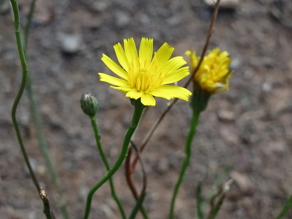
- Hairy cat's ear · Hypochaeris radicata · 3125
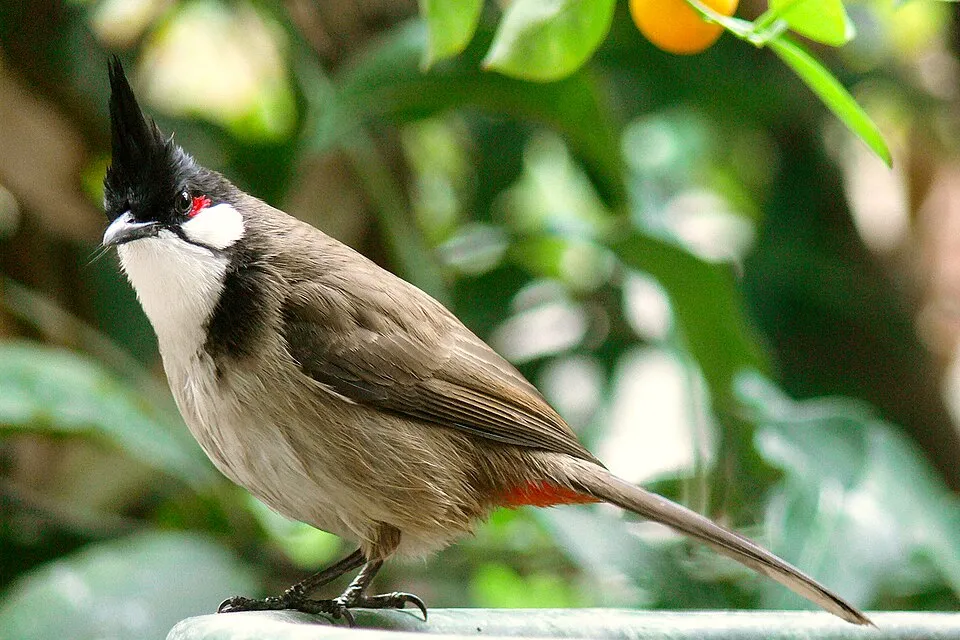
- Red-whiskered Bulbul · Pycnonotus jocosus · 2712
- Hen's eyes · Ardisia crenata · 2550
+18 more species
- Doratoxylon apetalum · 2395
- Réunion Bulbul · Hypsipetes borbonicus · 2378
- Giant Bramble · Rubus alceifolius · 2357
- Mexican fleabane · Erigeron karvinskianus · 2331
- Cheesewood · Pittosporum senacia · 2263
- Réunion Olive White-eye · Zosterops olivaceus · 2208
- Florida hopbush · Dodonaea viscosa · 2164
- Malabar plum · Syzygium jambos · 2094
- Red Fody · Foudia madagascariensis · 2069
- Mascarene Paradise Flycatcher · Terpsiphone bourbonnensis · 1888
- Spreading snakeroot · Ageratina riparia · 1815
- Albinoberry · Aphloia theiformis · 1804
- Mascarene swiftlet · Aerodramus francicus · 1765
- Phyllanthus casticum · 1705
- Antirhea borbonica · 1694
- Lantana · Lantana camara · 1678
- Indian laurel · Litsea glutinosa · 1647
- Kahila garland-lily · Hedychium gardnerianum · 1607
Records: GBIF.org (CC-BY). Names: Wikidata (CC0), GBIF. Photos: Wikimedia Commons.
Conservation challenges
The primary purpose of the site is to preserve its natural habitats and the biodiversity they support. The species recorded (Biodiversity tab) reflect its ecological value. The designations it holds frame its management and the control of land use.
According to Global Forest Change data (University of Maryland, Global Forest Watch), about 1,150 ha of tree cover were lost within the boundary between 2001 and 2023 (1% of its area), peaking in 2006 and 2013. These losses include logging, storms and fires, and do not account for regrowth. At night, 7% of the area gives off artificial light detectable from space (NASA VIIRS Black Marble composite, 2016). According to the Water Framework Directive assessment (2022 river basin management plans, data 2012–2017), only 10% of the 302 km of rivers assessed within the site are in good or high ecological status; the others mostly have moderate ecological status. Other assessed water bodies: lakes, 1 of 1 in good ecological status or better; coastal waters, 1 of 1 in good ecological status or better. Since 2000, 189 invasive alien species have been recorded within the site (GBIF observations). Among them: Psidium cattleianum (Cattley guava), Hypochaeris radicata (Hairy cat's ear) and Pycnonotus jocosus (Red-whiskered Bulbul).
Pressure indicators
Tree cover lost
1,150 ha
2001–2023 · 1% of the area
20012023
Fires since 2016
0
No large fire mapped (fires over about 30 ha)
Light at night
7%
of the area gives off artificial light visible from space
DarkLit
Built-up land
< 1%
buildings, business areas, roads, quarries · farmland 1%
Rivers and lakes
10%
of the 302 km of assessed rivers in good or high ecological status · WFD 2022
Lakes: 1 of 1 good or better
Coastal waters: 1 of 1 good or better
assessments 2012–2017
Invasive alien species
189
recorded since 2000
Cattley guava
 Hairy cat's ear
 Red-whiskered Bulbul
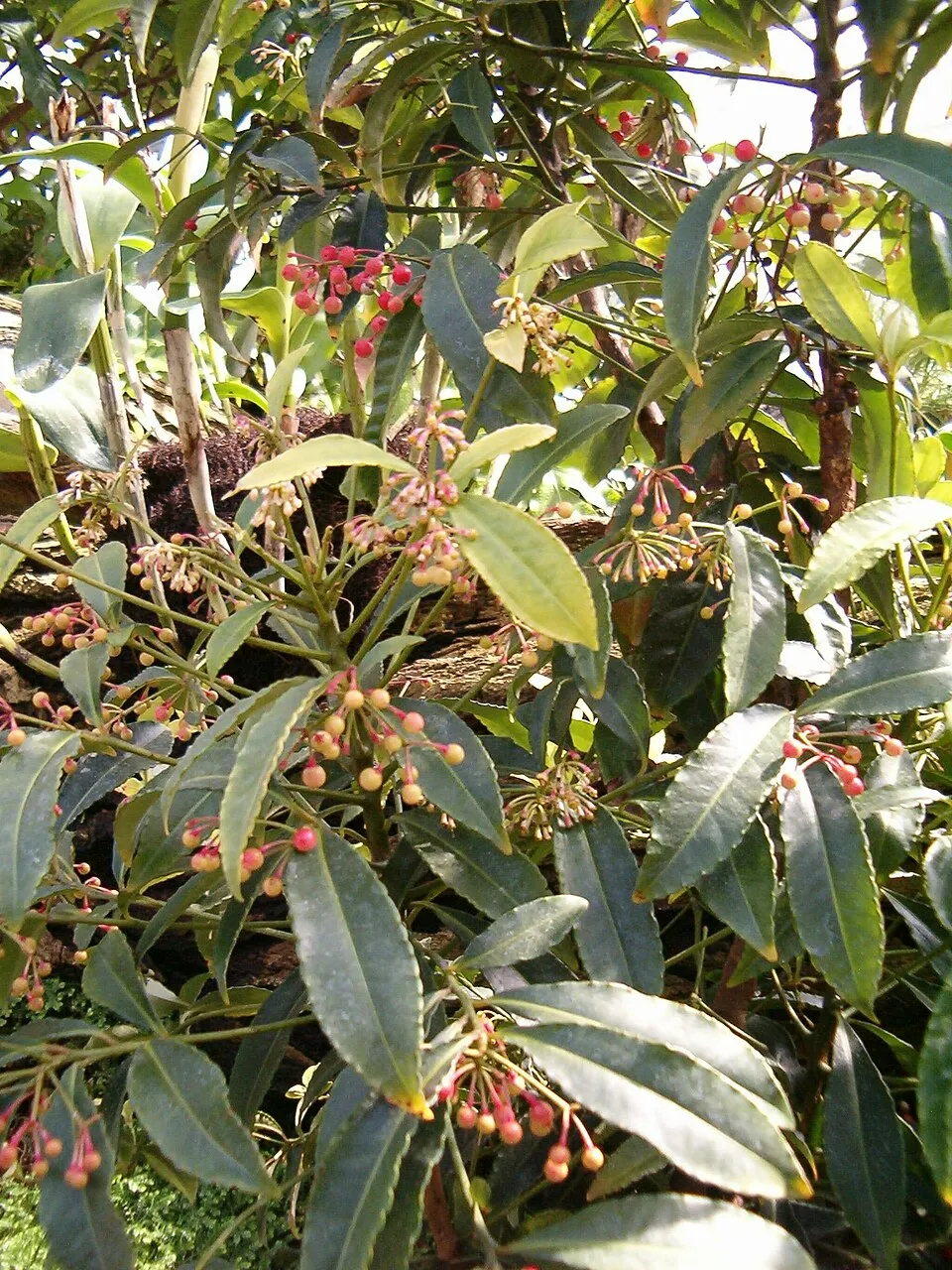 Hen's eyes
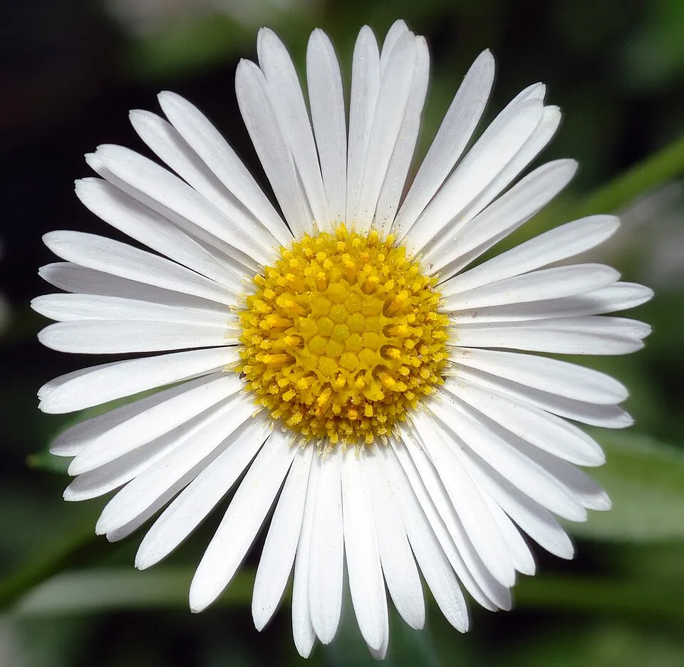 Mexican fleabane
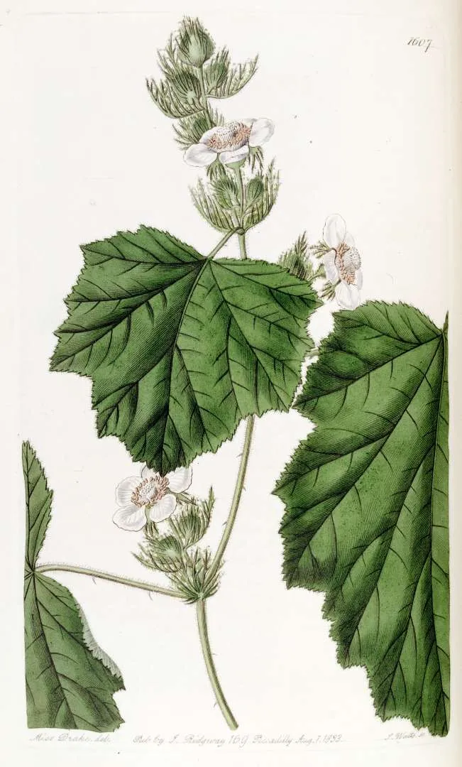 Giant Bramble
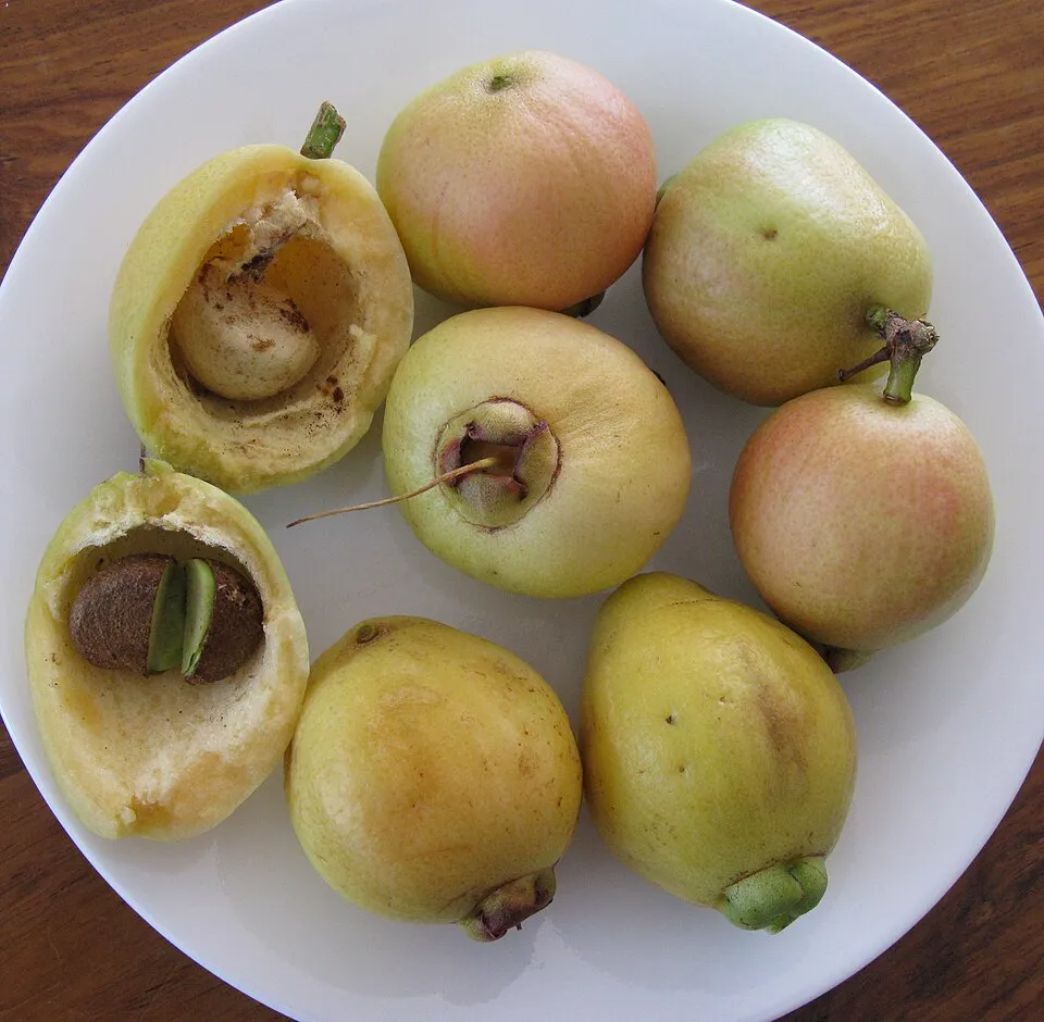 Malabar plum
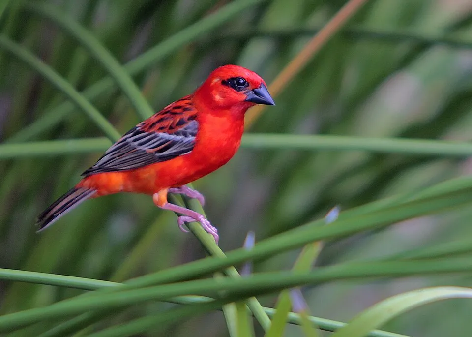 Red Fody
Hairy cat's ear
Red-whiskered Bulbul
Hen's eyes
Mexican fleabane
Giant Bramble
Malabar plum
Red Fody
Photos: Hairy cat's ear © AnRo0002 · CC0-1.0; Red-whiskered Bulbul © myjkccd · Public domain; Hen's eyes © BotBln · CC BY-SA 3.0; Mexican fleabane © André Karwath aka Aka · CC BY-SA 2.5; Giant Bramble © Missouri Botanical Garden · Public domain; Malabar plum © JonRichfield · CC BY-SA 3.0; Red Fody © David Dennis · CC BY-SA 2.0
Sources: Global Forest Change (Hansen et al., University of Maryland, via Global Forest Watch, CC-BY 4.0); EFFIS, European Commission / Copernicus; NASA Black Marble 2016 (public domain); CORINE Land Cover 2018 (Copernicus) or MODIS.
Ecological status of water bodies: European Environment Agency, WISE – Water Framework Directive, 3rd river basin management plans (2022), CC BY 4.0. Official national classification, not comparable between countries.
Invasive alien species: Global Register of Introduced and Invasive Species (ISSG, CC BY 4.0); Union list, Regulation (EU) 1143/2014 (INBO, CC0); GBIF.org records (CC0 / CC BY 4.0), at least 2 per species.
Practical information
Cities and airport
- Saint-Denis
3 km as the crow flies - Saint-André
5 km as the crow flies - Airport: Roland Garros (RUN)
5 km as the crow flies
Visitor information
- Chalet du Brulé - Kaz tuit-tuit
< 1 km from the site boundary - Boureau d'information de La Nouvelle
within the site - Office de Tourisme de Cilaos
< 1 km from the site boundary - Office de Tourisme Intercommunal de l'Est
< 1 km from the site boundary
Parking
77 public car parks listed within the site
Parking des Cryptomériasparking du Piton de l'Eauparking de Piton Textorparking du Sentier Scout
Things to see
196 viewpoints · 67 waterfalls · 8 lakes and ponds · 34 caves
- Balcon de Dolomieu
viewpoint · 2,485 m - Bassin Bleu
waterfall - Bassin des Aigrettes
lake or pond - Caverne du Chisny
cave · 2,358 m - Morne Langevin
viewpoint · 2,383 m
Where to stay
23 mountain huts · 52 campsites
- Refuge de la Caverne Dufour
Staffed hut · 2,478 m - Aire de bivouac Cap Blanc
campsite - Gîte du Volcan
Staffed hut · 2,240 m - Aire de camping de Yoland Louise
campsite - Gîte de Bélouve
Staffed hut · 1,500 m
Hiking
27 waymarked routes listed, including:
Canalisation des OrangersChemin CrémontSentier Jacky InardSentier de la Grande JumentSentier Bayonne
Trail difficulty
- T1 · easy hiking · 15% · 67 km
- T2 · mountain hiking · 50% · 204 km
- T3–T6 · demanding or alpine hiking · 30% · 127 km
398 km graded out of 912 km of paths
SAC scale (T1–T6) © OpenStreetMap contributors (ODbL): indicative only, check with the park.
By bike
V1 Tour de l'Île · 9 km
Signed cycle routes: this does not mean that cycling is allowed on footpaths.
Data © OpenStreetMap contributors (ODbL) · Wikidata (CC0)
Routes © OpenStreetMap contributors (ODbL), via Waymarked Trails
Waymarked hiking routes
GR R1 GR R1
43.6 km within the site ↗ 1,558 m↘ 1,712 m 1,118–2,080 m
up to T2 · mountain hiking
Canalisation des Orangers
11.7 km within the site ↗ 1,582 m↘ 1,378 m 597–979 m
up to T2 · mountain hiking
Sentier Jacky Inard
5.3 km within the site ↗ 457 m↘ 267 m 1,964–2,334 m
up to T2 · mountain hiking
Sentier de la Grande Jument
4.2 km within the site ↗ 664 m↘ 0 m 804–1,481 m
Tracks © OpenStreetMap contributors (ODbL), clipped to the boundary; elevation gain and profiles computed on the longest section from Mapzen Terrain Tiles (≈ 30 m), indicative only. Indicative difficulty (SAC scale, OpenStreetMap, via Waymarked Trails): check with the park.
Bathing
1 monitored bathing site in or within 1 km of the site · 2025 classification
Excellent · 1
- Bassin de la Passerelle · river · Excellent
Source: European Environment Agency, official bathing water classification (Directive 2006/7/EC, CC-BY 4.0). Swimming is only permitted at the sites and times authorised locally.
Access and visiting
Nearest towns of over 50,000 people, as the crow flies: Saint-Denis (3 km) and Saint-André (5 km). Nearest airport: Roland Garros (RUN), about 5 km away. About 950,000 people live within 20 km of the site boundary; some 7,900 people are estimated to live inside (GHSL estimate, 2020). This population has grown by about 22% since 2000. Visitor information on site: Chalet du Brulé - Kaz tuit-tuit, Boureau d'information de La Nouvelle and Office de Tourisme de Cilaos. Public car parks listed within the site: 77, including Parking des Cryptomérias, parking du Piton de l'Eau and parking de Piton Textor. Waymarked hiking routes listed in OpenStreetMap: 27, including Canalisation des Orangers, Chemin Crémont, Sentier Jacky Inard and Sentier de la Grande Jument. Of the roughly 400 km of paths with a difficulty grade in OpenStreetMap, 15% are easy hiking (T1), 50% mountain hiking (T2) and 30% demanding or alpine hiking (T3–T6). This is indicative only: check with the park. A signed cycle route crosses the site: “V1 Tour de l'Île” (OpenStreetMap). To see: 196 viewpoints, 67 waterfalls, 8 lakes and ponds and 34 caves, including Balcon de Dolomieu (2,485 m), Bassin Bleu, Bassin des Aigrettes and Caverne du Chisny (2,358 m). Where to stay: 23 mountain huts and 52 campsites, including Refuge de la Caverne Dufour (2,478 m), Aire de bivouac Cap Blanc and Gîte du Volcan (2,240 m). To plan a visit (access, opening periods, visitor rules), it is best to consult the official information from the managing body and the official website listed in this page's sources.
Source: OpenStreetMap (ODbL), Wikidata (CC0), October 2026.
Built heritage
According to the French Ministry of Culture's Mérimée database, 2 historic monuments stand within the boundary, all at the second level of protection (inscrit). Examples include “Chemin dit des Anglais” in La Saint-Denis;Possession and “L'Ilet-à-Guillaume” in Saint-Denis.
1 bridge, lighthouse, mill or working building1 house or civic building
-
Chemin dit des Anglais
La Saint-Denis;Possession · 18th c. -
L'Ilet-à-Guillaume
Saint-Denis · 19th c.
Source: Mérimée database, French Ministry of Culture (Licence Ouverte 2.0). Each record links to the Plateforme ouverte du patrimoine (POP).
When to visit
Best time to visit: from April to November, with average temperatures of 14 to 20 °C and moderate rainfall. Precipitation peaks from December to March (up to 290 mm per month). These averages apply to the site's representative point (1,339 m); higher up it is markedly cooler and snow lasts longer. Day length ranges from about 10 h 51 min in June to 13 h 25 min in December. Wildlife records published on GBIF peak for birds (October and November), plants (from April to June) and mammals (December and January). These peaks also reflect when observers are most active.
Source: Copernicus ERA5-Land (C3S), monthly averages 1996–2025 at the representative point, temperatures adjusted for elevation.
Contains modified Copernicus Climate Change Service information 2026. Neither the European Commission nor ECMWF is responsible for any use that may be made of the Copernicus information or data it contains.
Wildlife records calendar
JFMAMJJASOND
Birds
Plants
Butterflies & moths
Dragonflies
Mammals
Monthly records published on GBIF (CC-BY), relative to the busiest month; also reflects observer activity.
Gallery
© © Geolina · CC BY-SA 4.0
© Jean-Louis Sicot · CC BY-SA 4.0
© MarcM1FLEReunion · CC BY-SA 3.0
© Daniel Magotteaux · CC BY-SA 3.0
© Joachim THIÉBAUT · CC BY-SA 4.0
© Valoche974 · CC BY-SA 4.0
Sources and licences
- Wikidata: Q550389
- OpenStreetMap: relation 1110803
- Official website: http://www.reunion-parcnational.fr
- Wikipedia: en.wikipedia.org/wiki/Réunion_National_Park
- WDPA: 388669
References
- cds.climate.copernicus.eu: climate · CC-BY-4.0
- registry.opendata.aws: elevation of the reference point, detailed relief · PD
- land.copernicus.eu: land cover, sea share · COPERNICUS
- doi.org: population around the site · CC-BY-4.0
- wikidata.org: official area, establishment date, nearby cities and airport, access and peaks, lake depths, places to see, official website · CC0-1.0
- eea.europa.eu: bathing water quality, ecological status of waters · CC-BY-4.0
- en.eurovelo.com: EuroVelo cycle routes · ODbL-1.0
- cycling.waymarkedtrails.org: cycle routes · ODbL-1.0
- opentopodata.org: elevations · PD
- forest-fire.emergency.copernicus.eu: wildfires · COPERNICUS
- globalforestwatch.org: tree cover loss · CC-BY-4.0
- gbif.org: seasonality of sightings, invasive alien species, observed species · CC-BY-4.0
- pop.culture.gouv.fr: protected heritage · LO-2.0
- hydrosheds.org: lakes · CC-BY-4.0
- openstreetmap.org: official name, access and peaks, places to see, trail difficulty, wheelchair access · ODbL-1.0
- earthobservatory.nasa.gov: night light · PD
- hiking.waymarkedtrails.org: route difficulty · ODbL-1.0
- nsidc.org: snow cover · PD
- wikidata.org: Wikipedia article · CC-BY-SA-4.0
Data © OpenStreetMap contributors (ODbL), Wikidata (CC0) and the sources cited.