Brazil · Terrestrial
Tijuca National Park
National park of 3,958 hectares in Brazil, established in 1961.
Overview
National park of 3,958 hectares in Brazil, established in 1961.
Tijuca National Park is located in Brazil (South America). It is a predominantly terrestrial area. Established in 1961, it covers about 3,958 hectares.
Protections and designations
Other designations
Protected as a national park. It is covered by an additional protection designation.
In our collections
Frequently asked questions
Where is Tijuca National Park?
In Brazil (South America). Representative point: 22.9594° S, 43.2778° W.
How large is Tijuca National Park?
About 3,958 hectares (40 km²). It is the 73rd largest of the 74 national parks in Brazil covered by Parkavela.
When was Tijuca National Park established?
In 1961.
What habitats and landscapes does Tijuca National Park include?
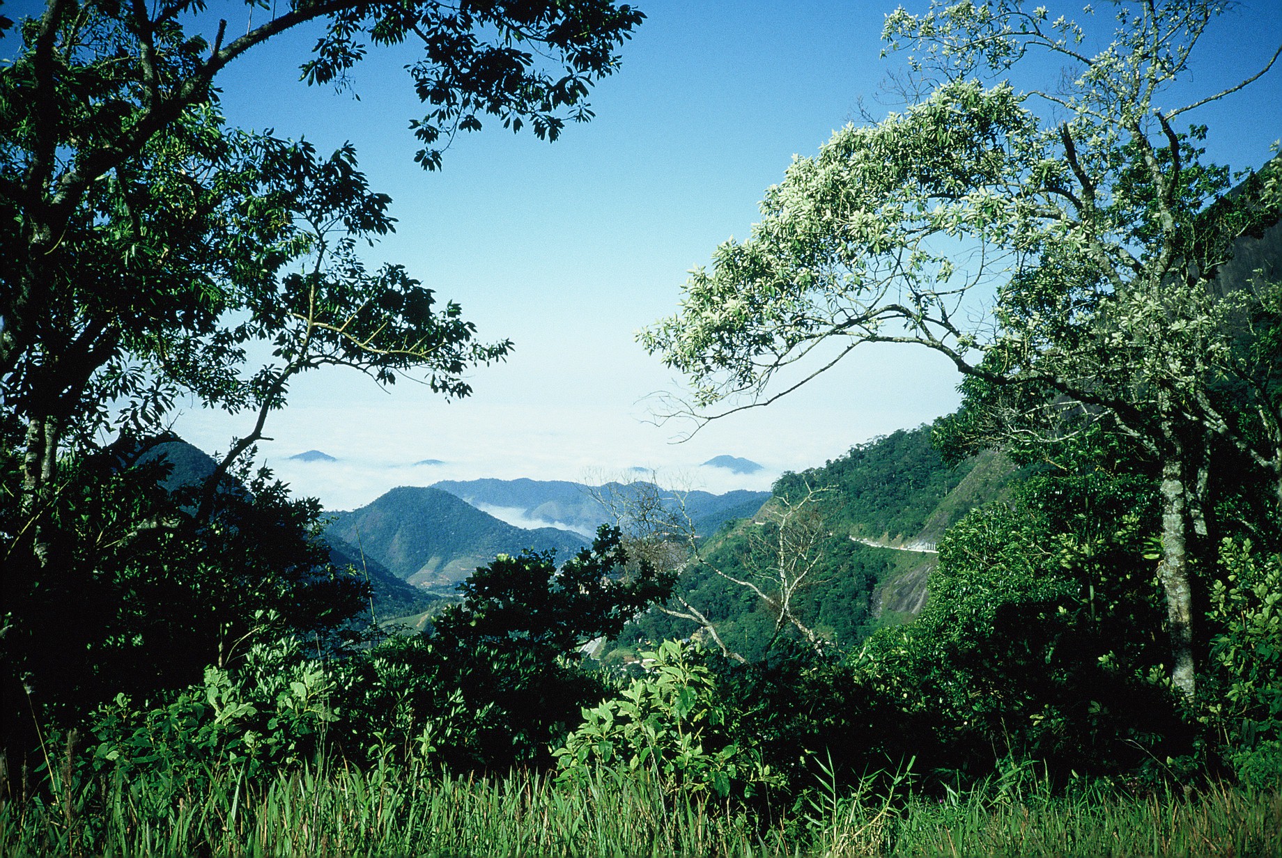
A terrestrial area, with forests and mountains.
What is the highest point of Tijuca National Park?
Pico da Tijuca, at 1,021 m (OpenStreetMap).
What are the main summits of Tijuca National Park?
Pico da Tijuca (1,021 m), Bico do Papagaio (990 m), Ponta do Urubu (983 m), Morro da Cocanha (976 m) and Alto do Santiago (922 m) (OpenStreetMap).
When is the best time to visit Tijuca National Park?
Best time to visit: the dry season, from May to September, with less than 70 mm of rain per month.
What is there to see in Tijuca National Park?
5 waterfalls and 4 lakes and ponds, including Cachoeira do Primata (229 m), Lago do Açude da Solidão, Cascata de Rocaille da Floresta da Tijuca and Lago do Quebra (Wikidata).
Are there historic monuments in Tijuca National Park?
Yes. According to Wikidata, 5 monuments listed by IPHAN as federal heritage of Brazil stand within the boundary. For example: “Christ the Redeemer” in Alto da Boa Vista, “Corcovado” in Alto da Boa Vista and “Parque Lage” in Zona Sul do Rio de Janeiro.
What is the nearest large city to Tijuca National Park?
Nearest towns of over 50,000 people, as the crow flies: Rio de Janeiro (3 km) and Greater Rio de Janeiro (4 km). Nearest airport: Santos Dumont (SDU), about 5 km away.
How can I reach Tijuca National Park by train?
The nearest railway station is Quintino, about 2 km from the site boundary.
Where can I get visitor information on site?
Igreja Metodista de Cascadura, Centro de Visitantes and Visit Rio.
Are there waymarked hiking trails in Tijuca National Park?
Yes. Waymarked hiking routes listed in OpenStreetMap: 2.
Which species can be seen in Tijuca National Park?
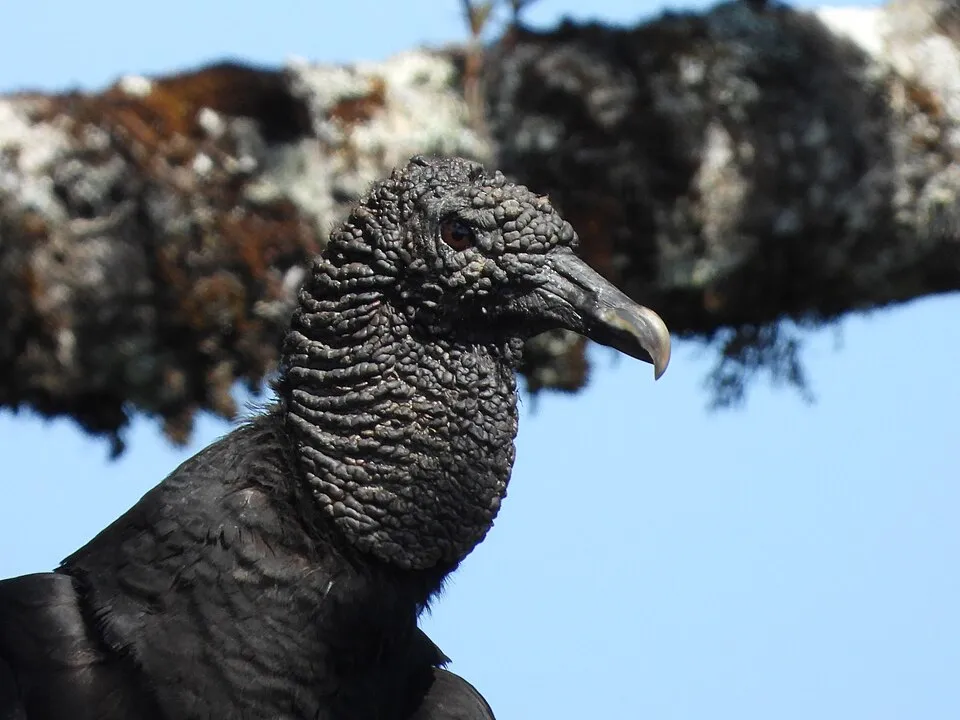
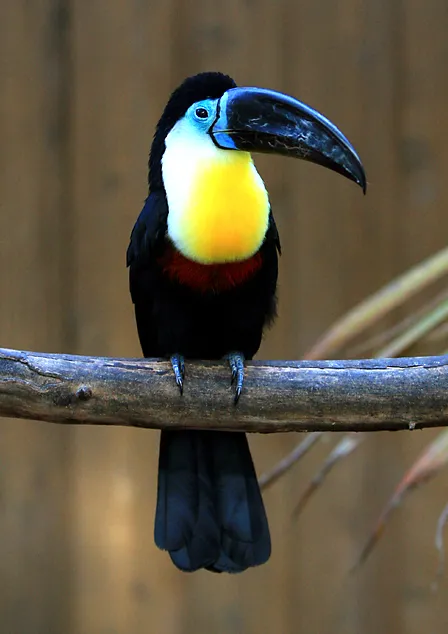
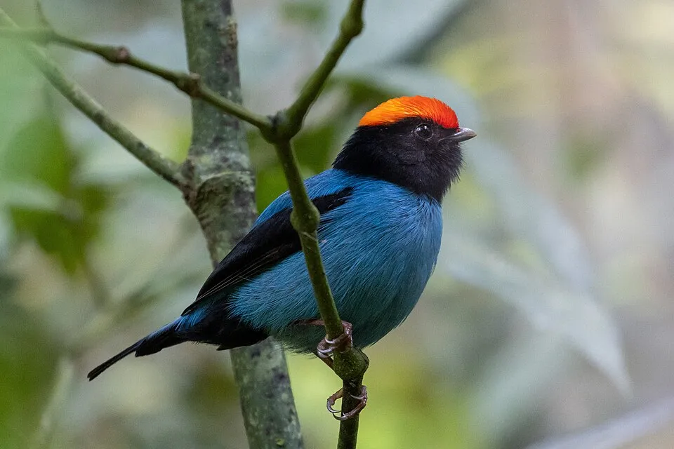
Among the species most often recorded on GBIF are Coragyps atratus (Black Vulture), Ramphastos vitellinus (Channel-billed Toucan), Chiroxiphia caudata (Blue Manakin) and Tangara seledon (Green-headed Tanager).
What is the official website of Tijuca National Park?
© OpenStreetMap
Download the boundary: GeoJSON · GPX Boundary © OpenStreetMap contributors (ODbL).
Geography
The representative point of the site lies at around 400 m above sea level. Over the 1996–2025 period, the mean annual temperature is about 21.4 °C and total precipitation reaches roughly 1,275 mm per year. The warmest month is usually February, the coolest July, and the wettest January.
Area
- Area
- 3,958 ha
- Elevation
- 400 m
- Median elevation
- 435 m
- Mean slope
- 25°
- Coordinates
- -22.9594, -43.2778
Terrain: Mapzen Terrain Tiles (SRTM, USGS)
Elevation bands
- below 500 m 62%
- 500–1,000 m 39%
share of the site in each elevation band (smoothed terrain model: summits are rounded off) · Terrain: Mapzen Terrain Tiles (SRTM, USGS)
Main summits
- Pico da Tijuca1,021 m
- Bico do Papagaio990 m
- Ponta do Urubu983 m
- Morro da Cocanha976 m
- Alto do Santiago922 m
- Pico da Tijuca Mirim920 m
- Pedra João Antônio908 m
- Pico do Andaraí Maior861 m
- Pedra da Gávea844 m
- Pedra do Conde819 m
Data © OpenStreetMap contributors (ODbL)
Climate
● Mean temperature (°C) · ▮ Precipitation (mm)
Source: Copernicus ERA5-Land (C3S, doi:10.24381/cds.68d2bb30), monthly averages 1996–2025 interpolated to the representative point, temperatures adjusted for elevation.
Contains modified Copernicus Climate Change Service information 2026. Neither the European Commission nor ECMWF is responsible for any use that may be made of the Copernicus information or data it contains.
Natural habitats
According to the global MODIS land cover (NASA, 2024), the site is mainly made up of forests (80%) and built-up or developed land (12%). It is mostly dense evergreen broadleaved forest. Elevation ranges from about 60 m to 1,021 m (highest point: Pico da Tijuca). Median elevation is 435 m, and 39% of the site lies above 500 m (SRTM elevation model). The terrain is steep: 29% of slopes exceed 30° (mean slope 25°).
Biodiversity
Based on occurrences aggregated by GBIF, several species are regularly recorded within the site. Among the most frequent are Coragyps atratus (Black Vulture), Ramphastos vitellinus (Channel-billed Toucan), Chiroxiphia caudata (Blue Manakin) and Tangara seledon (Green-headed Tanager). The full list of documented taxa is shown below.
Species to look out for

Bird
Green-headed Tanager
Tangara seledon806 records © Dario Sanches from São Paulo, Brasil · CC BY-SA 2.0

Bird
Golden-crowned Warbler
Basileuterus culicivorus796 records © Dario Sanches from SÃO PAULO, BRASIL · CC BY-SA 2.0

Bird
Yellow-lored Tody-Flycatcher
Todirostrum poliocephalum698 records © Dario Sanches from SÃO PAULO, BRASIL · CC BY-SA 2.0
Observed species
Occurrences documented via GBIF; they are neither an exhaustive inventory nor proof of current presence.
- Black Vulture · Coragyps atratus · 921
- Channel-billed Toucan · Ramphastos vitellinus · 896
- Blue Manakin · Chiroxiphia caudata · 827
- Green-headed Tanager · Tangara seledon · 806
- Golden-crowned Warbler · Basileuterus culicivorus · 796
- Yellow-lored Tody-Flycatcher · Todirostrum poliocephalum · 698
- Lesser Woodcreeper · Xiphorhynchus fuscus · 692
- Southern House Wren · Troglodytes musculus · 690
- Olivaceous Woodcreeper · Sittasomus griseicapillus · 668
- Red-necked tanager · Tangara cyanocephala · 667
- Bananaquit · Coereba flaveola · 650
- Plain-brown woodcreeper · Dendrocincla fuliginosa · 635
+18 more species
- Plain Antvireo · Dysithamnus mentalis · 630
- Violet-capped Woodnymph · Thalurania glaucopis · 621
- Maroon-bellied Parakeet · Pyrrhura frontalis · 617
- Long-billed Wren · Cantorchilus longirostris · 569
- Rufous-winged Antwren · Herpsilochmus rufimarginatus · 559
- Yellow-olive Flatbill · Tolmomyias sulphurescens · 557
- White-barred Piculet · Picumnus cirratus · 542
- Flame-crested Tanager · Loriotus cristatus · 541
- Scaled Antbird · Drymophila squamata · 538
- Black-cheeked Gnateater · Conopophaga melanops · 536
- Plain Parakeet · Brotogeris tirica · 529
- Pin-tailed Manakin · Ilicura militaris · 526
- Tropical Parula · Setophaga pitiayumi · 525
- Palm Tanager · Thraupis palmarum · 514
- Great Kiskadee · Pitangus sulphuratus · 493
- Pale-breasted Thrush · Turdus leucomelas · 492
- Sepia-capped Flycatcher · Leptopogon amaurocephalus · 481
- Red-crowned Ant Tanager · Habia rubica · 475
Records: GBIF.org (CC-BY). Names: Wikidata (CC0), GBIF. Photos: Wikimedia Commons.
Conservation challenges
The primary purpose of the site is to preserve its natural habitats and the biodiversity they support. The species recorded (Biodiversity tab) reflect its ecological value. The designations it holds frame its management and the control of land use.
According to Global Forest Change data (University of Maryland, Global Forest Watch), about 53 ha of tree cover were lost within the boundary between 2001 and 2023 (1% of its area), peaking in 2017. These losses include logging, storms and fires, and do not account for regrowth. At night, 100% of the area gives off artificial light detectable from space (NASA VIIRS Black Marble composite, 2016). Built-up and developed land (buildings, business areas, roads, quarries) covers 12% of the area (MODIS). Since 2000, 23 invasive alien species have been recorded within the site (GBIF observations). Among them: Passer domesticus (House Sparrow), Estrilda astrild (Common Waxbill) and Artocarpus heterophyllus (Jackfruit tree).
Pressure indicators
Tree cover lost
53 ha
2001–2023 · 1% of the area
20012023
Light at night
100%
of the area gives off artificial light visible from space
DarkLit
Built-up land
12%
buildings, business areas, roads, quarries
Invasive alien species
23
recorded since 2000
 House Sparrow
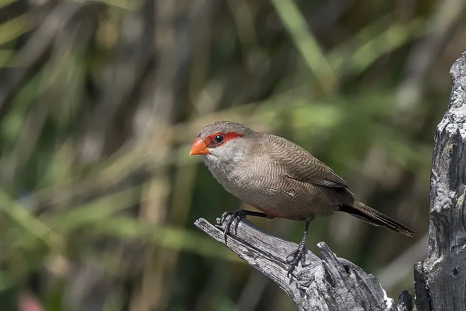 Common Waxbill
 Jackfruit tree
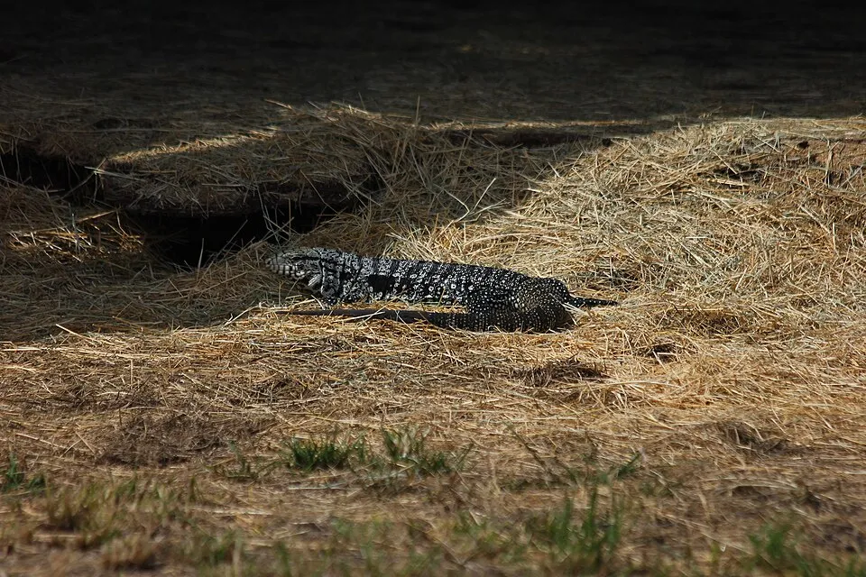 Black-and-white Tegu
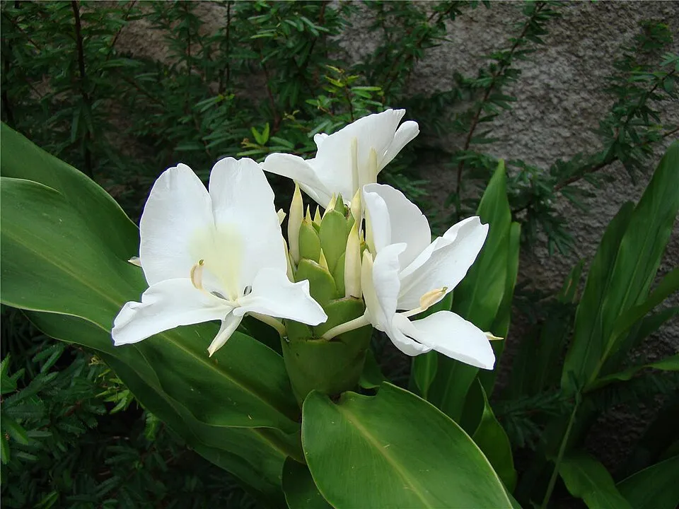 White garland-lily
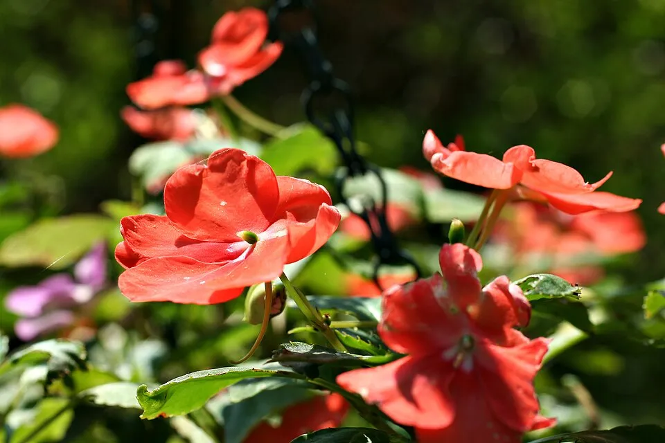 Buzzy lizzy
 Common marmoset
 Dark False Mussel
Photos: House Sparrow © Diliff · CC BY-SA 3.0; Common Waxbill © Charles J. Sharp · CC BY-SA 4.0; Jackfruit tree © Tushar Hossain · CC BY-SA 4.0; Black-and-white Tegu © Kaz Born · CC BY 4.0; White garland-lily © Minister2009 · CC BY-SA 3.0; Buzzy lizzy © Thegreenj · CC BY-SA 3.0; Common marmoset © Raimond Spekking · CC BY-SA 4.0; Dark False Mussel © Motte123 · CC0-1.0
Sources: Global Forest Change (Hansen et al., University of Maryland, via Global Forest Watch, CC-BY 4.0); EFFIS, European Commission / Copernicus; NASA Black Marble 2016 (public domain); CORINE Land Cover 2018 (Copernicus) or MODIS.
Invasive alien species: Global Register of Introduced and Invasive Species (ISSG, CC BY 4.0); Union list, Regulation (EU) 1143/2014 (INBO, CC0); GBIF.org records (CC0 / CC BY 4.0), at least 2 per species.
Practical information
Cities and airport
- Rio de Janeiro
3 km as the crow flies - Greater Rio de Janeiro
4 km as the crow flies - Airport: Santos Dumont (SDU)
5 km as the crow flies
Visitor information
- Igreja Metodista de Cascadura
2 km from the site boundary - Centro de Visitantes
within the site - Visit Rio
2 km from the site boundary - CEJEP: Comunidade Evangélica Jesus é a porta
2 km from the site boundary
Parking
14 public car parks listed within the site
Estacionamento Parque Lage
Things to see
5 waterfalls · 4 lakes and ponds
- Cachoeira do Primata
waterfall · 229 m - Lago do Açude da Solidão
lake or pond - Cascata de Rocaille da Floresta da Tijuca
waterfall - Lago do Quebra
lake or pond - Cascata o Quebra
waterfall
Hiking
2 waymarked routes listed
Data © OpenStreetMap contributors (ODbL) · Wikidata (CC0)
Waymarked hiking routes
Tracks © OpenStreetMap contributors (ODbL), clipped to the boundary; elevation gain and profiles computed on the longest section from Mapzen Terrain Tiles (≈ 30 m), indicative only. Indicative difficulty (SAC scale, OpenStreetMap, via Waymarked Trails): check with the park.
Access and visiting
The nearest railway station is Quintino, about 2 km from the site boundary. Nearest towns of over 50,000 people, as the crow flies: Rio de Janeiro (3 km) and Greater Rio de Janeiro (4 km). Nearest airport: Santos Dumont (SDU), about 5 km away. About 8.3 million people live within 20 km of the site boundary, 4.5 million of them within 10 km; some 30,000 people are estimated to live inside (GHSL estimate, 2020). This population has grown by about 13% since 2000. Visitor information on site: Igreja Metodista de Cascadura, Centro de Visitantes and Visit Rio. Public car parks listed within the site: 14, including Estacionamento Parque Lage. Waymarked hiking routes listed in OpenStreetMap: 2. To see: 5 waterfalls and 4 lakes and ponds, including Cachoeira do Primata (229 m), Lago do Açude da Solidão, Cascata de Rocaille da Floresta da Tijuca and Lago do Quebra. To plan a visit (access, opening periods, visitor rules), it is best to consult the official information from the managing body and the official website listed in this page's sources.
Source: OpenStreetMap (ODbL), Wikidata (CC0), November 2026.
Built heritage
According to Wikidata, 5 monuments listed by IPHAN as federal heritage of Brazil stand within the boundary. Among them are 3 houses and civic buildings. Examples include “Christ the Redeemer” in Alto da Boa Vista, “Corcovado” in Alto da Boa Vista and “Parque Lage” in Zona Sul do Rio de Janeiro.
-
Christ the Redeemer
Alto da Boa Vista · 20th c. -
Corcovado
Alto da Boa Vista -
Parque Lage
Zona Sul do Rio de Janeiro -
Pedra da Gávea
Barra da Tijuca -
Tijuca National Park
Rio de Janeiro · 20th c.
Source: Wikidata (CC0), monuments in each country’s official heritage protection registers, at national or regional level. Each item links to its Wikidata entry.
When to visit
Best time to visit: the dry season, from May to September, with less than 70 mm of rain per month. Precipitation peaks in December and January (up to 190 mm per month). These averages apply to the site's representative point (400 m); higher up it is markedly cooler. Day length ranges from about 10 h 44 min in June to 13 h 32 min in December. Wildlife records published on GBIF peak for birds (from July to September), dragonflies (March) and mammals (from May to September). These peaks also reflect when observers are most active.
Source: Copernicus ERA5-Land (C3S), monthly averages 1996–2025 at the representative point, temperatures adjusted for elevation.
Contains modified Copernicus Climate Change Service information 2026. Neither the European Commission nor ECMWF is responsible for any use that may be made of the Copernicus information or data it contains.
Wildlife records calendar
JFMAMJJASOND
Birds
Plants
Butterflies & moths
Dragonflies
Mammals
Monthly records published on GBIF (CC-BY), relative to the busiest month; also reflects observer activity.
Gallery
© Halley Pacheco de Oliveira · CC BY-SA 3.0
© Chensiyuan · CC BY 3.0
© Juh oliveira87 · CC BY-SA 3.0
© FILIPE STEIN DE ARRUDA BOTELHO · CC BY-SA 3.0
© Eduardo Gabão · CC BY-SA 3.0
© Rodrigochadi · CC BY-SA 3.0
Sources and licences
- Wikidata: Q1974494
- OpenStreetMap: relation 1124490
- Official website: https://www.icmbio.gov.br/parnatijuca/
- Wikipedia: en.wikipedia.org/wiki/Tijuca_National_Park
- WDPA: 74
References
- cds.climate.copernicus.eu: climate · CC-BY-4.0
- registry.opendata.aws: elevation of the reference point, detailed relief · PD
- lpdaac.usgs.gov: land cover · PD
- doi.org: population around the site · CC-BY-4.0
- naturalearthdata.com: sea share · PD
- wikidata.org: official area, highest point, establishment date, protected heritage, official name, nearby cities and airport, access and peaks, lake depths, places to see, official website · CC0-1.0
- en.eurovelo.com: EuroVelo cycle routes · ODbL-1.0
- cycling.waymarkedtrails.org: cycle routes · ODbL-1.0
- opentopodata.org: elevations · PD
- globalforestwatch.org: tree cover loss · CC-BY-4.0
- gbif.org: seasonality of sightings, invasive alien species, observed species · CC-BY-4.0
- earthobservatory.nasa.gov: night light · PD
- openstreetmap.org: access and peaks · ODbL-1.0
- hiking.waymarkedtrails.org: route difficulty · ODbL-1.0
- nsidc.org: snow cover · PD
- wikidata.org: Wikipedia article · CC-BY-SA-4.0
Data © OpenStreetMap contributors (ODbL), Wikidata (CC0) and the sources cited.