Bolivia · Terrestrial
Tunari National Park
National park of 329,960 hectares in Bolivia, established in 1992.
Overview
National park of 329,960 hectares in Bolivia, established in 1992.
Tunari National Park is located in Bolivia (South America). It is a predominantly terrestrial area. Established in 1992, it covers about 329,960 hectares.
In our collections
Frequently asked questions
Where is Tunari National Park?
In Bolivia (South America). Representative point: 17.2328° S, 66.3459° W.
How large is Tunari National Park?
About 329,960 hectares (3,300 km²). It is the 7th largest of the 13 national parks in Bolivia covered by Parkavela.
When was Tunari National Park established?
In 1992.
What habitats and landscapes does Tunari National Park include?
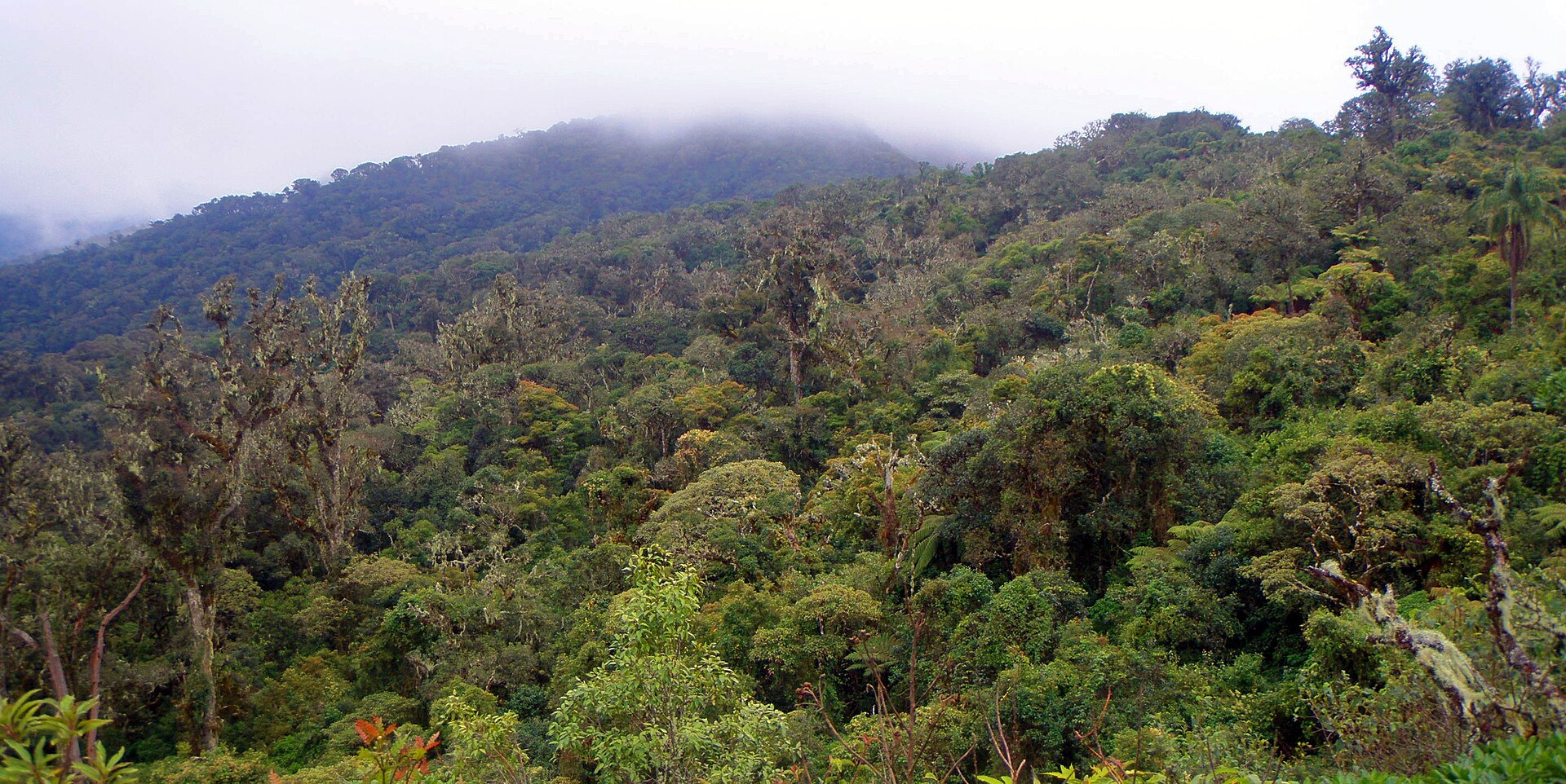
A terrestrial area, with mountains.
What is the highest point of Tunari National Park?
Cerro Pirhuata, at 5,060 m (OpenStreetMap).
What are the main summits of Tunari National Park?
Cerro Pirhuata (5,060 m), Tunari (5,035 m), Cerro San Agustín (4,830 m), Cerro Santa Rosa (4,600 m) and Cerro Potrera (3,794 m) (OpenStreetMap).
When is the best time to visit Tunari National Park?
Mildest period: from September to May, with average temperatures of 3 to 6 °C.
What is there to see in Tunari National Park?
8 lakes and ponds, including Lago Larati (3,667 m), Laguna Wara Wara, Sayt'u Qucha and Laguna Hierba Buena (4,379 m) (Wikidata).
Are there historic monuments in Tunari National Park?
Yes. According to Wikidata, one monument protected in Bolivia as National Monuments stands within the boundary. For example: “Ruinas de Inka Raqay” in Sipe Sipe.
What is the nearest large city to Tunari National Park?
Nearest towns of over 50,000 people, as the crow flies: Sipe Sipe (within the area) and Tiquipaya (2 km). Nearest airport: Jorge Wilstermann (CBB), about 8 km away.
How can I reach Tunari National Park by train?
The nearest railway station is Pueblo Nuevo, about 3 km from the site boundary.
Where can I get visitor information on site?
Oficina Guardaparques Parque Tunari, Ex Casa de Guardaparques and Informaciones.
Are there waymarked hiking trails in Tunari National Park?
Yes. Waymarked hiking routes listed in OpenStreetMap: 2, including lagunas.
Which species can be seen in Tunari National Park?
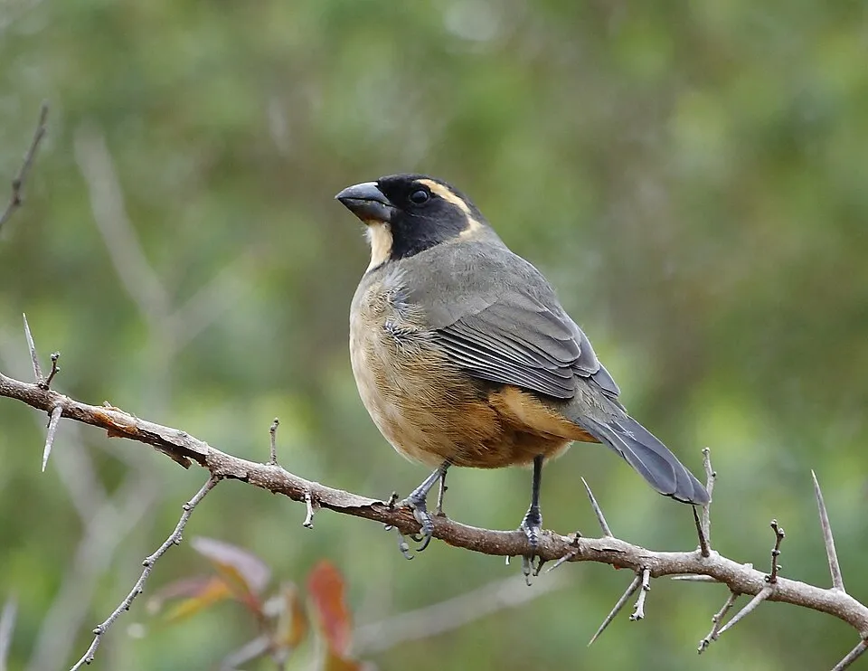
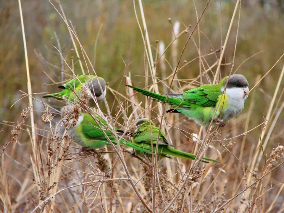
Among the species most often recorded on GBIF are Zonotrichia capensis (Rufous-collared Sparrow), Saltator aurantiirostris (Golden-billed Saltator), Turdus chiguanco (Chiguanco Thrush) and Psilopsiagon aymara (Grey-hooded Parakeet).
© OpenStreetMap
Download the boundary: GeoJSON · GPX Boundary © OpenStreetMap contributors (ODbL).
Geography
The representative point of the site lies at around 4,572 m above sea level. Over the 1996–2025 period, the mean annual temperature is about 4.4 °C and total precipitation reaches roughly 1,420 mm per year. The warmest month is usually November, the coolest July, and the wettest January.
Area
- Area of the boundary
- 329,960 ha
- Elevation
- 4,572 m
- Median elevation
- 3,991 m
- Mean slope
- 16°
- Coordinates
- -17.2328, -66.3459
Terrain: Mapzen Terrain Tiles (SRTM, USGS)
Elevation bands
- 2,000–2,500 m 1%
- 2,500–3,000 m 8%
- above 3,000 m 91%
share of the site in each elevation band (smoothed terrain model: summits are rounded off) · Terrain: Mapzen Terrain Tiles (SRTM, USGS)
Main summits
- Cerro Pirhuata5,060 m
- Tunari5,035 m
- Cerro San Agustín4,830 m
- Cerro Santa Rosa4,600 m
- Cerro Potrera3,794 m
- Yuraq Yaku3,230 m
- Cerro Takholoma3,225 m
Data © OpenStreetMap contributors (ODbL)
Climate
● Mean temperature (°C) · ▮ Precipitation (mm)
Source: Copernicus ERA5-Land (C3S, doi:10.24381/cds.68d2bb30), monthly averages 1996–2025 interpolated to the representative point, temperatures adjusted for elevation.
Contains modified Copernicus Climate Change Service information 2026. Neither the European Commission nor ECMWF is responsible for any use that may be made of the Copernicus information or data it contains.
Natural habitats
According to the global MODIS land cover (NASA, 2024), the site is mainly made up of grassland and meadows (97%). Elevation ranges from about 2,770 m to 5,060 m (highest point: Cerro Pirhuata). Median elevation is 3,991 m, and 91% of the site lies above 3,000 m (SRTM elevation model). The terrain is steep: 53% of slopes exceed 15° (mean slope 16°).
Biodiversity
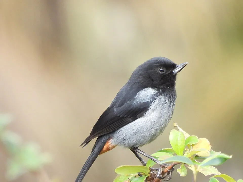
Based on occurrences aggregated by GBIF, several species are regularly recorded within the site. Among the most frequent are Zonotrichia capensis (Rufous-collared Sparrow), Saltator aurantiirostris (Golden-billed Saltator), Turdus chiguanco (Chiguanco Thrush) and Psilopsiagon aymara (Grey-hooded Parakeet). The full list of documented taxa is shown below.
Species to look out for
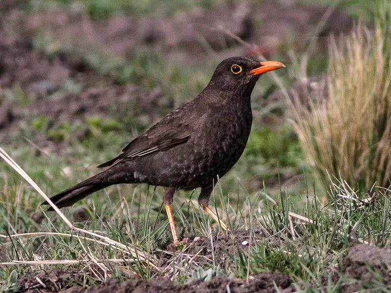
Bird
Chiguanco Thrush
Turdus chiguanco613 records © Ron Knight from Seaford, East Sussex, United Kingdom · CC BY 2.0
Observed species
Occurrences documented via GBIF; they are neither an exhaustive inventory nor proof of current presence.
- Rufous-collared Sparrow · Zonotrichia capensis · 734
- Golden-billed Saltator · Saltator aurantiirostris · 675
- Chiguanco Thrush · Turdus chiguanco · 613
- Grey-hooded Parakeet · Psilopsiagon aymara · 548
- Grey-bellied Flowerpiercer · Diglossa carbonaria · 483
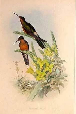
- Giant Hummingbird · Patagona gigas · 475
- Rufous-bellied Mountain Tanager · Pseudosaltator rufiventris · 468
- Red-tailed Comet · Sappho sparganurus · 450
- Greyish Baywing · Agelaioides badius · 445
- Hooded Siskin · Spinus magellanicus · 427
- Buff-winged Cinclodes · Cinclodes fuscus · 416
- Eared Dove · Zenaida auriculata · 411
+18 more species
- Rufous Hornero · Furnarius rufus · 401
- Rufous-sided Warbling Finch · Poospizopsis hypocondria · 376
- Cochabamba Mountain Finch · Poospiza garleppi · 374
- Rusty-vented Canastero · Asthenes dorbignyi · 374
- Blue-and-yellow Tanager · Rauenia bonariensis · 360
- Southern House Wren · Troglodytes musculus · 358
- Sparkling Violetear · Colibri coruscans · 354
- Tufted Tit-Tyrant · Anairetes parulus · 345
- Black-hooded Sierra Finch · Phrygilus atriceps · 342
- Brown-capped Tit-Spinetail · Leptasthenura fuliginiceps · 316
- White-winged Black Tyrant · Knipolegus aterrimus · 304
- Brown-capped Whitestart · Myioborus brunniceps · 295
- Blue-and-white Swallow · Notiochelidon cyanoleuca · 291
- Solanum brevicaule · 280
- Bolivian Blackbird · Agelaioides oreopsar · 279
- Greenish Yellow Finch · Sicalis olivascens · 277
- Bare-faced Ground Dove · Metriopelia ceciliae · 275
- Band-tailed Seedeater · Catamenia analis · 269
Records: GBIF.org (CC-BY). Names: Wikidata (CC0), GBIF. Photos: Wikimedia Commons.
Conservation challenges
The primary purpose of the site is to preserve its natural habitats and the biodiversity they support. The species recorded (Biodiversity tab) reflect its ecological value. Its status as a national park sets the regulatory framework for its protection.
According to Global Forest Change data (University of Maryland, Global Forest Watch), about 42 ha of tree cover were lost within the boundary between 2001 and 2023, peaking in 2003 and 2008. These losses include logging, storms and fires, and do not account for regrowth. At night, 9% of the area gives off artificial light detectable from space (NASA VIIRS Black Marble composite, 2016). Invasive alien species have been recorded within the site since 2000 (GBIF observations). Among them: Columba livia (Rock Dove), Spergula arvensis (Corn spurry) and Dodonaea viscosa (Florida hopbush).
Pressure indicators
Tree cover lost
42 ha
2001–2023
20012023
Light at night
9%
of the area gives off artificial light visible from space
DarkLit
Built-up land
< 1%
buildings, business areas, roads, quarries
Invasive alien species
4
recorded since 2000
 Rock Dove
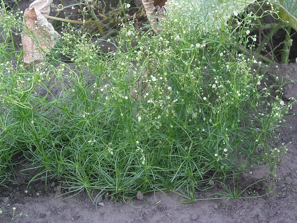 Corn spurry
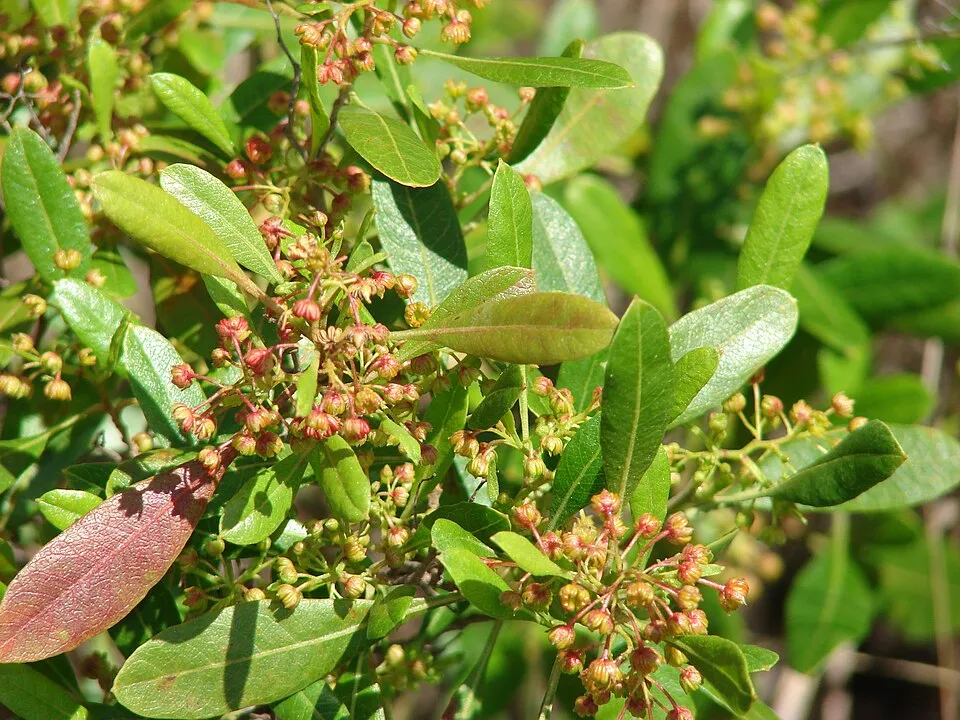 Florida hopbush
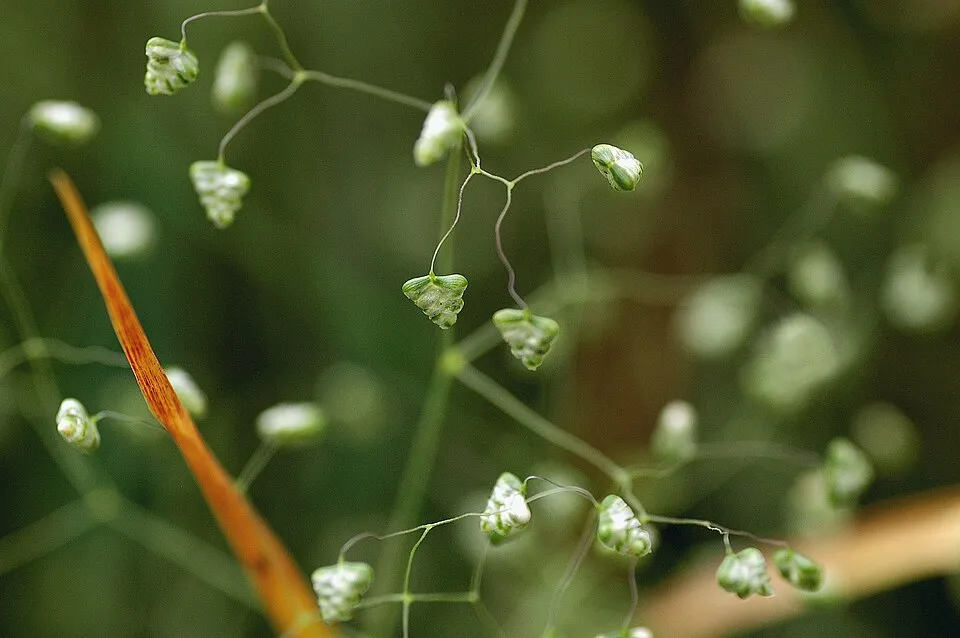 Little quakinggrass
Photos: Rock Dove © william_stephens · CC BY 4.0; Corn spurry © Rasbak · CC BY-SA 3.0; Florida hopbush © Forest & Kim Starr · CC BY 3.0; Little quakinggrass © Sphl · CC BY-SA 3.0
Sources: Global Forest Change (Hansen et al., University of Maryland, via Global Forest Watch, CC-BY 4.0); EFFIS, European Commission / Copernicus; NASA Black Marble 2016 (public domain); CORINE Land Cover 2018 (Copernicus) or MODIS.
Invasive alien species: Global Register of Introduced and Invasive Species (ISSG, CC BY 4.0); Union list, Regulation (EU) 1143/2014 (INBO, CC0); GBIF.org records (CC0 / CC BY 4.0), at least 2 per species.
Practical information
Cities and airport
- Sipe Sipe
within the site - Tiquipaya
2 km as the crow flies - Airport: Jorge Wilstermann (CBB)
8 km as the crow flies
Visitor information
- Oficina Guardaparques Parque Tunari
within the site - Ex Casa de Guardaparques
within the site - Informaciones
2 km from the site boundary
Parking
7 public car parks listed within the site
Things to see
8 lakes and ponds
- Lago Larati
lake or pond · 3,667 m - Laguna Wara Wara
lake or pond - Sayt'u Qucha
lake or pond - Laguna Hierba Buena
lake or pond · 4,379 m - Laguna Azeroni
lake or pond · 4,616 m
Hiking
2 waymarked routes listed, including:
lagunas
Data © OpenStreetMap contributors (ODbL) · Wikidata (CC0)
Access and visiting
The nearest railway station is Pueblo Nuevo, about 3 km from the site boundary. Nearest towns of over 50,000 people, as the crow flies: Sipe Sipe (within the area) and Tiquipaya (2 km). Nearest airport: Jorge Wilstermann (CBB), about 8 km away. About 1.5 million people live within 20 km of the site boundary, 1.3 million of them within 10 km; some 66,000 people are estimated to live inside (GHSL estimate, 2020). This population has grown by about 53% since 2000. Visitor information on site: Oficina Guardaparques Parque Tunari, Ex Casa de Guardaparques and Informaciones. Public car parks listed within the site: 7. Waymarked hiking routes listed in OpenStreetMap: 2, including lagunas. To see: 8 lakes and ponds, including Lago Larati (3,667 m), Laguna Wara Wara, Sayt'u Qucha and Laguna Hierba Buena (4,379 m). To plan a visit (access, opening periods, visitor rules), it is best to consult the official information from the managing body and the official website listed in this page's sources.
Source: OpenStreetMap (ODbL), Wikidata (CC0), November 2026.
Built heritage
According to Wikidata, one monument protected in Bolivia as National Monuments stands within the boundary. It is “Ruinas de Inka Raqay” in Sipe Sipe.
-
Ruinas de Inka Raqay
Sipe Sipe
Source: Wikidata (CC0), monuments in each country’s official heritage protection registers, at national or regional level. Each item links to its Wikidata entry.
When to visit
Mildest period: from September to May, with average temperatures of 3 to 6 °C. Precipitation peaks from November to March (up to 280 mm per month). These averages apply to the site's representative point (4,572 m); higher up it is markedly cooler and snow lasts longer. Day length ranges from about 11 h 06 min in June to 13 h 09 min in December. Wildlife records published on GBIF peak for birds (September and October), plants (April) and mammals (July). These peaks also reflect when observers are most active.
Source: Copernicus ERA5-Land (C3S), monthly averages 1996–2025 at the representative point, temperatures adjusted for elevation.
Contains modified Copernicus Climate Change Service information 2026. Neither the European Commission nor ECMWF is responsible for any use that may be made of the Copernicus information or data it contains.
Wildlife records calendar
JFMAMJJASOND
Birds
Plants
Mammals
Monthly records published on GBIF (CC-BY), relative to the busiest month; also reflects observer activity.
Gallery
© Fabio Giudici · CC BY-SA 2.0
© Edunavia1 · CC BY-SA 4.0
© Lilian Mendoza Tancara · CC BY-SA 4.0
© JDeybyMontenegroS · CC BY-SA 4.0
© E.Fer.Q · CC BY-SA 4.0
© Esteban Crespo · CC BY-SA 4.0
Sources and licences
- Wikidata: Q1651320
- OpenStreetMap: relation 443850
- Wikipedia: en.wikipedia.org/wiki/Tunari_National_Park
- WDPA: 4644
References
- cds.climate.copernicus.eu: climate · CC-BY-4.0
- registry.opendata.aws: elevation of the reference point, detailed relief · PD
- lpdaac.usgs.gov: land cover · PD
- doi.org: population around the site · CC-BY-4.0
- naturalearthdata.com: sea share · PD
- openstreetmap.org: official name, access and peaks · ODbL-1.0
- en.eurovelo.com: EuroVelo cycle routes · ODbL-1.0
- cycling.waymarkedtrails.org: cycle routes · ODbL-1.0
- opentopodata.org: elevations · PD
- wikidata.org: establishment date, protected heritage, nearby cities and airport, access and peaks, lake depths, places to see · CC0-1.0
- globalforestwatch.org: tree cover loss · CC-BY-4.0
- gbif.org: seasonality of sightings, invasive alien species, observed species · CC-BY-4.0
- earthobservatory.nasa.gov: night light · PD
- nsidc.org: snow cover · PD
- wikidata.org: Wikipedia article · CC-BY-SA-4.0
Data © OpenStreetMap contributors (ODbL), Wikidata (CC0) and the sources cited.