Madagascar · Terrestrial
Ankarafantsika National Park
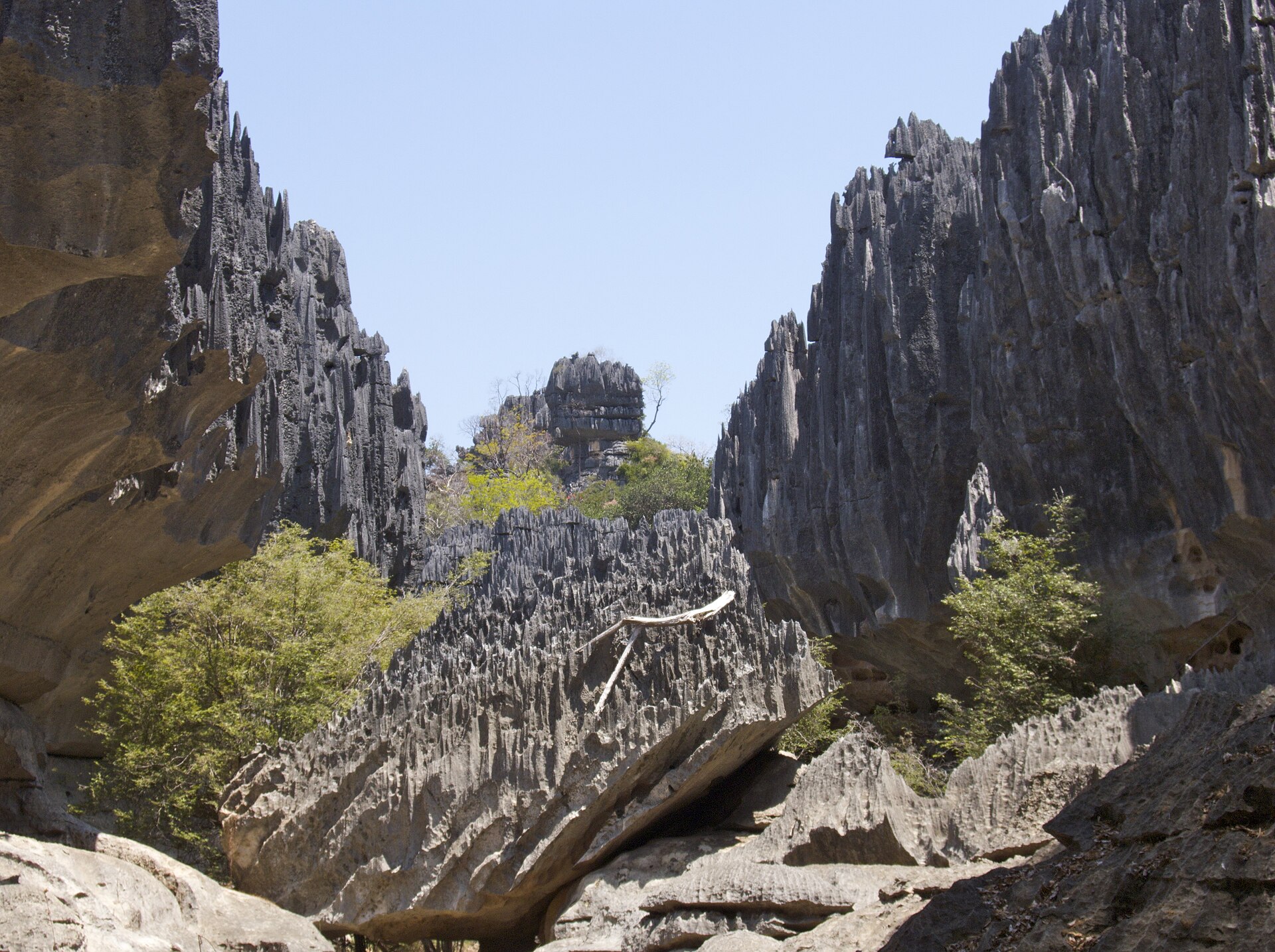
National park of 135,000 hectares in Madagascar, established in 1927.
Overview
National park of 135,000 hectares in Madagascar, established in 1927.
Ankarafantsika National Park is located in Madagascar (Africa). It is a predominantly terrestrial area. Established in 1927, it covers about 135,000 hectares.
Protections and designations
UNESCO World Heritage
Protected as a national park. International labels and designations: UNESCO World Heritage (“Andrefana Dry Forests”). Key dates: established in 1927 and World Heritage listing in 2023.
In our collections
Timeline
-
1927
Established
-
2023
Inscribed as a UNESCO World Heritage Site Andrefana Dry Forests
Sources: Wikidata (CC0) for establishment and international labels; EEA Natura 2000 database (CC-BY 4.0) for site designation dates.
Frequently asked questions
Where is Ankarafantsika National Park?
In Madagascar (Africa). Representative point: 16.1500° S, 47.0333° E.
How large is Ankarafantsika National Park?
About 135,000 hectares (1,350 km²). It is the 3rd largest of the 20 national parks in Madagascar covered by Parkavela.
When was Ankarafantsika National Park established?
In 1927.
What habitats and landscapes does Ankarafantsika National Park include?
A terrestrial area.
Which international labels apply to Ankarafantsika National Park?
UNESCO World Heritage (“Andrefana Dry Forests”).
When is the best time to visit Ankarafantsika National Park?
Best time to visit: the dry season, from May to September, with less than 20 mm of rain per month.
Which species can be seen in Ankarafantsika National Park?
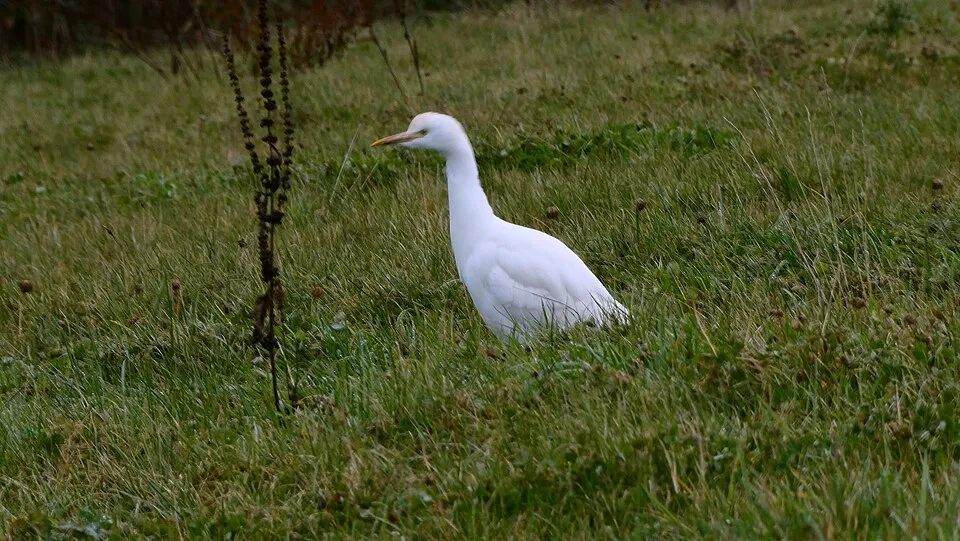
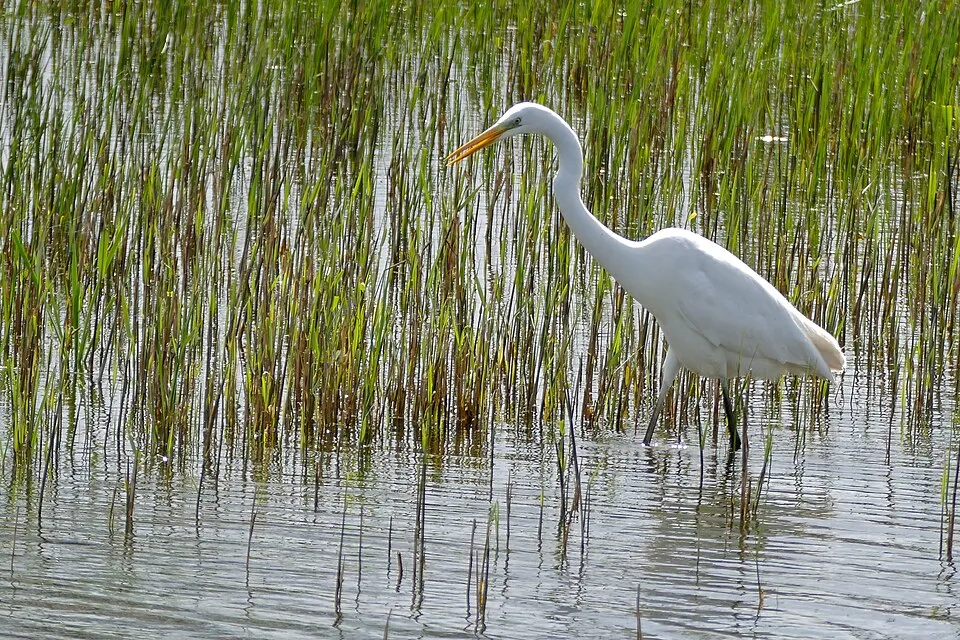
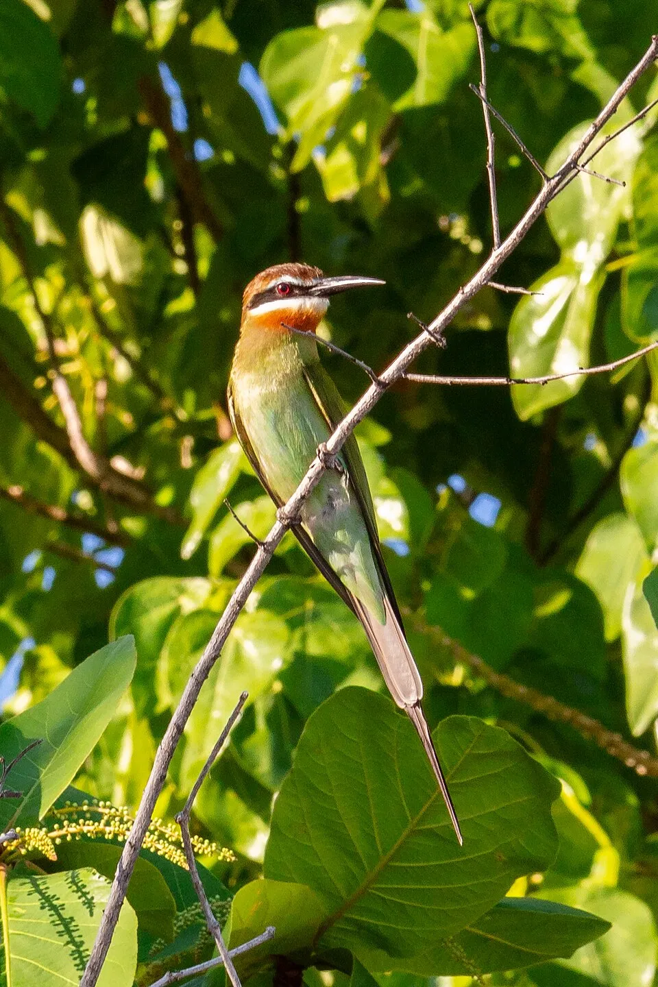
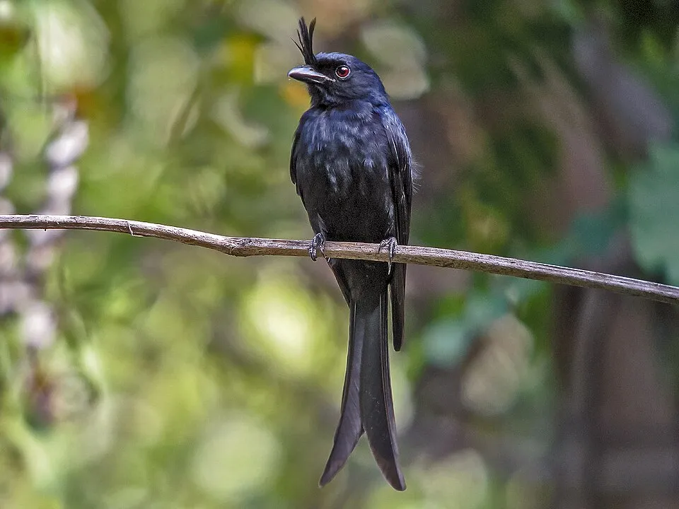
Among the species most often recorded on GBIF are Bubulcus ibis (Western Cattle Egret), Ardea alba (Great Egret), Merops superciliosus (Olive Bee-eater) and Dicrurus forficatus (Crested Drongo).
What is the official website of Ankarafantsika National Park?
© OpenStreetMap
Download the boundary: GeoJSON · GPX Boundary © OpenStreetMap contributors (ODbL).
Geography
The representative point of the site lies at around 176 m above sea level. Over the 1996–2025 period, the mean annual temperature is about 26.5 °C and total precipitation reaches roughly 1,618 mm per year. The warmest month is usually October, the coolest July, and the wettest January.
Area
- Area
- 135,000 ha
- Elevation
- 176 m
- Coordinates
- -16.15, 47.0333
Climate
● Mean temperature (°C) · ▮ Precipitation (mm)
Source: Copernicus ERA5-Land (C3S, doi:10.24381/cds.68d2bb30), monthly averages 1996–2025 interpolated to the representative point, temperatures adjusted for elevation.
Contains modified Copernicus Climate Change Service information 2026. Neither the European Commission nor ECMWF is responsible for any use that may be made of the Copernicus information or data it contains.
Biodiversity
Based on occurrences aggregated by GBIF, several species are regularly recorded within the site. Among the most frequent are Bubulcus ibis (Western Cattle Egret), Ardea alba (Great Egret), Merops superciliosus (Olive Bee-eater) and Dicrurus forficatus (Crested Drongo). The full list of documented taxa is shown below.
Species to look out for
Bird
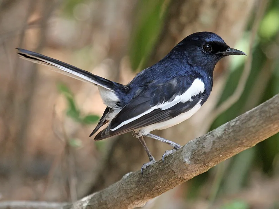
Madagascar Magpie-robin
Copsychus albospecularis44 records © DickDaniels (http://theworldbirds.org/) · CC BY-SA 3.0
Observed species
Occurrences documented via GBIF; they are neither an exhaustive inventory nor proof of current presence.
- Western Cattle Egret · Bubulcus ibis · 50
- Great Egret · Ardea alba · 48
- Olive Bee-eater · Merops superciliosus · 47
- Crested Drongo · Dicrurus forficatus · 47
- Madagascar Magpie-robin · Copsychus albospecularis · 44
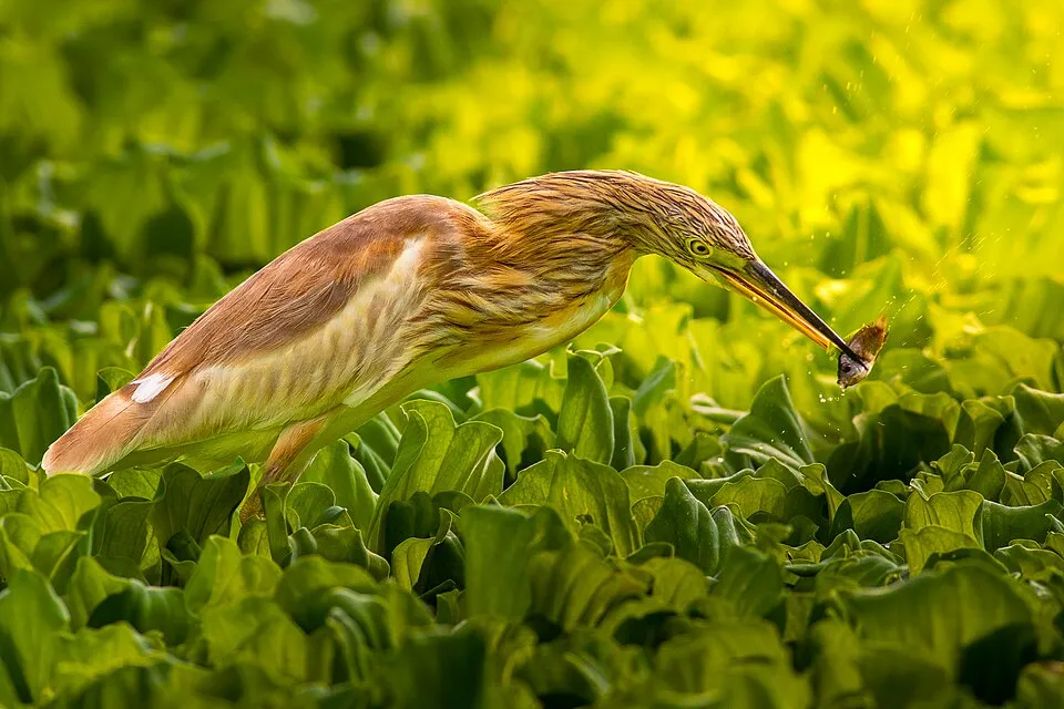
- Squacco Heron · Ardeola ralloides · 43
- Purple Heron · Ardea purpurea · 43
- Sickle-billed Vanga · Falculea palliata · 43
- Malagasy Paradise Flycatcher · Terpsiphone mutata · 42
- Black Heron · Egretta ardesiaca · 41
- Malagasy Bulbul · Hypsipetes madagascariensis · 41
- Black Kite · Milvus migrans · 38
+18 more species
- Glossy Ibis · Plegadis falcinellus · 37
- Coquerel's Coua · Coua coquereli · 37
- Malagasy Kingfisher · Corythornis vintsioides · 37
- Madagascar Fish Eagle · Haliaeetus vociferoides · 36
- Broad-billed roller · Eurystomus glaucurus · 36
- Red-capped Coua · Coua ruficeps · 35
- White-faced Whistling Duck · Dendrocygna viduata · 35
- Malagasy Turtle Dove · Nesoenas picturatus · 35
- Souimanga Sunbird · Cinnyris sovimanga · 35
- Common Newtonia · Newtonia brunneicauda · 33
- White-breasted mesite · Mesitornis variegatus · 32
- Crested coua · Coua cristata · 32
- Malagasy Coucal · Centropus toulou · 32
- Pied Crow · Corvus albus · 30
- Namaqua Dove · Oena capensis · 30
- Greater Vasa Parrot · Coracopsis vasa · 29
- Lesser Vasa Parrot · Coracopsis nigra · 29
- Humblot's Heron · Ardea humbloti · 29
Records: GBIF.org (CC-BY). Names: Wikidata (CC0), GBIF. Photos: Wikimedia Commons.
Conservation challenges
The primary purpose of the site is to preserve its natural habitats and the biodiversity they support. The species recorded (Biodiversity tab) reflect its ecological value. The designations it holds frame its management and the control of land use.
Pressure indicators
Invasive alien species
1
recorded since 2000
Sources: Global Forest Change (Hansen et al., University of Maryland, via Global Forest Watch, CC-BY 4.0); EFFIS, European Commission / Copernicus; NASA Black Marble 2016 (public domain); CORINE Land Cover 2018 (Copernicus) or MODIS.
Invasive alien species: Global Register of Introduced and Invasive Species (ISSG, CC BY 4.0); Union list, Regulation (EU) 1143/2014 (INBO, CC0); GBIF.org records (CC0 / CC BY 4.0), at least 2 per species.
Access and visiting
To plan a visit (access, opening periods, visitor rules), it is best to consult the official information from the managing body and the official website listed in this page's sources.
When to visit
Best time to visit: the dry season, from May to September, with less than 20 mm of rain per month. Precipitation peaks from November to March (up to 480 mm per month). Day length ranges from about 11 h 10 min in June to 13 h 05 min in December.
Source: Copernicus ERA5-Land (C3S), monthly averages 1996–2025 at the representative point, temperatures adjusted for elevation.
Contains modified Copernicus Climate Change Service information 2026. Neither the European Commission nor ECMWF is responsible for any use that may be made of the Copernicus information or data it contains.
Gallery
© Frank Vassen from Brussels, Belgium · CC BY 2.0
© Frank Vassen from Brussels, Belgium · CC BY 2.0
© Frank Vassen · CC BY 2.0
© Papango401 · CC BY-SA 4.0
© Papango401 · CC BY-SA 4.0
© Frank Vassen · CC BY 2.0
Sources and licences
- Wikidata: Q1936476
- OpenStreetMap: relation 1156008
- Official website: http://www.parcs-madagascar.com/fiche-aire-protegee.php?Ap=15
- Wikipedia: en.wikipedia.org/wiki/Ankarafantsika_National_Park
- WDPA: 1299
References
- cds.climate.copernicus.eu: climate · CC-BY-4.0
- registry.opendata.aws: elevation of the reference point · PD
- land.copernicus.eu: land cover · COPERNICUS
- naturalearthdata.com: sea share · PD
- wikidata.org: official area, establishment date, official name, nearby cities and airport, official website · CC0-1.0
- opentopodata.org: elevations · PD
- gbif.org: invasive alien species, observed species · CC-BY-4.0
- openstreetmap.org: access and peaks, trail difficulty · ODbL-1.0
- nsidc.org: snow cover · PD
- wikidata.org: Wikipedia article · CC-BY-SA-4.0
Data © OpenStreetMap contributors (ODbL), Wikidata (CC0) and the sources cited.