South Africa · Terrestrial
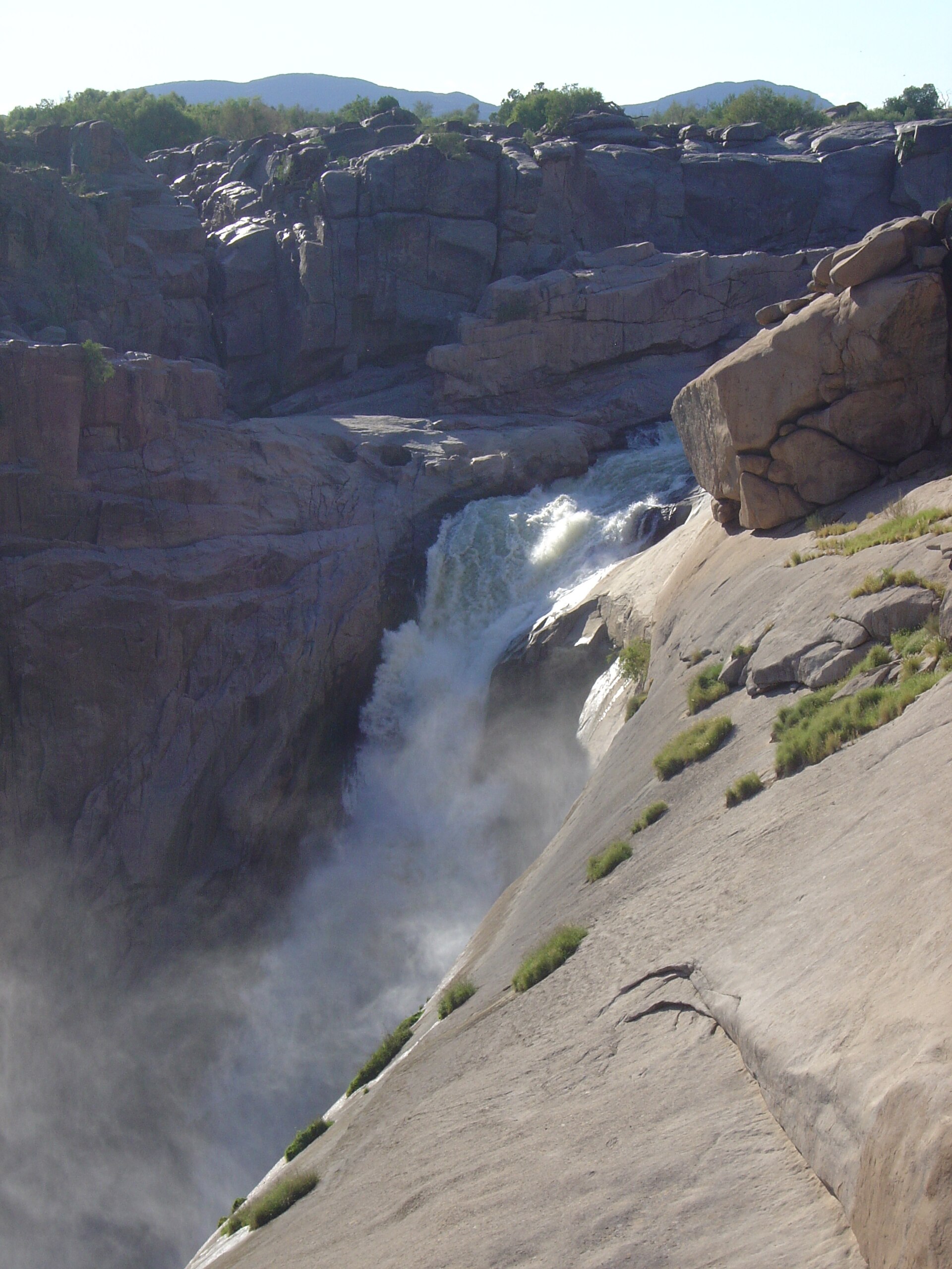
Augrabies Falls National Park
National park of 82,000 hectares in South Africa, established in 1966.
Overview
National park of 82,000 hectares in South Africa, established in 1966.
Augrabies Falls National Park is located in South Africa (Africa). It is a predominantly terrestrial area. Established in 1966, it covers about 82,000 hectares. The site is managed by national park of South Africa.
In our collections
Frequently asked questions
Where is Augrabies Falls National Park?
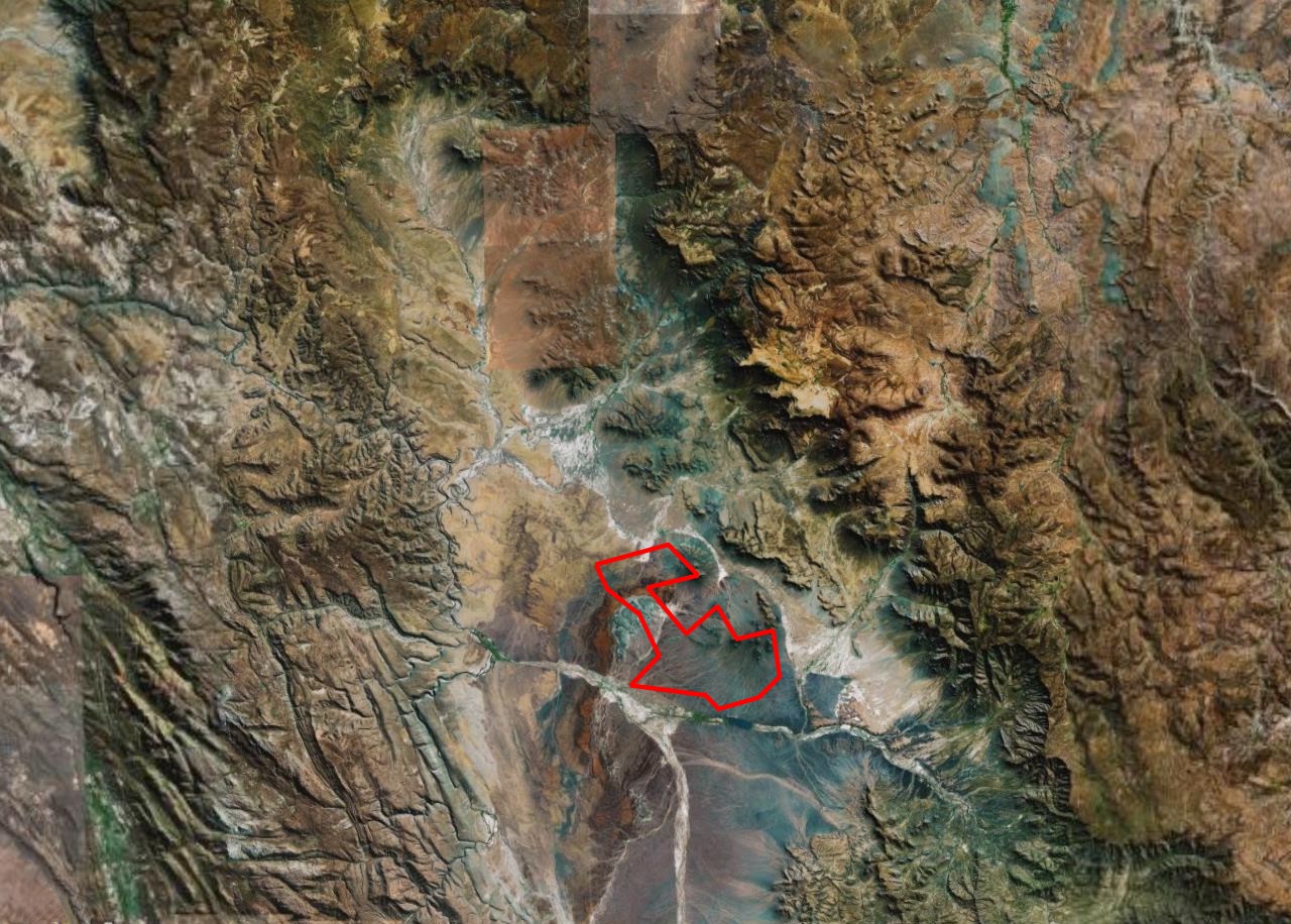
In South Africa (Africa). Representative point: 28.5911° S, 20.3383° E.
How large is Augrabies Falls National Park?
About 82,000 hectares (820 km²). It is the 9th largest of the 20 national parks in South Africa covered by Parkavela.
When was Augrabies Falls National Park established?
In 1966.
What habitats and landscapes does Augrabies Falls National Park include?
A terrestrial area, where land cover is dominated by heath and scrub (85%).
What is the highest point of Augrabies Falls National Park?
Spieëlkop, at 904 m (OpenStreetMap).
When is the best time to visit Augrabies Falls National Park?
Best time to visit: April and May, with average temperatures of 17 to 23 °C and moderate rainfall.
What is there to see in Augrabies Falls National Park?
Waterfall Augrabies Falls (595 m) (Wikidata).
What is the nearest large city to Augrabies Falls National Park?
Nearest towns of over 50,000 people, as the crow flies: Upington (83 km).
How can I reach Augrabies Falls National Park by train?
The nearest railway station is Toeslaan, about 21 km from the site boundary.
Where can I get visitor information on site?
Augrabies Falls Rest Camp and Riemvasmaak Tourist Office.
Are there waymarked hiking trails in Augrabies Falls National Park?
Yes. Waymarked hiking routes listed in OpenStreetMap: 2. The “Klipspringer Hiking Trail” route runs for about 33 km through the site, with some 410 m of ascent on its longest section.
Which species can be seen in Augrabies Falls National Park?
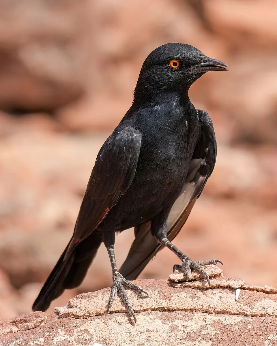
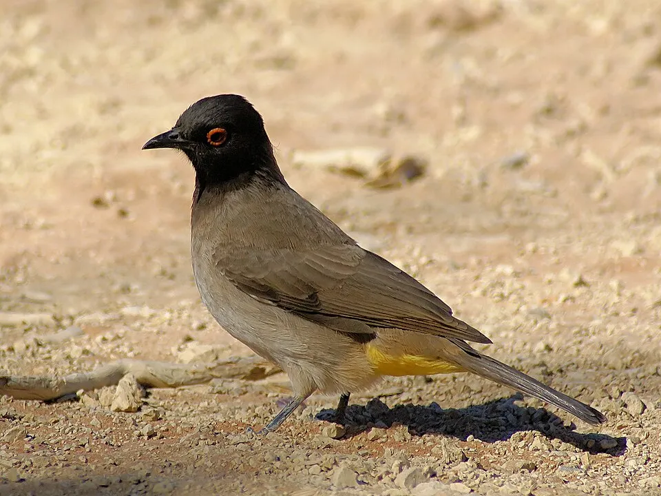
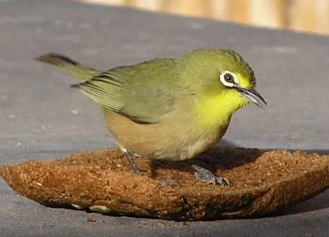
Among the species most often recorded on GBIF are Onychognathus nabouroup (Pale-winged Starling), Pycnonotus nigricans (African Red-eyed Bulbul), Cinnyris fuscus (Dusky Sunbird) and Zosterops pallidus (Orange River White-eye).
Who manages Augrabies Falls National Park?
National park of South Africa.
What is the official website of Augrabies Falls National Park?
© OpenStreetMap
Download the boundary: GeoJSON · GPX Boundary © OpenStreetMap contributors (ODbL).
Geography
The representative point of the site lies at around 616 m above sea level. Over the 1996–2025 period, the mean annual temperature is about 22.1 °C and total precipitation reaches roughly 146 mm per year. The warmest month is usually January, the coolest July, and the wettest January.
Area
- Area
- 82,000 ha
- Elevation
- 616 m
- Median elevation
- 660 m
- Coordinates
- -28.5911, 20.3383
Terrain: Mapzen Terrain Tiles (SRTM, USGS)
Climate
● Mean temperature (°C) · ▮ Precipitation (mm)
Source: Copernicus ERA5-Land (C3S, doi:10.24381/cds.68d2bb30), monthly averages 1996–2025 interpolated to the representative point, temperatures adjusted for elevation.
Contains modified Copernicus Climate Change Service information 2026. Neither the European Commission nor ECMWF is responsible for any use that may be made of the Copernicus information or data it contains.
Natural habitats
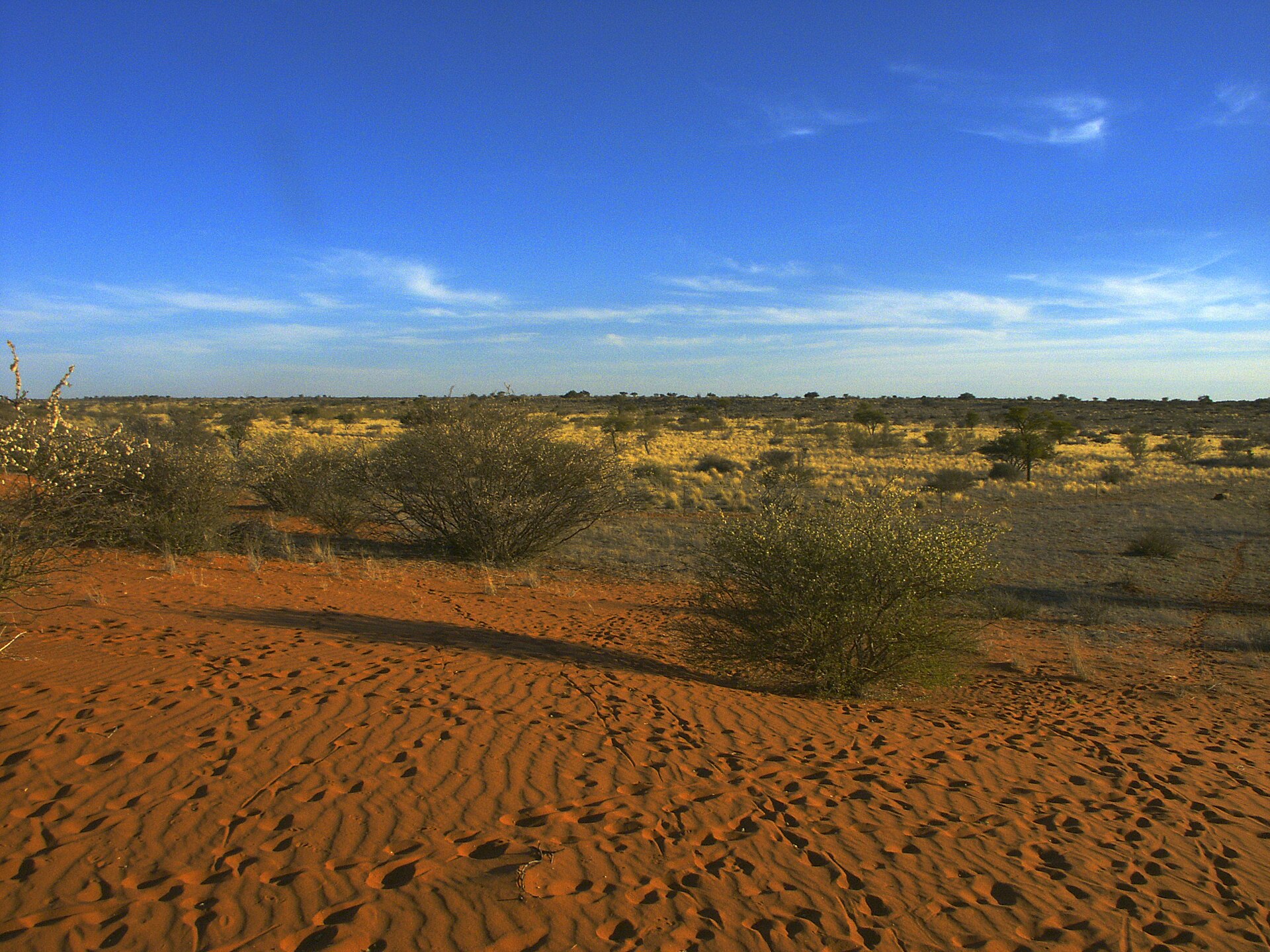
According to the global MODIS land cover (NASA, 2024), the site is mainly made up of heath and scrub (85%) and bare rock and scree (13%). Elevation ranges from about 430 m to 904 m (highest point: Spieëlkop).
Biodiversity
Based on occurrences aggregated by GBIF, several species are regularly recorded within the site. Among the most frequent are Onychognathus nabouroup (Pale-winged Starling), Pycnonotus nigricans (African Red-eyed Bulbul), Cinnyris fuscus (Dusky Sunbird) and Zosterops pallidus (Orange River White-eye). The full list of documented taxa is shown below.
Species to look out for



Observed species
Occurrences documented via GBIF; they are neither an exhaustive inventory nor proof of current presence.
- Pale-winged Starling · Onychognathus nabouroup · 645
- African Red-eyed Bulbul · Pycnonotus nigricans · 542
- Dusky Sunbird · Cinnyris fuscus · 480
- Orange River White-eye · Zosterops pallidus · 476
- Rock Martin · Ptyonoprogne fuligula · 450
- Laughing Dove · Spilopelia senegalensis · 428
- Alpine Swift · Tachymarptis melba · 405
- Acacia Pied Barbet · Tricholaema leucomelas · 377
- Speckled Pigeon · Columba guinea · 362
- White-throated Canary · Crithagra albogularis · 361
- Southern Masked Weaver · Ploceus velatus · 354
- Cape Robin-Chat · Dessonornis caffer · 331
+18 more species
- Cape Sparrow · Passer melanurus · 330
- Black-chested Prinia · Prinia flavicans · 320
- Mountain Wheatear · Oenanthe monticola · 284
- Cape Wagtail · Motacilla capensis · 282
- Familiar Chat · Oenanthe familiaris · 281
- White-backed Mousebird · Colius colius · 270
- Ring-necked Dove · Streptopelia capicola · 246
- Karoo Long-billed Lark · Certhilauda subcoronata · 242
- Pririt Batis · Batis pririt · 236
- Cape Bunting · Emberiza capensis · 235
- Common Waxbill · Estrilda astrild · 229
- Verreaux's Eagle · Aquila verreauxii · 226
- Hadada Ibis · Bostrychia hagedash · 218
- Lark-like Bunting · Emberiza impetuani · 201
- Namaqua Dove · Oena capensis · 201
- African Pied Wagtail · Motacilla aguimp · 201
- African Palm Swift · Cypsiurus parvus · 196
- House Sparrow · Passer domesticus · 195
Records: GBIF.org (CC-BY). Names: Wikidata (CC0), GBIF. Photos: Wikimedia Commons.
Conservation challenges
The primary purpose of the site is to preserve its natural habitats and the biodiversity they support. The species recorded (Biodiversity tab) reflect its ecological value. Its status as a national park sets the regulatory framework for its protection.
At night, the area gives off virtually no artificial light detectable from space (NASA VIIRS Black Marble composite, 2016).
Pressure indicators
Light at night
< 1%
of the area gives off artificial light visible from space
DarkLit
Built-up land
< 1%
buildings, business areas, roads, quarries
Invasive alien species
1
recorded since 2000
Sources: Global Forest Change (Hansen et al., University of Maryland, via Global Forest Watch, CC-BY 4.0); EFFIS, European Commission / Copernicus; NASA Black Marble 2016 (public domain); CORINE Land Cover 2018 (Copernicus) or MODIS.
Invasive alien species: Global Register of Introduced and Invasive Species (ISSG, CC BY 4.0); Union list, Regulation (EU) 1143/2014 (INBO, CC0); GBIF.org records (CC0 / CC BY 4.0), at least 2 per species.
Practical information
Cities and airport
- Upington
83 km as the crow flies
Visitor information
- Augrabies Falls Rest Camp
within the site - Riemvasmaak Tourist Office
2 km from the site boundary
Parking
2 public car parks listed within the site
Fountain Viewpoint
Hiking
2 waymarked routes listed
Data © OpenStreetMap contributors (ODbL) · Wikidata (CC0)
Waymarked hiking routes
Tracks © OpenStreetMap contributors (ODbL), clipped to the boundary; elevation gain and profiles computed on the longest section from Mapzen Terrain Tiles (≈ 30 m), indicative only.
Access and visiting
The nearest railway station is Toeslaan, about 21 km from the site boundary. Nearest towns of over 50,000 people, as the crow flies: Upington (83 km). About 19,000 people live within 20 km of the site boundary, 13,000 of them within 10 km; some 810 people are estimated to live inside (GHSL estimate, 2020). This population has grown by about 21% since 2000. Visitor information on site: Augrabies Falls Rest Camp and Riemvasmaak Tourist Office. Public car parks listed within the site: 2, including Fountain Viewpoint. Waymarked hiking routes listed in OpenStreetMap: 2. To see: waterfall Augrabies Falls (595 m). To plan a visit (access, opening periods, visitor rules), it is best to consult the official information from the managing body (national park of South Africa) and the official website listed in this page's sources.
Source: OpenStreetMap (ODbL), Wikidata (CC0), November 2026.
When to visit
Best time to visit: April and May, with average temperatures of 17 to 23 °C and moderate rainfall. Day length ranges from about 10 h 20 min in June to 13 h 57 min in December. Wildlife records published on GBIF peak for birds (September), plants (August), butterflies and moths (March), dragonflies (March) and mammals (August). These peaks also reflect when observers are most active.
Source: Copernicus ERA5-Land (C3S), monthly averages 1996–2025 at the representative point, temperatures adjusted for elevation.
Contains modified Copernicus Climate Change Service information 2026. Neither the European Commission nor ECMWF is responsible for any use that may be made of the Copernicus information or data it contains.
Wildlife records calendar
JFMAMJJASOND
Birds
Plants
Butterflies & moths
Dragonflies
Mammals
Monthly records published on GBIF (CC-BY), relative to the busiest month; also reflects observer activity.
Gallery
© Zaian · Public domain
© NJR ZA · CC BY-SA 3.0
© Notafish · CC BY-SA 2.0
© Christian Wörtz (woertz) · CC BY-SA 2.5
© amanderson2 · CC BY 2.0
© NJR ZA · CC BY-SA 3.0
Sources and licences
- Wikidata: Q760459
- OpenStreetMap: relation 2855695
- Official website: http://www.sanparks.org/parks/augrabies
- Wikipedia: en.wikipedia.org/wiki/Augrabies_Falls_National_Park
- WDPA: 878
References
- cds.climate.copernicus.eu: climate · CC-BY-4.0
- registry.opendata.aws: elevation of the reference point, detailed relief · PD
- lpdaac.usgs.gov: land cover · PD
- doi.org: population around the site · CC-BY-4.0
- naturalearthdata.com: sea share · PD
- wikidata.org: official area, highest point, establishment date, protected heritage, managing body, official name, nearby cities and airport, access and peaks, lake depths, places to see, official website · CC0-1.0
- en.eurovelo.com: EuroVelo cycle routes · ODbL-1.0
- cycling.waymarkedtrails.org: cycle routes · ODbL-1.0
- opentopodata.org: elevations · PD
- globalforestwatch.org: tree cover loss · CC-BY-4.0
- gbif.org: seasonality of sightings, invasive alien species, observed species · CC-BY-4.0
- earthobservatory.nasa.gov: night light · PD
- openstreetmap.org: access and peaks · ODbL-1.0
- hiking.waymarkedtrails.org: route difficulty · ODbL-1.0
- nsidc.org: snow cover · PD
- wikidata.org: Wikipedia article · CC-BY-SA-4.0
Data © OpenStreetMap contributors (ODbL), Wikidata (CC0) and the sources cited.