
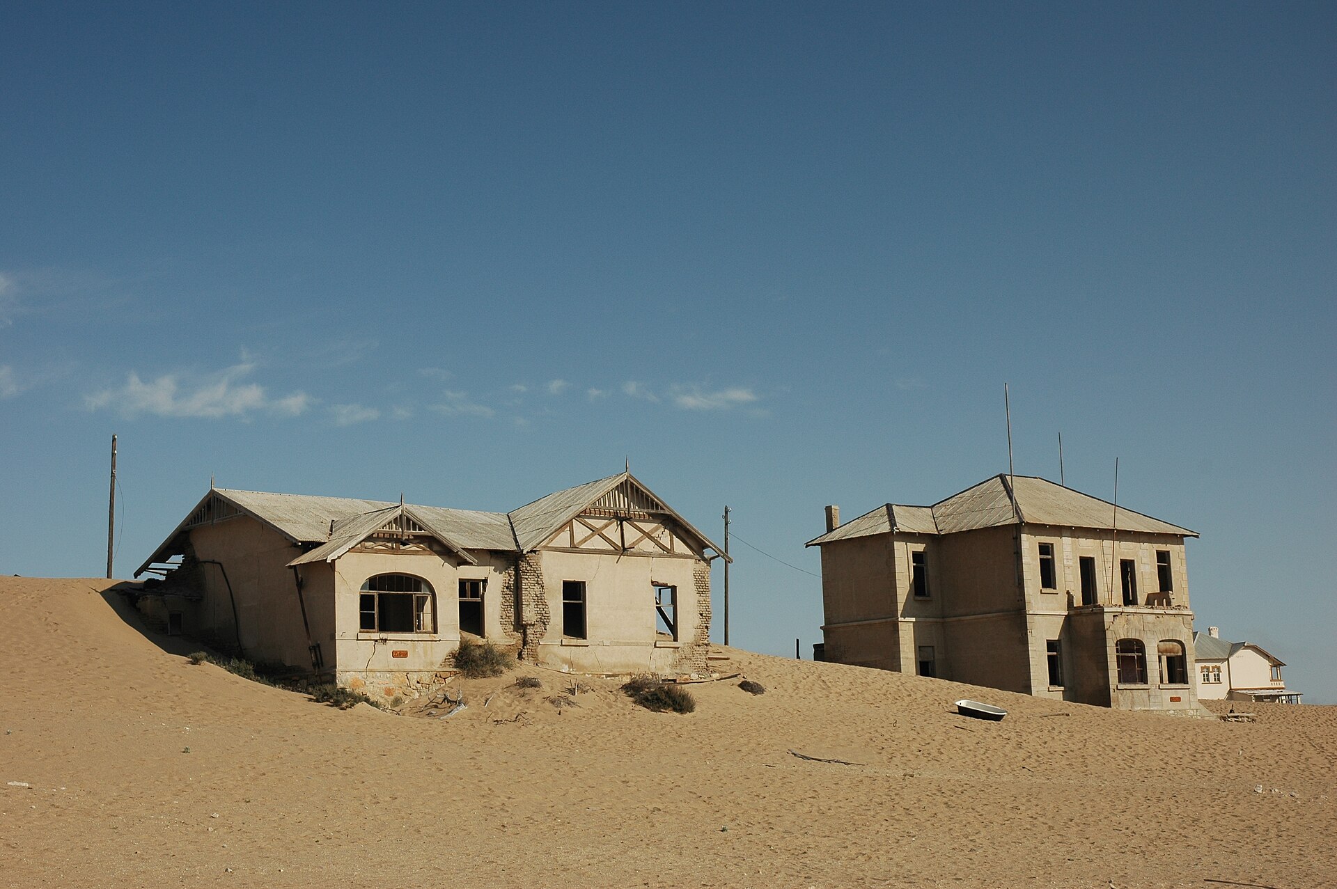
Namibia · Terrestrial
Tsau ǁKhaeb National Park
National park of 2,600,000 hectares in Namibia, established in 2008.
Overview
National park of 2,600,000 hectares in Namibia, established in 2008.
Tsau ǁKhaeb National Park is located in Namibia (Africa). It is a predominantly terrestrial area. Established in 2008, it covers about 2,600,000 hectares.
Protections and designations
Ramsar site
Protected as a national park. International labels and designations: Ramsar site (“Orange River”).
In our collections
Frequently asked questions
Where is Tsau ǁKhaeb National Park?
In Namibia (Africa). Representative point: 27.4114° S, 15.9055° E.
How large is Tsau ǁKhaeb National Park?
About 2,600,000 hectares (26,000 km²). It is the 2nd largest of the 10 national parks in Namibia covered by Parkavela.
When was Tsau ǁKhaeb National Park established?
In 2008.
What habitats and landscapes does Tsau ǁKhaeb National Park include?
A terrestrial area, with mountains.
What is the highest point of Tsau ǁKhaeb National Park?
Kuckaus, at 1,415 m (OpenStreetMap).
What are the main summits of Tsau ǁKhaeb National Park?
Kuckaus (1,415 m), Agub (1,330 m), Tsaus (1,226 m), Giams (1,209 m) and Swartkloofberg (1,188 m) (OpenStreetMap).
Which international labels apply to Tsau ǁKhaeb National Park?
Ramsar site (“Orange River”).
When is the best time to visit Tsau ǁKhaeb National Park?
The climate suits visits all year round.
Are there historic monuments in Tsau ǁKhaeb National Park?
Yes. According to Wikidata, one monument protected in Namibia as national monuments or heritage sites (National Heritage Act 2004) stands within the boundary. For example: “Site of Original Dias Cross”.
Which species can be seen in Tsau ǁKhaeb National Park?
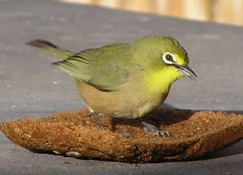
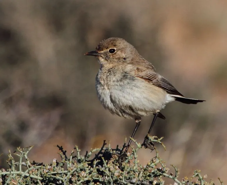
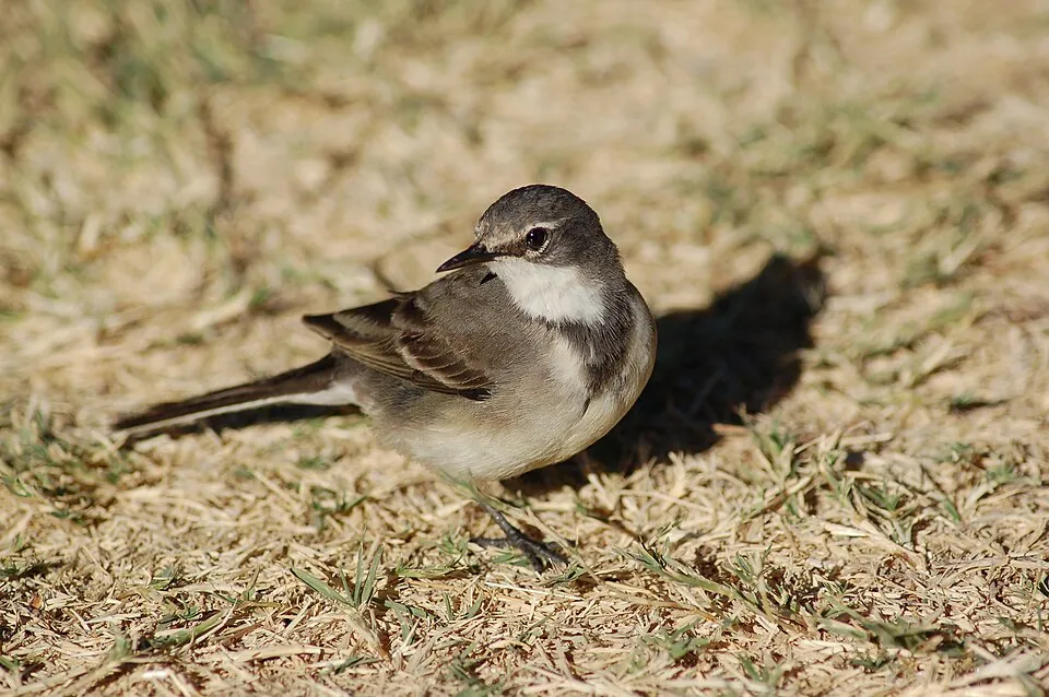
Among the species most often recorded on GBIF are Zosterops pallidus (Orange River White-eye), Corvus albus (Pied Crow), Emarginata tractrac (Tractrac Chat) and Larus dominicanus (Kelp Gull).
© OpenStreetMap
Download the boundary: GeoJSON · GPX Boundary © OpenStreetMap contributors (ODbL).
Geography
The representative point of the site lies at around 578 m above sea level. Over the 1996–2025 period, the mean annual temperature is about 18.5 °C and total precipitation reaches roughly 66 mm per year. The warmest month is usually February, the coolest July, and the wettest March.
Area
- Area
- 2,600,000 ha
- Elevation
- 578 m
- Median elevation
- 379 m
- Coordinates
- -27.4114, 15.9055
Terrain: Mapzen Terrain Tiles (SRTM, USGS)
Elevation bands
- below 500 m 65%
- 500–1,000 m 34%
- 1,000–1,500 m 1%
share of the site in each elevation band (smoothed terrain model: summits are rounded off) · Terrain: Mapzen Terrain Tiles (SRTM, USGS)
Main summits
- Kuckaus1,415 m
- Agub1,330 m
- Tsaus1,226 m
- Giams1,209 m
- Swartkloofberg1,188 m
- Nudavib1,166 m
- Rooiberg1,125 m
- Heioab1,121 m
- Höchster1,114 m
- Aurusberg1,084 m
Data © OpenStreetMap contributors (ODbL)
Climate
● Mean temperature (°C) · ▮ Precipitation (mm)
Source: Copernicus ERA5-Land (C3S, doi:10.24381/cds.68d2bb30), monthly averages 1996–2025 interpolated to the representative point, temperatures adjusted for elevation.
Contains modified Copernicus Climate Change Service information 2026. Neither the European Commission nor ECMWF is responsible for any use that may be made of the Copernicus information or data it contains.
Natural habitats
According to the global MODIS land cover (NASA, 2024), the site is mainly made up of bare rock and scree (99%). Elevation ranges from sea level to 1,415 m (highest point: Kuckaus). Median elevation is 379 m, and 35% of the site lies above 500 m (SRTM elevation model).
Biodiversity
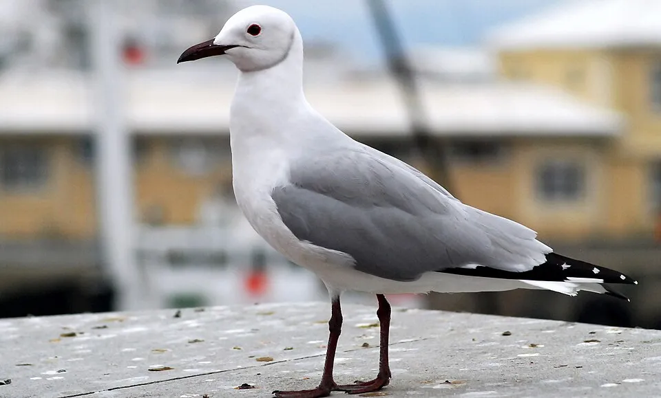
Based on occurrences aggregated by GBIF, several species are regularly recorded within the site. Among the most frequent are Zosterops pallidus (Orange River White-eye), Corvus albus (Pied Crow), Emarginata tractrac (Tractrac Chat) and Larus dominicanus (Kelp Gull). The full list of documented taxa is shown below.
Species to look out for

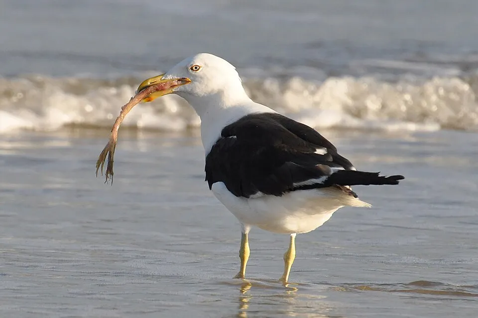
Bird
Kelp Gull
Larus dominicanus268 records © Cláudio Dias Timm from Rio Grande do Sul · CC BY-SA 2.0
Observed species
Occurrences documented via GBIF; they are neither an exhaustive inventory nor proof of current presence.
- Orange River White-eye · Zosterops pallidus · 469
- Pied Crow · Corvus albus · 375
- Tractrac Chat · Emarginata tractrac · 278
- Kelp Gull · Larus dominicanus · 268
- Cape Wagtail · Motacilla capensis · 251
- Hartlaub's gull · Chroicocephalus hartlaubii · 230
- African Oystercatcher · Haematopus moquini · 229
- Cape Sparrow · Passer melanurus · 205
- Cape Teal · Anas capensis · 162
- Namaqua Sandgrouse · Pterocles namaqua · 160
- Familiar Chat · Oenanthe familiaris · 158
- South African Shelduck · Tadorna cana · 157
+18 more species
- Quartinia poecila · 155
- White-fronted Plover · Charadrius marginatus · 150
- American Flamingo · Phoenicopterus ruber · 144
- Rock Martin · Ptyonoprogne fuligula · 143
- Cape Cormorant · Phalacrocorax capensis · 142
- Crowned Cormorant · Microcarbo coronatus · 134
- Greater Crested Tern · Thalasseus bergii · 132
- Cape Crow · Corvus capensis · 131
- Lesser Flamingo · Phoeniconaias minor · 129
- Pied Avocet · Recurvirostra avosetta · 128
- Ruddy Turnstone · Arenaria interpres · 127
- Little Egret · Egretta garzetta · 122
- Common Waxbill · Estrilda astrild · 122
- Eurasian Whimbrel · Numenius phaeopus · 118
- Southern Masked Weaver · Ploceus velatus · 117
- Blacksmith Lapwing · Vanellus armatus · 114
- African Red-eyed Bulbul · Pycnonotus nigricans · 111
- Caspian Tern · Hydroprogne caspia · 110
Records: GBIF.org (CC-BY). Names: Wikidata (CC0), GBIF. Photos: Wikimedia Commons.
Conservation challenges
The primary purpose of the site is to preserve its natural habitats and the biodiversity they support. The species recorded (Biodiversity tab) reflect its ecological value. The designations it holds frame its management and the control of land use.
At night, the area gives off virtually no artificial light detectable from space (NASA VIIRS Black Marble composite, 2016).
Pressure indicators
Light at night
< 1%
of the area gives off artificial light visible from space
DarkLit
Invasive alien species
1
recorded since 2000
Sources: Global Forest Change (Hansen et al., University of Maryland, via Global Forest Watch, CC-BY 4.0); EFFIS, European Commission / Copernicus; NASA Black Marble 2016 (public domain); CORINE Land Cover 2018 (Copernicus) or MODIS.
Invasive alien species: Global Register of Introduced and Invasive Species (ISSG, CC BY 4.0); Union list, Regulation (EU) 1143/2014 (INBO, CC0); GBIF.org records (CC0 / CC BY 4.0), at least 2 per species.
Practical information
Parking
4 public car parks listed within the site
Grossebucht
Data © OpenStreetMap contributors (ODbL)
Access and visiting
About 36,000 people live within 20 km of the site boundary; some 4,100 people are estimated to live inside (GHSL estimate, 2020). This population has grown by about 59% since 2000. Public car parks listed within the site: 4, including Grossebucht. To plan a visit (access, opening periods, visitor rules), it is best to consult the official information from the managing body and the official website listed in this page's sources.
Source: OpenStreetMap (ODbL), Wikidata (CC0), November 2026.
Built heritage
According to Wikidata, one monument protected in Namibia as national monuments or heritage sites (National Heritage Act 2004) stands within the boundary. It is “Site of Original Dias Cross”.
Source: Wikidata (CC0), monuments in each country’s official heritage protection registers, at national or regional level. Each item links to its Wikidata entry.
When to visit
The climate suits visits all year round. These averages apply to the site's representative point (578 m); higher up it is markedly cooler. Day length ranges from about 10 h 25 min in June to 13 h 52 min in December. Wildlife records published on GBIF peak for birds (September), plants (September), butterflies and moths (March and April) and mammals (September). These peaks also reflect when observers are most active.
Source: Copernicus ERA5-Land (C3S), monthly averages 1996–2025 at the representative point, temperatures adjusted for elevation.
Contains modified Copernicus Climate Change Service information 2026. Neither the European Commission nor ECMWF is responsible for any use that may be made of the Copernicus information or data it contains.
Wildlife records calendar
JFMAMJJASOND
Birds
Plants
Butterflies & moths
Mammals
Monthly records published on GBIF (CC-BY), relative to the busiest month; also reflects observer activity.
Gallery
© GIRAUD Patrick · CC BY 2.5
© Ralf Junghanns · CC BY-SA 3.0
© Hp.Baumeler · CC BY-SA 4.0
© Calips · CC BY 2.5
© Plastic pony · CC BY-SA 4.0
© Plastic pony · CC BY-SA 4.0
Sources and licences
- Wikidata: Q1933532
- OpenStreetMap: relation 4869664
- Wikipedia: en.wikipedia.org/wiki/Tsau_ǁKhaeb_Sperrgebiet_National_Park
- WDPA: 303691
References
- cds.climate.copernicus.eu: climate · CC-BY-4.0
- registry.opendata.aws: elevation of the reference point, detailed relief · PD
- lpdaac.usgs.gov: land cover · PD
- doi.org: population around the site · CC-BY-4.0
- naturalearthdata.com: sea share · PD
- wikidata.org: official area, establishment date, protected heritage, nearby cities and airport, access and peaks, lake depths, places to see · CC0-1.0
- en.eurovelo.com: EuroVelo cycle routes · ODbL-1.0
- cycling.waymarkedtrails.org: cycle routes · ODbL-1.0
- opentopodata.org: elevations · PD
- globalforestwatch.org: tree cover loss · CC-BY-4.0
- gbif.org: seasonality of sightings, invasive alien species, observed species · CC-BY-4.0
- openstreetmap.org: official name, access and peaks · ODbL-1.0
- earthobservatory.nasa.gov: night light · PD
- nsidc.org: snow cover · PD
- wikidata.org: Wikipedia article · CC-BY-SA-4.0
Data © OpenStreetMap contributors (ODbL), Wikidata (CC0) and the sources cited.
