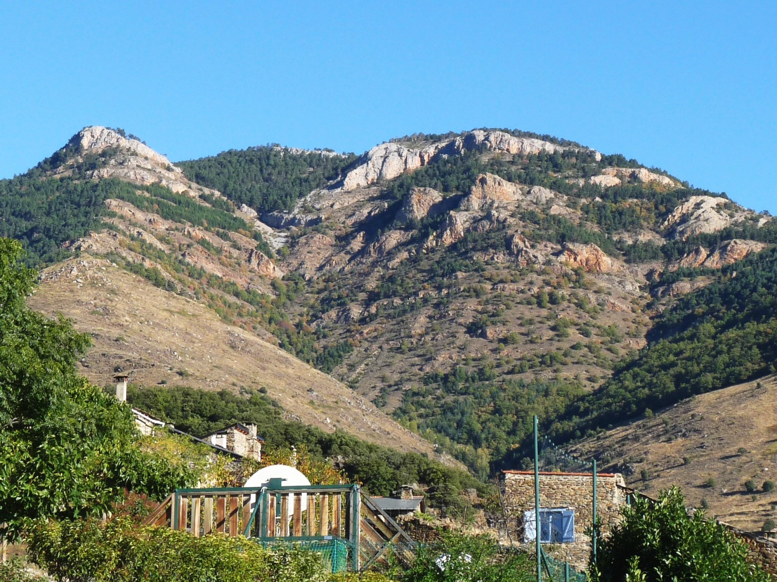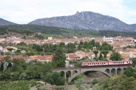

France · Terrestrial
Corbières-Fenouillèdes Regional Natural Park
Regional nature park of 174,060 hectares in France, established in 2021.
Overview
Regional nature park of 174,060 hectares in France, established in 2021.
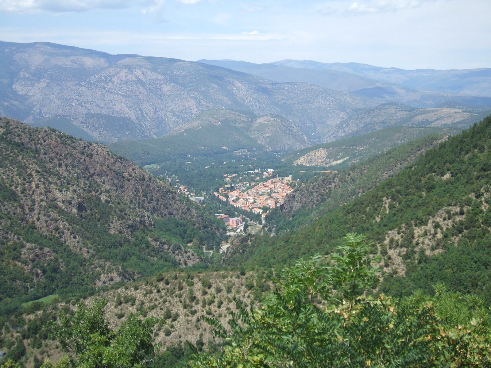
Corbières-Fenouillèdes Regional Natural Park is a regional nature park in France (Europe). It is a predominantly terrestrial area. Established on 5 September 2021, it covers about 174,060 hectares.
Protections and designations
Natura 2000 · habitats (SAC) · 4 sites
- Grotte de la Valette FR9101461
- Sites à chiroptères des Pyrénées orientales FR9102010
- Vallée de l'Orbieu FR9101489
- Vallée du Torgan FR9101458
Natura 2000 · birds (SPA) · 5 sites
- Basses Corbières FR9110111
- Corbières occidentales FR9112027
- Corbières orientales FR9112008
- Hautes Corbières FR9112028
- Pays de Sault FR9112009
Protected as a regional nature park. International labels and designations: Natura 2000 network (9 sites). Key dates: first Natura 2000 site under the Birds Directive in 2006, first Natura 2000 site under the Habitats Directive in 2008 and established in 2021.
In our collections
Timeline
-
2006
First Natura 2000 site under the Birds Directive 5 such sites designated up to 2015
-
2008
First Natura 2000 site under the Habitats Directive 4 such sites designated up to 2015
-
2021
Established
Sources: Wikidata (CC0) for establishment and international labels; EEA Natura 2000 database (CC-BY 4.0) for site designation dates.
Frequently asked questions
Where is Corbières-Fenouillèdes Regional Natural Park?
In France (Europe). Representative point: 42.9094° N, 2.5233° E.
How large is Corbières-Fenouillèdes Regional Natural Park?
About 174,060 hectares (1,741 km²). It is the 28th largest of the 59 regional parks in France covered by Parkavela.
When was Corbières-Fenouillèdes Regional Natural Park established?
On 5 September 2021.
What habitats and landscapes does Corbières-Fenouillèdes Regional Natural Park include?
A terrestrial area, with forests.
What rocks lie beneath Corbières-Fenouillèdes Regional Natural Park?
According to the BRGM's simplified lithological map, the bedrock consists mainly of limestones, marls and gypsum (50% of sampled points), granites (19%) and sandstones (13%). These are mostly sedimentary rocks.
What is the highest point of Corbières-Fenouillèdes Regional Natural Park?
Pic Dourmidou, at 1,844 m (OpenStreetMap).
What are the main summits of Corbières-Fenouillèdes Regional Natural Park?
Pic Dourmidou (1,844 m), Pic d'Estable (1,495 m), Pech dels Escarabatets (1,342 m), Pic de Toulouse (1,332 m) and Pech de Bugarach (1,231 m) (OpenStreetMap).
Which international labels apply to Corbières-Fenouillèdes Regional Natural Park?
Natura 2000 network (9 sites).
When is the best time to visit Corbières-Fenouillèdes Regional Natural Park?
Best time to visit: from June to October, with average temperatures of 12 to 20 °C and moderate rainfall.
What is there to see in Corbières-Fenouillèdes Regional Natural Park?
61 viewpoints, 18 waterfalls, 10 lakes and ponds and 66 caves, including Belvédère du Diable, Cascade de l'Ermitage, Bassin de la Gorbelhe and Barrenc du Taureau (OpenStreetMap).
Where can I stay in Corbières-Fenouillèdes Regional Natural Park?
4 mountain huts and 40 campsites, including Ancienne Verrerie du Bourrasset, Aire Camping Cars Domaine Peter Sichel and Gite Saint-Roch (OpenStreetMap).
Are there historic monuments in Corbières-Fenouillèdes Regional Natural Park?
Yes. According to the French Ministry of Culture's Mérimée database, 73 historic monuments stand within the boundary, 26 of them with the highest level of protection (classé). For example: “Dolmen dit Table des Morts” in Massac, “Ensemble des vestiges du château d'Aguilar” in Tuchan and “Pont faisant communiquer le village de Lagrasse et le quartier de l'Abbaye” in Lagrasse.
Can you swim in Corbières-Fenouillèdes Regional Natural Park?
5 monitored bathing sites lie in or within 1 km of the site; official 2025 classification: 2 excellent, 1 sufficient and 1 poor (European Environment Agency). Swimming is only permitted at the sites and times authorised locally.
What is the nearest large city to Corbières-Fenouillèdes Regional Natural Park?
Nearest towns of over 50,000 people, as the crow flies: Perpignan (15 km) and Narbonne (19 km). Nearest airport: Perpignan–Rivesaltes (PGF), about 11 km away.
How can I reach Corbières-Fenouillèdes Regional Natural Park by train?
Campagne railway station lies within the site.
Where can I get visitor information on site?
Maison Forestière, Ancienne Maison Forestière and Maison Forestière de Roquebrune.
Are there waymarked hiking trails in Corbières-Fenouillèdes Regional Natural Park?
Yes. Waymarked hiking routes listed in OpenStreetMap: 64, including De la Manche aux Pyrénées. The “De la Manche aux Pyrénées 23, Carcassonne - Sournia” route runs for about 105 km through the site, with some 3,180 m of ascent on its longest section.
Which species can be seen in Corbières-Fenouillèdes Regional Natural Park?
Among the species most often recorded on GBIF are Turdus merula (Common Blackbird), Fringilla coelebs (Eurasian Chaffinch), Erithacus rubecula (European robin) and Sylvia atricapilla (Eurasian Blackcap).
What is the official website of Corbières-Fenouillèdes Regional Natural Park?
© OpenStreetMap
Download the boundary: GeoJSON · GPX Boundary © OpenStreetMap contributors (ODbL).
Geography
The representative point of the site lies at around 767 m above sea level. Over the 1996–2025 period, the mean annual temperature is about 10.7 °C and total precipitation reaches roughly 773 mm per year. The warmest month is usually July, the coolest January, and the wettest April. According to the BRGM's simplified lithological map, the bedrock consists mainly of limestones, marls and gypsum (50% of sampled points), granites (19%) and sandstones (13%). These are mostly sedimentary rocks.
Area
- Area of the boundary
- 174,060 ha
- Elevation
- 767 m
- Median elevation
- 407 m
- Mean slope
- 12°
- Coordinates
- 42.9094, 2.5233
Terrain: Mapzen Terrain Tiles (SRTM, USGS)
Elevation bands
- below 500 m 64%
- 500–1,000 m 33%
- 1,000–1,500 m 3%
share of the site in each elevation band (smoothed terrain model: summits are rounded off) · Terrain: Mapzen Terrain Tiles (SRTM, USGS)
Bedrock
- Limestones, marls and gypsum 50 %
- Granites 19 %
- Sandstones 13 %
- Gneiss 6 %
- Clays 6 %
- Sands 6 %
Sedimentary rocks 75 % · Igneous rocks 19 % · Metamorphic rocks 6 %
Source: BRGM, simplified lithological map at 1:1,000,000 (Licence Ouverte), 16 points sampled within the boundary.
Main summits
- Pic Dourmidou1,844 m
- Pic d'Estable1,495 m
- Pech dels Escarabatets1,342 m
- Pic de Toulouse1,332 m
- Pech de Bugarach1,231 m
- Roc de l'Ours1,209 m
- Tuc de Gaubeille1,143 m
- La Pique Grosse1,081 m
- Sarrat d'en Grau1,047 m
- Les Crêtes d’Al Pouil1,037 m
Data © OpenStreetMap contributors (ODbL)
Climate
● Mean temperature (°C) · ▮ Precipitation (mm)
Source: Copernicus ERA5-Land (C3S, doi:10.24381/cds.68d2bb30), monthly averages 1996–2025 interpolated to the representative point, temperatures adjusted for elevation.
Contains modified Copernicus Climate Change Service information 2026. Neither the European Commission nor ECMWF is responsible for any use that may be made of the Copernicus information or data it contains.
Natural habitats
According to CORINE Land Cover (2018), the site is mainly made up of forests (40%), farmland (20%) and Mediterranean scrub (17%). Woodland is mostly broadleaved. Elevation ranges from about 130 m to 1,844 m (highest point: Pic Dourmidou). Median elevation is 407 m, and 36% of the site lies above 500 m (SRTM elevation model). The 9 Natura 2000 sites overlapping the area list 29 habitats of European interest (7 priority), the most extensive being Quercus ilex and Quercus rotundifolia forests, semi-natural dry grasslands and scrubland facies on calcareous substrates (Festuco-Brometalia) (* important orchid sites) and (Sub-) Mediterranean pine forests with endemic black pines.
Biodiversity
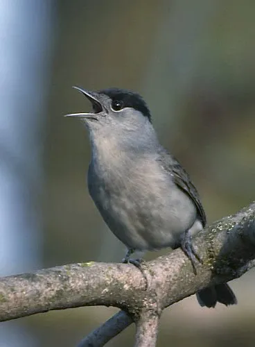
Based on occurrences aggregated by GBIF, several species are regularly recorded within the site. Among the most frequent are Turdus merula (Common Blackbird), Fringilla coelebs (Eurasian Chaffinch), Erithacus rubecula (European robin) and Sylvia atricapilla (Eurasian Blackcap). The full list of documented taxa is shown below. The overlapping Natura 2000 sites list 81 species of European interest: 41 birds, 25 mammals, 1 reptile, 2 amphibians, 2 fish and 10 invertebrates.
Habitats of European interest
From the official forms of the 9 Natura 2000 sites overlapping the area (areas reported for each whole site).
- Quercus ilex and Quercus rotundifolia forests 3,368 ha
- Semi-natural dry grasslands and scrubland facies on calcareous substrates (Festuco-Brometalia) (* important orchid sites) 1,987 ha
- (Sub-) Mediterranean pine forests with endemic black pines priority 1,027 ha
- Medio-European limestone beech forests of the Cephalanthero-Fagion 897 ha
- European dry heaths 557 ha
- Salix alba and Populus alba galleries 540 ha
- Alluvial forests with Alnus glutinosa and Fraxinus excelsior (Alno-Padion, Alnion incanae, Salicion albae) priority 378 ha
- Calcareous rocky slopes with chasmophytic vegetation 362 ha
and 21 more
Species of European interest
Birds · 41
Boreal Owl (Aegolius funereus) resident, Cinereous Vulture (Aegypius monachus) passage wintering, Common Kingfisher (Alcedo atthis) resident, Tawny Pipit (Anthus campestris) breeding passage, Golden Eagle (Aquila chrysaetos) resident wintering passage, Bonelli's Eagle (Aquila fasciata) resident passage wintering, Dark-bellied Brant Goose (Branta bernicla bernicla) passage, Eurasian Eagle-owl (Bubo bubo) resident wintering passage, Eurasian Stone-curlew (Burhinus oedicnemus) breeding passage, Greater Short-toed Lark (Calandrella brachydactyla) breeding, European Nightjar (Caprimulgus europaeus) breeding passage, White stork (Ciconia ciconia) passage and 29 more
Mammals · 25
Barbastelle (Barbastella barbastellus), Serotine bat (Eptesicus serotinus), European wildcat (Felis silvestris), Pyrenean desman (Galemys pyrenaicus), Common genet (Genetta genetta), Savi's Pipistrelle (Hypsugo savii), Eurasian otter (Lutra lutra), Common bent-wing bat (Miniopterus schreibersii), Bechstein's bat (Myotis bechsteinii), Lesser mouse-eared myotis (Myotis blythii), Long-fingered bat (Myotis capaccinii), Daubenton's bat (Myotis daubentonii) and 13 more
Reptiles · 1
Amphibians · 2
Pyrenean newt (Euproctus asper), Marbled newt (Triturus marmoratus)
Fish · 2
Mediterranean Barbel (Barbus meridionalis), South-West European Nase (Parachondrostoma toxostoma)
Invertebrates · 10
White-clawed Crayfish (Austropotamobius pallipes), Greater Capricorn Beetle (Cerambyx cerdo), Southern damselfly (Coenagrion mercuriale), Jersey Tiger (Euplagia quadripunctaria), Pronged clubtail (Gomphus graslinii), Stag beetle (Lucanus cervus), Splendid Cruiser (Macromia splendens), Orange-spotted Emerald (Oxygastra curtisii), Rosalia longicorn (Rosalia alpina), Spanish Festoon (Zerynthia rumina)
Source: Natura 2000 standard data forms (EEA, CC-BY 4.0). Not exhaustive: sensitive species are not published.
Species to look out for



Observed species
Occurrences documented via GBIF; they are neither an exhaustive inventory nor proof of current presence.
- Common Blackbird · Turdus merula · 13833
- Eurasian Chaffinch · Fringilla coelebs · 10619
- European robin · Erithacus rubecula · 7809
- Eurasian Blackcap · Sylvia atricapilla · 7664
- Great tit · Parus major · 7445
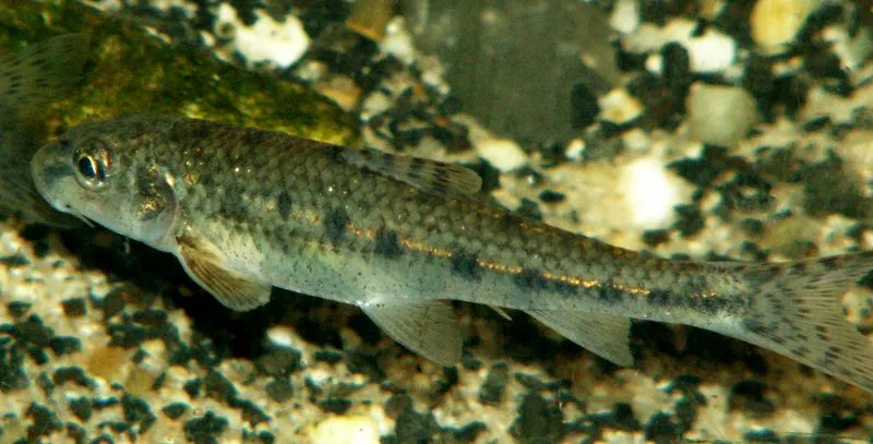
- Gudgeon · Gobio gobio · 7424
- Common minnow · Phoxinus phoxinus · 7272
- Mediterranean Barbel · Barbus meridionalis · 6207
- Chub · Squalius cephalus · 6058
- European Goldfinch · Carduelis carduelis · 5185
- Eurasian blue tit · Cyanistes caeruleus · 5144
- Sardinian warbler · Sylvia melanocephala · 5068
+18 more species
- Brown Trout · Salmo trutta · 5012
- Griffon Vulture · Gyps fulvus · 4828
- Common Nightingale · Luscinia megarhynchos · 4725
- House Sparrow · Passer domesticus · 4702
- Woodlark · Lullula arborea · 4560
- Eurasian Jay · Garrulus glandarius · 4453
- Cirl Bunting · Emberiza cirlus · 4286
- Common Starling · Sturnus vulgaris · 3886
- European Serin · Serinus serinus · 3675
- Song Thrush · Turdus philomelos · 3641
- Black Redstart · Phoenicurus ochruros · 3576
- European Greenfinch · Chloris chloris · 3348
- Common Wood Pigeon · Columba palumbus · 3331
- Eurasian Wren · Troglodytes troglodytes · 3285
- Carrion crow · Corvus corone · 3221
- Roach · Rutilus rutilus · 2999
- Short-toed Snake Eagle · Circaetus gallicus · 2984
- Stone loach · Barbatula barbatula · 2892
Records: GBIF.org (CC-BY). Names: Wikidata (CC0), GBIF. Photos: Wikimedia Commons.
Conservation challenges
The primary purpose of the site is to preserve its natural habitats and the biodiversity they support. The species recorded (Biodiversity tab) reflect its ecological value. The designations it holds frame its management and the control of land use.
According to Global Forest Change data (University of Maryland, Global Forest Watch), about 5,150 ha of tree cover were lost within the boundary between 2001 and 2023 (3% of its area), peaking in 2019 and 2020. These losses include logging, storms and fires, and do not account for regrowth. Apart from forest felling and regrowth (about 2,680 ha in total), land cover remained almost unchanged between 1990 and 2018 according to CORINE Land Cover; only some 230 ha were built over. Since 2016, the European EFFIS system (Copernicus) has mapped 37 fires here, burning about 6,340 ha within the boundary; the largest, in August 2025 (near Coustouge), covered 4,136 ha. At night, 3% of the area gives off artificial light detectable from space (NASA VIIRS Black Marble composite, 2016). Built-up and developed land (buildings, business areas, roads, quarries) covers 1% of the area, and farmland 20% (CORINE Land Cover). According to the Natura 2000 forms, of 22 assessed habitats of European interest, 12 are in excellent condition and 2 in average or reduced condition. According to the Water Framework Directive assessment (2022 river basin management plans, data 2012–2017), 75% of the 662 km of rivers assessed within the site are in good or high ecological status. Other assessed water bodies: lakes, 1 of 1 in good ecological status or better. Since 2000, 74 invasive alien species have been recorded within the site (GBIF observations), 14 of them listed as of Union concern under EU Regulation 1143/2014. Among them: Faxonius limosus (Spinycheek crayfish), Ailanthus altissima (Tree-of-heaven) and Vespa velutina (Asian hornet).
Pressure indicators
Tree cover lost
5,151 ha
2001–2023
20012023
Fires since 2016
6,340 ha
burned within the boundary (37 mapped fires)
- 2025 · Coustouge · 4,136 ha
- 2016 · Paziols · 1,116 ha
- 2022 · Opoul-Périllos · 292 ha
Light at night
3%
of the area gives off artificial light visible from space
DarkLit
Built-up land
1%
buildings, business areas, roads, quarries · farmland 20%
Land cover change
< 0.5%
of the area changed, 1990–2018 · CORINE
forest felling and regrowth: 2,680 ha in total
Rivers and lakes
75%
of the 662 km of assessed rivers in good or high ecological status · WFD 2022
Lakes: 1 of 1 good or better
assessments 2012–2017
Invasive alien species
74
incl. 14 of EU concern · since 2000
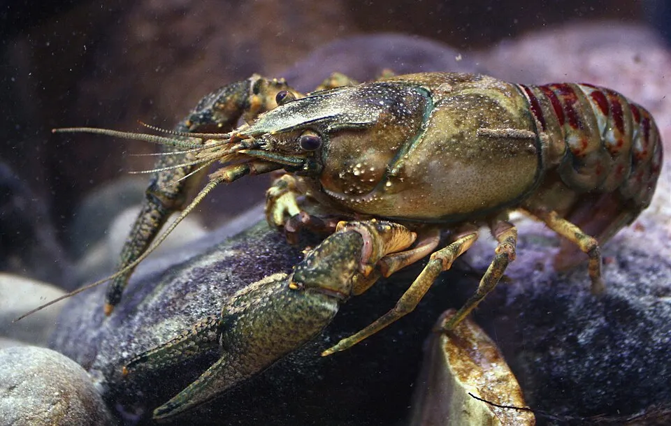 Spinycheek crayfishEU
 Tree-of-heavenEU
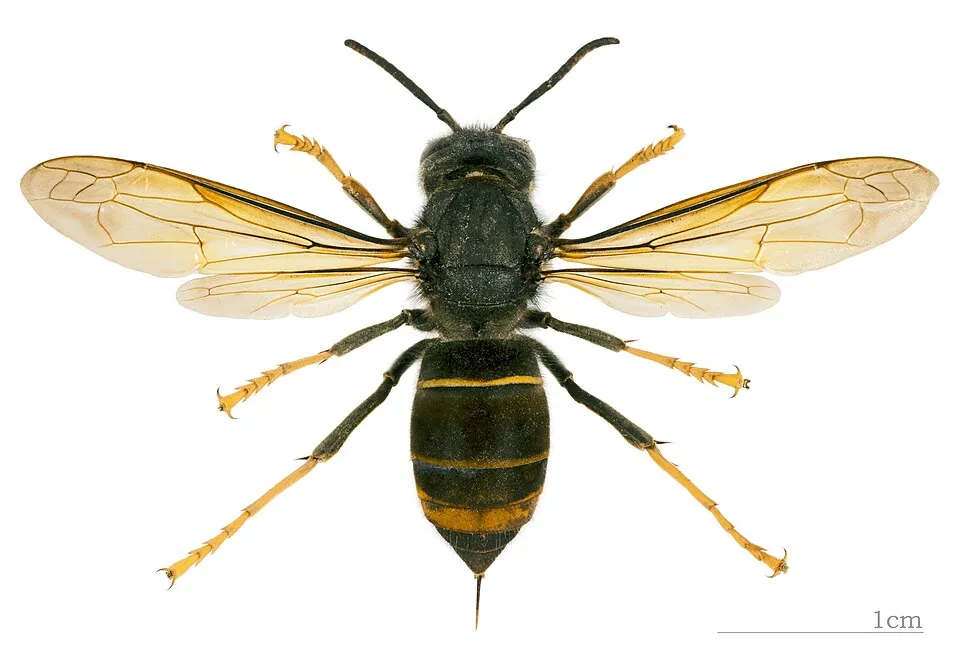 Asian hornetEU
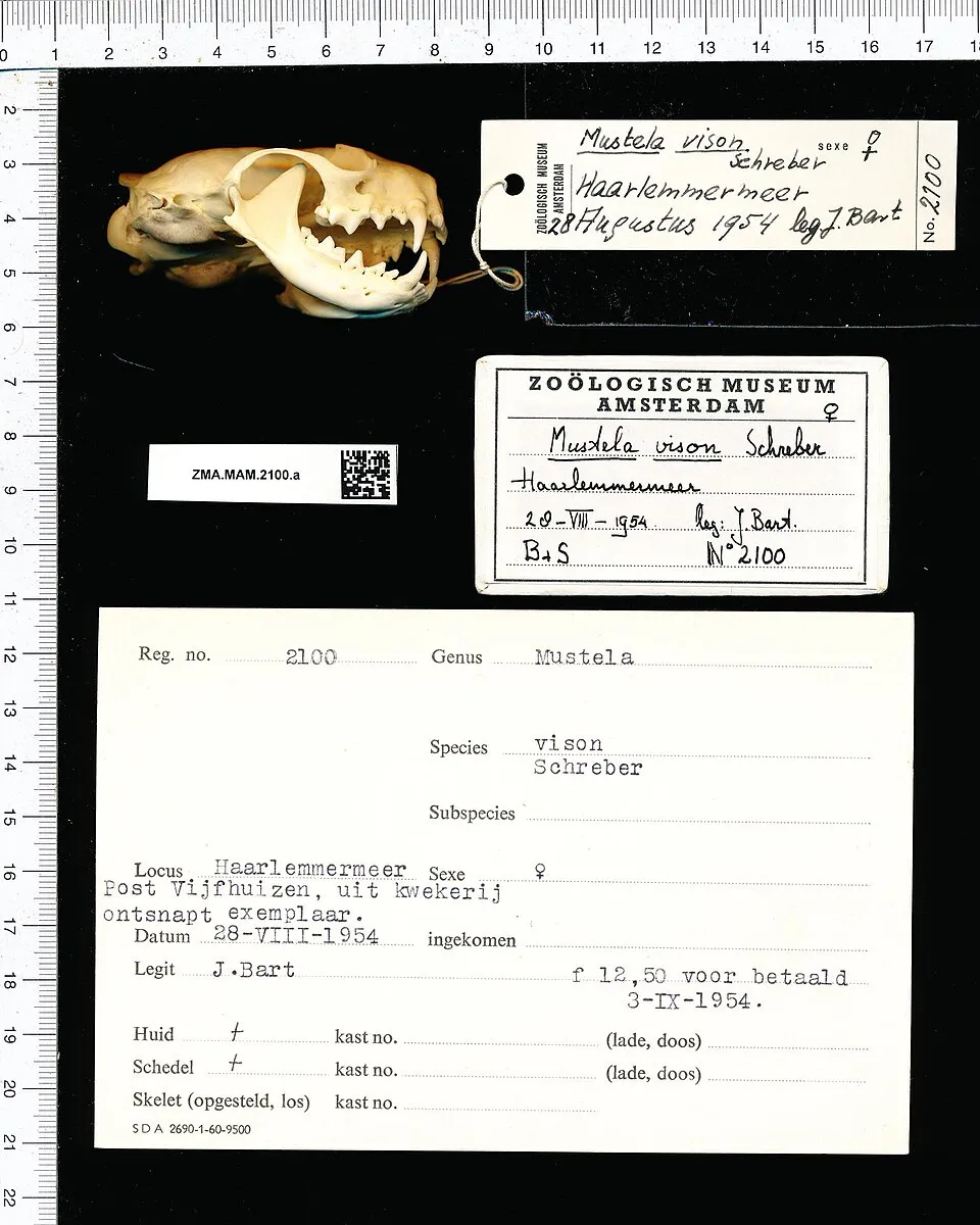 American minkEU
 Paper mulberryEU
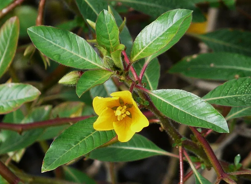 Floating primrose-willowEU
 CoypuEU
 PumpkinseedEU
Photos: Spinycheek crayfish © Astacoides · CC BY-SA 3.0; Tree-of-heaven © Darkone · CC BY-SA 2.5; Asian hornet © Didier Descouens · CC BY-SA 4.0; American mink © Schreber · CC0-1.0; Paper mulberry © Didier Descouens · CC BY-SA 4.0; Floating primrose-willow © Père Igor · CC BY-SA 3.0; Coypu © Philippe Amelant · CC BY-SA 3.0; Pumpkinseed © Cephas · CC BY-SA 3.0
Sources: Global Forest Change (Hansen et al., University of Maryland, via Global Forest Watch, CC-BY 4.0); EFFIS, European Commission / Copernicus; NASA Black Marble 2016 (public domain); CORINE Land Cover 2018 (Copernicus) or MODIS.
CORINE Land Cover Change 1990–2018: generated using European Union's Copernicus Land Monitoring Service information (EEA), aggregated by Parkavela; DOI 10.2909/f30f1000-7cf8-43bb-872c-5eb093911b24.
Ecological status of water bodies: European Environment Agency, WISE – Water Framework Directive, 3rd river basin management plans (2022), CC BY 4.0. Official national classification, not comparable between countries.
Invasive alien species: Global Register of Introduced and Invasive Species (ISSG, CC BY 4.0); Union list, Regulation (EU) 1143/2014 (INBO, CC0); GBIF.org records (CC0 / CC BY 4.0), at least 2 per species.
Practical information
Cities and airport
- Perpignan
15 km as the crow flies - Narbonne
19 km as the crow flies - Airport: Perpignan–Rivesaltes (PGF)
11 km as the crow flies
Visitor information
- Maison Forestière
within the site - Ancienne Maison Forestière
within the site - Maison Forestière de Roquebrune
< 1 km from the site boundary - Office de Tourisme Aude en Pyrénées - Quillan
within the site
Things to see
61 viewpoints · 18 waterfalls · 10 lakes and ponds · 66 caves
- Belvédère du Diable
viewpoint - Cascade de l'Ermitage
waterfall - Bassin de la Gorbelhe
lake or pond - Barrenc du Taureau
cave - Belvédère du Mangonneau
viewpoint
Where to stay
4 mountain huts · 40 campsites
- Ancienne Verrerie du Bourrasset
Staffed hut - Aire Camping Cars Domaine Peter Sichel
campsite - Gite Saint-Roch
Staffed hut - Aire Domaine Bertrand-Bergé
campsite - Le Maou
Staffed hut
Hiking
64 waymarked routes listed, including:
De la Manche aux Pyrénées
By bike
V81 La Vélosud · 76 km
+ 7 local loops
Signed cycle routes: this does not mean that cycling is allowed on footpaths.
Data © OpenStreetMap contributors (ODbL) · Wikidata (CC0)
Routes © OpenStreetMap contributors (ODbL), via Waymarked Trails
Waymarked hiking routes
De la Manche aux Pyrénées 23, Carcassonne - Sournia
105 km within the site ↗ 3,175 m↘ 3,398 m 208–979 m
De la Manche aux Pyrénées 24, Sournia - Bourg-Madame
11.7 km within the site ↗ 115 m↘ 373 m 500–801 m
SC 04 : Duilhac-sous-Peyrepertuse - Cubières-sur-Cinoble
11.8 km within the site ↗ 644 m↘ 580 m 365–915 m
Tracks © OpenStreetMap contributors (ODbL), clipped to the boundary; elevation gain and profiles computed on the longest section from Mapzen Terrain Tiles (≈ 30 m), indicative only.
Bathing
5 monitored bathing sites in or within 1 km of the site · 2025 classification
Excellent · 2
Sufficient · 1
Poor · 1
Not classified · 1
- Lac du Village de Vacances · lake · Excellent
- Le Pont sur l'Orbieu - les Fargues · river · Excellent
- Gorges du Gouleyrous · river · Sufficient
- Saint Jean sur l'Orbieu · river · Poor
- Moulin de Ribaute · river · Not classified
Source: European Environment Agency, official bathing water classification (Directive 2006/7/EC, CC-BY 4.0). Swimming is only permitted at the sites and times authorised locally.
Access and visiting
Campagne railway station lies within the site. Nearest towns of over 50,000 people, as the crow flies: Perpignan (15 km) and Narbonne (19 km). Nearest airport: Perpignan–Rivesaltes (PGF), about 11 km away. About 530,000 people live within 20 km of the site boundary, 140,000 of them within 10 km; some 30,000 people are estimated to live inside (GHSL estimate, 2020). This population has grown by about 24% since 2000. Visitor information on site: Maison Forestière, Ancienne Maison Forestière and Maison Forestière de Roquebrune. Waymarked hiking routes listed in OpenStreetMap: 64, including De la Manche aux Pyrénées. A signed cycle route crosses the site: “V81 La Vélosud” (OpenStreetMap). To see: 61 viewpoints, 18 waterfalls, 10 lakes and ponds and 66 caves, including Belvédère du Diable, Cascade de l'Ermitage, Bassin de la Gorbelhe and Barrenc du Taureau. Where to stay: 4 mountain huts and 40 campsites, including Ancienne Verrerie du Bourrasset, Aire Camping Cars Domaine Peter Sichel and Gite Saint-Roch. To plan a visit (access, opening periods, visitor rules), it is best to consult the official information from the managing body and the official website listed in this page's sources.
Source: OpenStreetMap (ODbL), Wikidata (CC0), October 2026.
Built heritage
According to the French Ministry of Culture's Mérimée database, 73 historic monuments stand within the boundary, 26 of them with the highest level of protection (classé). Among them are 33 religious buildings, 22 castles and fortifications and 10 houses and civic buildings. Notable classé monuments include “Dolmen dit Table des Morts” in Massac, “Ensemble des vestiges du château d'Aguilar” in Tuchan and “Pont faisant communiquer le village de Lagrasse et le quartier de l'Abbaye” in Lagrasse.
33 religious buildings22 castles and fortifications10 houses and civic buildings5 bridges, lighthouses, mills and working buildings3 prehistoric and archaeological sites
-
Dolmen dit Table des Morts
Classé
Massac · Prehistory -
Ensemble des vestiges du château d'Aguilar
Classé
Tuchan · 12th c., 15th c. -
Pont faisant communiquer le village de Lagrasse et le quartier de l'Abbaye
Classé
Lagrasse · 12th c. -
Église Notre-Dame-de-Laval
Classé
Caudiès-de-Fenouillèdes · 15th c., 19th c. -
Halle
Classé
Lagrasse · 14th c. -
Grotte de la Caune de l'Arago
Classé
Tautavel · Prehistory -
Ruines du château de Peyrepertuse
Classé
Duilhac-sous-Peyrepertuse · 11th c., 12th c., 13th c. -
Église Saint-Laurent d'Arsa
Classé
Sournia · 12th c.
and 65 more
Source: Mérimée database, French Ministry of Culture (Licence Ouverte 2.0). Each record links to the Plateforme ouverte du patrimoine (POP).
When to visit
Best time to visit: from June to October, with average temperatures of 12 to 20 °C and moderate rainfall. Day length ranges from about 9 h 02 min in December to 15 h 20 min in June. Wildlife records published on GBIF peak for birds (April and May), plants (May), butterflies and moths (May and June), dragonflies (July) and mammals (July). These peaks also reflect when observers are most active.
Source: Copernicus ERA5-Land (C3S), monthly averages 1996–2025 at the representative point, temperatures adjusted for elevation.
Contains modified Copernicus Climate Change Service information 2026. Neither the European Commission nor ECMWF is responsible for any use that may be made of the Copernicus information or data it contains.
Wildlife records calendar
JFMAMJJASOND
Birds
Plants
Butterflies & moths
Dragonflies
Mammals
Monthly records published on GBIF (CC-BY), relative to the busiest month; also reflects observer activity.
Gallery
© Mairie saint-paul de Fenouillet · CC BY-SA 4.0
© Palauenc05 · CC BY-SA 4.0
© Cdcpaysdecouiza · CC BY-SA 3.0
© Romain Bréget · CC BY-SA 3.0
© ArnoLagrange · CC BY-SA 3.0
© Jean-Louis Socquet-Jouglard · CC BY-SA 3.0
Sources and licences
- Wikidata: Q108539989
- OpenStreetMap: relation 13180710
- Official website: https://www.parc.corbieres-fenouilledes.fr/
- Wikipedia: fr.wikipedia.org/wiki/Parc_naturel_régional_Corbières-Fenouillèdes
References
- cds.climate.copernicus.eu: climate · CC-BY-4.0
- registry.opendata.aws: elevation of the reference point, detailed relief · PD
- land.copernicus.eu: land cover, land cover change, sea share · COPERNICUS
- doi.org: population around the site · CC-BY-4.0
- openstreetmap.org: official name, access and peaks, places to see · ODbL-1.0
- eea.europa.eu: bathing water quality, ecological status of waters · CC-BY-4.0
- en.eurovelo.com: EuroVelo cycle routes · ODbL-1.0
- cycling.waymarkedtrails.org: cycle routes · ODbL-1.0
- opentopodata.org: elevations · PD
- wikidata.org: establishment date, nearby cities and airport, access and peaks, lake depths, places to see, official website · CC0-1.0
- forest-fire.emergency.copernicus.eu: wildfires · COPERNICUS
- globalforestwatch.org: tree cover loss · CC-BY-4.0
- gbif.org: seasonality of sightings, invasive alien species, observed species · CC-BY-4.0
- infoterre.brgm.fr: geology · LO-2.0
- pop.culture.gouv.fr: protected heritage · LO-2.0
- hydrosheds.org: lakes · CC-BY-4.0
- natura2000.eea.europa.eu: Natura 2000 habitats and species · CC-BY-4.0
- earthobservatory.nasa.gov: night light · PD
- hiking.waymarkedtrails.org: route difficulty · ODbL-1.0
- nsidc.org: snow cover · PD
- wikidata.org: Wikipedia article · CC-BY-SA-4.0
Data © OpenStreetMap contributors (ODbL), Wikidata (CC0) and the sources cited.