South Korea · Marine
Dadohaehaesang National Park
National park of 232,120 hectares in South Korea, established in 1981.
Overview
National park of 232,120 hectares in South Korea, established in 1981.
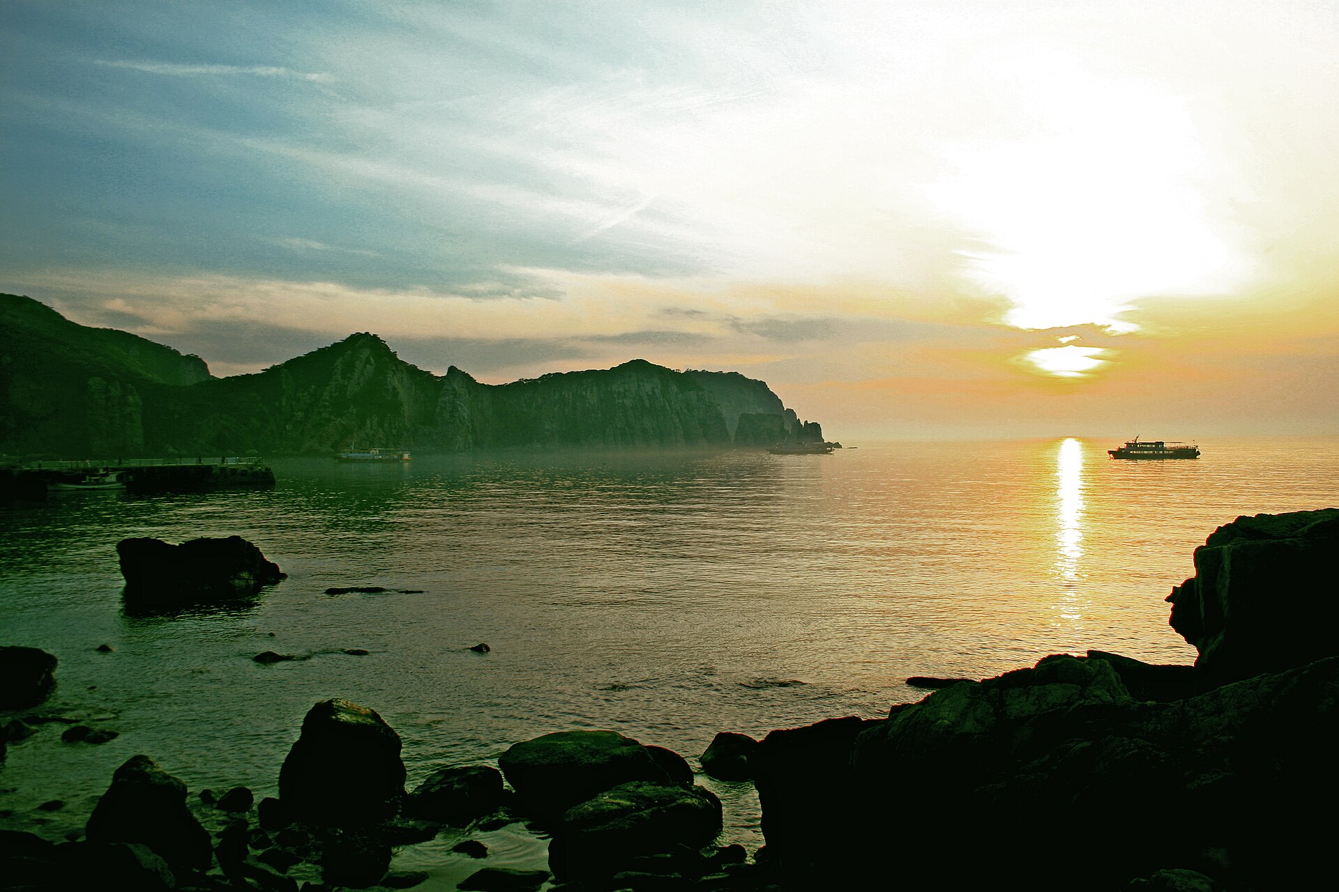
Dadohaehaesang National Park is located in South Korea (Asia). It is a predominantly marine area. Established in 1981, it covers about 232,120 hectares.
Protections and designations
UNESCO Biosphere Reserve
Ramsar site
Protected as a national park. International labels and designations: UNESCO Biosphere Reserve (“Shinan Dadohae”) and Ramsar site (“Jangdo Island High Moor”). Key dates: established in 1981 and Ramsar Site in 2005.
In our collections
Timeline
-
1981
Established
-
2005
Ramsar Site (wetland of international importance) Jangdo Island High Moor
Sources: Wikidata (CC0) for establishment and international labels; EEA Natura 2000 database (CC-BY 4.0) for site designation dates.
Frequently asked questions
Where is Dadohaehaesang National Park?
In South Korea (Asia). Representative point: 34.1910° N, 126.7000° E.
How large is Dadohaehaesang National Park?
About 232,120 hectares (2,321 km²). It is the largest of the 23 national parks in South Korea covered by Parkavela. About 202,500 ha are at sea.
When was Dadohaehaesang National Park established?
In 1981.
What habitats and landscapes does Dadohaehaesang National Park include?
A marine area, with coasts.
Which international labels apply to Dadohaehaesang National Park?
UNESCO Biosphere Reserve (“Shinan Dadohae”) and Ramsar site (“Jangdo Island High Moor”).
When is the best time to visit Dadohaehaesang National Park?
Best time to visit: September and October, with average temperatures of 18 to 24 °C and moderate rainfall.
What is the nearest large city to Dadohaehaesang National Park?
Nearest towns of over 50,000 people, as the crow flies: Yeosu (19 km) and Suncheon (34 km). Nearest airport: Yeosu (RSU), about 28 km away.
How can I reach Dadohaehaesang National Park by train?
The nearest railway station is Yedang, about 25 km from the site boundary.
Where can I get visitor information on site?
Bogil Tourist Information Center.
Which species can be seen in Dadohaehaesang National Park?
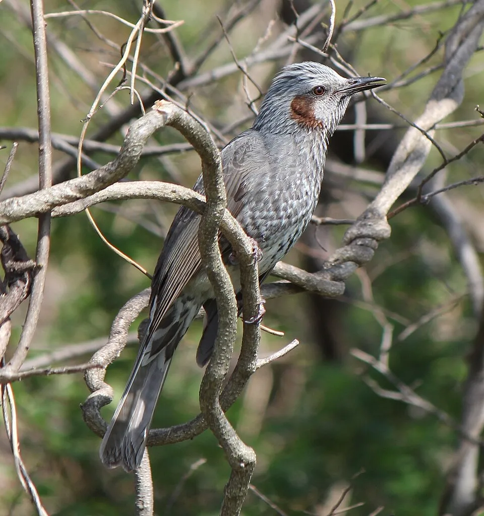
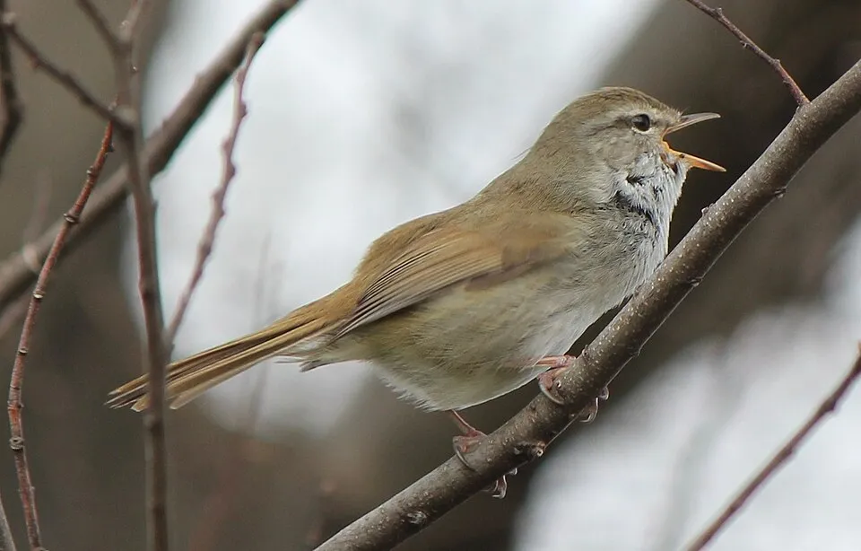
Among the species most often recorded on GBIF are Hypsipetes amaurotis (Brown-eared Bulbul), Larus crassirostris (Black-tailed Gull), Horornis diphone (Japanese Bush Warbler) and Ardea cinerea (Grey Heron).
What is the official website of Dadohaehaesang National Park?
english.knps.or.kr/Knp/Dadohae/Intro/Introduction.aspx?MenuNum=1&Submenu=Npp
© OpenStreetMap
Download the boundary: GeoJSON · GPX Boundary © OpenStreetMap contributors (ODbL).
Geography
Over the 1996–2025 period, the mean annual temperature is about 15.2 °C and total precipitation reaches roughly 1,284 mm per year. The warmest month is usually August, the coolest January, and the wettest June.
Area
- Area
- 232,120 ha
- Coordinates
- 34.191, 126.7
Climate
● Mean temperature (°C) · ▮ Precipitation (mm)
Source: Copernicus ERA5 (C3S, doi:10.24381/cds.f17050d7), monthly averages 1996–2025 interpolated to the representative point, temperatures adjusted for elevation.
Contains modified Copernicus Climate Change Service information 2026. Neither the European Commission nor ECMWF is responsible for any use that may be made of the Copernicus information or data it contains.
Natural habitats
According to the global MODIS land cover (NASA, 2024), the land area is mainly made up of marshes and bogs (49%), forests (44%) and heath and scrub (6%). Woodland mixes broadleaved and coniferous trees. The sea covers about 87% of the site. The seabed reaches about 88 m deep (median depth 25 m; GEBCO bathymetry).
Biodiversity
Based on occurrences aggregated by GBIF, several species are regularly recorded within the site. Among the most frequent are Hypsipetes amaurotis (Brown-eared Bulbul), Larus crassirostris (Black-tailed Gull), Horornis diphone (Japanese Bush Warbler) and Ardea cinerea (Grey Heron). The full list of documented taxa is shown below.
Species to look out for
Bird
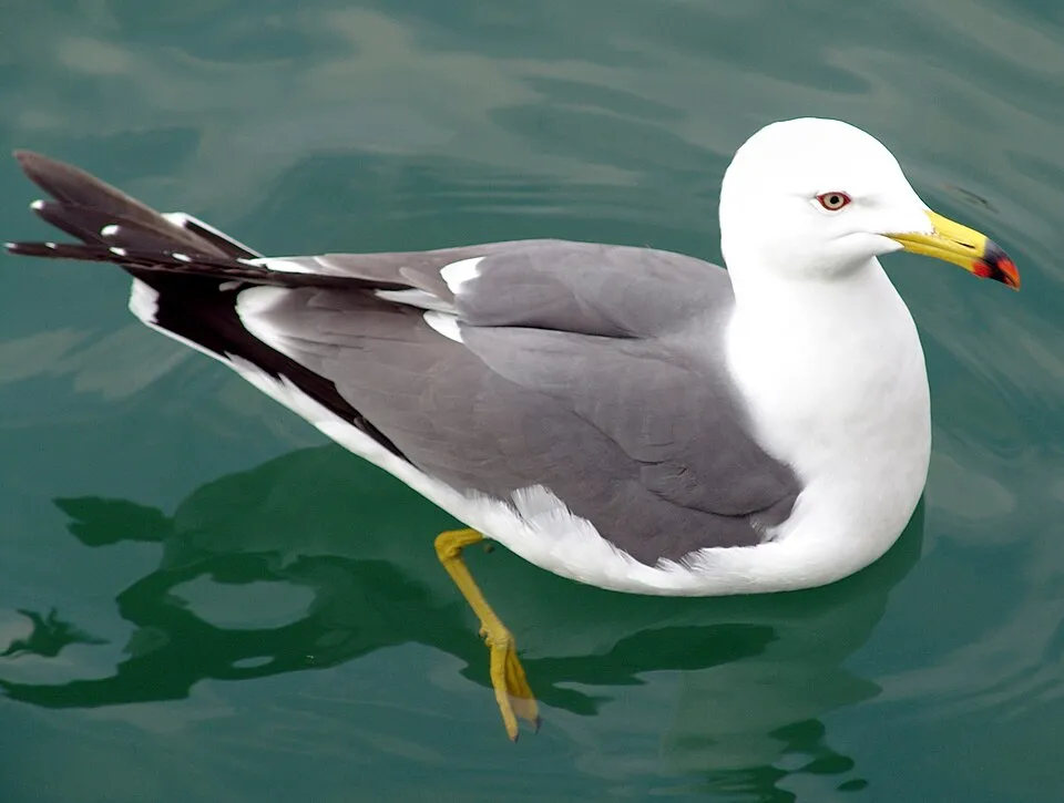
Black-tailed Gull
Larus crassirostris426 records © Angie from Sawara, Chiba-ken, Japan · CC BY 2.0

Observed species
Occurrences documented via GBIF; they are neither an exhaustive inventory nor proof of current presence.
- Brown-eared Bulbul · Hypsipetes amaurotis · 513
- Black-tailed Gull · Larus crassirostris · 426
- Japanese Bush Warbler · Horornis diphone · 396
- Grey Heron · Ardea cinerea · 370
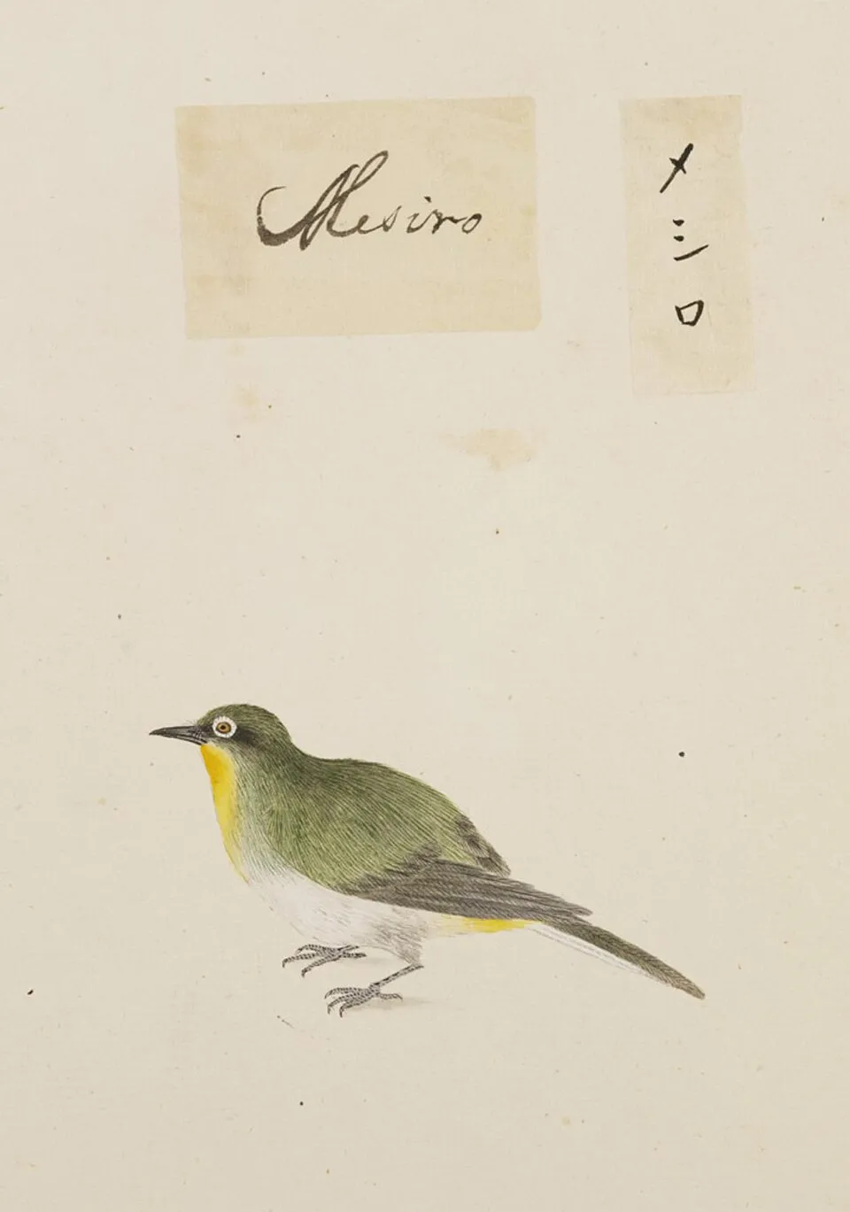
- Warbling white-eye · Zosterops japonicus · 367
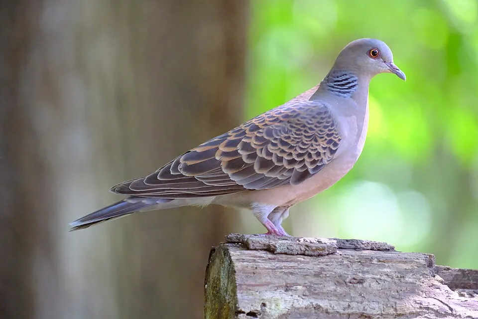
- Oriental Turtle Dove · Streptopelia orientalis · 346
- Pale Thrush · Turdus pallidus · 324
- Olive-backed Pipit · Anthus hodgsoni · 281
- White Wagtail · Motacilla alba · 261
- Camellia · Camellia japonica · 232
- Barn Swallow · Hirundo rustica · 229
- Black-faced Bunting · Emberiza spodocephala · 222
+18 more species
- Little Bunting · Emberiza pusilla · 210
- Little Egret · Egretta garzetta · 208
- Grey Wagtail · Motacilla cinerea · 205
- Varied Tit · Poecile varius · 204
- Stejneger's Stonechat · Saxicola stejnegeri · 200
- Great Egret · Ardea alba · 193
- Bull-headed Shrike · Lanius bucephalus · 185
- Peregrine Falcon · Falco peregrinus · 183
- Asian-jasmine · Trachelospermum asiaticum · 181
- Blue Rock Thrush · Monticola solitarius · 180
- Thunberg’s bay-tree · Machilus thunbergii · 174
- Yellow-browed Bunting · Emberiza chrysophrys · 161
- Nerita japonica · 157
- Yellow-browed Warbler · Phylloscopus inornatus · 153
- Eastern Yellow Wagtail · Motacilla tschutschensis · 151
- Itajii · Castanopsis sieboldii · 150
- China root · Smilax china · 147
- Brambling · Fringilla montifringilla · 144
Records: GBIF.org (CC-BY). Names: Wikidata (CC0), GBIF. Photos: Wikimedia Commons.
Conservation challenges
The primary purpose of the site is to preserve its natural habitats and the biodiversity they support. The species recorded (Biodiversity tab) reflect its ecological value. The designations it holds frame its management and the control of land use.
Pressure indicators
Built-up land
< 1%
buildings, business areas, roads, quarries
Invasive alien species
1
recorded since 2000
Sources: Global Forest Change (Hansen et al., University of Maryland, via Global Forest Watch, CC-BY 4.0); EFFIS, European Commission / Copernicus; NASA Black Marble 2016 (public domain); CORINE Land Cover 2018 (Copernicus) or MODIS.
Invasive alien species: Global Register of Introduced and Invasive Species (ISSG, CC BY 4.0); Union list, Regulation (EU) 1143/2014 (INBO, CC0); GBIF.org records (CC0 / CC BY 4.0), at least 2 per species.
Practical information
Cities and airport
- Yeosu
19 km as the crow flies - Suncheon
34 km as the crow flies - Airport: Yeosu (RSU)
28 km as the crow flies
Visitor information
- Bogil Tourist Information Center
< 1 km from the site boundary
Data © OpenStreetMap contributors (ODbL) · Wikidata (CC0)
Waymarked hiking routes
Yeosu Geumodo Bireong-gil, Course 2
3.7 km within the site ↗ 109 m↘ 104 m 4–108 m
up to T1 · hiking
Yeosu Geumodo Bireong-gil, Course 3
3.8 km within the site ↗ 179 m↘ 181 m 4–151 m
up to T1 · hiking
Yeosu Geumodo Bireong-gil, Course 4
2.8 km within the site ↗ 118 m↘ 120 m 1–81 m
up to T1 · hiking
Yeosu Geumodo Bireong-gil, Course 5
3.3 km within the site ↗ 107 m↘ 118 m 2–118 m
up to T1 · hiking
Tracks © OpenStreetMap contributors (ODbL), clipped to the boundary; elevation gain and profiles computed on the longest section from Mapzen Terrain Tiles (≈ 30 m), indicative only. Indicative difficulty (SAC scale, OpenStreetMap, via Waymarked Trails): check with the park.
Access and visiting
The nearest railway station is Yedang, about 25 km from the site boundary. Nearest towns of over 50,000 people, as the crow flies: Yeosu (19 km) and Suncheon (34 km). Nearest airport: Yeosu (RSU), about 28 km away. About 290,000 people live within 20 km of the site boundary, 85,000 of them within 10 km (GHSL estimate, 2020). This population has fallen by about 30% since 2000. Visitor information on site: Bogil Tourist Information Center. To plan a visit (access, opening periods, visitor rules), it is best to consult the official information from the managing body and the official website listed in this page's sources.
Source: OpenStreetMap (ODbL), Wikidata (CC0), November 2026.
When to visit
Best time to visit: September and October, with average temperatures of 18 to 24 °C and moderate rainfall. Precipitation peaks from May to August (up to 200 mm per month). Day length ranges from about 9 h 53 min in December to 14 h 25 min in June. Wildlife records published on GBIF peak for birds (April and May), plants (June and July), butterflies and moths (June), dragonflies (September) and mammals (February). These peaks also reflect when observers are most active.
Source: Copernicus ERA5 (C3S), monthly averages 1996–2025 at the representative point, temperatures adjusted for elevation.
Contains modified Copernicus Climate Change Service information 2026. Neither the European Commission nor ECMWF is responsible for any use that may be made of the Copernicus information or data it contains.
Wildlife records calendar
JFMAMJJASOND
Birds
Plants
Butterflies & moths
Dragonflies
Mammals
Monthly records published on GBIF (CC-BY), relative to the busiest month; also reflects observer activity.
Gallery
© justinjfj · CC BY 2.0
© Lcarrion88 · CC BY-SA 4.0
© Seungh · CC BY-SA 3.0
© Lcarrion88 · CC BY-SA 4.0
© Seungh · CC BY-SA 4.0
© Lcarrion88 · CC BY-SA 4.0
Sources and licences
- Wikidata: Q484112
- OpenStreetMap: relation 17336597
- Official website: http://english.knps.or.kr/Knp/Dadohae/Intro/Introduction.aspx?MenuNum=1&Submenu=Npp
- Wikipedia: en.wikipedia.org/wiki/Dadohaehaesang_National_Park
- WDPA: 4736
References
- cds.climate.copernicus.eu: climate · CC-BY-4.0
- registry.opendata.aws: elevation of the reference point · PD
- lpdaac.usgs.gov: land cover · PD
- doi.org: population around the site · CC-BY-4.0
- naturalearthdata.com: sea share · PD
- wikidata.org: official area, establishment date, protected heritage, official name, nearby cities and airport, official website · CC0-1.0
- gebco.net: depths · PD
- opentopodata.org: elevations · PD
- gbif.org: seasonality of sightings, invasive alien species, observed species · CC-BY-4.0
- openstreetmap.org: access and peaks, trail difficulty, wheelchair access · ODbL-1.0
- hiking.waymarkedtrails.org: route difficulty · ODbL-1.0
- wikidata.org: Wikipedia article · CC-BY-SA-4.0
Data © OpenStreetMap contributors (ODbL), Wikidata (CC0) and the sources cited.