Japan · Mixed
Daisen-Oki National Park
National park of 35,097 hectares in Japan, established in 1936.
Overview
National park of 35,097 hectares in Japan, established in 1936.
Daisen-Oki National Park is located in Japan (Asia). It covers both land and sea. Established on 1 February 1936, it covers about 35,097 hectares.
In our collections
Frequently asked questions
Where is Daisen-Oki National Park?
In Japan (Asia). Representative point: 35.5703° N, 133.1846° E.
How large is Daisen-Oki National Park?
About 35,097 hectares (351 km²). It is the 24th largest of the 35 national parks in Japan covered by Parkavela. About 17,000 ha are at sea.
When was Daisen-Oki National Park established?
On 1 February 1936.
What habitats and landscapes does Daisen-Oki National Park include?
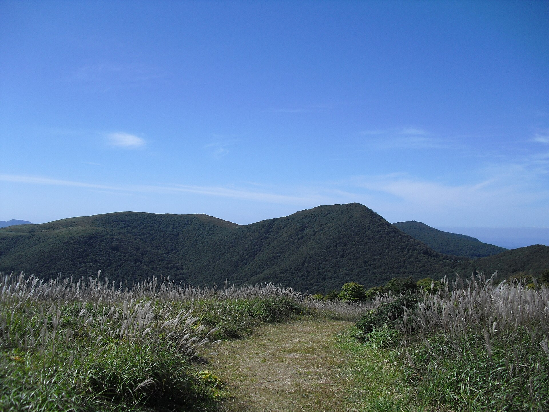
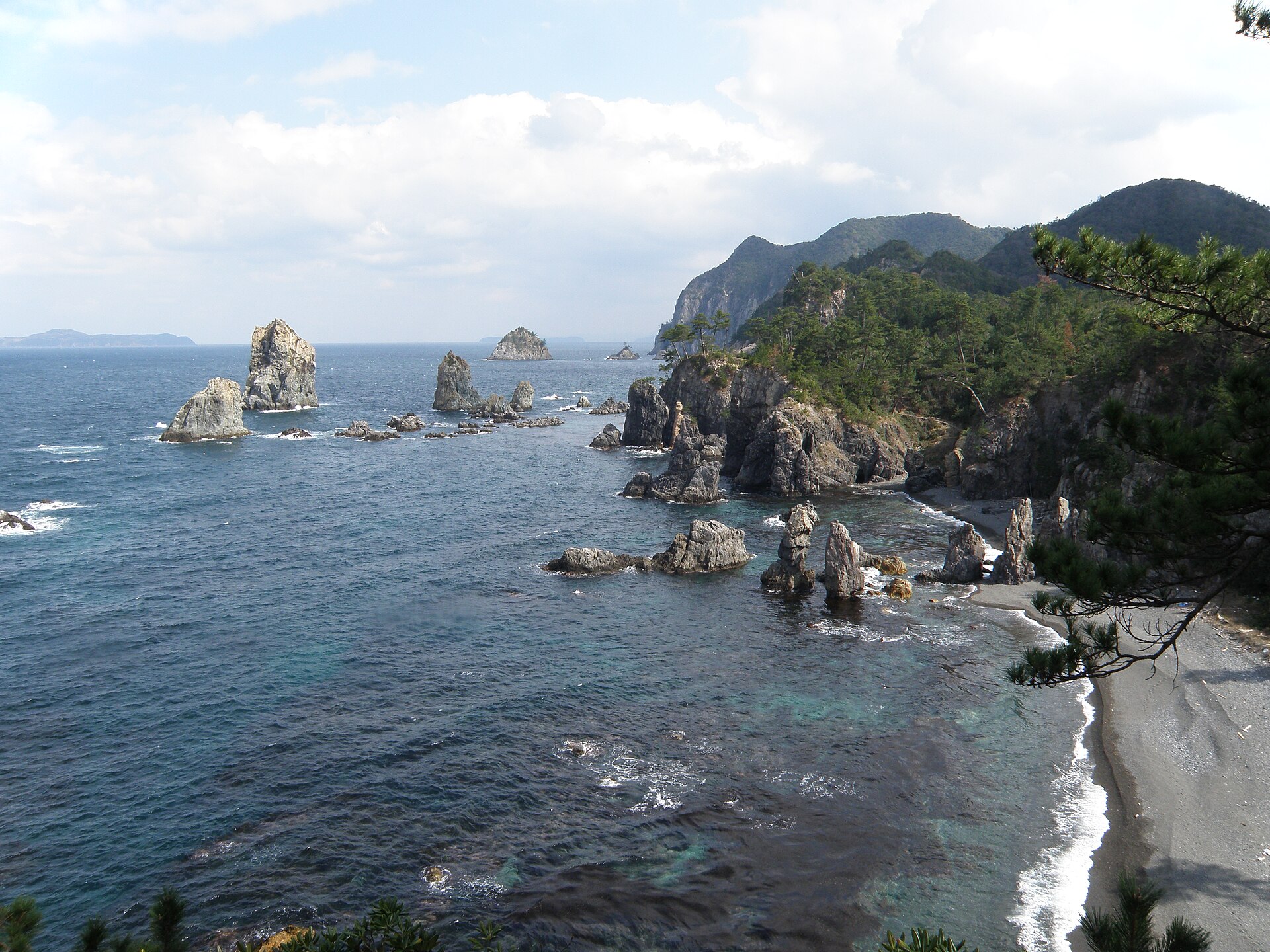
An area spanning land and sea, with forests, mountains and coasts.
What is the highest point of Daisen-Oki National Park?
Daisen, at 1,729 m (Wikidata).
What are the main summits of Daisen-Oki National Park?
Daisen (1,729 m), Karasugasen (1,448 m), Yahazu-yama (1,358 m), Kabutoga-sen (1,338 m) and Mount Sanbe (1,126 m) (Wikidata).
When is the best time to visit Daisen-Oki National Park?
Best time to visit: May and June, with average temperatures of 17 to 22 °C and moderate rainfall.
Is there snow in Daisen-Oki National Park?
Yes. According to NASA's MODIS satellites (2015–2025 average), snow covers the site about 40 days a year, mostly in January and February.
What is there to see in Daisen-Oki National Park?
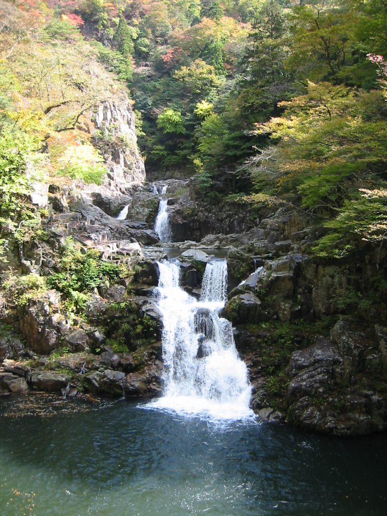
1 waterfall and 1 cave, including Daisen Falls and Kaka no kukedo (Wikidata).
Are there historic monuments in Daisen-Oki National Park?
Yes. According to Wikidata, 7 monuments protected in Japan as Important Cultural Properties or Historic Sites stand within the boundary, 2 of them National Treasures or Special Historic Sites. For example: “Honden of Izumo Taisha” in Izumo and “Izumo Taisha” in Izumo.
What is the nearest large city to Daisen-Oki National Park?
Nearest towns of over 50,000 people, as the crow flies: Izumo (0.4 km) and Matsue (8 km). Nearest airport: Miho-Yonago (YGJ), about 8 km away.
How can I reach Daisen-Oki National Park by train?
The nearest railway station is Izumo Taisha-mae, less than 1 km from the site boundary.
Which species can be seen in Daisen-Oki National Park?
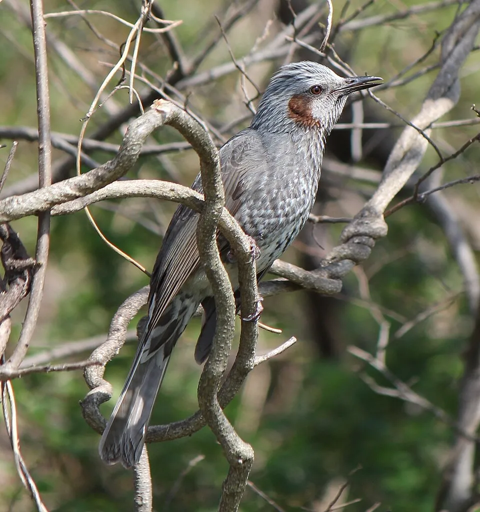
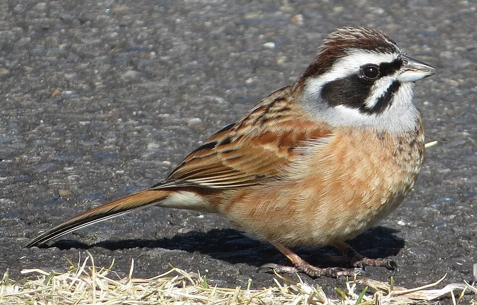
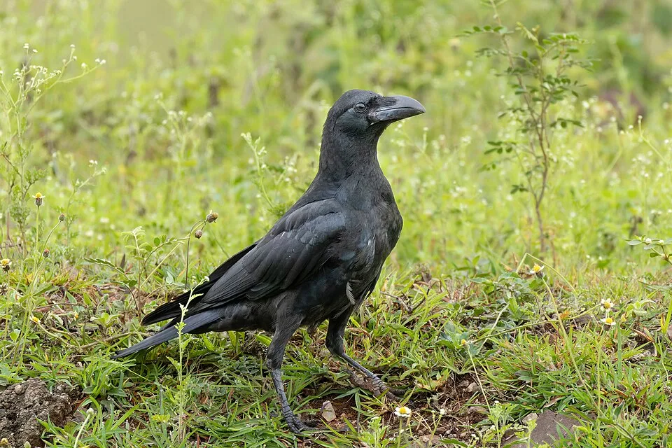
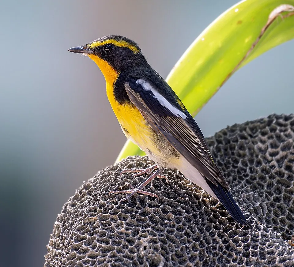
Among the species most often recorded on GBIF are Hypsipetes amaurotis (Brown-eared Bulbul), Emberiza cioides (Meadow Bunting), Corvus macrorhynchos (Large-billed Crow) and Ficedula narcissina (Narcissus Flycatcher).
What is the official website of Daisen-Oki National Park?
© OpenStreetMap
Download the boundary: GeoJSON · GPX Boundary © OpenStreetMap contributors (ODbL).
Geography
Over the 1996–2025 period, the mean annual temperature is about 16.0 °C and total precipitation reaches roughly 1,810 mm per year. The warmest month is usually August, the coolest January, and the wettest December.
Area
- Area
- 35,097 ha
- Median elevation
- 225 m
- Mean slope
- 14°
- Snow cover
- ≈ 40 days a year
- Coordinates
- 35.5703, 133.1846
Terrain: Mapzen Terrain Tiles (SRTM, USGS)
Elevation bands
- below 500 m 62%
- 500–1,000 m 31%
- 1,000–1,500 m 6%
share of the site in each elevation band (smoothed terrain model: summits are rounded off) · Terrain: Mapzen Terrain Tiles (SRTM, USGS)
Main summits
- Daisen1,729 m
- Karasugasen1,448 m
- Yahazu-yama1,358 m
- Kabutoga-sen1,338 m
- Mount Sanbe1,126 m
- Shimo-Hiruzen1,100 m
- Mount Hobutsu1,005 m
- Naka-Hiruzen971 m
- Mount Senjō687 m
- Mount Daimanji608 m
Data: Wikidata (CC0), pending OpenStreetMap data
Climate
● Mean temperature (°C) · ▮ Precipitation (mm)
Source: Copernicus ERA5-Land (C3S, doi:10.24381/cds.68d2bb30), monthly averages 1996–2025 interpolated to the representative point, temperatures adjusted for elevation.
Contains modified Copernicus Climate Change Service information 2026. Neither the European Commission nor ECMWF is responsible for any use that may be made of the Copernicus information or data it contains.
Snow cover measured by satellite
J
F
M
A
M
J
J
A
S
O
N
D
average share of the site under snow · snowiest parts · ≈ 40 days a year
Snow cover: MODIS/Terra MOD10CM v61 (Hall & Riggs, 2021, NASA NSIDC DAAC, doi:10.5067/MODIS/MOD10CM.061), imagery from NASA GIBS (ESDIS); 2015–2025 average, grid of about 5 km.
Natural habitats
According to the global MODIS land cover (NASA, 2024), the land area is mainly made up of forests (88%) and marshes and bogs (7%). Woodland mixes broadleaved and coniferous trees. The sea covers about 48% of the site. The seabed reaches about 54 m deep (median depth 20 m; GEBCO bathymetry). Elevation ranges from sea level to 1,729 m (highest point: Daisen). Median elevation is 225 m, and 38% of the site lies above 500 m (SRTM elevation model).
Biodiversity
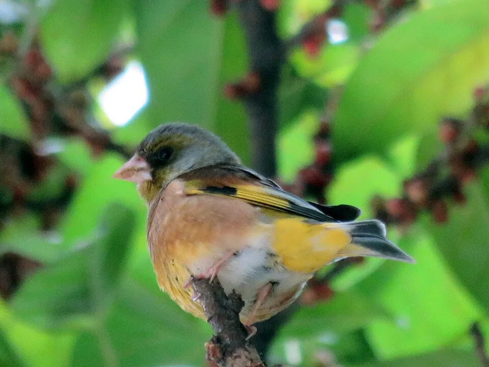
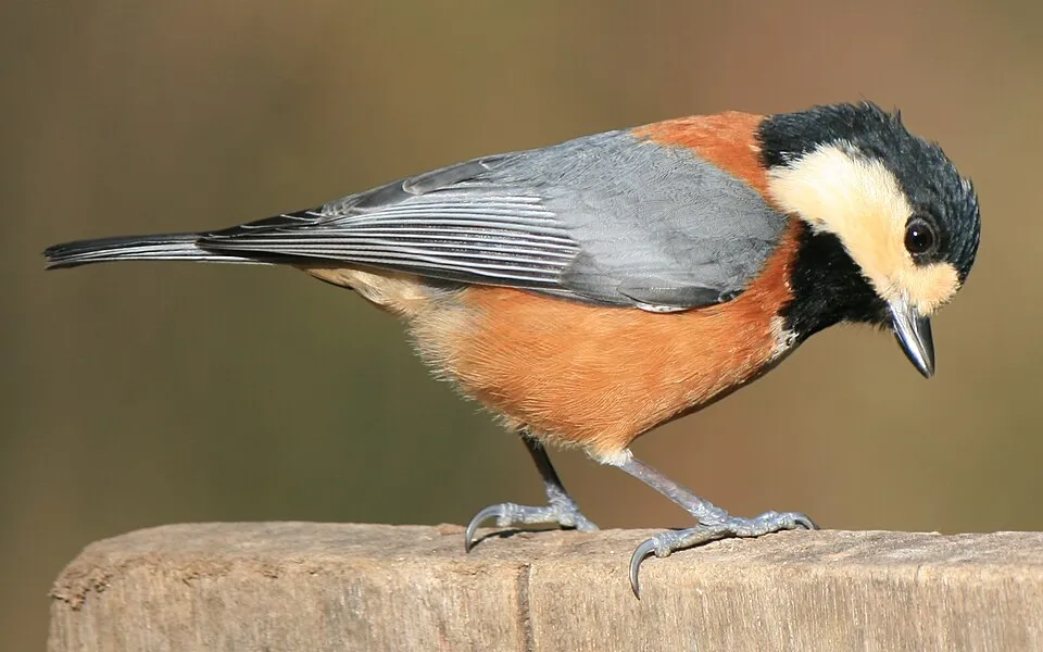
Based on occurrences aggregated by GBIF, several species are regularly recorded within the site. Among the most frequent are Hypsipetes amaurotis (Brown-eared Bulbul), Emberiza cioides (Meadow Bunting), Corvus macrorhynchos (Large-billed Crow) and Ficedula narcissina (Narcissus Flycatcher). The full list of documented taxa is shown below.
Species to look out for
Observed species
Occurrences documented via GBIF; they are neither an exhaustive inventory nor proof of current presence.
- Brown-eared Bulbul · Hypsipetes amaurotis · 331
- Meadow Bunting · Emberiza cioides · 283
- Large-billed Crow · Corvus macrorhynchos · 194
- Narcissus Flycatcher · Ficedula narcissina · 180
- Grey-capped Greenfinch · Chloris sinica · 180
- Varied Tit · Poecile varius · 150
- Japanese Pygmy Woodpecker · Yungipicus kizuki · 141
- Japanese Tit · Parus minor · 137
- Carrion crow · Corvus corone · 133
- Japanese Bush Warbler · Horornis diphone · 122
- Japanese Grosbeak · Eophona personata · 98
- Long-tailed Tit · Aegithalos caudatus · 97
+18 more species
- Brambling · Fringilla montifringilla · 93
- Cinereous Tit · Parus cinereus · 89
- Pelagic Cormorant · Phalacrocorax pelagicus · 85
- Japanese Thrush · Turdus cardis · 80
- Warbling white-eye · Zosterops japonicus · 77
- Oriental Cuckoo · Cuculus optatus · 75
- Black Kite · Milvus migrans · 67
- Coal tit · Periparus ater · 63
- Calamagrostis longiseta · 63
- Indian Spot-billed Duck · Anas poecilorhyncha · 62
- Great Spotted Woodpecker · Dendrocopos major · 61
- Eurasian Tree Sparrow · Passer montanus · 58
- Eurasian Skylark · Alauda arvensis · 58
- Lesser Cuckoo · Cuculus poliocephalus · 57
- Eurasian Nuthatch · Sitta europaea · 54
- Streaked Shearwater · Calonectris leucomelas · 51
- Red-billed Leiothrix · Leiothrix lutea · 48
- Daurian Redstart · Phoenicurus auroreus · 46
Records: GBIF.org (CC-BY). Names: Wikidata (CC0), GBIF. Photos: Wikimedia Commons.
Conservation challenges
The primary purpose of the site is to preserve its natural habitats and the biodiversity they support. The species recorded (Biodiversity tab) reflect its ecological value. Its status as a national park sets the regulatory framework for its protection.
According to Global Forest Change data (University of Maryland, Global Forest Watch), about 330 ha of tree cover were lost within the boundary between 2001 and 2023 (under 1% of its area), peaking in 2012 and 2019. These losses include logging, storms and fires, and do not account for regrowth. At night, the area gives off virtually no artificial light detectable from space (NASA VIIRS Black Marble composite, 2016). Invasive alien species have been recorded within the site since 2000 (GBIF observations). Among them: Leiothrix lutea (Red-billed Leiothrix), Columba livia (Rock Dove) and Misgurnus anguillicaudatus (Pond loach).
Pressure indicators
Tree cover lost
330 ha
2001–2023 · < 1% of the area
20012023
Light at night
< 1%
of the area gives off artificial light visible from space
DarkLit
Invasive alien species
4
recorded since 2000
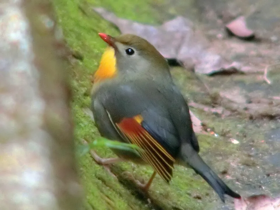 Red-billed Leiothrix
 Rock Dove
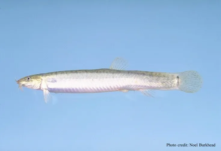 Pond loach
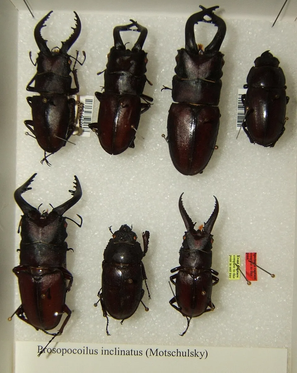 East Asian Inclined Stag Beetle
Photos: Red-billed Leiothrix © Charles Lam from Hong Kong, China · CC BY-SA 2.0; Rock Dove © william_stephens · CC BY 4.0; Pond loach © Eugene van der Pijll · Public domain; East Asian Inclined Stag Beetle © Kugamazog · CC BY-SA 2.5
Sources: Global Forest Change (Hansen et al., University of Maryland, via Global Forest Watch, CC-BY 4.0); EFFIS, European Commission / Copernicus; NASA Black Marble 2016 (public domain); CORINE Land Cover 2018 (Copernicus) or MODIS.
Invasive alien species: Global Register of Introduced and Invasive Species (ISSG, CC BY 4.0); Union list, Regulation (EU) 1143/2014 (INBO, CC0); GBIF.org records (CC0 / CC BY 4.0), at least 2 per species.
Practical information
Cities and airport
- Izumo
< 1 km as the crow flies - Matsue
8 km as the crow flies - Airport: Miho-Yonago (YGJ)
8 km as the crow flies
Data: Wikidata (CC0), pending OpenStreetMap data
Access and visiting
The nearest railway station is Izumo Taisha-mae, less than 1 km from the site boundary. Nearest towns of over 50,000 people, as the crow flies: Izumo (0.4 km) and Matsue (8 km). Nearest airport: Miho-Yonago (YGJ), about 8 km away. About 790,000 people live within 20 km of the site boundary, 390,000 of them within 10 km; some 6,300 people are estimated to live inside (GHSL estimate, 2020). This population has fallen by about 11% since 2000. To see: 1 waterfall and 1 cave, including Daisen Falls and Kaka no kukedo. To plan a visit (access, opening periods, visitor rules), it is best to consult the official information from the managing body and the official website listed in this page's sources.
Source: Wikidata (CC0), November 2026.
Built heritage
According to Wikidata, 7 monuments protected in Japan as Important Cultural Properties or Historic Sites stand within the boundary, 2 of them National Treasures or Special Historic Sites. Among them are 2 bridges, lighthouses, mills and working buildings and 1 religious building. Nationally designated items include “Honden of Izumo Taisha” in Izumo and “Izumo Taisha” in Izumo.
2 bridges, lighthouses, mills and working buildings1 religious building
-
Honden of Izumo Taisha
National
Izumo -
Izumo Taisha
National
Izumo · 7th c. -
Daisen-ji Temple
Daisen · 8th c. -
Izumo-Hinomisaki Lighthouse
Izumo · 20th c. -
Hinomisaki Shrine
Izumo district -
Mihonoseki Lighthouse
Matsue · 19th c. -
Tamawakasu-no-Mikoto Shrine
Suki district
Source: Wikidata (CC0), monuments in each country’s official heritage protection registers, at national or regional level. Each item links to its Wikidata entry.
When to visit
Best time to visit: May and June, with average temperatures of 17 to 22 °C and moderate rainfall. According to NASA's MODIS satellites (2015–2025 average), snow covers the site about 40 days a year, mostly in January and February. Day length ranges from about 9 h 46 min in December to 14 h 33 min in June. Wildlife records published on GBIF peak for birds (May), plants (July and August) and butterflies and moths (August and September). These peaks also reflect when observers are most active.
Source: Copernicus ERA5-Land (C3S), monthly averages 1996–2025 at the representative point, temperatures adjusted for elevation.
Contains modified Copernicus Climate Change Service information 2026. Neither the European Commission nor ECMWF is responsible for any use that may be made of the Copernicus information or data it contains.
Wildlife records calendar
JFMAMJJASOND
Birds
Plants
Butterflies & moths
Monthly records published on GBIF (CC-BY), relative to the busiest month; also reflects observer activity.
Gallery
© Mass Ave 975 · CC BY-SA 3.0
© Bernard Gagnon · CC BY-SA 3.0
© 663highland · CC BY 2.5
© Reggaeman · CC BY-SA 3.0
© 紫煙 · CC BY-SA 3.0
© Gamy25 · Public domain
Sources and licences
- Wikidata: Q1155784
- Official website: http://www.env.go.jp/park/daisen/index.html
- Wikipedia: en.wikipedia.org/wiki/Daisen-Oki_National_Park
- WDPA: 12260
References
- env.go.jp: official area · CC-BY-4.0
- cds.climate.copernicus.eu: climate · CC-BY-4.0
- registry.opendata.aws: elevation of the reference point, detailed relief · PD
- lpdaac.usgs.gov: land cover · PD
- doi.org: population around the site · CC-BY-4.0
- naturalearthdata.com: sea share · PD
- en.eurovelo.com: EuroVelo cycle routes · ODbL-1.0
- cycling.waymarkedtrails.org: cycle routes · ODbL-1.0
- gebco.net: depths · PD
- opentopodata.org: elevations · PD
- wikidata.org: establishment date, protected heritage, official name, nearby cities and airport, access and peaks, lake depths, places to see, official website · CC0-1.0
- globalforestwatch.org: tree cover loss · CC-BY-4.0
- gbif.org: seasonality of sightings, invasive alien species, observed species · CC-BY-4.0
- earthobservatory.nasa.gov: night light · PD
- nsidc.org: snow cover · PD
- wikidata.org: Wikipedia article · CC-BY-SA-4.0
Data © OpenStreetMap contributors (ODbL), Wikidata (CC0) and the sources cited.