
Italy · Terrestrial
Monte Fenera Nature Park
Regional nature park of 3,320 hectares in Italy, established in 1987.
Overview
Regional nature park of 3,320 hectares in Italy, established in 1987.
Monte Fenera Nature Park is a regional nature park in Italy (Europe). It is a predominantly terrestrial area. Established in 1987, it covers about 3,320 hectares.
Protections and designations
Natura 2000 · habitats (SAC)
- Monte Fenera IT1120003
Protected as a regional nature park. International labels and designations: Natura 2000 network (1 site: “Monte Fenera”).
In our collections
Frequently asked questions
Where is Monte Fenera Nature Park?
In Italy (Europe). Representative point: 45.7100° N, 8.3160° E.
How large is Monte Fenera Nature Park?
About 3,320 hectares (33 km²). It is the 81st largest of the 128 regional parks in Italy covered by Parkavela.
When was Monte Fenera Nature Park established?
In 1987.
What habitats and landscapes does Monte Fenera Nature Park include?
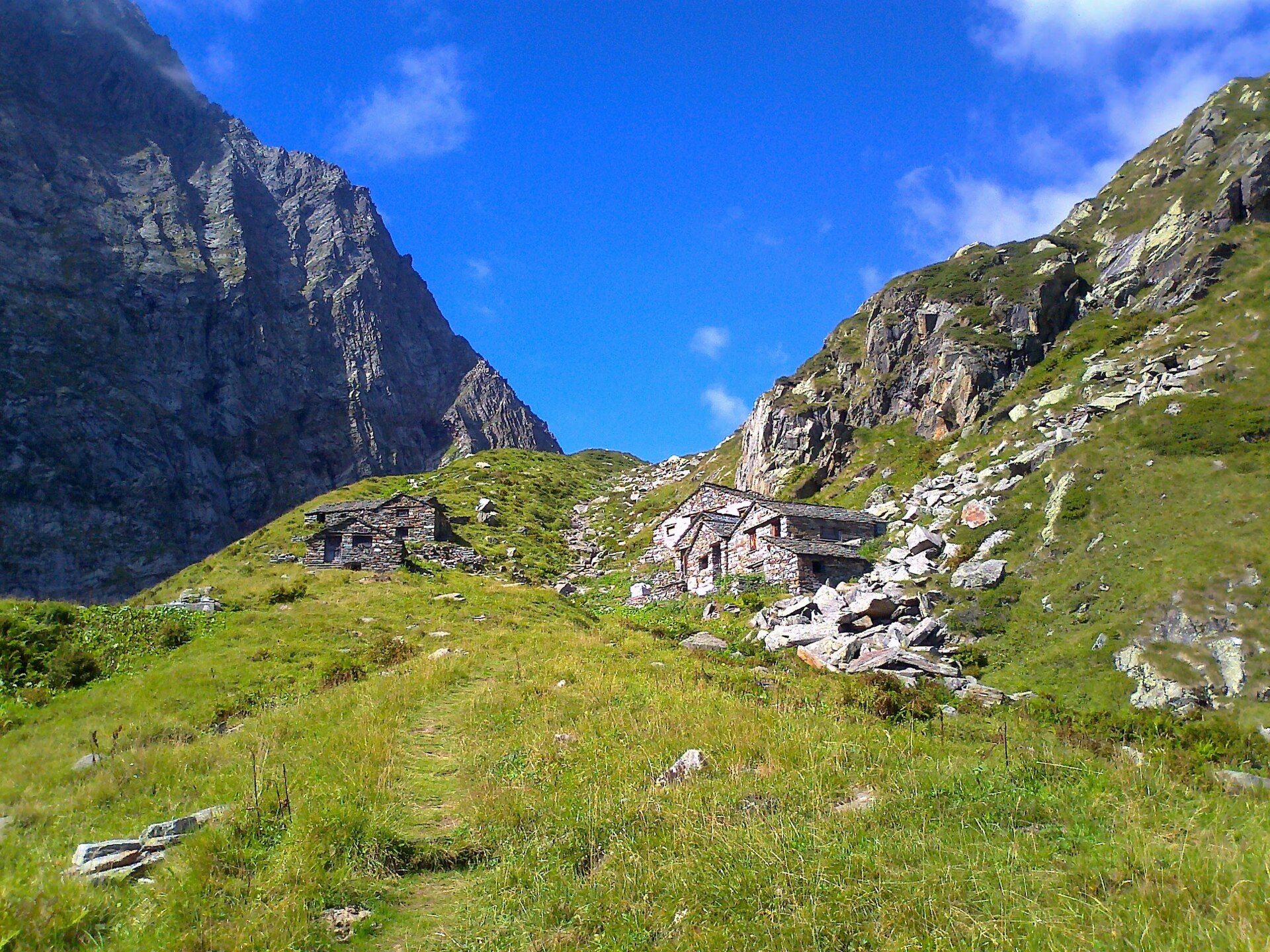
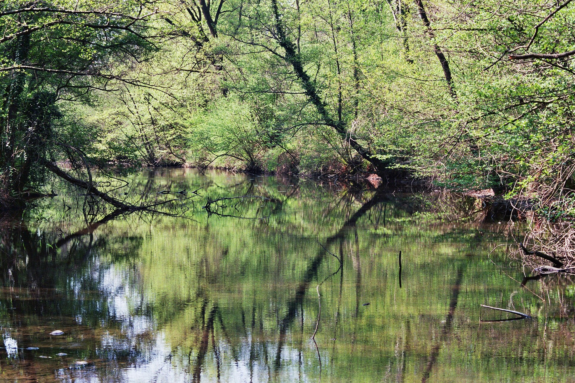
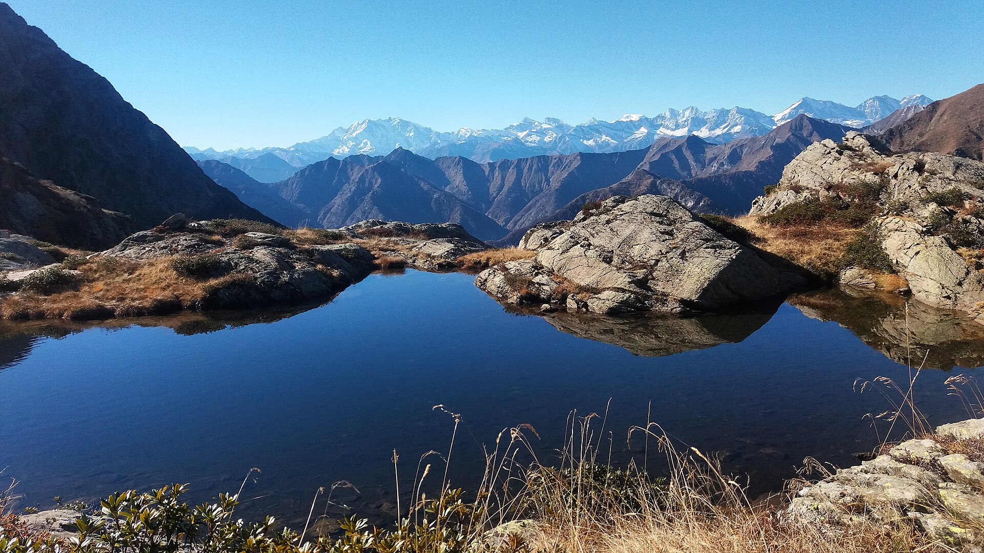
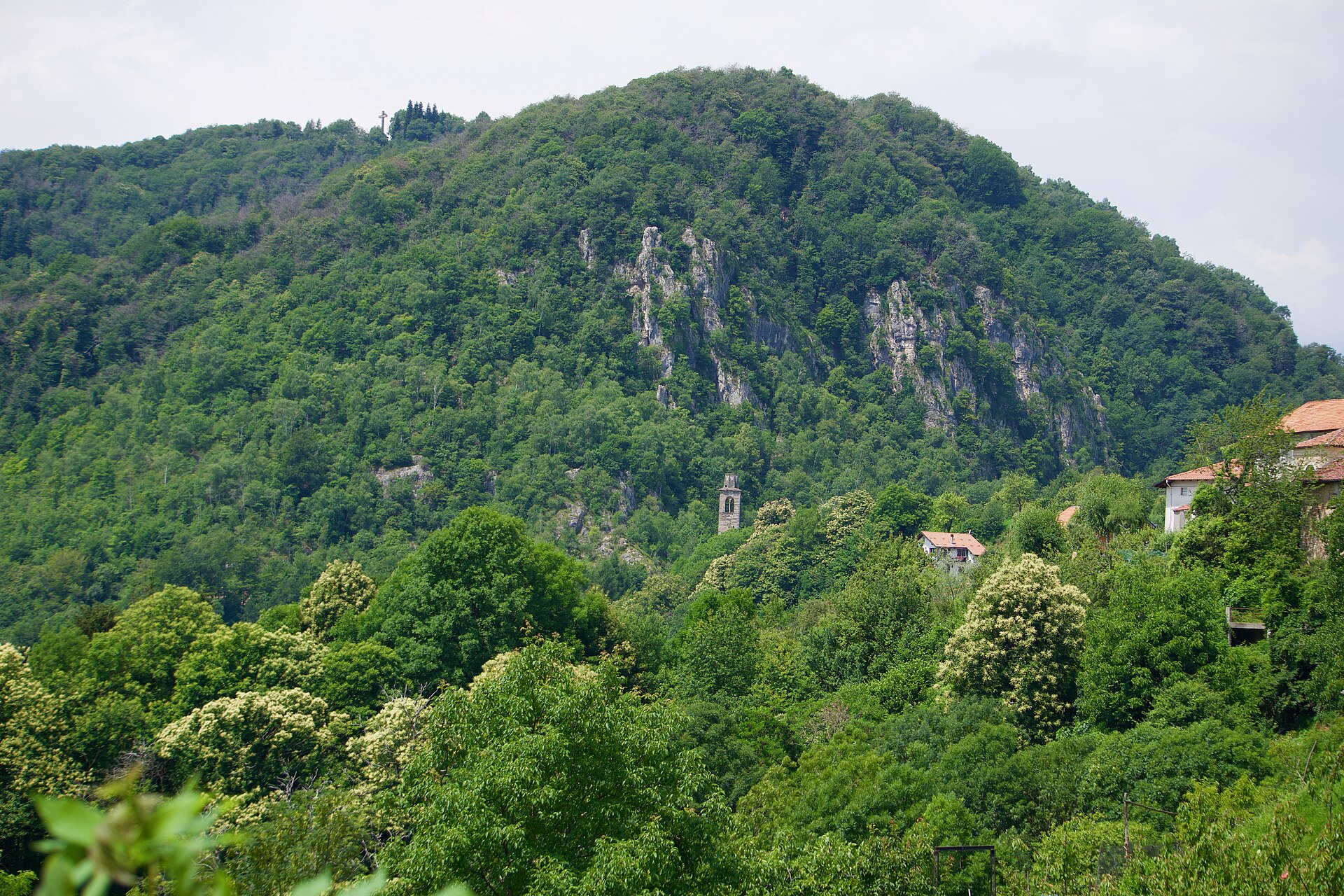
A terrestrial area, with forests and mountains.
What rocks lie beneath Monte Fenera Nature Park?
According to the European 1:1 million geological map (EGDI), the bedrock consists mainly of andesites and dacites (63% of sampled points) and gneiss (31%). These are mostly igneous rocks. The geological units date mainly from the Permian (69% of sampled points).
What is the highest point of Monte Fenera Nature Park?
Monte Fenera, at 899 m (OpenStreetMap).
What are the main summits of Monte Fenera Nature Park?
Monte Fenera (899 m), Monte Lovagone (857 m), Monte Calvario (849 m), Punta Bucciolini (787 m) and Motto Ciafera (772 m) (OpenStreetMap).
Which international labels apply to Monte Fenera Nature Park?
Natura 2000 network (1 site: “Monte Fenera”).
When is the best time to visit Monte Fenera Nature Park?
Best time to visit: from June to September, with average temperatures of 13 to 18 °C and moderate rainfall.
What is there to see in Monte Fenera Nature Park?
13 viewpoints and 6 caves, including Croce del Teso (741 m), Ciota Ciara (680 m), Motto della Capretta (680 m) and Belvedere (OpenStreetMap).
Where can I stay in Monte Fenera Nature Park?
Rifugio GASB (670 m) (OpenStreetMap).
Are there historic monuments in Monte Fenera Nature Park?
Yes. According to Wikidata, 3 monuments protected as Italian national cultural heritage stand within the boundary. For example: “Sant'Agata” in Grignasco, “Castello di Robiallo” in Borgosesia and “Castello” in Grignasco.
What is the nearest large city to Monte Fenera Nature Park?
Nearest towns of over 50,000 people, as the crow flies: Novara (30 km) and Gallarate (30 km). Nearest airport: Milan–Malpensa "Silvio Berlusconi" (MXP), about 25 km away.
How can I reach Monte Fenera Nature Park by train?
The nearest railway station is Sesto Calende, about 18 km from the site boundary.
Where can I get visitor information on site?
Pro Loco di Boca.
Are there waymarked hiking trails in Monte Fenera Nature Park?
Yes. Waymarked hiking routes listed in OpenStreetMap: 27. The “SN · Sentiero Novara tappa 17” route runs for about 9 km through the site, with some 330 m of ascent on its longest section.
Which species can be seen in Monte Fenera Nature Park?
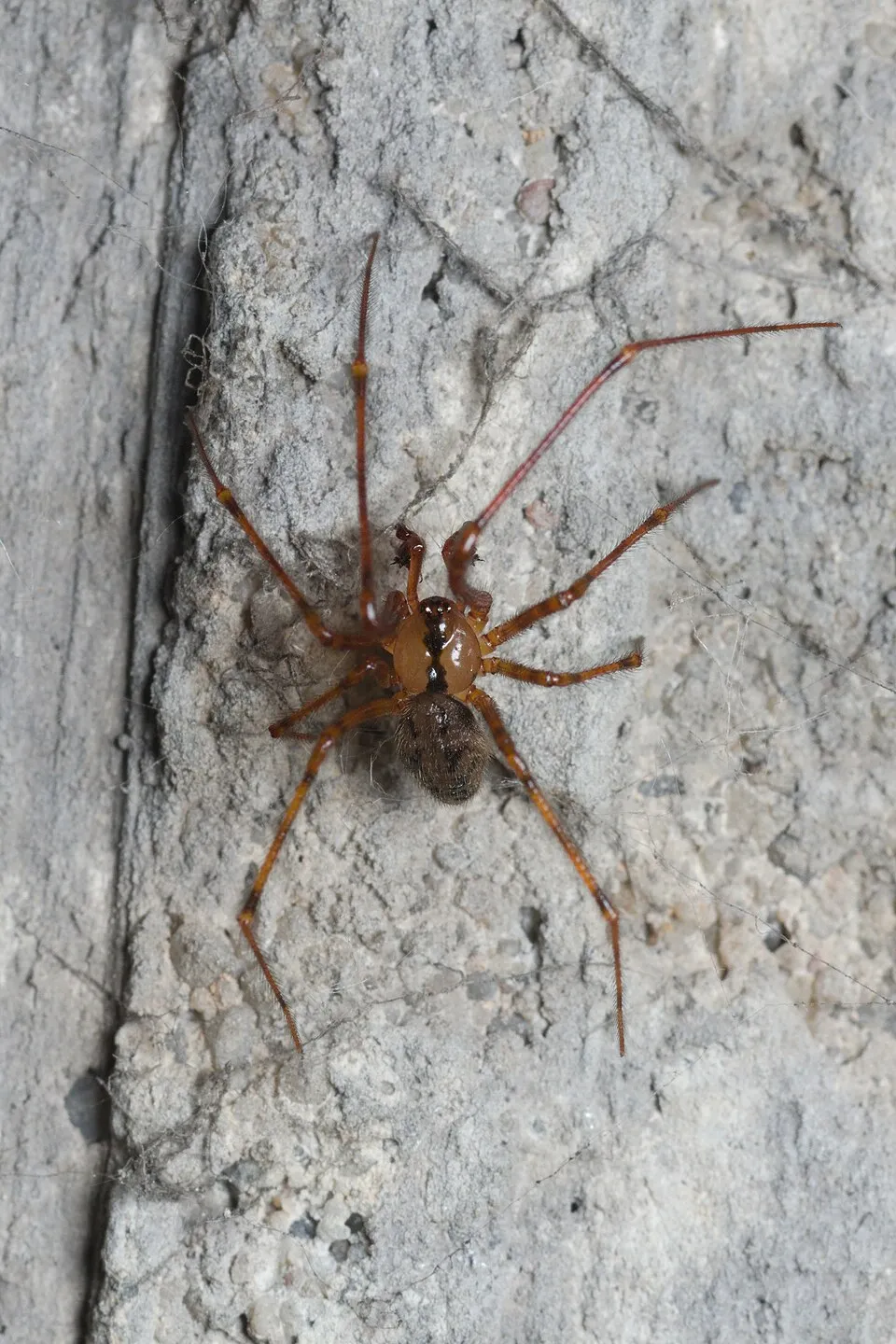
Among the species most often recorded on GBIF are Meta menardi (European Cave Spider), Metellina merianae (Half-light Orbweaver), Kryptonesticus eremita and Troglohyphantes lucifuga.
© OpenStreetMap
Download the boundary: GeoJSON · GPX Boundary © OpenStreetMap contributors (ODbL).
Geography
The representative point of the site lies at around 877 m above sea level. Over the 1996–2025 period, the mean annual temperature is about 8.3 °C and total precipitation reaches roughly 2,072 mm per year. The warmest month is usually July, the coolest January, and the wettest May. According to the European 1:1 million geological map (EGDI), the bedrock consists mainly of andesites and dacites (63% of sampled points) and gneiss (31%). These are mostly igneous rocks. The geological units date mainly from the Permian (69% of sampled points).
Area
- Area of the boundary
- 3,320 ha
- Elevation
- 877 m
- Median elevation
- 558 m
- Mean slope
- 15°
- Coordinates
- 45.71, 8.316
Terrain: Mapzen Terrain Tiles (SRTM, USGS)
Bedrock
- Andesites and dacites 63 %
- Gneiss 31 %
- Rhyolites 6 %
Igneous rocks 69 % · Metamorphic rocks 31 % · Main age: Permian (69%)
Source: EGDI 1:1M geological map (EuroGeoSurveys and national geological surveys), CC BY 4.0 · 16 sampled points within the site.
Main summits
- Monte Fenera899 m
- Monte Lovagone857 m
- Monte Calvario849 m
- Punta Bucciolini787 m
- Motto Ciafera772 m
- Monte Ovagone729 m
- Punta Ceresola713 m
- Croce del Teso712 m
- Sasso Bianco708 m
- Cima Misocco681 m
Data © OpenStreetMap contributors (ODbL)
Climate
● Mean temperature (°C) · ▮ Precipitation (mm)
Source: Copernicus ERA5-Land (C3S, doi:10.24381/cds.68d2bb30), monthly averages 1996–2025 interpolated to the representative point, temperatures adjusted for elevation.
Contains modified Copernicus Climate Change Service information 2026. Neither the European Commission nor ECMWF is responsible for any use that may be made of the Copernicus information or data it contains.
Natural habitats
According to CORINE Land Cover (2018), the site is mainly made up of forests (94%). Woodland is mostly broadleaved. Elevation ranges from about 320 m to 899 m (highest point: Monte Fenera). The terrain is steep: 50% of slopes exceed 15° (mean slope 15°). The Natura 2000 site overlapping the area lists 16 habitats of European interest (4 priority), the most extensive being Castanea sativa woods, Sub-Atlantic and medio-European oak or oak-hornbeam forests of the Carpinion betuli and Luzulo-Fagetum beech forests.
Biodiversity
Based on occurrences aggregated by GBIF, several species are regularly recorded within the site. Among the most frequent are Meta menardi (European Cave Spider), Metellina merianae (Half-light Orbweaver), Kryptonesticus eremita and Troglohyphantes lucifuga. The full list of documented taxa is shown below. The overlapping Natura 2000 site lists 21 species of European interest: 10 mammals, 4 reptiles, 2 fish and 5 invertebrates.
Habitats of European interest
From the official form of the Natura 2000 site overlapping the area (areas reported for the whole site).
- Castanea sativa woods 1,837 ha
- Sub-Atlantic and medio-European oak or oak-hornbeam forests of the Carpinion betuli 396 ha
- Luzulo-Fagetum beech forests 112 ha
- Tilio-Acerion forests of slopes, screes and ravines priority 104 ha
- European dry heaths 24 ha
- Alluvial forests with Alnus glutinosa and Fraxinus excelsior (Alno-Padion, Alnion incanae, Salicion albae) priority 12 ha
- Lowland hay meadows (Alopecurus pratensis, Sanguisorba officinalis) 6 ha
- Semi-natural dry grasslands and scrubland facies on calcareous substrates (Festuco-Brometalia) (* important orchid sites) 5 ha
and 8 more
Species of European interest
Mammals · 10
Barbastelle (Barbastella barbastellus), Grey wolf (Canis lupus), Lesser mouse-eared myotis (Myotis blythii), Geoffroy's bat (Myotis emarginatus), Greater mouse-eared bat (Myotis myotis), Natterer's bat (Myotis nattereri), Brown long-eared bat (Plecotus auritus), Greater Horseshoe Bat (Rhinolophus ferrumequinum), Lesser horseshoe bat (Rhinolophus hipposideros), European free-tailed bat (Tadarida teniotis)
Reptiles · 4
Western Whip Snake (Hierophis viridiflavus), Western green lizard (Lacerta bilineata), Common wall lizard (Podarcis muralis), Aesculapian Snake (Zamenis longissimus)
Invertebrates · 5
White-clawed Crayfish (Austropotamobius pallipes), False ringlet (Coenonympha oedippus), Jersey Tiger (Euplagia quadripunctaria), Apollo (Parnassius apollo), Southern Festoon (Zerynthia polyxena)
Source: Natura 2000 standard data forms (EEA, CC-BY 4.0). Not exhaustive: sensitive species are not published.
Species to look out for


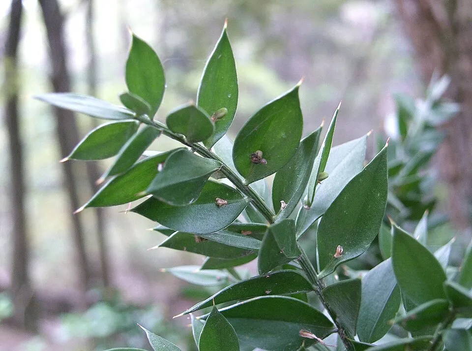

Observed species
Occurrences documented via GBIF; they are neither an exhaustive inventory nor proof of current presence.
- European Cave Spider · Meta menardi · 159
- Half-light Orbweaver · Metellina merianae · 96
- Kryptonesticus eremita · 67
- Troglohyphantes lucifuga · 64
- Troglohyphantes lanai · 43
- Comb-footed Cellar Spider · Nesticus cellulanus · 24
- Tegenaria silvestris · 23
- Butcher's-broom · Ruscus aculeatus · 16
- Spring snowflake · Leucojum vernum · 11
- Green hellebore · Helleborus viridis · 10
- Cornelian cherry · Cornus mas · 9
- Yellow Archangel · Lamium galeobdolon · 8
+18 more species
- Hart's tonguefern · Asplenium scolopendrium · 7
- Ox-eye · Buphthalmum salicifolium · 7
- Nettle-leaved bellflower · Campanula trachelium · 7
- Spurge-laurel · Daphne laureola · 7
- Moehringia muscosa · 7
- Wall-rue · Asplenium ruta-muraria · 6
- Sticky clary · Salvia glutinosa · 6
- Corymbflower tansy · Tanacetum corymbosum · 6
- Retinella giustii · 6
- Straw Foxglove · Digitalis lutea · 6
- Wall germander · Teucrium chamaedrys · 6
- Tenuiphantes flavipes · 5
- Dog's-tooth-violet · Erythronium dens-canis · 5
- Knotted Crane's-bill · Geranium nodosum · 5
- Meadow clary · Salvia pratensis · 5
- Traveller's-joy · Clematis vitalba · 5
- Great masterwort · Astrantia major · 5
- Dame's-violet · Hesperis matronalis · 5
Records: GBIF.org (CC-BY). Names: Wikidata (CC0), GBIF. Photos: Wikimedia Commons.
Conservation challenges
The primary purpose of the site is to preserve its natural habitats and the biodiversity they support. The species recorded (Biodiversity tab) reflect its ecological value. The designations it holds frame its management and the control of land use.
According to Global Forest Change data (University of Maryland, Global Forest Watch), about 43 ha of tree cover were lost within the boundary between 2001 and 2023 (1% of its area), peaking in 2004 and 2020. These losses include logging, storms and fires, and do not account for regrowth. According to CORINE Land Cover, land cover here remained almost unchanged between 1990 and 2018 (less than 0.5% of the area affected); only some 7 ha were built over. At night, 70% of the area gives off artificial light detectable from space (NASA VIIRS Black Marble composite, 2016). According to the Natura 2000 forms, of 11 assessed habitats of European interest, 2 are in excellent condition and the rest in good condition. According to the Water Framework Directive assessment (2022 river basin management plans, data 2014–2019), 56% of the 9 km of rivers assessed within the site are in good or high ecological status.
Pressure indicators
Tree cover lost
43 ha
2001–2023
20012023
Fires since 2016
0
No large fire mapped (fires over about 30 ha)
Light at night
70%
of the area gives off artificial light visible from space
DarkLit
Built-up land
< 1%
buildings, business areas, roads, quarries · farmland 4%
Land cover change
< 0.5%
of the area changed, 1990–2018 · CORINE
Rivers and lakes
56%
of the 9 km of assessed rivers in good or high ecological status · WFD 2022
assessments 2014–2019
Invasive alien species
1
recorded since 2000
Sources: Global Forest Change (Hansen et al., University of Maryland, via Global Forest Watch, CC-BY 4.0); EFFIS, European Commission / Copernicus; NASA Black Marble 2016 (public domain); CORINE Land Cover 2018 (Copernicus) or MODIS.
CORINE Land Cover Change 1990–2018: generated using European Union's Copernicus Land Monitoring Service information (EEA), aggregated by Parkavela; DOI 10.2909/f30f1000-7cf8-43bb-872c-5eb093911b24.
Ecological status of water bodies: European Environment Agency, WISE – Water Framework Directive, 3rd river basin management plans (2022), CC BY 4.0. Official national classification, not comparable between countries.
Invasive alien species: Global Register of Introduced and Invasive Species (ISSG, CC BY 4.0); Union list, Regulation (EU) 1143/2014 (INBO, CC0); GBIF.org records (CC0 / CC BY 4.0), at least 2 per species.
Practical information
Cities and airport
- Novara
30 km as the crow flies - Gallarate
30 km as the crow flies - Airport: Milan–Malpensa "Silvio Berlusconi" (MXP)
25 km as the crow flies
Visitor information
- Pro Loco di Boca
< 1 km from the site boundary
Things to see
13 viewpoints · 6 caves
- Croce del Teso
viewpoint · 741 m - Ciota Ciara
cave · 680 m - Motto della Capretta
viewpoint · 680 m - Belvedere
cave - Buco della Bondaccia
cave
Hiking
27 waymarked routes listed
Data © OpenStreetMap contributors (ODbL) · Wikidata (CC0)
Waymarked hiking routes
SN Sentiero Novara tappa 17
9.2 km within the site ↗ 334 m↘ 335 m 457–779 m
up to T2 · mountain hiking
M02 Unnamed route
3.2 km within the site ↗ 26 m↘ 96 m 336–433 m
up to T1 · hiking
Tracks © OpenStreetMap contributors (ODbL), clipped to the boundary; elevation gain and profiles computed on the longest section from Mapzen Terrain Tiles (≈ 30 m), indicative only. Indicative difficulty (SAC scale, OpenStreetMap, via Waymarked Trails): check with the park.
Access and visiting
The nearest railway station is Sesto Calende, about 18 km from the site boundary. Nearest towns of over 50,000 people, as the crow flies: Novara (30 km) and Gallarate (30 km). Nearest airport: Milan–Malpensa "Silvio Berlusconi" (MXP), about 25 km away. About 310,000 people live within 20 km of the site boundary, 120,000 of them within 10 km; some 1,500 people are estimated to live inside (GHSL estimate, 2020). Visitor information on site: Pro Loco di Boca. Waymarked hiking routes listed in OpenStreetMap: 27. To see: 13 viewpoints and 6 caves, including Croce del Teso (741 m), Ciota Ciara (680 m), Motto della Capretta (680 m) and Belvedere. Where to stay: Rifugio GASB (670 m). To plan a visit (access, opening periods, visitor rules), it is best to consult the official information from the managing body and the official website listed in this page's sources.
Source: OpenStreetMap (ODbL), Wikidata (CC0), October 2026.
Built heritage
According to Wikidata, 3 monuments protected as Italian national cultural heritage stand within the boundary. Examples include “Sant'Agata” in Grignasco, “Castello di Robiallo” in Borgosesia and “Castello” in Grignasco.
2 castles and fortifications1 religious building
-
Sant'Agata
Grignasco -
Castello di Robiallo
Borgosesia -
Castello
Grignasco
Source: Wikidata (CC0), monuments in each country’s official heritage protection registers, at national or regional level. Each item links to its Wikidata entry.
When to visit
Best time to visit: from June to September, with average temperatures of 13 to 18 °C and moderate rainfall. Average temperatures drop below 0 °C in December and January: frost is common. Day length ranges from about 8 h 42 min in December to 15 h 41 min in June. Wildlife records published on GBIF peak for birds (December and January), plants (May) and butterflies and moths (October). These peaks also reflect when observers are most active.
Source: Copernicus ERA5-Land (C3S), monthly averages 1996–2025 at the representative point, temperatures adjusted for elevation.
Contains modified Copernicus Climate Change Service information 2026. Neither the European Commission nor ECMWF is responsible for any use that may be made of the Copernicus information or data it contains.
Wildlife records calendar
JFMAMJJASOND
Birds
Plants
Butterflies & moths
Monthly records published on GBIF (CC-BY), relative to the busiest month; also reflects observer activity.
Gallery
© Andrea · CC BY-SA 4.0
© Andrea · CC BY-SA 4.0
© Alberto Orlandini · Public domain
© Pietro Liotta · CC BY-SA 3.0
© Pietro Liotta · CC BY-SA 3.0
© Francoerbi · CC BY-SA 4.0
Sources and licences
- Wikidata: Q3895639
- OpenStreetMap: relation 6990922
- Wikipedia: en.wikipedia.org/wiki/Monte_Fenera_Natural_Park
- WDPA: 32692
References
- cds.climate.copernicus.eu: climate · CC-BY-4.0
- registry.opendata.aws: elevation of the reference point, detailed relief · PD
- land.copernicus.eu: land cover, land cover change, sea share · COPERNICUS
- doi.org: population around the site · CC-BY-4.0
- openstreetmap.org: access and peaks, places to see · ODbL-1.0
- wikidata.org: highest point, establishment date, protected heritage, official name, nearby cities and airport, access and peaks, lake depths, places to see · CC0-1.0
- eea.europa.eu: bathing water quality, ecological status of waters · CC-BY-4.0
- en.eurovelo.com: EuroVelo cycle routes · ODbL-1.0
- cycling.waymarkedtrails.org: cycle routes · ODbL-1.0
- opentopodata.org: elevations · PD
- forest-fire.emergency.copernicus.eu: wildfires · COPERNICUS
- globalforestwatch.org: tree cover loss · CC-BY-4.0
- gbif.org: seasonality of sightings, invasive alien species, observed species · CC-BY-4.0
- europe-geology.eu: geology · CC-BY-4.0
- hydrosheds.org: lakes · CC-BY-4.0
- natura2000.eea.europa.eu: Natura 2000 habitats and species · CC-BY-4.0
- earthobservatory.nasa.gov: night light · PD
- hiking.waymarkedtrails.org: route difficulty · ODbL-1.0
- nsidc.org: snow cover · PD
- wikidata.org: Wikipedia article · CC-BY-SA-4.0
Data © OpenStreetMap contributors (ODbL), Wikidata (CC0) and the sources cited.