Italy · Terrestrial
Partenio Regional Park
Regional nature park of 14,870 hectares in Italy, established in 1993.
Overview
Regional nature park of 14,870 hectares in Italy, established in 1993.
Partenio Regional Park is a regional nature park in Italy (Europe). It is a predominantly terrestrial area. Established in 1993, it covers about 14,870 hectares.
Protections and designations
Natura 2000 · habitats (SAC)
- Dorsale dei Monti del Partenio IT8040006
Protected as a regional nature park. International labels and designations: Natura 2000 network (1 site: “Dorsale dei Monti del Partenio”).
In our collections
Frequently asked questions
Where is Partenio Regional Park?
In Italy (Europe). Representative point: 40.9866° N, 14.6878° E.
How large is Partenio Regional Park?
About 14,870 hectares (149 km²). It is the 35th largest of the 128 regional parks in Italy covered by Parkavela.
When was Partenio Regional Park established?
In 1993.
What habitats and landscapes does Partenio Regional Park include?
A terrestrial area, with forests and mountains.
What rocks lie beneath Partenio Regional Park?
According to the European 1:1 million geological map (EGDI), the bedrock consists mainly of limestones (75% of sampled points) and rhyolites (25%). These are mostly sedimentary rocks. The geological units date mainly from the Jurassic (67% of sampled points).
What is the highest point of Partenio Regional Park?
M. Acerone di Avella ( Toppole ), at 1,598 m (OpenStreetMap).
What are the main summits of Partenio Regional Park?
M. Acerone di Avella ( Toppole ) (1,598 m), Monte Ciesco Bianco (1,589 m), Cima Valle di Piedimonte (1,582 m), Monte Partenio (1,573 m) and Monte Vallatrone (1,517 m) (OpenStreetMap).
Which international labels apply to Partenio Regional Park?
Natura 2000 network (1 site: “Dorsale dei Monti del Partenio”).
When is the best time to visit Partenio Regional Park?
Best time to visit: from May to September, with average temperatures of 10 to 19 °C and moderate rainfall.
What is there to see in Partenio Regional Park?
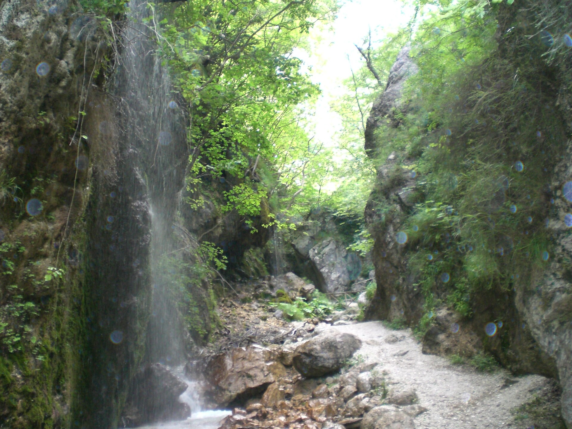
14 viewpoints, 1 waterfall, 1 lake or pond, 3 caves and 1 glacier, including Tuppo dei Fogli (1,096 m), Cascata di Acquapendente, Campo Maggiore and Grotta Cafurt (OpenStreetMap).
Where can I stay in Partenio Regional Park?
13 mountain huts, including Rifugio Lauro (1,250 m), Rifugio Acqua delle Vene and Rifugio Fonte San Giovanni (OpenStreetMap).
Are there historic monuments in Partenio Regional Park?
Yes. According to Wikidata, 10 monuments protected as Italian national cultural heritage stand within the boundary. For example: “Territorial Abbey of Montevergine” in Mercogliano, “Castello Pignatelli della Leonessa” in San Martino Valle Caudina and “Antiquarium of Mercogliano” in Mercogliano.
What is the nearest large city to Partenio Regional Park?
Nearest towns of over 50,000 people, as the crow flies: Avellino (4 km) and Acerra (7 km). Nearest airport: Naples (NAP), about 16 km away.
How can I reach Partenio Regional Park by train?
The nearest railway station is Cancello, less than 1 km from the site boundary.
Where can I get visitor information on site?
Pro Loco Cervinara.
Are there waymarked hiking trails in Partenio Regional Park?
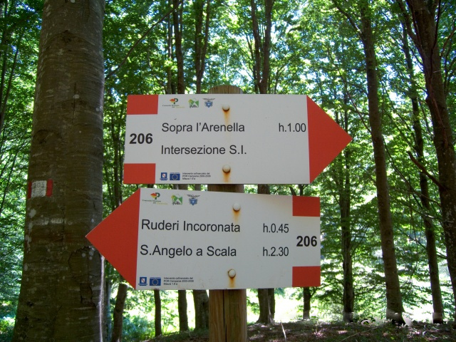
Yes. Waymarked hiking routes listed in OpenStreetMap: 56, including E 1 and Via Francigena. The “European Long distance path E1 - part Italy - Campania” route runs for about 27 km through the site, with some 1,590 m of ascent on its longest section.
Which species can be seen in Partenio Regional Park?
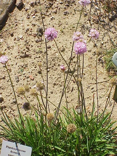
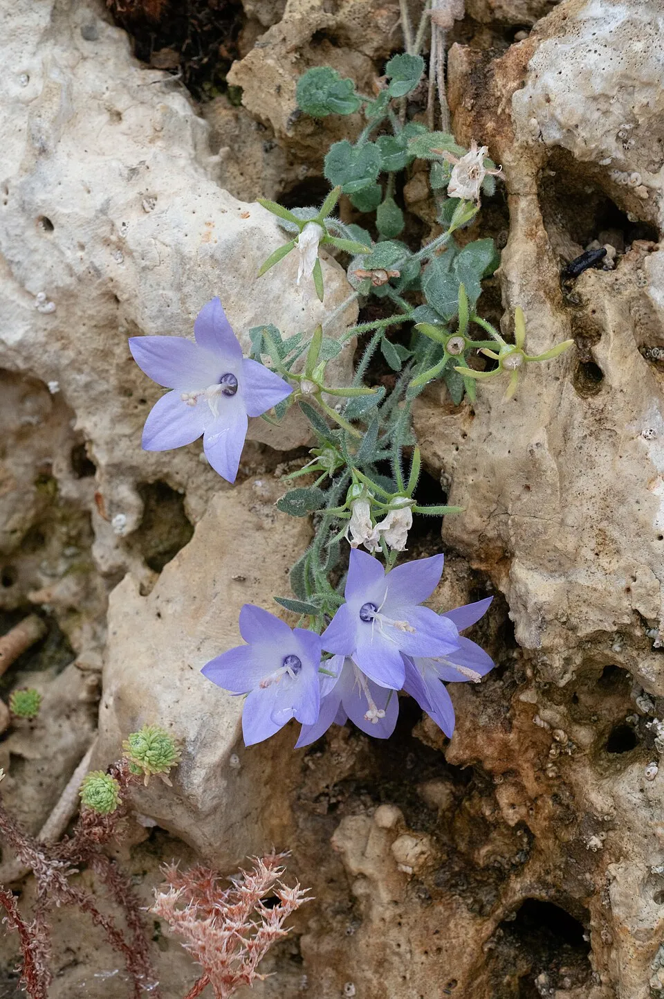
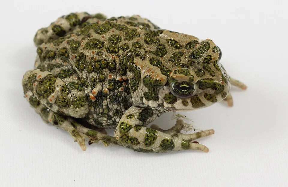
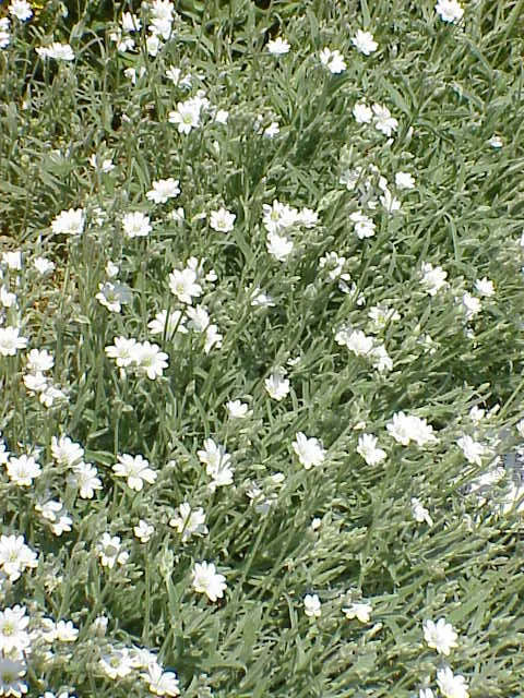
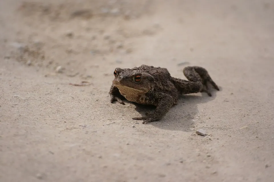
Among the species most often recorded on GBIF are Armeria nebrodensis, Campanula fragilis (Italian Bellflower), Bufotes viridis (Green Toad) and Cerastium tomentosum (Snow-in-summer).
What is the official website of Partenio Regional Park?
© OpenStreetMap
Download the boundary: GeoJSON · GPX Boundary © OpenStreetMap contributors (ODbL).
Geography
The representative point of the site lies at around 1,227 m above sea level. Over the 1996–2025 period, the mean annual temperature is about 8.9 °C and total precipitation reaches roughly 1,151 mm per year. The warmest month is usually August, the coolest January, and the wettest November. According to the European 1:1 million geological map (EGDI), the bedrock consists mainly of limestones (75% of sampled points) and rhyolites (25%). These are mostly sedimentary rocks. The geological units date mainly from the Jurassic (67% of sampled points).
Area
- Area
- 14,870 ha
- Elevation
- 1,227 m
- Median elevation
- 733 m
- Mean slope
- 22°
- Coordinates
- 40.9866, 14.6878
Terrain: Mapzen Terrain Tiles (SRTM, USGS)
Elevation bands
- below 500 m 25%
- 500–1,000 m 49%
- 1,000–1,500 m 26%
share of the site in each elevation band (smoothed terrain model: summits are rounded off) · Terrain: Mapzen Terrain Tiles (SRTM, USGS)
Bedrock
- Limestones 75 %
- Rhyolites 25 %
Sedimentary rocks 75 % · Igneous rocks 25 % · Main age: Jurassic (67%)
Source: EGDI 1:1M geological map (EuroGeoSurveys and national geological surveys), CC BY 4.0 · 12 sampled points within the site.
Main summits
- M. Acerone di Avella ( Toppole )1,598 m
- Monte Ciesco Bianco1,589 m
- Cima Valle di Piedimonte1,582 m
- Monte Partenio1,573 m
- Monte Vallatrone1,517 m
- Monte Vergine1,493 m
- Porca delle Pere1,485 m
- Toppa Riviezzo1,434 m
- Croce di Puntone1,425 m
- Toppa Spino1,414 m
Data © OpenStreetMap contributors (ODbL)
Climate
● Mean temperature (°C) · ▮ Precipitation (mm)
Source: Copernicus ERA5-Land (C3S, doi:10.24381/cds.68d2bb30), monthly averages 1996–2025 interpolated to the representative point, temperatures adjusted for elevation.
Contains modified Copernicus Climate Change Service information 2026. Neither the European Commission nor ECMWF is responsible for any use that may be made of the Copernicus information or data it contains.
Natural habitats
According to CORINE Land Cover (2018), the site is mainly made up of forests (69%) and farmland (16%). Woodland is mostly broadleaved. Elevation ranges from about 100 m to 1,598 m (highest point: M. Acerone di Avella ( Toppole )). Median elevation is 733 m, and 26% of the site lies above 1,000 m (SRTM elevation model). The terrain is steep: 22% of slopes exceed 30° (mean slope 22°). The Natura 2000 site overlapping the area lists 10 habitats of European interest (3 priority), the most extensive being Apeninne beech forests with Taxus and Ilex, Castanea sativa woods and semi-natural dry grasslands and scrubland facies on calcareous substrates (Festuco-Brometalia) (* important orchid sites).
Biodiversity
Based on occurrences aggregated by GBIF, several species are regularly recorded within the site. Among the most frequent are Armeria nebrodensis, Campanula fragilis (Italian Bellflower), Bufotes viridis (Green Toad) and Cerastium tomentosum (Snow-in-summer). The full list of documented taxa is shown below. The overlapping Natura 2000 site lists 21 species of European interest: 14 mammals, 1 reptile, 1 amphibian and 5 invertebrates.
Habitats of European interest
From the official form of the Natura 2000 site overlapping the area (areas reported for the whole site).
- Apeninne beech forests with Taxus and Ilex priority 4,064 ha
- Castanea sativa woods 2,824 ha
- Semi-natural dry grasslands and scrubland facies on calcareous substrates (Festuco-Brometalia) (* important orchid sites) 429 ha
- Eastern white oak woods priority 336 ha
- Pannonian-Balkanic turkey oak-sessile oak forests 264 ha
- Thermo-Mediterranean and pre-desert scrub 206 ha
- Quercus ilex and Quercus rotundifolia forests 60 ha
- Calcareous rocky slopes with chasmophytic vegetation 43 ha
and 2 more
Species of European interest
Mammals · 14
Barbastelle (Barbastella barbastellus), Grey wolf (Canis lupus), Common bent-wing bat (Miniopterus schreibersii), Lesser mouse-eared myotis (Myotis blythii), Long-fingered bat (Myotis capaccinii), Greater mouse-eared bat (Myotis myotis), Natterer's bat (Myotis nattereri), Lesser noctule (Nyctalus leisleri), Common noctule (Nyctalus noctula), Soprano Pipistrelle (Pipistrellus pygmaeus), Mediterranean Horseshoe Bat (Rhinolophus euryale), Greater Horseshoe Bat (Rhinolophus ferrumequinum) and 2 more
Reptiles · 1
Amphibians · 1
Invertebrates · 5
Greater Capricorn Beetle (Cerambyx cerdo), Southern damselfly (Coenagrion mercuriale), Italian goldenring (Cordulegaster trinacriae), Italian Marbled White (Melanargia arge), Rosalia longicorn (Rosalia alpina)
Source: Natura 2000 standard data forms (EEA, CC-BY 4.0). Not exhaustive: sensitive species are not published.
Species to look out for

Observed species
Occurrences documented via GBIF; they are neither an exhaustive inventory nor proof of current presence.
- Armeria nebrodensis · 35
- Italian Bellflower · Campanula fragilis · 19
- Green Toad · Bufotes viridis · 18
- Snow-in-summer · Cerastium tomentosum · 15
- Common toad · Bufo bufo · 13
- European Hop-hornbeam · Ostrya carpinifolia · 12
- European Beech · Fagus sylvatica · 11
- Centaurea deusta · 11
- Purple Toothwort · Lathraea clandestina · 11
- Dwarf Elder · Sambucus ebulus · 10
- Viola pseudogracilis · 10
- Stinking Hellebore · Helleborus foetidus · 10
+18 more species
- Campanula foliosa · 9
- Round-leaved saxifrage · Saxifraga rotundifolia · 9
- Adenostyles australis · 9
- Fire salamander · Salamandra salamandra · 8
- Common Buzzard · Buteo buteo · 7
- Orange lily · Lilium bulbiferum · 7
- Red helleborine · Cephalanthera rubra · 7
- Amethyst eryngo · Eryngium amethystinum · 7
- Lobel's Maple · Acer lobelii · 7
- Nettle-leaved bellflower · Campanula trachelium · 7
- Pimpinella tragium · 7
- Common Kestrel · Falco tinnunculus · 7
- Martagon lily · Lilium martagon · 6
- Bird's-nest orchid · Neottia nidus-avis · 6
- Round-headed Leek · Allium sphaerocephalon · 6
- Sticky clary · Salvia glutinosa · 6
- Dog rose · Rosa canina · 6
- Soapwort · Saponaria officinalis · 6
Records: GBIF.org (CC-BY). Names: Wikidata (CC0), GBIF. Photos: Wikimedia Commons.
Conservation challenges
The primary purpose of the site is to preserve its natural habitats and the biodiversity they support. The species recorded (Biodiversity tab) reflect its ecological value. The designations it holds frame its management and the control of land use.
According to Global Forest Change data (University of Maryland, Global Forest Watch), about 136 ha of tree cover were lost within the boundary between 2001 and 2023 (under 1% of its area), peaking in 2017 and 2023. These losses include logging, storms and fires, and do not account for regrowth. According to the European CORINE Land Cover inventory (Copernicus), land cover changed on about 291 ha of the site between 1990 and 2018 (2% of its area): forest shrank by 278 ha, mostly giving way to open natural land, while open natural land grew by 253 ha, mostly at the expense of forest. Since 2016, the European EFFIS system (Copernicus) has mapped 44 fires here, burning about 2,425 ha within the boundary; the largest, in July 2017 (near Roccarainola), covered 229 ha. At night, 81% of the area gives off artificial light detectable from space (NASA VIIRS Black Marble composite, 2016). Built-up and developed land (buildings, business areas, roads, quarries) covers 3% of the area, and farmland 16% (CORINE Land Cover). According to the Natura 2000 forms, of 10 assessed habitats of European interest, 1 is in excellent condition and 1 in average or reduced condition.
Pressure indicators
Tree cover lost
136 ha
2001–2023 · < 1% of the area
20012023
Fires since 2016
2,425 ha
burned within the boundary (44 mapped fires)
- 2017 · Roccarainola · 229 ha
- 2025 · Roccarainola · 225 ha
- 2019 · San Felice a Cancello · 179 ha
Light at night
81%
of the area gives off artificial light visible from space
DarkLit
Built-up land
3%
buildings, business areas, roads, quarries · farmland 16%
Land cover change
291 ha
changed cover, 1990–2018 · CORINE · 2% of the area
- −278 ha · forest
- +253 ha · open natural land
Invasive alien species
1
recorded since 2000
Sources: Global Forest Change (Hansen et al., University of Maryland, via Global Forest Watch, CC-BY 4.0); EFFIS, European Commission / Copernicus; NASA Black Marble 2016 (public domain); CORINE Land Cover 2018 (Copernicus) or MODIS.
CORINE Land Cover Change 1990–2018: generated using European Union's Copernicus Land Monitoring Service information (EEA), aggregated by Parkavela; DOI 10.2909/f30f1000-7cf8-43bb-872c-5eb093911b24.
Invasive alien species: Global Register of Introduced and Invasive Species (ISSG, CC BY 4.0); Union list, Regulation (EU) 1143/2014 (INBO, CC0); GBIF.org records (CC0 / CC BY 4.0), at least 2 per species.
Practical information
Cities and airport
- Avellino
4 km as the crow flies - Acerra
7 km as the crow flies - Airport: Naples (NAP)
16 km as the crow flies
Visitor information
- Pro Loco Cervinara
2 km from the site boundary
Things to see
14 viewpoints · 1 waterfall · 1 lake or pond · 3 caves · 1 glacier
- Tuppo dei Fogli
viewpoint · 1,096 m - Cascata di Acquapendente
waterfall - Campo Maggiore
lake or pond - Grotta Cafurt
cave - Neviere
glacier
Where to stay
13 mountain huts
- Rifugio Lauro
Staffed hut · 1,250 m - Rifugio Acqua delle Vene
Staffed hut - Rifugio Fonte San Giovanni
Staffed hut - Rifugio Mafariello
Staffed hut - Rifugio Toppo del Monaco
Staffed hut
Hiking
56 waymarked routes listed, including:
E 1Via Francigena
Data © OpenStreetMap contributors (ODbL) · Wikidata (CC0)
Waymarked hiking routes
E1 European Long distance path E1 - part Italy - Campania
26.9 km within the site ↗ 1,591 m↘ 1,174 m 322–1,458 m
VF Via Francigena - 08 Campanie
1.8 km within the site ↗ 42 m↘ 0 m 115–161 m
200 Grande Traversata del Partenio
44.5 km within the site ↗ 1,381 m↘ 1,701 m 419–1,571 m
215 Sentiero di Travertone
3.3 km within the site ↗ 355 m↘ 44 m 1,028–1,370 m
Tracks © OpenStreetMap contributors (ODbL), clipped to the boundary; elevation gain and profiles computed on the longest section from Mapzen Terrain Tiles (≈ 30 m), indicative only.
Access and visiting
The nearest railway station is Cancello, less than 1 km from the site boundary. Nearest towns of over 50,000 people, as the crow flies: Avellino (4 km) and Acerra (7 km). Nearest airport: Naples (NAP), about 16 km away. About 2.7 million people live within 20 km of the site boundary, 630,000 of them within 10 km; some 12,000 people are estimated to live inside (GHSL estimate, 2020). Visitor information on site: Pro Loco Cervinara. Waymarked hiking routes listed in OpenStreetMap: 56, including E 1 and Via Francigena. To see: 14 viewpoints, 1 waterfall, 1 lake or pond, 3 caves and 1 glacier, including Tuppo dei Fogli (1,096 m), Cascata di Acquapendente, Campo Maggiore and Grotta Cafurt. Where to stay: 13 mountain huts, including Rifugio Lauro (1,250 m), Rifugio Acqua delle Vene and Rifugio Fonte San Giovanni. To plan a visit (access, opening periods, visitor rules), it is best to consult the official information from the managing body and the official website listed in this page's sources.
Source: OpenStreetMap (ODbL), Wikidata (CC0), October 2026.
Built heritage
According to Wikidata, 10 monuments protected as Italian national cultural heritage stand within the boundary. Among them are 5 castles and fortifications, 2 religious buildings and 2 bridges, lighthouses, mills and working buildings. Examples include “Territorial Abbey of Montevergine” in Mercogliano, “Castello Pignatelli della Leonessa” in San Martino Valle Caudina and “Antiquarium of Mercogliano” in Mercogliano.
5 castles and fortifications2 religious buildings2 bridges, lighthouses, mills and working buildings1 prehistoric or archaeological site
-
Territorial Abbey of Montevergine
Mercogliano · 12th c. -
Castello Pignatelli della Leonessa
San Martino Valle Caudina -
Antiquarium of Mercogliano
Mercogliano -
Museo civico di Summonte
Summonte -
Mother church of San Nicola di Bari
Summonte -
Castle of Capocastello
Mercogliano -
Torre Angioina di Summonte
Summonte -
Castello di Matinale
San Felice a Cancello
and 2 more
Source: Wikidata (CC0), monuments in each country’s official heritage protection registers, at national or regional level. Each item links to its Wikidata entry.
When to visit
Best time to visit: from May to September, with average temperatures of 10 to 19 °C and moderate rainfall. Precipitation peaks in November (up to 170 mm per month). These averages apply to the site's representative point (1,227 m); higher up it is markedly cooler. Day length ranges from about 9 h 14 min in December to 15 h 06 min in June. Wildlife records published on GBIF peak for birds (December and January), plants (June) and butterflies and moths (from June to August). These peaks also reflect when observers are most active.
Source: Copernicus ERA5-Land (C3S), monthly averages 1996–2025 at the representative point, temperatures adjusted for elevation.
Contains modified Copernicus Climate Change Service information 2026. Neither the European Commission nor ECMWF is responsible for any use that may be made of the Copernicus information or data it contains.
Wildlife records calendar
JFMAMJJASOND
Birds
Plants
Butterflies & moths
Monthly records published on GBIF (CC-BY), relative to the busiest month; also reflects observer activity.
Gallery
© Fiore Silvestro Barbato from Napoli (NA), Italy · CC BY-SA 2.0
© Antonio De Capua · CC BY-SA 4.0
© Lucamato · CC BY-SA 4.0
© Giuseppe de pascale · CC BY-SA 4.0
© Antonio De Capua · CC BY-SA 4.0
© Earth Science and Remote Sensing Unit, NASA Johnson Space Center · Public domain
Sources and licences
- Wikidata: Q3895740
- OpenStreetMap: relation 3174626
- Official website: http://www.parcopartenio.it/sito/
- Wikipedia: fr.wikipedia.org/wiki/Parc_régional_du_Partenio
- WDPA: 178965
References
- cds.climate.copernicus.eu: climate · CC-BY-4.0
- registry.opendata.aws: elevation of the reference point, detailed relief · PD
- land.copernicus.eu: land cover, land cover change, sea share · COPERNICUS
- doi.org: population around the site · CC-BY-4.0
- wikidata.org: official area, establishment date, protected heritage, nearby cities and airport, access and peaks, lake depths, places to see, official website · CC0-1.0
- eea.europa.eu: bathing water quality, ecological status of waters · CC-BY-4.0
- en.eurovelo.com: EuroVelo cycle routes · ODbL-1.0
- cycling.waymarkedtrails.org: cycle routes · ODbL-1.0
- opentopodata.org: elevations · PD
- forest-fire.emergency.copernicus.eu: wildfires · COPERNICUS
- globalforestwatch.org: tree cover loss · CC-BY-4.0
- gbif.org: seasonality of sightings, invasive alien species, observed species · CC-BY-4.0
- europe-geology.eu: geology · CC-BY-4.0
- hydrosheds.org: lakes · CC-BY-4.0
- natura2000.eea.europa.eu: Natura 2000 habitats and species · CC-BY-4.0
- openstreetmap.org: official name, access and peaks, places to see · ODbL-1.0
- earthobservatory.nasa.gov: night light · PD
- hiking.waymarkedtrails.org: route difficulty · ODbL-1.0
- nsidc.org: snow cover · PD
- wikidata.org: Wikipedia article · CC-BY-SA-4.0
Data © OpenStreetMap contributors (ODbL), Wikidata (CC0) and the sources cited.