Bird
Great Spotted Woodpecker
Dendrocopos major243 records © Sławomir Staszczuk (info [AT] photoss.net) · CC BY-SA 3.0
Poland · Terrestrial
Landscape park of 10,000 hectares in Poland, established in 1983.
Landscape park of 10,000 hectares in Poland, established in 1983.
Sobibór Landscape Park is located in Poland (Europe). It is a predominantly terrestrial area. Established in 1983, it covers about 10,000 hectares.
Protected as a landscape park. International labels and designations: Natura 2000 network (1 site: “Lasy Sobiborskie”). Key dates: established in 1983 and first Natura 2000 site under the Habitats Directive in 2009.
Sources: Wikidata (CC0) for establishment and international labels; EEA Natura 2000 database (CC-BY 4.0) for site designation dates.
In Poland (Europe). Representative point: 51.4267° N, 23.5774° E.
About 10,000 hectares (100 km²). It is the 87th largest of the 121 landscape parks in Poland covered by Parkavela.
In 1983.
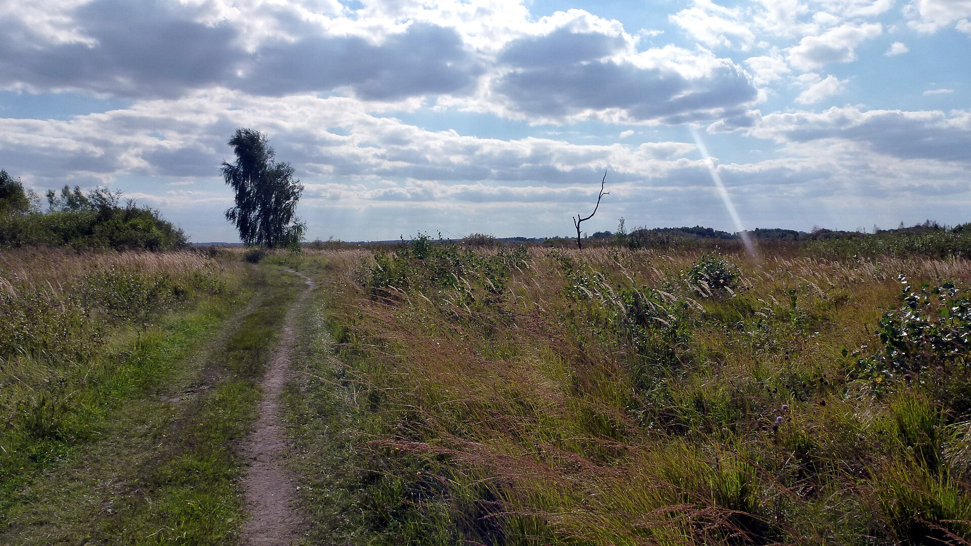
A terrestrial area, with forests.
According to the European 1:1 million geological map (EGDI), the bedrock consists mainly of sands and gravels (100% of sampled points). These are mostly sedimentary rocks. The geological units date mainly from the Quaternary (100% of sampled points).
Natura 2000 network (1 site: “Lasy Sobiborskie”).
Yes. According to NASA's MODIS satellites (2015–2025 average), snow covers most of the site in December and January, with about 50 snow-covered days a year on average.
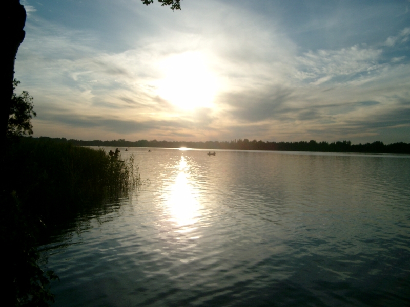
7 lakes and ponds, including Brudno, Brudzieniec, Jezioro Orchowe and Jezioro Wspólne (OpenStreetMap).
Yes. According to Wikidata, 4 monuments listed in the Polish register of monuments stand within the boundary. For example: “Cmentarz prawosławny w Kosyniu” in Kosyń, “Zespół cerkwi prawosławnej” in Kosyń and “Saint Stanislaus Kostka church in Kosyń” in Kosyń.
4 monitored bathing sites lie in or within 1 km of the site; official 2025 classification: 4 excellent (European Environment Agency). Swimming is only permitted at the sites and times authorised locally.
Nearest towns of over 50,000 people, as the crow flies: Chełm (26 km) and Biała Podlaska (65 km). Nearest airport: Lublin (LUZ), about 60 km away.
The nearest railway station is Uladava, about 7 km from the site boundary.
Lasy Państwowe Nadleśnictwo Sobibór.
Yes. Waymarked hiking routes listed in OpenStreetMap: 3, including Szlak Siedmiu Jezior Włodawskich and Szlak Lasów Sobiborskich. The “LU-5523-s · Szlak Lasów Sobiborskich” route runs for about 8 km through the site.
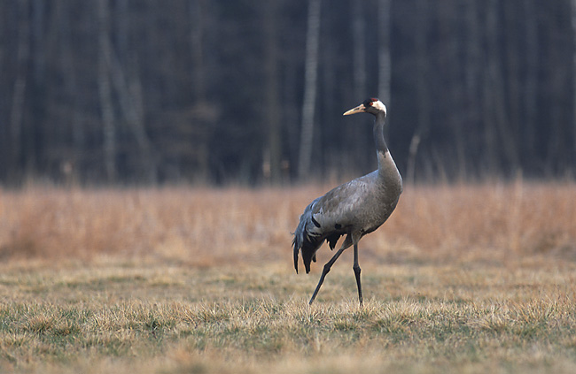
Among the species most often recorded on GBIF are Dendrocopos major (Great Spotted Woodpecker), Parus major (Great tit), Fringilla coelebs (Eurasian Chaffinch) and Dryocopus martius (Black Woodpecker).
© OpenStreetMap
Download the boundary: GeoJSON · GPX Boundary © OpenStreetMap contributors (ODbL).
According to the European 1:1 million geological map (EGDI), the bedrock consists mainly of sands and gravels (100% of sampled points). These are mostly sedimentary rocks. The geological units date mainly from the Quaternary (100% of sampled points). The site contains 5 lakes larger than 10 ha, totalling 1.3 km² of water; the largest, Jezioro Spólne, covers 50 ha (HydroLAKES).
Lakes: HydroLAKES (Messager et al. 2016, hydrosheds.org, CC BY 4.0) · depths: Wikidata (CC0)
Sedimentary rocks 100 % · Main age: Quaternary (100%)
Source: EGDI 1:1M geological map (EuroGeoSurveys and national geological surveys), CC BY 4.0 · 13 sampled points within the site.
average share of the site under snow · snowiest parts · ≈ 50 days a year
Snow cover: MODIS/Terra MOD10CM v61 (Hall & Riggs, 2021, NASA NSIDC DAAC, doi:10.5067/MODIS/MOD10CM.061), imagery from NASA GIBS (ESDIS); 2015–2025 average, grid of about 5 km.
According to CORINE Land Cover (2018), the site is mainly made up of forests (78%), marshes and bogs (8%) and farmland (8%). Woodland is mostly coniferous. The land is almost flat (mean slope under 2°). The Natura 2000 site overlapping the area lists 14 habitats of European interest (5 priority), the most extensive being lowland hay meadows (Alopecurus pratensis, Sanguisorba officinalis), bog woodland and natural eutrophic lakes with Magnopotamion or Hydrocharition-type vegetation.
Based on occurrences aggregated by GBIF, several species are regularly recorded within the site. Among the most frequent are Dendrocopos major (Great Spotted Woodpecker), Parus major (Great tit), Fringilla coelebs (Eurasian Chaffinch) and Dryocopus martius (Black Woodpecker). The full list of documented taxa is shown below. The overlapping Natura 2000 site lists 16 species of European interest: 4 mammals, 1 reptile, 1 amphibian, 3 fish, 5 invertebrates and 2 plants.
From the official form of the Natura 2000 site overlapping the area (areas reported for the whole site).
and 6 more
Grey wolf (Canis lupus), Eurasian Beaver (Castor fiber), Eurasian otter (Lutra lutra), Pond bat (Myotis dasycneme)
European Pond Turtle (Emys orbicularis)
Spined loach (Cobitis taenia), Weatherfish (Misgurnus fossilis), European bitterling (Rhodeus amarus)
Danube Clouded Yellow (Colias myrmidone), Marsh fritillary (Euphydryas aurinia), Large copper (Lycaena dispar), Dusky Large Blue (Maculinea nausithous), Scarce large blue (Maculinea teleius)
Source: Natura 2000 standard data forms (EEA, CC-BY 4.0). Not exhaustive: sensitive species are not published.
Bird
243 records © Sławomir Staszczuk (info [AT] photoss.net) · CC BY-SA 3.0


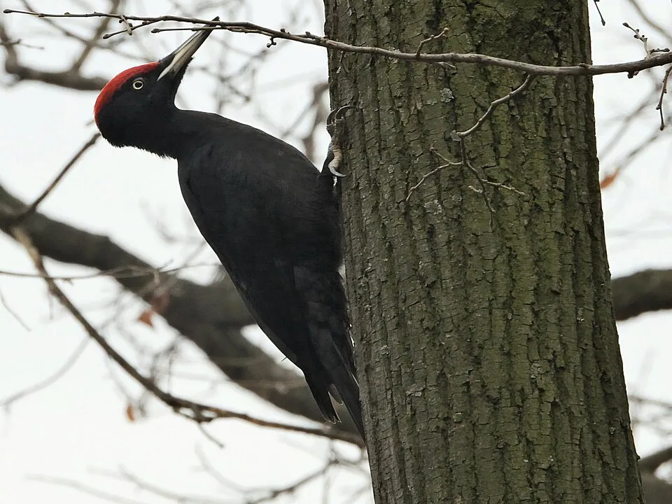


Occurrences documented via GBIF; they are neither an exhaustive inventory nor proof of current presence.
Records: GBIF.org (CC-BY). Names: Wikidata (CC0), GBIF. Photos: Wikimedia Commons.
The primary purpose of the site is to preserve its natural habitats and the biodiversity they support. The species recorded (Biodiversity tab) reflect its ecological value. The designations it holds frame its management and the control of land use.
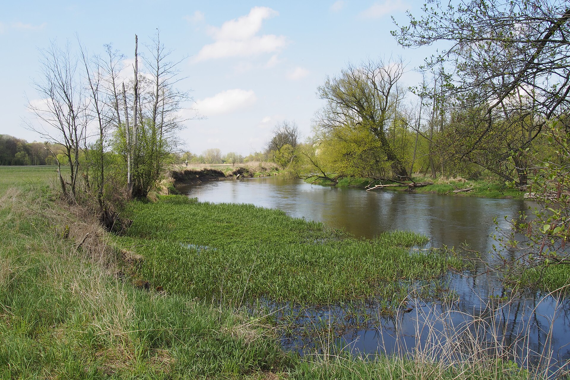
According to Global Forest Change data (University of Maryland, Global Forest Watch), about 1,360 ha of tree cover were lost within the boundary between 2001 and 2023 (14% of its area), peaking in 2004 and 2017. These losses include logging, storms and fires, and do not account for regrowth. Apart from forest felling and regrowth (about 250 ha in total), land cover remained almost unchanged between 1990 and 2018 according to CORINE Land Cover. At night, the area gives off virtually no artificial light detectable from space (NASA VIIRS Black Marble composite, 2016). According to the Natura 2000 forms, of 12 assessed habitats of European interest, 7 are in excellent condition and 1 in average or reduced condition. According to the Water Framework Directive assessment (2022 river basin management plans, data 2014–2019), of the 2 rivers assessed within the site, 1 has poor ecological status and 1 bad ecological status.
1,360 ha
2001–2023 · 14% of the area
0
No large fire mapped (fires over about 30 ha)
0%
of the area gives off artificial light visible from space
< 1%
buildings, business areas, roads, quarries · farmland 8%
< 0.5%
of the area changed, 1990–2018 · CORINE
forest felling and regrowth: 250 ha in total
0%
of the 35 km of assessed rivers in good or high ecological status · WFD 2022
assessments 2014–2019
1
recorded since 2000
Sources: Global Forest Change (Hansen et al., University of Maryland, via Global Forest Watch, CC-BY 4.0); EFFIS, European Commission / Copernicus; NASA Black Marble 2016 (public domain); CORINE Land Cover 2018 (Copernicus) or MODIS.
CORINE Land Cover Change 1990–2018: generated using European Union's Copernicus Land Monitoring Service information (EEA), aggregated by Parkavela; DOI 10.2909/f30f1000-7cf8-43bb-872c-5eb093911b24.
Ecological status of water bodies: European Environment Agency, WISE – Water Framework Directive, 3rd river basin management plans (2022), CC BY 4.0. Official national classification, not comparable between countries.
Invasive alien species: Global Register of Introduced and Invasive Species (ISSG, CC BY 4.0); Union list, Regulation (EU) 1143/2014 (INBO, CC0); GBIF.org records (CC0 / CC BY 4.0), at least 2 per species.
7 lakes and ponds
3 waymarked routes listed, including:
Signed cycle routes: this does not mean that cycling is allowed on footpaths.
Data © OpenStreetMap contributors (ODbL) · Wikidata (CC0)
Routes © OpenStreetMap contributors (ODbL), via Waymarked Trails
5.7 km within the site ↗ 6 m↘ 0 m 166–177 m
8.2 km within the site ↗ 16 m↘ 22 m 161–181 m
Tracks © OpenStreetMap contributors (ODbL), clipped to the boundary; elevation gain and profiles computed on the longest section from Mapzen Terrain Tiles (≈ 30 m), indicative only.
4 monitored bathing sites in or within 1 km of the site · 2025 classification
Source: European Environment Agency, official bathing water classification (Directive 2006/7/EC, CC-BY 4.0). Swimming is only permitted at the sites and times authorised locally.
The nearest railway station is Uladava, about 7 km from the site boundary. Nearest towns of over 50,000 people, as the crow flies: Chełm (26 km) and Biała Podlaska (65 km). Nearest airport: Lublin (LUZ), about 60 km away. About 57,000 people live within 20 km of the site boundary, 29,000 of them within 10 km; some 490 people are estimated to live inside (GHSL estimate, 2020). This population has fallen by about 7% since 2000. Visitor information on site: Lasy Państwowe Nadleśnictwo Sobibór. Waymarked hiking routes listed in OpenStreetMap: 3, including Szlak Siedmiu Jezior Włodawskich and Szlak Lasów Sobiborskich. The site is crossed by 2 signed cycle routes: “GV Green Velo - East of Poland Cycling Trail” and “NSR Nadbużański Szlak Rowerowy” (OpenStreetMap). To see: 7 lakes and ponds, including Brudno, Brudzieniec, Jezioro Orchowe and Jezioro Wspólne. To plan a visit (access, opening periods, visitor rules), it is best to consult the official information from the managing body and the official website listed in this page's sources.
Source: OpenStreetMap (ODbL), Wikidata (CC0), October 2026.
According to Wikidata, 4 monuments listed in the Polish register of monuments stand within the boundary. Examples include “Cmentarz prawosławny w Kosyniu” in Kosyń, “Zespół cerkwi prawosławnej” in Kosyń and “Saint Stanislaus Kostka church in Kosyń” in Kosyń.
Source: Wikidata (CC0), monuments in each country’s official heritage protection registers, at national or regional level. Each item links to its Wikidata entry.
According to NASA's MODIS satellites (2015–2025 average), snow covers most of the site in December and January, with about 50 snow-covered days a year on average.
Monthly records published on GBIF (CC-BY), relative to the busiest month; also reflects observer activity.
Data © OpenStreetMap contributors (ODbL), Wikidata (CC0) and the sources cited.