Canada · Terrestrial
Thaidene Nëné National Park Reserve
National park of 1,430,500 hectares in Canada, established in 2019.
Overview
National park of 1,430,500 hectares in Canada, established in 2019.
Thaidene Nëné National Park Reserve is located in Canada (North America). It is a predominantly terrestrial area. Established on 21 August 2019, it covers about 1,430,500 hectares. The site is managed by Parks Canada.
In our collections
Frequently asked questions
Where is Thaidene Nëné National Park Reserve?
In Canada (North America). Representative point: 62.7075° N, 108.6344° W.
How large is Thaidene Nëné National Park Reserve?
About 1,430,500 hectares (14,305 km²). It is the 9th largest of the 47 national parks in Canada covered by Parkavela.
When was Thaidene Nëné National Park Reserve established?
On 21 August 2019.
What habitats and landscapes does Thaidene Nëné National Park Reserve include?
A terrestrial area, where land cover is dominated by grassland and meadows (49%).
When is the best time to visit Thaidene Nëné National Park Reserve?
Mildest period: July, with average temperatures of 14 to 15 °C.
Is there snow in Thaidene Nëné National Park Reserve?
Yes. According to NASA's MODIS satellites (2015–2025 average), snow covers most of the site from October to May, with about 225 snow-covered days a year on average.
What is there to see in Thaidene Nëné National Park Reserve?
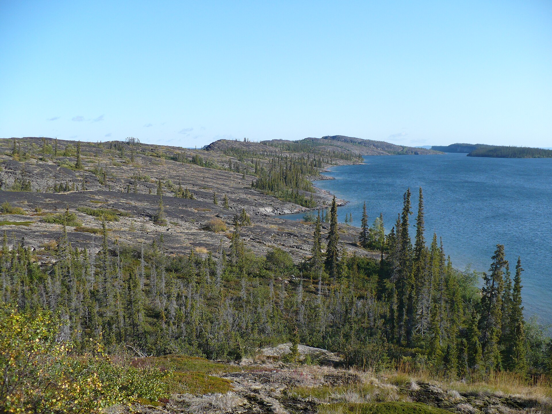
4 waterfalls and 36 lakes and ponds, including Anderson Falls, Artillery Lake (365 m), Hanbury Falls and Daisy Lake (311 m) (Wikidata).
Are there historic monuments in Thaidene Nëné National Park Reserve?
Yes. According to Wikidata, one monument designated National Historic Sites of Canada stands within the boundary. For example: “Fort Reliance National Historic Site of Canada”.
What is the nearest airport to Thaidene Nëné National Park Reserve?
Nearest airport: Yellowknife (YZF), about 183 km away.
Which species can be seen in Thaidene Nëné National Park Reserve?
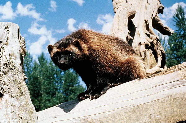
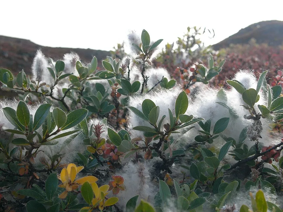
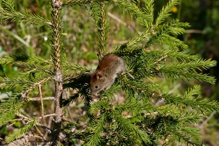
Among the species most often recorded on GBIF are Gulo gulo (Wolverine), Salix glauca (Grayleaf willow), Myodes rutilus (Northern red-backed vole) and Valvata helicoidea.
Who manages Thaidene Nëné National Park Reserve?
Parks Canada.
What is the official website of Thaidene Nëné National Park Reserve?
© OpenStreetMap
Download the boundary: GeoJSON · GPX Boundary © OpenStreetMap contributors (ODbL).
Geography
The representative point of the site lies at around 375 m above sea level. Over the 1996–2025 period, the mean annual temperature is about -6.8 °C and total precipitation reaches roughly 390 mm per year. The warmest month is usually July, the coolest January, and the wettest August.
Area
- Area
- 1,430,500 ha
- Elevation
- 375 m
- Median elevation
- 357 m
- Snow cover
- ≈ 225 days a year
- Coordinates
- 62.7075, -108.6344
Terrain: Mapzen Terrain Tiles (SRTM, USGS)
Climate
● Mean temperature (°C) · ▮ Precipitation (mm)
Source: Copernicus ERA5-Land (C3S, doi:10.24381/cds.68d2bb30), monthly averages 1996–2025 interpolated to the representative point, temperatures adjusted for elevation.
Contains modified Copernicus Climate Change Service information 2026. Neither the European Commission nor ECMWF is responsible for any use that may be made of the Copernicus information or data it contains.
Snow cover measured by satellite
J
F
M
A
M
J
J
A
S
O
N
D
average share of the site under snow · snowiest parts · ≈ 225 days a year
Snow cover: MODIS/Terra MOD10CM v61 (Hall & Riggs, 2021, NASA NSIDC DAAC, doi:10.5067/MODIS/MOD10CM.061), imagery from NASA GIBS (ESDIS); 2015–2025 average, grid of about 5 km.
Natural habitats
According to the global MODIS land cover (NASA, 2024), the site is mainly made up of grassland and meadows (49%), heath and scrub (43%) and marshes and bogs (8%). Elevation ranges from about 160 to 430 m (sampled elevations, SRTM).
Biodiversity
Based on occurrences aggregated by GBIF, several species are regularly recorded within the site. Among the most frequent are Gulo gulo (Wolverine), Salix glauca (Grayleaf willow), Myodes rutilus (Northern red-backed vole) and Valvata helicoidea. The full list of documented taxa is shown below.
Species to look out for

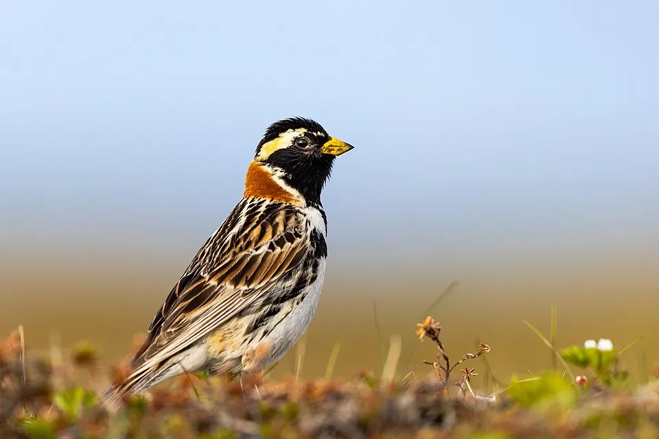
Bird
Lapland Longspur
Calcarius lapponicus13 records © Alaska Region U.S. Fish & Wildlife Service from Anchorage, United States · Public domain
Observed species
Occurrences documented via GBIF; they are neither an exhaustive inventory nor proof of current presence.
- Wolverine · Gulo gulo · 98
- Grayleaf willow · Salix glauca · 20
- Northern red-backed vole · Myodes rutilus · 20
- Valvata helicoidea · 15
- Redpoll · Acanthis flammea · 15
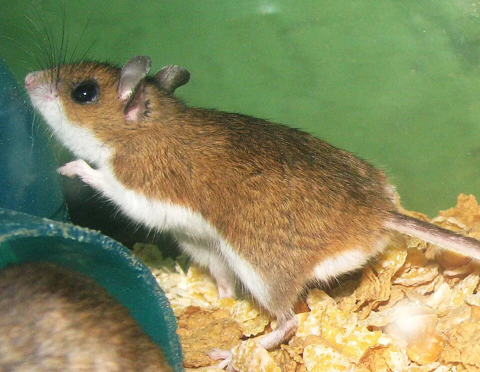
- North American Deermouse · Peromyscus maniculatus · 13
- Lapland Longspur · Calcarius lapponicus · 13
- Harris's Sparrow · Zonotrichia querula · 13
- Glaucous bluegrass · Poa glauca · 12
- Glandular birch · Betula glandulosa · 12
- American Robin · Turdus migratorius · 12
- Belted Whiteface · Leucorrhinia proxima · 11
+18 more species
- Slimy sculpin · Cottus cognatus · 11
- Canada Jay · Perisoreus canadensis · 11
- Canada Whiteface · Leucorrhinia patricia · 10
- Water sedge · Carex aquatilis · 10
- Three toothed saxifrage · Saxifraga tricuspidata · 10
- American Tree Sparrow · Spizelloides arborea · 10
- Common loon · Gavia immer · 9
- Purple reedgrass · Calamagrostis purpurascens · 9
- Grey wolf · Canis lupus · 9
- White-crowned Sparrow · Zonotrichia leucophrys · 9
- Canada Goose · Branta canadensis · 9
- Northern willow · Salix arctophila · 9
- Myrtle Warbler · Setophaga coronata · 9
- Arctic fox · Vulpes lagopus · 8
- White Spruce · Picea glauca · 8
- Netleaf willow · Salix reticulata · 8
- Western Heather Vole · Phenacomys intermedius · 7
- Northern Raven · Corvus corax · 7
Records: GBIF.org (CC-BY). Names: Wikidata (CC0), GBIF. Photos: Wikimedia Commons.
Conservation challenges
The primary purpose of the site is to preserve its natural habitats and the biodiversity they support. The species recorded (Biodiversity tab) reflect its ecological value. Its status as a national park sets the regulatory framework for its protection.
According to Global Forest Change data (University of Maryland, Global Forest Watch), about 81,740 ha of tree cover were lost within the boundary between 2001 and 2023 (6% of its area), peaking in 2012 and 2014. These losses include logging, storms and fires, and do not account for regrowth. At night, the area gives off virtually no artificial light detectable from space (NASA VIIRS Black Marble composite, 2016).
Pressure indicators
Tree cover lost
81,738 ha
2001–2023 · 6% of the area
20012023
Light at night
0%
of the area gives off artificial light visible from space
DarkLit
Sources: Global Forest Change (Hansen et al., University of Maryland, via Global Forest Watch, CC-BY 4.0); EFFIS, European Commission / Copernicus; NASA Black Marble 2016 (public domain); CORINE Land Cover 2018 (Copernicus) or MODIS.
Practical information
Cities and airport
- Airport: Yellowknife (YZF)
183 km as the crow flies
Things to see
4 waterfalls · 36 lakes and ponds
- Anderson Falls
waterfall - Artillery Lake
lake or pond · 365 m - Hanbury Falls
waterfall - Daisy Lake
lake or pond · 311 m - Parry Falls
waterfall
Data © OpenStreetMap contributors (ODbL) · Wikidata (CC0)
Access and visiting
Nearest airport: Yellowknife (YZF), about 183 km away. Fewer than 5,000 people live within 20 km of the site boundary, a very sparsely populated area; the site itself is virtually uninhabited (GHSL estimate, 2020). To see: 4 waterfalls and 36 lakes and ponds, including Anderson Falls, Artillery Lake (365 m), Hanbury Falls and Daisy Lake (311 m). To plan a visit (access, opening periods, visitor rules), it is best to consult the official information from the managing body (Parks Canada) and the official website listed in this page's sources.
Source: OpenStreetMap (ODbL), Wikidata (CC0), October 2026.
Built heritage
According to Wikidata, one monument designated National Historic Sites of Canada stands within the boundary. It is “Fort Reliance National Historic Site of Canada”.
Source: Wikidata (CC0), monuments in each country’s official heritage protection registers, at national or regional level. Each item links to its Wikidata entry.
When to visit
Mildest period: July, with average temperatures of 14 to 15 °C. Average temperatures drop below 0 °C from October to April: frost is common. Precipitation peaks in August (up to 70 mm per month). According to NASA's MODIS satellites (2015–2025 average), snow covers most of the site from October to May, with about 225 snow-covered days a year on average. Day length ranges from about 4 h 54 min in December to 20 h 03 min in June. Wildlife records published on GBIF peak for birds (August), plants (July) and mammals (August). These peaks also reflect when observers are most active.
Source: Copernicus ERA5-Land (C3S), monthly averages 1996–2025 at the representative point, temperatures adjusted for elevation.
Contains modified Copernicus Climate Change Service information 2026. Neither the European Commission nor ECMWF is responsible for any use that may be made of the Copernicus information or data it contains.
Wildlife records calendar
JFMAMJJASOND
Birds
Plants
Mammals
Monthly records published on GBIF (CC-BY), relative to the busiest month; also reflects observer activity.
Gallery
© Paul Gierszewski · Public domain
© Paul Gierszewski · CC BY 4.0
© Paul Gierszewski · CC BY 4.0
© Paul Gierszewski · CC BY 4.0
© Paul Gierszewski · CC BY 4.0
Sources and licences
- Wikidata: Q724310
- Official website: https://parks.canada.ca/pn-np/nt/thaidene-nene
- Wikipedia: en.wikipedia.org/wiki/Thaidene_Nëné_National_Park_Reserve
- WDPA: 555704301
References
- cds.climate.copernicus.eu: climate · CC-BY-4.0
- registry.opendata.aws: elevation of the reference point · PD
- lpdaac.usgs.gov: land cover · PD
- doi.org: population around the site · CC-BY-4.0
- naturalearthdata.com: sea share · PD
- wikidata.org: official area, establishment date, protected heritage, managing body, nearby cities and airport, access and peaks, lake depths, places to see, official website · CC0-1.0
- en.eurovelo.com: EuroVelo cycle routes · ODbL-1.0
- cycling.waymarkedtrails.org: cycle routes · ODbL-1.0
- opentopodata.org: elevations · CC-BY-4.0
- globalforestwatch.org: tree cover loss · CC-BY-4.0
- gbif.org: seasonality of sightings, invasive alien species, observed species · CC-BY-4.0
- openstreetmap.org: official name, access and peaks · ODbL-1.0
- earthobservatory.nasa.gov: night light · PD
- registry.opendata.aws: detailed relief · CC-BY-4.0
- nsidc.org: snow cover · PD
- wikidata.org: Wikipedia article · CC-BY-SA-4.0
Data © OpenStreetMap contributors (ODbL), Wikidata (CC0) and the sources cited.