Mexico · Marine
Arrecife Alacranes National Park
National park of 333,769 hectares in Mexico, established in 1994.
Overview
National park of 333,769 hectares in Mexico, established in 1994.
Arrecife Alacranes National Park is located in Mexico (North America). It is a predominantly marine area. Established on 6 June 1994, it covers about 333,769 hectares.
Protections and designations
Ramsar site
Protected as a national park. International labels and designations: Ramsar site. Key dates: established in 1994 and Ramsar Site in 2008.
In our collections
Timeline
-
1994
Established
-
2008
Ramsar Site (wetland of international importance) Arrecife Alacranes National Park
Sources: Wikidata (CC0) for establishment and international labels; EEA Natura 2000 database (CC-BY 4.0) for site designation dates.
Frequently asked questions
Where is Arrecife Alacranes National Park?
In Mexico (North America). Representative point: 22.4745° N, 89.6951° W.
How large is Arrecife Alacranes National Park?
About 333,769 hectares (3,338 km²). It is the 2nd largest of the 52 national parks in Mexico covered by Parkavela.
When was Arrecife Alacranes National Park established?
On 6 June 1994.
What habitats and landscapes does Arrecife Alacranes National Park include?
A marine area, with coasts and coral reefs.
Which international labels apply to Arrecife Alacranes National Park?
Ramsar site.
When is the best time to visit Arrecife Alacranes National Park?
Best time to visit: the dry season, from January to April, with less than 30 mm of rain per month.
What is the nearest airport to Arrecife Alacranes National Park?
Nearest airport: Manuel Crescencio Rejón (MID), about 134 km away.
Which species can be seen in Arrecife Alacranes National Park?
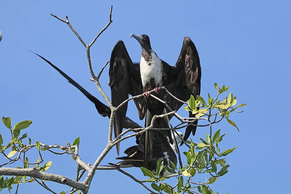
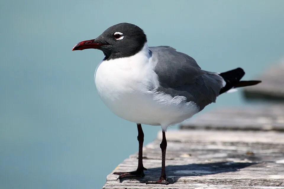
Among the species most often recorded on GBIF are Fregata magnificens (Magnificent frigatebird), Leucophaeus atricilla (Laughing Gull), Thalasseus maximus (Royal Tern) and Arenaria interpres (Ruddy Turnstone).
© OpenStreetMap
Download the boundary: GeoJSON · GPX Boundary © OpenStreetMap contributors (ODbL).
Geography
Over the 1996–2025 period, the mean annual temperature is about 25.8 °C and total precipitation reaches roughly 569 mm per year. The warmest month is usually August, the coolest January, and the wettest August.
Area
- Area
- 333,769 ha
- Coordinates
- 22.4745, -89.6951
Climate
● Mean temperature (°C) · ▮ Precipitation (mm)
Source: Copernicus ERA5 (C3S, doi:10.24381/cds.f17050d7), monthly averages 1996–2025 interpolated to the representative point, temperatures adjusted for elevation.
Contains modified Copernicus Climate Change Service information 2026. Neither the European Commission nor ECMWF is responsible for any use that may be made of the Copernicus information or data it contains.
Natural habitats
The sea covers about 96% of the site. The seabed reaches about 143 m deep (median depth 55 m; GEBCO bathymetry). Reef-building corals are documented in the area: 779 records published on GBIF.
Biodiversity
Based on occurrences aggregated by GBIF, several species are regularly recorded within the site. Among the most frequent are Fregata magnificens (Magnificent frigatebird), Leucophaeus atricilla (Laughing Gull), Thalasseus maximus (Royal Tern) and Arenaria interpres (Ruddy Turnstone). The full list of documented taxa is shown below.
Species to look out for

Bird
Royal Tern
Thalasseus maximus101 records © Dick Daniels (http://carolinabirds.org/) · CC BY-SA 3.0

Bird
Ruddy Turnstone
Arenaria interpres88 records © Original: neekoh.fi; this edit: MPF · CC BY 2.0
Observed species
Occurrences documented via GBIF; they are neither an exhaustive inventory nor proof of current presence.
- Magnificent frigatebird · Fregata magnificens · 144
- Laughing Gull · Leucophaeus atricilla · 105
- Royal Tern · Thalasseus maximus · 101
- Ruddy Turnstone · Arenaria interpres · 88
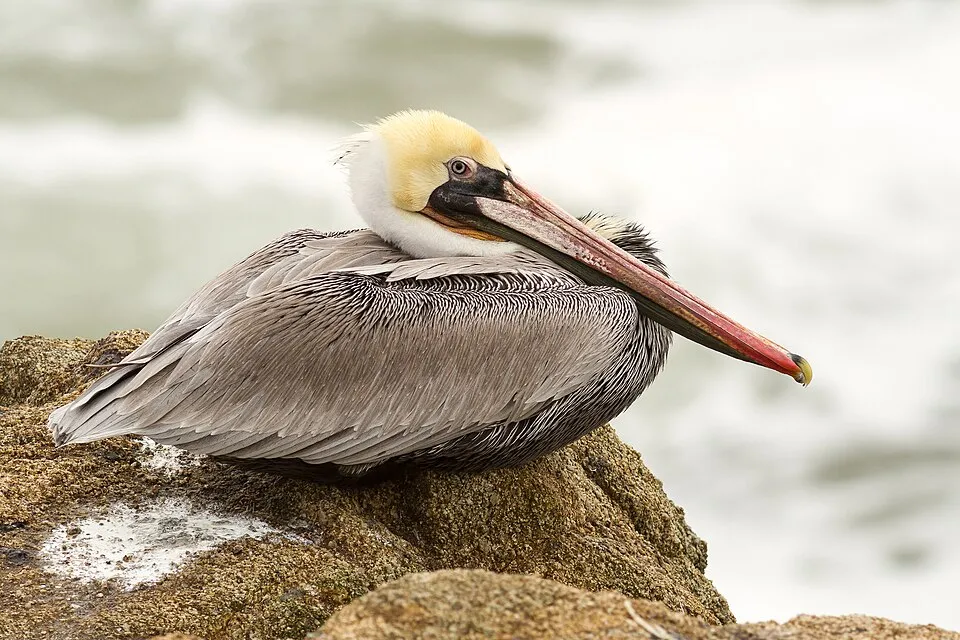
- Brown pelican · Pelecanus occidentalis · 86
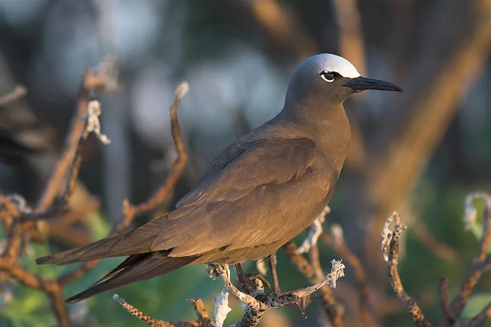
- Brown Noddy · Anous stolidus · 85
- Sandwich Tern · Thalasseus sandvicensis · 79
- Masked Booby · Sula dactylatra · 76
- Sooty Tern · Onychoprion fuscatus · 76
- Bridled Tern · Onychoprion anaethetus · 64
- Sanderling · Calidris alba · 58
- Barn Swallow · Hirundo rustica · 54
+18 more species
- Grey Plover · Pluvialis squatarola · 51
- Swollen-claw Mantis · Neogonodactylus oerstedii · 41
- Brown Booby · Sula leucogaster · 41
- Mangrove Tunicate · Ecteinascidia turbinata · 40
- Black Land Crab · Gecarcinus lateralis · 40
- Ophiothrix (Ophiothrix) oerstedii · Ophiothrix oerstedii · 34
- Speckled snapping shrimp · Synalpheus fritzmuelleri · 32
- Pink Lumpy Sponge · Monanchora arbuscula · 32
- Feather hydroid · Pennaria disticha · 32
- Red-footed Booby · Sula sula · 31
- Palm Warbler · Setophaga palmarum · 31
- Willet · Tringa semipalmata · 30
- Periclimenaeus caraibicus · 29
- Leucothoe ashleyae · 29
- Tricolor hermit · Clibanarius tricolor · 28
- Watercress Algae · Halimeda opuntia · 28
- American grass shrimp · Cuapetes americanus · 28
- Peregrine Falcon · Falco peregrinus · 27
Records: GBIF.org (CC-BY). Names: Wikidata (CC0), GBIF. Photos: Wikimedia Commons.
Conservation challenges
The primary purpose of the site is to preserve its natural habitats and the biodiversity they support. The species recorded (Biodiversity tab) reflect its ecological value. The designations it holds frame its management and the control of land use.
Pressure indicators
Invasive alien species
2
recorded since 2000
 Sea thread hydroid
 Rock Dove
Photos: Sea thread hydroid © Claudia RATTI · CC BY 4.0; Rock Dove © william_stephens · CC BY 4.0
Sources: Global Forest Change (Hansen et al., University of Maryland, via Global Forest Watch, CC-BY 4.0); EFFIS, European Commission / Copernicus; NASA Black Marble 2016 (public domain); CORINE Land Cover 2018 (Copernicus) or MODIS.
Invasive alien species: Global Register of Introduced and Invasive Species (ISSG, CC BY 4.0); Union list, Regulation (EU) 1143/2014 (INBO, CC0); GBIF.org records (CC0 / CC BY 4.0), at least 2 per species.
Practical information
Cities and airport
- Airport: Manuel Crescencio Rejón (MID)
134 km as the crow flies
Data © OpenStreetMap contributors (ODbL) · Wikidata (CC0)
Access and visiting
Nearest airport: Manuel Crescencio Rejón (MID), about 134 km away. To plan a visit (access, opening periods, visitor rules), it is best to consult the official information from the managing body and the official website listed in this page's sources.
Source: OpenStreetMap (ODbL), Wikidata (CC0), November 2026.
When to visit
Best time to visit: the dry season, from January to April, with less than 30 mm of rain per month. Precipitation peaks in August and September (up to 120 mm per month). Day length ranges from about 10 h 46 min in December to 13 h 30 min in June. Wildlife records published on GBIF peak for birds (April) and plants (June and July). These peaks also reflect when observers are most active.
Source: Copernicus ERA5 (C3S), monthly averages 1996–2025 at the representative point, temperatures adjusted for elevation.
Contains modified Copernicus Climate Change Service information 2026. Neither the European Commission nor ECMWF is responsible for any use that may be made of the Copernicus information or data it contains.
Wildlife records calendar
JFMAMJJASOND
Birds
Plants
Monthly records published on GBIF (CC-BY), relative to the busiest month; also reflects observer activity.
Gallery
© NASA · Public domain
© Yodigo · CC BY-SA 3.0
© Jhaguilar81 · CC BY-SA 3.0
© Superchiken · CC BY-SA 3.0
Sources and licences
- Wikidata: Q64504436
- Wikipedia: fr.wikipedia.org/wiki/Parc_national_Arrecife_Alacranes
- WDPA: 306775
References
- cds.climate.copernicus.eu: climate · CC-BY-4.0
- registry.opendata.aws: elevation of the reference point · PD
- land.copernicus.eu: land cover · COPERNICUS
- doi.org: population around the site · CC-BY-4.0
- naturalearthdata.com: sea share · PD
- wikidata.org: official area, establishment date, protected heritage, nearby cities and airport, access and peaks, places to see · CC0-1.0
- gbif.org: coral records, seasonality of sightings, invasive alien species, observed species · CC-BY-4.0
- gebco.net: depths · PD
- opentopodata.org: elevations · PD
- openstreetmap.org: official name, access and peaks, trail difficulty · ODbL-1.0
- wikidata.org: Wikipedia article · CC-BY-SA-4.0
Data © OpenStreetMap contributors (ODbL), Wikidata (CC0) and the sources cited.