

Mexico · Marine
Arrecife de Puerto Morelos National Park
National park of 9,067 hectares in Mexico, established in 1998.
Overview
National park of 9,067 hectares in Mexico, established in 1998.
Arrecife de Puerto Morelos National Park is located in Mexico (North America). It is a predominantly marine area. Established on 2 February 1998, it covers about 9,067 hectares. The site is managed by National Commission of Protected Natural Areas.
Protections and designations
Ramsar site
Protected as a national park. International labels and designations: Ramsar site. Key dates: established in 1998 and Ramsar Site in 2004.
In our collections
Timeline
-
1998
Established
-
2004
Ramsar Site (wetland of international importance) Arrecife de Puerto Morelos National Park
Sources: Wikidata (CC0) for establishment and international labels; EEA Natura 2000 database (CC-BY 4.0) for site designation dates.
Frequently asked questions
Where is Arrecife de Puerto Morelos National Park?
In Mexico (North America). Representative point: 20.9044° N, 86.8250° W.
How large is Arrecife de Puerto Morelos National Park?
About 9,067 hectares (91 km²). It is the 19th largest of the 52 national parks in Mexico covered by Parkavela.
When was Arrecife de Puerto Morelos National Park established?
On 2 February 1998.
What habitats and landscapes does Arrecife de Puerto Morelos National Park include?
A marine area, with coral reefs.
Which international labels apply to Arrecife de Puerto Morelos National Park?
Ramsar site.
When is the best time to visit Arrecife de Puerto Morelos National Park?
Best time to visit: the dry season, from February to April, with less than 50 mm of rain per month.
What is the nearest large city to Arrecife de Puerto Morelos National Park?
Nearest towns of over 50,000 people, as the crow flies: Cancun (18 km). Nearest airport: Cancún (CUN), about 7 km away.
Which species can be seen in Arrecife de Puerto Morelos National Park?
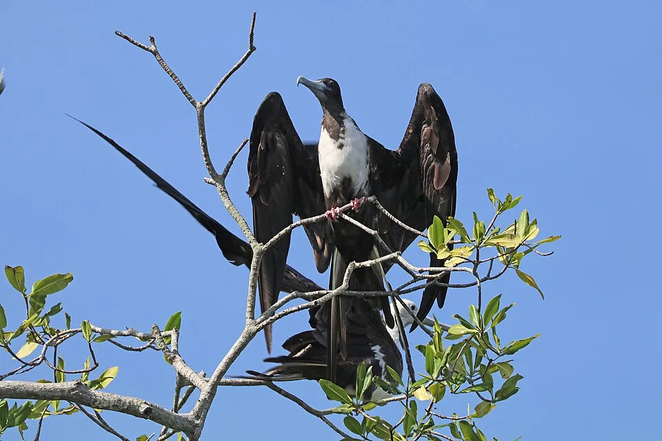
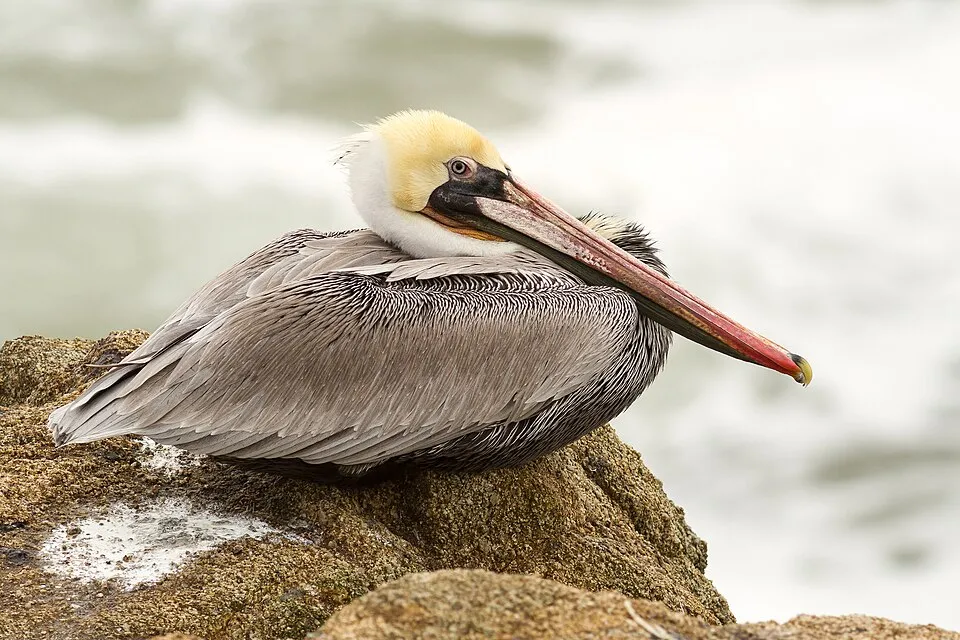
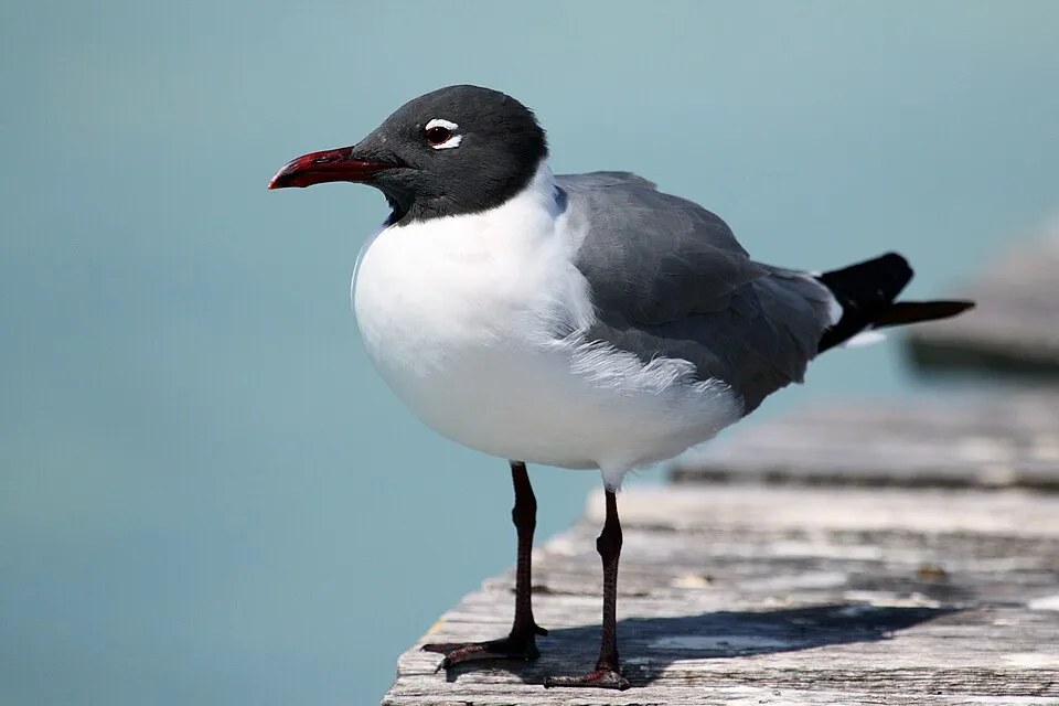
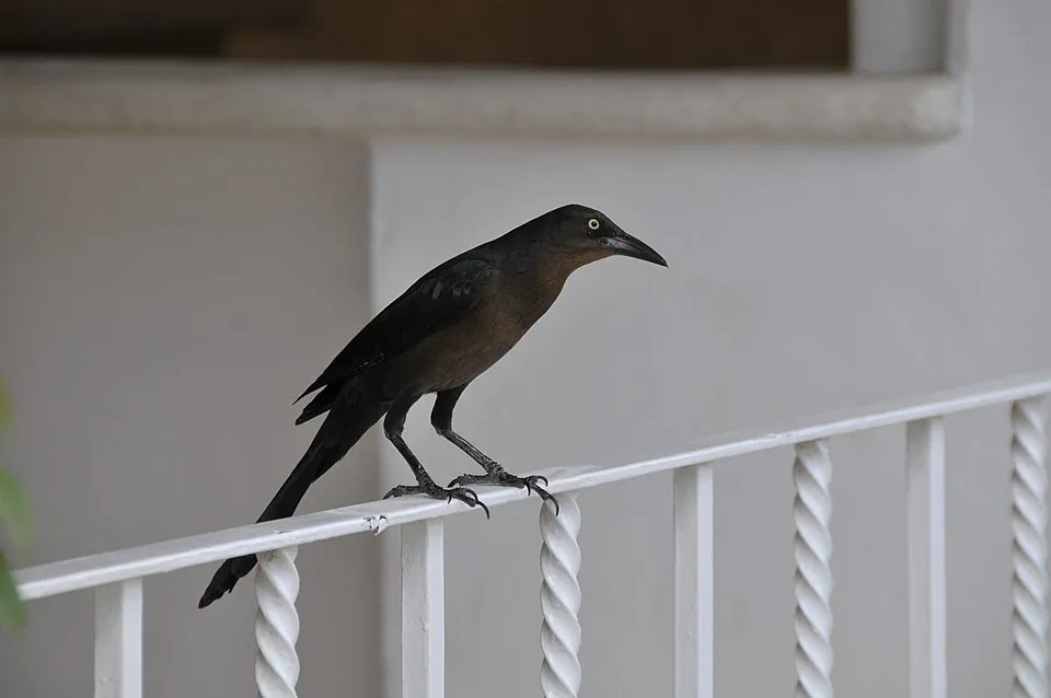
Among the species most often recorded on GBIF are Fregata magnificens (Magnificent frigatebird), Pelecanus occidentalis (Brown pelican), Leucophaeus atricilla (Laughing Gull) and Quiscalus mexicanus (Great-tailed Grackle).
Who manages Arrecife de Puerto Morelos National Park?
National Commission of Protected Natural Areas.
© OpenStreetMap
Download the boundary: GeoJSON · GPX Boundary © OpenStreetMap contributors (ODbL).
Geography
Over the 1996–2025 period, the mean annual temperature is about 26.3 °C and total precipitation reaches roughly 1,173 mm per year. The warmest month is usually August, the coolest January, and the wettest October.
Area
- Area
- 9,067 ha
- Coordinates
- 20.9044, -86.825
Climate
● Mean temperature (°C) · ▮ Precipitation (mm)
Source: Copernicus ERA5-Land (C3S, doi:10.24381/cds.68d2bb30), monthly averages 1996–2025 interpolated to the representative point, temperatures adjusted for elevation.
Contains modified Copernicus Climate Change Service information 2026. Neither the European Commission nor ECMWF is responsible for any use that may be made of the Copernicus information or data it contains.
Natural habitats
The site is almost entirely marine. The seabed reaches about 146 m deep (median depth 21 m; GEBCO bathymetry). Reef-building corals are documented in the area: 681 records published on GBIF.
Biodiversity
Based on occurrences aggregated by GBIF, several species are regularly recorded within the site. Among the most frequent are Fregata magnificens (Magnificent frigatebird), Pelecanus occidentalis (Brown pelican), Leucophaeus atricilla (Laughing Gull) and Quiscalus mexicanus (Great-tailed Grackle). The full list of documented taxa is shown below.
Species to look out for

Bird
Royal Tern
Thalasseus maximus307 records © Dick Daniels (http://carolinabirds.org/) · CC BY-SA 3.0

Bird
Ruddy Turnstone
Arenaria interpres275 records © Original: neekoh.fi; this edit: MPF · CC BY 2.0
Observed species
Occurrences documented via GBIF; they are neither an exhaustive inventory nor proof of current presence.
- Magnificent frigatebird · Fregata magnificens · 457
- Brown pelican · Pelecanus occidentalis · 435
- Laughing Gull · Leucophaeus atricilla · 424
- Great-tailed Grackle · Quiscalus mexicanus · 377
- Royal Tern · Thalasseus maximus · 307
- Ruddy Turnstone · Arenaria interpres · 275
- Tropical Mockingbird · Mimus gilvus · 258
- Sanderling · Calidris alba · 213
- Eurasian Collared Dove · Streptopelia decaocto · 175
- Great Kiskadee · Pitangus sulphuratus · 143
- Double-crested Cormorant · Phalacrocorax auritus · 133
- Osprey · Pandion haliaetus · 119
+18 more species
- Tropical Kingbird · Tyrannus melancholicus · 119
- Sandwich Tern · Thalasseus sandvicensis · 117
- Prorocentrum lima · 92
- Stalked Lettuce Leaf Algae · Halimeda tuna · 91
- Prorocentrum hoffmannianum · 88
- Grey Plover · Pluvialis squatarola · 86
- Hooded Oriole · Icterus cucullatus · 76
- Yellow-throated Warbler · Setophaga dominica · 74
- Prorocentrum mexicanum · 71
- Spiny Brittle Star · Ophiocoma echinata · 68
- Social Flycatcher · Myiozetetes similis · 67
- Least Sandpiper · Calidris minutilla · 66
- Blue tang · Acanthurus coeruleus · 66
- Prorocentrum emarginatum · 63
- Prorocentrum belizeanum · 63
- Blue Striped Grunt · Haemulon sciurus · 62
- Turkey Vulture · Cathartes aura · 60
- Cinnamon Hummingbird · Amazilia rutila · 58
Records: GBIF.org (CC-BY). Names: Wikidata (CC0), GBIF. Photos: Wikimedia Commons.
Conservation challenges
The primary purpose of the site is to preserve its natural habitats and the biodiversity they support. The species recorded (Biodiversity tab) reflect its ecological value. The designations it holds frame its management and the control of land use.
Invasive alien species have been recorded within the site since 2000 (GBIF observations). Among them: Streptopelia decaocto (Eurasian Collared Dove), Pterois volitans (Common lionfish) and Columba livia (Rock Dove).
Pressure indicators
Invasive alien species
3
recorded since 2000
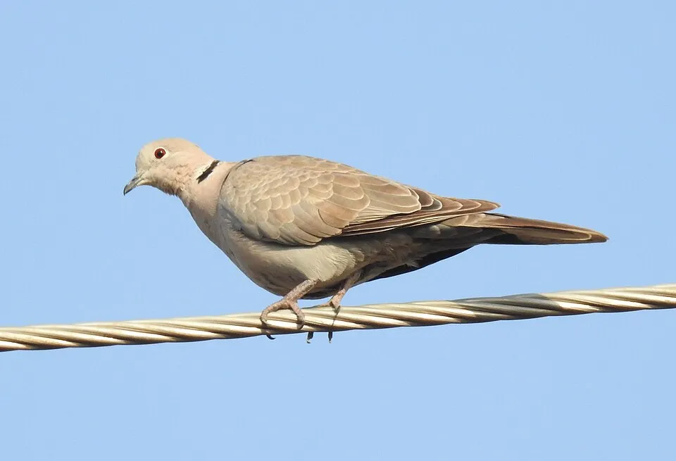 Eurasian Collared Dove
 Common lionfish
 Rock Dove
Photos: Eurasian Collared Dove © Dr. Raju Kasambe · CC BY-SA 4.0; Common lionfish © and (C)2007 Derek Ramsey (Ram-Man) · CC BY-SA 2.5; Rock Dove © william_stephens · CC BY 4.0
Sources: Global Forest Change (Hansen et al., University of Maryland, via Global Forest Watch, CC-BY 4.0); EFFIS, European Commission / Copernicus; NASA Black Marble 2016 (public domain); CORINE Land Cover 2018 (Copernicus) or MODIS.
Invasive alien species: Global Register of Introduced and Invasive Species (ISSG, CC BY 4.0); Union list, Regulation (EU) 1143/2014 (INBO, CC0); GBIF.org records (CC0 / CC BY 4.0), at least 2 per species.
Practical information
Cities and airport
- Cancun
18 km as the crow flies - Airport: Cancún (CUN)
7 km as the crow flies
Data © OpenStreetMap contributors (ODbL) · Wikidata (CC0)
Access and visiting
Nearest towns of over 50,000 people, as the crow flies: Cancun (18 km). Nearest airport: Cancún (CUN), about 7 km away. About 510,000 people live within 20 km of the site boundary, 22,000 of them within 10 km (GHSL estimate, 2020). This population has grown by about 33% since 2000. To plan a visit (access, opening periods, visitor rules), it is best to consult the official information from the managing body (National Commission of Protected Natural Areas) and the official website listed in this page's sources.
Source: OpenStreetMap (ODbL), Wikidata (CC0), November 2026.
When to visit
Best time to visit: the dry season, from February to April, with less than 50 mm of rain per month. Precipitation peaks in June and in September and October (up to 200 mm per month). Day length ranges from about 10 h 52 min in December to 13 h 24 min in June. Wildlife records published on GBIF peak for birds (from December to March) and plants (December). These peaks also reflect when observers are most active.
Source: Copernicus ERA5-Land (C3S), monthly averages 1996–2025 at the representative point, temperatures adjusted for elevation.
Contains modified Copernicus Climate Change Service information 2026. Neither the European Commission nor ECMWF is responsible for any use that may be made of the Copernicus information or data it contains.
Wildlife records calendar
JFMAMJJASOND
Birds
Plants
Monthly records published on GBIF (CC-BY), relative to the busiest month; also reflects observer activity.
Gallery
© Jaontiveros · Public domain
© ProtoplasmaKid · CC BY-SA 4.0
© ProtoplasmaKid · CC BY-SA 4.0
© ProtoplasmaKid · CC BY-SA 4.0
© ProtoplasmaKid · CC BY-SA 4.0
© ProtoplasmaKid · CC BY-SA 4.0
Sources and licences
- Wikidata: Q6378151
- Wikipedia: es.wikipedia.org/wiki/Parque_nacional_Arrecife_de_Puerto_Morelos
- WDPA: 166966
References
- cds.climate.copernicus.eu: climate · CC-BY-4.0
- registry.opendata.aws: elevation of the reference point · PD
- lpdaac.usgs.gov: land cover · PD
- doi.org: population around the site · CC-BY-4.0
- naturalearthdata.com: sea share · PD
- wikidata.org: official area, establishment date, protected heritage, managing body, nearby cities and airport, access and peaks, places to see · CC0-1.0
- gbif.org: coral records, seasonality of sightings, invasive alien species, observed species · CC-BY-4.0
- gebco.net: depths · PD
- opentopodata.org: elevations · PD
- openstreetmap.org: official name, access and peaks, trail difficulty · ODbL-1.0
- wikidata.org: Wikipedia article · CC-BY-SA-4.0
Data © OpenStreetMap contributors (ODbL), Wikidata (CC0) and the sources cited.


