Mexico · Mixed
Arrecifes de Xcalak National Park
National park of 17,949 hectares in Mexico, established in 2000.
Overview
National park of 17,949 hectares in Mexico, established in 2000.
Arrecifes de Xcalak National Park is located in Mexico (North America). It covers both land and sea. Established on 27 November 2000, it covers about 17,949 hectares. The site is managed by National Commission of Protected Natural Areas.
Protections and designations
Ramsar site
Protected as a national park. International labels and designations: Ramsar site. Key dates: established in 2000 and Ramsar Site in 2003.
In our collections
Timeline
-
2000
Established
-
2003
Ramsar Site (wetland of international importance) Arrecifes de Xcalak National Park
Sources: Wikidata (CC0) for establishment and international labels; EEA Natura 2000 database (CC-BY 4.0) for site designation dates.
Frequently asked questions
Where is Arrecifes de Xcalak National Park?
In Mexico (North America). Representative point: 18.3400° N, 87.8023° W.
How large is Arrecifes de Xcalak National Park?
About 17,949 hectares (179 km²). It is the 15th largest of the 52 national parks in Mexico covered by Parkavela. About 13,100 ha are at sea.
When was Arrecifes de Xcalak National Park established?
On 27 November 2000.
What habitats and landscapes does Arrecifes de Xcalak National Park include?
An area spanning land and sea, with forests, coasts and coral reefs.
Which international labels apply to Arrecifes de Xcalak National Park?
Ramsar site.
When is the best time to visit Arrecifes de Xcalak National Park?
Best time to visit: the dry season, from February to April, with less than 40 mm of rain per month.
What is the nearest large city to Arrecifes de Xcalak National Park?
Nearest towns of over 50,000 people, as the crow flies: Chetumal (52 km) and Belize (84 km). Nearest airport: Chetumal (CTM), about 55 km away.
Which species can be seen in Arrecifes de Xcalak National Park?
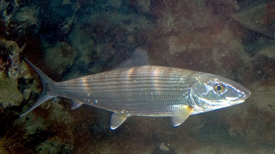
Among the species most often recorded on GBIF are Albula vulpes (Bonefish), Eucinostomus jonesii (Slender Mojarra), Orbicella annularis (Head star coral) and Gnatholepis thompsoni (Goldspot Goby).
Who manages Arrecifes de Xcalak National Park?
National Commission of Protected Natural Areas.
© OpenStreetMap
Download the boundary: GeoJSON · GPX Boundary © OpenStreetMap contributors (ODbL).
Geography
Over the 1996–2025 period, the mean annual temperature is about 26.7 °C and total precipitation reaches roughly 1,373 mm per year. The warmest month is usually August, the coolest January, and the wettest October.
Area
- Area
- 17,949 ha
- Coordinates
- 18.34, -87.8023
Climate
● Mean temperature (°C) · ▮ Precipitation (mm)
Source: Copernicus ERA5-Land (C3S, doi:10.24381/cds.68d2bb30), monthly averages 1996–2025 interpolated to the representative point, temperatures adjusted for elevation.
Contains modified Copernicus Climate Change Service information 2026. Neither the European Commission nor ECMWF is responsible for any use that may be made of the Copernicus information or data it contains.
Natural habitats
According to the global MODIS land cover (NASA, 2024), the land area is mainly made up of marshes and bogs (72%) and forests (27%). It is mostly dense evergreen broadleaved forest. The sea covers about 73% of the site. The seabed reaches about 228 m deep (median depth 102 m; GEBCO bathymetry). Reef-building corals are documented in the area: 952 records published on GBIF.
Biodiversity
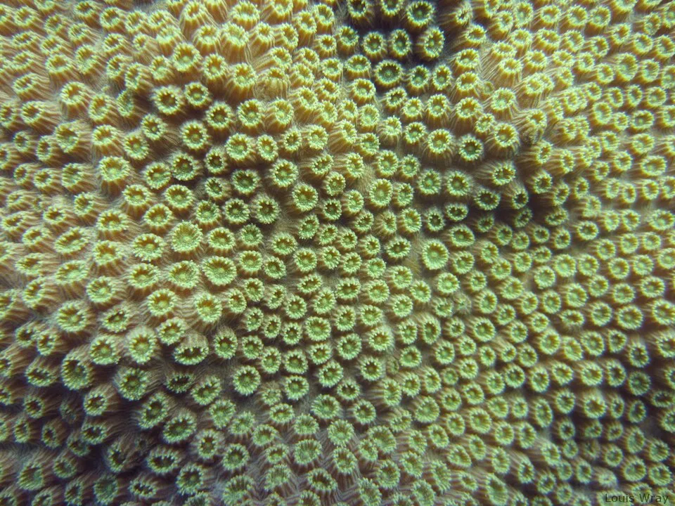
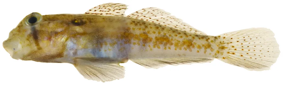
Based on occurrences aggregated by GBIF, several species are regularly recorded within the site. Among the most frequent are Albula vulpes (Bonefish), Eucinostomus jonesii (Slender Mojarra), Orbicella annularis (Head star coral) and Gnatholepis thompsoni (Goldspot Goby). The full list of documented taxa is shown below.
Species to look out for
Fish
Goldspot Goby
Gnatholepis thompsoni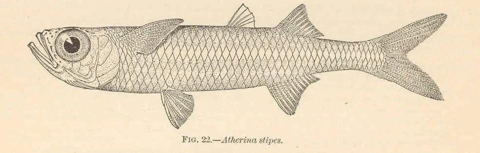
Fish
Hardhead Silverside
Atherinomorus stipes125 records © Barton Warren Evermann / Millard Caleb Marsh · Public domain
Fish
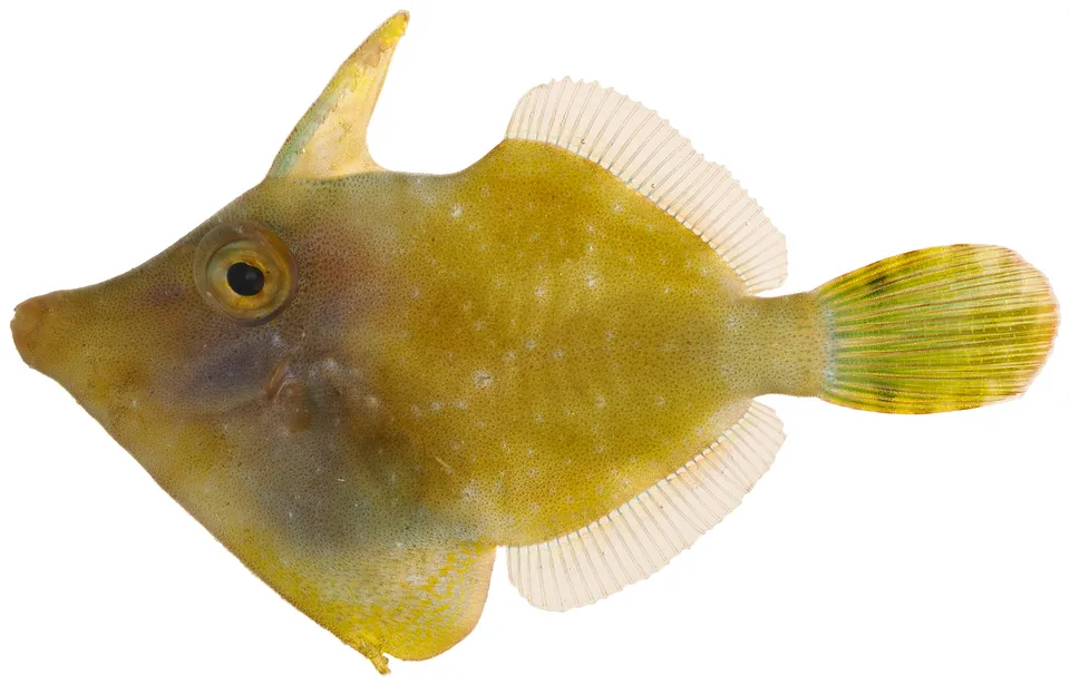
Fringed Filefish
Monacanthus ciliatus
Observed species
Occurrences documented via GBIF; they are neither an exhaustive inventory nor proof of current presence.
- Bonefish · Albula vulpes · 2664
- Slender Mojarra · Eucinostomus jonesii · 636
- Head star coral · Orbicella annularis · 252
- Goldspot Goby · Gnatholepis thompsoni · 214
- Dash Goby · Ctenogobius saepepallens · 138
- Hardhead Silverside · Atherinomorus stipes · 125
- Dwarf Round Herring · Jenkinsia lamprotaenia · 118
- Fringed Filefish · Monacanthus ciliatus · 107
- Schoolmaster snapper · Lutjanus apodus · 96
- Lancer dragonet · Callionymus bairdi · 96
- Dwarf wrasse · Doratonotus megalepis · 90
- Blue Striped Grunt · Haemulon sciurus · 88
+18 more species
- Redear Herring · Harengula humeralis · 82
- Boulder star coral · Orbicella faveolata · 82
- False Herring · Harengula clupeola · 77
- Blue tang · Acanthurus coeruleus · 72
- Rosy Blenny · Malacoctenus macropus · 71
- French grunt · Haemulon flavolineatum · 67
- Symmetrical Brain Coral · Pseudodiploria strigosa · 67
- Emerald Clingfish · Acyrtops beryllinus · 64
- Great Barracuda · Sphyraena barracuda · 64
- Mushroom Scorpionfish · Scorpaena inermis · 62
- Bluehead wrasse · Thalassoma bifasciatum · 60
- Slippery dick · Halichoeres bivittatus · 59
- Lofty Triplefin · Enneanectes altivelis · 58
- Mangrove snapper · Lutjanus griseus · 57
- Flarenostril Clingfish · Acyrtops amplicirrus · 57
- Stoplight parrotfish · Sparisoma viride · 56
- Massive Starlet Coral · Siderastrea siderea · 54
- Beaugregory · Stegastes leucostictus · 54
Records: GBIF.org (CC-BY). Names: Wikidata (CC0), GBIF. Photos: Wikimedia Commons.
Conservation challenges
The primary purpose of the site is to preserve its natural habitats and the biodiversity they support. The species recorded (Biodiversity tab) reflect its ecological value. The designations it holds frame its management and the control of land use.
At night, the area gives off virtually no artificial light detectable from space (NASA VIIRS Black Marble composite, 2016). Invasive alien species have been recorded within the site since 2000 (GBIF observations). Among them: Pterois volitans (Common lionfish), Columba livia (Rock Dove) and Streptopelia decaocto (Eurasian Collared Dove).
Pressure indicators
Tree cover lost
3 ha
2001–2023 · < 1% of the area
20012023
Light at night
< 1%
of the area gives off artificial light visible from space
DarkLit
Invasive alien species
3
recorded since 2000
 Common lionfish
 Rock Dove
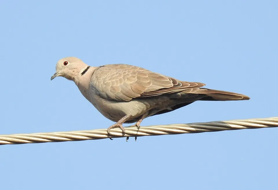 Eurasian Collared Dove
Photos: Common lionfish © and (C)2007 Derek Ramsey (Ram-Man) · CC BY-SA 2.5; Rock Dove © william_stephens · CC BY 4.0; Eurasian Collared Dove © Dr. Raju Kasambe · CC BY-SA 4.0
Sources: Global Forest Change (Hansen et al., University of Maryland, via Global Forest Watch, CC-BY 4.0); EFFIS, European Commission / Copernicus; NASA Black Marble 2016 (public domain); CORINE Land Cover 2018 (Copernicus) or MODIS.
Invasive alien species: Global Register of Introduced and Invasive Species (ISSG, CC BY 4.0); Union list, Regulation (EU) 1143/2014 (INBO, CC0); GBIF.org records (CC0 / CC BY 4.0), at least 2 per species.
Practical information
Cities and airport
- Chetumal
52 km as the crow flies - Belize
84 km as the crow flies - Airport: Chetumal (CTM)
55 km as the crow flies
Data © OpenStreetMap contributors (ODbL) · Wikidata (CC0)
Access and visiting
Nearest towns of over 50,000 people, as the crow flies: Chetumal (52 km) and Belize (84 km). Nearest airport: Chetumal (CTM), about 55 km away. Fewer than 5,000 people live within 20 km of the site boundary, a very sparsely populated area; the site itself is virtually uninhabited (GHSL estimate, 2020). To plan a visit (access, opening periods, visitor rules), it is best to consult the official information from the managing body (National Commission of Protected Natural Areas) and the official website listed in this page's sources.
Source: OpenStreetMap (ODbL), Wikidata (CC0), November 2026.
When to visit
Best time to visit: the dry season, from February to April, with less than 40 mm of rain per month. Precipitation peaks in June and from August to November (up to 250 mm per month). Day length ranges from about 11 h 02 min in December to 13 h 13 min in June. Wildlife records published on GBIF peak for birds (November) and plants (June). These peaks also reflect when observers are most active.
Source: Copernicus ERA5-Land (C3S), monthly averages 1996–2025 at the representative point, temperatures adjusted for elevation.
Contains modified Copernicus Climate Change Service information 2026. Neither the European Commission nor ECMWF is responsible for any use that may be made of the Copernicus information or data it contains.
Wildlife records calendar
JFMAMJJASOND
Birds
Plants
Monthly records published on GBIF (CC-BY), relative to the busiest month; also reflects observer activity.
Gallery
© laxoch · CC BY 4.0
© Juan Ortega · CC BY 3.0
© Jan Ebr & Ivana Ebrová · CC BY 4.0
© Xochitl Castaño · CC BY 4.0
© Xochitl Castaño · CC BY 4.0
© Jan Ebr & Ivana Ebrová · CC BY 4.0
Sources and licences
- Wikidata: Q64513854
- OpenStreetMap: relation 16376044
- WDPA: 306776
References
- cds.climate.copernicus.eu: climate · CC-BY-4.0
- registry.opendata.aws: elevation of the reference point, detailed relief · PD
- lpdaac.usgs.gov: land cover · PD
- doi.org: population around the site · CC-BY-4.0
- naturalearthdata.com: sea share · PD
- wikidata.org: official area, establishment date, protected heritage, managing body, nearby cities and airport, access and peaks, lake depths, places to see · CC0-1.0
- gbif.org: coral records, seasonality of sightings, invasive alien species, observed species · CC-BY-4.0
- en.eurovelo.com: EuroVelo cycle routes · ODbL-1.0
- cycling.waymarkedtrails.org: cycle routes · ODbL-1.0
- gebco.net: depths · PD
- opentopodata.org: elevations · PD
- globalforestwatch.org: tree cover loss · CC-BY-4.0
- openstreetmap.org: official name, access and peaks · ODbL-1.0
- earthobservatory.nasa.gov: night light · PD
- nsidc.org: snow cover · PD
Data © OpenStreetMap contributors (ODbL), Wikidata (CC0) and the sources cited.