Slovenia · Terrestrial
Boč-Donačka gora Landscape Park
Nature park of 2,148 hectares in Slovenia.
Overview
Nature park of 2,148 hectares in Slovenia.
Boč-Donačka gora Landscape Park is a nature park in Slovenia (Europe). It is a predominantly terrestrial area. It covers about 2,148 hectares.
Protections and designations
Natura 2000 · habitats (SAC)
- Boč - Haloze - Donačka gora SI3000118
Protected as a nature park. International labels and designations: Natura 2000 network (1 site: “Boč - Haloze - Donačka gora”).
In our collections
Frequently asked questions
Where is Boč-Donačka gora Landscape Park?
In Slovenia (Europe). Representative point: 46.2875° N, 15.6321° E.
How large is Boč-Donačka gora Landscape Park?
About 2,148 hectares (21 km²). It is the 5th largest of the 8 nature parks in Slovenia covered by Parkavela.
What habitats and landscapes does Boč-Donačka gora Landscape Park include?
A terrestrial area, with forests and mountains.
What is the highest point of Boč-Donačka gora Landscape Park?
Boč, at 978 m (OpenStreetMap).
What are the main summits of Boč-Donačka gora Landscape Park?
Boč (978 m), Plešivec (820 m), Hrastovec (791 m), Dreveniška gora (782 m) and Tolsti vrh (Stavski vrh) (777 m) (OpenStreetMap).
Which international labels apply to Boč-Donačka gora Landscape Park?
Natura 2000 network (1 site: “Boč - Haloze - Donačka gora”).
What is there to see in Boč-Donačka gora Landscape Park?
Cave Belojača (Wikidata).
Where can I stay in Boč-Donačka gora Landscape Park?
2 mountain huts, including Planinski dom na Boču (698 m) and Planinska koča Velikonočnica (550 m) (Wikidata).
Are there historic monuments in Boč-Donačka gora Landscape Park?
Yes. According to Wikidata, 21 monuments listed in the Slovenian register of cultural heritage stand within the boundary. For example: “Cerkev sv. Ane” in Občina Makole, “Grad Studenice” in Občina Poljčane and “Domačija Pajek” in Občina Poljčane.
What is the nearest large city to Boč-Donačka gora Landscape Park?
Nearest towns of over 50,000 people, as the crow flies: Maribor (27 km) and Zagreb (56 km). Nearest airport: Ljubljana Jože Pučnik (LJU), about 86 km away.
How can I reach Boč-Donačka gora Landscape Park by train?
The nearest railway station is Poljčane, about 2 km from the site boundary.
Are there waymarked hiking trails in Boč-Donačka gora Landscape Park?
Yes. Waymarked hiking routes listed in OpenStreetMap: 21, including Jakobova pot, Štajersko-zagorska krožna pot, Dom na Boču and Cerovec. The “Štajersko-zagorska krožna pot” route runs for about 9 km through the site, with some 370 m of ascent on its longest section.
Which species can be seen in Boč-Donačka gora Landscape Park?
Among the species most often recorded on GBIF are Cryphonectria parasitica (Chestnut blight), Hymenoscyphus fraxineus (Ash Dieback), Impatiens parviflora (Small balsam) and Cardamine waldsteinii.
© OpenStreetMap
Download the boundary: GeoJSON · GPX Boundary © OpenStreetMap contributors (ODbL).
Area
- Area
- 2,148 ha
- Median elevation
- 529 m
- Mean slope
- 18°
- Coordinates
- 46.2875, 15.6321
Terrain: Mapzen Terrain Tiles (SRTM, USGS)
Main summits
- Boč978 m
- Plešivec820 m
- Hrastovec791 m
- Dreveniška gora782 m
- Tolsti vrh (Stavski vrh)777 m
- Kisovec734 m
- Galke684 m
- Velika Kopa662 m
- Dedni vrh (Šuštarica)653 m
- Golnik623 m
Data © OpenStreetMap contributors (ODbL)
Snow cover measured by satellite
J
F
M
A
M
J
J
A
S
O
N
D
average share of the site under snow · snowiest parts · ≈ 25 days a year
Snow cover: MODIS/Terra MOD10CM v61 (Hall & Riggs, 2021, NASA NSIDC DAAC, doi:10.5067/MODIS/MOD10CM.061), imagery from NASA GIBS (ESDIS); 2015–2025 average, grid of about 5 km.
Natural habitats
According to CORINE Land Cover (2018), the site is mainly made up of forests (79%) and farmland (19%). Woodland is mostly broadleaved. Elevation ranges from about 280 m to 978 m (highest point: Boč). The terrain is steep: 63% of slopes exceed 15° (mean slope 18°). The Natura 2000 site overlapping the area lists 7 habitats of European interest (1 priority), the most extensive being Luzulo-Fagetum beech forests, Illyrian Fagus sylvatica forests (Aremonio-Fagion) and semi-natural dry grasslands and scrubland facies on calcareous substrates (Festuco-Brometalia) (* important orchid sites).
Biodiversity
Based on occurrences aggregated by GBIF, several species are regularly recorded within the site. Among the most frequent are Cryphonectria parasitica (Chestnut blight), Hymenoscyphus fraxineus (Ash Dieback), Impatiens parviflora (Small balsam) and Cardamine waldsteinii. The full list of documented taxa is shown below. The overlapping Natura 2000 site lists 15 species of European interest: 5 mammals, 1 amphibian, 8 invertebrates and 1 plant.
Habitats of European interest
From the official form of the Natura 2000 site overlapping the area (areas reported for the whole site).
- Luzulo-Fagetum beech forests 2,580 ha
- Illyrian Fagus sylvatica forests (Aremonio-Fagion) 2,379 ha
- Semi-natural dry grasslands and scrubland facies on calcareous substrates (Festuco-Brometalia) (* important orchid sites) 937 ha
- Tilio-Acerion forests of slopes, screes and ravines priority 853 ha
- Lowland hay meadows (Alopecurus pratensis, Sanguisorba officinalis) 260 ha
- Siliceous rocky slopes with chasmophytic vegetation 37 ha
- Calcareous rocky slopes with chasmophytic vegetation 8 ha
Species of European interest
Mammals · 5
Barbastelle (Barbastella barbastellus), Common bent-wing bat (Miniopterus schreibersii), Bechstein's bat (Myotis bechsteinii), Greater Horseshoe Bat (Rhinolophus ferrumequinum), Lesser horseshoe bat (Rhinolophus hipposideros)
Amphibians · 1
Invertebrates · 8
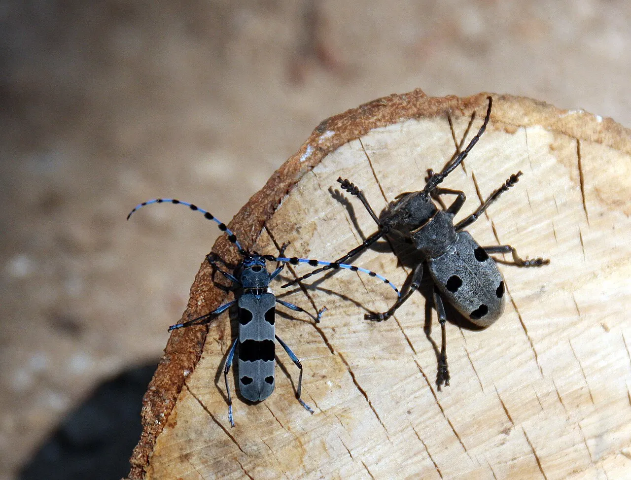
Stone crayfish (Austropotamobius torrentium), Carabus variolosus, Cucujus cinnaberinus, Jersey Tiger (Euplagia quadripunctaria), Stag beetle (Lucanus cervus), Morimus asper funereus, Rhysodes sulcatus, Rosalia longicorn (Rosalia alpina)
Plants · 1
Source: Natura 2000 standard data forms (EEA, CC-BY 4.0). Not exhaustive: sensitive species are not published.
Species to look out for



Observed species
Occurrences documented via GBIF; they are neither an exhaustive inventory nor proof of current presence.
- Chestnut blight · Cryphonectria parasitica · 182
- Ash Dieback · Hymenoscyphus fraxineus · 17
- Small balsam · Impatiens parviflora · 11
- Cardamine waldsteinii · 10
- Great tit · Parus major · 8
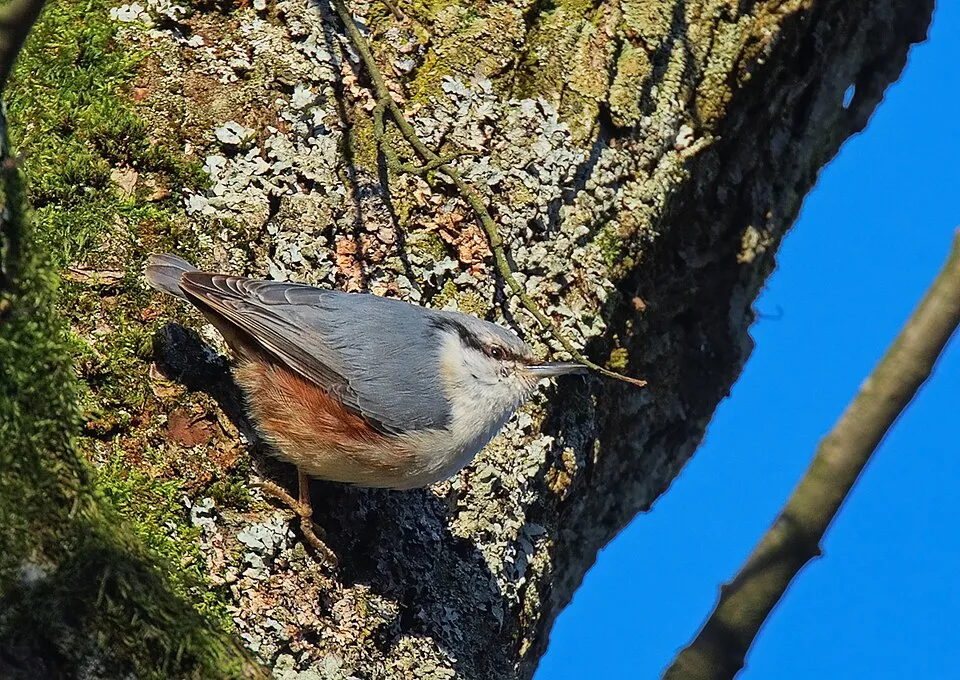
- Eurasian Nuthatch · Sitta europaea · 7
- Eurasian Chaffinch · Fringilla coelebs · 7
- Eastern daisy fleabane · Erigeron annuus · 7
- Annual ragweed · Ambrosia artemisiifolia · 7
- Chestnut Gall Wasp · Dryocosmus kuriphilus · 6
- Coal tit · Periparus ater · 6
- Eurasian blue tit · Cyanistes caeruleus · 6
Records: GBIF.org (CC-BY). Names: Wikidata (CC0), GBIF. Photos: Wikimedia Commons.
Conservation challenges
The primary purpose of the site is to preserve its natural habitats and the biodiversity they support. The species recorded (Biodiversity tab) reflect its ecological value. The designations it holds frame its management and the control of land use.
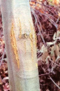
According to Global Forest Change data (University of Maryland, Global Forest Watch), about 42 ha of tree cover were lost within the boundary between 2001 and 2023 (2% of its area), peaking in 2020 and 2023. These losses include logging, storms and fires, and do not account for regrowth. According to CORINE Land Cover, land cover here remained almost unchanged between 1990 and 2018 (less than 0.5% of the area affected). At night, the area gives off virtually no artificial light detectable from space (NASA VIIRS Black Marble composite, 2016). According to the Natura 2000 forms, of 7 assessed habitats of European interest, 1 is in excellent condition and the rest in good condition. Since 2000, 7 invasive alien species have been recorded within the site (GBIF observations). Among them: Cryphonectria parasitica (Chestnut blight), Hymenoscyphus fraxineus (Ash Dieback) and Impatiens parviflora (Small balsam).
Pressure indicators
Tree cover lost
42 ha
2001–2023 · 2% of the area
20012023
Fires since 2016
0
No large fire mapped (fires over about 30 ha)
Light at night
0%
of the area gives off artificial light visible from space
DarkLit
Land cover change
< 0.5%
of the area changed, 1990–2018 · CORINE
Invasive alien species
7
recorded since 2000
Chestnut blight
Ash Dieback
Small balsam
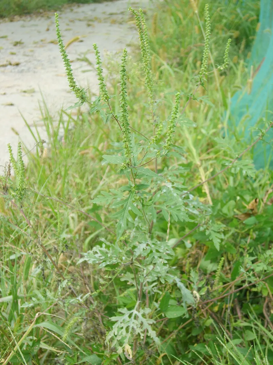 Annual ragweed
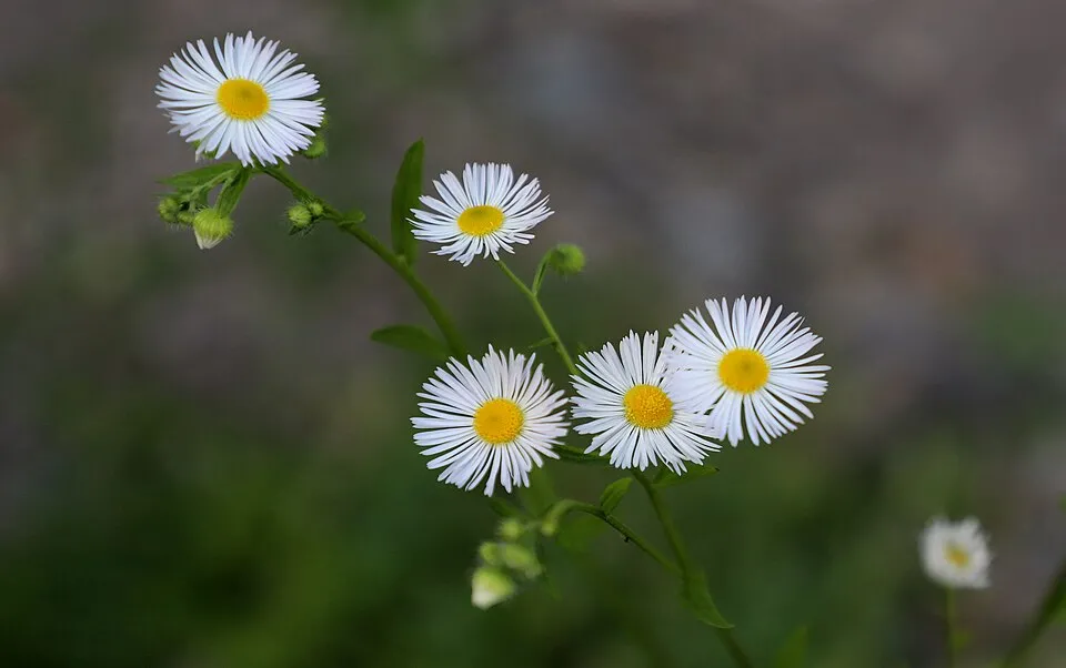 Eastern daisy fleabane
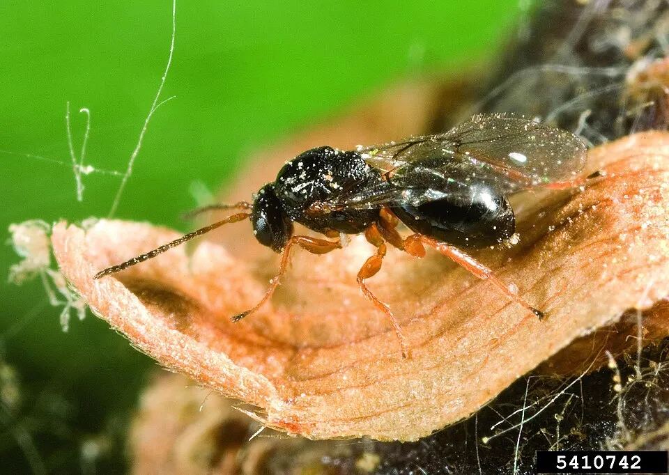 Chestnut Gall Wasp
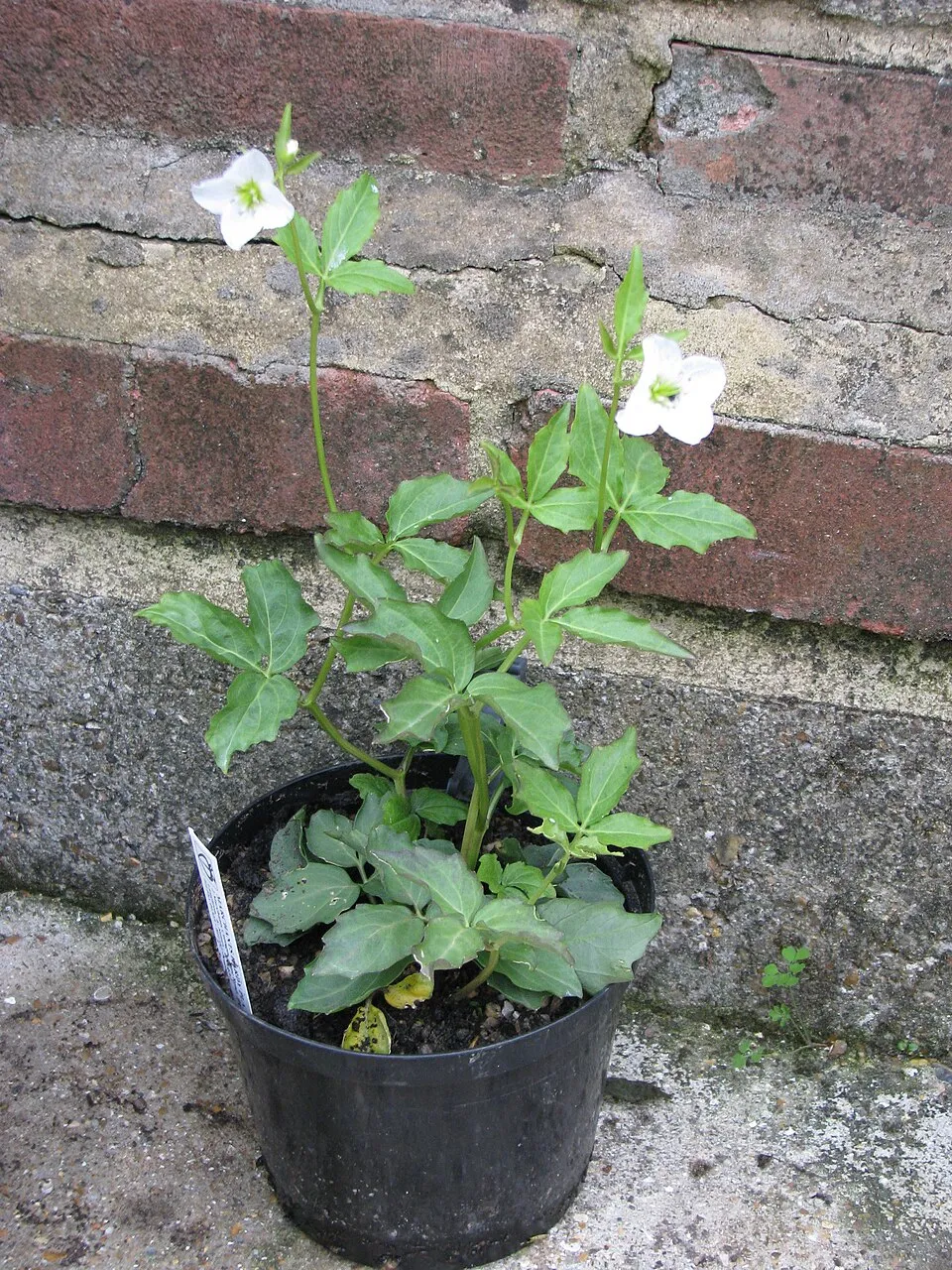
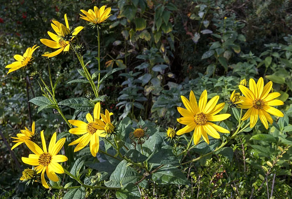 Jerusalem artichoke
Photos: Chestnut blight © Jomegat · Public domain; Small balsam © André Karwath aka Aka · CC BY-SA 2.5; Annual ragweed © Dalgial · CC BY-SA 3.0; Eastern daisy fleabane © W. Bulach · CC BY-SA 4.0; Chestnut Gall Wasp © Gyorgy Csoka, Hungary Forest Research Institute, Bugwood.org · CC BY 3.0; Jerusalem artichoke © JackyM59 · CC BY-SA 4.0
Sources: Global Forest Change (Hansen et al., University of Maryland, via Global Forest Watch, CC-BY 4.0); EFFIS, European Commission / Copernicus; NASA Black Marble 2016 (public domain); CORINE Land Cover 2018 (Copernicus) or MODIS.
CORINE Land Cover Change 1990–2018: generated using European Union's Copernicus Land Monitoring Service information (EEA), aggregated by Parkavela; DOI 10.2909/f30f1000-7cf8-43bb-872c-5eb093911b24.
Invasive alien species: Global Register of Introduced and Invasive Species (ISSG, CC BY 4.0); Union list, Regulation (EU) 1143/2014 (INBO, CC0); GBIF.org records (CC0 / CC BY 4.0), at least 2 per species.
Practical information
Cities and airport
- Maribor
27 km as the crow flies - Zagreb
56 km as the crow flies - Airport: Ljubljana Jože Pučnik (LJU)
86 km as the crow flies
Where to stay
2 mountain huts
- Planinski dom na Boču
mountain hut · 698 m - Planinska koča Velikonočnica
mountain hut · 550 m
Hiking
21 waymarked routes listed, including:
Jakobova potŠtajersko-zagorska krožna potDom na BočuCerovecRogaška SlatinaPot po vinskih goricah na Boč
By bike
Kolesarska Jakobova pot Slovenija · 3 km
Signed cycle routes: this does not mean that cycling is allowed on footpaths.
Data © OpenStreetMap contributors (ODbL) · Wikidata (CC0)
Routes © OpenStreetMap contributors (ODbL), via Waymarked Trails
Waymarked hiking routes
Zg. Kostrivnica - Velikonočnica - Dom na Boču
1.2 km within the site ↗ 69 m↘ 0 m 588–662 m
Tracks © OpenStreetMap contributors (ODbL), clipped to the boundary; elevation gain and profiles computed on the longest section from Mapzen Terrain Tiles (≈ 30 m), indicative only. Indicative difficulty (SAC scale, OpenStreetMap, via Waymarked Trails): check with the park.
Access and visiting
The nearest railway station is Poljčane, about 2 km from the site boundary. Nearest towns of over 50,000 people, as the crow flies: Maribor (27 km) and Zagreb (56 km). Nearest airport: Ljubljana Jože Pučnik (LJU), about 86 km away. About 200,000 people live within 20 km of the site boundary, 56,000 of them within 10 km; some 700 people are estimated to live inside (GHSL estimate, 2020). Waymarked hiking routes listed in OpenStreetMap: 21, including Jakobova pot, Štajersko-zagorska krožna pot, Dom na Boču and Cerovec. A signed cycle route crosses the site: “Kolesarska Jakobova pot Slovenija” (OpenStreetMap). To see: cave Belojača. Where to stay: 2 mountain huts, including Planinski dom na Boču (698 m) and Planinska koča Velikonočnica (550 m). To plan a visit (access, opening periods, visitor rules), it is best to consult the official information from the managing body and the official website listed in this page's sources.
Source: OpenStreetMap (ODbL), Wikidata (CC0), October 2026.
Built heritage
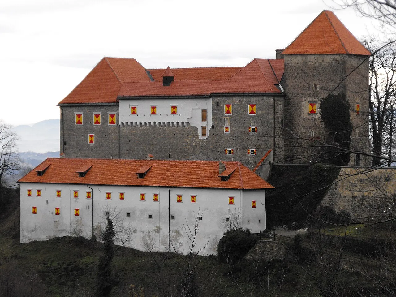
According to Wikidata, 21 monuments listed in the Slovenian register of cultural heritage stand within the boundary. Among them are 8 religious buildings, 4 houses and civic buildings and 2 castles and fortifications. Examples include “Cerkev sv. Ane” in Občina Makole, “Grad Studenice” in Občina Poljčane and “Domačija Pajek” in Občina Poljčane.
8 religious buildings4 houses and civic buildings2 castles and fortifications
-
Cerkev sv. Ane
Občina Makole -
Grad Studenice
Občina Poljčane -
Domačija Pajek
Občina Poljčane -
Spomenik padlim kurirjem na Dednem vrhu
Občina Makole -
Cerkev sv. Marjete
Občina Rogaška Slatina -
Štatenberg Castle
Občina Makole -
Hiša Studenice 11
Občina Poljčane -
Steber s kipom Matere božje
Občina Poljčane
and 13 more
Source: Wikidata (CC0), monuments in each country’s official heritage protection registers, at national or regional level. Each item links to its Wikidata entry.
When to visit
Snow only makes brief appearances in winter (about 25 days a year on average, MODIS satellites 2015–2025).
Wildlife records calendar
JFMAMJJASOND
Birds
Plants
Monthly records published on GBIF (CC-BY), relative to the busiest month; also reflects observer activity.
Gallery
© Yerpo · CC BY-SA 4.0
© breki74 from Maribor, Slovenia · CC BY-SA 2.0
© Jernej Furman from Slovenia · CC BY 2.0
© Vid Pogacnik · CC BY-SA 4.0
© breki74 from Maribor, Slovenia · CC BY-SA 2.0
© Vid Pogacnik · CC BY-SA 4.0
Sources and licences
- Wikidata: Q12794244
- Wikipedia: de.wikipedia.org/wiki/Boč-Donačka_gora
- WDPA: 178732
References
- land.copernicus.eu: land cover, land cover change, sea share · COPERNICUS
- doi.org: population around the site · CC-BY-4.0
- wikidata.org: official area, protected heritage, nearby cities and airport, access and peaks, lake depths, places to see · CC0-1.0
- eea.europa.eu: bathing water quality, ecological status of waters · CC-BY-4.0
- en.eurovelo.com: EuroVelo cycle routes · ODbL-1.0
- cycling.waymarkedtrails.org: cycle routes · ODbL-1.0
- opentopodata.org: elevations · PD
- forest-fire.emergency.copernicus.eu: wildfires · COPERNICUS
- globalforestwatch.org: tree cover loss · CC-BY-4.0
- gbif.org: seasonality of sightings, invasive alien species, observed species · CC-BY-4.0
- hydrosheds.org: lakes · CC-BY-4.0
- natura2000.eea.europa.eu: Natura 2000 habitats and species · CC-BY-4.0
- openstreetmap.org: official name, access and peaks, trail difficulty · ODbL-1.0
- earthobservatory.nasa.gov: night light · PD
- registry.opendata.aws: detailed relief · PD
- hiking.waymarkedtrails.org: route difficulty · ODbL-1.0
- nsidc.org: snow cover · PD
- wikidata.org: Wikipedia article · CC-BY-SA-4.0
Data © OpenStreetMap contributors (ODbL), Wikidata (CC0) and the sources cited.