Hungary · Terrestrial
Őrség National Park
National park of 44,000 hectares in Hungary, established in 2002.
Overview
National park of 44,000 hectares in Hungary, established in 2002.
Őrség National Park is located in Hungary (Europe). It is a predominantly terrestrial area. Established in 2002, it covers about 44,000 hectares.
Protections and designations
Natura 2000 · habitats (SAC)
- Őrség HUON20018
Natura 2000 · birds (SPA)
- Őrség HUON10001
Protected as a national park. International labels and designations: Natura 2000 network (2 sites). Key dates: established in 2002, first Natura 2000 site under the Birds Directive in 2004 and first Natura 2000 site under the Habitats Directive in 2010.
In our collections
Timeline
-
2002
Established
-
2004
First Natura 2000 site under the Birds Directive
-
2010
First Natura 2000 site under the Habitats Directive
Sources: Wikidata (CC0) for establishment and international labels; EEA Natura 2000 database (CC-BY 4.0) for site designation dates.
Frequently asked questions
Where is Őrség National Park?
In Hungary (Europe). Representative point: 46.8389° N, 16.4211° E.
How large is Őrség National Park?
About 44,000 hectares (440 km²). It is the 5th largest of the 8 national parks in Hungary covered by Parkavela.
When was Őrség National Park established?
In 2002.
What habitats and landscapes does Őrség National Park include?
A terrestrial area, with forests.
What rocks lie beneath Őrség National Park?
According to the European 1:1 million geological map (EGDI), recent unconsolidated deposits – clays and silts (44% of sampled points) and glacial deposits (31%) – cover most of the site; among the consolidated rocks: mudstones (25%). These are mostly sedimentary rocks. The geological units date mainly from the Quaternary (75% of sampled points).
What are the main summits of Őrség National Park?
Dreiländerecke / Hármashatárkő / Tromejnik (387 m), Ezüst-hegy (379 m), Katalin-hegy (367 m), János-hegy (354 m) and Nagy-sári-hegy (288 m) (OpenStreetMap).
Which international labels apply to Őrség National Park?
Natura 2000 network (2 sites).
When is the best time to visit Őrség National Park?
Mildest period: from June to August, with average temperatures of 20 to 22 °C.
What is there to see in Őrség National Park?
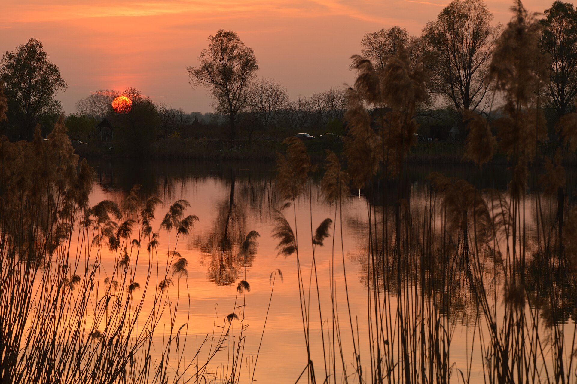
2 lakes and ponds, including Hársas-tó and Vadása-tó (Wikidata).
Can you swim in Őrség National Park?
3 monitored bathing sites lie in or within 1 km of the site; official 2025 classification: 1 excellent and 2 good (European Environment Agency). Swimming is only permitted at the sites and times authorised locally.
What is the nearest large city to Őrség National Park?
Nearest towns of over 50,000 people, as the crow flies: Zalaegerszeg (20 km) and Szombathely (28 km). Nearest airport: Graz (GRZ), about 53 km away.
How can I reach Őrség National Park by train?
Őriszentpéter railway station lies within the site.
Where can I get visitor information on site?
Tourinform, Malom látogatóközpont and Ökoturisztikai Információs Centrum.
Are there waymarked hiking trails in Őrség National Park?
Yes. Waymarked hiking routes listed in OpenStreetMap: 66, including E 7, Szent Jakab út Via Pannonia, Mária út, and PM, Mária-út. The “RPDDK · Rockenbauer Pál Dél-dunántúli Kéktúra” route runs for about 42 km through the site, with some 360 m of ascent on its longest section.
Which species can be seen in Őrség National Park?
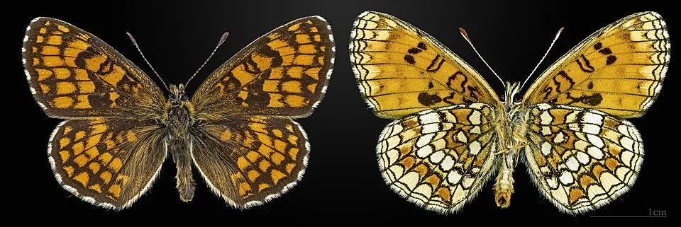
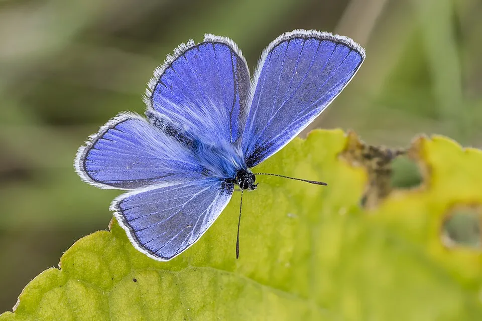
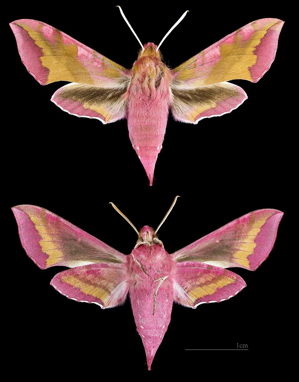
Among the species most often recorded on GBIF are Melitaea athalia (Heath Fritillary), Polyommatus icarus (Common blue), Deilephila porcellus (Small elephant hawk-moth) and Miltochrista miniata (Rosy footman).
What is the official website of Őrség National Park?
© OpenStreetMap
Download the boundary: GeoJSON · GPX Boundary © OpenStreetMap contributors (ODbL).
Geography
The representative point of the site lies at around 225 m above sea level. Over the 1996–2025 period, the mean annual temperature is about 11.4 °C and total precipitation reaches roughly 796 mm per year. The warmest month is usually July, the coolest January, and the wettest May. According to the European 1:1 million geological map (EGDI), recent unconsolidated deposits – clays and silts (44% of sampled points) and glacial deposits (31%) – cover most of the site; among the consolidated rocks: mudstones (25%). These are mostly sedimentary rocks. The geological units date mainly from the Quaternary (75% of sampled points).
Area
- Area
- 44,000 ha
- Elevation
- 225 m
- Median elevation
- 259 m
- Coordinates
- 46.8389, 16.4211
Terrain: Mapzen Terrain Tiles (SRTM, USGS)
Bedrock
- Clays and silts 44 %
- Glacial deposits 31 %
- Mudstones 25 %
Sedimentary rocks 100 % · Main age: Quaternary (75%)
Source: EGDI 1:1M geological map (EuroGeoSurveys and national geological surveys), CC BY 4.0 · 16 sampled points within the site.
Main summits
- Dreiländerecke / Hármashatárkő / Tromejnik387 m
- Ezüst-hegy379 m
- Katalin-hegy367 m
- János-hegy354 m
- Nagy-sári-hegy288 m
- Nagysári-hegy286 m
- Bucsa-hegy276 m
- Máli-hegy264 m
- Öreg hegy258 m
- Balla-hegy253 m
Data © OpenStreetMap contributors (ODbL)
Climate
● Mean temperature (°C) · ▮ Precipitation (mm)
Source: Copernicus ERA5-Land (C3S, doi:10.24381/cds.68d2bb30), monthly averages 1996–2025 interpolated to the representative point, temperatures adjusted for elevation.
Contains modified Copernicus Climate Change Service information 2026. Neither the European Commission nor ECMWF is responsible for any use that may be made of the Copernicus information or data it contains.
Snow cover measured by satellite
J
F
M
A
M
J
J
A
S
O
N
D
average share of the site under snow · snowiest parts · ≈ 15 days a year
Snow cover: MODIS/Terra MOD10CM v61 (Hall & Riggs, 2021, NASA NSIDC DAAC, doi:10.5067/MODIS/MOD10CM.061), imagery from NASA GIBS (ESDIS); 2015–2025 average, grid of about 5 km.
Natural habitats
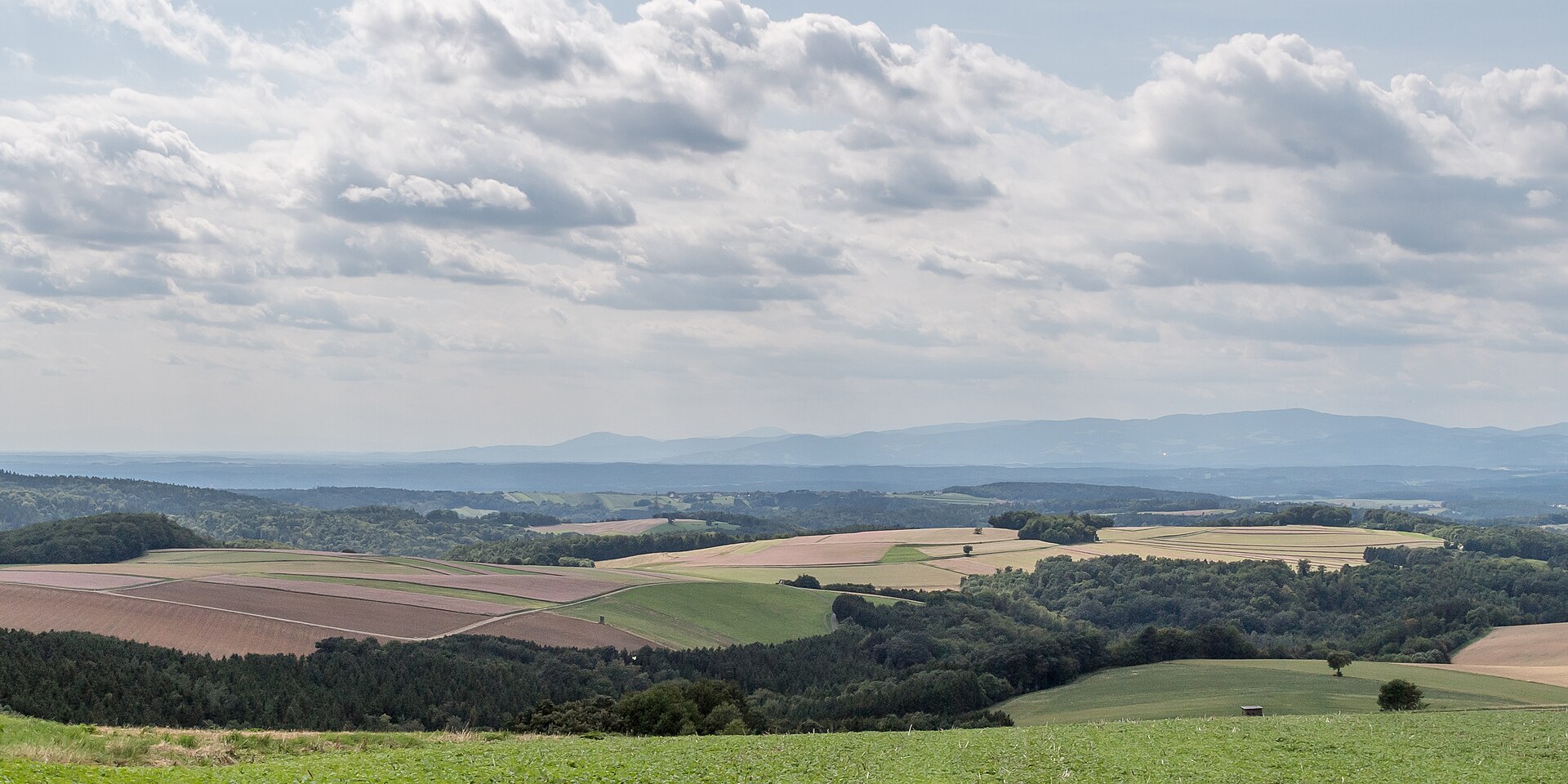
According to CORINE Land Cover (2018), the site is mainly made up of forests (63%) and farmland (29%). Woodland mixes broadleaved and coniferous trees. Elevation ranges from about 190 to 350 m (sampled elevations, SRTM). The 2 Natura 2000 sites overlapping the area list 18 habitats of European interest (2 priority), the most extensive being Pannonic woods with Quercus petraea and Carpinus betulus, Asperulo-Fagetum beech forests and alluvial forests with Alnus glutinosa and Fraxinus excelsior (Alno-Padion, Alnion incanae, Salicion albae).
Biodiversity
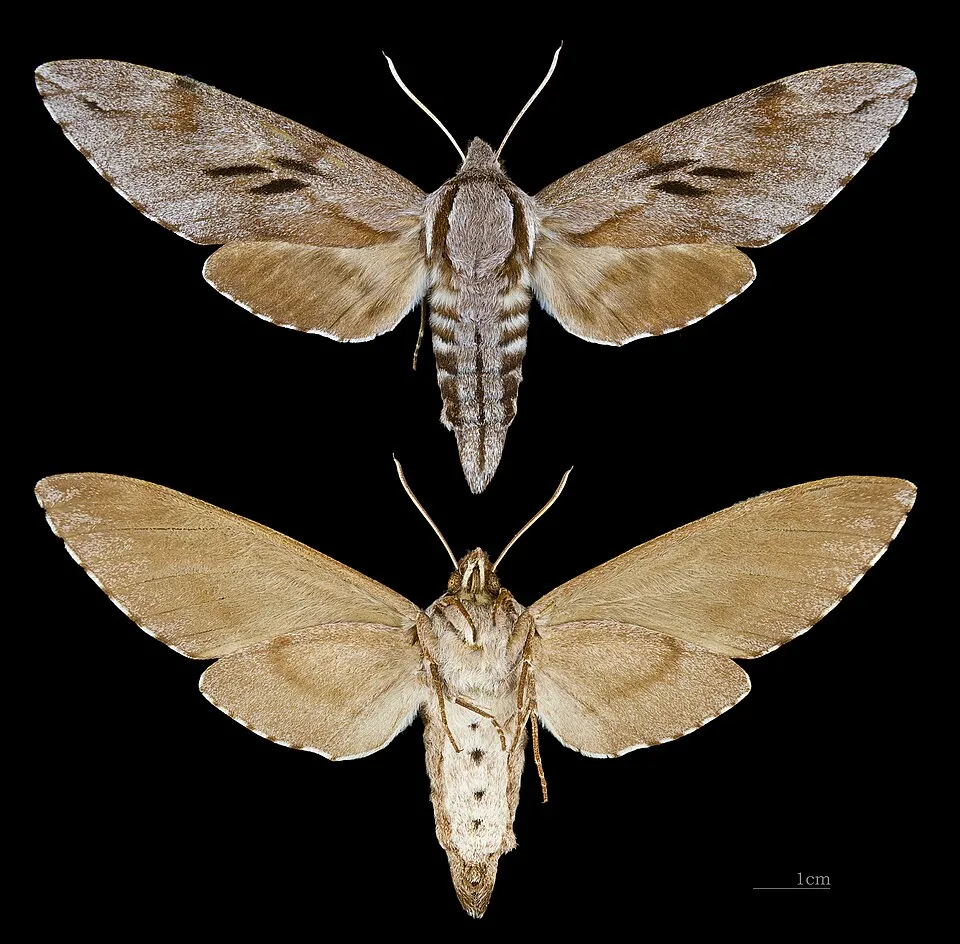
Based on occurrences aggregated by GBIF, several species are regularly recorded within the site. Among the most frequent are Melitaea athalia (Heath Fritillary), Polyommatus icarus (Common blue), Deilephila porcellus (Small elephant hawk-moth) and Miltochrista miniata (Rosy footman). The full list of documented taxa is shown below. The overlapping Natura 2000 sites list 59 species of European interest: 24 birds, 5 mammals, 1 reptile, 3 amphibians, 10 fish, 15 invertebrates and 1 plant.
Habitats of European interest
From the official forms of the 2 Natura 2000 sites overlapping the area (areas reported for each whole site).
- Pannonic woods with Quercus petraea and Carpinus betulus priority 5,352 ha
- Asperulo-Fagetum beech forests 5,019 ha
- Alluvial forests with Alnus glutinosa and Fraxinus excelsior (Alno-Padion, Alnion incanae, Salicion albae) priority 1,042 ha
- Mountain hay meadows 524 ha
- Lowland hay meadows (Alopecurus pratensis, Sanguisorba officinalis) 486 ha
- Molinia meadows on calcareous, peaty or clayey-silt-laden soils (Molinion caeruleae) 180 ha
- Alluvial meadows of river valleys of the Cnidion dubii 176 ha
- Pannonian-Balkanic turkey oak-sessile oak forests 44 ha
and 10 more
Species of European interest
Birds · 24
Common Sandpiper (Actitis hypoleucos) breeding, Common Kingfisher (Alcedo atthis) resident, European Nightjar (Caprimulgus europaeus) breeding, White stork (Ciconia ciconia) passage breeding, Black Stork (Ciconia nigra) breeding, Stock Dove (Columba oenas) breeding, Corn Crake (Crex crex) breeding, Syrian Woodpecker (Dendrocopos syriacus) resident, Black Woodpecker (Dryocopus martius) resident, Collared Flycatcher (Ficedula albicollis) breeding, White-tailed Eagle (Haliaeetus albicilla) resident, Little Bittern (Ixobrychus minutus) breeding and 12 more
Mammals · 5
Barbastelle (Barbastella barbastellus), Eurasian Beaver (Castor fiber), Eurasian otter (Lutra lutra), Bechstein's bat (Myotis bechsteinii), Greater mouse-eared bat (Myotis myotis)
Reptiles · 1
European Pond Turtle (Emys orbicularis)
Amphibians · 3
European fire-bellied toad (Bombina bombina), Yellow-bellied toad (Bombina variegata), Italian crested newt (Triturus carnifex)
Fish · 10
Asp (Aspius aspius), Eudontomyzon spp., White-finned gudgeon (Gobio albipinnatus), Striped Ruffe (Gymnocephalus schraetzer), Weatherfish (Misgurnus fossilis), Rhodeus sericeus amarus, Kessler's Gudgeon (Romanogobio kesslerii), Golden Spined Loach (Sabanejewia aurata), Streber (Zingel streber), Zingel (Zingel zingel)
Invertebrates · 15
Greater Capricorn Beetle (Cerambyx cerdo), Danube Clouded Yellow (Colias myrmidone), Balkan goldenring (Cordulegaster heros), Cucujus cinnaberinus, Eastern Eggar (Eriogaster catax), Marsh fritillary (Euphydryas aurinia), Scarce Fritillary (Euphydryas maturna), Jersey Tiger (Euplagia quadripunctaria), Yellow-spotted Whiteface (Leucorrhinia pectoralis), Stag beetle (Lucanus cervus), Large copper (Lycaena dispar), Dusky Large Blue (Maculinea nausithous) and 3 more
Plants · 1
Eleocharis carniolica
Source: Natura 2000 standard data forms (EEA, CC-BY 4.0). Not exhaustive: sensitive species are not published.
Species to look out for


Observed species
Occurrences documented via GBIF; they are neither an exhaustive inventory nor proof of current presence.
- Heath Fritillary · Melitaea athalia · 127
- Common blue · Polyommatus icarus · 100
- Small elephant hawk-moth · Deilephila porcellus · 81
- Rosy footman · Miltochrista miniata · 78
- Ruby tiger · Phragmatobia fuliginosa · 77
- Latticed Heath · Chiasmia clathrata · 73
- Pine hawk-moth · Sphinx pinastri · 72
- White ermine · Spilosoma lubricipeda · 68
- Common Heath · Ematurga atomaria · 67
- Clouded Border · Lomaspilis marginata · 67
- Double line · Mythimna turca · 66
- Green silver-lines · Pseudoips prasinana · 65
+18 more species
- Yellow-tail · Sphrageidus similis · 65
- Pebble hook-tip · Drepana falcataria · 64
- Small pearl-bordered fritillary · Boloria selene · 62
- Heart and Dart · Agrotis exclamationis · 61
- Japanese Oak Silkmoth · Antheraea yamamai · 61
- Elkalyce argiades · 60
- Pale oak beauty · Hypomecis punctinalis · 59
- Marbled Sedge · Hydropsyche contubernalis · 59
- Peach blossom · Thyatira batis · 59
- Lime hawk-moth · Mimas tiliae · 57
- Beautiful hook-tip · Laspeyria flexula · 56
- Loweia tityrus · 56
- Citrus Looper · Ascotis selenaria · 56
- Yellow shell · Camptogramma bilineata · 56
- Mazarine Blue · Cyaniris semiargus · 56
- Lithax obscurus · 55
- Spotted fritillary · Melitaea didyma · 55
- Engrailed · Ectropis crepuscularia · 54
Records: GBIF.org (CC-BY). Names: Wikidata (CC0), GBIF. Photos: Wikimedia Commons.
Conservation challenges
The primary purpose of the site is to preserve its natural habitats and the biodiversity they support. The species recorded (Biodiversity tab) reflect its ecological value. The designations it holds frame its management and the control of land use.
According to Global Forest Change data (University of Maryland, Global Forest Watch), about 2,970 ha of tree cover were lost within the boundary between 2001 and 2023 (7% of its area). These losses include logging, storms and fires, and do not account for regrowth. According to the European CORINE Land Cover inventory (Copernicus), land cover changed on about 489 ha of the site between 1990 and 2018 (1% of its area): farmland shrank by 450 ha, mostly giving way to forest, while forest grew by 335 ha, mostly at the expense of farmland. Forest felling and regrowth add about 3,630 ha in total over the period. At night, the area gives off virtually no artificial light detectable from space (NASA VIIRS Black Marble composite, 2016). Built-up and developed land (buildings, business areas, roads, quarries) covers 2% of the area, and farmland 29% (CORINE Land Cover). According to the Natura 2000 forms, of 16 assessed habitats of European interest, 4 are in excellent condition and 5 in average or reduced condition. According to the Water Framework Directive assessment (2022 river basin management plans, data 2013–2019), only 20% of the 102 km of rivers assessed within the site are in good or high ecological status; the others mostly have moderate ecological status. Since 2000, 5 invasive alien species have been recorded within the site (GBIF observations), one of them listed as of Union concern under EU Regulation 1143/2014. Among them: Impatiens glandulifera (Himalayan Balsam), Harmonia axyridis (Asian Lady Beetle) and Cydalima perspectalis (Box Tree Moth).
Pressure indicators
Tree cover lost
2,969 ha
2001–2023 · 7% of the area
20012023
Fires since 2016
0
No large fire mapped (fires over about 30 ha)
Light at night
< 1%
of the area gives off artificial light visible from space
DarkLit
Built-up land
2%
buildings, business areas, roads, quarries · farmland 29%
Land cover change
489 ha
changed cover, 1990–2018 · CORINE · 1% of the area
- −450 ha · farmland
- +335 ha · forest
forest felling and regrowth: 3,630 ha in total
Rivers and lakes
20%
of the 102 km of assessed rivers in good or high ecological status · WFD 2022
assessments 2013–2019
Invasive alien species
5
incl. 1 of EU concern · since 2000
 Himalayan Balsam
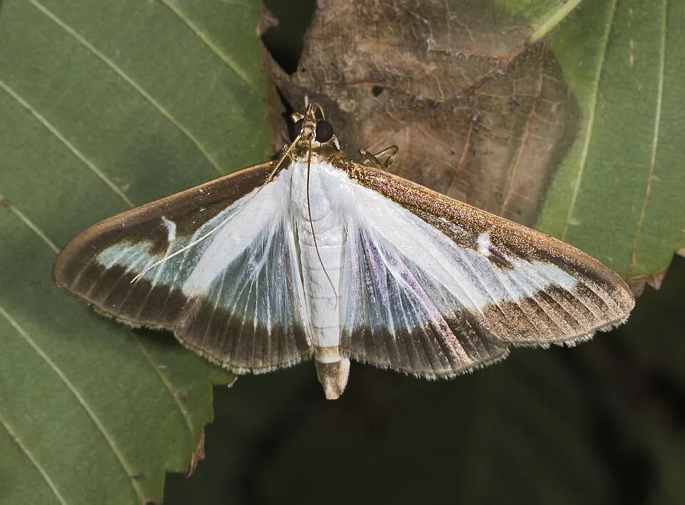 Box Tree Moth
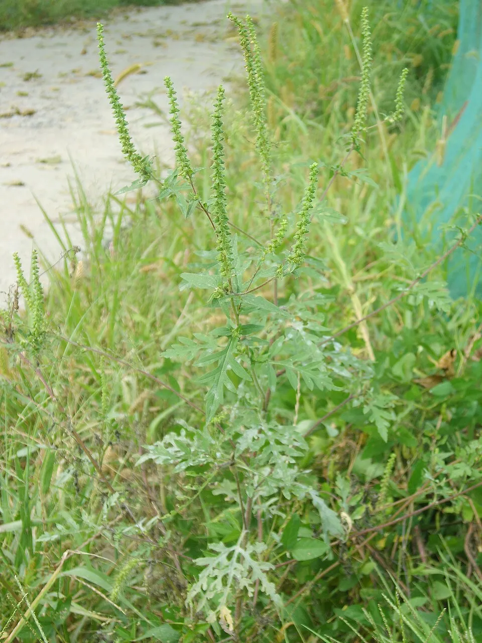 Annual ragweed
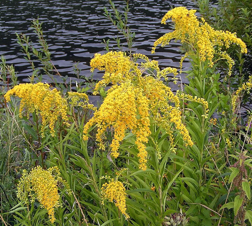 Giant goldenrod
Photos: Himalayan Balsam © Guptaele · CC BY-SA 4.0; Box Tree Moth © Didier Descouens · CC BY-SA 3.0; Annual ragweed © Dalgial · CC BY-SA 3.0; Giant goldenrod © Pethan · CC BY-SA 3.0
Sources: Global Forest Change (Hansen et al., University of Maryland, via Global Forest Watch, CC-BY 4.0); EFFIS, European Commission / Copernicus; NASA Black Marble 2016 (public domain); CORINE Land Cover 2018 (Copernicus) or MODIS.
CORINE Land Cover Change 1990–2018: generated using European Union's Copernicus Land Monitoring Service information (EEA), aggregated by Parkavela; DOI 10.2909/f30f1000-7cf8-43bb-872c-5eb093911b24.
Ecological status of water bodies: European Environment Agency, WISE – Water Framework Directive, 3rd river basin management plans (2022), CC BY 4.0. Official national classification, not comparable between countries.
Invasive alien species: Global Register of Introduced and Invasive Species (ISSG, CC BY 4.0); Union list, Regulation (EU) 1143/2014 (INBO, CC0); GBIF.org records (CC0 / CC BY 4.0), at least 2 per species.
Practical information
Cities and airport
- Zalaegerszeg
20 km as the crow flies - Szombathely
28 km as the crow flies - Airport: Graz (GRZ)
53 km as the crow flies
Visitor information
- Tourinform
within the site - Malom látogatóközpont
within the site - Ökoturisztikai Információs Centrum
within the site - Vízi Vándor Természetvédelmi Látogatóközpont
within the site
Parking
40 public car parks listed within the site
Hársas-tó
Hiking
66 waymarked routes listed, including:
E 7Szent Jakab út Via PannoniaMária út,PM, Mária-út,Rockenbauer Pál Dél-dunántúli KéktúraZ Vasfüggöny túraút (Rajka
By bike
EV14 · 44 kmEV13 · 12 km Pannon Pleasure kerékpártúra hálózat · 52 kmŐrség 5 · 50 kmŐrség 4 · 38 kmVadása-tó kerékpártúra · 34 km
Signed cycle routes: this does not mean that cycling is allowed on footpaths.
Data © OpenStreetMap contributors (ODbL) · Wikidata (CC0)
Contains information from EuroVelo GPX tracks downloaded from www.EuroVelo.com on 2026-10-22, which is made available here under the Open Database License (ODbL). EuroVelo® is a registered trademark of the ECF. Routes © OpenStreetMap contributors (ODbL), via Waymarked Trails
Waymarked hiking routes
Szent Jakab út Via Pannonia – fő ág és rövid alternatív szakaszok
9.8 km within the site ↗ 75 m↘ 71 m 201–243 m
E7 European long distance path E7 - part Hungary
1.8 km within the site ↗ 0 m↘ 12 m 246–261 m
PM, Mária-út, M60 (Halogy – Szentgotthárd)
28.4 km within the site ↗ 273 m↘ 327 m 194–309 m
K RPDDK 3/1 (Őriszentpéter – Magyarszombatfa)
4.6 km within the site ↗ 63 m↘ 25 m 225–285 m
RPDDK Rockenbauer Pál Dél-dunántúli Kéktúra
42 km within the site ↗ 357 m↘ 290 m 195–295 m
Z Z Vasfüggöny túraút (Rajka – Felsőszölnök – Gyékényes)
21.8 km within the site ↗ 104 m↘ 116 m 231–290 m
Tracks © OpenStreetMap contributors (ODbL), clipped to the boundary; elevation gain and profiles computed on the longest section from Mapzen Terrain Tiles (≈ 30 m), indicative only.
Bathing
3 monitored bathing sites in or within 1 km of the site · 2025 classification
Excellent · 1
Good · 2
- Hegyhatszentjakab Vadasa Tofurdo · lake · Excellent
- Szentgotthard-Mariaujfalu Harsas-To · lake · Good
- Zalalovo Borostyan Tostrand · lake · Good
Source: European Environment Agency, official bathing water classification (Directive 2006/7/EC, CC-BY 4.0). Swimming is only permitted at the sites and times authorised locally.
Access and visiting
Őriszentpéter railway station lies within the site. Nearest towns of over 50,000 people, as the crow flies: Zalaegerszeg (20 km) and Szombathely (28 km). Nearest airport: Graz (GRZ), about 53 km away. About 220,000 people live within 20 km of the site boundary, 67,000 of them within 10 km; some 9,700 people are estimated to live inside (GHSL estimate, 2020). This population has fallen by about 13% since 2000. Visitor information on site: Tourinform, Malom látogatóközpont and Ökoturisztikai Információs Centrum. Public car parks listed within the site: 40, including Hársas-tó. Waymarked hiking routes listed in OpenStreetMap: 66, including E 7, Szent Jakab út Via Pannonia, Mária út, and PM, Mária-út. The EuroVelo 14 (about 44 km) and EuroVelo 13 (about 12 km) cycle routes cross the site; 11 other signed cycle routes also pass through, including “Pannon Pleasure kerékpártúra hálózat” and “Őrség 5” (EuroVelo, OpenStreetMap). To see: 2 lakes and ponds, including Hársas-tó and Vadása-tó. To plan a visit (access, opening periods, visitor rules), it is best to consult the official information from the managing body and the official website listed in this page's sources.
Source: OpenStreetMap (ODbL), Wikidata (CC0), October 2026.
When to visit
Mildest period: from June to August, with average temperatures of 20 to 22 °C. Snow only makes brief appearances in winter (about 15 days a year on average, MODIS satellites 2015–2025). Day length ranges from about 8 h 33 min in December to 15 h 51 min in June. Wildlife records published on GBIF peak for birds (June), plants (April and May), butterflies and moths (July and August), dragonflies (May) and mammals (June). These peaks also reflect when observers are most active.
Source: Copernicus ERA5-Land (C3S), monthly averages 1996–2025 at the representative point, temperatures adjusted for elevation.
Contains modified Copernicus Climate Change Service information 2026. Neither the European Commission nor ECMWF is responsible for any use that may be made of the Copernicus information or data it contains.
Wildlife records calendar
JFMAMJJASOND
Birds
Plants
Butterflies & moths
Dragonflies
Mammals
Monthly records published on GBIF (CC-BY), relative to the busiest month; also reflects observer activity.
Gallery
© Darinko · CC BY-SA 3.0
© János Korom Dr. from Wien, Austria · CC BY-SA 2.0
© Fizped · CC BY 3.0
© Kalyob · CC BY-SA 3.0
© János Korom Dr. from Wien, Austria · CC BY-SA 2.0
© Bara1711 · CC BY-SA 4.0
Sources and licences
- Wikidata: Q386630
- OpenStreetMap: relation 8545511
- Official website: https://orseginemzetipark.hu/
- Wikipedia: en.wikipedia.org/wiki/Őrség_National_Park
- WDPA: 178327
References
- cds.climate.copernicus.eu: climate · CC-BY-4.0
- registry.opendata.aws: elevation of the reference point, detailed relief · PD
- land.copernicus.eu: land cover, land cover change, sea share · COPERNICUS
- doi.org: population around the site · CC-BY-4.0
- wikidata.org: official area, establishment date, protected heritage, nearby cities and airport, access and peaks, lake depths, places to see, official website · CC0-1.0
- eea.europa.eu: bathing water quality, ecological status of waters · CC-BY-4.0
- en.eurovelo.com: EuroVelo cycle routes · ODbL-1.0
- cycling.waymarkedtrails.org: cycle routes · ODbL-1.0
- opentopodata.org: elevations · PD
- forest-fire.emergency.copernicus.eu: wildfires · COPERNICUS
- globalforestwatch.org: tree cover loss · CC-BY-4.0
- gbif.org: seasonality of sightings, invasive alien species, observed species · CC-BY-4.0
- europe-geology.eu: geology · CC-BY-4.0
- hydrosheds.org: lakes · CC-BY-4.0
- natura2000.eea.europa.eu: Natura 2000 habitats and species · CC-BY-4.0
- openstreetmap.org: official name, access and peaks, trail difficulty · ODbL-1.0
- earthobservatory.nasa.gov: night light · PD
- hiking.waymarkedtrails.org: route difficulty · ODbL-1.0
- nsidc.org: snow cover · PD
- wikidata.org: Wikipedia article · CC-BY-SA-4.0
Data © OpenStreetMap contributors (ODbL), Wikidata (CC0) and the sources cited.