Australia · Terrestrial
Daintree National Park
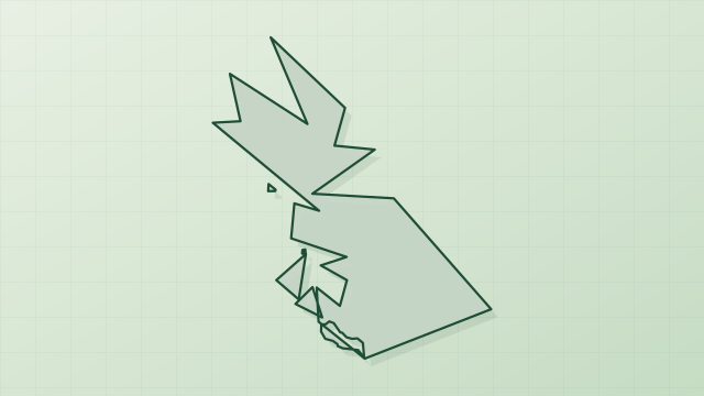
National park of 116,350 hectares in Australia, established in 1988.
Overview
National park of 116,350 hectares in Australia, established in 1988.
Daintree National Park is located in Australia (Oceania). It is a predominantly terrestrial area. Established in 1988, it covers about 116,350 hectares. The site is managed by Queensland Parks and Wildlife Service.
In our collections
Frequently asked questions
Where is Daintree National Park?
In Australia (Oceania). Representative point: 16.3000° S, 145.2000° E.
How large is Daintree National Park?
About 116,350 hectares (1,164 km²). It is the 67th largest of the 678 national parks in Australia covered by Parkavela.
When was Daintree National Park established?
In 1988.
What habitats and landscapes does Daintree National Park include?
A terrestrial area, with forests and mountains.
What is the highest point of Daintree National Park?
Thornton Peak, at 1,374 m (OpenStreetMap).
When is the best time to visit Daintree National Park?
Best time to visit: from May to October, with average temperatures of 15 to 20 °C and moderate rainfall.
What is the nearest large city to Daintree National Park?
Nearest towns of over 50,000 people, as the crow flies: Cairns (67 km). Nearest airport: Cairns (CNS), about 62 km away.
Where can I get visitor information on site?
Kuku Yalanji Information Centre, Mossman Gorge Centre and Crocodile Express Daintree River Cruises.
Which species can be seen in Daintree National Park?
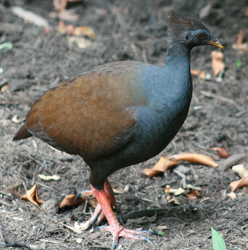
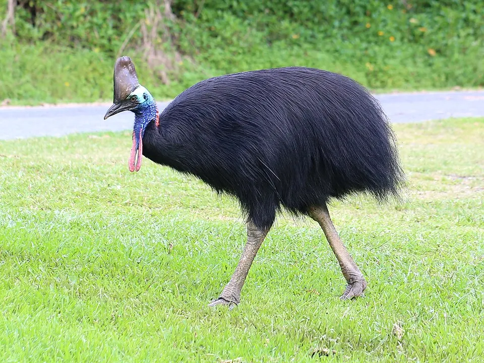
Among the species most often recorded on GBIF are Megapodius reinwardt (Orange-footed Scrubfowl), Meliphaga notata (Yellow-spotted Honeyeater), Symposiachrus trivirgatus (Spectacled Monarch) and Casuarius casuarius (Southern cassowary).
Who manages Daintree National Park?
Queensland Parks and Wildlife Service.
What is the official website of Daintree National Park?
© OpenStreetMap
Download the boundary: GeoJSON · GPX Boundary © OpenStreetMap contributors (ODbL).
Geography
The representative point of the site lies at around 1,067 m above sea level. Over the 1996–2025 period, the mean annual temperature is about 18.7 °C and total precipitation reaches roughly 1,514 mm per year. The warmest month is usually December, the coolest July, and the wettest January.
Area
- Area
- 116,350 ha
- Elevation
- 1,067 m
- Median elevation
- 365 m
- Mean slope
- 13°
- Coordinates
- -16.3, 145.2
Terrain: Mapzen Terrain Tiles (SRTM, USGS)
Elevation bands
- below 500 m 62%
- 500–1,000 m 25%
- 1,000–1,500 m 13%
share of the site in each elevation band (smoothed terrain model: summits are rounded off) · Terrain: Mapzen Terrain Tiles (SRTM, USGS)
Climate
● Mean temperature (°C) · ▮ Precipitation (mm)
Source: Copernicus ERA5-Land (C3S, doi:10.24381/cds.68d2bb30), monthly averages 1996–2025 interpolated to the representative point, temperatures adjusted for elevation.
Contains modified Copernicus Climate Change Service information 2026. Neither the European Commission nor ECMWF is responsible for any use that may be made of the Copernicus information or data it contains.
Natural habitats
According to the global MODIS land cover (NASA, 2024), the site is mainly made up of forests (98%). It is mostly dense evergreen broadleaved forest. Elevation ranges from sea level to 1,374 m (highest point: Thornton Peak). Median elevation is 365 m, and 13% of the site lies above 1,000 m (SRTM elevation model).
Biodiversity
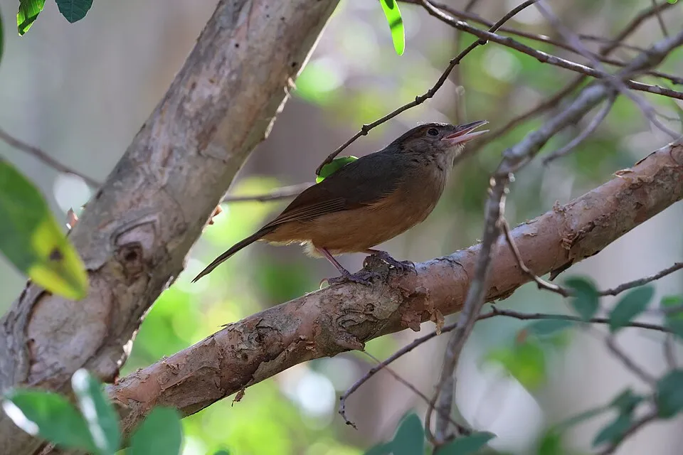
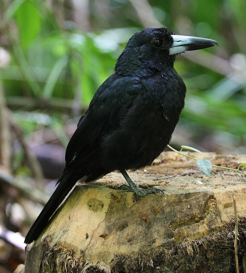
Based on occurrences aggregated by GBIF, several species are regularly recorded within the site. Among the most frequent are Megapodius reinwardt (Orange-footed Scrubfowl), Meliphaga notata (Yellow-spotted Honeyeater), Symposiachrus trivirgatus (Spectacled Monarch) and Casuarius casuarius (Southern cassowary). The full list of documented taxa is shown below.
Species to look out for
Bird
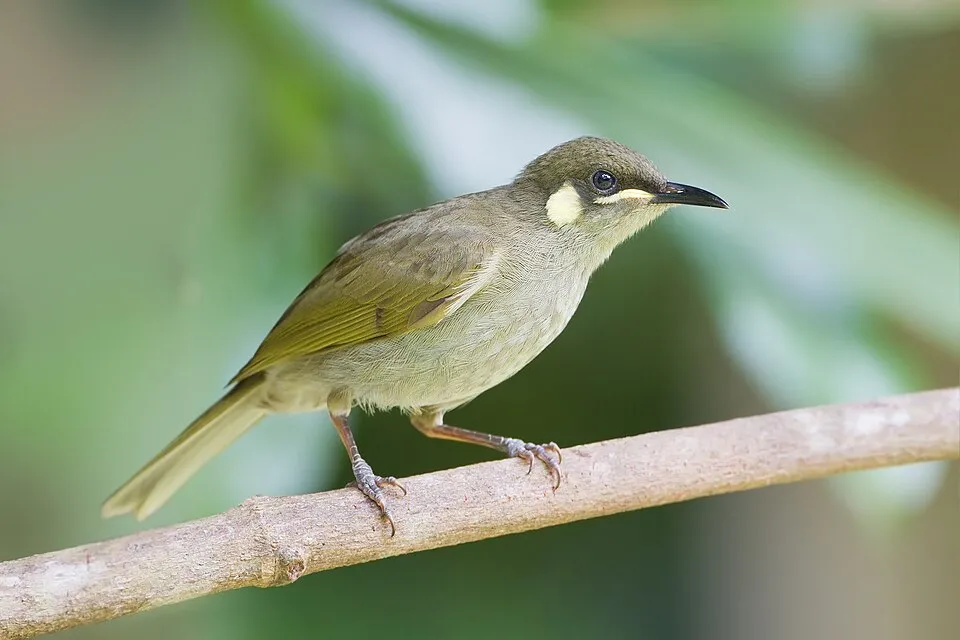
Yellow-spotted Honeyeater
Meliphaga notata1,147 records © JJ Harrison (https://www.jjharrison.com.au/) · CC BY 3.0
Bird
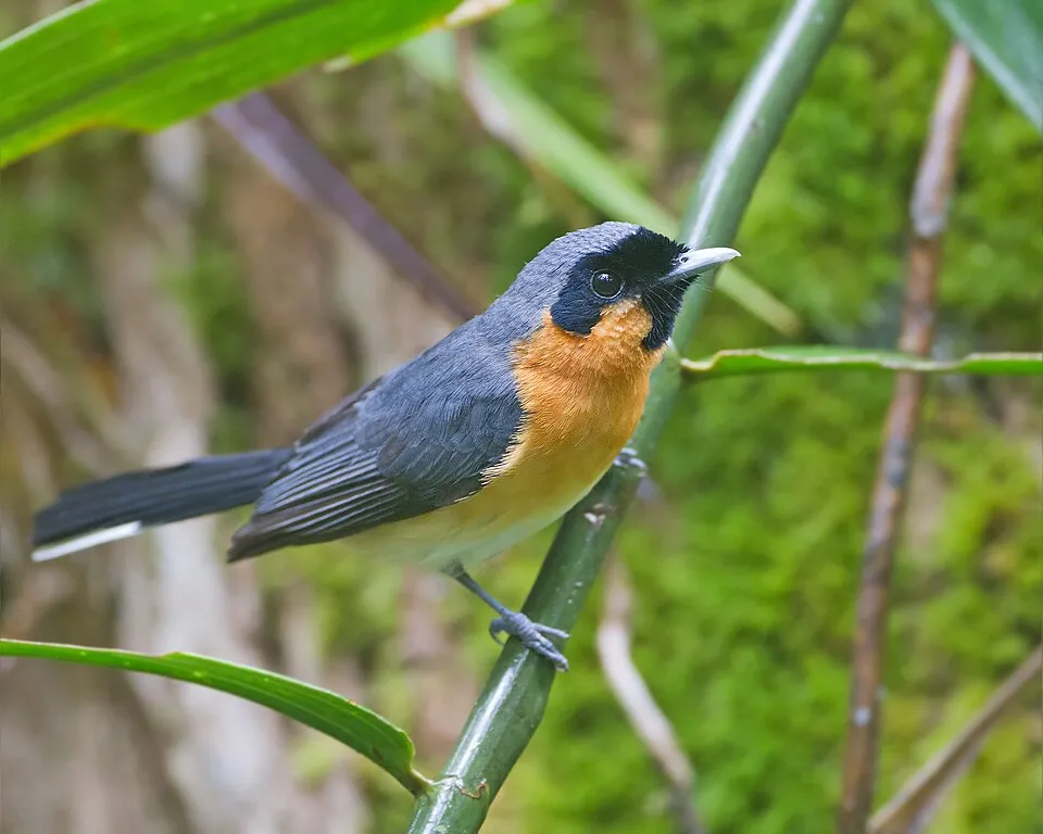
Spectacled Monarch
Symposiachrus trivirgatus1,082 records © JJ Harrison (https://www.jjharrison.com.au/) · CC BY-SA 3.0
Observed species
Occurrences documented via GBIF; they are neither an exhaustive inventory nor proof of current presence.
- Orange-footed Scrubfowl · Megapodius reinwardt · 1709
- Yellow-spotted Honeyeater · Meliphaga notata · 1147
- Spectacled Monarch · Symposiachrus trivirgatus · 1082
- Southern cassowary · Casuarius casuarius · 1001
- Little Shrikethrush · Colluricincla megarhyncha · 936
- Black Butcherbird · Melloria quoyi · 924
- Wompoo Fruit Dove · Ptilinopus magnificus · 891
- Australian Brushturkey · Alectura lathami · 890
- Metallic Starling · Aplonis metallica · 702
- Sulphur-crested Cockatoo · Cacatua galerita · 697
- Temnoplectron reyi · 677
- Varied Triller · Lalage leucomela · 579
+18 more species
- Australasian Figbird · Sphecotheres vieilloti · 526
- Bridled Honeyeater · Bolemoreus frenatus · 517
- Victoria's Riflebird · Ptiloris victoriae · 515
- Shining Flycatcher · Myiagra alecto · 479
- Coptodactyla depressa · 469
- Spangled Drongo · Dicrurus bracteatus · 466
- Australian Swiftlet · Aerodramus terraereginae · 438
- Helmeted Friarbird · Philemon buceroides · 437
- Macleay's Honeyeater · Xanthotis macleayanus · 437
- Torresian Imperial Pigeon · Ducula spilorrhoa · 426
- Spotted Catbird · Ailuroedus maculosus · 416
- Coconut Lorikeet · Trichoglossus haematodus · 410
- Dusky Myzomela · Myzomela obscura · 389
- Rufous Fantail · Rhipidura rufifrons · 380
- Mistletoebird · Dicaeum hirundinaceum · 376
- Bar-shouldered Dove · Geopelia humeralis · 373
- Large-billed scrubwren · Sericornis magnirostra · 361
- Large-billed Gerygone · Gerygone magnirostris · 345
Records: GBIF.org (CC-BY). Names: Wikidata (CC0), GBIF. Photos: Wikimedia Commons.
Conservation challenges
The primary purpose of the site is to preserve its natural habitats and the biodiversity they support. The species recorded (Biodiversity tab) reflect its ecological value. Its status as a national park sets the regulatory framework for its protection.
According to Global Forest Change data (University of Maryland, Global Forest Watch), about 112 ha of tree cover were lost within the boundary between 2001 and 2023, peaking in 2012 and 2014. These losses include logging, storms and fires, and do not account for regrowth. At night, the area gives off virtually no artificial light detectable from space (NASA VIIRS Black Marble composite, 2016). Since 2000, 13 invasive alien species have been recorded within the site (GBIF observations). Among them: Sus scrofa (Wild boar), Acridotheres tristis (Common myna) and Spilopelia chinensis (Spotted Dove).
Pressure indicators
Tree cover lost
112 ha
2001–2023 · < 1% of the area
20012023
Light at night
< 1%
of the area gives off artificial light visible from space
DarkLit
Invasive alien species
13
recorded since 2000
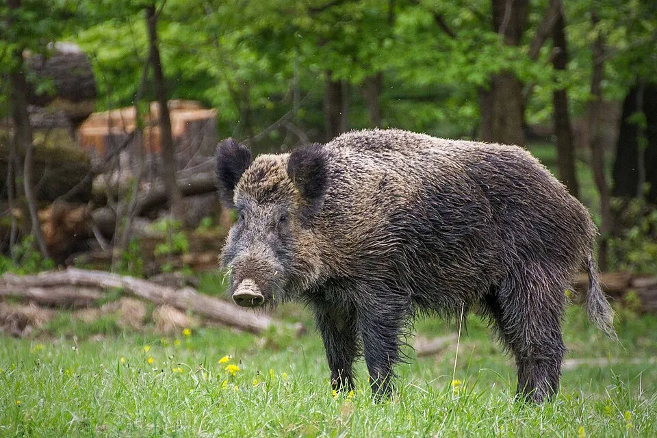 Wild boar
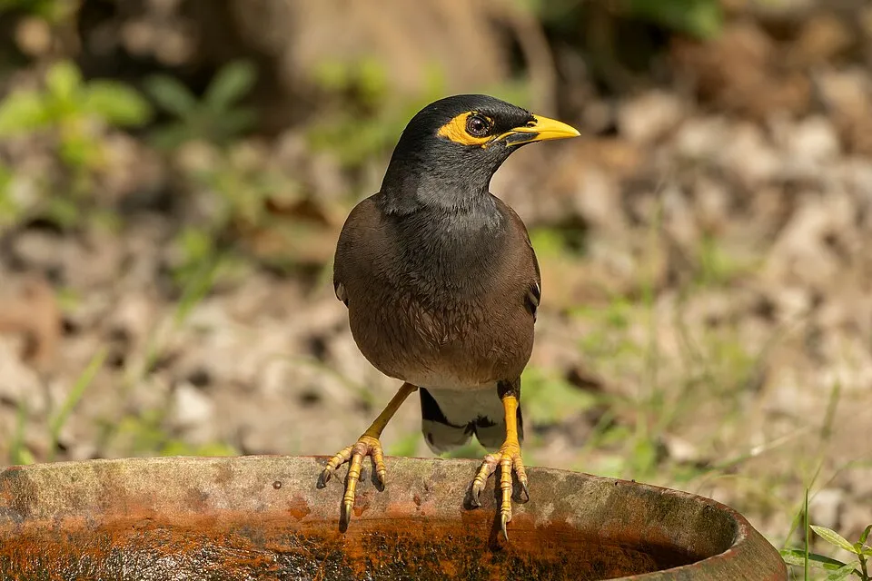 Common myna
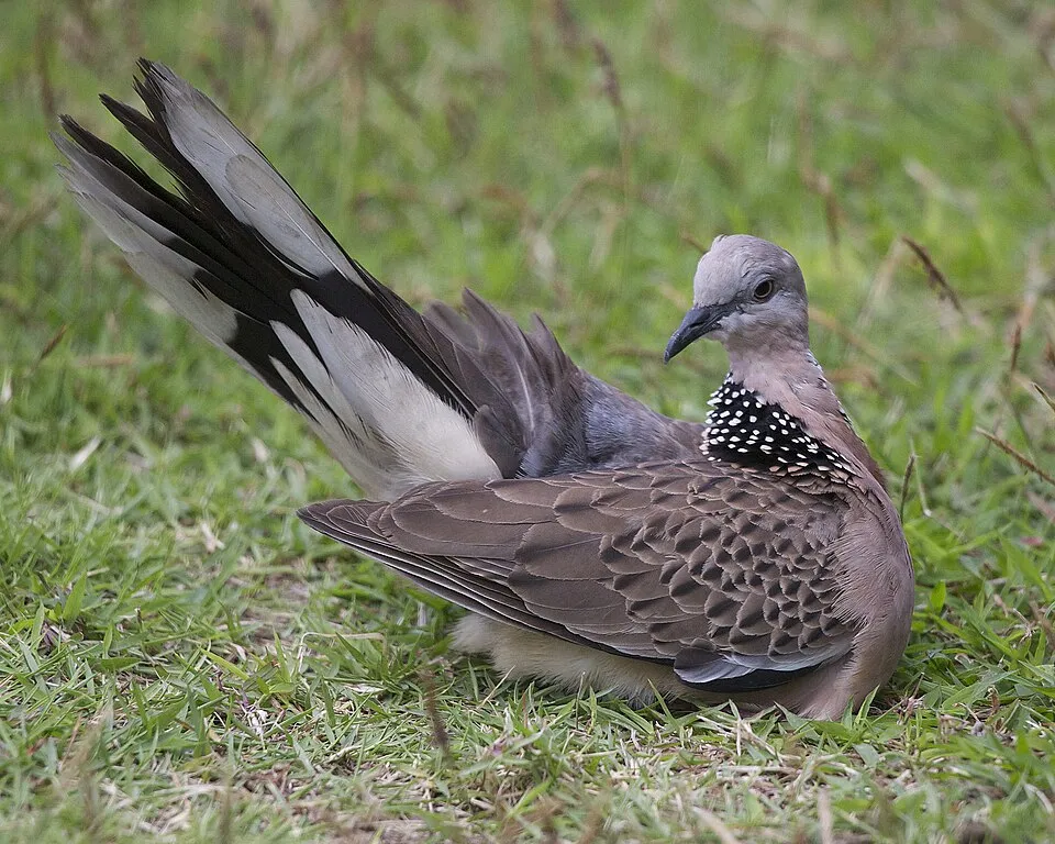 Spotted Dove
 Octopus tree
Cane toad
 Rock Dove
Blush Satinash
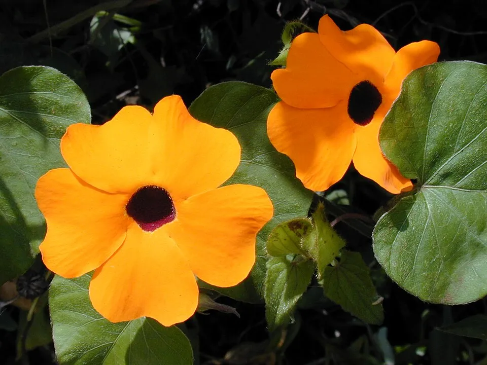 Blackeyed Susan vine
Photos: Wild boar © Valentin Panzirsch · CC BY-SA 3.0; Common myna © Tisha Mukherjee · CC BY-SA 4.0; Spotted Dove © Lip Kee from Singapore, Republic of Singapore · CC BY-SA 2.0; Octopus tree © coenobita · CC BY 4.0; Rock Dove © william_stephens · CC BY 4.0; Blackeyed Susan vine © Forest & Kim Starr · CC BY 3.0
Sources: Global Forest Change (Hansen et al., University of Maryland, via Global Forest Watch, CC-BY 4.0); EFFIS, European Commission / Copernicus; NASA Black Marble 2016 (public domain); CORINE Land Cover 2018 (Copernicus) or MODIS.
Invasive alien species: Global Register of Introduced and Invasive Species (ISSG, CC BY 4.0); Union list, Regulation (EU) 1143/2014 (INBO, CC0); GBIF.org records (CC0 / CC BY 4.0), at least 2 per species.
Practical information
Cities and airport
- Cairns
67 km as the crow flies - Airport: Cairns (CNS)
62 km as the crow flies
Visitor information
- Kuku Yalanji Information Centre
within the site - Mossman Gorge Centre
< 1 km from the site boundary - Crocodile Express Daintree River Cruises
2 km from the site boundary - Daintree Tourist Information Centre
2 km from the site boundary
Parking
7 public car parks listed within the site
Data © OpenStreetMap contributors (ODbL) · Wikidata (CC0)
Access and visiting
Nearest towns of over 50,000 people, as the crow flies: Cairns (67 km). Nearest airport: Cairns (CNS), about 62 km away. About 13,000 people live within 20 km of the site boundary, 7,200 of them within 10 km; some 760 people are estimated to live inside (GHSL estimate, 2020). This population has grown by about 19% since 2000. Visitor information on site: Kuku Yalanji Information Centre, Mossman Gorge Centre and Crocodile Express Daintree River Cruises. Public car parks listed within the site: 7. To plan a visit (access, opening periods, visitor rules), it is best to consult the official information from the managing body (Queensland Parks and Wildlife Service) and the official website listed in this page's sources.
Source: OpenStreetMap (ODbL), Wikidata (CC0), November 2026.
When to visit
Best time to visit: from May to October, with average temperatures of 15 to 20 °C and moderate rainfall. Precipitation peaks from December to April (up to 350 mm per month). These averages apply to the site's representative point (1,067 m); higher up it is markedly cooler. Day length ranges from about 11 h 10 min in June to 13 h 06 min in December. Wildlife records published on GBIF peak for birds (from July to October), plants (from June to September), butterflies and moths (October), dragonflies (November) and mammals (October and November). These peaks also reflect when observers are most active.
Source: Copernicus ERA5-Land (C3S), monthly averages 1996–2025 at the representative point, temperatures adjusted for elevation.
Contains modified Copernicus Climate Change Service information 2026. Neither the European Commission nor ECMWF is responsible for any use that may be made of the Copernicus information or data it contains.
Wildlife records calendar
JFMAMJJASOND
Birds
Plants
Butterflies & moths
Dragonflies
Mammals
Monthly records published on GBIF (CC-BY), relative to the busiest month; also reflects observer activity.
Gallery
© Diliff · CC BY-SA 2.5
© Dinkum · CC0-1.0
© Paul Holloway from Birmingham, United Kingdom · CC BY-SA 2.0
© dronepicr · CC BY 2.0
© Photnart · CC BY-SA 3.0
© Zoharby · CC BY-SA 3.0
Sources and licences
- Wikidata: Q1157644
- OpenStreetMap: relation 8478278
- Official website: https://parks.des.qld.gov.au/parks/daintree
- Wikipedia: en.wikipedia.org/wiki/Daintree_National_Park
- WDPA: 405
References
- cds.climate.copernicus.eu: climate · CC-BY-4.0
- registry.opendata.aws: elevation of the reference point, detailed relief · PD
- lpdaac.usgs.gov: land cover · PD
- doi.org: population around the site · CC-BY-4.0
- naturalearthdata.com: sea share · PD
- wikidata.org: official area, highest point, establishment date, protected heritage, managing body, official name, nearby cities and airport, lake depths, official website · CC0-1.0
- en.eurovelo.com: EuroVelo cycle routes · ODbL-1.0
- cycling.waymarkedtrails.org: cycle routes · ODbL-1.0
- opentopodata.org: elevations · PD
- globalforestwatch.org: tree cover loss · CC-BY-4.0
- gbif.org: seasonality of sightings, invasive alien species, observed species · CC-BY-4.0
- earthobservatory.nasa.gov: night light · PD
- openstreetmap.org: access and peaks · ODbL-1.0
- nsidc.org: snow cover · PD
- wikidata.org: Wikipedia article · CC-BY-SA-4.0
Data © OpenStreetMap contributors (ODbL), Wikidata (CC0) and the sources cited.