Lithuania · Terrestrial
Dzūkija National Park
National park of 58,519 hectares in Lithuania, established in 1991.
Overview
National park of 58,519 hectares in Lithuania, established in 1991.
Dzūkija National Park is located in Lithuania (Europe). It is a predominantly terrestrial area. Established in 1991, it covers about 58,519 hectares.
Protections and designations
Natura 2000 · habitats (SAC) · 2 sites
- Dainavos giria LTVAR0017
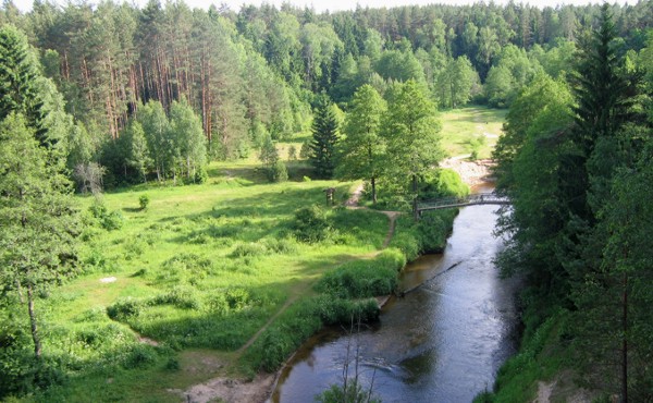
- Ūlos upė LTVAR0012
Natura 2000 · birds (SPA) · 2 sites
- Dainavos giria LTVARB005
- Grybaulios žuvininkystės tvenkiniai LTVARB007
Protected as a national park. International labels and designations: Natura 2000 network (4 sites). Key dates: established in 1991 and first Natura 2000 site under the Birds Directive in 2004.
In our collections
Timeline
-
1991
Established
-
2004
First Natura 2000 site under the Birds Directive 2 such sites designated up to 2004
Sources: Wikidata (CC0) for establishment and international labels; EEA Natura 2000 database (CC-BY 4.0) for site designation dates.
Frequently asked questions
Where is Dzūkija National Park?
In Lithuania (Europe). Representative point: 54.0819° N, 24.3767° E.
How large is Dzūkija National Park?
About 58,519 hectares (585 km²). It is the largest of the 5 national parks in Lithuania covered by Parkavela.
When was Dzūkija National Park established?
In 1991.
What habitats and landscapes does Dzūkija National Park include?
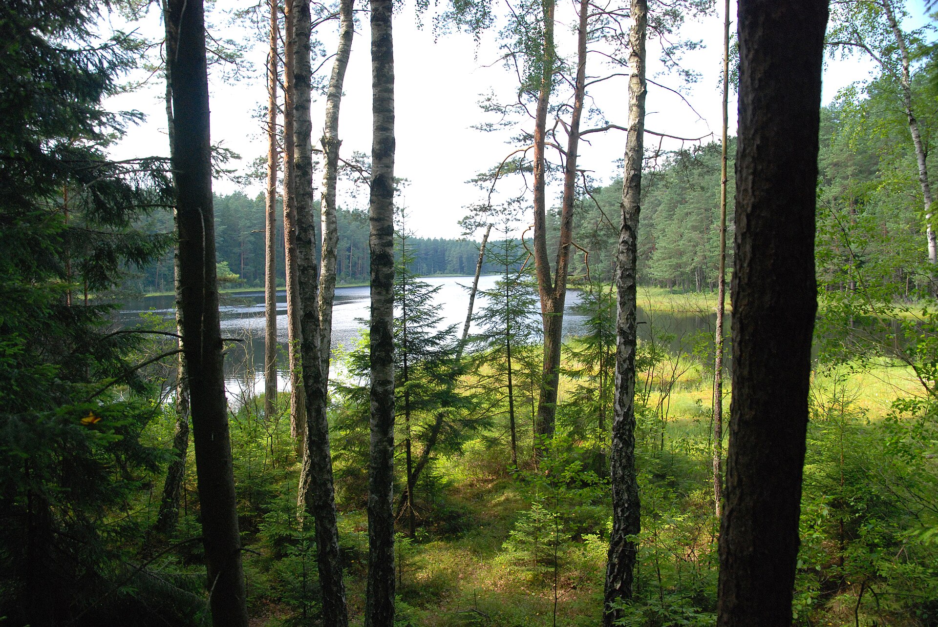
A terrestrial area, with forests.
What is the highest point of Dzūkija National Park?
Šaudzyklos kalnas, at 124 m (OpenStreetMap).
Which international labels apply to Dzūkija National Park?
Natura 2000 network (4 sites).
When is the best time to visit Dzūkija National Park?
Mildest period: from June to August, with average temperatures of 17 to 20 °C.
Is there snow in Dzūkija National Park?
Yes. According to NASA's MODIS satellites (2015–2025 average), snow covers most of the site from December to February, with about 75 snow-covered days a year on average.
What is there to see in Dzūkija National Park?
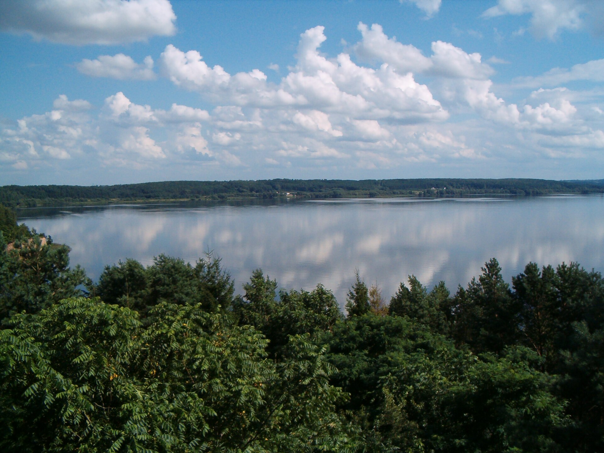
41 lakes and ponds, including Netiesėlis, Netiesis, Pakampys and Pakelinis (Wikidata).
What is the nearest large city to Dzūkija National Park?
Nearest towns of over 50,000 people, as the crow flies: Alytus (17 km) and Suwałki (67 km). Nearest airport: Vilnius (VNO), about 76 km away.
How can I reach Dzūkija National Park by train?
Marcinkonys railway station lies within the site.
Where can I get visitor information on site?
Dzūkijos nacionalinio parko lankytojų centras, Dzūkijos NP Marcinkonių lankytojų centras and Dzūkijos nacionalinio parko Merkinės lankytojų centras.
Are there waymarked hiking trails in Dzūkija National Park?
Yes. Waymarked hiking routes listed in OpenStreetMap: 15, including E 11 (23 km) and Vilnius-Vygriai. The “Vilnius-Vygriai” route runs for about 26 km through the site, with some 100 m of ascent on its longest section.
Which species can be seen in Dzūkija National Park?
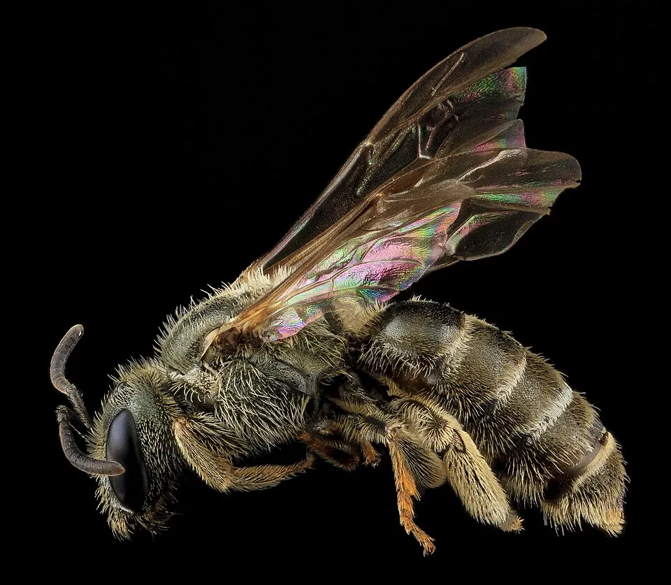
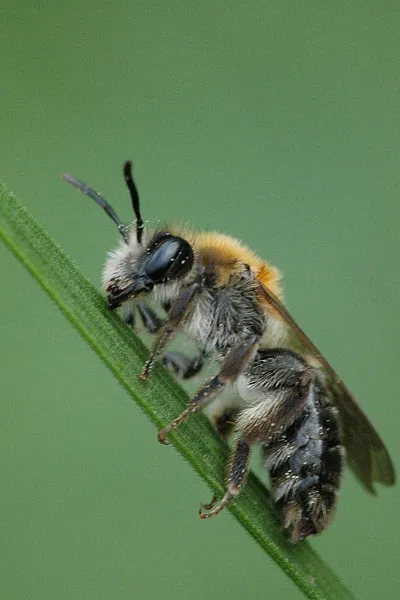
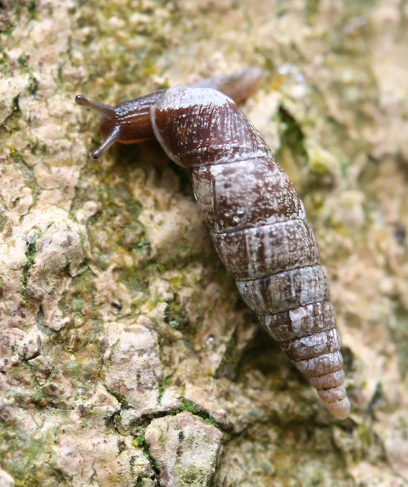
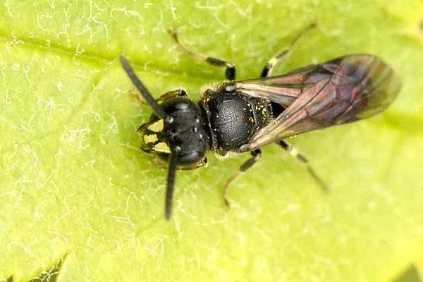
Among the species most often recorded on GBIF are Halictus confusus (Confusing Metallic-furrow Bee), Andrena barbilabris (Long-lipped Andrena), Cochlodina laminata (Plaited Door Snail) and Hylaeus communis (Common Yellow-face Bee).
What is the official website of Dzūkija National Park?
© OpenStreetMap
Download the boundary: GeoJSON · GPX Boundary © OpenStreetMap contributors (ODbL).
Geography
The representative point of the site lies at around 117 m above sea level. Over the 1996–2025 period, the mean annual temperature is about 8.0 °C and total precipitation reaches roughly 735 mm per year. The warmest month is usually July, the coolest January, and the wettest July. The site contains 5 lakes larger than 10 ha, totalling 66 ha of water; the largest, Lizdų ežeras, covers 25 ha (HydroLAKES).
Area
- Area
- 58,519 ha
- Elevation
- 117 m
- Snow cover
- ≈ 75 days a year
- Lakes over 10 ha
- 5 (66 ha)
- Coordinates
- 54.0819, 24.3767
Lakes: HydroLAKES (Messager et al. 2016, hydrosheds.org, CC BY 4.0) · depths: Wikidata (CC0)
Climate
● Mean temperature (°C) · ▮ Precipitation (mm)
Source: Copernicus ERA5-Land (C3S, doi:10.24381/cds.68d2bb30), monthly averages 1996–2025 interpolated to the representative point, temperatures adjusted for elevation.
Contains modified Copernicus Climate Change Service information 2026. Neither the European Commission nor ECMWF is responsible for any use that may be made of the Copernicus information or data it contains.
Snow cover measured by satellite
J
F
M
A
M
J
J
A
S
O
N
D
average share of the site under snow · snowiest parts · ≈ 75 days a year
Snow cover: MODIS/Terra MOD10CM v61 (Hall & Riggs, 2021, NASA NSIDC DAAC, doi:10.5067/MODIS/MOD10CM.061), imagery from NASA GIBS (ESDIS); 2015–2025 average, grid of about 5 km.
Natural habitats
According to CORINE Land Cover (2018), the site is mainly made up of forests (79%), farmland (11%) and heath and scrub (5%). Woodland is mostly coniferous. The 4 Natura 2000 sites overlapping the area list 29 habitats of European interest (11 priority), the most extensive being western Taïga, central European lichen Scots pine forests and bog woodland.
Biodiversity
Based on occurrences aggregated by GBIF, several species are regularly recorded within the site. Among the most frequent are Halictus confusus (Confusing Metallic-furrow Bee), Andrena barbilabris (Long-lipped Andrena), Cochlodina laminata (Plaited Door Snail) and Hylaeus communis (Common Yellow-face Bee). The full list of documented taxa is shown below. The overlapping Natura 2000 sites list 69 species of European interest: 30 birds, 2 mammals, 1 reptile, 2 amphibians, 5 fish, 14 invertebrates, 14 plants and 1 lichen.
Habitats of European interest
From the official forms of the 4 Natura 2000 sites overlapping the area (areas reported for each whole site).
- Western Taïga priority 4,581 ha
- Central European lichen Scots pine forests 1,371 ha
- Bog woodland priority 812 ha
- Fennoscandian deciduous swamp woods priority 537 ha
- Alluvial forests with Alnus glutinosa and Fraxinus excelsior (Alno-Padion, Alnion incanae, Salicion albae) priority 293 ha
- Transition mires and quaking bogs 123 ha
- Active raised bogs priority 121 ha
- Coniferous forests on, or connected to, glaciofluvial eskers 121 ha
and 21 more
Species of European interest
Birds · 30
Boreal Owl (Aegolius funereus) resident, Common Kingfisher (Alcedo atthis) breeding, Tawny Pipit (Anthus campestris) breeding, Lesser spotted eagle (Aquila pomarina) breeding, Hazel Grouse (Bonasa bonasia) resident, Eurasian Bittern (Botaurus stellaris) breeding, Eurasian Eagle-owl (Bubo bubo) breeding, European Nightjar (Caprimulgus europaeus) breeding, White stork (Ciconia ciconia) breeding, Black Stork (Ciconia nigra) breeding, Western Marsh Harrier (Circus aeruginosus) breeding, Montagu's Harrier (Circus pygargus) breeding and 18 more
Mammals · 2
Reptiles · 1
European Pond Turtle (Emys orbicularis)
Amphibians · 2
European fire-bellied toad (Bombina bombina), Great crested newt (Triturus cristatus)
Fish · 5
Asp (Aspius aspius), Spined loach (Cobitis taenia), European bullhead (Cottus gobio), European brook lamprey (Lampetra planeri), European bitterling (Rhodeus amarus)
Invertebrates · 14
Boros schneideri, Cucujus cinnaberinus, Dark whiteface (Leucorrhinia albifrons), Lilypad whiteface (Leucorrhinia caudalis), Yellow-spotted Whiteface (Leucorrhinia pectoralis), Woodland brown (Lopinga achine), Large copper (Lycaena dispar), Violet Copper (Lycaena helle), Green snaketail (Ophiogomphus cecilia), Large blue (Phengaris arion), Siberian Winter Damsel (Sympecma paedisca), Thick shelled river mussel (Unio crassus) and 2 more
Plants · 14
Hairy agrimony (Agrimonia pilosa), Mountain arnica (Arnica montana), Buxbaumia moss (Buxbaumia viridis), Lady's-slipper orchid (Cypripedium calceolus), Dianthus arenarius subsp. arenarius, Drepanocladus vernicosus, Leucobryum moss (Leucobryum glaucum), Fen orchid (Liparis loeselii), Interrupted clubmoss (Lycopodium annotinum), Stag's-horn Clubmoss (Lycopodium clavatum), Eastern pasqueflower (Pulsatilla patens), Yellow marsh saxifrage (Saxifraga hirculus) and 2 more
Lichens · 1
Cladonia subg. cladina
Source: Natura 2000 standard data forms (EEA, CC-BY 4.0). Not exhaustive: sensitive species are not published.
Species to look out for

Observed species
Occurrences documented via GBIF; they are neither an exhaustive inventory nor proof of current presence.
- Confusing Metallic-furrow Bee · Halictus confusus · 135
- Long-lipped Andrena · Andrena barbilabris · 125
- Plaited Door Snail · Cochlodina laminata · 111
- Common Yellow-face Bee · Hylaeus communis · 97
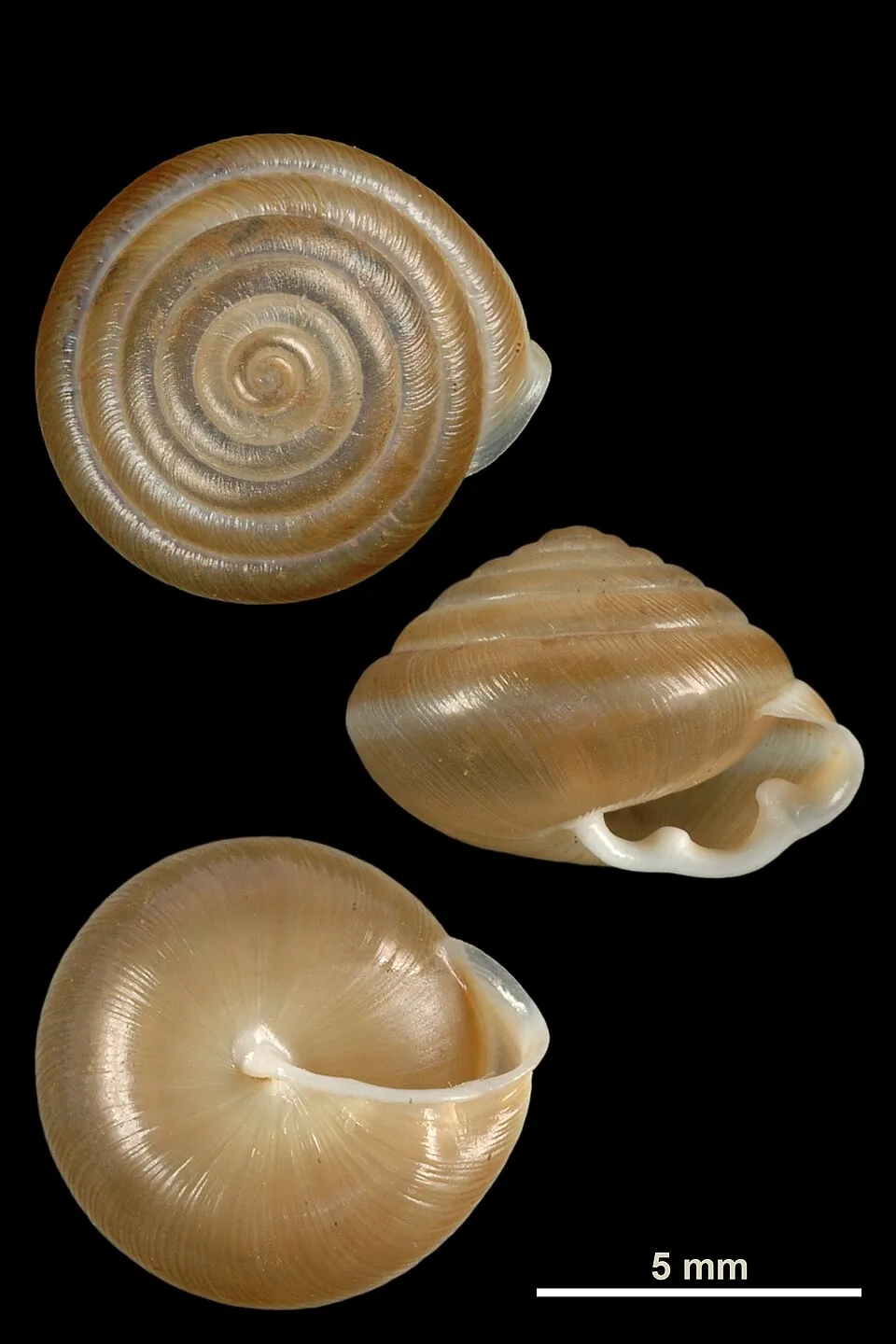
- Double-tooth hairy snail · Perforatella bidentata · 77
- Eurasian Chaffinch · Fringilla coelebs · 68
- Impunctate Mini-miner · Andrena subopaca · 67
- Orange-vented Mason Bee · Osmia leaiana · 65
- Common Furrow Bee · Lasioglossum calceatum · 63
- Great tit · Parus major · 62
- Short-horned Furrow Bee · Lasioglossum brevicorne · 61
- Common Wood Pigeon · Columba palumbus · 59
+18 more species
- Margined Colletes · Colletes marginatus · 58
- Reticulate Blood Bee · Sphecodes reticulatus · 58
- Ribbed Grass Snail · Vallonia costata · 57
- Common Blackbird · Turdus merula · 57
- Ridge-saddled Carpenter Bee · Heriades truncorum · 56
- Bloomed Furrow Bee · Lasioglossum albipes · 56
- Willughby's Leafcutter Bee · Megachile willughbiella · 55
- Great Spotted Woodpecker · Dendrocopos major · 54
- White Wagtail · Motacilla alba · 54
- Hairy-saddled Colletes · Colletes fodiens · 52
- Common Chiffchaff · Phylloscopus collybita · 52
- Ventricose door snail · Macrogastra ventricosa · 52
- Three-spined stickleback · Gasterosteus aculeatus · 50
- Black-headed Leafcutter Bee · Megachile circumcincta · 49
- Bush Snail · Fruticicola fruticum · 49
- White-jawed Yellow-face Bee · Hylaeus confusus · 48
- White-zoned Furrow Bee · Lasioglossum leucozonium · 48
- Ashy Mining Bee · Andrena cineraria · 48
Records: GBIF.org (CC-BY). Names: Wikidata (CC0), GBIF. Photos: Wikimedia Commons.
Conservation challenges
The primary purpose of the site is to preserve its natural habitats and the biodiversity they support. The species recorded (Biodiversity tab) reflect its ecological value. The designations it holds frame its management and the control of land use.
According to Global Forest Change data (University of Maryland, Global Forest Watch), about 9,190 ha of tree cover were lost within the boundary between 2001 and 2023 (16% of its area), peaking in 2016 and 2017. These losses include logging, storms and fires, and do not account for regrowth. According to the European CORINE Land Cover inventory (Copernicus), land cover changed on about 694 ha of the site between 1990 and 2018 (1% of its area): open water shrank by 589 ha, mostly giving way to farmland, while farmland grew by 570 ha, mostly at the expense of open water. Forest felling and regrowth add about 3,850 ha in total over the period. At night, the area gives off virtually no artificial light detectable from space (NASA VIIRS Black Marble composite, 2016). According to the Natura 2000 forms, of 29 assessed habitats of European interest, 2 are in excellent condition and 2 in average or reduced condition. According to the Water Framework Directive assessment (2022 river basin management plans, data 2014–2019), 58% of the 144 km of rivers assessed within the site are in good or high ecological status.
Pressure indicators
Tree cover lost
9,186 ha
2001–2023 · 16% of the area
20012023
Fires since 2016
0
No large fire mapped (fires over about 30 ha)
Light at night
0%
of the area gives off artificial light visible from space
DarkLit
Built-up land
< 1%
buildings, business areas, roads, quarries · farmland 11%
Land cover change
694 ha
changed cover, 1990–2018 · CORINE · 1% of the area
- −589 ha · water bodies
- +570 ha · farmland
forest felling and regrowth: 3,850 ha in total
Rivers and lakes
58%
of the 144 km of assessed rivers in good or high ecological status · WFD 2022
assessments 2014–2019
Sources: Global Forest Change (Hansen et al., University of Maryland, via Global Forest Watch, CC-BY 4.0); EFFIS, European Commission / Copernicus; NASA Black Marble 2016 (public domain); CORINE Land Cover 2018 (Copernicus) or MODIS.
CORINE Land Cover Change 1990–2018: generated using European Union's Copernicus Land Monitoring Service information (EEA), aggregated by Parkavela; DOI 10.2909/f30f1000-7cf8-43bb-872c-5eb093911b24.
Ecological status of water bodies: European Environment Agency, WISE – Water Framework Directive, 3rd river basin management plans (2022), CC BY 4.0. Official national classification, not comparable between countries.
Practical information
Cities and airport
- Alytus
17 km as the crow flies - Suwałki
67 km as the crow flies - Airport: Vilnius (VNO)
76 km as the crow flies
Visitor information
- Dzūkijos nacionalinio parko lankytojų centras
within the site - Dzūkijos NP Marcinkonių lankytojų centras
within the site - Dzūkijos nacionalinio parko Merkinės lankytojų centras
within the site
Parking
46 public car parks listed within the site
Čepkelių mokomasis takasŪlos akis
Things to see
41 lakes and ponds
- Netiesėlis
lake or pond - Netiesis
lake or pond - Pakampys
lake or pond - Pakelinis
lake or pond - Linamarkė
lake or pond
Hiking
15 waymarked routes listed, including:
E 11 (23 km)Vilnius-Vygriai
By bike
EV11 · 26 km LT1 Kapčiamiestis - Vilnius · 36 km
EV11: route still largely undeveloped
Signed cycle routes: this does not mean that cycling is allowed on footpaths.
Data © OpenStreetMap contributors (ODbL) · Wikidata (CC0)
Contains information from EuroVelo GPX tracks downloaded from www.EuroVelo.com on 2026-10-22, which is made available here under the Open Database License (ODbL). EuroVelo® is a registered trademark of the ECF. Routes © OpenStreetMap contributors (ODbL), via Waymarked Trails
Waymarked hiking routes
E11 E11 section 54: Didžiasalis – Druskininkai – Žiogeliai
5.5 km within the site ↗ 6 m↘ 11 m 86–102 m
Adolfo Ramanausko-Vanago Laisvės kovų keliais
22.8 km within the site ↗ 121 m↘ 106 m 74–124 m
Tracks © OpenStreetMap contributors (ODbL), clipped to the boundary; elevation gain and profiles computed on the longest section from Mapzen Terrain Tiles (≈ 30 m), indicative only.
Access and visiting
Marcinkonys railway station lies within the site. Nearest towns of over 50,000 people, as the crow flies: Alytus (17 km) and Suwałki (67 km). Nearest airport: Vilnius (VNO), about 76 km away. About 110,000 people live within 20 km of the site boundary, 27,000 of them within 10 km; some 4,200 people are estimated to live inside (GHSL estimate, 2020). This population has fallen by about 31% since 2000. Visitor information on site: Dzūkijos nacionalinio parko lankytojų centras, Dzūkijos NP Marcinkonių lankytojų centras and Dzūkijos nacionalinio parko Merkinės lankytojų centras. Public car parks listed within the site: 46, including Čepkelių mokomasis takas and Ūlos akis. Waymarked hiking routes listed in OpenStreetMap: 15, including E 11 (23 km) and Vilnius-Vygriai. The EuroVelo 11 cycle route (East Europe Route) crosses the site for about 26 km, on a route still largely undeveloped; another signed cycle route also passes through: “LT1 Kapčiamiestis - Vilnius” (EuroVelo, OpenStreetMap). To see: 41 lakes and ponds, including Netiesėlis, Netiesis, Pakampys and Pakelinis. To plan a visit (access, opening periods, visitor rules), it is best to consult the official information from the managing body and the official website listed in this page's sources.
Source: OpenStreetMap (ODbL), Wikidata (CC0), October 2026.
When to visit
Mildest period: from June to August, with average temperatures of 17 to 20 °C. Average temperatures drop below 0 °C from December to February: frost is common. Precipitation peaks in July (up to 110 mm per month). According to NASA's MODIS satellites (2015–2025 average), snow covers most of the site from December to February, with about 75 snow-covered days a year on average. Day length ranges from about 7 h 23 min in December to 17 h 08 min in June. Wildlife records published on GBIF peak for birds (May), plants (June and July), butterflies and moths (July) and dragonflies (May and June). These peaks also reflect when observers are most active.
Source: Copernicus ERA5-Land (C3S), monthly averages 1996–2025 at the representative point, temperatures adjusted for elevation.
Contains modified Copernicus Climate Change Service information 2026. Neither the European Commission nor ECMWF is responsible for any use that may be made of the Copernicus information or data it contains.
Wildlife records calendar
JFMAMJJASOND
Birds
Plants
Butterflies & moths
Dragonflies
Monthly records published on GBIF (CC-BY), relative to the busiest month; also reflects observer activity.
Gallery
© JonasS · CC BY-SA 3.0
© Wojsyl · CC BY-SA 3.0
© Hugo.arg · CC BY-SA 4.0
© Šarūnas · Public domain
© Šarūnas · Public domain
© Hugo.arg · Public domain
Sources and licences
- Wikidata: Q738428
- OpenStreetMap: relation 7876911
- Official website: http://www.cepkeliai-dzukija.lt/
- Wikipedia: en.wikipedia.org/wiki/Dzūkija_National_Park
- WDPA: 31551
References
- cds.climate.copernicus.eu: climate · CC-BY-4.0
- registry.opendata.aws: elevation of the reference point, detailed relief · PD
- land.copernicus.eu: land cover, land cover change, sea share · COPERNICUS
- doi.org: population around the site · CC-BY-4.0
- wikidata.org: official area, establishment date, nearby cities and airport, access and peaks, lake depths, places to see, official website · CC0-1.0
- eea.europa.eu: bathing water quality, ecological status of waters · CC-BY-4.0
- en.eurovelo.com: EuroVelo cycle routes · ODbL-1.0
- cycling.waymarkedtrails.org: cycle routes · ODbL-1.0
- opentopodata.org: elevations · PD
- forest-fire.emergency.copernicus.eu: wildfires · COPERNICUS
- globalforestwatch.org: tree cover loss · CC-BY-4.0
- gbif.org: seasonality of sightings, invasive alien species, observed species · CC-BY-4.0
- hydrosheds.org: lakes · CC-BY-4.0
- natura2000.eea.europa.eu: Natura 2000 habitats and species · CC-BY-4.0
- openstreetmap.org: official name, access and peaks, trail difficulty, wheelchair access · ODbL-1.0
- earthobservatory.nasa.gov: night light · PD
- hiking.waymarkedtrails.org: route difficulty · ODbL-1.0
- nsidc.org: snow cover · PD
- wikidata.org: Wikipedia article · CC-BY-SA-4.0
Data © OpenStreetMap contributors (ODbL), Wikidata (CC0) and the sources cited.