Mollusc
Moss Chrysalis Snail
Pupilla muscorum111 records © Francisco Welter Schultes · Public domain
Lithuania · Terrestrial
Nature park of 17,700 hectares in Lithuania, established in 1992.
Nature park of 17,700 hectares in Lithuania, established in 1992.
Meteliai Regional Park is a nature park in Lithuania (Europe). It is a predominantly terrestrial area. Established in 1992, it covers about 17,700 hectares.
Protected as a nature park. International labels and designations: Natura 2000 network (2 sites). Key dates: established in 1992 and first Natura 2000 site under the Birds Directive in 2004.
Sources: Wikidata (CC0) for establishment and international labels; EEA Natura 2000 database (CC-BY 4.0) for site designation dates.
In Lithuania (Europe). Representative point: 54.2853° N, 23.7097° E.
About 17,700 hectares (177 km²). It is the 6th largest of the 29 nature parks in Lithuania covered by Parkavela.
In 1992.
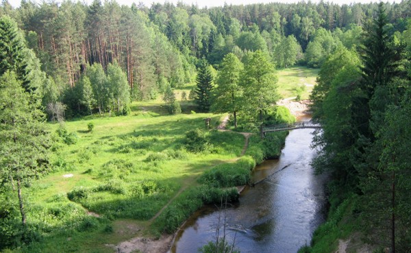
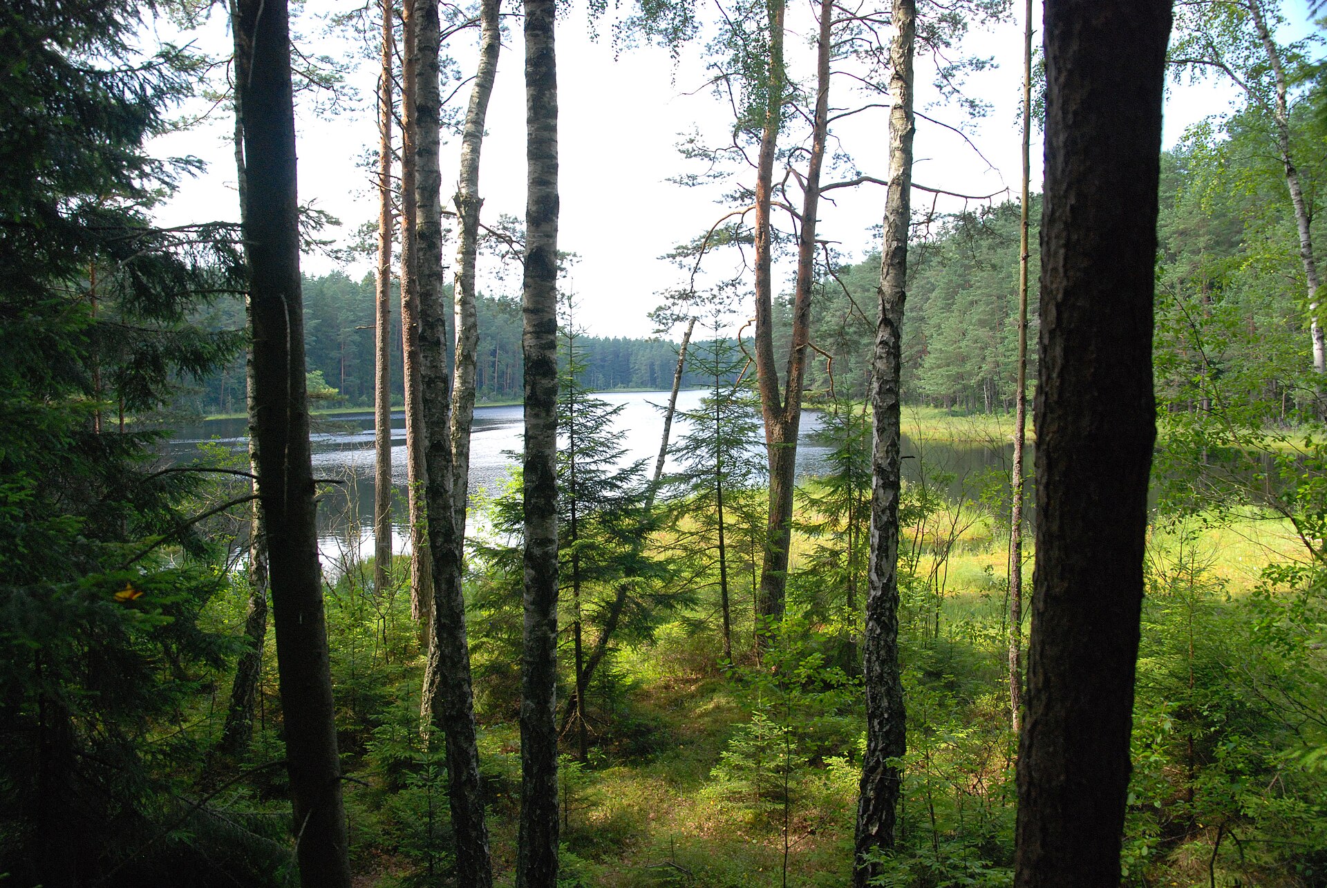
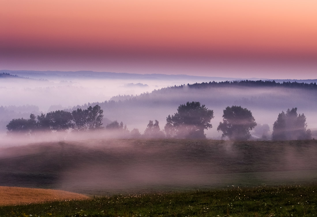
A terrestrial area, with forests and freshwater.
Natura 2000 network (2 sites).
Mildest period: from June to August, with average temperatures of 17 to 19 °C.
Yes. According to NASA's MODIS satellites (2015–2025 average), snow covers most of the site in December and January, with about 55 snow-covered days a year on average.
18 lakes and ponds, including Metelys (106 m), Dusia (106 m), Obelija and Bakšių ežeras (Wikidata).
2 monitored bathing sites lie in or within 1 km of the site; official 2025 classification: 2 excellent (European Environment Agency). Swimming is only permitted at the sites and times authorised locally.
Nearest towns of over 50,000 people, as the crow flies: Alytus (16 km) and Suwałki (43 km). Nearest airport: Kaunas (KUN), about 71 km away.
The nearest railway station is Šeštokai, about 7 km from the site boundary.
Metelių regioninio parko lankytojų centras and Lazdijų turizmo informacinis centras.
Yes. Waymarked hiking routes listed in OpenStreetMap: 5, including Camino Lituano. The “Camino Lituano 20 etapas: Meteliai–Lazdijai” route runs for about 17 km through the site, with some 60 m of ascent on its longest section.
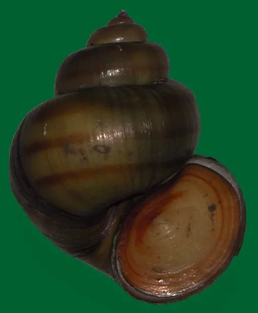
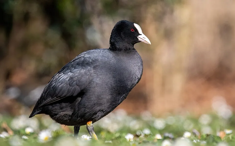
Among the species most often recorded on GBIF are Pupilla muscorum (Moss Chrysalis Snail), Viviparus contectus (Lister's River Snail), Fulica atra (Common Coot) and Cygnus olor (Mute Swan).
© OpenStreetMap
Download the boundary: GeoJSON · GPX Boundary © OpenStreetMap contributors (ODbL).
The representative point of the site lies at around 102 m above sea level. Over the 1996–2025 period, the mean annual temperature is about 8.0 °C and total precipitation reaches roughly 694 mm per year. The warmest month is usually July, the coolest January, and the wettest July. The site contains 4 lakes larger than 10 ha, totalling 40.3 km² of water; the largest, Dusia, covers 22.7 km² (HydroLAKES). Dusia (2,317 ha) is 32.4 m deep (Wikidata).
Lakes: HydroLAKES (Messager et al. 2016, hydrosheds.org, CC BY 4.0) · depths: Wikidata (CC0)
● Mean temperature (°C) · ▮ Precipitation (mm)
Source: Copernicus ERA5-Land (C3S, doi:10.24381/cds.68d2bb30), monthly averages 1996–2025 interpolated to the representative point, temperatures adjusted for elevation.
Contains modified Copernicus Climate Change Service information 2026. Neither the European Commission nor ECMWF is responsible for any use that may be made of the Copernicus information or data it contains.
average share of the site under snow · snowiest parts · ≈ 55 days a year
Snow cover: MODIS/Terra MOD10CM v61 (Hall & Riggs, 2021, NASA NSIDC DAAC, doi:10.5067/MODIS/MOD10CM.061), imagery from NASA GIBS (ESDIS); 2015–2025 average, grid of about 5 km.
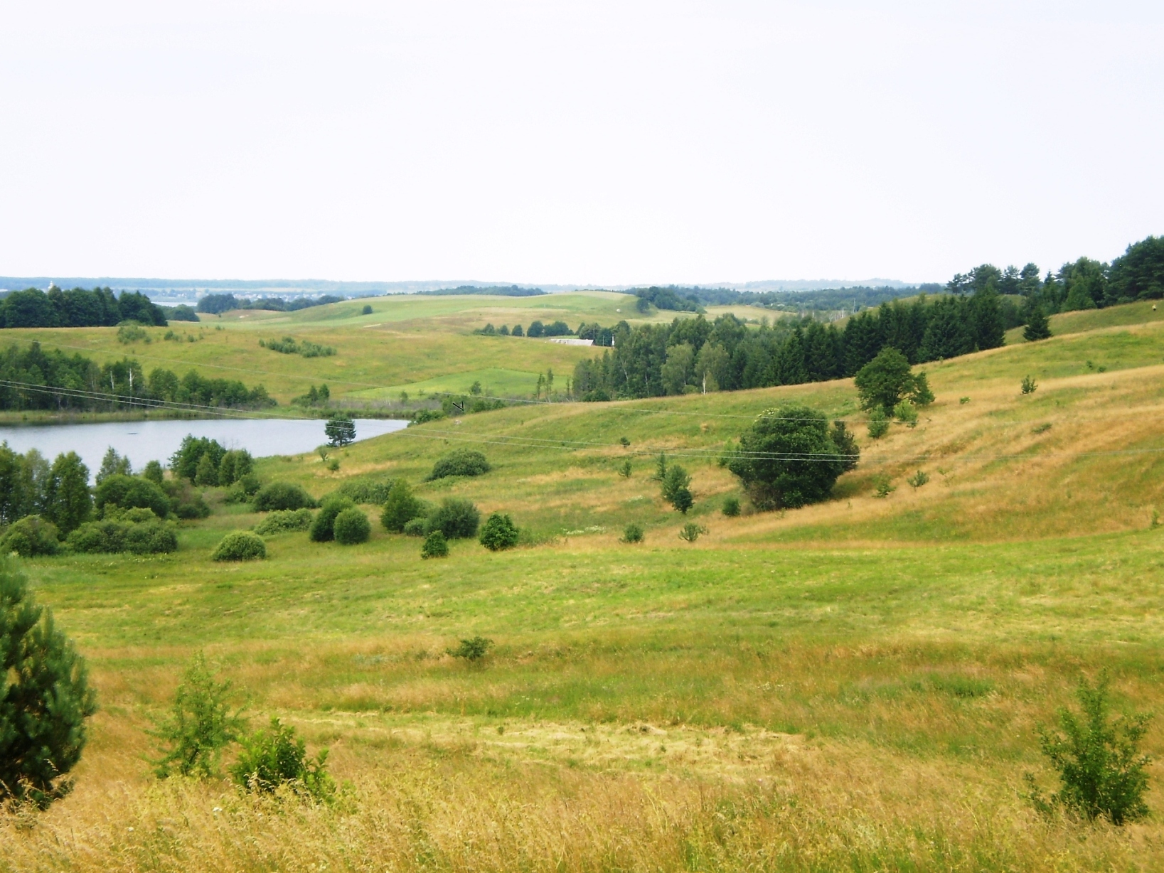
According to CORINE Land Cover (2018), the site is mainly made up of farmland (38%), forests (24%) and lakes and rivers (24%). Woodland mixes broadleaved and coniferous trees. Elevation ranges from about 100 to 200 m (sampled elevations, SRTM). The 2 Natura 2000 sites overlapping the area list 19 habitats of European interest (9 priority), the most extensive being hard oligo-mesotrophic waters with benthic vegetation of Chara spp, Sub-Atlantic and medio-European oak or oak-hornbeam forests of the Carpinion betuli and Fennoscandian herb-rich forests with Picea abies.
Based on occurrences aggregated by GBIF, several species are regularly recorded within the site. Among the most frequent are Pupilla muscorum (Moss Chrysalis Snail), Viviparus contectus (Lister's River Snail), Fulica atra (Common Coot) and Cygnus olor (Mute Swan). The full list of documented taxa is shown below. The overlapping Natura 2000 sites list 30 species of European interest: 13 birds, 2 mammals, 1 reptile, 2 amphibians, 2 fish, 7 invertebrates and 3 plants.
From the official forms of the 2 Natura 2000 sites overlapping the area (areas reported for each whole site).
and 11 more
Ferruginous Duck (Aythya nyroca) breeding, Eurasian Bittern (Botaurus stellaris) breeding, Black Tern (Chlidonias niger) breeding, Western Marsh Harrier (Circus aeruginosus) breeding, Montagu's Harrier (Circus pygargus) breeding, Corn Crake (Crex crex) breeding, Common Crane (Grus grus) breeding, White-tailed Eagle (Haliaeetus albicilla) breeding wintering, Red-backed Shrike (Lanius collurio) breeding, Bluethroat (Luscinia svecica) breeding, Little Crake (Porzana parva) breeding, Spotted Crake (Porzana porzana) breeding and 1 more
European Pond Turtle (Emys orbicularis)
European fire-bellied toad (Bombina bombina), Great crested newt (Triturus cristatus)
Yellow-spotted Whiteface (Leucorrhinia pectoralis), Large copper (Lycaena dispar), Hermit beetle (Osmoderma eremita), Siberian Winter Damsel (Sympecma paedisca), Narrow-mouthed whorl snail (Vertigo angustior), Desmoulin's whorl snail (Vertigo moulinsiana), Xylomoia strix
Lady's-slipper orchid (Cypripedium calceolus), Drepanocladus vernicosus, Thesium ebracteatum
Source: Natura 2000 standard data forms (EEA, CC-BY 4.0). Not exhaustive: sensitive species are not published.
Mollusc
111 records © Francisco Welter Schultes · Public domain



Occurrences documented via GBIF; they are neither an exhaustive inventory nor proof of current presence.
Records: GBIF.org (CC-BY). Names: Wikidata (CC0), GBIF. Photos: Wikimedia Commons.
The primary purpose of the site is to preserve its natural habitats and the biodiversity they support. The species recorded (Biodiversity tab) reflect its ecological value. The designations it holds frame its management and the control of land use.
According to Global Forest Change data (University of Maryland, Global Forest Watch), about 446 ha of tree cover were lost within the boundary between 2001 and 2023 (3% of its area), peaking in 2005 and 2017. These losses include logging, storms and fires, and do not account for regrowth. Apart from forest felling and regrowth (about 380 ha in total), land cover remained almost unchanged between 1990 and 2018 according to CORINE Land Cover. At night, the area gives off virtually no artificial light detectable from space (NASA VIIRS Black Marble composite, 2016). According to the Natura 2000 forms, all 18 assessed habitats of European interest are in good condition. According to the Water Framework Directive assessment (2022 river basin management plans, data 2014–2019), of the 2 rivers assessed within the site, 1 has good ecological status and 1 moderate ecological status. Other assessed water bodies: lakes, 2 of 3 in good ecological status or better.
446 ha
2001–2023
0
No large fire mapped (fires over about 30 ha)
0%
of the area gives off artificial light visible from space
< 1%
buildings, business areas, roads, quarries · farmland 38%
< 0.5%
of the area changed, 1990–2018 · CORINE
forest felling and regrowth: 380 ha in total
61%
of the 4 km of assessed rivers in good or high ecological status · WFD 2022
Lakes: 2 of 3 good or better
assessments 2014–2019
Sources: Global Forest Change (Hansen et al., University of Maryland, via Global Forest Watch, CC-BY 4.0); EFFIS, European Commission / Copernicus; NASA Black Marble 2016 (public domain); CORINE Land Cover 2018 (Copernicus) or MODIS.
CORINE Land Cover Change 1990–2018: generated using European Union's Copernicus Land Monitoring Service information (EEA), aggregated by Parkavela; DOI 10.2909/f30f1000-7cf8-43bb-872c-5eb093911b24.
Ecological status of water bodies: European Environment Agency, WISE – Water Framework Directive, 3rd river basin management plans (2022), CC BY 4.0. Official national classification, not comparable between countries.
18 lakes and ponds
5 waymarked routes listed, including:
Data © OpenStreetMap contributors (ODbL) · Wikidata (CC0)
16.9 km within the site ↗ 59 m↘ 77 m 105–153 m
14.7 km within the site ↗ 33 m↘ 35 m 102–138 m
Tracks © OpenStreetMap contributors (ODbL), clipped to the boundary; elevation gain and profiles computed on the longest section from Mapzen Terrain Tiles (≈ 30 m), indicative only.
2 monitored bathing sites in or within 1 km of the site · 2025 classification
Source: European Environment Agency, official bathing water classification (Directive 2006/7/EC, CC-BY 4.0). Swimming is only permitted at the sites and times authorised locally.
The nearest railway station is Šeštokai, about 7 km from the site boundary. Nearest towns of over 50,000 people, as the crow flies: Alytus (16 km) and Suwałki (43 km). Nearest airport: Kaunas (KUN), about 71 km away. About 100,000 people live within 20 km of the site boundary, 18,000 of them within 10 km; some 1,700 people are estimated to live inside (GHSL estimate, 2020). This population has fallen by about 29% since 2000. Visitor information on site: Metelių regioninio parko lankytojų centras and Lazdijų turizmo informacinis centras. Waymarked hiking routes listed in OpenStreetMap: 5, including Camino Lituano. To see: 18 lakes and ponds, including Metelys (106 m), Dusia (106 m), Obelija and Bakšių ežeras. To plan a visit (access, opening periods, visitor rules), it is best to consult the official information from the managing body and the official website listed in this page's sources.
Source: OpenStreetMap (ODbL), Wikidata (CC0), October 2026.
Mildest period: from June to August, with average temperatures of 17 to 19 °C. Average temperatures drop below 0 °C from December to February: frost is common. Precipitation peaks in July (up to 100 mm per month). According to NASA's MODIS satellites (2015–2025 average), snow covers most of the site in December and January, with about 55 snow-covered days a year on average. Day length ranges from about 7 h 21 min in December to 17 h 10 min in June. Wildlife records published on GBIF peak for birds (December), plants (May) and butterflies and moths (July). These peaks also reflect when observers are most active.
Source: Copernicus ERA5-Land (C3S), monthly averages 1996–2025 at the representative point, temperatures adjusted for elevation.
Contains modified Copernicus Climate Change Service information 2026. Neither the European Commission nor ECMWF is responsible for any use that may be made of the Copernicus information or data it contains.
Monthly records published on GBIF (CC-BY), relative to the busiest month; also reflects observer activity.
Data © OpenStreetMap contributors (ODbL), Wikidata (CC0) and the sources cited.