United States · Mixed
Everglades National Park
National park of 610,484 hectares in the United States, established in 1947.
Overview
National park of 610,484 hectares in the United States, established in 1947.
Everglades National Park is located in the United States (North America). It covers both land and sea. Established on 6 December 1947, it covers about 610,484 hectares. The site is managed by National Park Service.
Protections and designations
UNESCO World Heritage
UNESCO Biosphere Reserve
Ramsar site
Protected as a national park. International labels and designations: UNESCO World Heritage (“Everglades National Park”), UNESCO Biosphere Reserve (“Everglades & Dry Tortugas”) and Ramsar site. Key dates: established in 1947, Biosphere Reserve in 1976, World Heritage listing in 1979 and Ramsar Site in 1987.
In our collections
Timeline
-
1947
Established
-
1976
UNESCO Biosphere Reserve Everglades & Dry Tortugas
-
1979
Inscribed as a UNESCO World Heritage Site Everglades National Park
-
1987
Ramsar Site (wetland of international importance) Everglades National Park
Sources: Wikidata (CC0) for establishment and international labels; EEA Natura 2000 database (CC-BY 4.0) for site designation dates.
Frequently asked questions
Where is Everglades National Park?
In the United States (North America). Representative point: 25.3125° N, 80.6875° W.
How large is Everglades National Park?
About 610,484 hectares (6,105 km²). It is the 10th largest of the 62 national parks in the United States covered by Parkavela. About 209,000 ha are at sea.
When was Everglades National Park established?
On 6 December 1947.
What habitats and landscapes does Everglades National Park include?
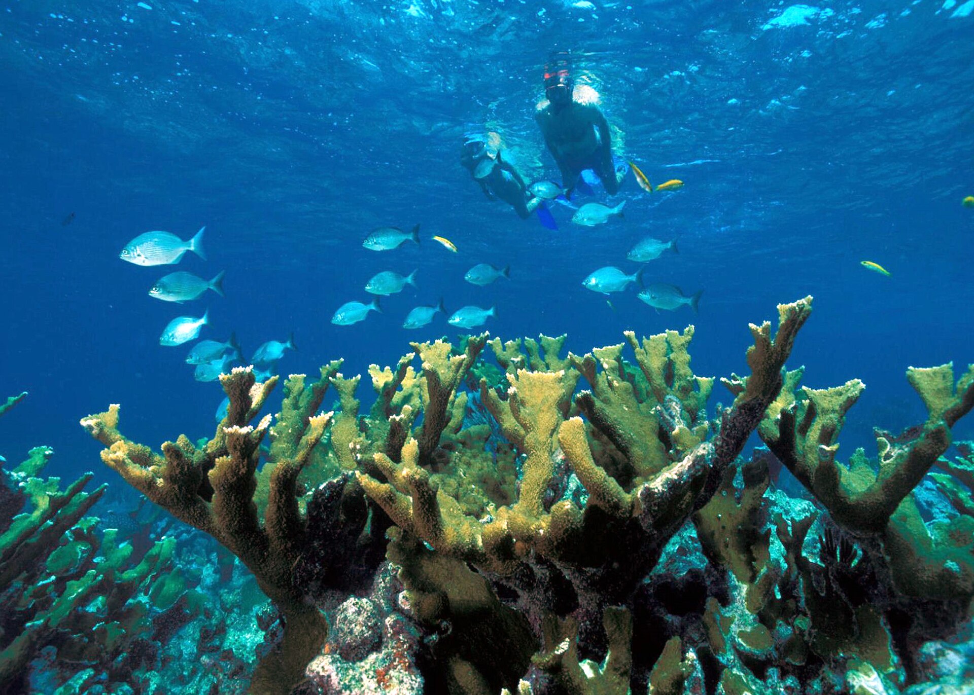
An area spanning land and sea, with coasts and coral reefs.
What is the highest point of Everglades National Park?
Rock Reef Pass, at 1 m (OpenStreetMap).
What are the main summits of Everglades National Park?
Rock Reef Pass (1 m), Panther Mound (1 m), Grossman Ridge (1 m), Bear Lake Mound (0 m) and Johnson Mound (0 m) (OpenStreetMap).
Which international labels apply to Everglades National Park?
UNESCO World Heritage (“Everglades National Park”), UNESCO Biosphere Reserve (“Everglades & Dry Tortugas”) and Ramsar site.
When is the best time to visit Everglades National Park?
Best time to visit: the dry season, from November to April, with less than 50 mm of rain per month.
What is there to see in Everglades National Park?
5 lakes and ponds, including Lake Ingraham, Ferguson Bay, Jungle Bay and Mud Bay (Wikidata).
Are there historic monuments in Everglades National Park?
Yes. According to Wikidata, 10 monuments listed in the National Register of Historic Places stand within the boundary, 1 of them a National Historic Landmark. For example: “Mud Lake Canal”.
What is the nearest large city to Everglades National Park?
Nearest towns of over 50,000 people, as the crow flies: Hialeah (23 km) and Miami Gardens (32 km). Nearest airport: Miami (MIA), about 21 km away.
How can I reach Everglades National Park by train?
The nearest railway station is Miami, about 26 km from the site boundary.
Where can I get visitor information on site?
Ernest F. Coe Visitor Center, Shark Valley Visitor Center and Visitor Center.
Are there waymarked hiking trails in Everglades National Park?
Yes. Waymarked hiking routes listed in OpenStreetMap: 12, including South Dade Greenway. The “Long Pine Key Trail” route runs for about 11 km through the site.
Which species can be seen in Everglades National Park?
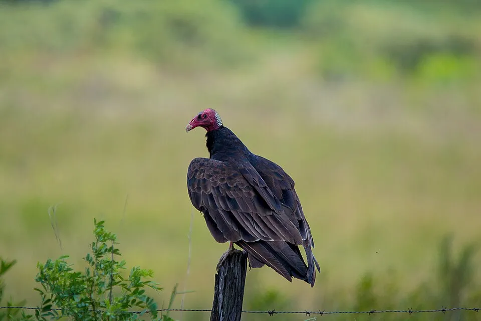
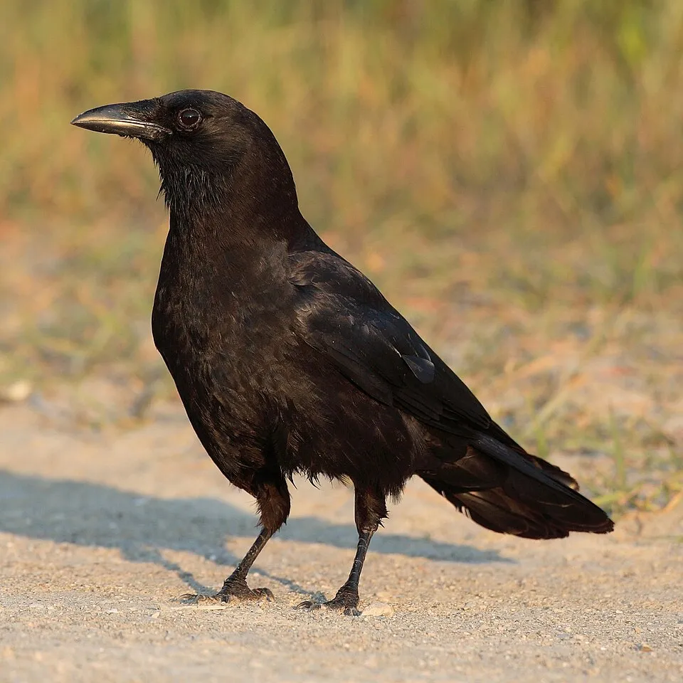
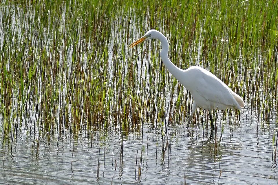
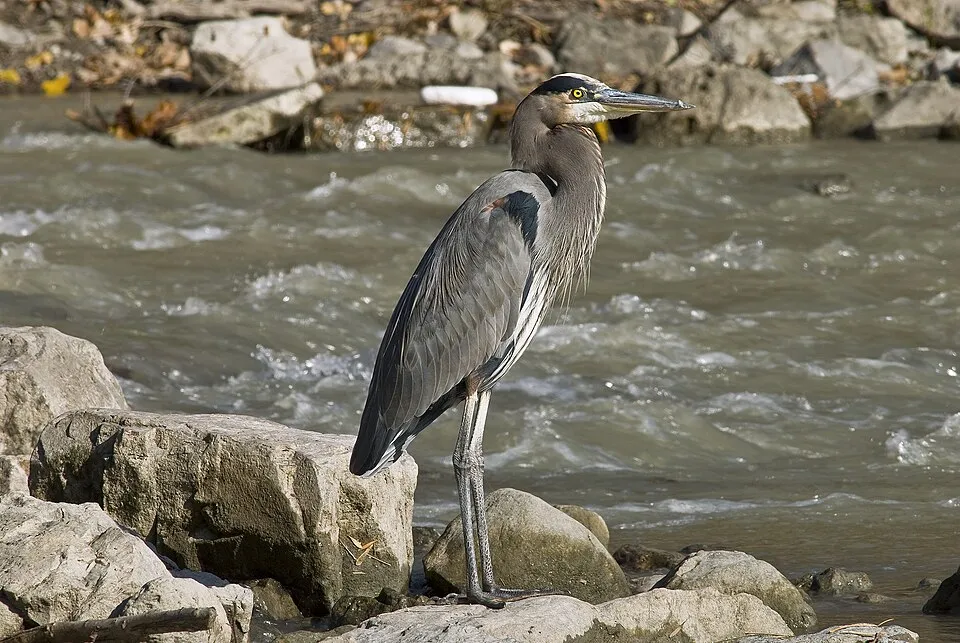
Among the species most often recorded on GBIF are Cathartes aura (Turkey Vulture), Corvus brachyrhynchos (American Crow), Ardea alba (Great Egret) and Ardea herodias (Great blue heron).
Who manages Everglades National Park?
National Park Service.
What is the official website of Everglades National Park?
© OpenStreetMap
Download the boundary: GeoJSON · GPX Boundary © OpenStreetMap contributors (ODbL).
Geography
Over the 1996–2025 period, the mean annual temperature is about 24.6 °C and total precipitation reaches roughly 1,031 mm per year. The warmest month is usually August, the coolest January, and the wettest June.
Area
- Area
- 610,484 ha
- Coordinates
- 25.3125, -80.6875
Main summits
- Rock Reef Pass1 m
- Panther Mound1 m
- Grossman Ridge1 m
- Bear Lake Mound0 m
- Johnson Mound0 m
- Hamilton Mound0 m
- Rookery Mound0 m
Data © OpenStreetMap contributors (ODbL)
Climate
● Mean temperature (°C) · ▮ Precipitation (mm)
Source: Copernicus ERA5-Land (C3S, doi:10.24381/cds.68d2bb30), monthly averages 1996–2025 interpolated to the representative point, temperatures adjusted for elevation.
Contains modified Copernicus Climate Change Service information 2026. Neither the European Commission nor ECMWF is responsible for any use that may be made of the Copernicus information or data it contains.
Natural habitats
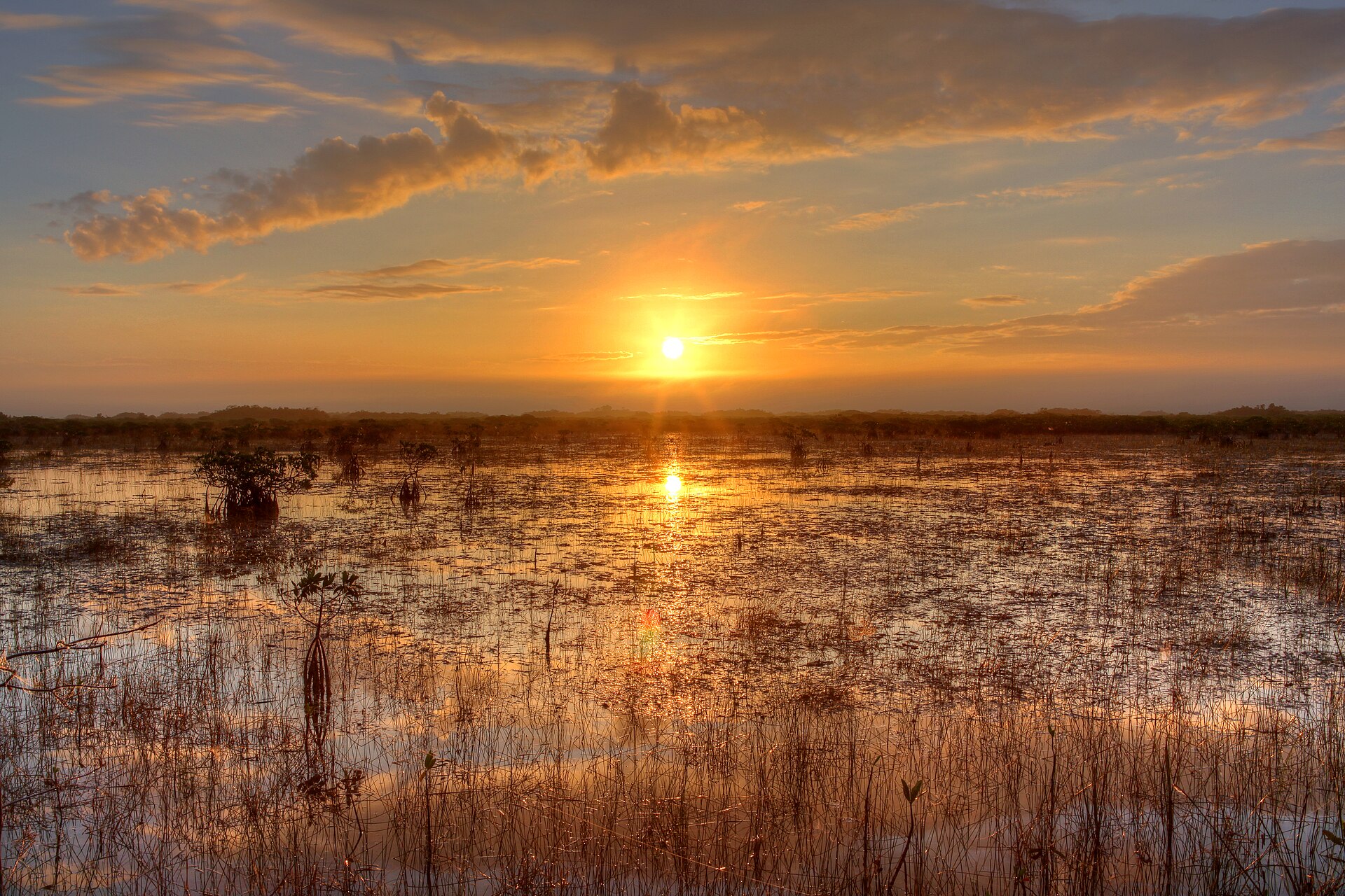
According to the global MODIS land cover (NASA, 2024), the land area is mainly made up of marshes and bogs (83%) and grassland and meadows (13%). The sea covers about 34% of the site. The seabed reaches about 52 m deep (median depth 4 m; GEBCO bathymetry). The land is almost flat (mean slope under 2°). Reef-building corals are documented in the area: 155 records published on GBIF.
Biodiversity
Based on occurrences aggregated by GBIF, several species are regularly recorded within the site. Among the most frequent are Cathartes aura (Turkey Vulture), Corvus brachyrhynchos (American Crow), Ardea alba (Great Egret) and Ardea herodias (Great blue heron). The full list of documented taxa is shown below.
Species to look out for
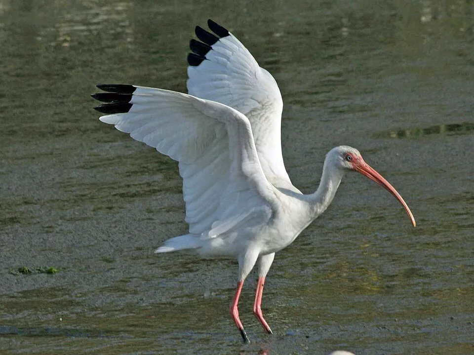
Bird
American White Ibis
Eudocimus albus25,110 records © Dick Daniels (http://theworldbirds.org/) · CC BY-SA 3.0
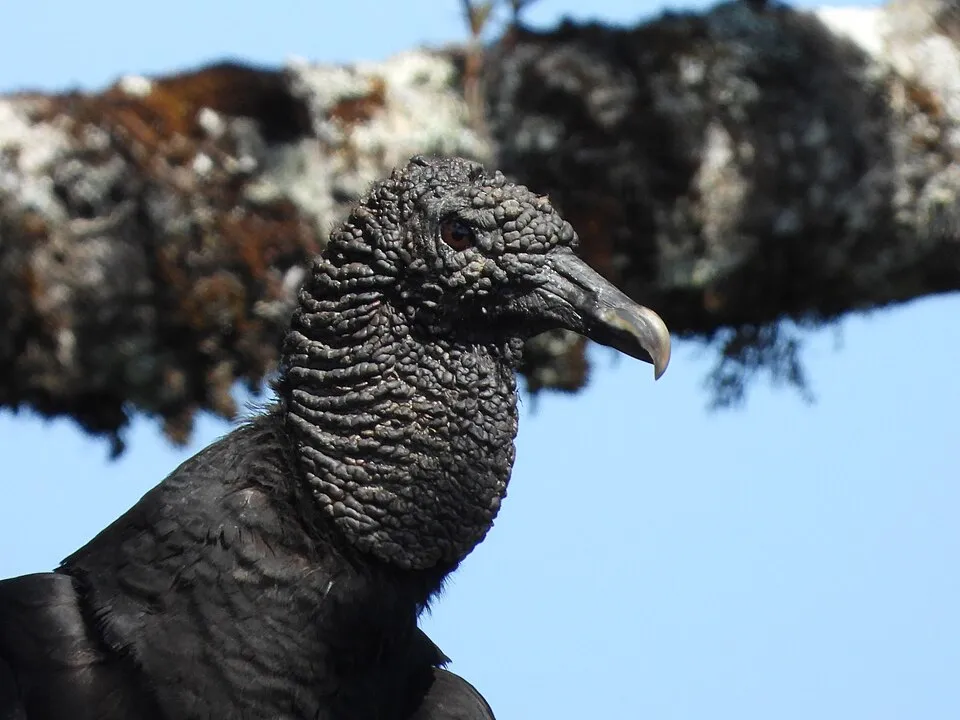
Observed species
Occurrences documented via GBIF; they are neither an exhaustive inventory nor proof of current presence.
- Turkey Vulture · Cathartes aura · 35320
- American Crow · Corvus brachyrhynchos · 33380
- Great Egret · Ardea alba · 32285
- Great blue heron · Ardea herodias · 25556
- American White Ibis · Eudocimus albus · 25110
- Black Vulture · Coragyps atratus · 24951
- Anhinga · Anhinga anhinga · 22478
- Osprey · Pandion haliaetus · 22272
- Red-shouldered Hawk · Buteo lineatus · 21490
- Northern Cardinal · Cardinalis cardinalis · 20688
- Red-bellied Woodpecker · Melanerpes carolinus · 20164
- Grey Catbird · Dumetella carolinensis · 19910
+18 more species
- Double-crested Cormorant · Phalacrocorax auritus · 19461
- Northern Mockingbird · Mimus polyglottos · 19325
- White-eyed Vireo · Vireo griseus · 18820
- Little Blue Heron · Egretta caerulea · 18785
- Tricolored Heron · Egretta tricolor · 18539
- Palm Warbler · Setophaga palmarum · 18024
- Snowy Egret · Egretta thula · 15949
- Blue-grey Gnatcatcher · Polioptila caerulea · 15837
- Green Heron · Butorides virescens · 14471
- Red-winged Blackbird · Agelaius phoeniceus · 13634
- Great Crested Flycatcher · Myiarchus crinitus · 13149
- Wood Stork · Mycteria americana · 13016
- Common Yellowthroat · Geothlypis trichas · 12063
- Belted Kingfisher · Megaceryle alcyon · 11179
- Boat-tailed Grackle · Quiscalus major · 10945
- Brown pelican · Pelecanus occidentalis · 10476
- Roseate Spoonbill · Platalea ajaja · 10453
- Myrtle Warbler · Setophaga coronata · 10174
Records: GBIF.org (CC-BY). Names: Wikidata (CC0), GBIF. Photos: Wikimedia Commons.
Conservation challenges
The primary purpose of the site is to preserve its natural habitats and the biodiversity they support. The species recorded (Biodiversity tab) reflect its ecological value. The designations it holds frame its management and the control of land use.
According to Global Forest Change data (University of Maryland, Global Forest Watch), about 29,670 ha of tree cover were lost within the boundary between 2001 and 2023 (5% of its area), peaking in 2017 and 2018. These losses include logging, storms and fires, and do not account for regrowth. At night, 1% of the area gives off artificial light detectable from space (NASA VIIRS Black Marble composite, 2016).
Pressure indicators
Tree cover lost
29,669 ha
2001–2023 · 5% of the area
20012023
Light at night
1%
of the area gives off artificial light visible from space
DarkLit
Sources: Global Forest Change (Hansen et al., University of Maryland, via Global Forest Watch, CC-BY 4.0); EFFIS, European Commission / Copernicus; NASA Black Marble 2016 (public domain); CORINE Land Cover 2018 (Copernicus) or MODIS.
Practical information
Cities and airport
- Hialeah
23 km as the crow flies - Miami Gardens
32 km as the crow flies - Airport: Miami (MIA)
21 km as the crow flies
Visitor information
- Ernest F. Coe Visitor Center
within the site - Shark Valley Visitor Center
within the site - Visitor Center
2 km from the site boundary - Visitor Center Windley Key Fossil Reef Geological State Park
3 km from the site boundary
Parking
55 public car parks listed within the site · 13 trailheads
Trail Parking AreaTrailer and Oversized ParkingVisitor Center Car ParkingBoat Trailer Parking
Things to see
5 lakes and ponds
- Lake Ingraham
lake or pond - Ferguson Bay
lake or pond - Jungle Bay
lake or pond - Mud Bay
lake or pond - Oyster Bay
lake or pond
Hiking
12 waymarked routes listed, including:
South Dade Greenway
By bike
ECG East Coast Greenway · 10 km1 · 10 km
Signed cycle routes: this does not mean that cycling is allowed on footpaths.
Wheelchair access
- Anhinga Trail
path - Gumbo Limbo Trail
path
accessible toilets: 2
Reported by OpenStreetMap contributors (ODbL); check with the park before visiting.
Data © OpenStreetMap contributors (ODbL) · Wikidata (CC0)
Routes © OpenStreetMap contributors (ODbL), via Waymarked Trails
Waymarked hiking routes
Tracks © OpenStreetMap contributors (ODbL), clipped to the boundary; elevation gain and profiles computed on the longest section from Mapzen Terrain Tiles (≈ 30 m), indicative only.
Access and visiting
The nearest railway station is Miami, about 26 km from the site boundary. Nearest towns of over 50,000 people, as the crow flies: Hialeah (23 km) and Miami Gardens (32 km). Nearest airport: Miami (MIA), about 21 km away. About 1.2 million people live within 20 km of the site boundary, 410,000 of them within 10 km; some 960 people are estimated to live inside (GHSL estimate, 2020). This population has grown by about 23% since 2000. Visitor information on site: Ernest F. Coe Visitor Center, Shark Valley Visitor Center and Visitor Center. Public car parks listed within the site: 55, including Trail Parking Area, Trailer and Oversized Parking and Visitor Center Car Parking. Waymarked hiking routes listed in OpenStreetMap: 12, including South Dade Greenway. The site is crossed by 2 signed cycle routes: “ECG East Coast Greenway” and “1” (OpenStreetMap). OpenStreetMap contributors list 2 wheelchair-accessible places: Anhinga Trail and Gumbo Limbo Trail; check with the park before visiting. To see: 5 lakes and ponds, including Lake Ingraham, Ferguson Bay, Jungle Bay and Mud Bay. To plan a visit (access, opening periods, visitor rules), it is best to consult the official information from the managing body (National Park Service) and the official website listed in this page's sources.
Source: OpenStreetMap (ODbL), Wikidata (CC0), October 2026.
Built heritage
According to Wikidata, 10 monuments listed in the National Register of Historic Places stand within the boundary, 1 of them a National Historic Landmark. Among them are 3 prehistoric and archaeological sites, 1 bridge, lighthouse, mill or working building and 1 house or civic building. Nationally designated items include “Mud Lake Canal”.
3 prehistoric and archaeological sites1 bridge, lighthouse, mill or working building1 house or civic building
-
Mud Lake Canal
National
-
Cane Patch
-
Ted Smallwood Store
Chokoloskee · 20th c. -
Anhinga Trail
-
Rookery Mound
-
Bear Lake Mounds Archeological District
-
Turner River Site
-
Monroe Lake Archeological District
and 2 more
Source: Wikidata (CC0), monuments in each country’s official heritage protection registers, at national or regional level. Each item links to its Wikidata entry.
When to visit
Best time to visit: the dry season, from November to April, with less than 50 mm of rain per month. Precipitation peaks from June to September (up to 170 mm per month). Day length ranges from about 10 h 34 min in December to 13 h 42 min in June. Wildlife records published on GBIF peak for birds (from January to March), plants (April and May), butterflies and moths (March), dragonflies (March and April) and mammals (April). These peaks also reflect when observers are most active.
Source: Copernicus ERA5-Land (C3S), monthly averages 1996–2025 at the representative point, temperatures adjusted for elevation.
Contains modified Copernicus Climate Change Service information 2026. Neither the European Commission nor ECMWF is responsible for any use that may be made of the Copernicus information or data it contains.
Wildlife records calendar
JFMAMJJASOND
Birds
Plants
Butterflies & moths
Dragonflies
Mammals
Monthly records published on GBIF (CC-BY), relative to the busiest month; also reflects observer activity.
Gallery
© Everglades NPS from Homestead, Florida, United States · Public domain
© Ken Lund from Reno, Nevada, USA · CC BY-SA 2.0
© evergladesnps · Public domain
© NPS photo · Public domain
© evergladesnps · Public domain
© Fred Ward · Public domain
Sources and licences
- Wikidata: Q274131
- OpenStreetMap: relation 2163707
- Official website: https://nps.gov/ever
- Wikipedia: en.wikipedia.org/wiki/Everglades_National_Park
- WDPA: 971
References
- cds.climate.copernicus.eu: climate · CC-BY-4.0
- registry.opendata.aws: elevation of the reference point, detailed relief · PD
- lpdaac.usgs.gov: land cover · PD
- doi.org: population around the site · CC-BY-4.0
- naturalearthdata.com: sea share · PD
- wikidata.org: official area, establishment date, protected heritage, managing body, nearby cities and airport, access and peaks, lake depths, places to see, official website · CC0-1.0
- gbif.org: coral records, seasonality of sightings, observed species · CC-BY-4.0
- en.eurovelo.com: EuroVelo cycle routes · ODbL-1.0
- cycling.waymarkedtrails.org: cycle routes · ODbL-1.0
- gebco.net: depths · PD
- opentopodata.org: elevations · PD
- globalforestwatch.org: tree cover loss · CC-BY-4.0
- openstreetmap.org: official name, access and peaks, trail difficulty, wheelchair access · ODbL-1.0
- earthobservatory.nasa.gov: night light · PD
- hiking.waymarkedtrails.org: route difficulty · ODbL-1.0
- nsidc.org: snow cover · PD
- wikidata.org: Wikipedia article · CC-BY-SA-4.0
Data © OpenStreetMap contributors (ODbL), Wikidata (CC0) and the sources cited.