Spain · Terrestrial
Garajonay National Park
National park of 3,950 hectares in Spain, established in 1981.
Overview
National park of 3,950 hectares in Spain, established in 1981.
Garajonay National Park is located in Spain (Europe). It is a predominantly terrestrial area. Established on 25 March 1981, it covers about 3,950 hectares.
Protections and designations
UNESCO World Heritage
UNESCO Biosphere Reserve
Natura 2000 · habitats (SAC) · 2 sites
- Benchijigua ES7020028
- Garajonay ES0000044
Natura 2000 · birds (SPA)
- Garajonay ES0000044
Protected as a national park. International labels and designations: UNESCO World Heritage (“Garajonay National Park”), UNESCO Biosphere Reserve (“La Gomera”) and Natura 2000 network (2 sites). Key dates: established in 1981, World Heritage listing in 1986, first Natura 2000 site under the Birds Directive in 1988 and first Natura 2000 site under the Habitats Directive in 2010.
In our collections
Timeline
-
1981
Established
-
1986
Inscribed as a UNESCO World Heritage Site Garajonay National Park
-
1988
First Natura 2000 site under the Birds Directive
-
2010
First Natura 2000 site under the Habitats Directive 2 such sites designated up to 2010
Sources: Wikidata (CC0) for establishment and international labels; EEA Natura 2000 database (CC-BY 4.0) for site designation dates.
Frequently asked questions
Where is Garajonay National Park?
In Spain (Europe). Representative point: 28.1263° N, 17.2372° W.
How large is Garajonay National Park?
About 3,950 hectares (40 km²). It is the 15th largest of the 16 national parks in Spain covered by Parkavela.
When was Garajonay National Park established?
On 25 March 1981.
What habitats and landscapes does Garajonay National Park include?
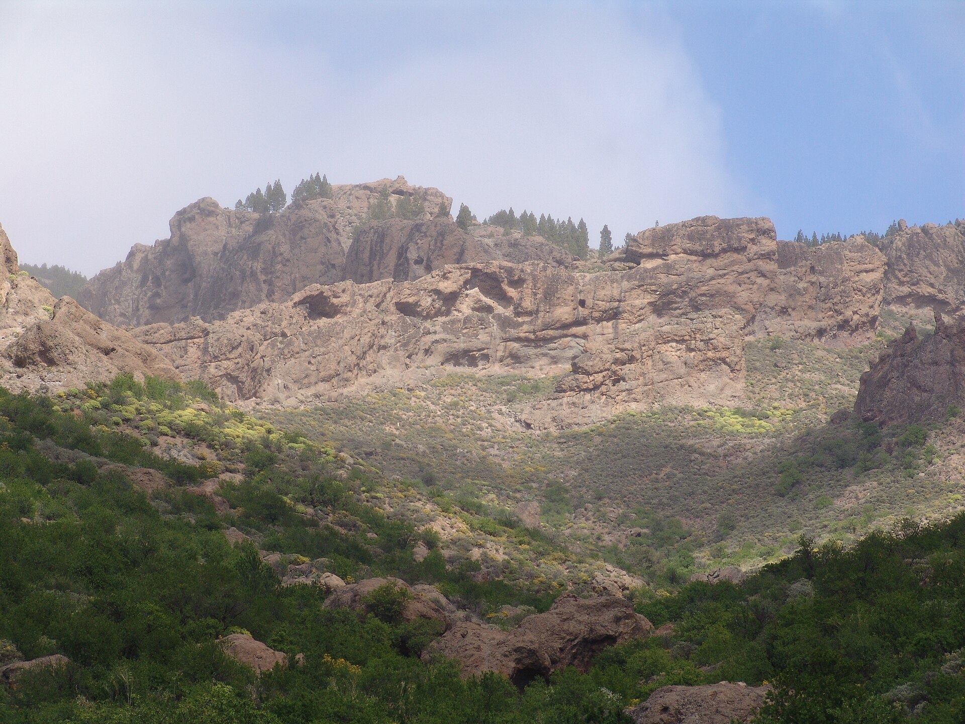
A terrestrial area, with forests and mountains.
What rocks lie beneath Garajonay National Park?
According to the European 1:1 million geological map (EGDI), the bedrock consists mainly of basalts (100% of sampled points). These are mostly igneous rocks. The geological units date mainly from the Neogene (100% of sampled points).
What is the highest point of Garajonay National Park?
Montaña de Igualero, at 1,484 m (OpenStreetMap).
What are the main summits of Garajonay National Park?
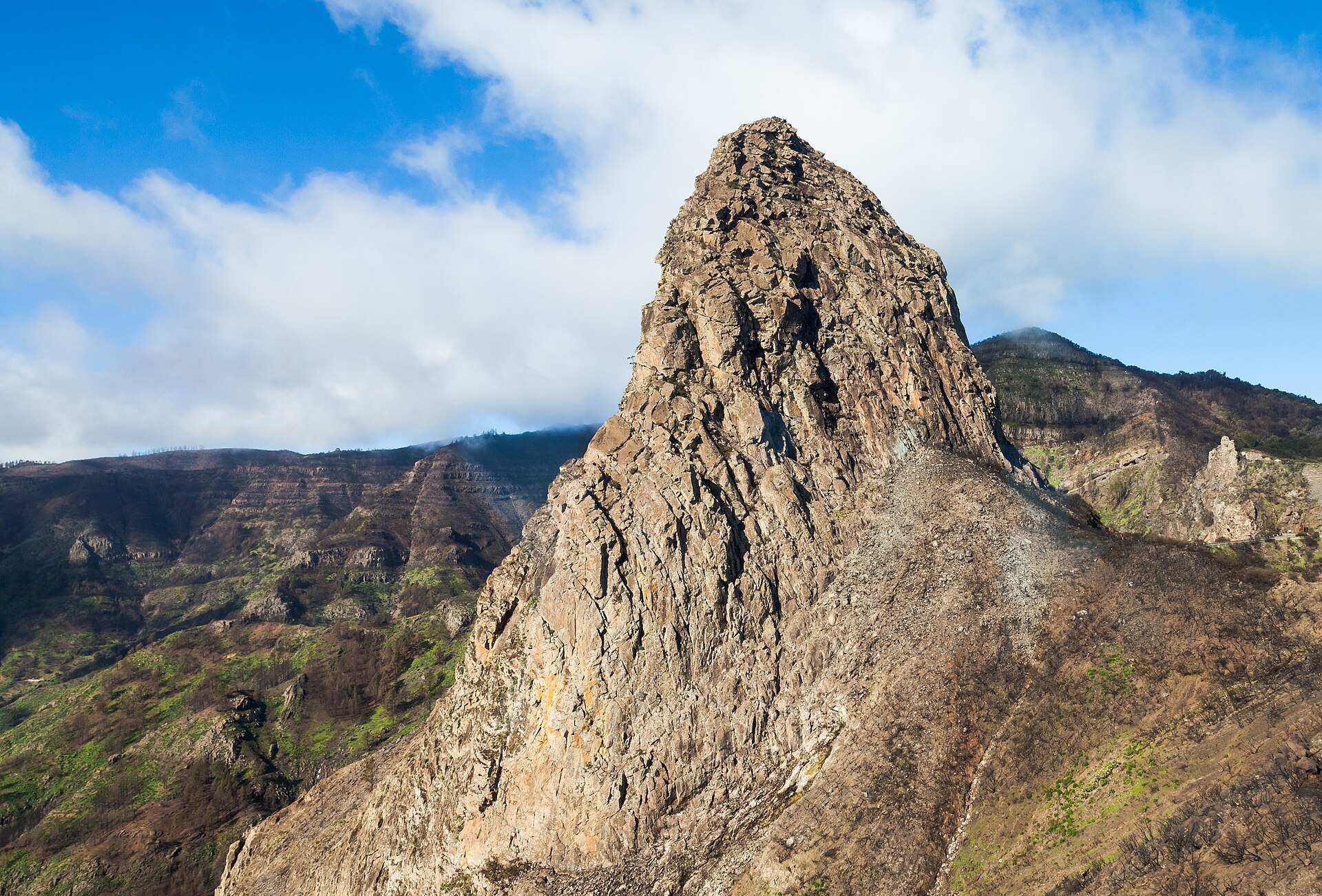
Montaña de Igualero (1,484 m), Alto de Garajonay (1,483 m), Alto de Pajarito (1,469 m), Montaña de las Negrilas (1,383 m) and Alto de Cherelepín (1,365 m) (OpenStreetMap).
Which international labels apply to Garajonay National Park?
UNESCO World Heritage (“Garajonay National Park”), UNESCO Biosphere Reserve (“La Gomera”) and Natura 2000 network (2 sites).
When is the best time to visit Garajonay National Park?
The climate suits visits all year round.
What is the nearest large city to Garajonay National Park?
Nearest towns of over 50,000 people, as the crow flies: San Cristóbal de La Laguna (94 km) and Santa Cruz de Tenerife (99 km). Nearest airport: Tenerife South (TFS), about 61 km away.
Where can I get visitor information on site?
Centro Visitantes.
Are there waymarked hiking trails in Garajonay National Park?
Yes. Waymarked hiking routes listed in OpenStreetMap: 42, including GR 131, GR 132, El Camino de Santiago entre Volcanes and Camino Natural Cumbres de la Gomera. The GR 131 route runs for about 10 km through the site, with some 150 m of ascent on its longest section.
Which species can be seen in Garajonay National Park?
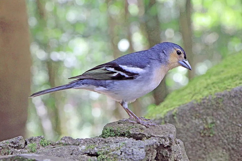
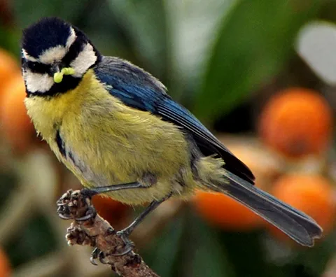
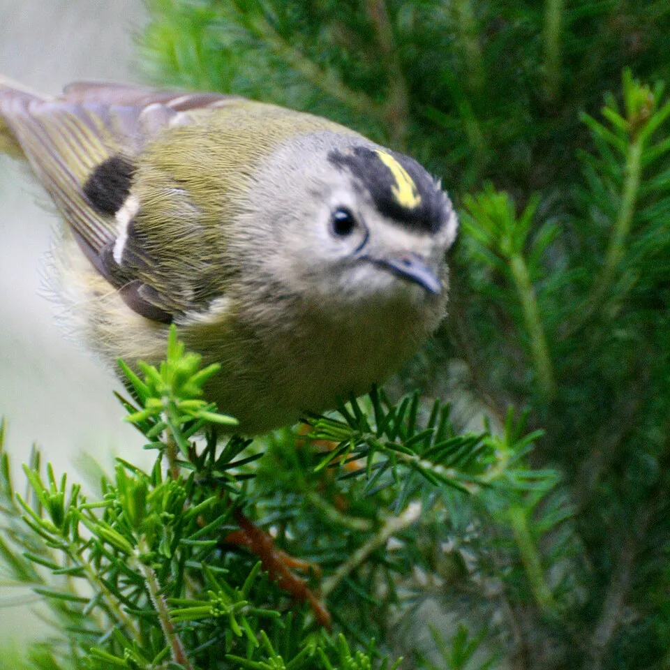
Among the species most often recorded on GBIF are Fringilla canariensis (Canary Islands Chaffinch), Phylloscopus canariensis (Canary Islands Chiffchaff), Turdus merula (Common Blackbird) and Cyanistes teneriffae (African Blue Tit).
What is the official website of Garajonay National Park?
miteco.gob.es/es/red-parques-nacionales/nuestros-parques/garajonay
© OpenStreetMap
Download the boundary: GeoJSON · GPX Boundary © OpenStreetMap contributors (ODbL).
Geography
The representative point of the site lies at around 1,205 m above sea level. Over the 1996–2025 period, the mean annual temperature is about 14.1 °C and total precipitation reaches roughly 146 mm per year. The warmest month is usually August, the coolest February, and the wettest December. According to the European 1:1 million geological map (EGDI), the bedrock consists mainly of basalts (100% of sampled points). These are mostly igneous rocks. The geological units date mainly from the Neogene (100% of sampled points).
Area
- Area
- 3,950 ha
- Elevation
- 1,205 m
- Median elevation
- 1,096 m
- Mean slope
- 16°
- Coordinates
- 28.1263, -17.2372
Terrain: Mapzen Terrain Tiles (SRTM, USGS)
Elevation bands
- 500–1,000 m 23%
- 1,000–1,500 m 77%
share of the site in each elevation band (smoothed terrain model: summits are rounded off) · Terrain: Mapzen Terrain Tiles (SRTM, USGS)
Bedrock
- Basalts 100 %
Igneous rocks 100 % · Main age: Neogene (100%)
Source: EGDI 1:1M geological map (EuroGeoSurveys and national geological surveys), CC BY 4.0 · 14 sampled points within the site.
Main summits
- Montaña de Igualero1,484 m
- Alto de Garajonay1,483 m
- Alto de Pajarito1,469 m
- Montaña de las Negrilas1,383 m
- Alto de Cherelepín1,365 m
- Paredes1,359 m
- Alto de la Aguelisma1,354 m
- Montaña de los Manantiales1,255 m
- Montaña de la Asomada1,233 m
- Roque de la Zarcita1,211 m
Data © OpenStreetMap contributors (ODbL)
Climate
● Mean temperature (°C) · ▮ Precipitation (mm)
Source: Copernicus ERA5-Land (C3S, doi:10.24381/cds.68d2bb30), monthly averages 1996–2025 interpolated to the representative point, temperatures adjusted for elevation.
Contains modified Copernicus Climate Change Service information 2026. Neither the European Commission nor ECMWF is responsible for any use that may be made of the Copernicus information or data it contains.
Natural habitats
According to CORINE Land Cover (2018), the site is mainly made up of forests (90%) and Mediterranean scrub (6%). Woodland is mostly broadleaved. Elevation ranges from about 830 m to 1,484 m (highest point: Montaña de Igualero). Median elevation is 1,096 m, and 77% of the site lies above 1,000 m (SRTM elevation model). The terrain is steep: 46% of slopes exceed 15° (mean slope 16°). The 2 Natura 2000 sites overlapping the area list 6 habitats of European interest (3 priority), the most extensive being Macaronesian laurel forests (Laurus, Ocotea), endemic macaronesian heaths and Canarian endemic pine forests.
Biodiversity
Based on occurrences aggregated by GBIF, several species are regularly recorded within the site. Among the most frequent are Fringilla canariensis (Canary Islands Chaffinch), Phylloscopus canariensis (Canary Islands Chiffchaff), Turdus merula (Common Blackbird) and Cyanistes teneriffae (African Blue Tit). The full list of documented taxa is shown below. The overlapping Natura 2000 sites list 15 species of European interest: 6 birds, 1 mammal and 8 plants.
Habitats of European interest
From the official forms of the 2 Natura 2000 sites overlapping the area (areas reported for each whole site).
- Macaronesian laurel forests (Laurus, Ocotea) priority 2,998 ha
- Endemic macaronesian heaths priority 452 ha
- Canarian endemic pine forests 151 ha
- Siliceous rocky slopes with chasmophytic vegetation 39 ha
- Palm groves of Phoenix priority 10 ha
- Olea and Ceratonia forests 3 ha
Species of European interest
Birds · 6
Canarian Sparrowhawk (Accipiter nisus granti) resident, Bolle's Pigeon (Columba bollii) resident, Laurel Pigeon (Columba junoniae) resident, Peregrine Falcon (Falco peregrinus) resident, Red-billed Chough (Pyrrhocorax pyrrhocorax), European turtle dove (Streptopelia turtur) breeding
Mammals · 1
Plants · 8
Aeonium gomerense, Cistus chinamadensis, Euphorbia bourgeana, Limonium dendroides, Morella rivas-martinezii, Sambucus nigra subsp. palmensis, Killarney Fern (Vandenboschia speciosa), Rooting chainfern (Woodwardia radicans)
Source: Natura 2000 standard data forms (EEA, CC-BY 4.0). Not exhaustive: sensitive species are not published.
Species to look out for
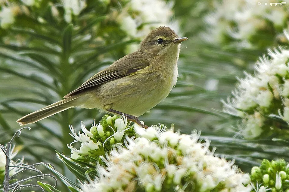
Bird
Canary Islands Chiffchaff
Phylloscopus canariensis472 records © Juan Emilio from Las Palmas de Gran Canaria, España · CC BY-SA 2.0


Observed species
Occurrences documented via GBIF; they are neither an exhaustive inventory nor proof of current presence.
- Canary Islands Chaffinch · Fringilla canariensis · 512
- Canary Islands Chiffchaff · Phylloscopus canariensis · 472
- Common Blackbird · Turdus merula · 450
- African Blue Tit · Cyanistes teneriffae · 386
- Bolle's Pigeon · Columba bollii · 343
- Podila humilis · 321
- Goldcrest · Regulus regulus · 298
- European robin · Erithacus rubecula · 288
- Atlantic Canary · Serinus canaria · 205
- Northern Raven · Corvus corax · 181
- Laurel Pigeon · Columba junoniae · 174
- Umbelopsis changbaiensis · 166
+18 more species
- Saitozyma podzolica · 164
- Common Kestrel · Falco tinnunculus · 151
- Plain Swift · Apus unicolor · 143
- Common Buzzard · Buteo buteo · 142
- Eurasian Blackcap · Sylvia atricapilla · 113
- Linnemannia zychae · 92
- Steganacarus tenerifensis · 90
- Rock Dove · Columba livia · 77
- Tree Heath · Erica arborea · 72
- Eurasian Chaffinch · Fringilla coelebs · 65
- Canary Herb-Robert · Geranium reuteri · 58
- Sardinian Warbler · Curruca melanocephala · 52
- Berthelot's Pipit · Anthus berthelotii · 51
- Solicoccozyma fuscescens · 48
- Montpelier cistus · Cistus monspeliensis · 46
- Barbary Partridge · Alectoris barbara · 40
- Grey Wagtail · Motacilla cinerea · 40
- Sonchus hierrensis · 38
Records: GBIF.org (CC-BY). Names: Wikidata (CC0), GBIF. Photos: Wikimedia Commons.
Conservation challenges
The primary purpose of the site is to preserve its natural habitats and the biodiversity they support. The species recorded (Biodiversity tab) reflect its ecological value. The designations it holds frame its management and the control of land use.
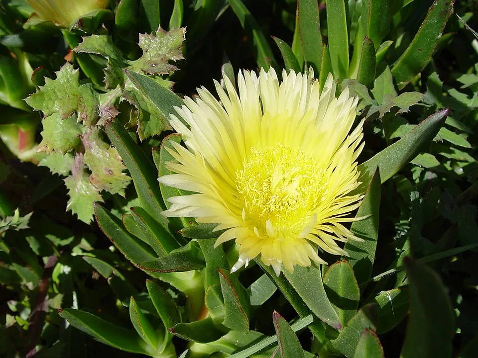
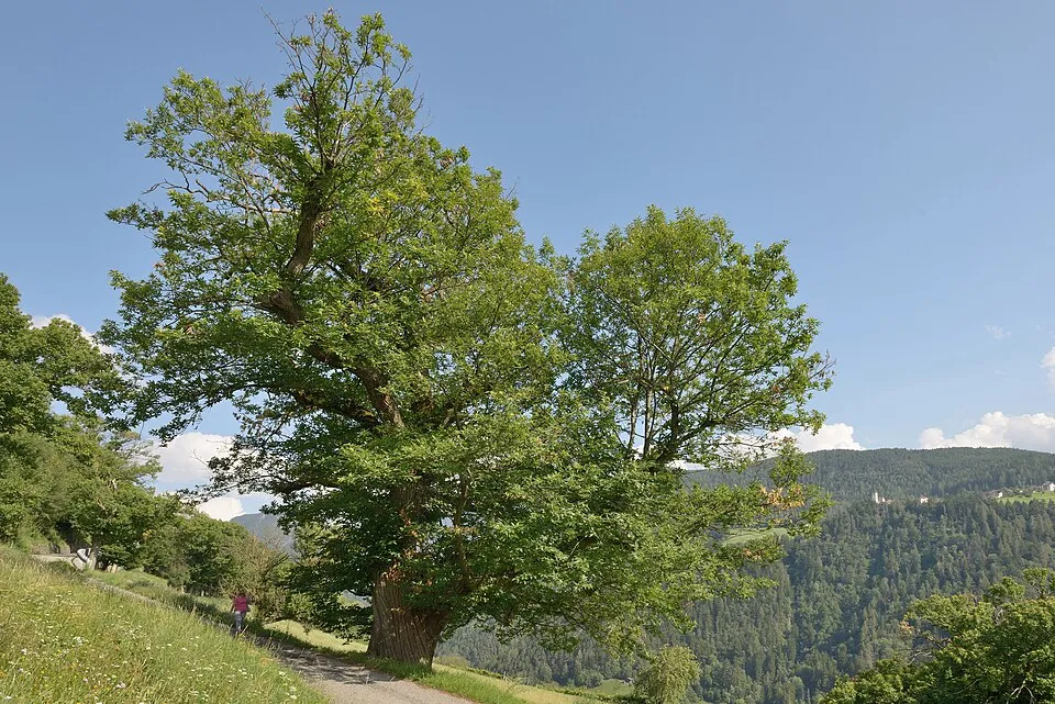
According to Global Forest Change data (University of Maryland, Global Forest Watch), about 39 ha of tree cover were lost within the boundary between 2001 and 2023 (under 1% of its area), peaking in 2012 and 2013. These losses include logging, storms and fires, and do not account for regrowth. According to CORINE Land Cover, land cover here remained almost unchanged between 1990 and 2018 (less than 0.5% of the area affected). At night, the area gives off virtually no artificial light detectable from space (NASA VIIRS Black Marble composite, 2016). According to the Natura 2000 forms, of 6 assessed habitats of European interest, 2 are in excellent condition and 2 in average or reduced condition. Since 2000, 6 invasive alien species have been recorded within the site (GBIF observations). Among them: Oxalis pes-caprae (Bermuda buttercup), Ageratina adenophora (Sticky snakeroot) and Tradescantia fluminensis (Small-leaf spiderwort).
Pressure indicators
Tree cover lost
39 ha
2001–2023 · < 1% of the area
20012023
Fires since 2016
0
No large fire mapped (fires over about 30 ha)
Light at night
0%
of the area gives off artificial light visible from space
DarkLit
Land cover change
< 0.5%
of the area changed, 1990–2018 · CORINE
Invasive alien species
6
recorded since 2000
 Bermuda buttercup
 Sticky snakeroot
 Small-leaf spiderwort
 Hottentot-fig
 Sweet Chestnut
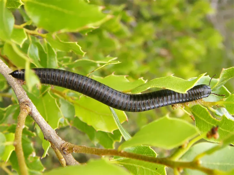 Portuguese millipede
Photos: Bermuda buttercup © MathKnight and Zachi Evenor אביר המתמטיקה וצחי אבנור · CC BY-SA 4.0; Sticky snakeroot © Ixitixel · CC BY-SA 3.0; Small-leaf spiderwort © Enrique Dans from Madrid, Spain · CC BY 2.0; Hottentot-fig © Taken by Carsten Niehaus (user:Lumbar). · CC BY-SA 3.0; Sweet Chestnut © This Photo was taken by Wolfgang Moroder. Feel free to use my photos, but please mention me as the author and send me a message. This image is not in the public domain. Please respect the copyright protection. It may only be used according… · CC BY-SA 3.0; Portuguese millipede © J. Coelho · CC BY 2.0
Sources: Global Forest Change (Hansen et al., University of Maryland, via Global Forest Watch, CC-BY 4.0); EFFIS, European Commission / Copernicus; NASA Black Marble 2016 (public domain); CORINE Land Cover 2018 (Copernicus) or MODIS.
CORINE Land Cover Change 1990–2018: generated using European Union's Copernicus Land Monitoring Service information (EEA), aggregated by Parkavela; DOI 10.2909/f30f1000-7cf8-43bb-872c-5eb093911b24.
Invasive alien species: Global Register of Introduced and Invasive Species (ISSG, CC BY 4.0); Union list, Regulation (EU) 1143/2014 (INBO, CC0); GBIF.org records (CC0 / CC BY 4.0), at least 2 per species.
Practical information
Cities and airport
- San Cristóbal de La Laguna
94 km as the crow flies - Santa Cruz de Tenerife
99 km as the crow flies - Airport: Tenerife South (TFS)
61 km as the crow flies
Visitor information
- Centro Visitantes
within the site
Parking
15 public car parks listed within the site
Raso de la BrumaLas MimbrerasEl ContaderoLos Barranquillos
Hiking
42 waymarked routes listed, including:
GR 131GR 132El Camino de Santiago entre VolcanesCamino Natural Cumbres de la GomeraRuta
Trail difficulty
- T1 · easy hiking · 70% · 22 km
- T2 · mountain hiking · 30% · 10 km
32 km graded out of 56 km of paths
SAC scale (T1–T6) © OpenStreetMap contributors (ODbL): indicative only, check with the park.
By bike
+ 4 local loops
Signed cycle routes: this does not mean that cycling is allowed on footpaths.
Data © OpenStreetMap contributors (ODbL) · Wikidata (CC0)
Routes © OpenStreetMap contributors (ODbL), via Waymarked Trails
Waymarked hiking routes
02 Camino Natural Cumbres de la Gomera - Etapa 2
7.2 km within the site ↗ 150 m↘ 374 m 1,099–1,462 m
03 Camino Natural Cumbres de la Gomera - Etapa 3
2.6 km within the site ↗ 53 m↘ 152 m 938–1,085 m
PN18 Ruta 18: Pajarito - El Cedro - Tajaqué - Pajarito
12.8 km within the site ↗ 588 m↘ 475 m 887–1,463 m
up to T1 · hiking
PN14 Ruta 14: Laguna Grande - Alto de Garajonay
10 km within the site ↗ 217 m↘ 222 m 1,235–1,462 m
Tracks © OpenStreetMap contributors (ODbL), clipped to the boundary; elevation gain and profiles computed on the longest section from Mapzen Terrain Tiles (≈ 30 m), indicative only. Indicative difficulty (SAC scale, OpenStreetMap, via Waymarked Trails): check with the park.
Access and visiting
Nearest towns of over 50,000 people, as the crow flies: San Cristóbal de La Laguna (94 km) and Santa Cruz de Tenerife (99 km). Nearest airport: Tenerife South (TFS), about 61 km away. About 21,000 people live within 20 km of the site boundary; some 250 people are estimated to live inside (GHSL estimate, 2020). This population has grown by about 25% since 2000. Visitor information on site: Centro Visitantes. Public car parks listed within the site: 15, including Raso de la Bruma, Las Mimbreras and El Contadero. Waymarked hiking routes listed in OpenStreetMap: 42, including GR 131, GR 132, El Camino de Santiago entre Volcanes and Camino Natural Cumbres de la Gomera. Of the roughly 30 km of paths with a difficulty grade in OpenStreetMap, 70% are easy hiking (T1) and 30% mountain hiking (T2). This is indicative only: check with the park. To plan a visit (access, opening periods, visitor rules), it is best to consult the official information from the managing body and the official website listed in this page's sources.
Source: OpenStreetMap (ODbL), Wikidata (CC0), October 2026.
When to visit
The climate suits visits all year round. These averages apply to the site's representative point (1,205 m); higher up it is markedly cooler. Day length ranges from about 10 h 22 min in December to 13 h 55 min in June. Wildlife records published on GBIF peak for birds (December), plants (April), butterflies and moths (April) and dragonflies (September). These peaks also reflect when observers are most active.
Source: Copernicus ERA5-Land (C3S), monthly averages 1996–2025 at the representative point, temperatures adjusted for elevation.
Contains modified Copernicus Climate Change Service information 2026. Neither the European Commission nor ECMWF is responsible for any use that may be made of the Copernicus information or data it contains.
Wildlife records calendar
JFMAMJJASOND
Birds
Plants
Butterflies & moths
Dragonflies
Monthly records published on GBIF (CC-BY), relative to the busiest month; also reflects observer activity.
Gallery
© Diego Delso · CC BY-SA 3.0
© barraquito from Barcelona · CC BY-SA 2.0
© Cardenasg · CC BY 2.5
© Llez · CC BY-SA 3.0
© Llez · CC BY-SA 3.0
© H. Zell · CC BY-SA 3.0
Sources and licences
- Wikidata: Q464942
- OpenStreetMap: relation 10036362
- Official website: https://www.miteco.gob.es/es/red-parques-nacionales/nuestros-parques/garajonay/
- Wikipedia: en.wikipedia.org/wiki/Garajonay_National_Park
- WDPA: 897
References
- cds.climate.copernicus.eu: climate · CC-BY-4.0
- registry.opendata.aws: elevation of the reference point, detailed relief · PD
- land.copernicus.eu: land cover, land cover change, sea share · COPERNICUS
- doi.org: population around the site · CC-BY-4.0
- wikidata.org: official area, highest point, establishment date, protected heritage, nearby cities and airport, access and peaks, lake depths, places to see, official website · CC0-1.0
- eea.europa.eu: bathing water quality, ecological status of waters · CC-BY-4.0
- en.eurovelo.com: EuroVelo cycle routes · ODbL-1.0
- cycling.waymarkedtrails.org: cycle routes · ODbL-1.0
- opentopodata.org: elevations · PD
- forest-fire.emergency.copernicus.eu: wildfires · COPERNICUS
- globalforestwatch.org: tree cover loss · CC-BY-4.0
- gbif.org: seasonality of sightings, invasive alien species, observed species · CC-BY-4.0
- europe-geology.eu: geology · CC-BY-4.0
- hydrosheds.org: lakes · CC-BY-4.0
- natura2000.eea.europa.eu: Natura 2000 habitats and species · CC-BY-4.0
- openstreetmap.org: official name, access and peaks, trail difficulty, wheelchair access · ODbL-1.0
- earthobservatory.nasa.gov: night light · PD
- hiking.waymarkedtrails.org: route difficulty · ODbL-1.0
- nsidc.org: snow cover · PD
- wikidata.org: Wikipedia article · CC-BY-SA-4.0
Data © OpenStreetMap contributors (ODbL), Wikidata (CC0) and the sources cited.